Excursion to the Otal valley from Bujaruelo
Pyrenees and mountains 📩
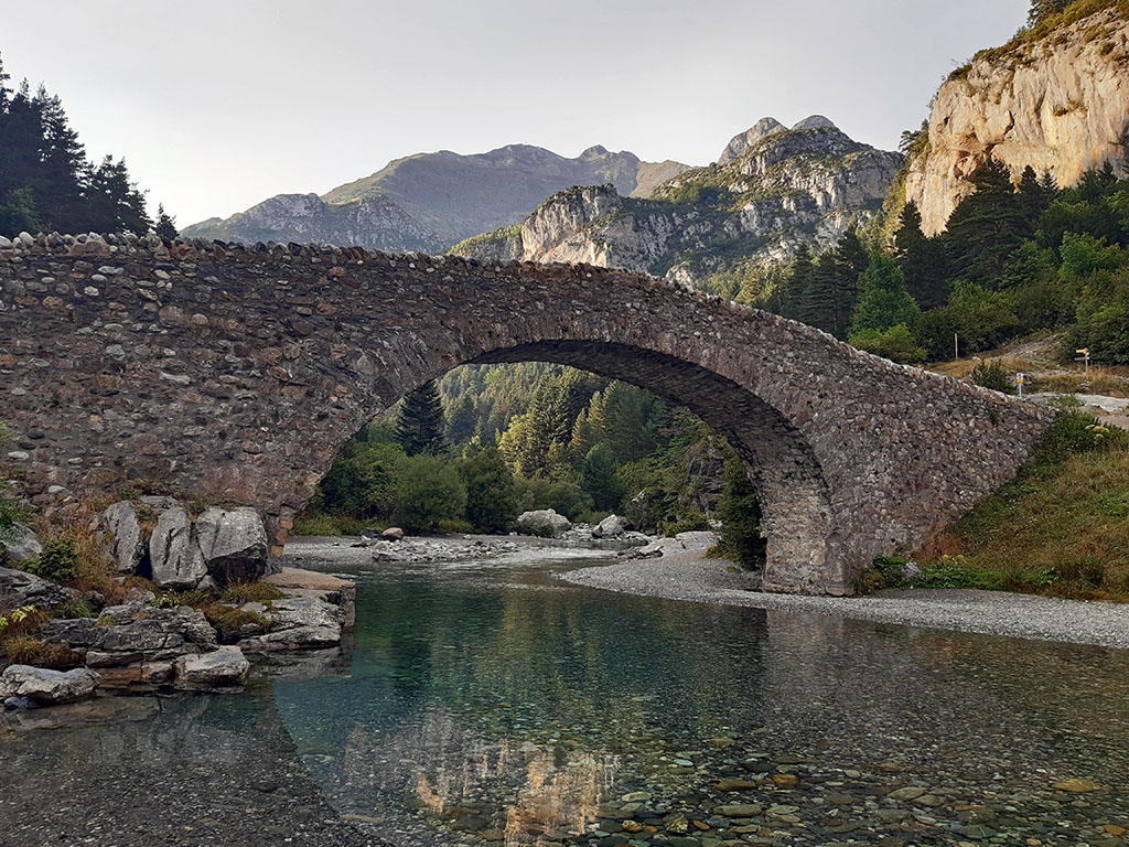
Here 🔥Visiting the medieval bridge of San Nicolas de Bujaruelo (13th century), refreshing yourself in the river and having a drink on the terrace of the refuge is undoubtedly a good plan, but any reward tastes better after a short walk, like this one. a simple excursion that you can do with your children to the Otal valley.
Easy routes in the valley of Bujaruelo
In the surroundings of Bujaruelo, surrounded by such mountains, finding easy routes that we can do with children is not easy. Among the most affordable options are usually to follow a section of the GR11 up or down the valley following the course of the Ara, to visit the valleys of Otal and Ordiso, or to climb the Ibón de Bernatuara, although the latter involves a 1,000-metre drop that may be too much for parents :).
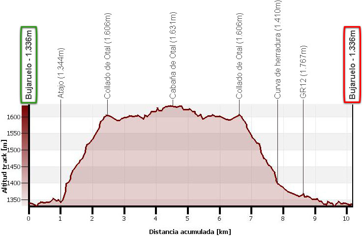
Route summary:
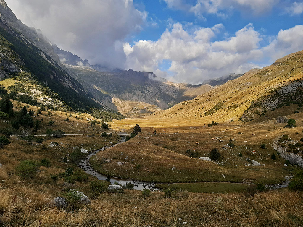
Surely, the best option for a route with children in the Bujaruelo area -short (between 4.8 and 10.2 kms if we go to the Otal hut) and with a low gradient (330 metres)- is the one that visits the Otal valley.. A beautiful U-shaped glacial valley where cattle graze freely in the summers.
The route is very simple and can be done in a different way to the one we propose here, going up along the right bank of the river (left of the walk) taking advantage of the shortcuts on the track; and descending along the left bank of the river Ara, following the GR11.
Map:
Downloadable:
> Download Track
How to get there:
See in Google Maps.
Once in Torla, which can be reached on the N-260 from Fiscal (19 kms) or from Biescas (25 kms), follow the road to Ordesa to the Puente de los Navarros, where a barrier prevents unauthorised vehicles from entering the meadow during the summer months. At this point the track to Bujaruelo comes out on the left (6 kms). In total 9 kms from Torla.
Technical specifications:
Distance: 10.2kms round trip to the Otal hut or 4.8 round trip to the Otal pass.
Cumulative difference in altitude: +/- 330m.
Timetable: 4 hours. Walking time without stops: 3h15min.
Water: On the way down we have the Fernalla fountain.
Difficulty: easy. Ideal for children who are used to walking.
Recommended equipment for the summer: boots or slippers,
walking sticks,
bottle of water...
Itinerary:
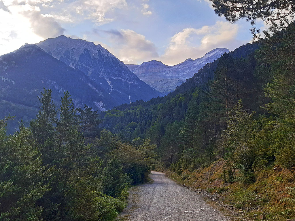
(0h00min; 0,0kms) Refuge-Camping of Bujaruelo (1.330m). The route starts at the back of the refuge, following the main track that runs along the right side of the valley (left of the walk). In other words, do not cross the Bujaruelo bridge.
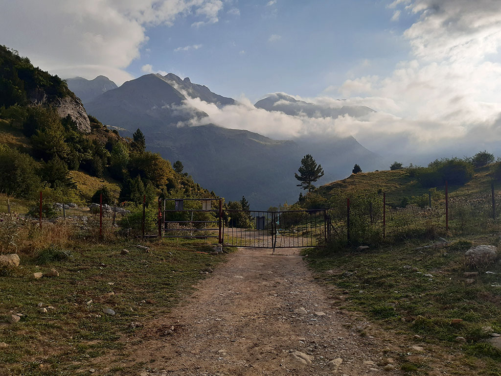
(0h15min; 1,0kms) Atajo (1.344m). After barely a kilometre of walking we will reach the first of the shortcuts, a path on the left hand side that goes up crossing the track on several occasions until we reach the Otal pass. If you prefer to walk along the track, simply follow it for another half kilometre until you reach the Fernalla spring, just before the Oncins bridge, where you take the track on the left at the crossroads.
(0h55min; 2,4kms) Col of Otal - Entrance to the Otal valley (1.606m). From here you can see the whole valley. Imagine the huge glacier that must have existed here.

At this point we can either start the return journey or comfortably walk the track all the way to the end, to the...
(1h25min; 4,5kms) Cabaña de Otal (1631m).
(1h55min; 6,6kms) Col of Otal - Entrance to Otal valley (1.606m). Either along the track or the shortcuts, we descend to a horseshoe bend in the track on the left hand side, at the exit of the last shortcut.
(2h25min; 7,8kms) Horseshoe bend - last shortcut (1.410m). At this point we can choose to return following the same path as on the way out, or go down the track passing the Fernalla fountain and the Oncins bridge until we join the GR11 on the left bank.
(2h45min; 8,6kms) GR11 (1.365). The Senda Pirenaica / GR11 (red and white markings) runs along the left bank of the Ara, crossing an area of meadows next to the river, before reaching the...
(3h15min; 10,2kms) Medieval bridge of Bujaruelo (1.336m)end of this route.
Bujaruelo, a strategic place for communications in the past.
In the past, the area around Bujaruelo was a strategic point for communications between the two sides of the Pyrenees. It was a crossing point for livestock to France, regulated by international treaty since 1390, a crossing point on the pilgrim routes to Santiago de Compostela, and a defensive bastion in the mid-20th century in the face of the fear of a possible invasion from Europe.
Next to the bridge is the refuge of Bujaruelo, a former pilgrims' hospital (12th century) built by the monks of the Order of the Knights Hospitaller of St. John of Jerusalem, and the ruins of the Romanesque chapel of St. Nicholas.
Fastpacking is not about going faster. It's about going lighter.
If you come from classic trekking, this is the next step: learning to move with less weight,
more fluid and enjoying every kilometre more.
Join the Outsiders Newsletter and start discovering what lightness feels like.