Ascent of D'Acher Castle (2,384m) from Oza Bridge
Pyrenees and mountains 📩
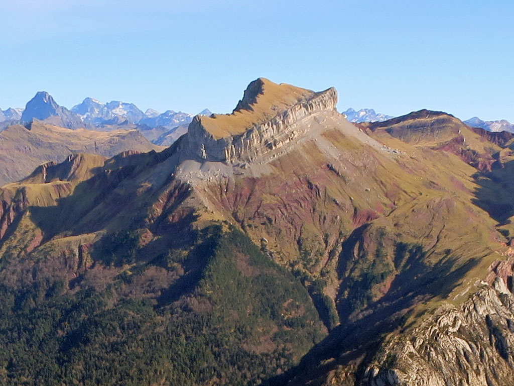
Here 🔥The Château D'Acher, in the Parc Naturel des Vallées Occidentales, is one of the must-see climbs in this part of the Pyrenees.
Its individual silhouette with its impregnable appearance is unmistakable. A magnet for mountaineers. Its four faces are defended by vertical walls reminiscent of a fortress, which have earned it the nickname of Castillo d'Acher. However, the barrier has some weaknesses where its normal routes ascend, and in the case of the one that concerns us, the one that ascends the south face, it does not present any technical difficulties.
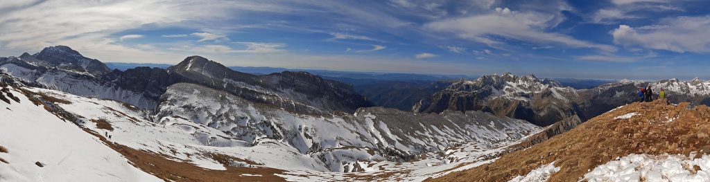
As if that were not enough, the Château D'Acher has some geological peculiarities that give it a special beauty. Of particular note are the colourful reddish rocks that we find all along the climb, the result of the oxidation of the iron minerals present in the Permian shales; or the suspended valley (a syncline) that crowns the top of the Château D'Acher.
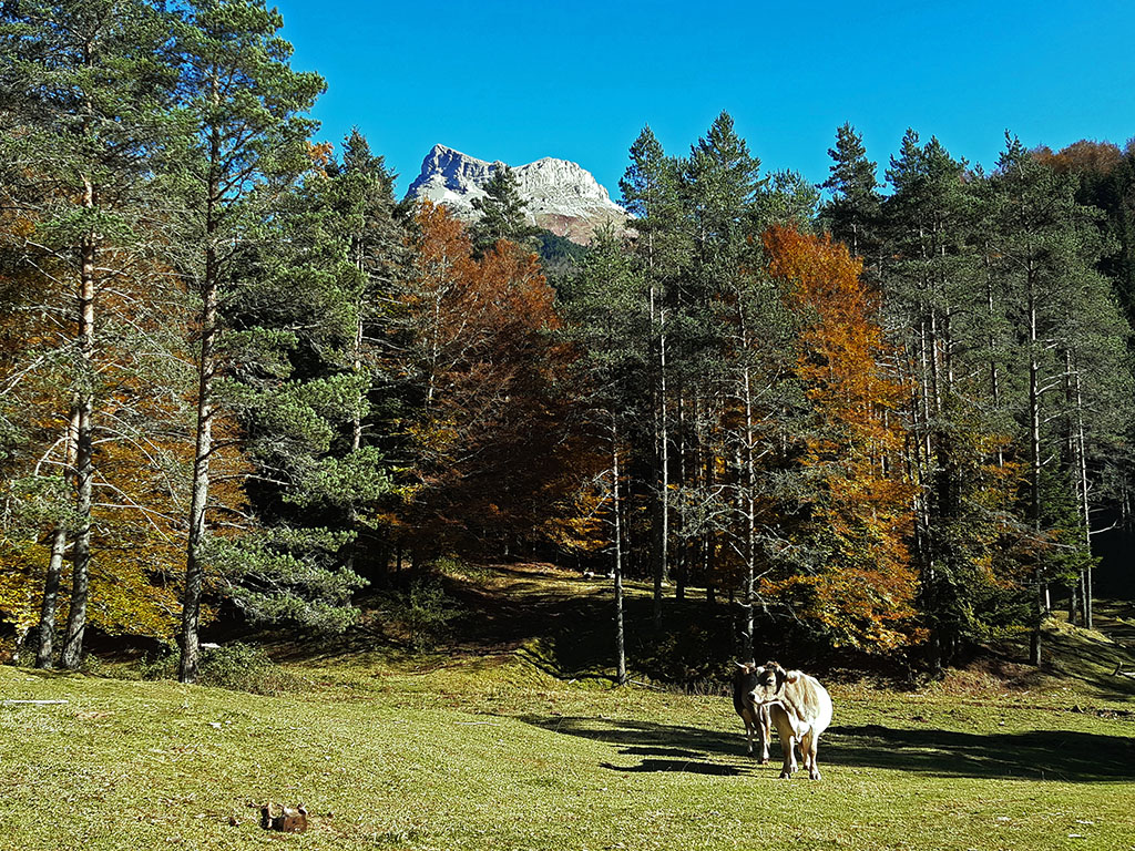
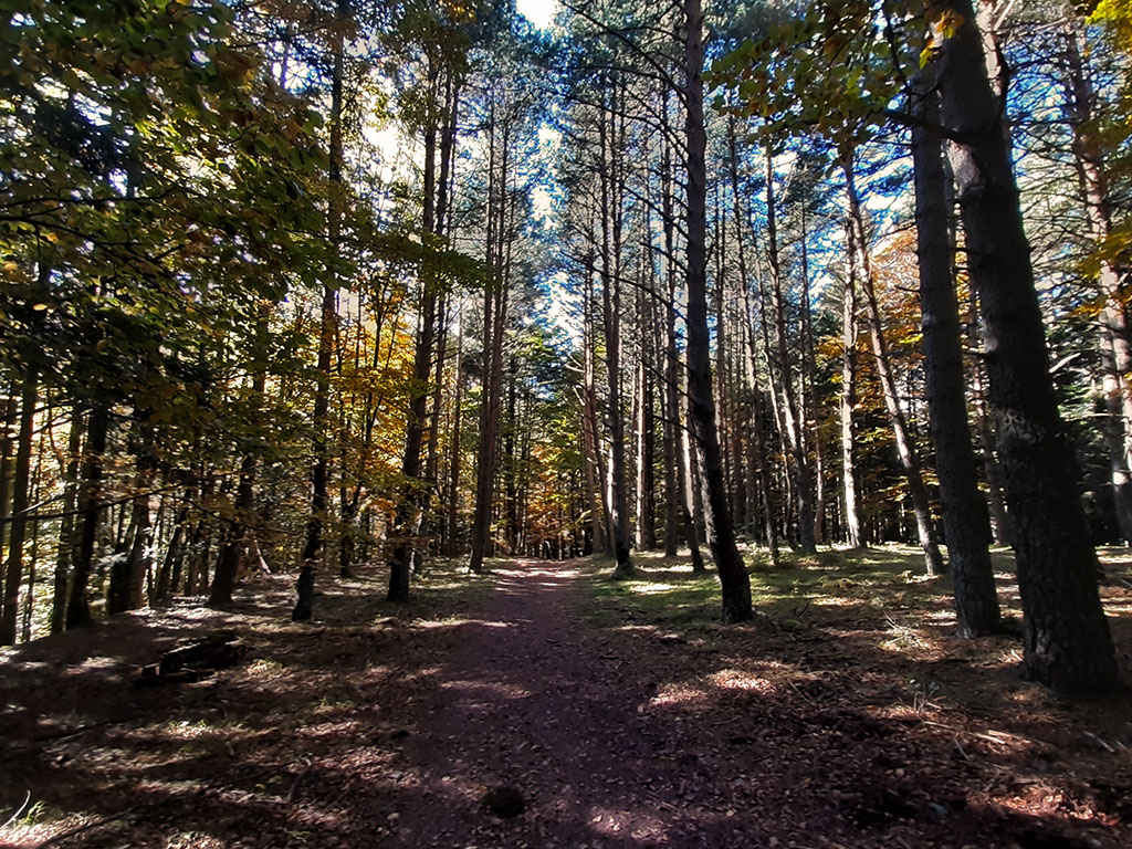
To finish off, we cannot forget the magnificent forest of firs, beeches and other species that we find in the first part of the ascent, in the Selva de Oza, or the magnificent views from the top.
In short, an excursion not to be missed and which makes Castillo D'Acher one of the favourite peaks among those who are new to the Pyrenees and one of the most popular among the most experienced mountaineers.
Summary:
Return route along the same path to climb to the D'Acher Castle. Once at Puente de Oza, we follow the GR11 in the direction of Puente de Santa Ana/Gabardito, until we reach the path to Castillo D'Acher. From here the slope becomes steeper. The path ascends through woodland and further up to an area of meadows where our mountain is already visible. We will notice a gap that cuts into the wall and that is the only weak point to ascend on foot. Once at the top, the only thing left to do is to make a practically horizontal traverse to the right, and the final slope to the summit. The return is by the same route.
Map:
Downloadable:
> Download Track
Technical specifications:
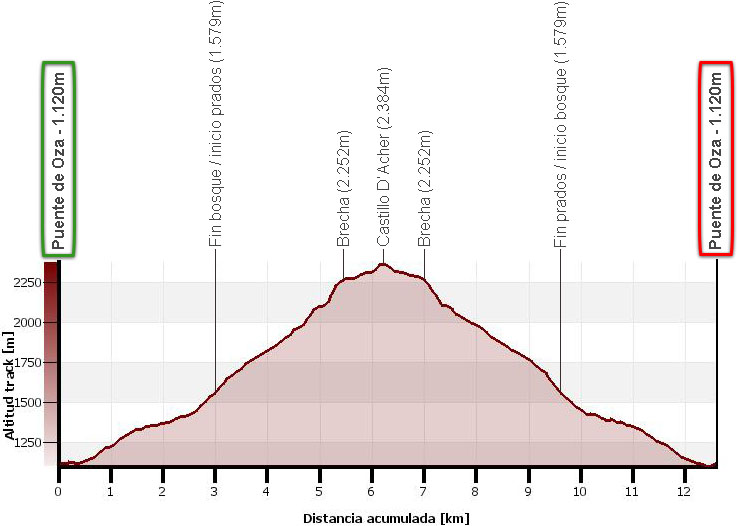
Distance: 12,6kms.
Cumulative difference in altitude: 1270m.
Timetable: about 6 and a half hours. Walking time without stops: 5h20min.
Water: In the forest area you pass a couple of streams.
Difficulty: The ascent is very steady, but nevertheless, it is quite easy to do. As far as technical difficulties are concerned, there are none to be found if it is in the summer season or if there is no ice or hard snow.
Recommended equipment for the summer: boots or slippers, two walking sticks, GPS (optional), canteen.
How to get there:
See in Google Maps.
To get to the starting point of this excursion, the Oza bridge, we will take as a reference point the town of Siresa, which we will reach following the A-176 from Puente la Reina de Jaca (26kms).
Once in Siresa, the last village in the Hecho valley, we continue straight on along a narrow road that leads to the Selva de Oza. The road follows the Aragón Subordán valley upstream, crossing the Boca del Infierno (Hell's Mouth) and a spectacular forest of fir and beech trees. We park just before crossing the bridge where the road changes banks, in a large car park on the left hand side. In total 10.5 kilometres from Siresa.
Itinerary:
(0h00min; 0,0kms) Bridge of Oza (1.120m). Once we cross the Oza bridge, we will take the GR11/Pyrenean Path that goes along the left bank of the Aragón Subordán towards the Santa Ana bridge and Gabardito.
In about 10 minutes, a signpost points to the left to the path to Castillo D'Acher, which separates from the GR11. The path ascends between firs, beeches and boxwoods, crosses a track (0h15min) and continues uphill without encountering any notable forks.
Further up, the path crosses the Espata ravine (0h50min) and leaves the forest.
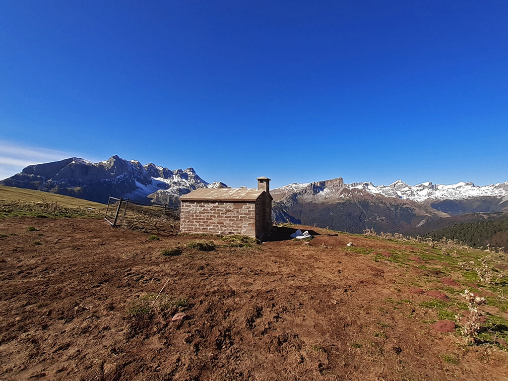
(1h05min; 3,0kms) End of forest/beginning of meadows (1.579m). Shortly after starting to climb up through the meadows, on the right, about 300 metres further on, you will come to the Lo Castillo D'Acher hut (acceptable, 6-8 people).
The path, well marked, continues to climb on clear ground with a tendency to the left, towards the southern slope of the Château D'Acher.
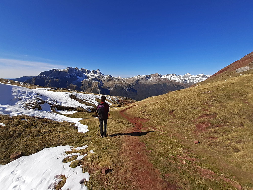

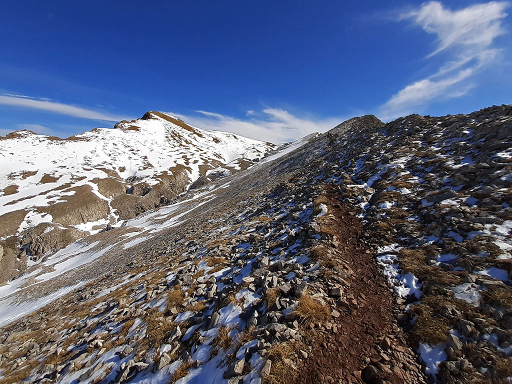
Follow it in an easterly direction, halfway uphill, until a point where the path to Castillo D'Acher suddenly turns left (1h55min) and starts to climb in the opposite direction (northwest). Be careful not to go straight ahead towards the pass of lo Barcal. You can also take a shortcut going straight ahead up the slope, without a path. A few minutes later, after passing an area of reddish rock, turn right to face the slope head on. The path is dispersed in the rocky area without this posing any orientation problems, as we head towards the gap that crosses the wall through its only weak point.
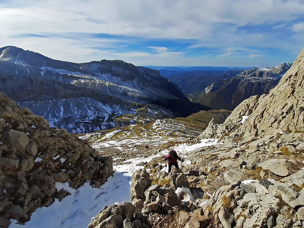
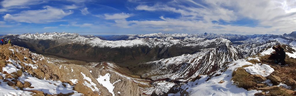
(2h30min; 5,3kms) Gap (2.252m). Once at the top, the suspended valley opens up before us, culminating on the right in the Château D'Acher.
What remains is simple. Walk halfway up the slope on the right, along a practically horizontal path that climbs up the valley and ends on the left, with the final ascent to the Château D'Acher.
(2h55min; 6.2kms) D'Acher Castle (2,384m).
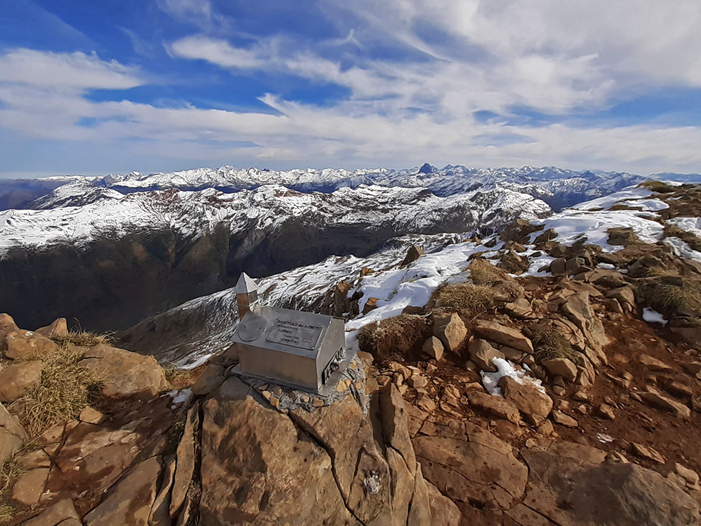
Magnificent views in all directions towards the surrounding mountains.
We will return by the same route.
(3h15min; 7,0kms) Gap (2.252m).
(4h20min; 9,6kms) End meadow / start forest (1.579m).

(5h20min; 12,6kms) Puente de Oza (1.120m).
Books / Maps:
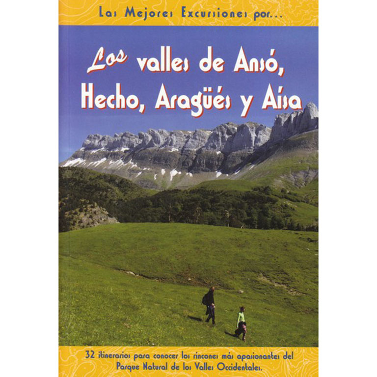
The valleys of Ansó, Hecho, Aragüés and Aísa.
- Editorial: The Rambler
- Language: Spanish
- No. of pages: 192
- ISBN-10 : 8495368498
- ISBN-13 : 978-8495368492
- Publication: 2009
Fastpacking is not about going faster. It's about going lighter.
If you come from classic trekking, this is the next step: learning to move with less weight,
more fluid and enjoying every kilometre more.
Join the Outsiders Newsletter and start discovering what lightness feels like.