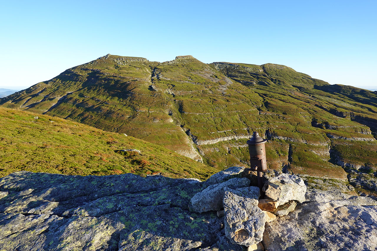
Castro Valnera (1.718m) y Cubada Grande (1.607m) desde El Bernacho
Pirineos y montaña 📩
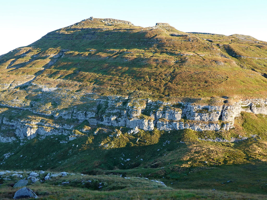
Aquí 🔥El Castro Valnera (1.718m), en pleno corazón de los valles pasiegos entre Cantabria y Burgos, es la montaña más alta del sector oriental de la Cordillera Cantábrica y una de las más prominentes de la península ibérica (la número 53). Una cumbre que fuera números, tiene una de las ascensiones más gratificantes y bonitas que podemos realizar a lo largo y ancho de la geografía española.
Su “modesta” altitud no debe llevarnos a subestimar al Castro Valnera. Su orografía y su situación en la divisoria de aguas cantábrico-mediterránea, hacen del Castro Valnera un lugar tremendamente expuesto a abundantes precipitaciones, muchas de ellas en forma de nieve, y al frío. De hecho, este clima riguroso se refleja en el paisaje con numerosos ejemplos de morfología glaciar (cubetas, morrenas, valles en “U”…).
Desde un punto de vista orográfico, el Castro Valnera presenta dos vertientes claramente diferenciadas. La vertiente cántabra, hacia donde se desploma salvajemente con unas laderas de hierba inclinadísimas de 1000 metros de desnivel; y la vertiente burgalesa, por donde transcurre esta ruta, mucho más amable pero también preciosa.
Mapa:
Descargables:
> Descargar Track
Resumen:
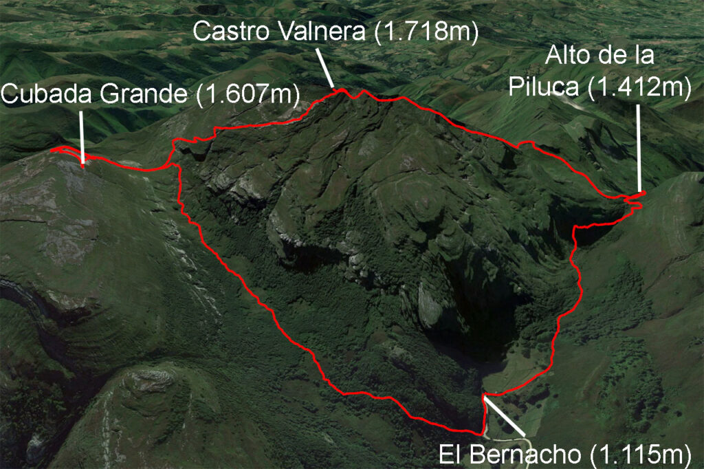
Ruta circular al Castro Valnera con subida a la Cubada Grande desde las Cabañas de El Bernacho. El recorrido sube hasta el collado existente entre los dos picos para desviarse a la Cubada Grande y regresar de nuevo al collado antes de acometer la subida al Castro Valnera. Para el descenso, se sigue el cresterío hasta el collado que precede a el Torcaverosa y de ahí al collado del Alto de La Piluca. El descenso a las cabañas del Bernacho ofrece dos posibilidades, nosotros hemos escogido el sendero de la derecha por el valle.
Cómo llegar:
Ver en Google Maps.
Tomando como referencia la localidad de Espinosa de los Monteros, seguiremos las indicaciones al Portillo de Lunada, que coincide en los 5 primeros kilómetros con la carretera al Portillo de la Sía y hasta el kilómetro 8 con la del puerto de las Estacas de Trueba / Vega de Pas. Al llegar a este cruce, abandonamos la BU-570 para continuar otros 3,5 km por la BU-572 en dirección al Portillo de Lunada y Castro Valnera (el Bernacho). Hacia el kilómetro 3,5 de esta carretera aparece una pista de hormigón al principio, después grava, en la que se indica el Castro Valnera y el Bernacho. La seguiremos otros 3,5 kilómetros. Para aparcar, el mejor lugar es un poco antes de que termine la pista, en una curva a mano izquierda previa a una subida, o si no, en la curva a derechas después de esta última subida. Otra opción es aparcar al final de la pista, donde también hay algún sitio. Desde aquí situamos el inicio de nuestro track.
Ficha Técnica:
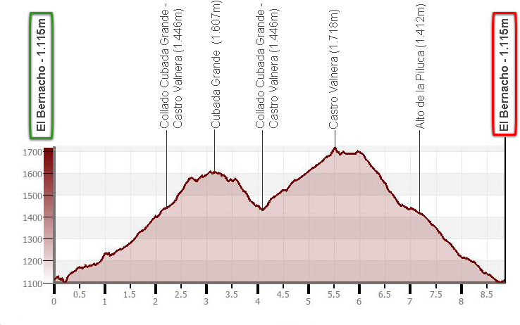
Distancia: 8,8kms.Desnivel acumulado: +/-850m.
Horario: unas 4 horas y media. Tiempo de marcha sin paradas: 3h50min.
Agua: no hay agua en el recorrido.
Dificultad: el recorrido no presenta pasos técnicos de escalada ni zonas comprometidas. Si el día está despejado es fácil orientarse.
Equipo recomendable para el verano: botas o zapatillas, dos bastones, GPS (opcional), cantimplora.
Itinerario:
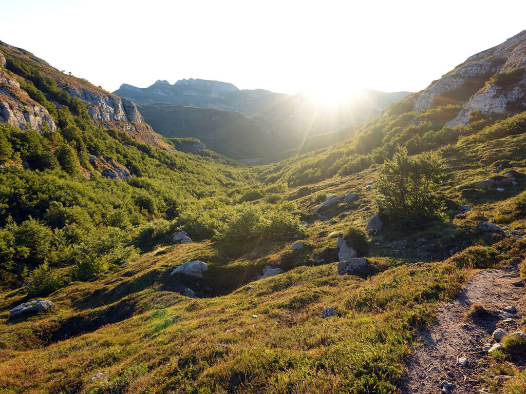
(0h00min; 0,0km) El Bernacho, Cabañas de… (1.115m).
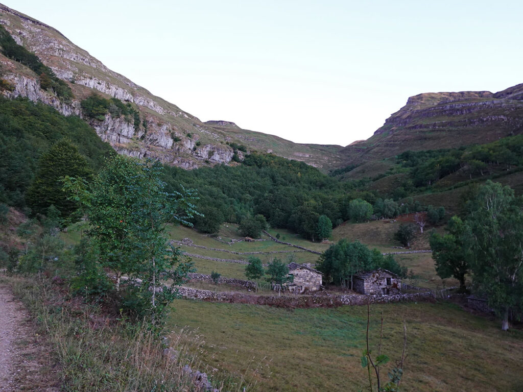
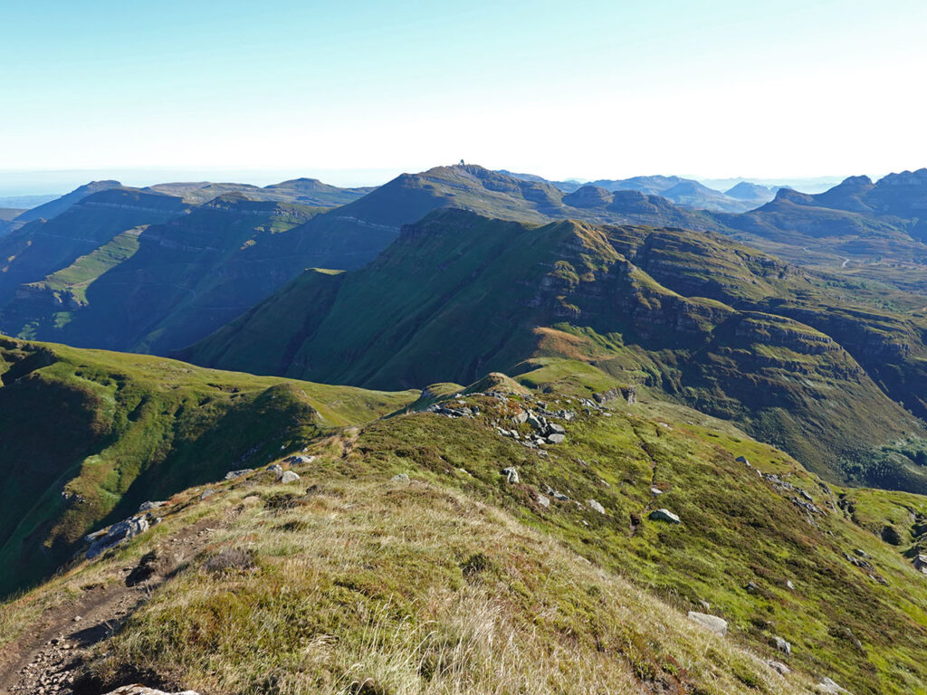
En la pista que lleva a las cabañas del Bernacho, en la última curva a la derecha, 150 metros antes de que acabe la pista, localizamos el sendero de subida al Castro Valnera. El inicio de la senda está señalizado mediante un poste de madera con las marcas de PR (blanca y amarilla) y de SL (blanca y verde). El comienzo entre el hayedo resulta muy agradable, no dura mucho, y media hora más tarde nos hayamos caminando por un terreno despejado en el que predominan los brezos. La senda va cogiendo algo de altura y si volvemos la vista atrás, podemos observar el valle por el que hemos subido y al fondo, la silueta del Becerril (1.455m), Bustarejo (1.517m) y Peña Lusa (1.573m).
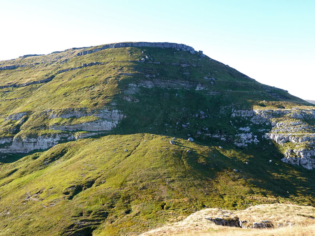
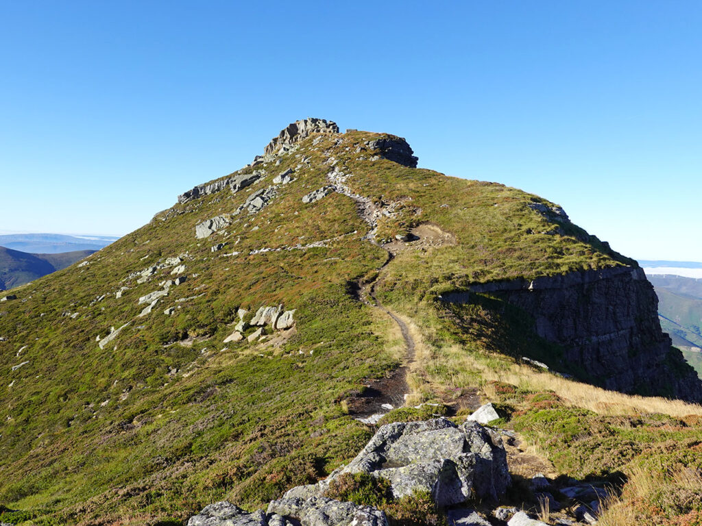
(1h00min; 2,2km) collado entre Cubada Grande y el Castro Valnera (1.446m). En este punto podemos decidir si subir directamente al Castro Valnera, continuar hacia La Capia (1.501m) o subir a Cubada Grande (1.607m). Aquí hemos optado por subir a Cubada Grande y dejar La Capia para otra ocasión. Por tanto, nos fijaremos en un senderillo a mano izquierda no demasiado marcado, que asciende en diagonal hacia la Cubada Grande.
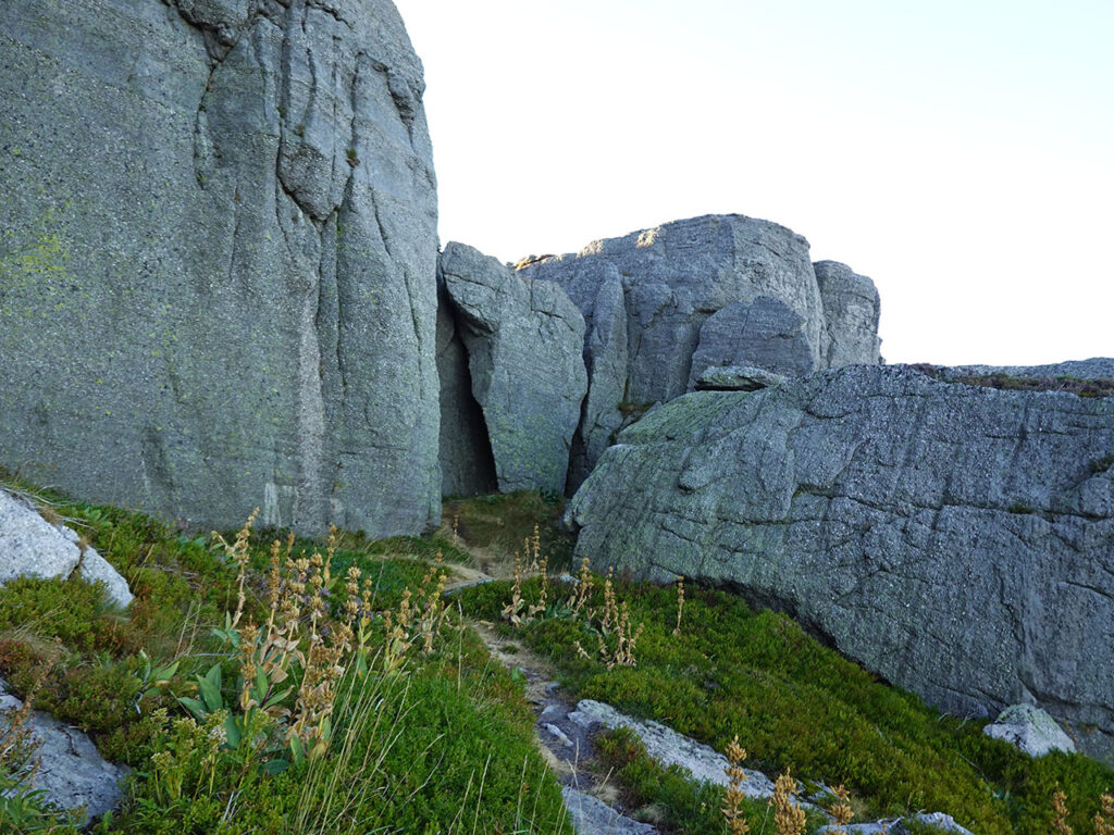
El acceso a la cumbre esta defendido por una pequeña muralla de unos pocos metros de alto pero muy alargada. El sendero bordea la muralla por la derecha (Sur) perdiendo algo de altura hasta localizar su punto flaco, una pequeña grieta-agujero por la que trepamos fácilmente.
La cima queda en dirección norte-noreste. Nosotros, si seguís el track, hemos ascendido siguiendo el borde del cortado dando un pequeño rodeo.
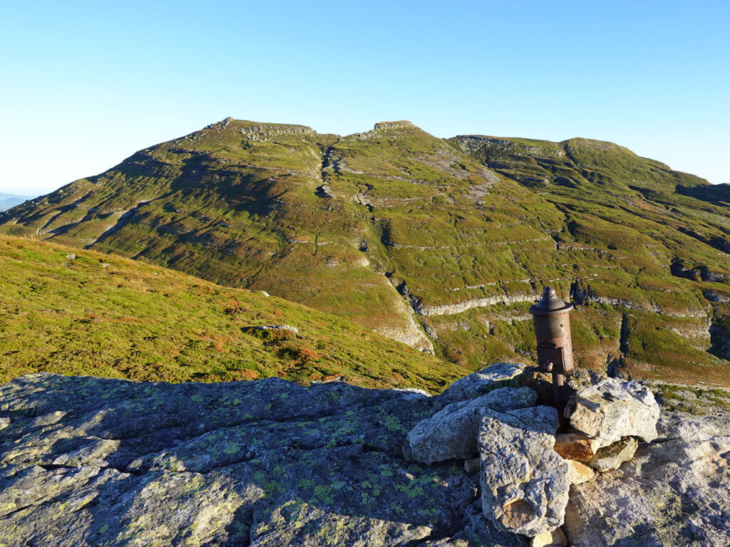
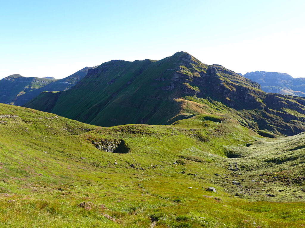
(1h30min; 3,2km) Cubada Grande (1.607m). Inmejorables vistas hacia el Castro Valnera y la comarca de las Merindades.
Para el descenso, ahora si, nos dirigiremos lo más recto posible en busca del paso a través de las rocas, y por terreno ya conocido regresaremos al…
(1h50min; 4,0km) collado entre Cubada Grande y el Castro Valnera (1.446m). Ahora nos dirigimos al Castro Valnera. El sendero faldea la base de la muralla hacia la izquierda (Oeste) en busca de un punto debil por el que superar la franja rocosa para, una vez arriba, girar a la derecha y ascender a media ladera por terreno herboso.
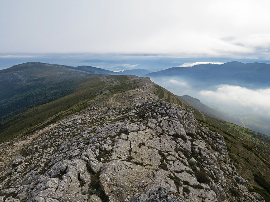
La senda principal contornea el Castro Valnera para salir a la cresta algunos metros más allá de la cima (norte), si bien, en este terreno la senda se diluye y aparecen otras opciones por las que podemos alcanzar la cumbre.
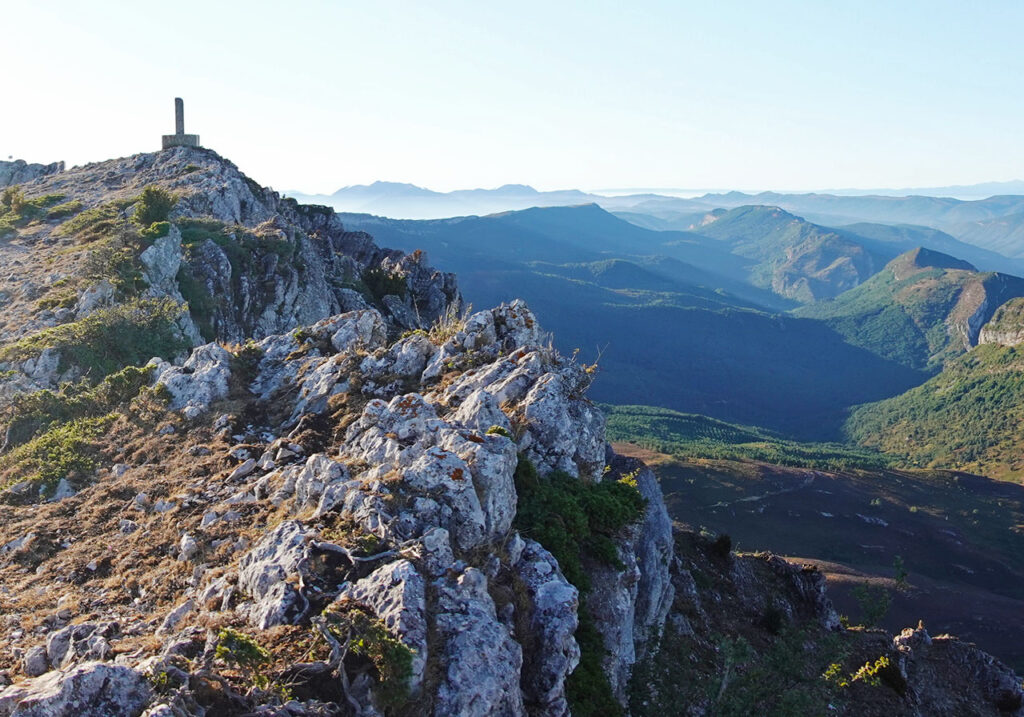
(2h30min; 5,5km) Castro Valnera (1.718m).
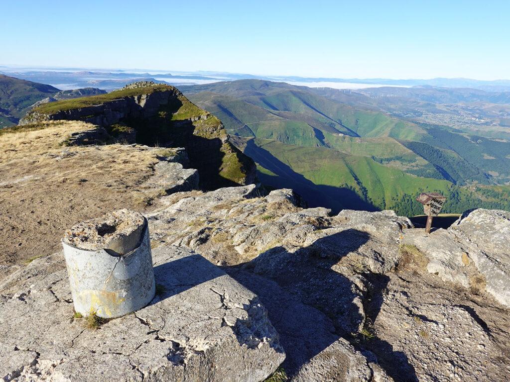
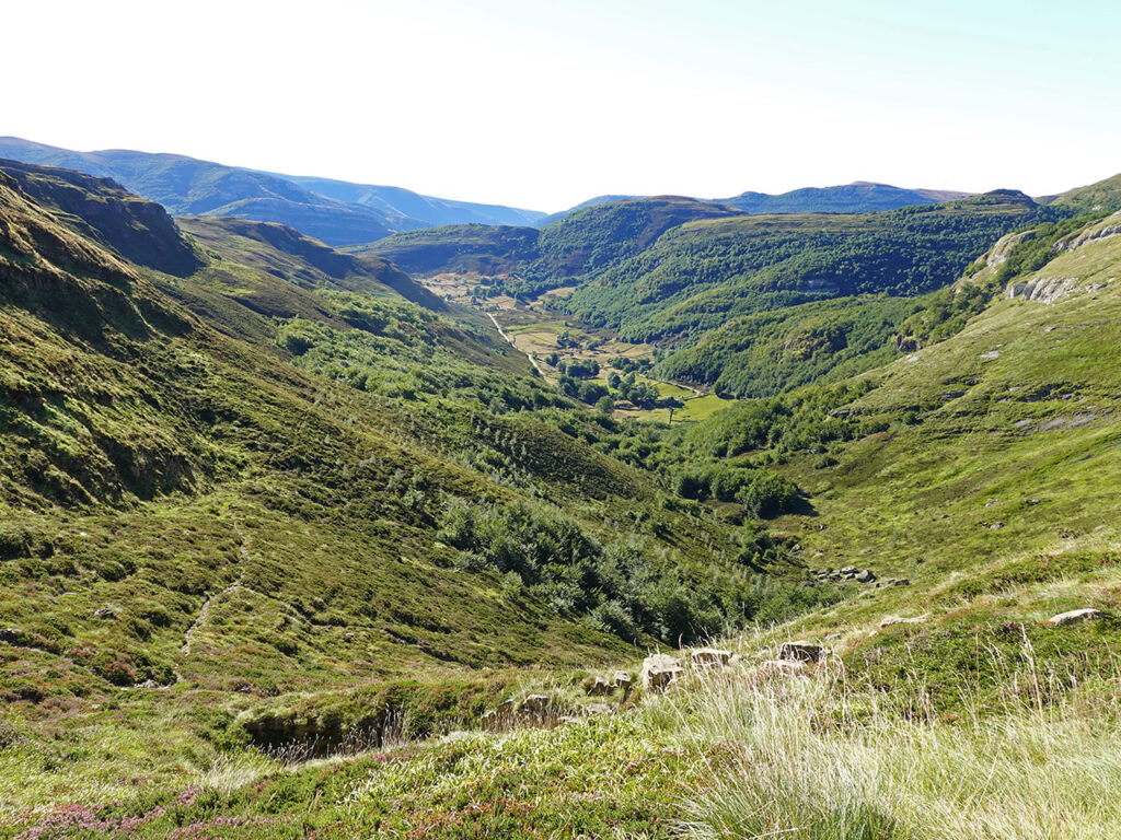
La panorámica hacia los valles cántabros es alucinante. Hacia esta vertiente el Castro Valnera se desploma por unas empinadísimas rampas de hierba de un intenso verdor. Mientras, al fondo, se divisa el mar cantábrico y Santander, al otro lado de la bahía.
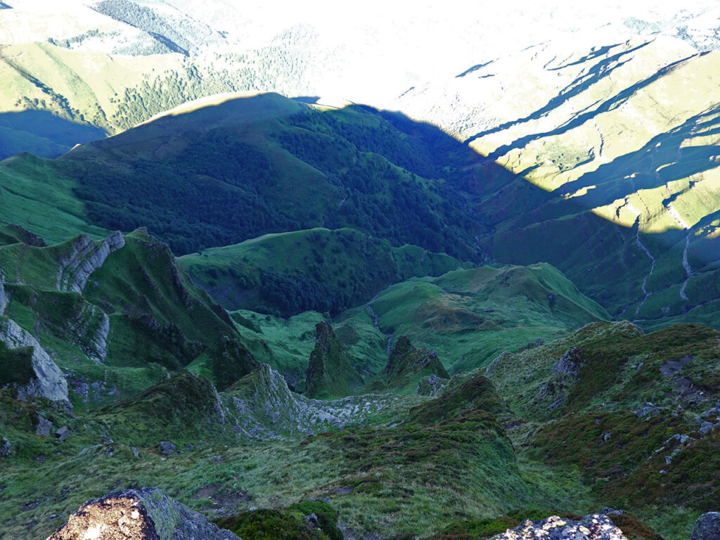
La senda continúa ahora sobre el filo de la cresta. La seguiremos hasta el collado que precede al pico de Torcaversosa, donde abandonaremos la divisoria para descender a mano derecha por una hondonada.
Nos dirigimos a un amplio collado bajo el Pico de la Miel conocido como…
(3h10min; 7,2km) alto de la Piluca (1.412m). El sendero gira a la derecha y poco después se divide, a media ladera, de frente, se sigue hacia el Pico de la Miel y el Portillo de Lunada; hacia abajo, a la derecha, regresamos a las cabañas del Bernacho. Con pena de no subir al pico de la Miel, seguimos a la derecha para encontrarnos con un segundo cruce 10 minutos más tarde. Ambas opciones llevan al Bernacho. Aquí describimos la senda de la derecha, la menos clara de las dos. El senderillo baja próximo a la pared de la derecha antes de torcer y enfilar hacia el fondo del valle.
En el momento en que realizamos la ruta el sendero estaba limpio pero, tiene fama de cerrarse con facilidad a causa del brezo. Sin mayores contratiempos alcanzamos el punto de inicio de esta ruta, las…
(3h50min; 8,8km) cabañas del Bernacho (1.115m).
CERCA DE AQUÍ TE PUEDE INTERESAR
Ruta circular a Peña Corva + San Mamés + Alto de San Lázaro. Subida desde Baíllo y bajada a Quintanalacuesta. [4h45min; 14,6km; +/-930m]
Parque Natural de Montes Obarenes – San Zodornil. Ruta circular al Humión y Flor desde Orbañanos, en la vertiente norte. [4h30min; 15,4km; +/-935m]