Hiking and trekking in the Fukushima region, Japan
Pyrenees and mountains 📩
Here 🔥This region of Japan offers interesting options for trekking enthusiasts. You can see a variety of vegetation, including alpine and wetland plants, and a dynamic landscape. Highlights include (we include links that will take you to the specific section of the article as shortcuts).:
- Oze National Park. This is one of the areas that many hikers consider to be one of the most unexplored in Japan.
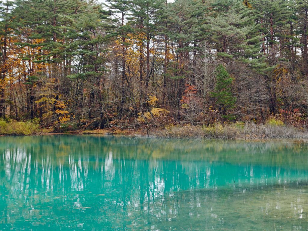
- Goshikinuma Pond. The ponds have emerald green, cobalt blue, turquoise blue, emerald blue and pastel blue colours, which change in each of the marshes.
- Jodo-dairaThe landscape is rugged with an active volcano and Mount Issaikyo ahead.
- Mount AdataraThe foliage in autumnal tones captivates with its marvellous autumn foliage.
- Mount Bandaiwhich lost its summit that was toppled by an eruption about 100 years ago. The north and south sides of this mountain differ in appearance. The view of Urabandai from the top of the mountain is simply remarkable.
Bandai Asahi National Park (Goshikinuma Pond, Mt. Bandai, Mt. Adatara, Jodo-daira and Mt. Issaikyo)
Link of interest: bandaisan-geo.com
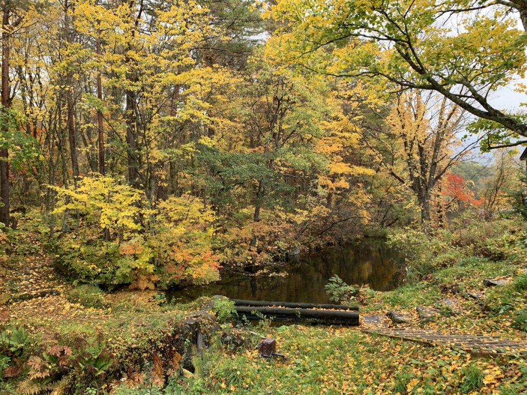
In this region, Urabandai is located, which is one of the places where you can appreciate Japan's natural beauty to the full. The region is home to Mount Bandai, which is one of the most famous mountains in the country. In addition, the region also has Lake Hibara, Goshikinuma which is a stunning five-coloured pond, numerous wetlands and crystal clear streams.
There is also Mount Bandai, or Treasure Mountain. The top of this mountain, if viewed from the north side, shows the peak that was created from an explosion in 1888. This explosion created a rockslide that stopped the flow of the river, resulting in the creation of lakes and marshes. Among these is Goshikinuma, which lies between Lake Hibara, Lake Akimoto and Lake Onogawa. In this pond you can see the colours of several lakes, together with the magnificent landscapes and hot springs. The river was dammed and the largest lake in the area, Lake Hibara, was born.
In the northern part of Mount Bandai is Urabandai, while in the south it is called Omotebandai. If the mountain is viewed from Omotebandai, it has a shape, but if it is viewed from Urabandai, the shape left by the explosion can be seen.
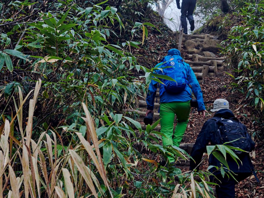
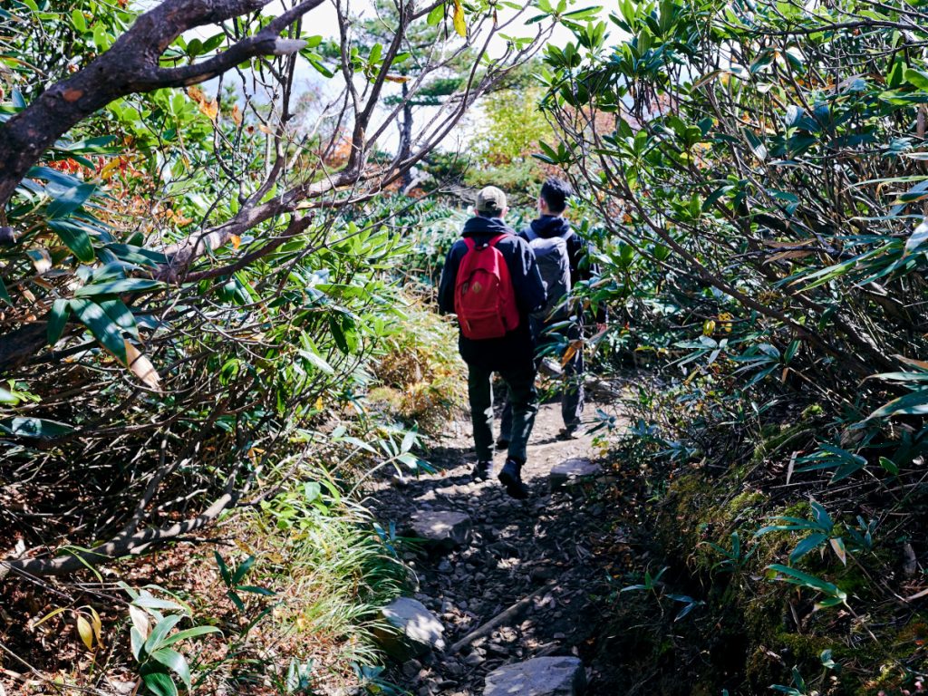
Urabandai is one of the best options for hiking and has magnificent forests. It is totally green in spring, then changes to dark green in summer, then to red in autumn and finally, silver in winter. It is an area where you can feel all the beauty of nature. Wildlife is rarely seen during the day, but is present at night. Also this area is recognised as an Important Bird Area (IBA), following international guidelines. A large number of wild birds can be observed, due to the region's different habitat types.
Oze National Park
Link of interest: Oze Preservation Foundation
These wastelands cover Fukushima, Niigata and Gunma prefectures. In 1940, construction of a hydroelectric dam began, but citizens rejected this construction and activated environmental protection plans. The project was subsequently halted in 1966. This was one of the first environmental protection activities to be carried out in Japan. As a result of Japan's pioneering environmental protection activities, the surrounding hot spring towns and mountain huts are still preserved today, and the area is now popular with many hikers as one of Japan's most unexplored regions.
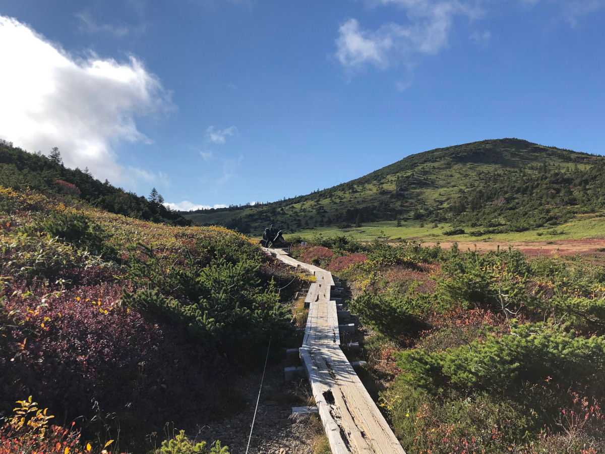
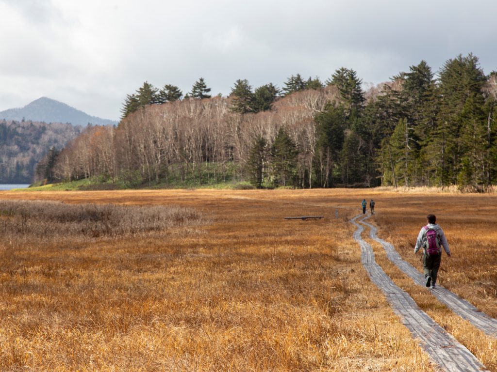
The Oze National Park covers an area of 372 km². Numerous ponds, marshes and mountains can be found in this area. In late spring, the park is in full bloom. There are many hiking trails in the park, which are graded according to the level of difficulty and can be done from spring until late autumn.
There are numerous hiking trails of different levels of difficulty (they are classified into three levels). Of particular note are the areas of Ozegahara with easy and medium level routes; from the Mount ShibutsuThe difficulty of the course is medium to difficult. Onsen-goya and Sanjo-no Taki Waterfalls; area of Ayamedaira, Fujimi Toge pass; Lake Ozenuma, Mount Hiuchigatake; y Kozodaira Hiuchi-Ura, Shibosawa-onsen-goya.
One of the busiest routes is from the trailhead at Hatomachitoge, which is beyond the marshy area and ponds, to the start of the Oshimizu trail. This trail can be done in six to eight hours. One of the attractions of this trail is that you cross the Ozegahara marshes around the Ozenuma Pond on raised wooden platforms.
This tour can be done as a day trip, departing from Tokyo. It is advisable to spend the night in the huts, in order to avoid having to get up early and travel on the same day of the tour.
Hiking in Goshikinuma Ponds
Link of interest: Urabandai Lake district of Japan
The ponds of Goshikinuma Pond refer to an area which has numerous lakes and ponds which include Bishamonnuma, Akanuma, Midoronuma, Tatsunuma, Bentennuma, Rurinuma, Aonuma and Yanaginuma. The ponds have emerald green, cobalt blue, turquoise blue, emerald blue and pastel blue colours, which change in each of the marshes.
The area consists of more than five ponds and is famous for its simply spectacular spectrum of colours. The way it is displayed depends on factors such as the weather, the season, where you look at it, the volcanic substances contained in the water, and many more. It even changes according to the time of year.
Excursions in the area are recommended for beginners, as they are usually short and allow you to enjoy Goshikinuma at its best. You can enjoy boating on the largest pond, Bishamonnuma. And if you want to go bird watching, it is best to do so after winter and before autumn. In the spring season the colours of the ponds are much more beautiful.
The route along the Goshikinuma (five marshlands) is approximately 3.6 km long and which is carried out in about 90 minutes. It is an easy route with hardly any slopes, although it is necessary to take precautions during the rainy season. It is a special protected area within the national park, so neither the vegetation nor the animals can be affected. This means that in order to protect the landscape it is important to stay within the established trails.
For enter the path can be done through two entrances, each with a car park and a bus stop. If you go by car, there is a car park where you can leave your car, walk the trail and return to the car park by bus. It is advisable to check the bus schedule in advance, as these are very limited.
Entrance of Goshinuma (Bishamonnuma pond side)
- By car: It is advisable to go to the Urabandai visitor centre or the car park at the tourist plaza at the entrance to Goshikinuma. It is located approximately five minutes walk from Bishamonnuma. There is also a very large area, which is the bus car park.
- By bus: Get off at Goshikinuma Iriguchi bus stop.
Entrance to Urabandai Kogen-eki (including Yanaginuma Pond, Aonuma Pond and Rurinuma Pond)
- By car: Urabandai Bussankan car park must be used. Yanaginuma Pond is in front of the car park. There is also a very large bus parking area.
- By bus: Get off at the Urabandai Kogen-eki bus stop.
This route of lakes and marshes is recommended for beginners, as it is a short walk that allows you to enjoy Goshikinuma.
Trekking to Mount Bandai
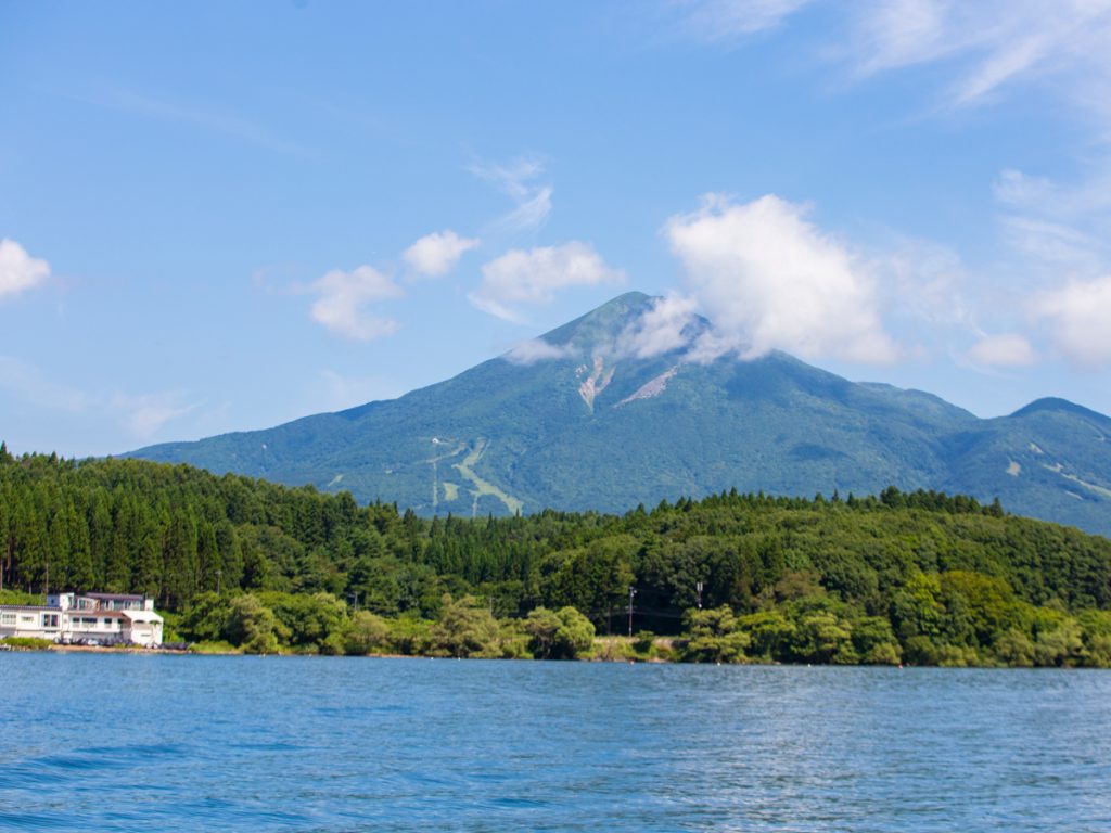
Mount Bandai extends over three cities and the villages of Inawashiro, Bandai and Kitashiobara in Yama District, Fukushima Prefecture. It has an altitude of 1,816 metres, and one of its main attractions is that the front and rear of Bandai show a different shape.
The eruption that occurred in 1888 significantly changed the topography of the area, not only of the mountains, but also of the surrounding area. Spectacular sites such as Lake Hibara and Goshikinuma were created. Even the effects of the eruption can still be seen at Urabandai on the north side of the mountain. On the south side is Lake Inawashiro, which is the fourth largest lake in the country. The Omotesando as seen from here looks particularly attractive, being very visited by tourists at any time of the year.
The ascent of Mount Bandai can be done by six routes, but the most recommended route is from the entrance to Happodai. This route is the one with the lowest gradient and can be done in approx. 2h10′ ascent; and 1h30′ descent. Route for mountaineers from intermediate or advanced level.
We will find an intermediate point called Bandai Onsen Nakanoyu Ruins. It was formerly a thermal spabut it is no longer in operation. However, you can still smell the sulphur smell. As you continue along the route, you can reach a junction that leads to the flower garden and Kobo Shimizu, which has some dazzling scenery.
Regardless of the route selected, you will always arrive at Kobo Shimizum, where there is a hut and a small rest area. It can take between 25 and 30 minutes from Kobo Shimizu to the top. On the route, from the Happodai climbing entrance to Kobo Shimizu, which is the fourth station, you reach a place where you have a clear view. From this point you can see Lake Hibara, Lake Onogawa, Lake Akimoto of Urabandai, as well as the copper swamp, crater field and crater wall.
Arriving at Kobo Shimizu tents can be found where you take a short break. You can hydrate yourself in this area, as there are plenty of fresh and cold water fountains. From this point to the summit, which is the fifth station, there is a short ascent that is done quickly.
When you reach the top of Mount Bandai, you can see a view of Lake Inawashiro, Mount Iide, Mount Gassan, Mount Azuma and Mount Adatara. It is possible to enjoy a 360-degree panoramic view. Towards the Urabandai side, it is possible to see the desolate landscape of the crater field as well as the rugged crater wall. A Urabandai - Kawakami route can be found which is difficult to climb for beginners.
It is possible to reach the start of the Happodai trail, either by car or taxi from Bandaimachi Station or Inawashiro Station. Alternatively, you can take a bus from Inawashiro Station to Bandai Kogen, and then take a taxi from there.
The taxi ride from JR Bandaimachi Station to the start of the Happodai Trail takes about 40 minutes, and then from Bandai Kogen Station to the start of the Happodai Trail takes about ten minutes.
Parking is completely free at the entrance to Happodai along the Bamdaisan Gold Line, and there are toilets and rest areas. Climbing is possible until before winter. The best time, however, is mid-September to about mid-October. It is not recommended to do the route on weekends. This route is intermediate to advanced. While there are routes, the one recommended for beginners takes 4 hours and 30 minutes to do, both there and back to the top.
Jodo-daira, Trekking to Mount Issaikyo
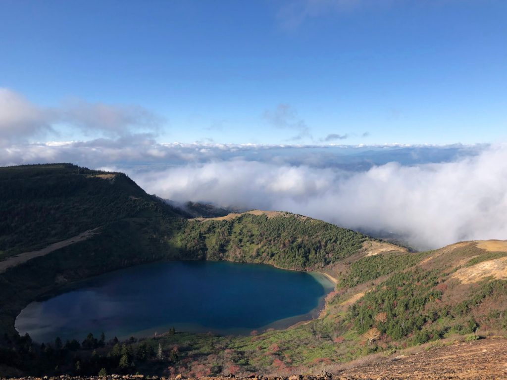
It is possible to do the Mount Issaikyo route. On this route you can reach the top of this active volcano, while listening to the sound of the smoke rising. From there it is possible to admire the breathtaking views of the emerald green water of the Witch's Eye, which is also known as the Goshikinuma Pond.
It takes about 2h30′ from the Jododaira Visitor's Centre to the top and back. If the weather is good, you can see Goshikinuma (different from Urabandai), which is known as the Witch's Eye, from the top.
Volcanic gases are always emitted and it is still an active volcano. Beginners and medium experience level.
Trekking to Mount Adatara
Mount Adatara has an altitude of 1,700 m, and is one of Japan's most famous mountains, attracting many mountaineers from Japan and other parts of the world. It can be reached by a cable car, which takes about an hour and a half to reach the top.
It is also well known for its autumn foliage colour. There is a large influx of walkers from the end of September to October. It is an easy fifteen-minute drive from Dake Onsen, which originates from Mount Adatara, to the start of the Okudake trail.
Highlights include:
- Yakushidake Scenic Park: From here you can see the entire Mount Adatara mountain range from Mount Yakushi, which is located at an altitude of 1,350 m. It is located below the cable car station, right at the top of the mountain. It is located below the cable car station, right at the top of the mountain.
- Top of Mount Adatara: From the summit, which is also known as Mount Nipple, you can see the aforementioned peaks to the north, south, east and west.
- Numanohira Crater: This is a huge crater that originated after the explosion of 1883. It has a breathtaking view, never to be forgotten.
- Uotome Falls: They are located in the Adatarayama valley, which is right next to the start of the Okudake trail. If you are lucky you can see the basin of the Vede Esmeralda Waterfall.
- Mount Adatara Cable Car: In just a ten-minute walk, you can see the streets of Nihonmatsu City and Fukushima City, as well as the Adatara Mountain Range, Azuma Kofuji and the Zao Mountain Range. In addition, if you walk another five minutes from the mountaintop station, you can see the dynamic Mount Adatara at Yakushidake.
- Kurogane Hut: This is a former mountain lodge, located under an iron mine in the Adatara mountain range. It is a site that is well known among climbers, who use it as a mountain lodge. It has a thermal spring that flows uninterruptedly all year round.
Beginners to intermediate level. If you go up by cable car, it is necessary to have at least 4hThe walk starts from the cable car station to the top of the mountain and returns along the same route. From the observatory near the cable car station, it is possible to observe the colourful landscape of Mount Adatara, especially when the flowers begin to change colour.
There is also a mountain hut (Kurogane-Goya) near the top where you can stay and enjoy the hot springs.
Make hiking and trekking in the region of Fukushima is an unforgettable experience. You can observe extraordinary landscapes, full of breathtaking beauty. Most of the routes in the area can be done without any problems, and you will find shelters and support to do it safely. The vast majority can be done in a short time, in day trips. The access points of the routes can be reached by car or bus. Despite the seismicity of the area, it is a unique experience.
Fastpacking is not about going faster. It's about going lighter.
If you come from classic trekking, this is the next step: learning to move with less weight,
more fluid and enjoying every kilometre more.
Join the Outsiders Newsletter and start discovering what lightness feels like.