West spur of Muganix, via Erlaitz I (80m, 4b) and ridge of Aiako Harria / Peñas de Aia (Irumugarrieta, Txurrumurru and Erroilbide).
Pyrenees and mountains 📩
Here 🔥AIAKO HARRIA / AIA'S CLUBS
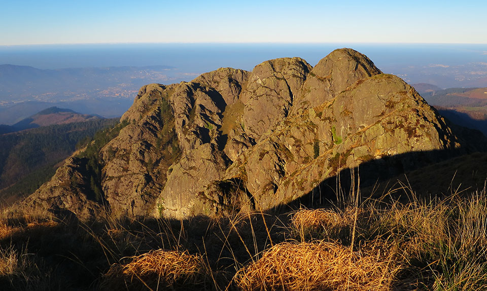
From a geological point of view, Aiako Harria / Peñas de Aia is a unique mountain. Its granite origin is unique in the Basque Country. Its formation is due to a thrust of magma welded before reaching the surface which, 250 million years ago, broke through the sedimentary rocks. The erosion of the surface layer did the rest until it took on the appearance we know today.
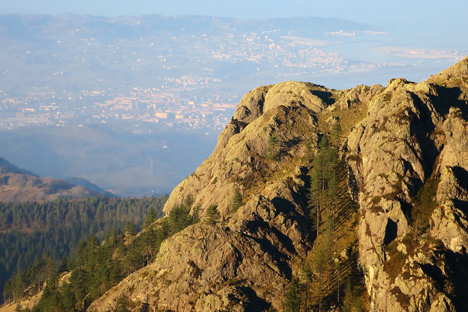
From a mountaineering point of view, it is one of the must-see peaks in the area, the first "big mountain" with the permission of Larún coming from the Cantabrian Sea. However, unlike Larún, Aiako Harria is safe from aerials, tracks and rack railway trains.
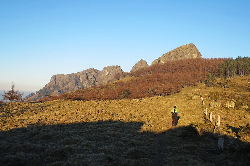
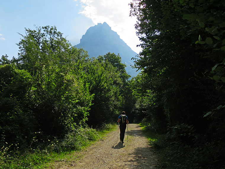
Travelling along the rugged ridge is not difficult, but spectacular. It is one of the best excursions that can be made in this part of the incipient Pyrenees. But if it is also combined with a short climb such as that of the Muganix (80m, 4b), the cocktail is unbeatable.
DOWNLOADABLE:
> Download Track
SUMMARY:
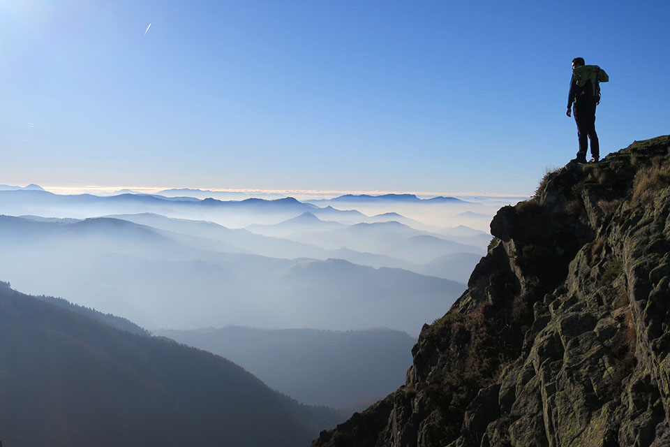
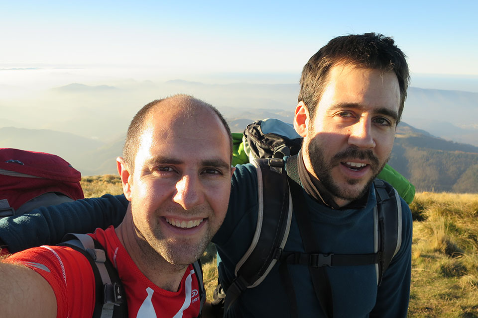
The starting point for this route is the Arritxulo refuge in the Aritxulegi pass. From here, following the GR121, we head towards the Elurretxe pass, where it joins the normal route up to Aiako Harria. At a twist in the path, we leave it to go to the base of the west spur of Muganix (80m, 4b), fully equipped. A short rock climb of excellent quality takes us to the top of Muganix. Now without the need for ropes we begin the second part of this excursion that goes along the ridge passing by its three main peaks: Irumugarrieta (806m), Txurrumurru (823m) and Erroilbide (832m). The descent from Erroilbide is along a path on the western slope, which then runs along the crest of the ridge to the south, towards the Aritxulegi pass.
Technical specifications:
Distance: 9,7kms
Cumulative difference in altitude: +/- 780m.
Timetable: 7-8 hours. Walking time without stops: 6h00min.
Difficulty: (4b, 80m) for the climbing route and some isolated passage on the ridge (maximum II).
Material: boots or slippers, walking sticks y GPS can be useful for approaching and finding the route. For climbing: cat's feet7 quickdraws and some bagasse and carabiners for meetings.
ITINERARY:
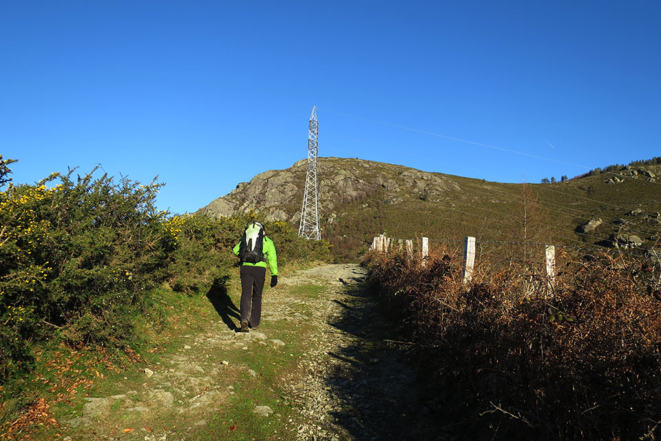
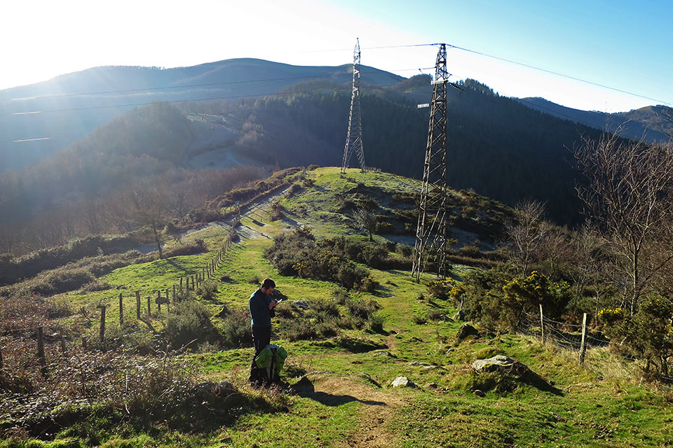
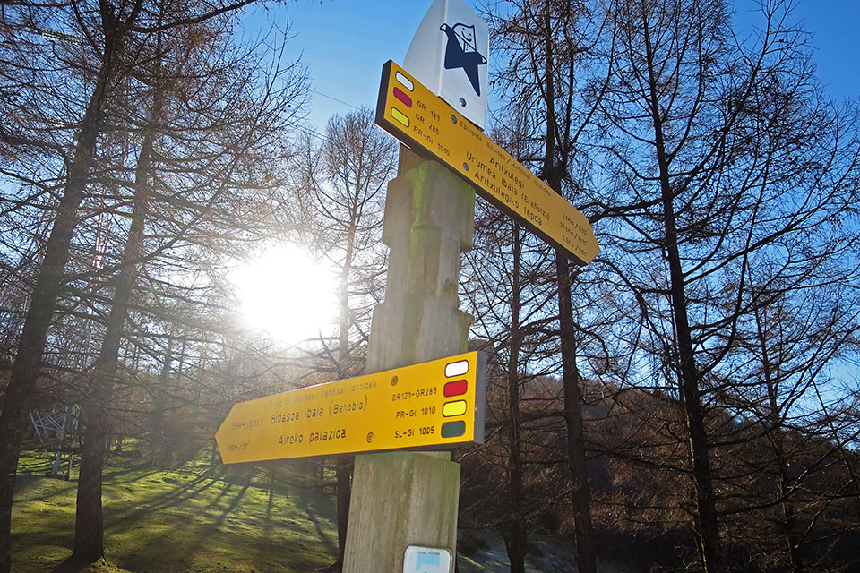
(0h00min; 0,0kms) Arritxulo Hostel (427m). Go up to the road and take the track on the right that goes up before the tunnel. Continue for about 350m until you reach the free refuge of Arritxulo, with a fountain. The track branches off shortly afterwards, take the path to the left marked in white and red (GR-121 - Tour around Guipuzcoa) coinciding with the Tour of the Peñas de Aia (PR-GI-20) in white and yellow. There are plenty of signposts. The path runs alongside a wire fence in the direction of some high-voltage pylons, where it forks again.
To the left of the fence is the path that we will follow to ElurretxeOn the other side, the path where we will go down from Erroilbide. We will ignore the wide path that disappears to the right.
The path starts to climb next to the fence and soon after you reach an area equipped for sport climbing (0h25min; 1,1kms). Although there is a sign that prohibits climbing, it only seems to affect this sector. Continue uphill to a kind of shoulder (0h30min; 1,3kms) from where a path starts to the right towards the summits. We ignore it and continue straight ahead through the forest, flanking the crags.
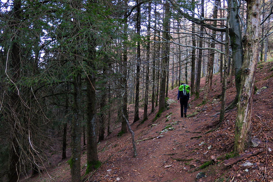
Further on (0h40min; 1,9kms) the path starts to descend, 200m of difference in altitude that you will have to recover later. You see some bunkers on the way and arrive at the...
(1h30min; 4,6kms) Elurretxe pass (500m)This is a very popular place. This is the starting point for most of the hikers who climb up to the Rocks of Aia. We will take the path towards the SE indicated as "Bidasoa Ibaia (Behobia)" and which, surprisingly, is not indicated to the summits.
We pass by what looks like a snow pit and shortly afterwards we turn sharply to the right. The path crosses a short stretch of forest before you come out into a clearing where there is another bunker. At this point (1h40min; 5,2kms) you leave the path and continue halfway along the slope on a faint path. You find the track some 400m-500m further on, after going completely around the spur, in a kind of grassy corridor.
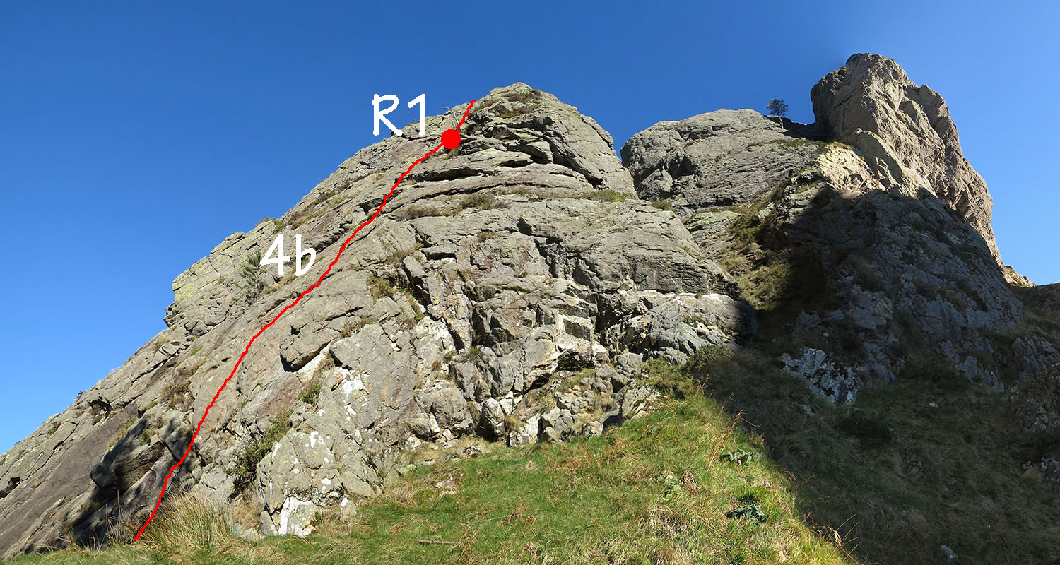
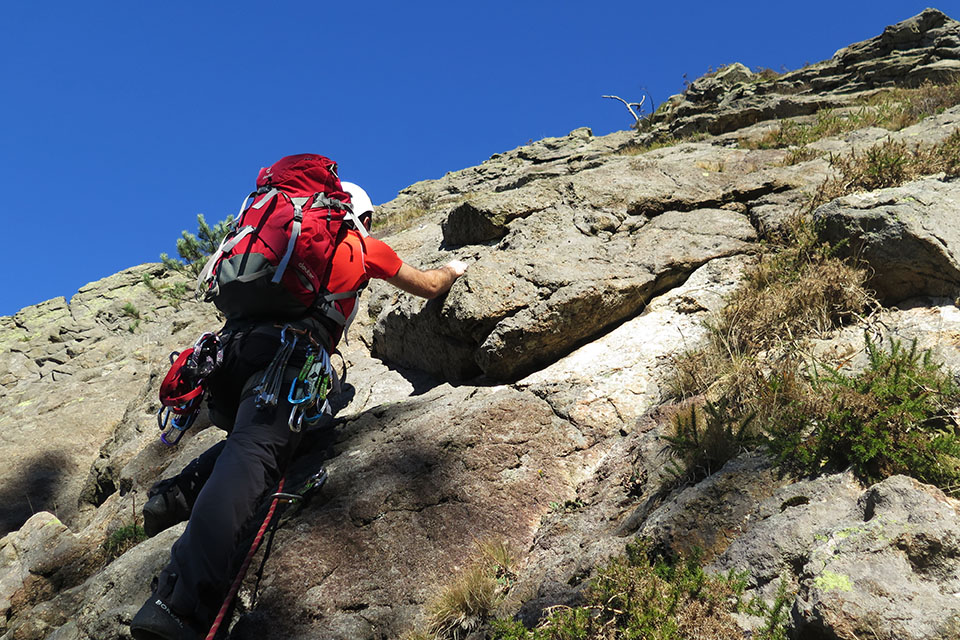
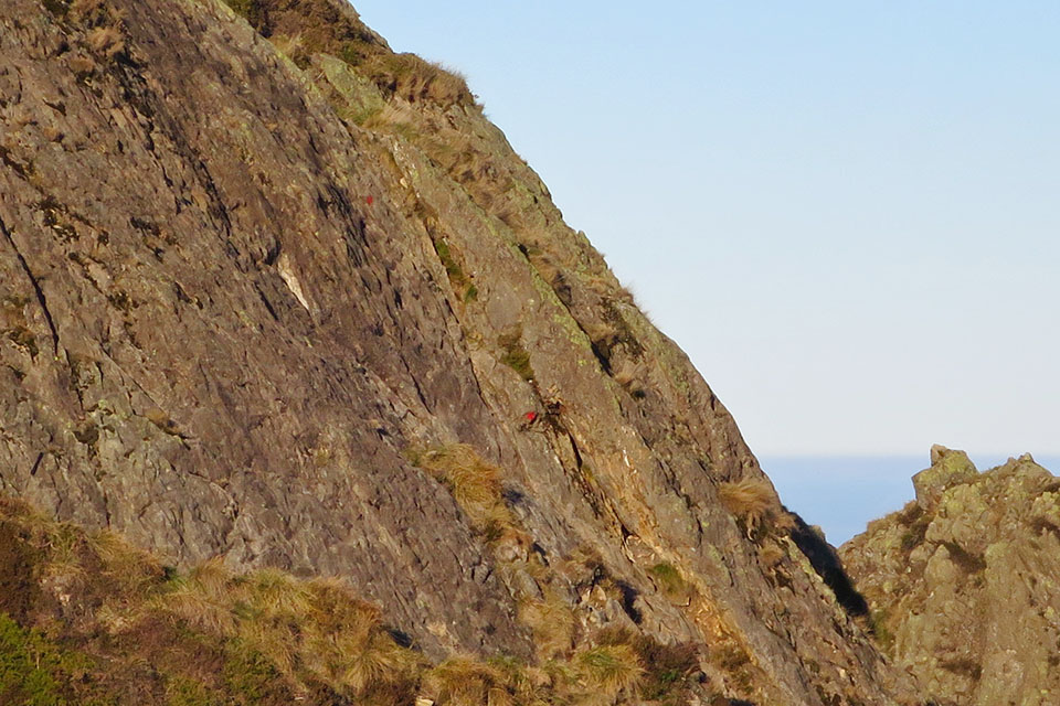
(2h30min; 5,7kms) Base of the West spur of Muganix (694m). To the attack! The climb, on excellent rock, is made up of 3 pitches: 4b, 4a and 3b with a walking area on the last pitch. The route is divided into two routes of similar difficulty, Erlaitz I and Erlaitz II. We took the Erlaitz I route. On the first pitch, the most vertical, we need 7 express.
Then the track goes down...
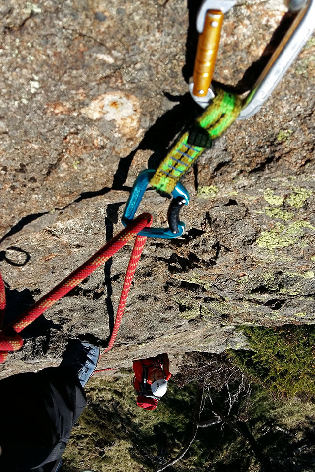
and the third length passed so quickly that we were left wanting more.
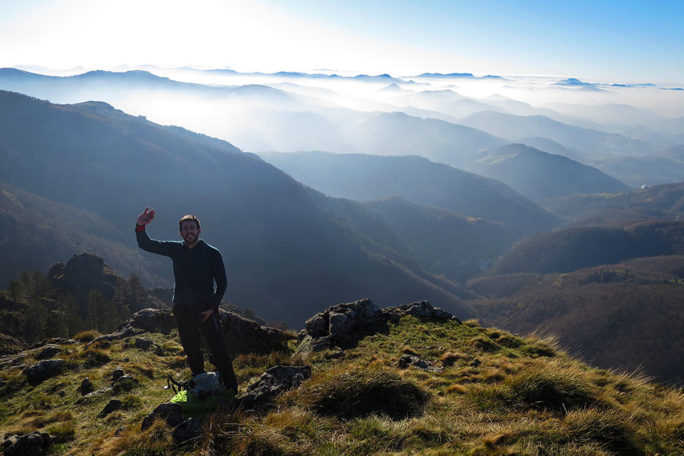
(4h00min; 5,8kms) Muganix (758m). No matter, we still have the ridge which, although it doesn't require a rope, is very entertaining. The route of the ridge has, in addition to several points where you have to throw your hands out, two small difficulties, a 4 m drop down from the crest and a 4 m climb up to the top of the crest. Irumugarrietaand the ring pitchA ring for abseiling. Although we had read that it was impressive, it is not so fierce, as the climb is towards the east face. It would have been another thing to have to do it towards the abyss of the west face!
So, from the Muganix (letterbox), we follow the red dotted markings to follow the chain of each of the summits. The first...
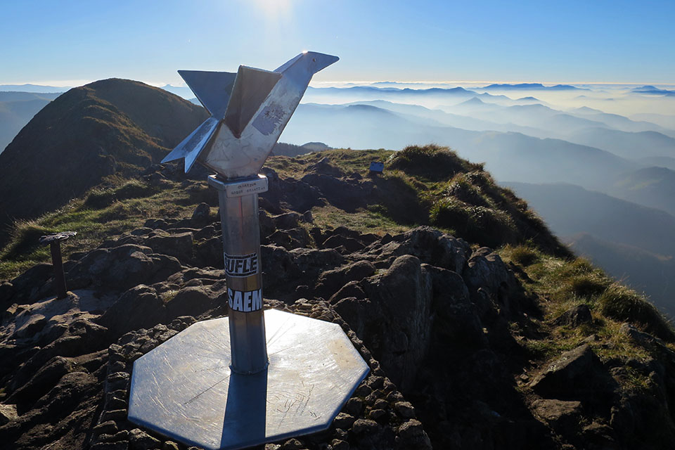
(4h15min; 6,2kms) Irumugarrieta (806m).
The following...
(4h30min; 6,5kms) Txurrumurru (823m).
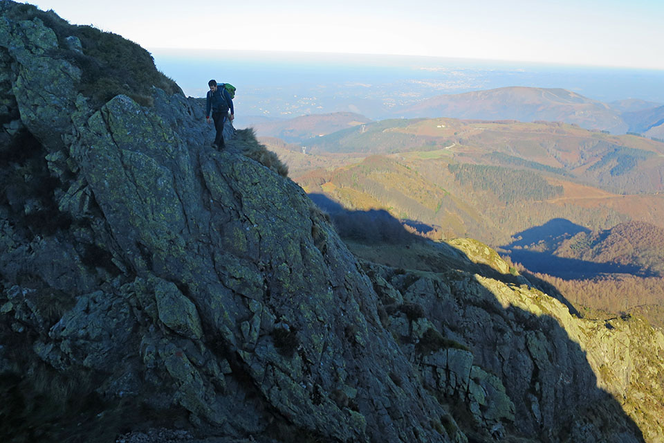
On the descent of Txurrumurru is the most difficult pass, the ring pass (II). From here we can rappel if necessary.
Once we have passed it, we still have to climb the last and highest peak.
(5h00min; 7,0kms) Erroilbide (832m).
Happy to have finished, we descend along the path on the west face. We pass a steep downhill stretch and continue halfway down the slope. Further on, the path enters a pine forest and turns to the left, looking for a wire fence that we follow until we reach a...
(5h30min) col (663m).
Cross the wire fence and go down next to a second fence until the path splits off to zigzag downhill. You will soon reach the area crossed by the high-voltage power line, which you passed through at the beginning of the route. From here to the car, passing by the Arritxulo refuge and fountain, it will take us about 10 minutes.
(6h00min; 9,7kms) Arritxulo Hostel (427m).
NEARBY MAY BE OF INTEREST TO YOU:
Mount Beriaín (1,493m) is more popularly known by the name of San Donato due to the hermitage dedicated to San Donato and San Cayetano on the summit...
(11.0kms; 850m; 5hours; climbing PD)
Fastpacking is not about going faster. It's about going lighter.
If you come from classic trekking, this is the next step: learning to move with less weight,
more fluid and enjoying every kilometre more.
Join the Outsiders Newsletter and start discovering what lightness feels like.