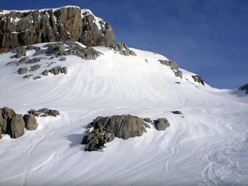
13 ski touring routes in the Pyrenees
Pyrenees and mountains 📩
Here 🔥Think of snowy valleys disappearing into the horizon, sunrises that paint the mountains in shades of pink and the crunch of snow beneath your skis. The Pyrenees are that place where every turn feels freer and every summit reaches a new level of epic. From the gentle slopes of the Saioa to the demanding glaciers of the Balaitus, the Pyrenees offer a winter universe capable of enchanting even the most sceptical of skiers. Each route is an invitation to connect with nature and with yourself, in an environment that combines authenticity and adventure in equal measure.
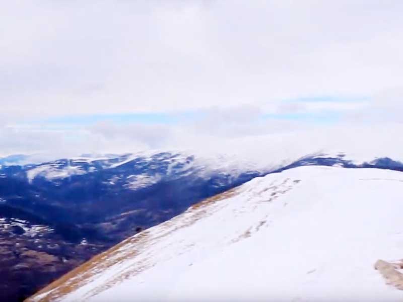
Saioa from the port of Artesiaga.

This route can be easily completed in about two hours, and is very popular with ski touring enthusiasts from Gipuzkoa and Navarre. It is not technically difficult and is recommended for beginners. The route starts at the Artesiaga harbourfollowing a well-signposted track. Once you reach the Saioa pass, you can climb to the summit from its southern slope, or by following the south-west direction. It is fairly easy to reach the highest point of the route; specifically, the summit of the Saioa 1,419 metres. The descent can be made by the same route as the ascent. The disadvantage of this route is that it is not in the high mountains, so you will not find snow all winter.
Pic D'Anie from the helical curve.
![Pic D'Anie from the helical curve / Photo: Enteradillo [CC-BY-SA-4.0] via Wikimedia-Commons](https://travesiapirenaica.b-cdn.net/wp-content/uploads/2019/02/Pico-Anie_by-Enteradillo-CC-BY-SA-4.0Wikimedia-Commons_800x600.jpg)
The Pic D'Anie or Auñamendi (2,504 metres) is a very popular peak with skiers in winter. The route starts from the helical curve located at the Belagua pass. The route starts with a climb but the terrain soon becomes smoother. For a large part of the route the final objective is the front. Although the terrain is very chaotic without snow, the path becomes smoother when covered with snow. However, beware of holes and crevasses. The terrain is constantly going up and down until we reach the foot of the Anie. From this point the terrain becomes steeper and you have to choose whether to continue on foot or on skis. The ascent can be done in about three hours. The descent takes about an hour by the same route.
Aspe from Aisa.
The itinerary begins and ends at the end of the road that runs through the Valle de Aisa. It is a route that requires a certain amount of physical preparation, as it exceeds four hours of activity. The highest point of the day is the summit of Aspeat 2,640 metres. From there, you can enjoy marvellous views of the most emblematic peaks of the Pyrenees, such as the Picos del Infierno and the Midi D'Ossau. To get there, you have to overcome steep snow slopes that require a certain amount of experience. If the slopes are icy, they can be quite difficult to overcome. However, everything that goes up comes down. The descent is very direct and fast, for those who want a bit of an adrenaline rush. However, it can get tricky if the snow is not in optimal conditions.
Balaitus by the Neous glacier.
This route is suitable for experienced skiers (important! for experienced mountaineers). It is advisable to do this route by spending the night in the Ledormeur hut. The route starts from the Porte d'Arrens. The terrain is not very difficult until you reach the Neous Glacier. The steepness of the slope becomes steeper as you enter the glacier, and the risk of falling is quite high. Once over the glacier you reach the Neous fireplace. There you must leave your skis behind and climb upwards with the help of the rope, crampons and ice axes. After overcoming the chimney and going along a small ridge, you will arrive at the summit of the Balaitus at 3,144 metres. After rappelling down the chimney you can put your skis back on for a descent of about three hours.
Anayet summit from the Anayet car park.
This is a route of more than 11 kilometres where you can enjoy one of the most beautiful peaks in the Pyrenees. It can easily be done in less than four hours. The ascent to the Vértice de l'Anayet can be made by two variants. On the one hand, it can be reached from the Barranco de Culibillas ravine. It is a riskier route, due to avalanches, but more solitary. On the other hand, the safer route runs largely along the ski slopes. It is a more comfortable and safer route. Both routes do not require great technical difficulty, although the last part of the ascent is quite steep; about 35 degrees. The descent can be done following the same route in about an hour and a half.
Pic du Midi de Bigorre from Barèges.
The route starts from the mythical Tourmalet pass. Snow permitting, from the car park at the summit. On a slightly ascending terrain, you will gradually gain metres in altitude. The terrain is comfortable and conducive to enjoying the views. When you reach the bottom of the valley you will be able to see the imposing southern slope of the Midi de Bigorre. You will have to climb up steep slopes. However, you will be able to enjoy them on the descent. They have an inclination of about 35 degrees. The only drawback of this summit (2,872 metres) is that at the top there is an observatory and large facilities, which deprive you of the wilderness. However, the views are very good. The route can be completed in about four and a half hours.
Taillon through the Rolando Gap.
![North face of the Taillon / Photo: Jean Baptiste Bellet [CC-BY-2.0] via Wikimedia Commons](https://travesiapirenaica.b-cdn.net/wp-content/uploads/2019/02/Taillon_by-Jean-Baptiste-Bellet-CC-BY-2.0Wikimedia-Commons_800x600.jpg)
The route starts from the car park of the Col de Tentes. From there, the terrain is comfortable and always slightly ascending until you reach the foot of the Serradets refuge. This is where the terrain is steepest. It is very common to spend the night in the refuge. However, it is currently closed because it is being renovated. The climb up to the Rolando Gap is hard, but not too dangerous. Once in the gap, turn right to continue under the wall, and over the cliff. This is where you will find the trickiest spots. The last climb is not technically difficult. This will take you to the top of the Taillon. The descent can be made along the same path, although it is advisable to go down the snow slope on the south face, and climb back up to the gap to link up with the usual path.
Posets by the Angel Orus Refuge.
This route should be done in two days. The first stage starts from the Espiantosa waterfall to reach the Angel Orus Refuge. On the second day it is time to attack the summit. The climb to the summit is fairly short, but tough. In about five kilometres you have to overcome a positive difference in altitude of more than 1,200 metres. However, the reward is well worth the effort, because Posets is the second highest peak in the Pyrenees at 3,369 metres. Until the final part of the ascent, the route can be done on skis. The descent can be made along the same path, or along a large slope on the southern slope of Posets. In both cases, the final objective will be the Angel Orus Refuge.
Peak of Aneto via La Renclusa.
Reaching the roof of the Pyrenees with skis is one of the adventures that many mountaineers dream of. It is a very common route, so the path is well marked. The first stage follows the path between the Benasque Hospital and the La Renclusa mountain hut. The second day will be more interesting, as the Aneto glacier must be crossed. Once over the glacier, it is time to go, without skis, through the dreaded Mohammed Bridgea narrow ridge of about 40 metres with chasms on both sides leading straight to the cross of Aneto (3,404 metres). The snowy descent can be made almost anywhere you want as long as you head towards the bottom of the valley in the direction of Benasque. It is a long descent, about three hours, where you will enjoy the best landscapes of the Pyrenees.
Pic del Gargantillar from Grau Roig.
This circular tour in Andorra starts in the car park of the ski resort. Grau Roig. It is a route that requires some experience as the channel that ascends to the summit is about 40 degrees steep. Up to the base of the Pic del Gargantillar the terrain is not very complicated. However, the ascent to this pyramidal summit is more fun. You have to overcome a fairly steep channel to reach the summit at 2,864 metres. It is advisable to do this last part on foot if the snow conditions are not the best. To end the day, you can enjoy a marvellous descent lasting an hour and a half. If you like taking risks, you will certainly enjoy descending the channel that leads to the summit. Be careful if the snow is icy.
Pedraforca by the Enforcadura.
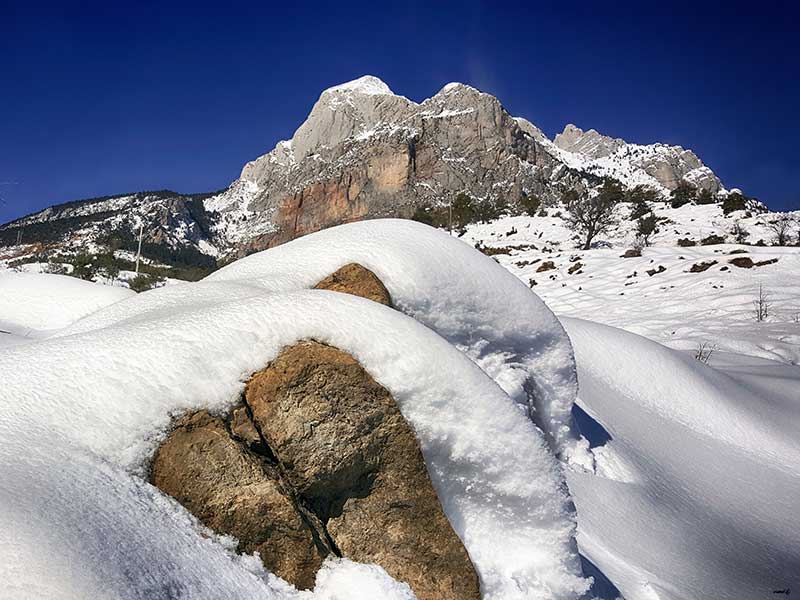
Although it is not the ideal mountain for ski touring, it should never be missing from the list of routes. Pedraforca (2,497 metres) is an emblematic summit for the Catalans. This short but beautiful route starts from the Gresolet viewpoint. If the snow is not abundant, you will have to carry your skis on your back for the first hour or so of the climb. Once you have passed the forest, you can put on your skis to climb the first shovels of snow. The channel will take you to the Enforcing where you will have to leave your skis to climb between rocks to the summit of the Pedraforca. The ascent is not very difficult. The descent is by the same route. You can complete this route in about four hours.
Puigmal D'Err from Nuria.
This is one of the most suitable routes for ski touring in Catalonia. The route starts at the Sanctuary of Nuria. The path starts on a track in the direction of Coll de Finestrelles. However, the signs will make you change direction and go into another valley. When you reach the bottom of the ravine, you will be at the pass before the summit. From there you can climb the Puigmal D'Err directly (2,910), or skirt the hill for a more comfortable ascent. The descent of this route is done along the same path. The ascent to this beautiful summit can be done easily in less than three hours. The descent is quick, and you can be back at the Sanctuary of Nuria in approximately one hour.
Taga from Pardines.
This circular route is not particularly difficult, so it is suitable for beginners or for the whole family. It starts at the Hermitage of Magdalena if snow permits. If this is not the case, the ascent will start from PardinesThe climb will take about 45 minutes. From the beginning of the concrete track you will see signs for Taga. The route is interspersed with open stretches and woodland. The final ascent to the summit can be made in any direction. The top of the TagaAt 2,035 metres it offers very good views of Puigmal DÉrr and the Catalan Pre-Pyrenees. The descent follows the same route. The ascent and descent of this route can be done in less than four hours.
More routes and resources
- Carros de Foc InvernalThe great circular route through the Aigüestortes National Park.
- Crossing GavarnieTo explore the French side and admire the mythical glacial cirque.
- Tour of the Midi d'OssauA classic for lovers of skiing and mountaineering.
- Alba Peak

FAQ: Questions that will make you feel more confident
In this guide you will find essential information for planning your winter getaway: safety tips, key equipment, the best time to put on your skis and a selection of routes that will make you dream of your next trip.
1. Safety and preparedness
Before thinking about summits and descents, there is one thing you should definitely put in your backpack: knowledge. Ski touring is synonymous with freedom, but it also involves taking certain risks.
Basic security kit
- ARVA, shovel and probeYour essential allies in the face of a possible avalanche.
- Crampons and ice axe (depending on the route): Some icy channels or shovels may require extra grip.
- Phone or GPSBe sure to carry them with a charged battery; coverage may fail in remote areas.
Training and knowledge
- Courses on nivologyLearn to read the terrain, interpret avalanche bulletins and recognise signs of snow instability.
- Rescue manoeuvresPractice with your security team and conduct drills in safe terrain.
- Route planning: Check the weather and snow conditions (AEMET, MeteoFrance, ICGC, etc.) before setting off.
TipIf this is your first time ski mountaineering in the high mountains, consider hiring a certified guide. It is better to invest in experience than to take a gamble on unknown terrain.
2. When to go? The snow calendar in the Pyrenees
The ski touring season in the Pyrenees can vary depending on altitude, orientation and snowfall each year. However, January to April is often the most stable window for finding good conditions.
- November - DecemberThe first snowfalls can give you unforgettable days, even if sometimes the snow base is still scarce.
- January - February: These are usually the coldest months and, hopefully, the months with the most snow accumulation. If you are looking for quality powder, this is your bet.
- March - AprilLonger days and milder temperatures. Ideal for those routes with higher slopes, such as Aneto or Balaitus, where the snow lasts until well into spring.
Spring AdvantageLonger daylight hours mean you can plan long ascents and enjoy memorable descents, as long as you get up early to avoid snow that is too soft at midday.
3. Choose your route: Difficulty and effort at a glance
In ski touring, there are no "magic formulas" for difficulty: weather and snow conditions change the whole game. Even so, three basic factors should be taken into account:
- UnevennessThe more metres you climb, the more physically demanding it is.
- PendingA 35° shovel can be a real challenge on hard snow.
- Total distance: Routes of more than 15 km may require a good endurance.
Example of a quick classification
- Basic levelRoutes with gradients of less than 600-700 m and gentle slopes (<30º).
- Intermediate levelSlopes of 800-1200 m and moderate sections (30º-35º).
- Advanced levelMore than 1200 m of vertical drop or slopes exceeding 35º for a prolonged period of time.
4. The Equipment You Must Have
Ready to spend your savings on gear? Don't worry, you don't have to go broke to equip yourself well, but it pays to know where to invest wisely.
Skis and bindings
- Lightweight touring skis: Prioritises uphill manoeuvrability.
- Pin fixings: Lighter weight for long carrying distances.
- Quality sealskinsGood grip can make all the difference on icy slopes.
Clothing and accessories
- Layer system: First thermal layer (merino or synthetic), second windproof/lining layer and waterproof jacket.
- Sunglasses and gogglesTotal protection against reverberation.
- Sunscreen: High level (SPF 50+), essential in snow.
Other essentials
- Backpack with ski attachments.
- Telescopic poles.
- Basic first aid kit and thermal blanket.
5. Where to sleep and who to explore with: Local services
The Pyrenees abound in mountain refuges where you can recharge your batteries after long days: Angel Orús (Posets), La Renclusa (Aneto), Ledormeur (Balaitus)... Some are still in season, but it is advisable to book in advance.
If you prefer professional companycontact guides from the Spanish Association of Mountain Guides (AEGM) o UIAGMwho are well aware of the safest lines in each valley.
IdeaExplore also ski resorts that offer cross-country routes, such as Grau Roig in Andorra, to get you started in a more controlled environment.
6. Responsible Mountain: How to reduce your footprint
The magic of the Pyrenees is also fragile. Every season we hear more and more about the pressure on the environment from the influx of visitors. How can we help to preserve it?
- Leave no traceNo litter, no tracks outside the marked trails.
- Respect wildlifeKeep your distance from the animals and do not make unnecessary noise.
- Share transportIf possible, organise your trip with friends to reduce emissions.
Pro tipChoose biodegradable creams and cleaning products, and stay in accommodation that is committed to sustainability.
7. Other FAQs
- Do I need mountain rescue insurance?
Yes, many companies offer specific insurance. The ideal is to have one that covers rescue and hospitalisation expenses. Insurance such as that of the Mountain Federation usually covers ski touring (sometimes what they don't cover is piste skiing), as well as that of other outdoor activity federations. It is important to check your case. - How high is the probability of avalanches?
It depends on the daily report and the snow conditions. Check official bulletins (AEMET, MeteoFrance, ICGC) and decide wisely. - Can I go alone or always in a group?
It is always advisable to go out in a group, especially if you have no experience in hiking. If you go alone, take extreme precautions and communicate your route. Bear in mind that you will be totally unprotected in case you fall under an avalanche.