Turó de l'Home (1,708m). Drive through the snowy Montseny.
Pyrenees and mountains 📩
Here 🔥The massif of Montseny is a mountain visible from a large part of Catalonia. It is not for nothing that its Latin name, Mont Signis, means signal mountain. For the Romans, it was the reference point for their approaches by sea and for hikers a great temple of pilgrimage, especially when it snowed. It doesn't snow every winter, but when it does, with the right equipment or just a plastic sheet to slide on, the people of Barcelona head for Santa Fe and the Turó de l'Home (1,708m), the summit of the Catalan pre-coastal mountain range.
Summary of the route:
Our route starts at the car park of Santa Fe del Montseny to go and look for the source of Passavets along an interior path. From here onwards the route will be circular, following the GR 5.2 markings which, in loops, first through the beech forest and then through the fir forest, will take us up to the top of the massif, the Turó de l'Home (1.708m). After resting in the small building on the summit we will go in the direction of les Agudeswe won't get there, but we will go down to look for the source of the Briançó and Passavets again. From here we will only have to retrace the initial route, along the road if we wish this time.
Map:
Downloadable:
How to get there?
The point of departure and return is Santa Fe del Montseny (Google maps). You can access it in different ways:
-At carFrom Barcelona there are about 72 km which can be done in 1h 15 min. You will have to take the AP-7 to Sant Celoni and take the BV-5114 road with its many curves.
-At public transportthe Parc Natural del Montseny has established the Bus Parc. It only operates on weekends and public holidays. It is managed by the Sagalés company and corresponds to line 573. From Barcelona you will have to go by train (web cercanias) to Sant Celoni. The combined return ticket from Barcelona costs 10.80 euros.
Technical specifications
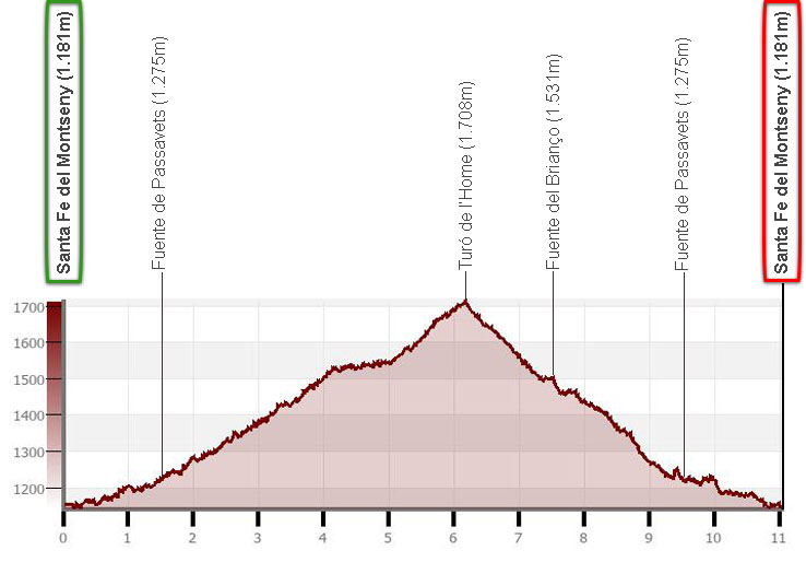
Distance: 11.0 km.
Cumulative difference in altitude: +/- 600m.
Timetable (with snow): about 4 and a half hours. Walking time without stops: 3h45min. Without snow, the time would be significantly reduced.
Water: In Santa Fe del Montseny, there are several restaurants and toilets. The Passavets and Briançó springs usually have water.
Difficulty: At any time of the year, the only determining factor in terms of difficulty would be the difference in altitude. Depending on the thickness of the snow you find and if you are not wearing snowshoes, the progression can be a little more difficult. Turó de l'Home often requires crampons in winter or spring due to snow and ice on its routes, especially on the ridge towards Les Agudes.
Recommended equipment for winter in snow: comfortable clothing, canteensome food, sun protection, a baton for the climb, GPS optional and consider the possibility of snowshoeing.
Suggestions: visit the surroundings of Santa Fe del Montseny. We can observe some specimens of giant sequoia and we can visit its small reservoir.
Itinerary
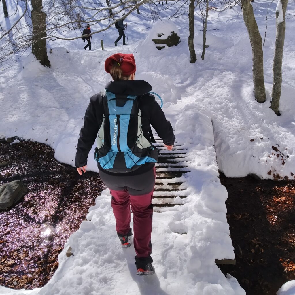
(0h00 min; 0.0 km) Santa Fe del Montseny (1,181 m). If you come by private vehicle, we recommend arriving early, as when it snows the number of visitors is very high. The small village of Santa Fe consists of the information centre "Can Casadeswith public toilets and a couple of restaurants. You will find the PR C-208 markers next to the Avet Blau restaurant, follow them through a beech wood and along a small path that leaves the Santa Fe stream on your right. Pass the road and arrive at a small car park, go up a few metres.
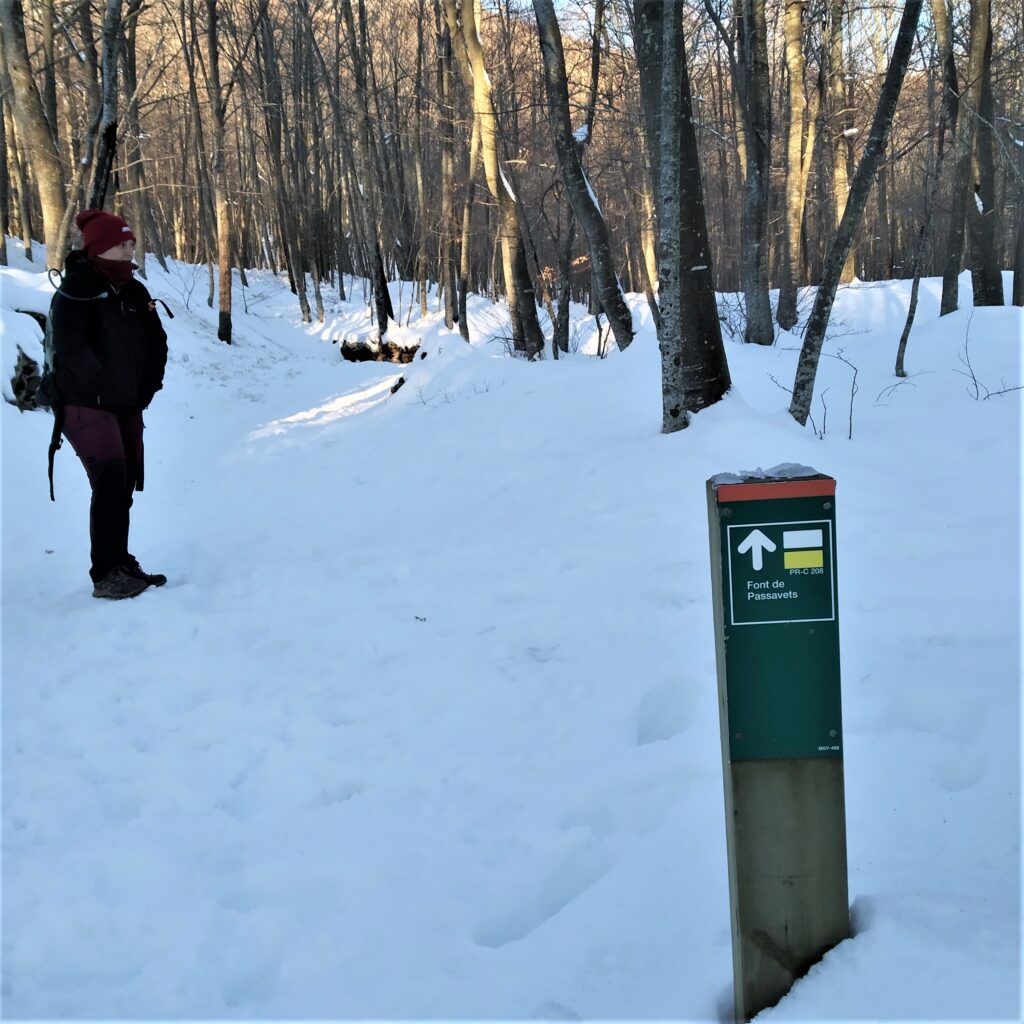
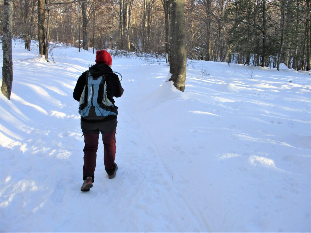
(0h30 min; 1.6 km) Passavets fountain (1275 m). Normally at this spring there are always people refilling water bottles, but today it is completely clogged with snow. We continue along the track uphill in continuous zigzagging loops. In this first stretch we find a beech forest. This Atlantic forest is distributed between 900 metres and 1600 metres approximately, it is a tree that needs a lot of water and here, in Montseny, thanks to the rainfall and the fog, it finds it. The erosion and transport of materials from the culminating peaks provide the beech trees with ideal soil to grow. Beech forests are characterised by being very shady, the trees grow in length in search of light and create a canopy with their leaves.
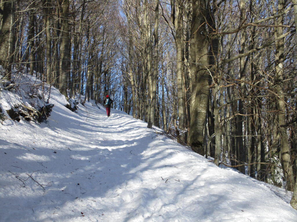
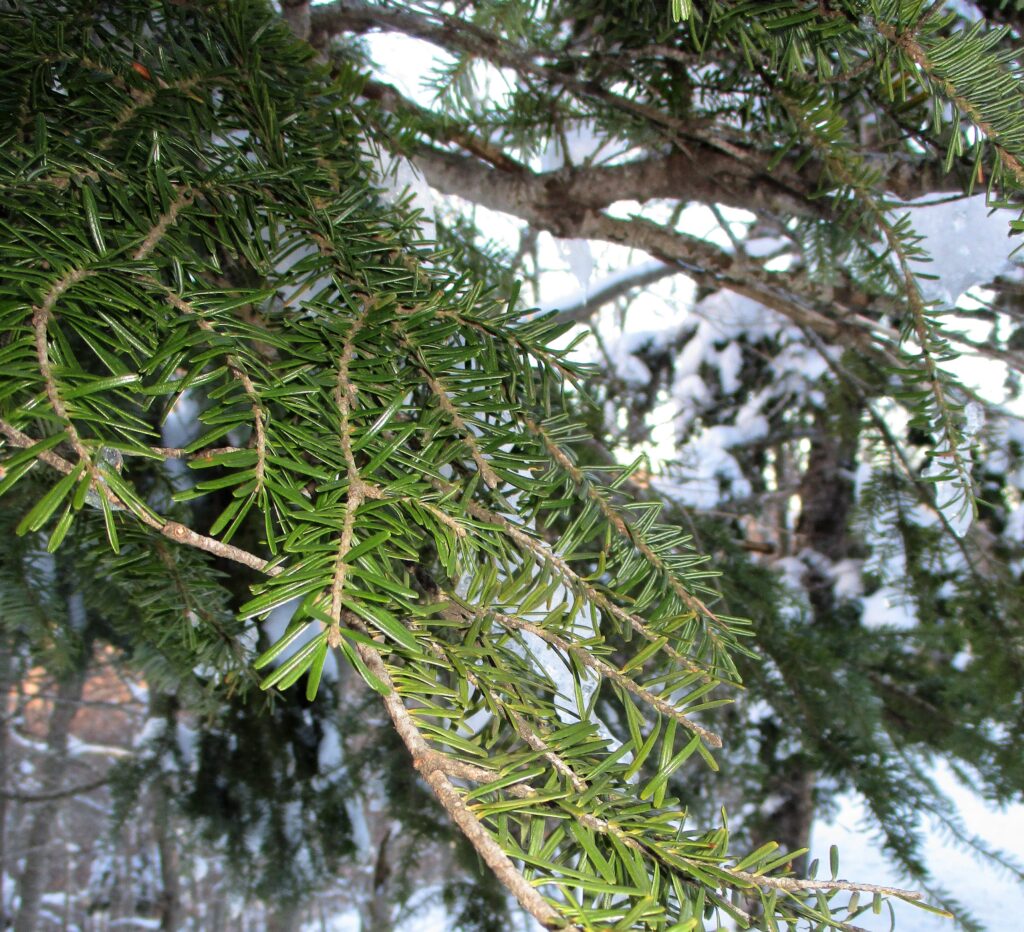
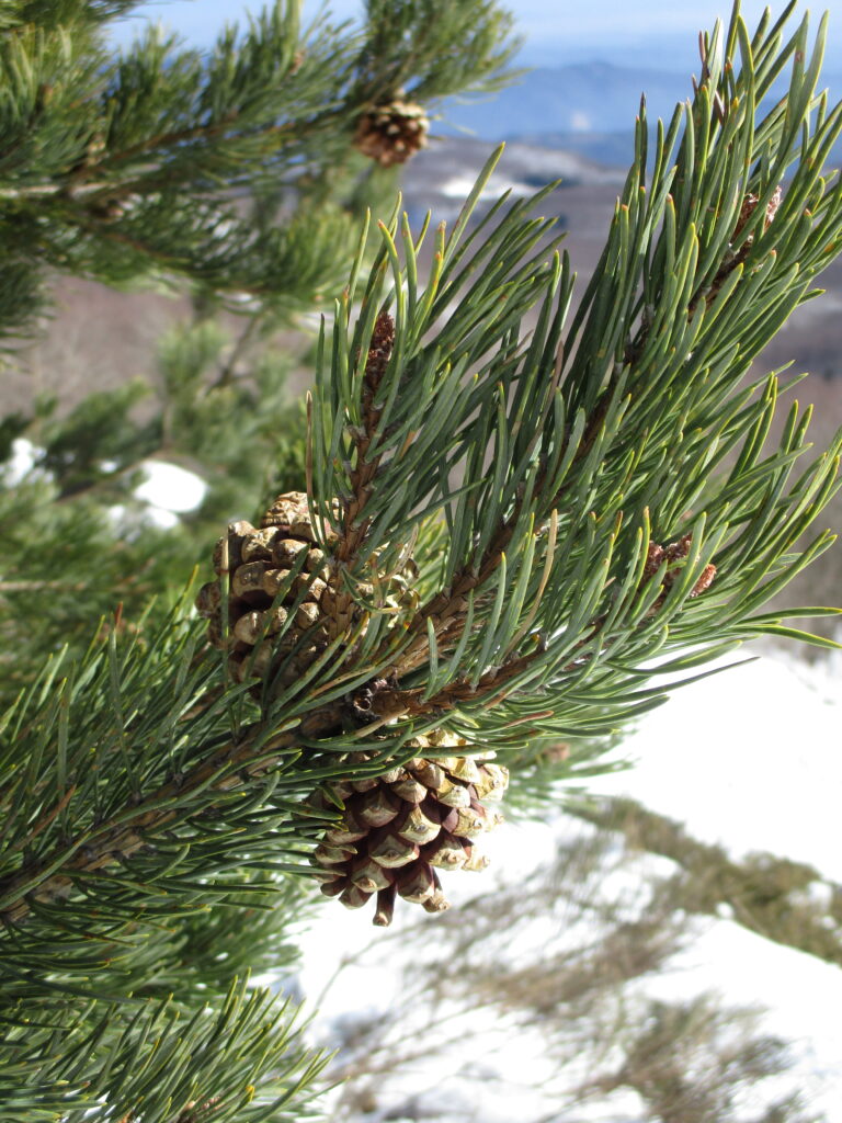
As we go upwards we find some spruce trees and some small extensions among the beech forests. This evergreen tree is distributed throughout the Pyrenees and the Montseny is the southern limit of its distribution.
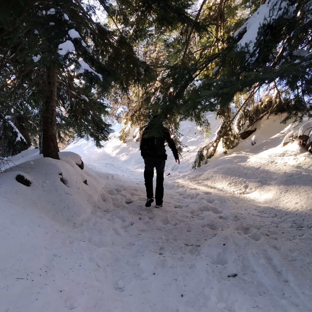
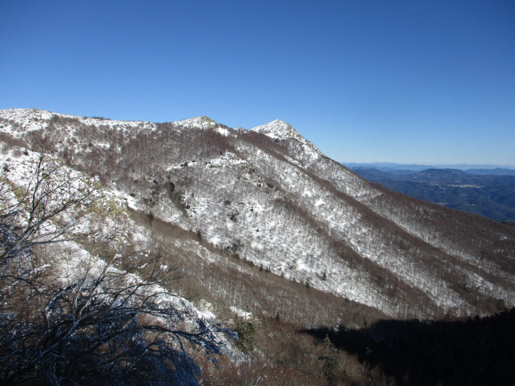
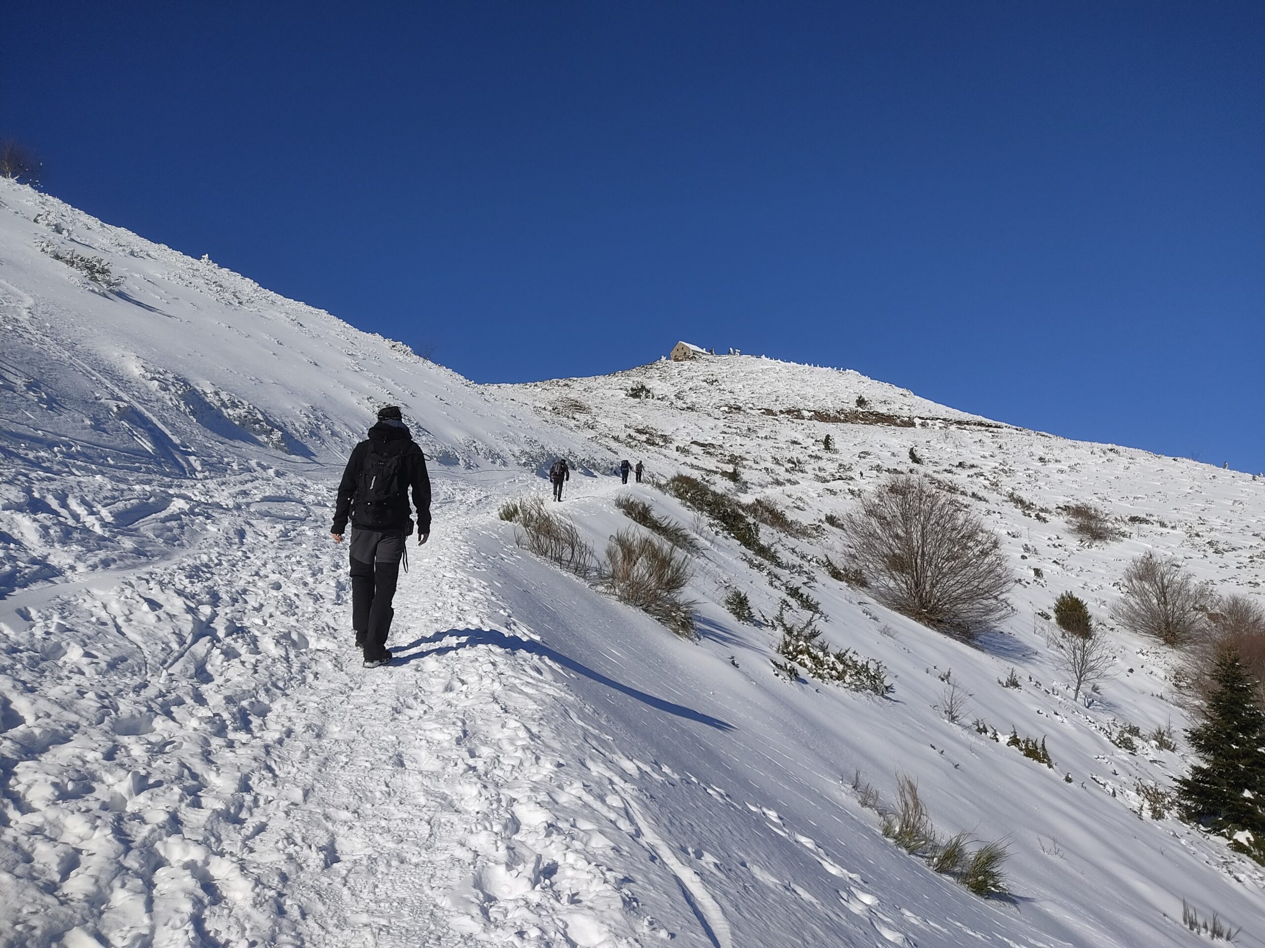
We continue climbing now through a more open terrain with views to the summit. We take a path to the left that leads us to a road. We have not mentioned it so far, but there is an access by car to the summit, although it is closed in snowy or icy weather. We skirt the summit on the left and reach the top. To our left we see protected on the Puig Sesollesthe current meteorological observatory.
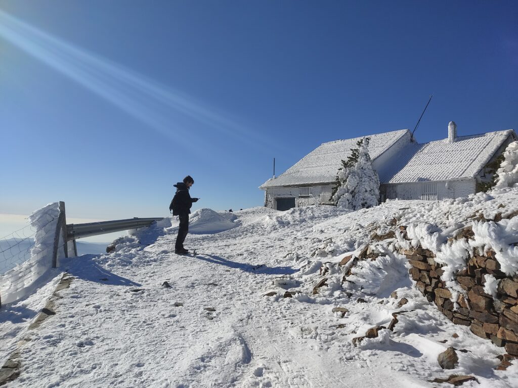
(2h00 min; 6.2 km) Turó de l'Home (1,708m). At the top we can find a geodesic vertex and a small esplanade where there is a small building.
A short history of the Turó de l'Home and Puig Sesolles".
In 1881, the "Associació Catalananista d'Excursions Científiques".proposed to build a refuge-observatory at the top of the Turó de l'Home (1707 m). The workers had to endure adverse weather conditions and manually flattened the summit by chopping "la llicorella" (a type of slate). Food was brought from the town of Breda and water was taken from the Font del Briançó. Communication between the summit and the town of Breda was by means of bonfires. The work was interrupted due to a lack of budget, until 1932, when Eduard Fontseré, with funding from the Generalitat, managed to get it up and running. Meteorological data was collected for many years until 1939, when it was razed to the ground by Franco's troops. The scientific data was confiscated and became the property of the Spanish army. This building remained in operation until 2004. In the neighbouring Puig Sesolles (1656 m) in 1974 a military communications detachment was built, illuminated on its perimeter and visible from many geographical points. At that time, communication was by microwave radiation and needed to be in high places. As this technology became obsolete, the facilities were abandoned in the 1990s. In 2001 the facilities were demolished and in 2010 the new observatory was built on Puig Sesolles. In 2022 the facilities were transferred from the Ministry of Defence to the Generalitat.
After the usual rest and contemplation of the views, we descend to the road. We follow the GR-5 signs to "les Agudes" but we leave it after a few metres following some red marks that are not very visible.
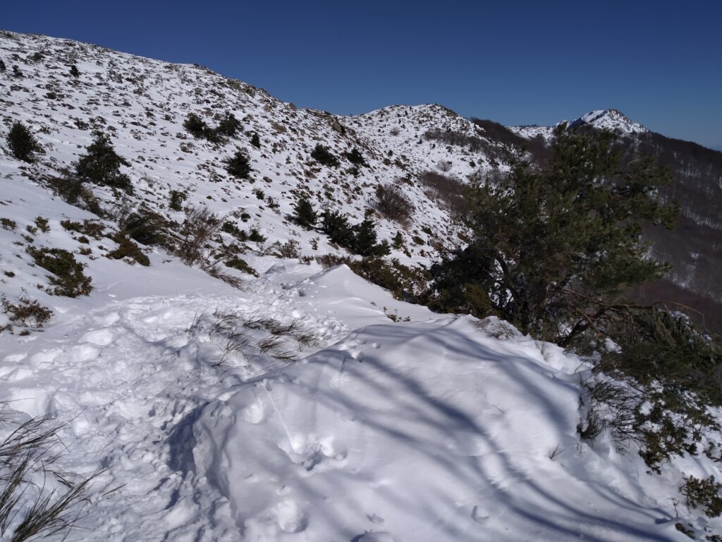
We continue our descent, keeping an eye on the slippery sections.
(2h35 min; 7.5 km) Briançó fountain (1531 m). Located on a small esplanade, it has an irregular flow. We continue the steep descent and cross a small bridge over the Santa Fe stream.
(3h15 min; 9.5 km) Passavets spring (1,275 m). We reach the fountain at the beginning and the car park. The return section can be done along the road instead of the path.
(3h45 min; 11.0 km) Santa Fe del Montseny (1,181 m).
Fastpacking is not about going faster. It's about going lighter.
If you come from classic trekking, this is the next step: learning to move with less weight,
more fluid and enjoying every kilometre more.
Join the Outsiders Newsletter and start discovering what lightness feels like.