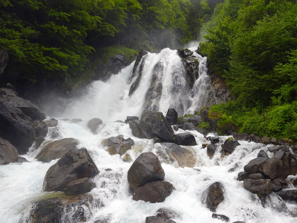
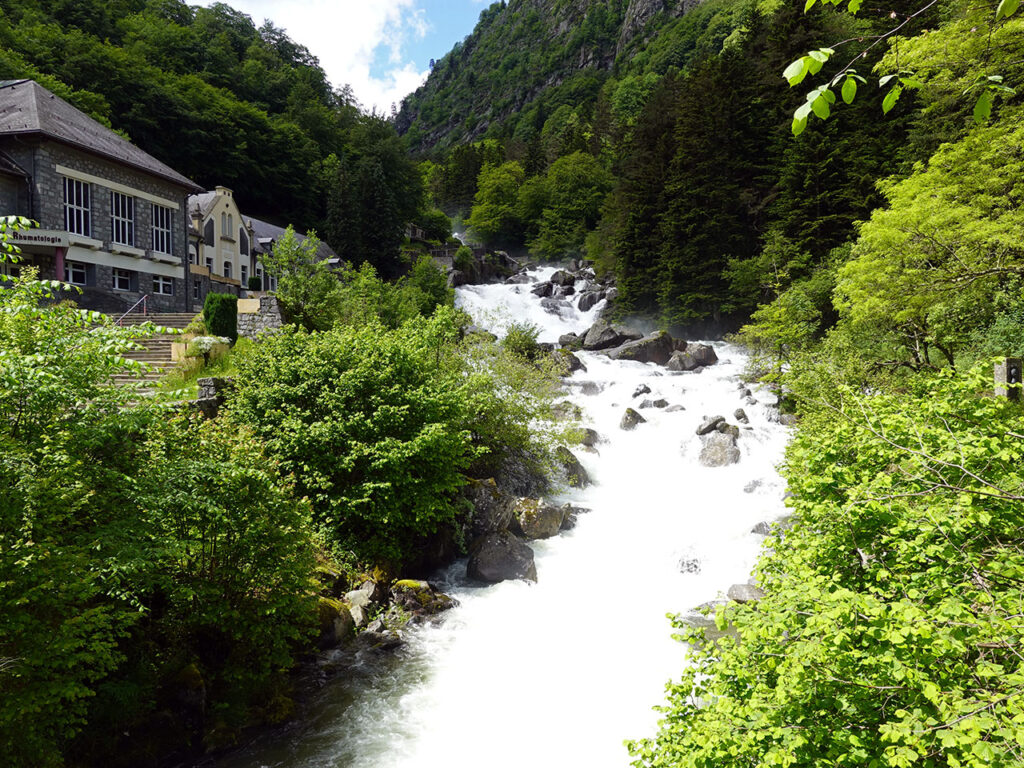
The Cascades trail in Cauterets.

2h00min 4,2km +35m/-475m

The Waterfalls Trail o Sentier des Cascadesnear Cauterets, is one of the simplest and most beautiful routes that we can do throughout the Pyrenees.

A pleasant walk, suitable for children, to spend a quiet day, or to combine with any of the other excursions in the area: Marcadau valley, lac de Gaube or Chemin Desmontzey or Chemin des Peres, among others.

A linear route that can be travelled in one direction only thanks to the bus service.

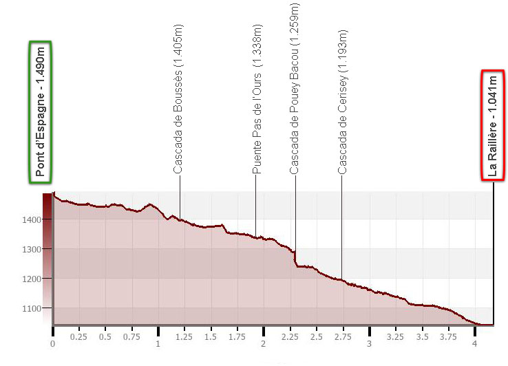
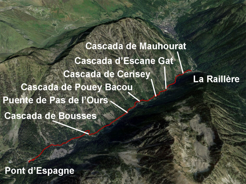
The Trail of the Cascades is a linear route of about 4.5 kilometres and 440 metres of vertical drop between La Raillère and the Pont d'Espagne. which can be made in both directions, or only in one of the two directions. In this case, the best option is to take the bus between Cauterets and the Pont d'Espagne, stopping at La Raillère.

If you take the bus, it is advisable to start at the Pont d'Espagne and go downhill to La Raillère, where this route and the description of the route ends. If you wish to extend a little further to Cauterets (3km), you have two options, along the "Chemin Desmontzey" or the "Chemin des Peres", the latter visiting the beautiful Pisse-Arros waterfall (Lutour waterfall).

Pisse-Arros waterfall

A recommendation.

If we are going to spend several days in the area, this route is ideal for one of those cloudy days when the mountains are covered, because here the most beautiful thing is the path through the forest next to the river and of course, the impressive waterfalls.

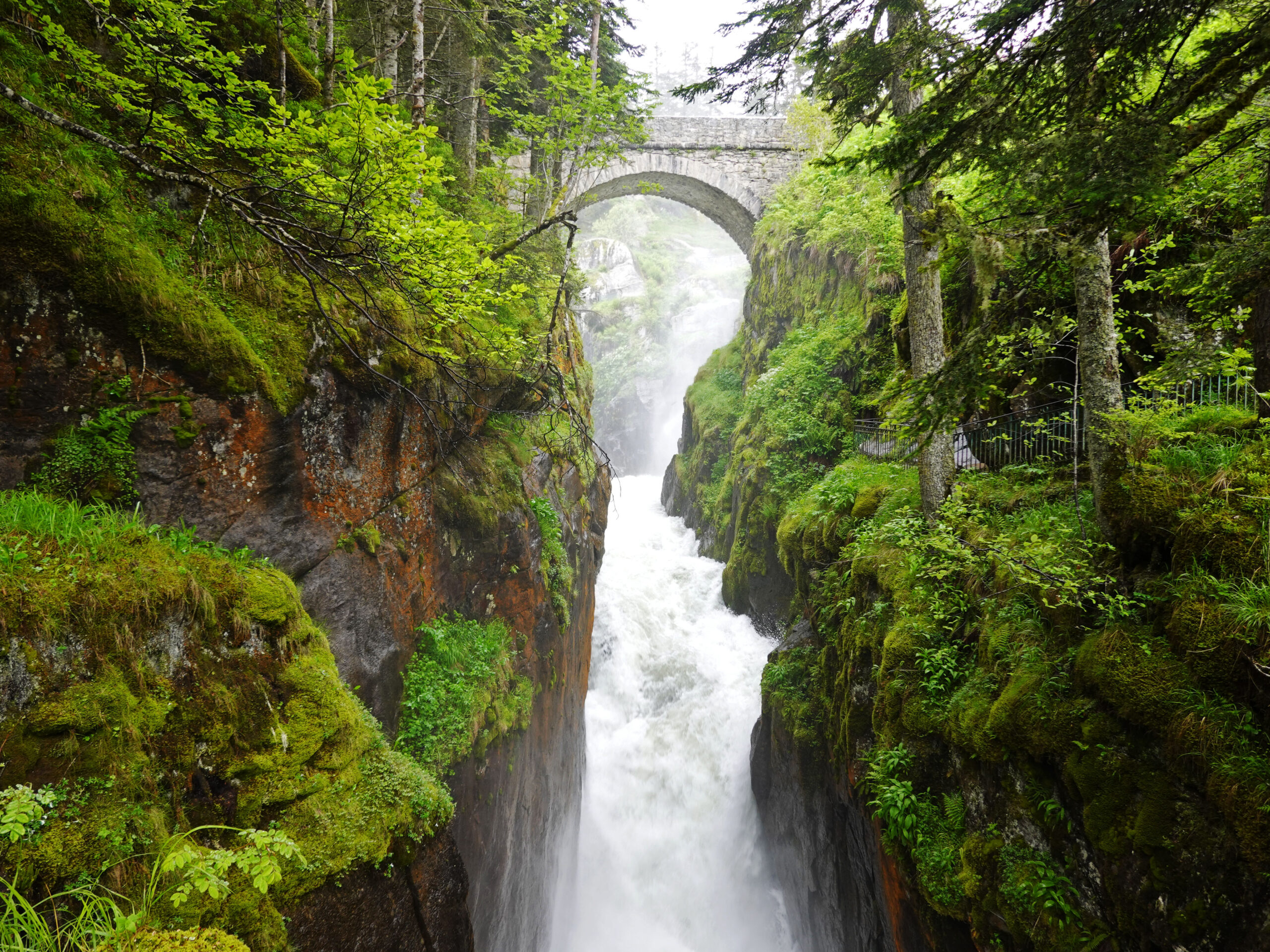
The Pont d'Espagne, a bit of history.

The Pont d'Espagne was built in 1886, at the same time as the road, to replace the old wooden footbridge located here. The bridge is located just after the confluence of the Gave de Gaube and the Gave de Marcadau (together they will form the Gave de Jéret), and was a constant crossing point for traders from both sides of the Pyrenees who exchanged animals and products across the valley and the Marcadau pass, at an altitude of 2,541 metres. This is precisely where the name Marcadau comes from, from the market.

In 1990, with the rise of tourism and the overcrowding of this place, in order to protect it, access by car was limited a few hundred metres before reaching the bridge, where today the gigantic Puntas car park is located.

Map:

Image from Google Earth

Downloadable:

> Download Track

Summary:

Linear downhill route between the Pont d'Espagne and La Raillère following the well-known Sentier des Cascades.

How to get there:

See in Google Maps.

Although the starting point of this excursion, the Pont d'EspagneIt is only 6 kilometres in a straight line from the Spanish border. To reach this place, we will have to make a detour, either entering by the Somport tunnel (2h55min) or the Portalet Pass (2h20min) if we come from the West side, or from the Bielsa tunnel (2h30min) if we enter from the east side.

In any case, the reference town is Cauterets, 8 kilometres from the Pont d'Espagne. The Pont d'Espagne can be reached by car, where there is a paid car park (€8/day). The other option is take the bus in Cauterets or at one of the other stops.

Technical specifications:
Distance: 4,2kms.
Cumulative difference in altitude: +35 / -475m.
Timetable: about 2.5 hours. Walking time without stops: 2h00min.
Water: There are no fountains along the route.
Difficulty: If we do the route downhill only, it is a short route that is perfectly suitable for children of 6-7 years of age. However, the path is rocky and slippery in places. We did this route with a 16-month-old baby, who walked hand in hand along several sections of the route.
Necessary equipment : waterproof footwear recommended.

Itinerary:

(0h00min: 0,0km) Pont d'Espagne (1.490m). The start of this route is at the Pont d'Espagne, where, if you have arrived by car or bus, you will first have had to leave behind the large car park and the cable car station.

From the bridge itself, we are already surprised by the sight of the first of the waterfalls, the one that descends from the gave de Gaube.

Gave de Gaube from the Pont d'Espagne

Next to the bridge there is an inn, the Hotellerie du Pont d'Espagne, which in addition to accommodation, offers a bar-restaurant service, except in October and November. The waterfall trail starts here, in front of the hotel, and right at the start you can visit the Pont d'Espagne and its waterfall from below, from where the most famous photo of this place is usually taken.

Classic photo of the Pont d'Espagne

The path continues alongside the river along a calmer stretch before reaching the...

(0h30min; 1,2km) Boussès waterfall (1.405m).

Boussès waterfall

Further on there is a bridge that leads to the road and another shortly after, the Pas de l'Ours waterfall bridge.

(0h50min; 1,9km) Pas de l'Ours Bridge (1.338m). The next important jump we find on the route is that of the...

(1h05min; 2,3km) Pouey Bacou waterfall (1.259m).

The Pouey Bacou waterfall, although not very vertical, is notable for its continuous succession of waterfalls.

We continue downhill and arrive at the...

(1h15min; 2,7km) Cerisey waterfall (1.193m)one of the most beautiful and best known, as it can be seen from the road to the Pont d'Espagne.

Cerisey Waterfall

We continue downhill passing by the Escane Gat waterfall and the Mauhourat waterfall, which is somewhat hidden from view from this side of the river. Perhaps it is better seen from the ruins on the other side.

(2h00min; 4,2km) La Raillère (1.041m).

Gave de Jéret from the Raillere.