Sierra de Montánchez (Cáceres). Circular route through El Castañar and Garganta de los Molinos.
Pyrenees and mountains 📩
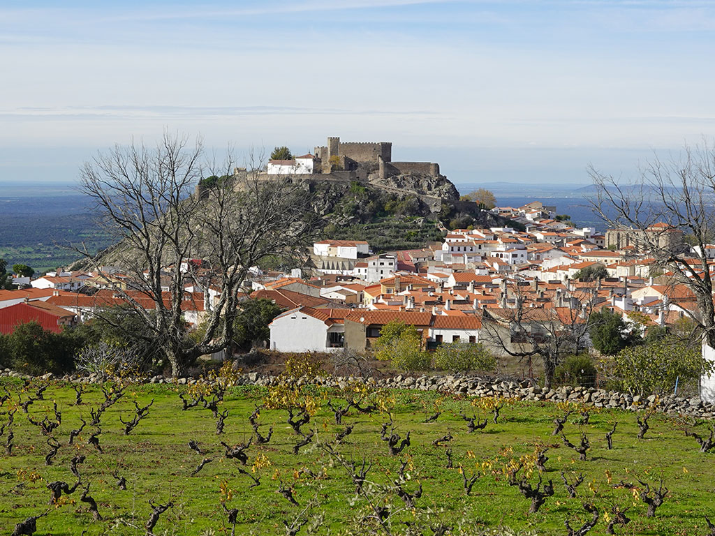
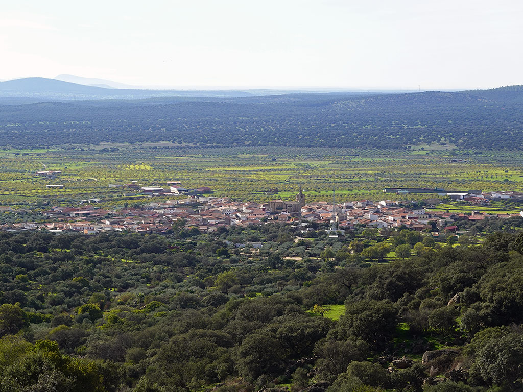
Here 🔥The place we propose you to visit this week could be said to be quite unknown outside Extremadura, the Sierra de Montánchez. A small mountain range located in the south of the province of Cáceres, between the basins of the Tagus and Guadiana rivers, which at its highest point, at just 994 metres, nevertheless has enough attractions to merit a visit.
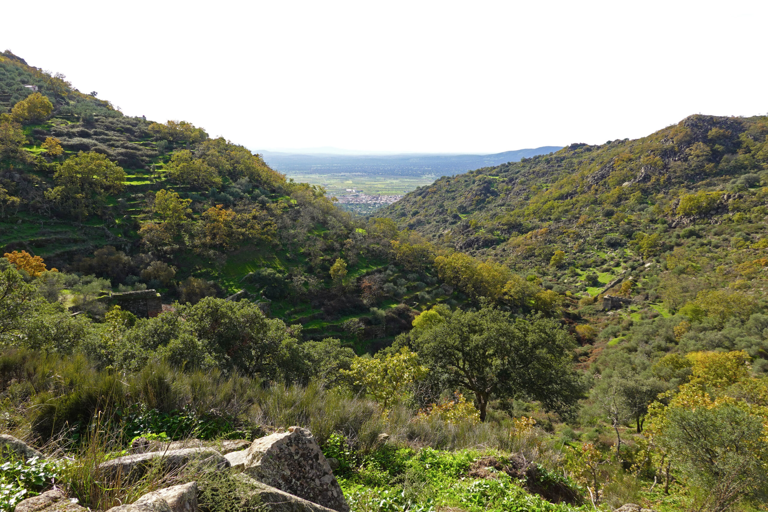
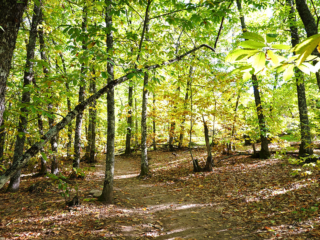
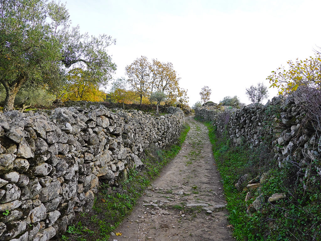
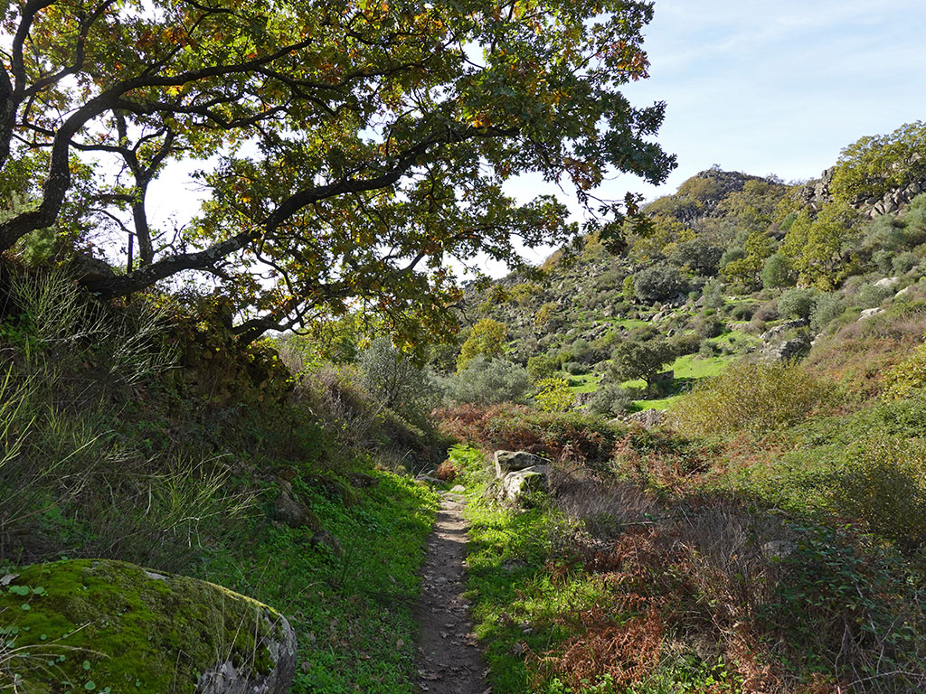
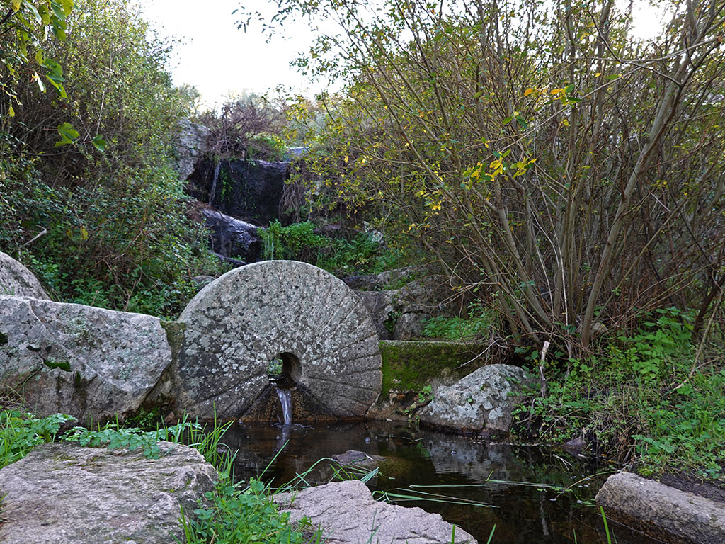
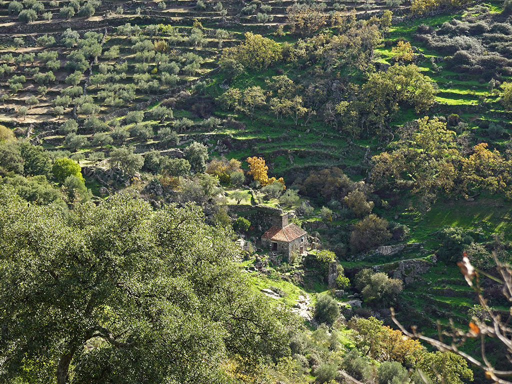
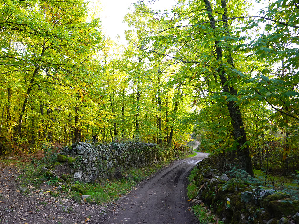
On the route we propose we will visit several of them, beginning with the chestnut groveA spectacle for the senses in autumn and at any time of the year. We will continue along rural roads flanked by ancient stone walls, oaks, cork oaks, holm oaks... The combination of the work of nature with that of man is harmonious: cobbled paths, terraces with olive trees hard worked by the steep slopes of the mountains, irrigation channels and old mills, as suggested by the name of the village itself. Gorge of the Mills.
The route we describe can be done from Montanchez or from Arroyomolinos. Here we describe it from Montanchez as it is the most common, although this is not how we did it. We set off late from Arroyomolinos to get to Montánchez at lunchtime, as we didn't want to leave without tasting its famous ham. If you leave earlier, you can still be in Montanchez by that time.
Summary:
Circular route from Montanchez in which we will visit its famous chestnut grove and the Garganta de los Molinos. The route starts by following the local path of the "De donde nace" route, which coincides with the Ruta del Castañar, to leave it after 45 minutes in Roblegordo and descend in search of the "Camino de las Vaquerizas" and then go down to the Garganta de los Molinos. We will return via this gorge and through the lower part of the chestnut grove, the part we had missed on the way out.
Map:
Downloadable:
How to get there:
See in Google Maps.
To get to the bullring in Montanchez, where this excursion starts, take the ring road around the town to the south, towards the eastern part of the town, the opposite side of the town to where the castle is located. Simply follow the signs on the road indicating "Plaza de Toros" and "Piscinas". In total it is 47 km from Cáceres, the same as from Mérida.
Technical sheet:
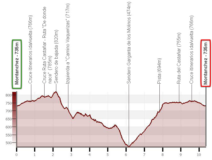
Distance: 10.3km.
Cumulative difference in altitude: +/- 450m.
Timetable: about 5 hours. Walking time without stops: 4h05min.
Water: there are no fountains along the route.
Difficulty: There are numerous junctions along the route. It is a good idea to take a GPS with you. Otherwise, apart from the gradient, the trails and paths are well laid out and easy to walk on.
Recommended equipment for the summer: boots or slippers, two walking sticks, GPS, canteen.
Itinerary:
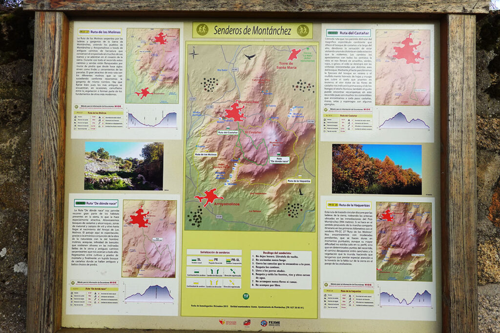
(0h00min; 0,0km) Bullring of Montanchez (735m). Once we are at the roundabout next to the southwest corner of the bullring, which is in fact a quadrangular square, we start walking eastwards along Rejoyuela street. As soon as we start we will find an information panel with several signposted routes through the sierra that start and finish here: the Ruta de los Molinos (PR-CC 27), the Ruta "De donde nace" (SL-CC 5), the Ruta del Castañar (SL-CC 6) and the Ruta de las Vaquerizas (PR-CC 28).
Our route shares some sections of the route with all of them, but it is not any of them. We continue our walk in a southerly direction, leaving the municipal swimming pools on the right and a small car park on the left. The track runs between small agricultural plots where, at the beginning, we will have to be careful to find the right crossings: first to the left, then to the right and later, straight ahead/right along the main track.
(0h15min; 0,8km) Crossing itinerary round trip (766m). When you reach a fork with a blue gate and a blue door in the middle, the outward and return routes separate. Although the route can be taken in either direction, here we describe it clockwise, i.e. we will take the path to the left. It is not long before we reach the first trees, a prelude to the marvellous chestnut grove that awaits us. Unfortunately it is not very big and sooner than we would have liked we reach a crossroads where it ends and our route separates from the Chestnut Grove Route.
(0h30min; 1,5km) Crossing Ruta del Castañar - Ruta "De donde Nace" (785m). Here it is worth taking a short detour along the path to the right and immerse yourself for a few moments in the chestnut grove. Take a forest bath.
Continuing our route, we continue straight on along a path flanked by high stone walls more than a metre high.
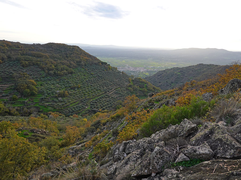
Gradually the southern slopes of the sierra come into view, with the Garganta de los Molinos in a bird's eye view and Arroyomolinos in the background.
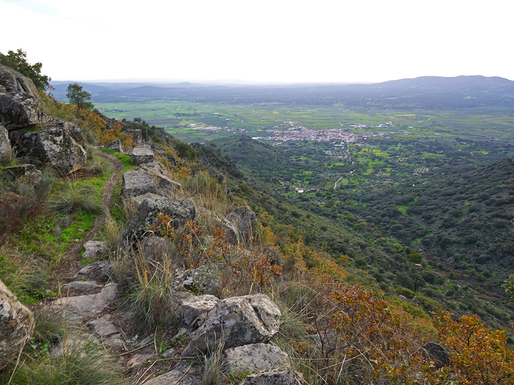
The path runs halfway up the slope of Roblegordo, where we must be very careful not to pass the unmarked downhill path on the right hand side.
(0h45min; 2,2km) Downhill path (820m). We leave the SL-CC 5 path (Ruta "De donde Nace"). The junction is at the beginning of a small climb, shortly after passing a place with magnificent views, which is followed by a small descent. The path quickly loses height to become, further down, close to the bottom of the valley, a wide path that will take on a westerly orientation. Continue along this path for about 250 metres, keeping an eye out for a path that descends to the left and crosses to the other side of the valley.
If we follow the wide path we came along to the end, in little more than 100 metres we will reach the return path through the Garganta de los Molinos, a good option for shortening this route (5.5 km).
(1h00min; 2,8km) road left (717m) which crosses the left bank of the valley, the "Camino de las Vaquerizas". This soon becomes a path that goes halfway up the hillside on the left. The views are fabulous towards the valley of the river Aljucén and the Garganta de los Molinos.
Further down, the path enters the forest and starts to move away to the left (east) from the Garganta de los Molinos, to later turn 180º and start to return through a difficult terrain of ascents and descents. In the area known as Las Galgeras, the path descends towards the Garganta de los Molinos to connect with the return path, very close to the track coming from Arroyomolinos and a pool.
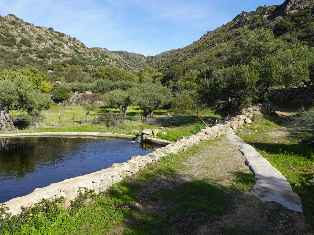
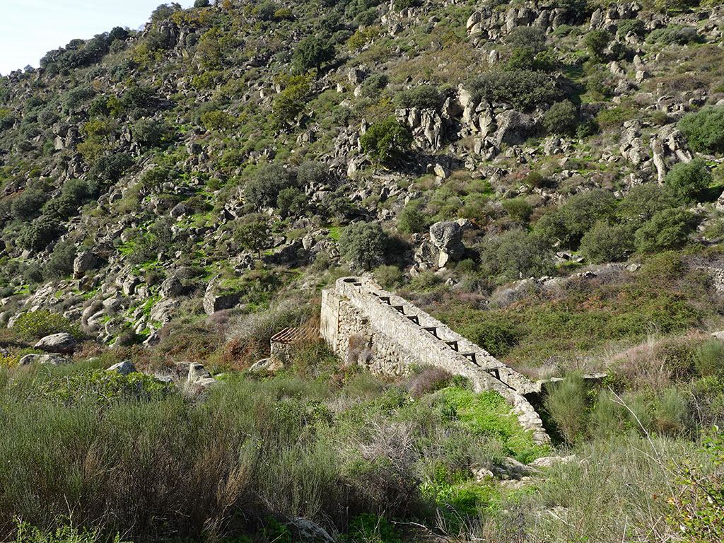
(2h15min; 6,2km) Path of the Garganta de los Molinos (474m). You can't get lost on the way back. It ascends along the valley floor passing by the ruins of several mills and old infrastructures.

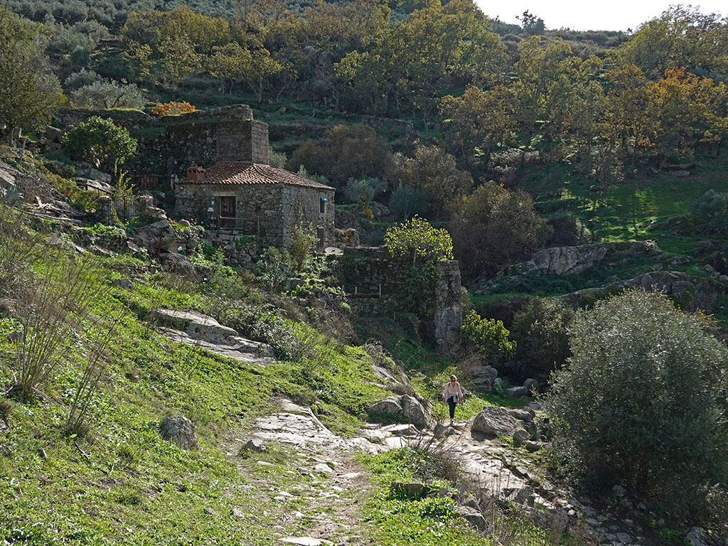
After about three quarters of an hour we passed Villa Granado, just before we came out to a...
(3h05min; 7,7km) tiled track (694m) where there is an information post. The slope becomes steeper to gain the upper part and reach the chestnut grove again from below.
(3h35min; 8,9km) Ruta del Castañar (755m). Following this path, which leaves the chestnut grove on the right, we return to the...
(3h50min; 9,6km) Crossing itinerary outward/return (766m) and to the...
(4h05min; 10,3km) Montanchez bullring (735m).
Fastpacking is not about going faster. It's about going lighter.
If you come from classic trekking, this is the next step: learning to move with less weight,
more fluid and enjoying every kilometre more.
Join the Outsiders Newsletter and start discovering what lightness feels like.