

19 miles in 19 hours: the Long - Néouvielle sector link-up

Pyrenees and mountains 📩
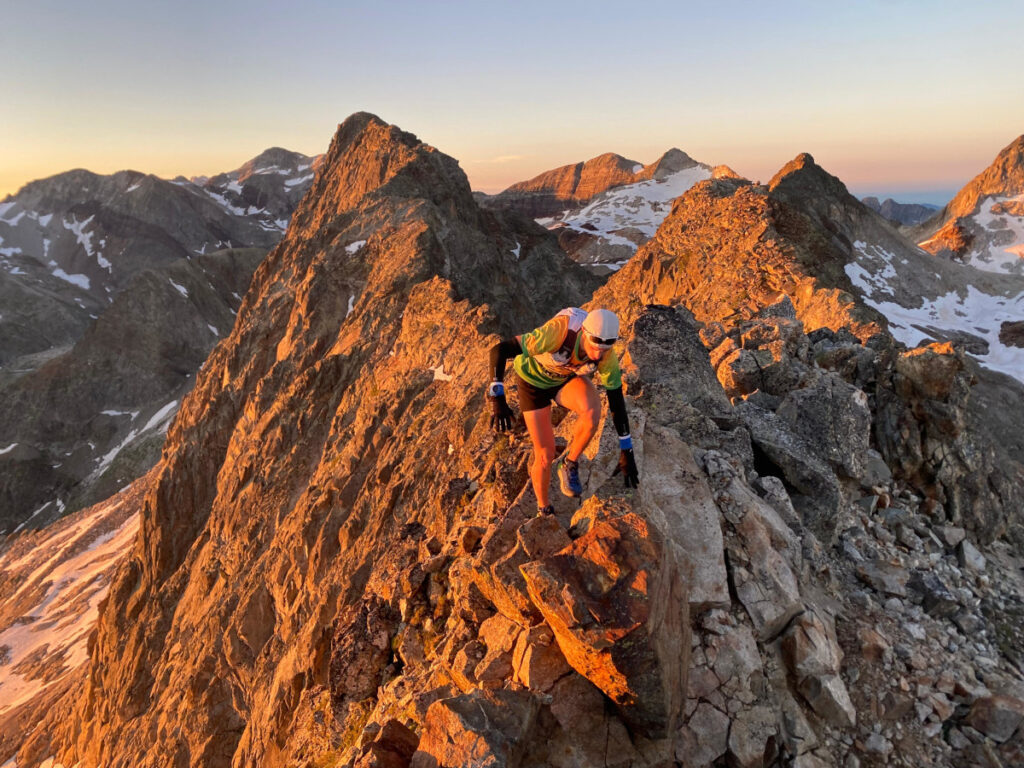
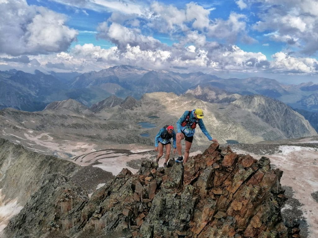
Here 🔥Marc Orobitg y Juan Aparici On July 11, 2026, the nineteen summits of more than 3,000 meters in the French sector of Long – Néouvielle were connected. They left Cap de Long at 4:30 in the morning and returned at 00:24. Nineteen hours and fifty-four minutes. Without a rope, without climbing equipment, only the helmet.
Technical specifications
| Date | Saturday July 11, 2026 |
| Protagonists | Marc Orobitg and Juan Aparici |
| Tour | Circular from the Lac de Cap de Long (2,161 m) |
| Distance | 30.1 km |
| Positive difference in altitude | +3,715 m |
| Weather | 19 h 54 min (4:30 → 00:24) |
| Peaks | 19 three thousand |
| Material | No ropes or climbing gear. Only helmet |
| Difficulty | Climbs and descents up to II+/III, degraded and exposed terrain, steep with crampons |

The massif: granite, lakes and a list that never stops growing
The Néouvielle is the highest massif in the French Pyrenees, and it is the same on both sides of the border. In just twenty-five kilometers long and seventeen wide, a closed world is concentrated within: more than seventy lakes suspended between granite plates and black pines that rise higher than they should.
The name comes from the Occitan language. Nuevla vieja, «old snow», and it refers to the many glaciers that used to be here. Today almost everything is a freezer. Of the remaining glacial relics, the most significant is that of the Pays Baché, hanging from Pic Long. The rest have disappeared, and with them have gone some of the usual paths of classic literature: what Angulo used to mark as a logical access point thirty years ago is today a problem.
Much of the massif is within the Neouvielle National Natural Reserve, created in 1936 and the third oldest in France, with the rest being part of the Pyrénées National Park. It is an area that can only be accessed on foot, and that is exactly the reason why it has been preserved as it is.

The large peaks are grouped to the south and are divided into two distinct blocks. To the north, the Group NéouvielleGranite, ridges that converge towards Pic de Néouvielle (3,091 m) and towards Pic des Trois Conseillers, delineating old glacial cirques. These are not heights that impress on paper, but the alpine charm of their crests is something else. Here, by the way, the Count Russell, the same one from Vignemale, began his alpine career. To the south, Pic Long group – Campbieil: the largest, of sedimentary rock, dominated by the 3,192 meters of the Pic Long, the roof of the massif.
And then there is the list. For decades, the reference catalogue was that of Juan Buyse, who in this sector was recognized 16 three-miles. Subsequent measurements have incorporated three levels that meet height and prominence requirements and that previously were outside the scope: the Premier Conseiller (3,035 m), the Pale de Crabounouse Norte (3,021 m) and the Pic Lentilla (3,157 m). Hence today's 19.
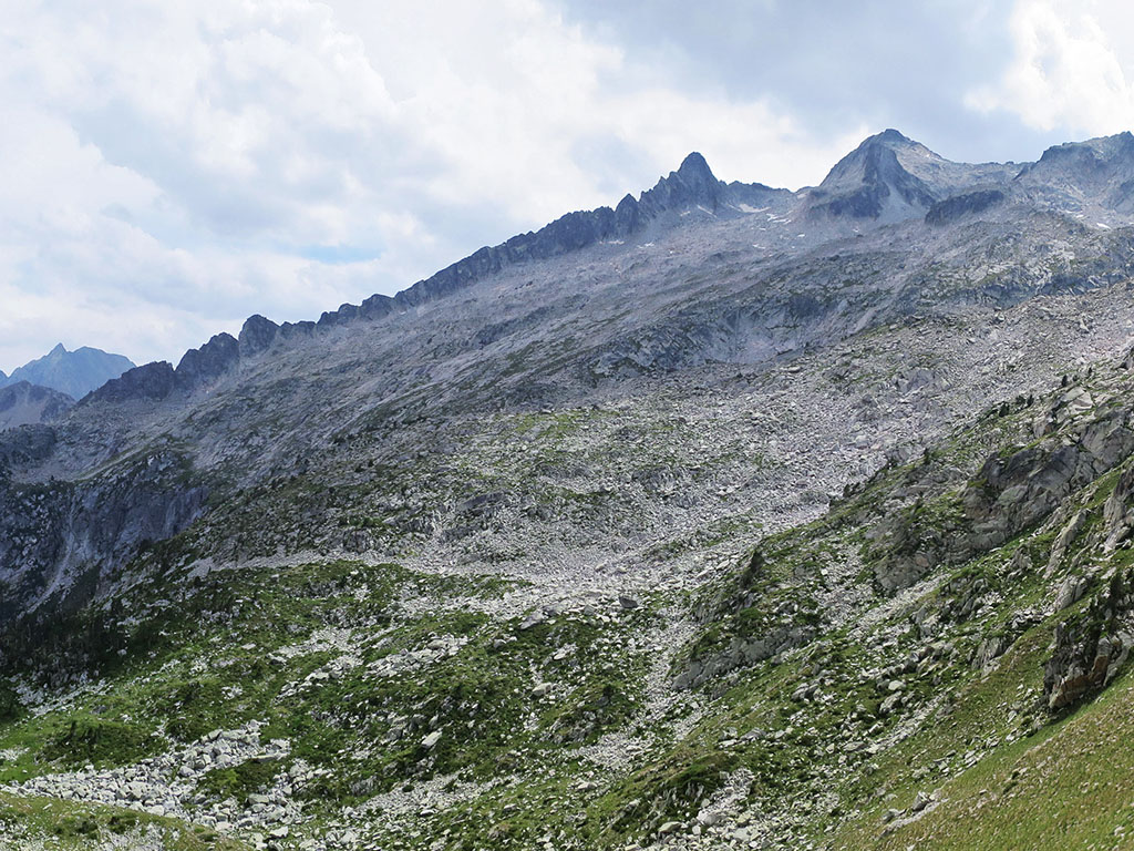
That makes the sector one of the most coveted chains in the Pyrenees. And also one of the most ungrateful: the three-thousand of Néouvielle are not concentrated like those of Vignemale. They are spread out in two groups separated by an entire valley of quarries.
The account of Juan Aparici
«We set off at 4:30 on Saturday from Lac de Cap de Long, towards the Ramougn, the most difficult mountain of the project. Then we climbed the Néouvielle, passed through the Chausenque gap and headed for the Turon de Néouvielle. We descended to find the Reboul Vidal peak, and returned to the Turon to climb the Conseillers crest, to complete the first sector. A easy sector, unlike the Ramougn, although very difficult due to its rocky terrain.
We descended down the Néouvielle ravine; we came across an exposed and broken down precipice, and a large crevice with a deep rimaya. We did not use any mountain or climbing equipment in this project; only the helmet.
We crossed a valley of extensive gravels to the Col de Tourrat. We climbed the first mountains of the Long sector, easy: Pale Crabounouse N, Pale Crabounouse, Bugarret and Dent d’Estibère Male. We climbed the crest of Pic Long, very broken and somewhat exposed, to climb the Long. Here we encountered technical and exposed terrain, passing through the Badet, the Badet and the Maou. It became difficult, with some fatigue, to climb the Tourrat and Maubic peaks.
But everything started to look different when we got down and went to look for the final objective. We climbed up to Lentilla with a sunset behind us, which mixed with the feeling that dreams sometimes come true. We went to Campbieil, it got dark there, and we climbed up to Estaragne with the front. A quick hug and descent towards Cap de Long, where we arrived very exhausted at 00:24 on Sunday morning.
For us it is important to maintain respect for the pioneers, Gorka and Unax, who managed to climb this area, although at that time, with the Juan Buyse list, there were 16 mountains over 3,000 meters, not 19. But they paved the way for the next Pyrenean dreamers.»

The 19 peaks, one by one
The schedules are extracted from the GPS track of the activity. They serve to understand how effort is distributed: where time is gained and where it is lost.
| # | Cima | Altitude | I step over it | Weather |
|---|---|---|---|---|
| - | Departure: Lac de Cap de Long | 2,161 m | 04:30 | - |
| 1 | Punta Ramougn | 3,011 m | 07:32 | 3 h 02 |
| 2 | Pic de Néouvielle | 3,091 m | 08:39 | 4 h 09 |
| 3 | Reboul-Vidal Point | 3,007 m | 11:04 | 6 h 34 |
| 4 | Turon de Néouvielle | 3,035 m | 11:18 | 6 h 49 |
| 5 | Premier Conseiller | 3,035 m | 11:44 | 7 h 14 |
| 6 | Pic des Trois Conseillers | 3,039 m | 11:49 | 7 h 19 |
| - | Crossing to the Long sector via the Col de Tourrat | |||
| 7 | Pale de Crabounouse Norte | 3,021 m | 15:38 | 11 h 08 |
| 8 | Crabounouse Pale | 3,021 m | 15:44 | 11 h 14 |
| 9 | Pic de Bugarret | 3,031 m | 15:54 | 11 h 24 |
| 10 | Dent d’Estibère Male | 3,017 m | 16:24 | 11 h 54 |
| 11 | Pic Long | 3,192 m | 17:18 | 12 h 48 |
| 12 | Badet needle | 3,135 m | 17:44 | 13 h 14 |
| 13 | Pic Badet | 3,160 m | 18:10 | 13 h 40 |
| 14 | Pic Maou | 3,074 m | 18:37 | 14 h 07 |
| 15 | Tourrat needle | 3,014 m | 20:02 | 15 h 32 |
| 16 | Pic Maubic | 3,058 m | 20:23 | 15 h 54 |
| 17 | Pic Lentilla | 3,157 m | 21:56 | 17 h 26 |
| 18 | Pic Campbieil | 3,173 m | 22:04 | 17 h 34 |
| 19 | Pic d’Estaragne | 3,006 m | 22:39 | 18 h 09 |
| - | Arrival: Lac de Cap de Long | 2,161 m | 00:24 | 19 h 54 |

Three quick readings from that table:
The Ramougn takes three hours. It is the first and most difficult climb of the day, and it is done in the dark. Leaving at 4:30 is not a whim: it is the only way for the tricky terrain to fall in the light ahead and not behind.
The descent to Reboul-Vidal takes more than two hours. Between the Néouvielle and that point there is the Chausenque gap, the exposed ditch and the cistern with a rimaya. This is the section where the decision is made on whether the project will continue.
Almost four hours of travel between sectors. From Trois Conseillers to Pale de Crabounouse Norte there is no difference: only the Néouvielle gap, the gravel valley and the Col de Tourrat. It is the geographical toll of the massif and the reason why this chain does not resemble any other in the Pyrenees.
Then, the last hour and a half is pure discount: Lentilla at dusk, Campbieil at night, Estaragne with front and bottom.
The pioneers
Juan himself insists on it, and it is worth noting. Gorka and Unax —the same as the 44 three-thousanders in the Perdiguero sector in 38 and a half hours, non-stop and self-sufficient—climbed this area more than a decade ago, when the Buyse list marked 16 summits. Their journey took around 20 hours, about 30 kilometers and about 3,500 meters of elevation gain.
It was once described as a sporting challenge even for mountaineers accustomed to the great Pyrenean treks. It still is. The difference is that now there are three more summits and the same clock.
Download the track
The route is available on Wikiloc:
 Spanish
 English
 French