Ibones Azules desde el Balneario de Panticosa
Pirineos y montaña 📩
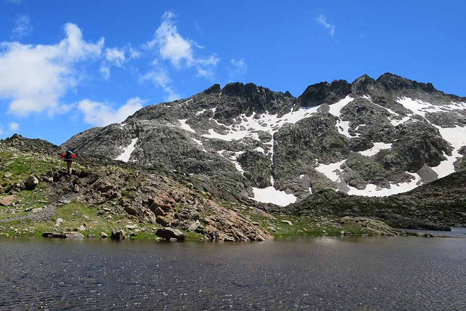
Aquí 🔥La subida a los Ibones Azules desde el Balneario de Panticosa es una de las rutas clásicas del Valle de Tena. Una bonita excursión en la que además de visitar estos dos ibones (Superior e Inferior), remontaremos el barranco excavado por el río Caldarés -entre pinos negros, paredes de granito y saltos de agua-, caminaremos por la orilla de los embalses de Bachimaña Alto y Bachimaña Bajo, y divisaremos un sinfín de picos que superan o rozan los tres mil metros, como los Picos del Infierno (3.082m), el Pico de Piedrafita (2.962m) o la Punta Zarra (2.940m).
Ficha técnica:
Distancia: 12,8 km.
Desnivel acumulado: +/- 880 m.
Horario: unas 6 horas. Tiempo de marcha sin paradas: 2h50min (subida) + 2h15min (bajada) = 5h05min.
Agua: en el refugio de los Ibones de Bachimaña y en las innumerables corrientes de agua que cruzaremos.
Dificultad: a pesar de ser una excursión muy popular, debes tener en cuenta que es necesario estar en forma para acometerla. Hay que salvar un desnivel positivo de 880 metros, que no es poco.
Equipo recomendable para el verano: botas ligeras o zapatillas de trekking, bastones, GPS (opcional), cantimplora, algo de comida, protección solar, gafas de sol…
Sugerencias: si se quiere regresar por diferente camino, existe la posibilidad en el refugio de Bachimaña de tomar el camino de la Tubería que lleva a Brazato y descender por el GR11 al balneario. También se puede, tomando el inicio de la ruta anterior, bajar por el ibón de Lumiacha. Otra posibilidad de hacer un pequeño bucle es tomar en el llano de O Bozuelo, el senderillo que baja por la otra margen del río Caldarés.
Cuándo ir: el verano es la mejor época por la ausencia de nieve. En invierno, la ruta solo es apta para montañeros experimentados con equipo adecuado para la progresión en nieve y hielo.


Itinerario
(0h00min; 0,0 km) Baños de Panticosa – Casa de Piedra (1.638 m). Iniciamos la marcha junto al refugio Casa de Piedra, siguiendo las marcas rojas y blancas del GR11 / Senda Pirenaica. El sendero comienza con «decisión», describiendo varias zetas que pronto nos harán coger altura entre un bosque de pinos negros, escarpadas paredes de granito y la agradable compañía del río Caldarés, que de vez en cuando ameniza la subida con algún salto de agua y alguna poza.

(0h40min; 1,2 km ) Llano de O Bozuelo (1.870 m). Un tranquilo paraje, punto de inicio para los que descienden el Barranco de Caldarés. Lo reconoceremos por una bucólica pradera y un sendero que va a cruzar un puente y que si queremos, podremos tomar a la vuelta para hacer este tramo circular. La pendiente se suaviza. El sendero continúa entre pinos, pasando algún tramo equipado con cable, útil en invierno. El bosque acaba frente a un escarpado circo por el que se precipitan las aguas del río Caldarés (Salto del Fraile). Es la conocida…
(1h10min; 2,3 km) Cuesta del Fraile – abajo (1.955 m), que salva en zigzag la muralla por el flanco izquierdo y que en invierno puede ser peligrosa por los aludes.


Al final de las zetas el sendero gira a la derecha. Ya comienza a verse cerca el refugio de los ibones de Bachimaña, que asoma sobre un promontorio al otro lado del valle.
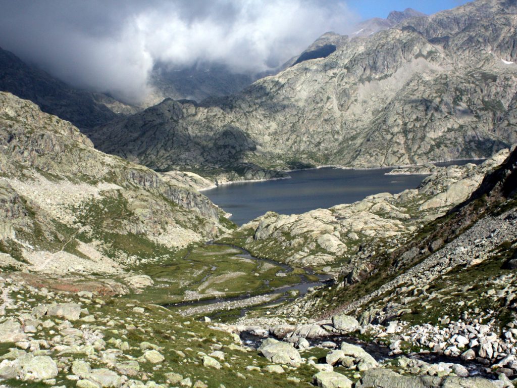
(1h40min; 3,3 km) Embalse Inferior de Bachimaña – Desvío al refugio de los Ibones de Bachimaña (2.200 m).


Dejamos el refugio al otro lado, a unos 150 metros de distancia, y continuamos subiendo por el GR-11 hasta el Embalse de Bachimaña Alto, mucho más grande que el anterior. Lo rodearemos por la izquierda hasta el final, hasta situarnos a la entrada del gran valle que se abre a la izquierda.

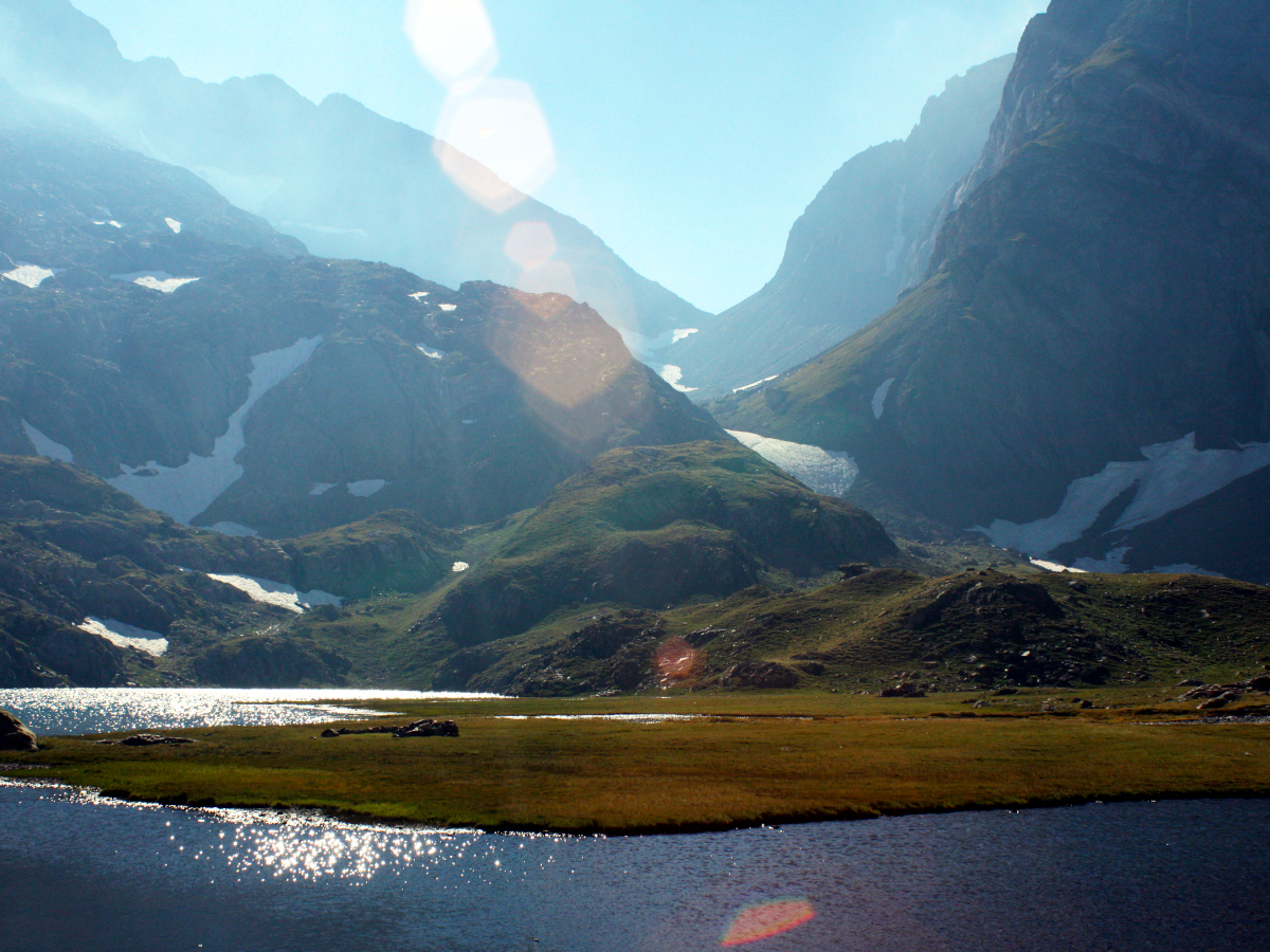
(2h20min; 5,0 km) Enlace GR-T 24 (2.212 m). Justo después de dejar atrás la cola del ibón-embalse, llegaremos a un cruce que enlaza el GR11 con el GR10 a través del Puerto de Marcadau (la Transversal 24). Nosotros seguiremos de frente por el GR11 atravesando una húmeda vaguada en la que de nuevo cruzaremos el menguado Caldarés.

Una última subida, un último esfuerzo, será la penitencia para alcanzar primero el…
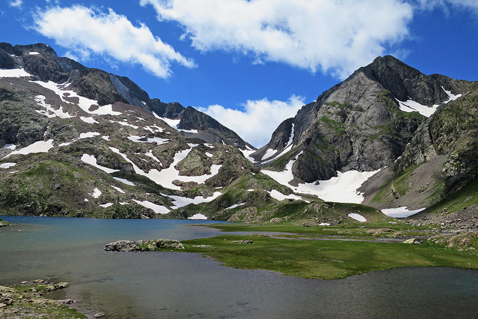
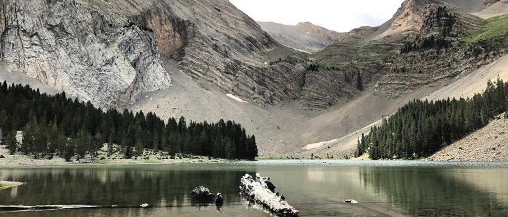
(2h35min; 5,9 km) Ibón Azul Inferior (2.356m), y después, el
(2h50min; 6,4 km) Ibón Azul Superior (2.400m). El regreso se realiza por el mismo itinerario. Nos llevará unas 2h15min (sin paradas) si regresamos por el mismo camino.