Montserrat routes: circular route to "les Agulles" and "els Frares Encantats" from Can Maçana.

Pyrenees and mountains 📩
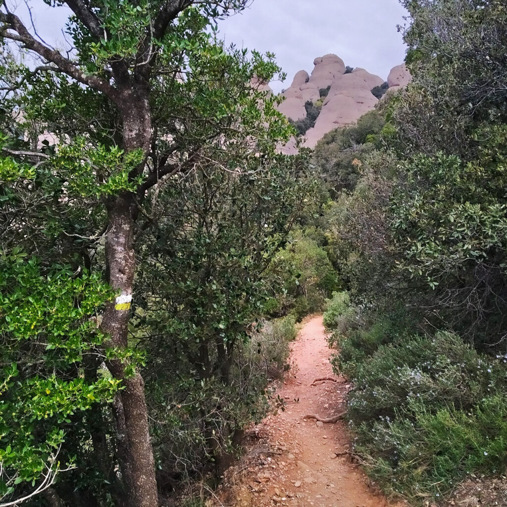
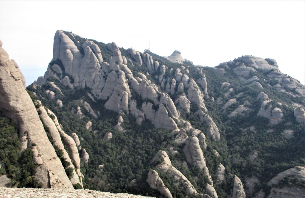
Here 🔥In the west of Montserrat, we find the area of les Agulles y els Frares Encantats. Two labyrinthine areas of needles that, together with the neighbouring Ecos, manage to keep away from the overcrowding of other climbing areas in Montserrat, and which are also somewhat quieter for hikers than the area near the monastery.
The route we propose here goes around these two rock formations (les Agulles and els Frares Encantats) in a clockwise direction. allowing us to take a closer look at some of the most emblematic ones, such as the Foradada Rock y the Cadireta. We will have the fun option of climbing the first one and passing under the second one. Next, our steps will lead us to the coll de Port o de Porc passing under the walls of els Frares EncantasThe vegetation will change radically in this area, with emblematic spires such as El Bisbe, El Lloro and El Frare Gros, among many others. The vegetation will change radically in the coll de Porc/Port as we pass from the shady area (north) to the sunny area (south). From here, the return path, following the PR C-78, will lead us halfway up the southern slope until we reach the coll de Guirló (already known), passing through the Esllavissada fountainthe Pas del Princepthe safe haven Vicenç Barbé y la Portella, always accompanied by different visual perspectives of the mountain. From the coll Guirló at coll de Can Maçana we will return the same way.
Summary:
Clockwise circular route to les Agulles and els Frares Encantats. From the coll de Can Maçana we will head to the coll GuirlóThe paths to and from the summit separate. We will continue along the northern slope towards the imposing Cadiretaby climbing (optionally) to the Foradada Rock. We will then follow the Coll de Porc o de Port, where we change to the southern slope. The return route follows the PR C-78, passing through the shelter Vicenç Barbé until linking up again with the outward route at Coll Guirló.
Map:
Downloadable:
How to get there?
See in Google maps.
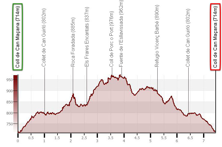
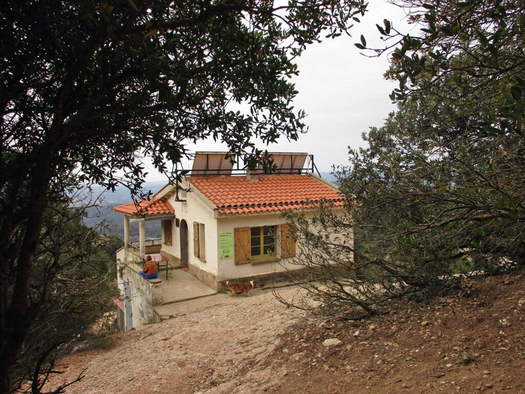
The starting point of this excursion is the coll de Can Maçanalocated on the BP-1101 road, at km 2.6 (El Bruc). It serves as an information centre and is equipped with tables and toilets. Free on weekdays, but costs €6 on weekends and public holidays.
Technical specifications
Distance: 7.5 km.
Cumulative difference in altitude: +/- 470 m.
Timetable: about 4.5 hours. Walking time non-stop: 3h20min.
Water: at the information centre (weekends and public holidays) and at the refuge. The spring at Coll de Porc or Port does not usually have water, but the one at l'Esllavissada usually does.
Difficulty: The route runs along well-defined and signposted paths. The gradient is moderate and allows for a relaxed walk. The only technical difficulty lies in the ascent to the Roca Foradada, in a rocky section equipped with a rope, which we will also have to watch out for on the way down, as the terrain is very eroded.
Recommended equipment: comfortable clothing, canteensome food, sun protection, a baton for the rise and GPS optional.
Suggestions: you can go to the Monastery of Montserrat, where apart from visiting the religious site, you can do other low-difficulty routes such as La Creu de Sant Miquel or El Camí dels Degotalls.
Itinerary
(0h00min; 0,0 km) Coll de Can Maçana (714 m). We leave the car park along a track marked GR 172, we are on the "camí de la Roca Foradada".
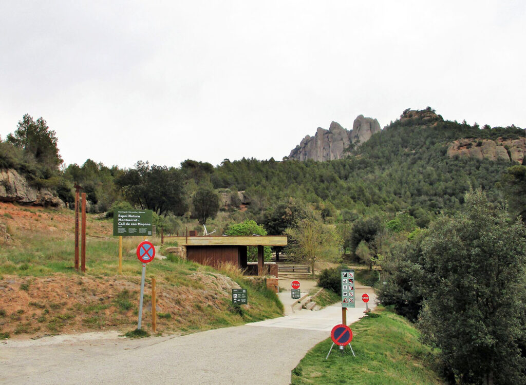
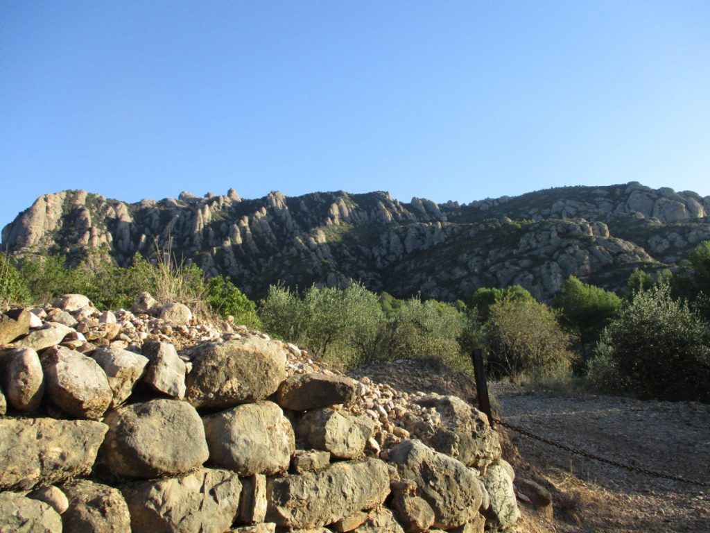
Accompanied by white pines, strawberry trees, rosemary, steppe... you reach the Coll de Can Maçana viewpoint, located to the left of the track. In the whole area of Montserrat, work is being carried out to limit the risk of fires, by means of forestry work, favouring a mosaic landscape with open areas and encouraging grazing. We can see rocky areas with conglomerate, sandstone and clay strips typical of this part of the massif. Shortly before the Can Guirló collet, you leave the path to the right that would take you to the ruins of the Sant Pau Vell hermitage and the Castell de la Guàrdia (857 m).
(0h25min; 1,0 km) Collet de Can Guirló (802 m). We pass a barrier and the track becomes a path. We walk between holm oaks and box trees.
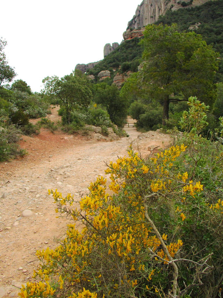
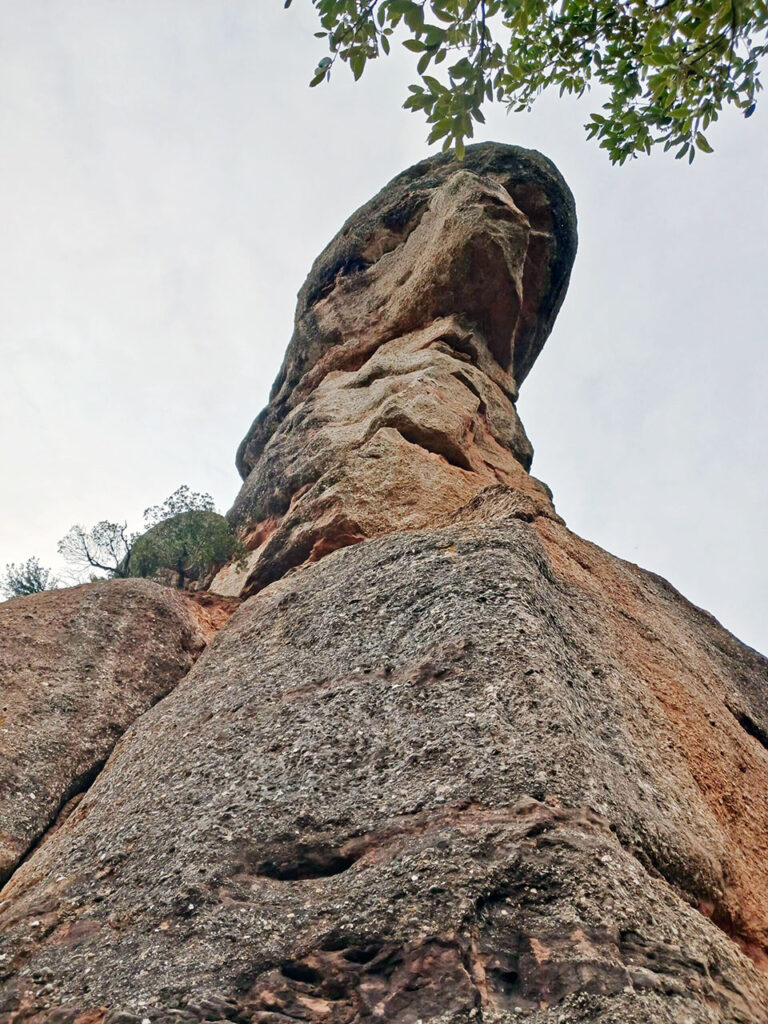
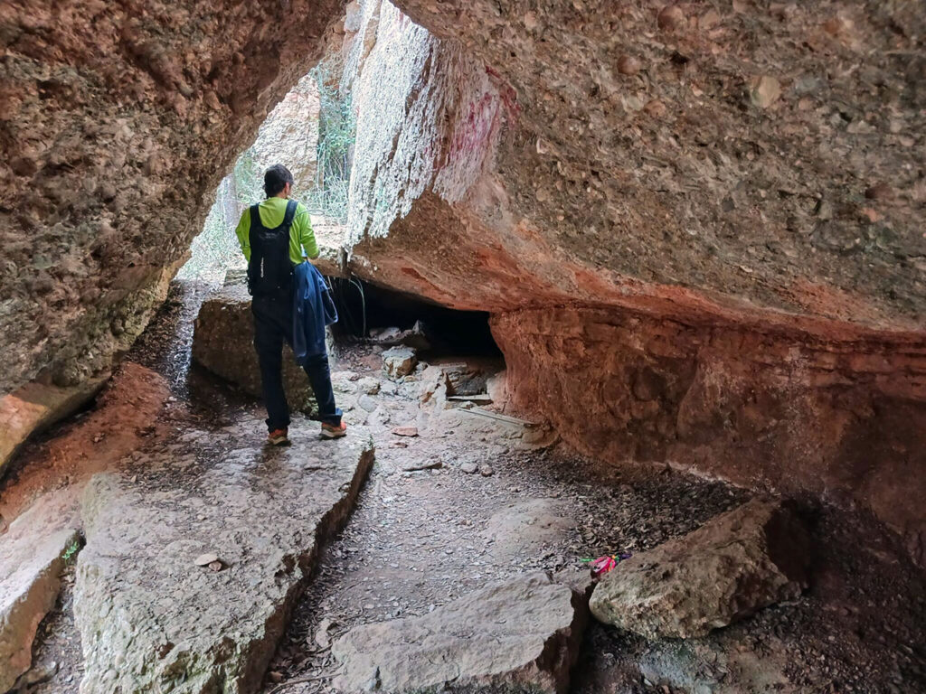
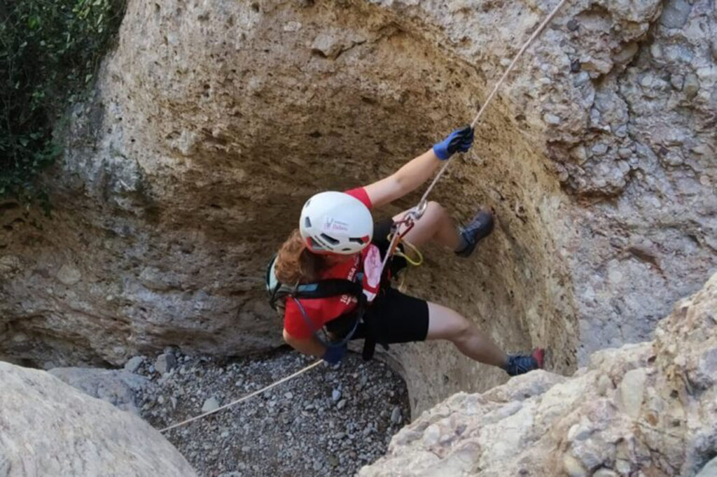
(0h45min; 3,0 km) Base Roca Foradada (835 m). To the right is the path upwards. We can divide it into three sections: the first, a path; the second, a rocky section that we climb with the help of a rope; and the third, a winding section up to the base of the spire.
(0h55min; 3.2 km) Roca Foradada (885 m). This triangular hole, with a flat base, is about 10 metres high and 6 metres wide at the base. As a curiosity, in mid-July, from the chapel of Sant Pau Vell, you can see the sun rise through this hole. You can also see it set, but for that you will have to go to places like Castellbell i el Vilar in mid-February. This visual phenomenon is called the "sun flower" and is a tourist attraction in the area.
The legends of the "Foradada Rock".
This rocky hole has always symbolised a portal or threshold to cross, usually to the underworld.
One of the legends tells how the devil, who had made himself lord and master of Montserrat, had to flee, pursued by the Virgin Mary. The devil, seeing himself cornered, struck the mountain, piercing it and opening a chasm that led him straight to hell.
Another curious legend tells of a mountain in the sky with which the angels would play. This mountain was dragged with a rope across the firmament. God, seeing the commotion they were making, made them bring the toy down to Earth. They dragged it so much that in the end the rope broke, although the hole through which they dragged it was visible.
The free fall of the "birdman
In December 2012, a Norwegian parachutist, Alexander Polli, free-fell through the interior of the Foradada Rock at 250 km/h.
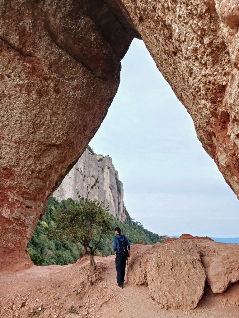
Back down again, on the GR-172 path, we continue the walk passing the base of the imposing spire of "la Cadireta", translated in Spanish as "la sillita" (the little chair), due to its morphology. This large block of conglomerate looks as if it is about to collapse and fall. For this reason, the sediments on which it sits and the fracture zone (diaclase), together with the neighbouring spire, are being monitored by means of sensors. For the time being, studies predict a good future for the next few centuries.
(1h15min; 2,6 km) Els Frares Encantats (837 m). Our path makes us leave the GR172 and climb through shady vegetation, dominated by holly trees. Technically, we have just changed the region of Montserrat, we have left "les Agulles" to enter "els Frares encantats" (enchanted friars in Spanish). Some needles in this region take religious names such as the Frare Gros (fat friar in Spanish), the Bisbe (bishop in Spanish) or the Nun, because of their relative resemblance to these religious figures.
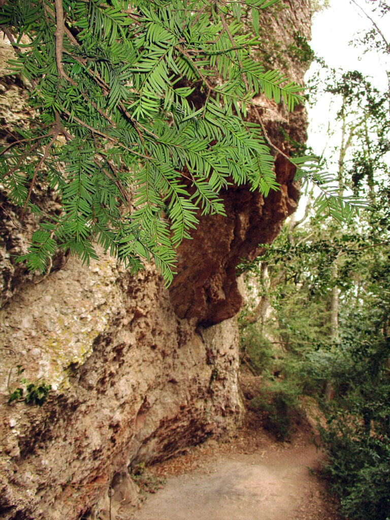
(1h40min; 3,4 km) Fountain of Coll de Porc o de Port (944 m). Located under a rocky ledge, it is a small spring of water that accumulates in a masonry structure at the front. It serves as a watering place for wildlife and a breeding ground for salamanders.
(1h50min; 3,6 km) Coll de Porc o de Port (976 m). This hill would mark the boundary of the "Frares encantats" area. The place name of the hill "Porc" (pig) or "Port" (port) is the subject of debate among experts, and it seems that the more correct name would be "Port". Turn right and observe a transition to the holm oak grove. We have just changed from the shadier northern slope to the sunnier southern slope, and this is reflected in the vegetation. A little later you will see an accumulation of rocks on your right.
(1h55min; 3,8 km) Esllavissada Fountain (962 m). Located under rocks or "bauma". It has a depression consolidated with cement (where there are usually salamander larvae) and a small channel covered with a metal lid. The name "Esllavissada" (landslide) refers to the conglomerate rocks that we find at the entrance and which have fallen. The water drips down the rock and is not purified.
Following the marks of the PR C-78, we pass the "torrent del Lloro" (parrot's torrent) and enter a more open terrain with juniper trees.
(2h30min; 5,1 km) Ampla Canal (803 m). We pass the turn-off that will give us access to the Agulles area.
(2h35min; 5,3 km) Vicenç Barbé Hut (890 m).
The shelter Vicenç Barbé is named after a pioneering climber of the early 20th century, who sadly died while climbing in Montserrat. The Barbé Needle was named in his honour, near the refuge. It was inaugurated in 1961 and is currently managed by the FEEC. Open at weekends, it has a capacity for 20 people and offers overnight stays.
Shortly after leaving the refuge, we leave a stepped path on the left that descends towards El Bruc and we reach a pass between the rocks known as La Portella, which we can easily descend with the help of our hands.
(3h05min; 6,4 km) Collet de Can Guirló (802 m). Once again in this well-known spot, we return to the left (west) to the starting point of this excursion.
(3h20min; 7,5 km) Coll de Can Maçana (716 m). End of our tour.
Nearby you may be interested in:
If you want to get to know the mountain of Montserrat and start with an impressive route, the ascent to Sant Jeroni (1,236m), the top of Montserrat, would be the recommended route. [3h30min; 11,7km; +/-760m].
Route through Montserrat from Collbató, on the southern slope of the massif [5h30min; 14,6km; +/-1.269m].
Dry canyon - Medium level - Total time: 5-6 h. Approach: 60′ approx. Descent: 2-3 h. Return: 40′.
Fastpacking is not about going faster. It's about going lighter.
If you come from classic trekking, this is the next step: learning to move with less weight,
more fluid and enjoying every kilometre more.
Join the Outsiders Newsletter and start discovering what lightness feels like.