Etapa 10 –Ruitelán – Sarria
Pirineos y montaña 📩
Aquí 🔥- Distancia: 53,21 km
- Altura máxima:1347.5 m
- Altura mínima: 477.57 m
- Desnivel positivo: 1459.09 m
- Desnivel negativo: 1636.5 m
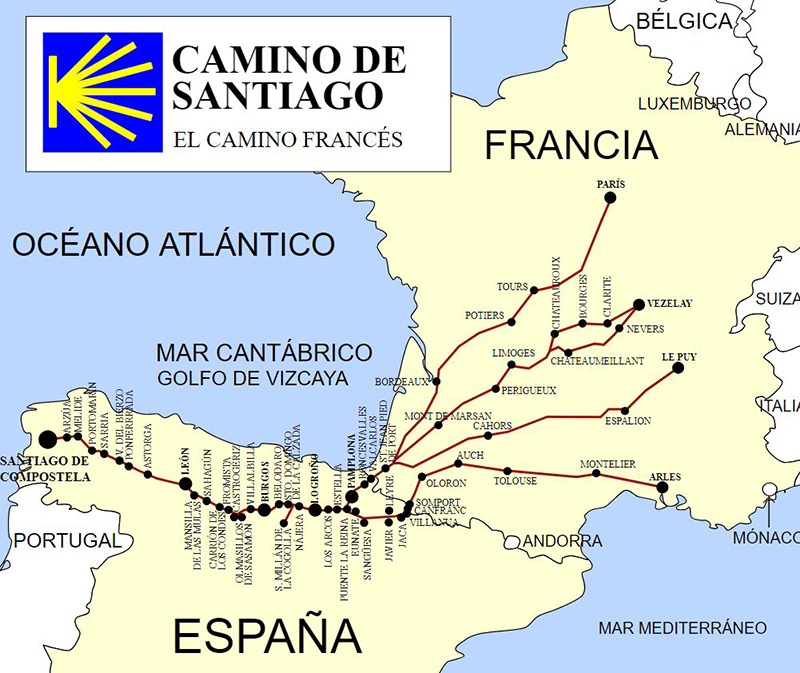
Camino de santiago décima etapa

Hoy nos disponemos a vivir una de esas experiencias únicas que quedan en el recuerdo para toda la vida, la ascensión al mítico Ocebreiro, son 8 kilómetros de ascensión pero de extraordinaria dureza, el paisaje nos hace de todas formas disfrutar de esta subida.
🎁 Guía gratis
Camino de Santiago 101
Prepara tu primer Camino con una guía rápida en inglés y una comunidad gratuita dirigida por un local que vive sobre el Camino Francés.
👉 Acceder gratis a Camino 101Por fin en esta etapa llegamos a Galicia, a partir de aquí dejamos atrás castilla con sus largos paramos y nos adentramos en unos parajes indescriptibles.
La subida se puede hacer sin problemas por el camino, pero siempre hay una carril asfaltado para ciclistas que va paralelo al camino.
Salimos de Ruitelán camino de la población de herrerías a escasos 2 km del inicio, donde el camino empieza a tornarse ascendente, hasta llegar al cruce de la Faba, no nos dará sensación de gran dureza, pero a partir de este punto y durante los próximos 3 km las rampas serán de extraordinaria dureza y la vegetación pasa a ser de alta montaña.
Llegamosa Laguna de Castilla (último pueblo de León), ojo aunque parezca que hemos coronado el puerto aún nos quedan duras rampas durante 2 km hasta llegar a Ocebreiro (aquí el primer mojón oficial nos muestra 151 km a Santiago)
Ya estamos en Galicia y la aldea nos muestra toda su Magia y esplendor, podemos observar el valle al cual tenemos que descender para adentrarnos por fin en Galicia por la provincia de Lugo.
A partir de este punto tenemos que estar alerta porque parece que al alcanzar Ocebreiro la ascensión ha terminado y nada más lejos de la realidad, nada más abandonar la aldea seguimos ascendiendo durante 2 km por un sendero en un bosque hasta el alto de San Roque, desde aquí tras un descenso por una pista forestal , llegamos a Hospital de la condesa y luego tomamos un camino de ascenso constante que nos acerca a Padornelo (km 18), a partir de este punto tendremos una breve pero durísima ascensión hasta el alto del Poio, ya prácticamente las duras ascensiones de la etapa han terminado (constando que Galicia es un tobogán constante que nos castiga las piernas).subida
Desde este punto llaneamos durante 2 km hasta Fonfría (km 22), y iniciamos un leve descenso de 2 km hasta O Biduedo; desde este punto nos preparamos para un precioso y complicado descenso, por carriles de montaña, de 7 km hasta la población de Triacastela (bajamos unos 500 metros).
En este punto se nos presenta la siguiente bifurcación del camino, por San Xil o por Samos, nosotros a pesar de ser un poco más larga optamos por la variante de Samos, por visitar el monasterio que da su nombre a la localidad, por Xan Xil el camino se adentra en la montaña y es algo más duro, por Samos tomamos la bifurcación a la izquierda e iremos por un precioso camino junto al río Sarria (Oribio), pasando por pequeñas aldeas (San Cristovo do Real, Renche, Freituxe y San Martiño), llegando a Samos y su precioso monasterio (km 45).
Salimos de Samos por la carretera hasta Teiguín, donde tomamos un sendero que luego se convertirá en pista junto al río pasando mor minúsculas aldeas (Gorolfe, Reiriz y Sivil), llegamos a Aguiada donde se unen los dos itinerarios, el de San Xil y el de Samos y 4 kilómetros más adelante llegamos a Sarria, nuestro lugar de descanso y primera noche en la Mágica Galicia, tras esta corta, dura y emotiva etapa
Etapas:
- Etapa 1. Saint Jean Pied de Port – Zubiri»
- Etapa 2. Zubiri – Puente la Reina»
- Etapa 3. Puente la Reina – Logroño»
- Etapa 4. Logroño – Belorado»
- Etapa 5. Belorado – Hontanas»
- Etapa 6. Hontanas – Sahagun»
- Etapa 7. Sahagun – León»
- Etapa 8. León – Rabanal del Camino»
- Etapa 9. Rabanal del camino – Ruitelán»
- Etapa 10. Ruitelán – Sarria»
- Etapa 11. Sarria – Arzua»
- Etapa 12. Arzua – Santiago de Compostela»