Sierra de Aralar: on a route through the Natural Park
Pyrenees and mountains 📩
Here 🔥The Sierra de Aralar and the Natural Park
The Sierra de Aralar, straddling the border between Navarre and Gipuzkoais an intricate karst massif The area is full of deep chasms, caves and important ravines and, although it barely exceeds 1,400m in altitude, it leaves a taste of the real mountain among those who come to discover it.
The upper part of the sierra has a rugged relief and is occupied by meadows dotted with limestone rock and lapiaz, where livestock graze freely. The western slope and the northern slope, with the Txindoki and the Malloas as the best-known places, are steep, with slopes of almost 1,200 metres. To the east, towards LekumberriThe beech-covered hillside stretches away to the south, while to the south, the Sanctuary of San Miguel de Aralardominates the Sakana 800m further up.
With a surface area of 208 square kilometres, approximately one third of which is located on the Gipuzkoa side, it is protected since 1994 under the status of a Natural Park. A network of marked trails runs through every corner of the park, which is the best way to get to know it. The green landscapes and the extensive forests seem to be enough reasons to get to know this place, but we cannot forget about the megalithsmore than 80 are catalogued, from the latxa sheepas one more part of the landscape from which the Idiazabal cheesesof the yew treesas an endangered species, which has the largest extension in Navarre, or the Romanesque Sanctuary of San Miguel de Aralar.
Put on your boots, we're going on the road!
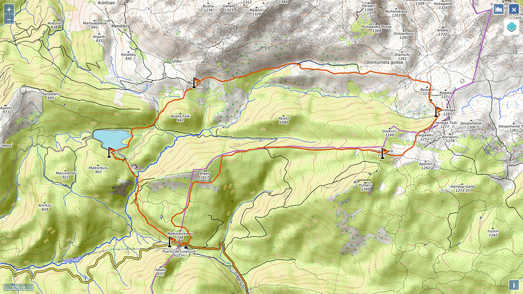
Circular to the Igaratza refuges from the Lizarrusti pass.
Summary
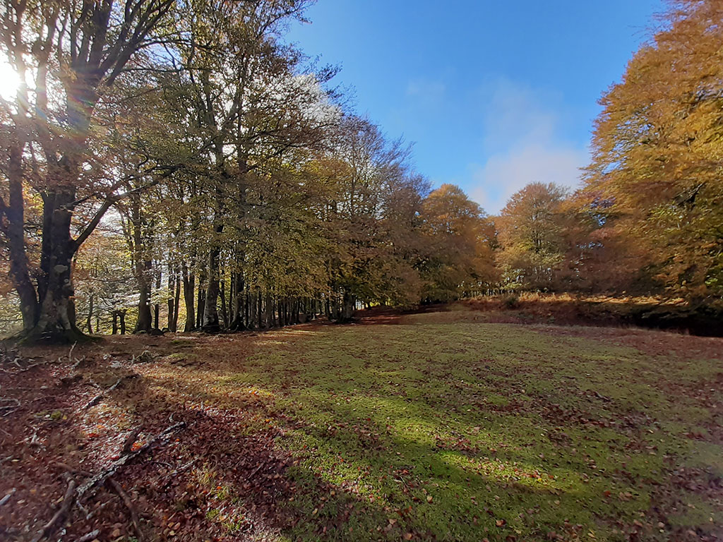
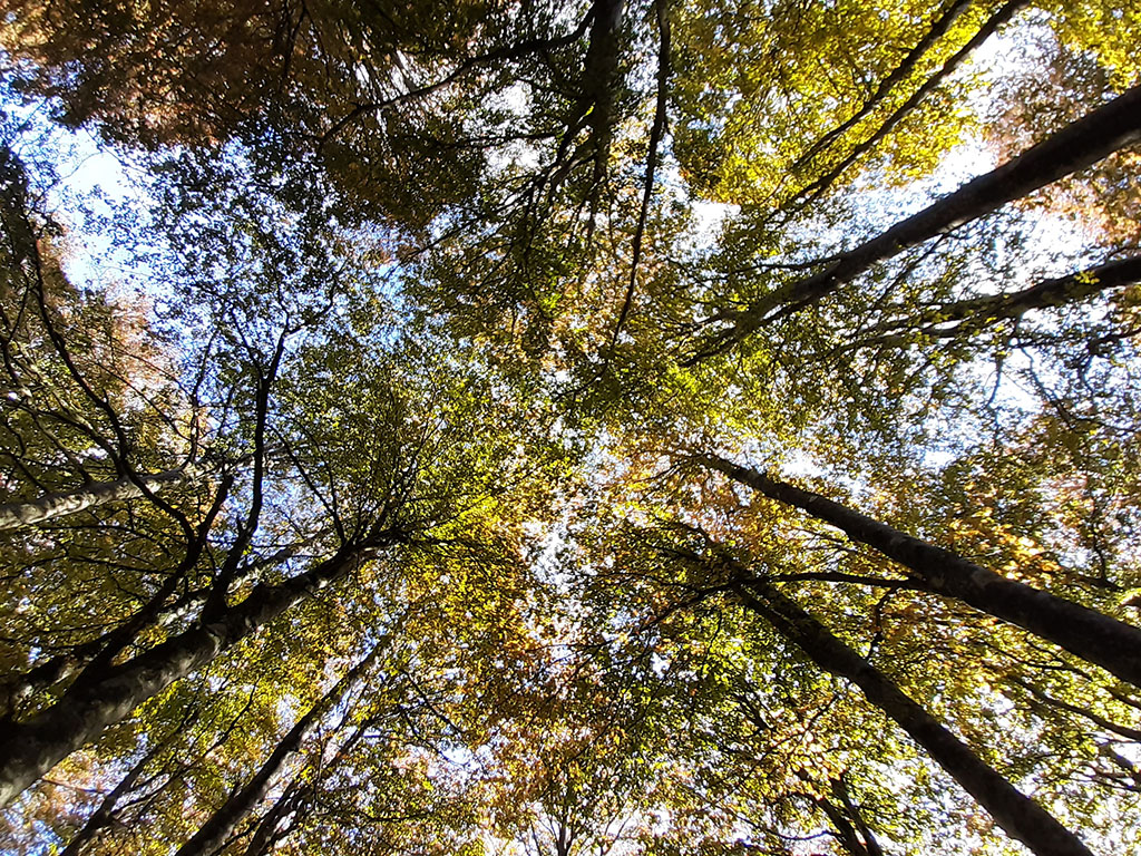
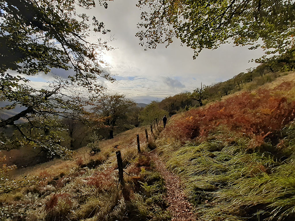
Circular route that can be followed in either direction, starting from the port of Lizarrustiin the ditch between Gipuzkoa and NavarreMost of the route runs through the province of Gipuzkoa. Although any time of the year is good, is particularly beautiful in autumnThe forest is tinged with ochre tones. From Lizarrusti, the path heads towards the Lareo reservoir following a busy PR through the Agauntza ravineThe reservoir is surrounded by the reservoir and continues towards the bordas de EnirioThe track then links up with a track that climbs to the upper part of the sierra, which we follow with some variations until we reach the Igaratza shelters. The way back is quicker, with a long descent through a postcard-perfect beech forest.
Downloadable
> Download Track
> Download pdf (mobile version)
How to get there
From Navarre or from Gipuzkoa, head for the Lizarrusti pass on the NA-120 / GI-120 (8 kilometres from Etxarri Aranatz or 17 kilometres from Beasain). The car can be left in the car park at the top of the pass, next to the interpretation centre, which also has a bar-restaurant and hostel.
Route technical sheet
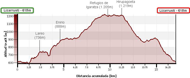
Distance: 17.1 kms.
Cumulative difference in altitude: 1.060m.
Timetable: About 6.5 hours. Walking time non-stop: 5h10min.
Water: There are three springs along the route. The first on the way to the reservoir, the second between the reservoir and the Enirio huts, and the third at the Igaratza refuges.
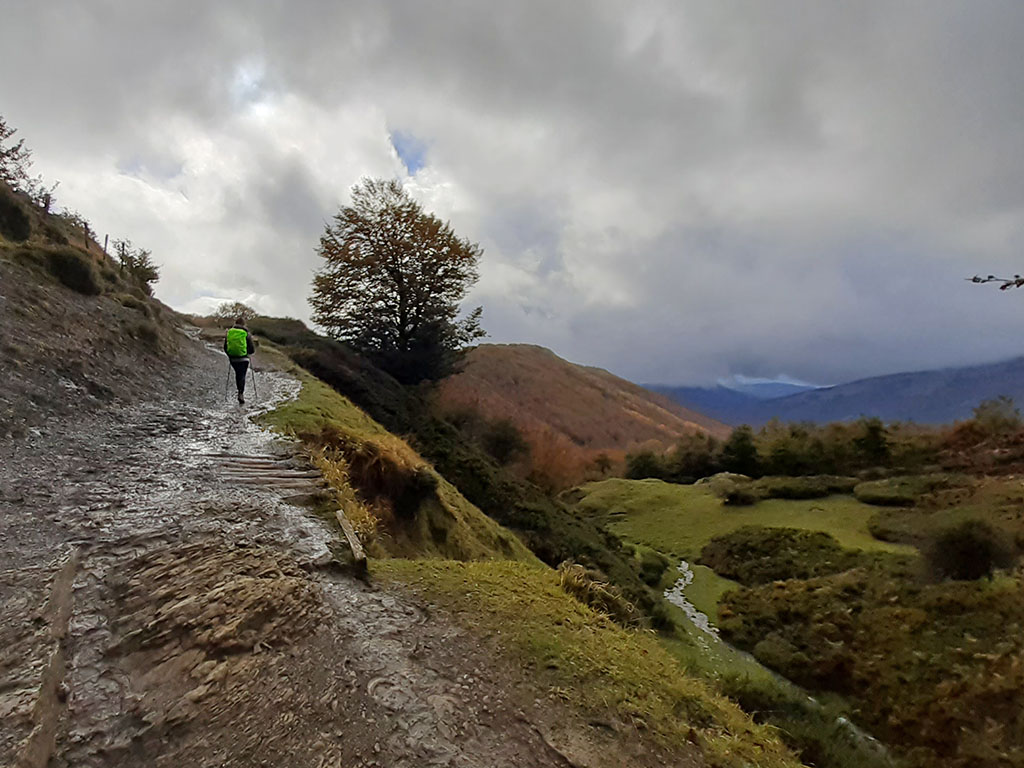
Difficulty: The route is quite long and in some parts the paths can be quite muddy (between Lareo and Enirio). The area below the Igaratza refuges can be confusing in foggy conditions.
Itinerary
(0h00min; 0,0kms) Lizarrusti pass - Car park (615m). The Lizarrusti pass is a strategic place where several long-distance footpaths (red-white) converge, such as the GR20 (Tour of the Aralar mountain range), GR35 (Aralar-Costa Transhumance Trail), GR121 (Tour of Gipuzkoa) and GR282 (Shepherds' Path), as well as other PR footpaths (yellow and white) with which we will share a large part of this route.
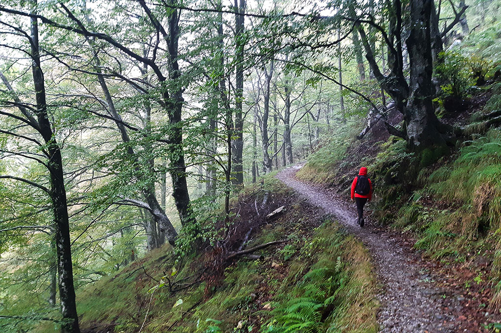
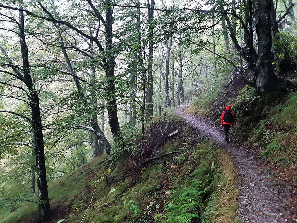
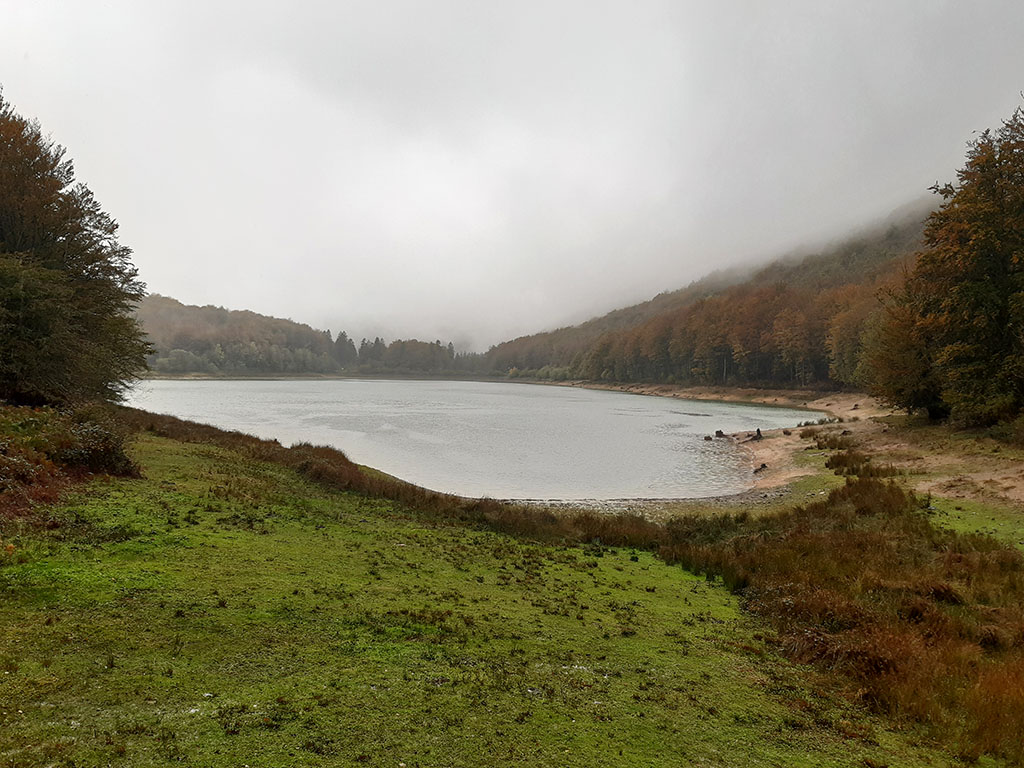
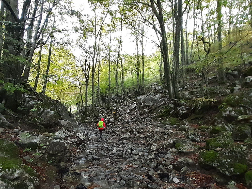
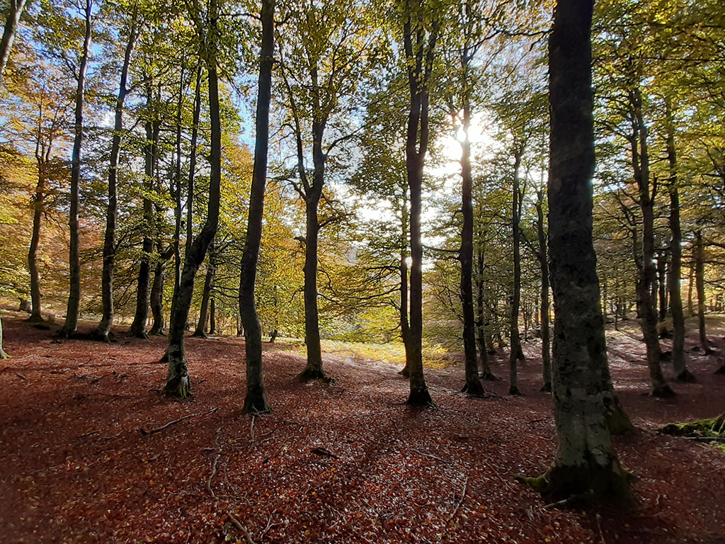
Just above the car park, there is a post indicating several of the aforementioned paths. We head off to the left (Lareo), along a horizontal path that used to be used by a wagon drawn by animals to transport firewood. In about 20 minutes we pass a fountain and cross the small tunnel of Akerreta. The path begins to gain height following the course of the Agauntza ravine, in one of the most beautiful sections of the excursion. Arriving at the reservoir, we come across a track that climbs up from near Aia.
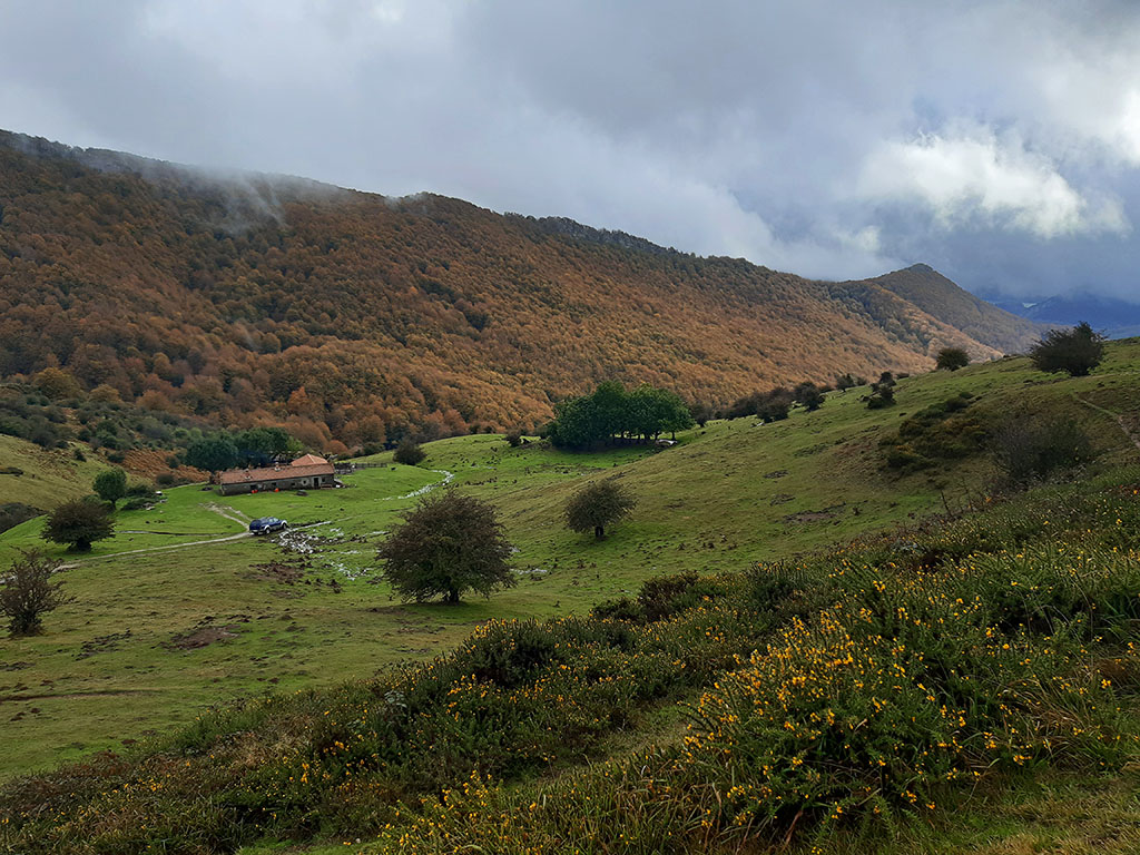
(0h45min; 2,3kms) Lareo reservoir (736m). We head to the right, bordering the reservoir (towards Enirio), until we join a track that goes around the reservoir on the other side. Follow it to the right for about 5 minutes, until you reach a bend where a small valley opens up on the left that separates Sarastarri and Akaitz Txiki. The path runs along a river bed that we soon leave to take a path that climbs up the right-hand slope, where a signpost indicates GR35 (Zaldibia) and GR283 (Oridizia). We gain metres following the red and white markings along a path that gets lost at times. We pass a fountain with a basin just as we leave the forest and enter an area where grassland is becoming more and more predominant.
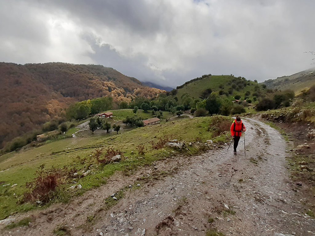
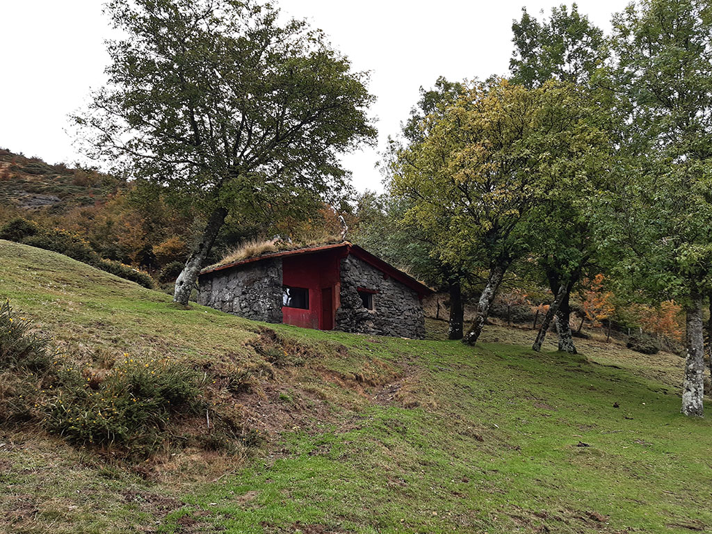
(1h35min; 4,6kms) Enirio (888m). Above the Enirio huts there is a comfortable track that we can now follow quickly (east). Follow it for about 25 minutes, until you come to a path that starts on the right and climbs up towards some huts. The path then gives way to a wider path, suitable for all-terrain vehicles, along which we continue climbing in the same direction. We pass a sign indicating Igaratza (12′) and then another sign indicating that we are 5 minutes away. This second fork is an important crossing point towards Irumugarrieta or the Arritzaga ravine, among other excursions in the area.
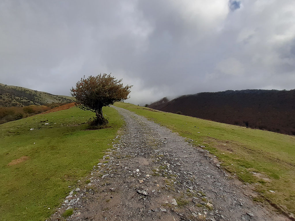
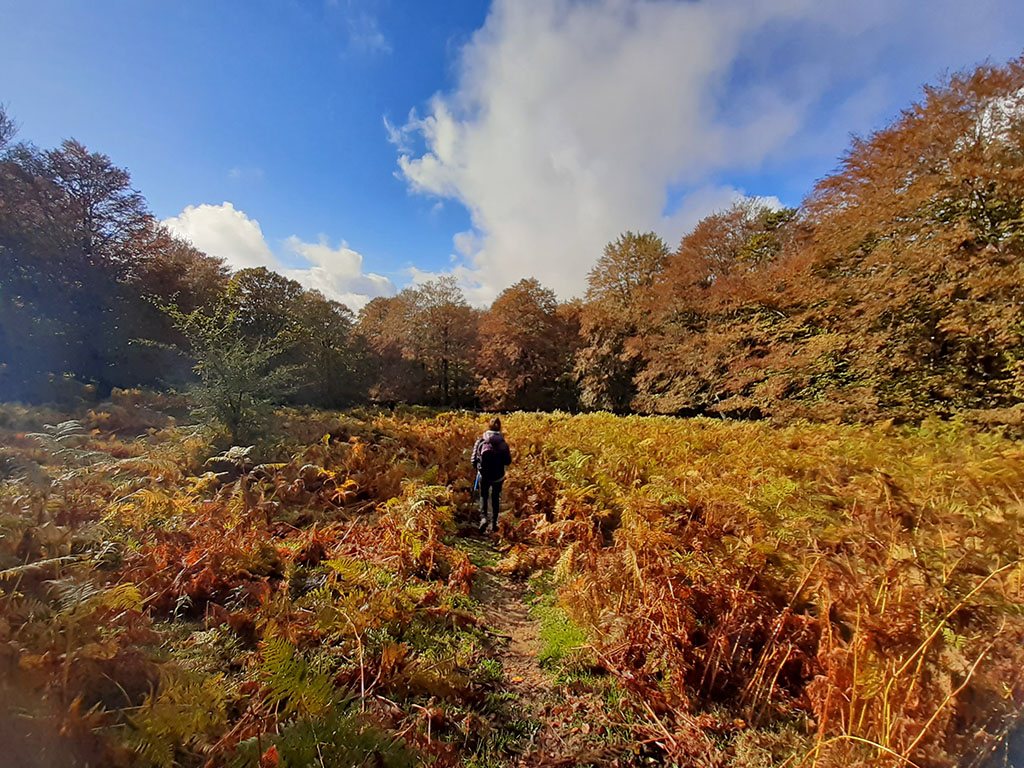
(3h05min; 9,8kms) Refugios de Igaratza (1208m). We will pass some huts, a fountain and a hermitage before reaching a small free refuge (clean and in good condition), ideal for a stop. We resume our walk by continuing along the path that forks shortly afterwards and which we follow along the branch to the right. Further on, you will come out onto a small area (confusing in fog) where the path turns to the left (S) looking for a corridor between the rocks that gives access to a second small area. We follow the red and white markings towards Hirupagoeta, although another option would be to turn off to the left to climb Putxerri (1,299m).
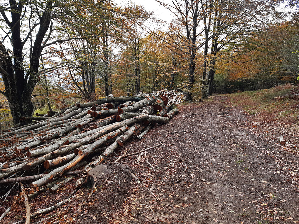
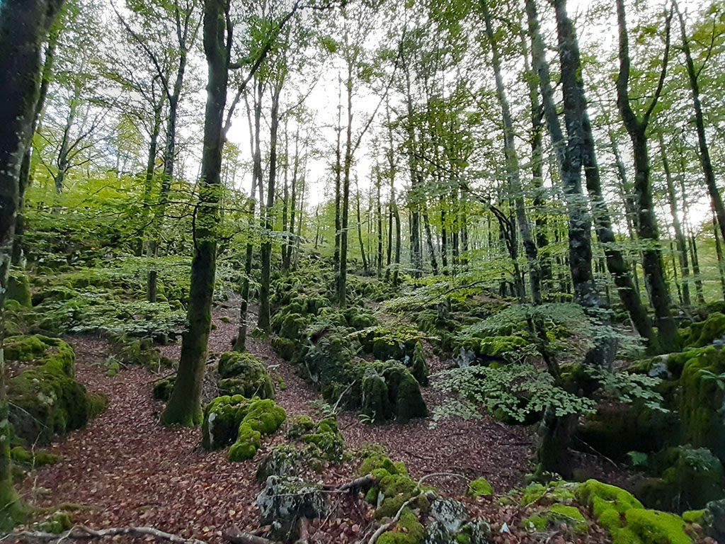
(3h30min; 11,3kms) Hirupagoeta (1219m). We start to descend immersed in a sea of beech trees, only interrupted by a small clearing where ferns thrive. The path leads to a wider path used for wood extraction. We walk along the divide, following the red and white GR12 and GR121 markings, until we reach a pass before Alleko (1,017m), which we will leave for another occasion. At this point the markings turn left around the Alleko and descend towards the southern slope, leaving the forest for a moment and giving us a glimpse of the prow of Beriain in the distance. The path begins to lose height rapidly between forest and rocks with curious moss-covered shapes. Further down we come across a PR that comes from the Lizarrusti pass, which we follow to the left at the two crossroads marked with wooden posts, taking the shortest path.
(5h10min; 17,1kms) Lizarrusti pass - Car park (615m).
The route in pictures

Fastpacking is not about going faster. It's about going lighter.
If you come from classic trekking, this is the next step: learning to move with less weight,
more fluid and enjoying every kilometre more.
Join the Outsiders Newsletter and start discovering what lightness feels like.