Pico de Casillas or Alto del Mirlo (1,768m) from Castañar del Tiemblo

Pyrenees and mountains 📩
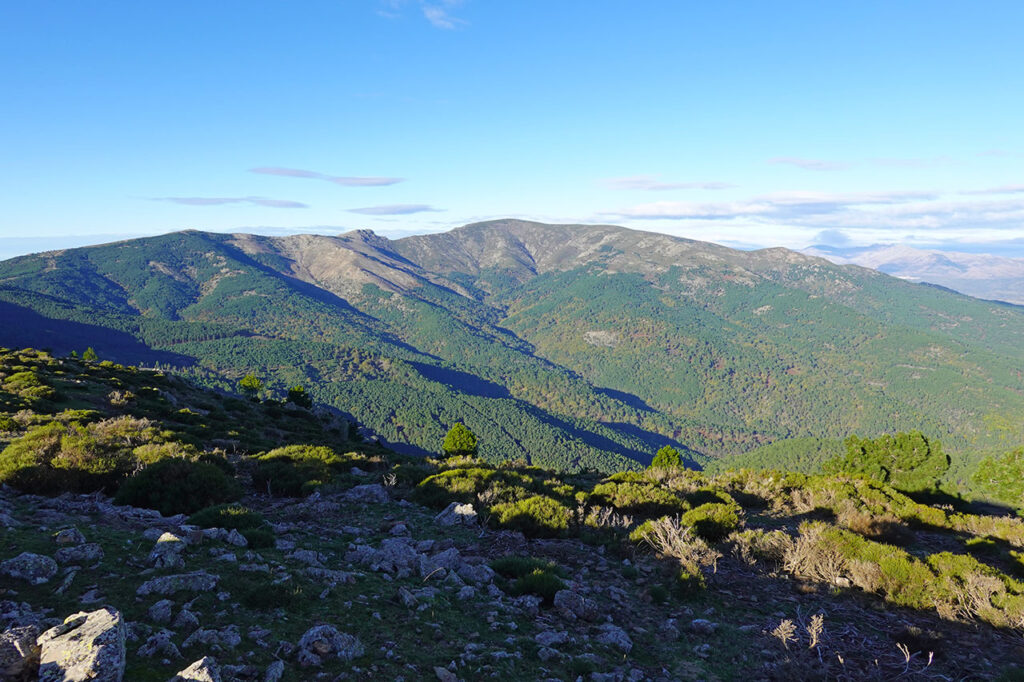
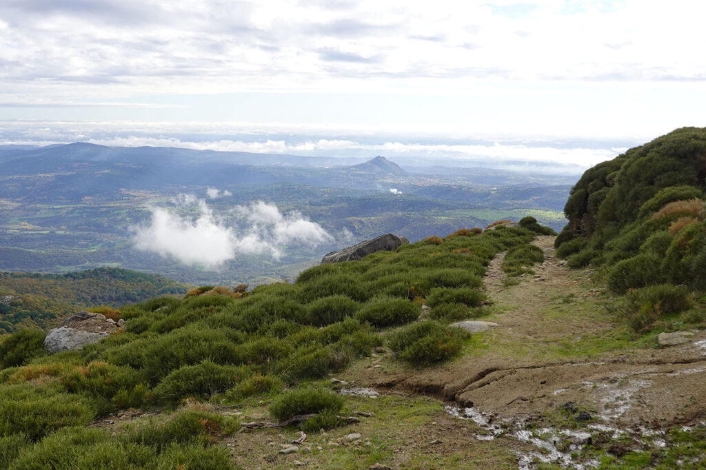
Here 🔥The Peak of Casillas or Alto del Mirlo (1,768m) is the first important mountain in the sierra de Gredos on the eastern side.
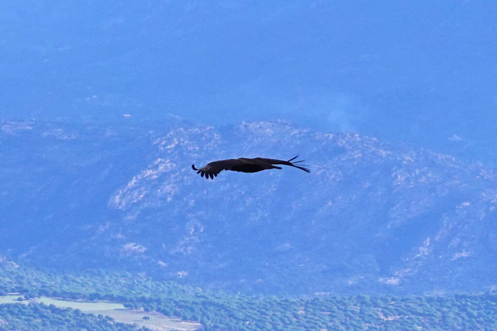
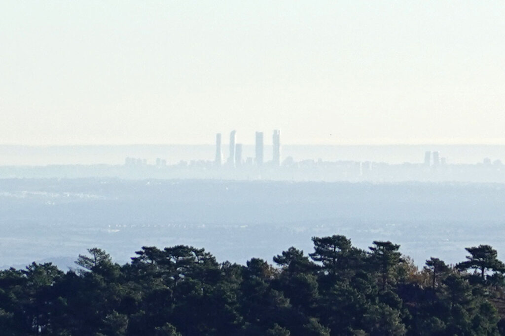
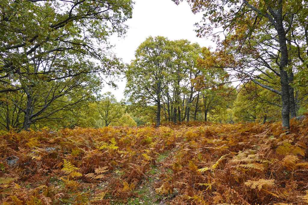
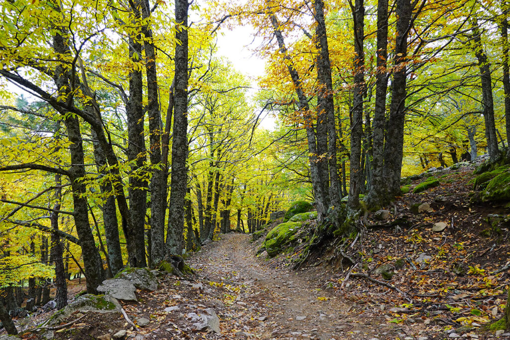
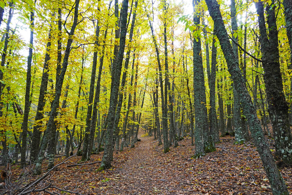
In this such an autumnal route we propose to you up to its summit we will cross the chestnut grove of Tiembloone of the most important chestnut forests in the world. Central SystemOn the way, we will discover several centenary trees such as El Abuelo, enormous pines, an extensive oak grove covered by a beautiful undergrowth of ferns, shepherds' sheepfolds and an old snow well. The upper part will delight us with magnificent views of the Alberche valley, the Iruelas Valley Nature Reservethe Sierra de Gredos and the Paramera, and even the city of Madrid in the background. In addition, with a bit of luck we will be able to see some black vultures, as this is where the largest colony of black vultures is concentrated. Castilla y León with 120 pairs, and perhaps, contemplate the flight of the imperial eagle.
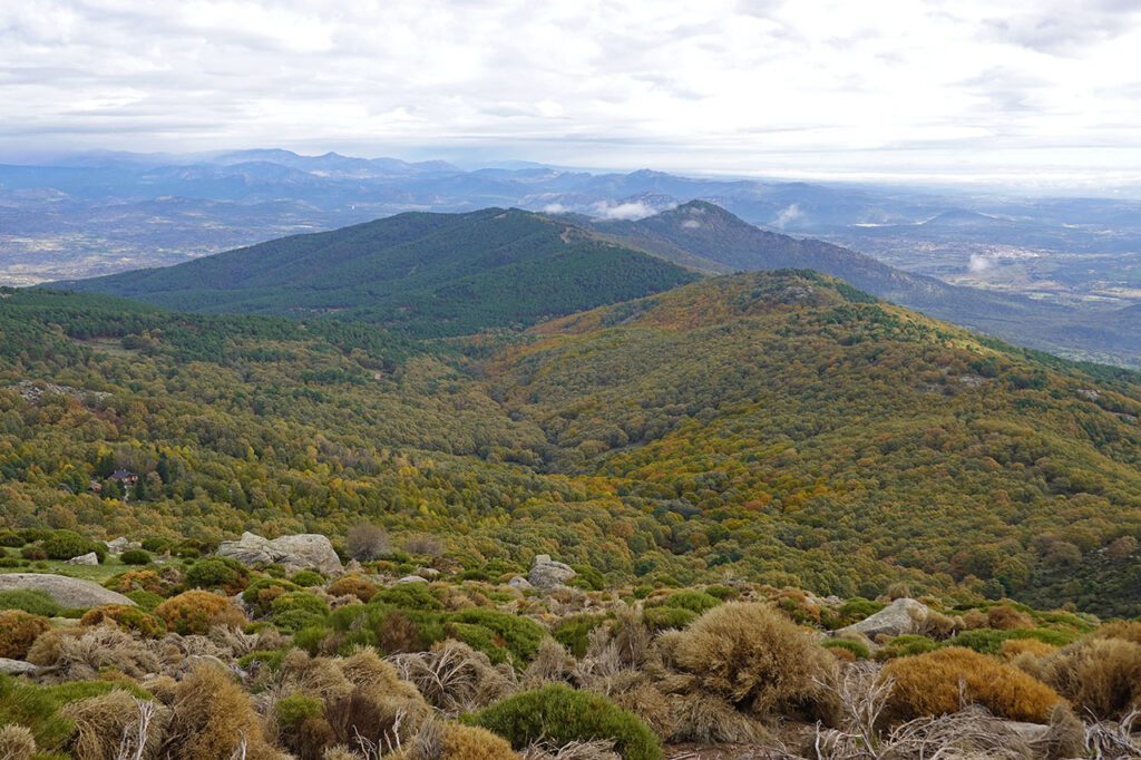
The Casillas Peak, the Iruelas Valley Nature Reserve and the Castañar del Tiemblo Chestnut grove.
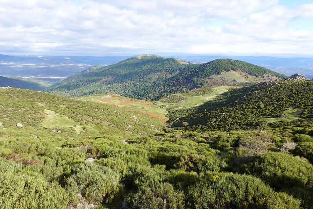
The Peak of Casillas or Alto del Mirlo (1,768m) is located in the easternmost part of the sierra de Gredosin the south-east of the province of Avilaalmost touching with that of Madrid. Its northern slope is home to the Valle de Iruelas Nature Reserve with its famous chestnut grove of TiembloThis route runs through it. To the south lies the La Mancha plain with the Alberche and Tajo valleys and the Montes de Toledo as a backdrop.
Those who are used to walking through the rough landscapes of the central sector of Gredos where snow, rock and the "beloved" piornos dominate the landscape, you will find here a small orchard.
The Iruelas Valley is a natural treasure of 8,828 Ha declared a Special Area of Conservation (SAC) and Special Protection Area for Birds (SPA) since 1991.
The reserve extends along the right bank of the Alberche, from the 1,959 metres of the Cerro de la Escusa to the 730 metres of the Burguillo reservoir.
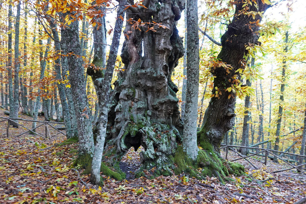
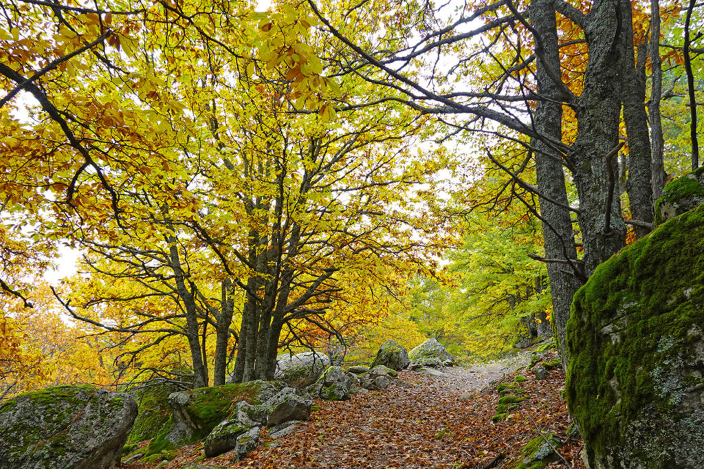
Its most precious jewel is the Castañar del TiembloThe forest has several hundred-year-old specimens, some with their own name (El Abuelo, del Codao, del Resecadal), scattered throughout the forest.
Surrounding it are oak forests, some giant specimens of Scots pine and limestone pine interspersed with chestnut and oak trees, or the extensive pine forests of resin pine in the lower part. Above, some repopulations of Scots pine, broom pine and mountain meadows dominate the landscape.
As for the fauna, the colony of black vultures, the largest in the world, stands out. Castilla y León with 120 pairs, and the pair of imperial eagles, an endangered species that nests every year in the valley.
Summary:
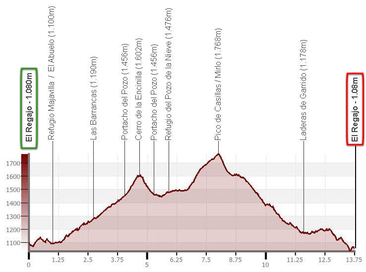
Ascent to Pico de Casillas or Alto del Mirlo from El Regajo (Tiemblo chestnut grove). Ascent via Portacho del Pozo and Cerro de la Encinilla (optional); descent via Cuesta del Enebro and Laderas de Garrido.
Map:
Downloadable:
How to get there:
See in Google Maps.
To get to the car park of El Regajo we head for the village of El Tiemblo (44km from Ávila; 83km from Madrid). Once here we take a track that leaves from the southern part of the town and goes up the left bank (right of the walk) of the Garganta de la Yedra (9km). To return back to El Tiemblo, a traffic sign obliges us to go down another track on the right bank.
Important note: For several years now, access by car to El Regajo has been regulated during the autumn season (see conditions in the El Tiemblo town council website).
Technical specifications:
Distance: 13.7km; 12.5km without climbing Cerro de la Encinilla.
Cumulative difference in altitude: +/- 1,050m; +/- 900m without climbing Cerro de la Encinilla.
Timetable: about 5 hours. Walking time without stops: 4h00min.
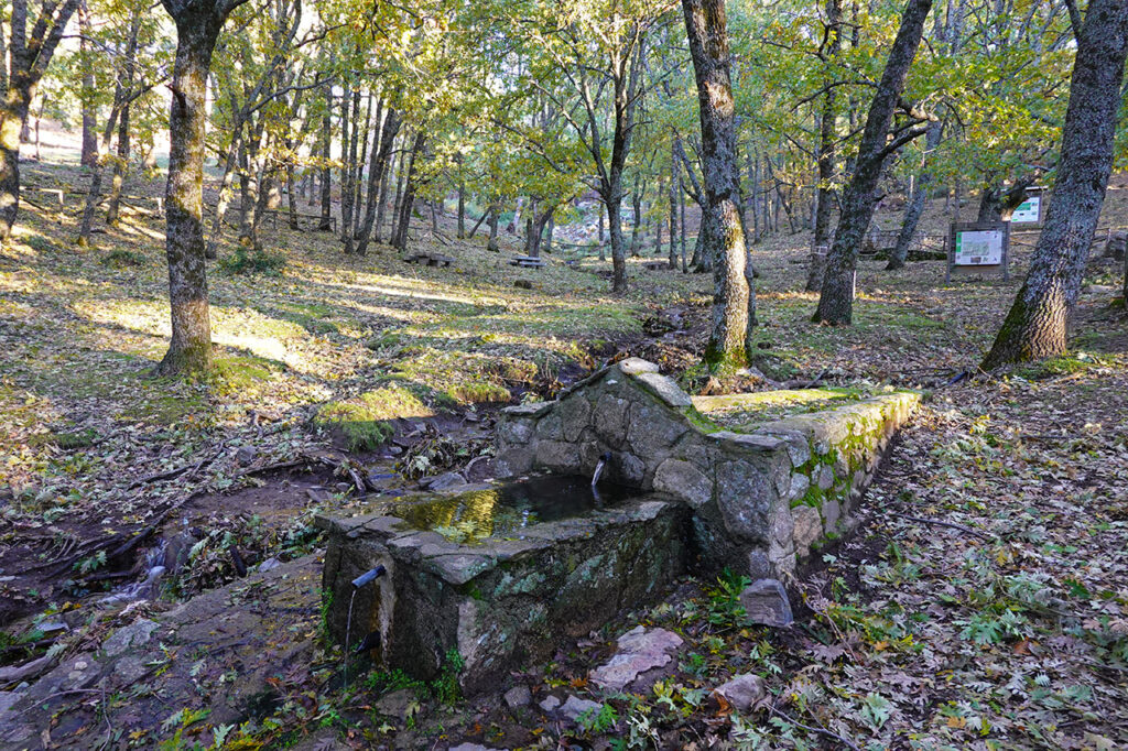
Water: On the way up we pass the fountain of the Barrancas recreational area and the fountain of the San Jurdón stream,
Difficulty: In the lower part there are numerous junctions that allow you to vary this route. If you want to follow it as it is, a GPS can be quite useful. Between Pozo de la Nieve and Pico de Casillas, you cross an area of rocks and pine trees that is not very thick but without a path. The same happens on the way down from the peak and on re-entering the forest (easier in both cases).
Recommended equipment for the summer: boots or slippers, two walking sticks, GPS, canteen.
Itinerary:
(0h00min; 0,0km) El Regajo / Parking (1.080m). We head towards the Majavilla refuge, for which we have two options. The first consists of following the Senda del Castañar (PRC-AV 54) that starts to the right of the track, a little further up. Follow it to the Cazueleros fountain (on the way back) where you take the turning on the right. The second option, the one that follows the track, crosses the Yedra gorge again to take a wide road cut off from traffic by a barrier. In this option, we will take a crossing on the left at the end of the first ascent that will take us through a forest of oaks and pines to the...
(0h10min; 0,6km) Refuge Majavilla / chestnut tree El Abuelo (1.100m).
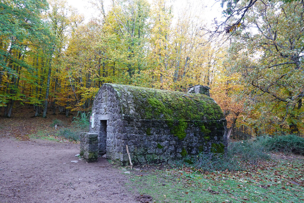
It is worth a 100-metre detour to see this impressive chestnut tree, which is over 500 years old, and another large specimen a little further down.
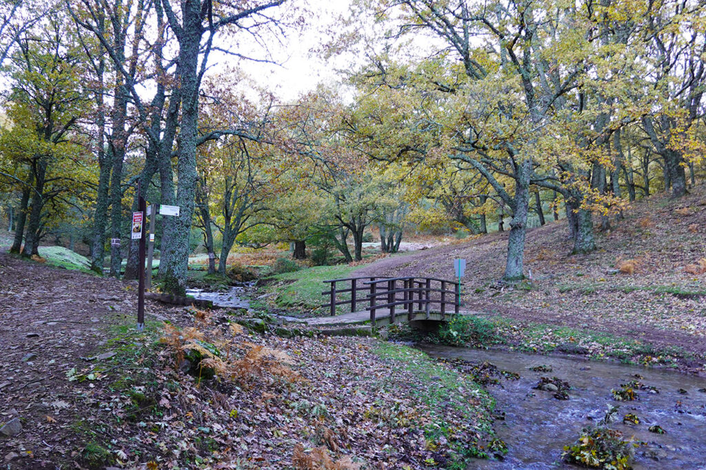
Back on the Senda del Castañar, we continue along it next to the stream until we reach a small wooden bridge, where we cross to the other side to continue climbing towards Las Barrancas.
Here we can take a shortcut (straight up) or continue to the right along a path that leads to another path and then to the left.
(0h35min; 2,1km) Recreation area Las Barrancas (1.190m). There are a couple of information panels, a fountain and several stone tables.
We leave the track and continue climbing straight ahead until we reach a clearing (waterlogged meadow) that opens up on our left, next to a hut-pen visible on the other side.
Cross the meadow to join the path on the other side and continue climbing. In 5 minutes we reach the stream of San Jurdón, where we find a fountain. We then pass a crossroads (5 minutes), which we take on the right and continue climbing, leaving the chestnut and oak forest below us.
(1h05min; 4,1km) Portacho del Pozo (1.456m).
We go up (optionally) on the right hand side to the...
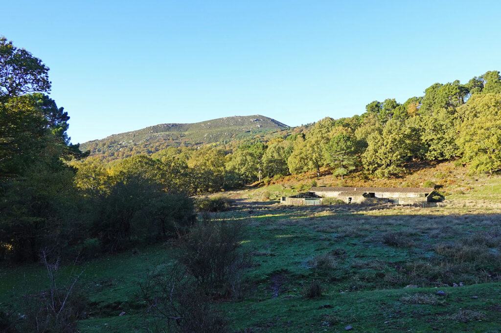
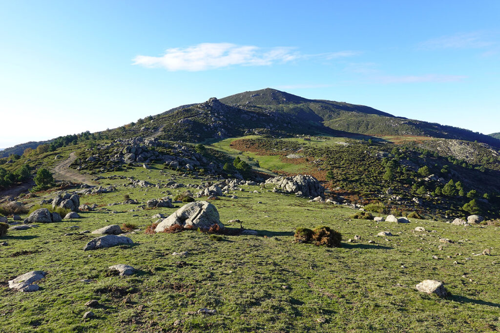
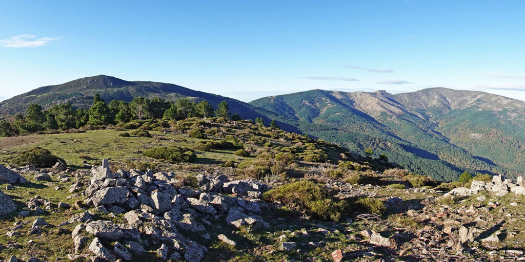
(1h20min; 4,7km) Cerro de la Encinilla (1.602m) to see if they give anything but no, and we have to make do with the fabulous views of the Iruelas valley, the Cerro de la Escusa, el Zapatero, etc.
We return again to the...
(1h30min; 5,3km) Portacho del Pozo (1.456m) to turn off to the right of the rope, along a path that leads to the...
(1h40min; 5,9km) Refugio/Pozo de la Nieve (1.476m).
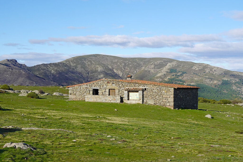
Unfortunately it is closed and we cannot see the well except with our camera through a small window.
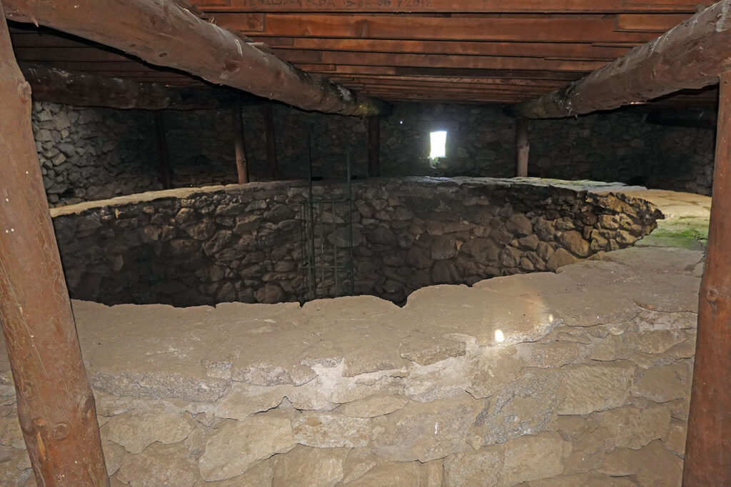
The Pozo de la Nieve path (PR-AV 21) continues halfway up the slope towards the Casillas pass along the edge of the pines, above a waterlogged meadow. We can continue along here (more difficult) or return to the rope and take the track. If we continue along the PR-AV 21 (where the track goes), we leave the path at the first watercourse (well before the Casillas pass) to go up along paths between the pines and rocks next to the stream, which disappears when we reach a small meadow. After this it gets a bit more complicated. We continue in the same vein upwards, wherever we can see best, closely following the dry riverbed of the stream.
We soon reach a track that we take to the right, which leads to a pass crossed by a firebreak and a wire fence, to the right of the peak. We turn left and gain the...
(2h20min; 8,0km) Pico de Casillas or Alto del Mirlo (1.768m), crowned by a geodesic vertex.
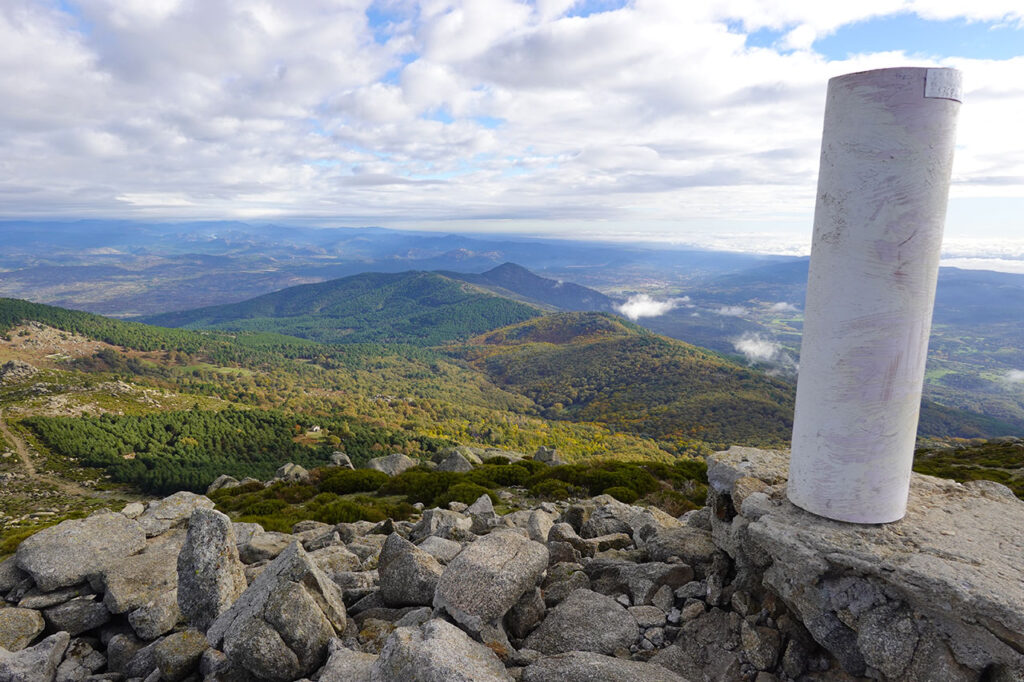
From here you can see the whole route and a large part of the way down, the western sector of Gredos, the Zapatero, the valleys of the Tajo and Alberche rivers, etc.
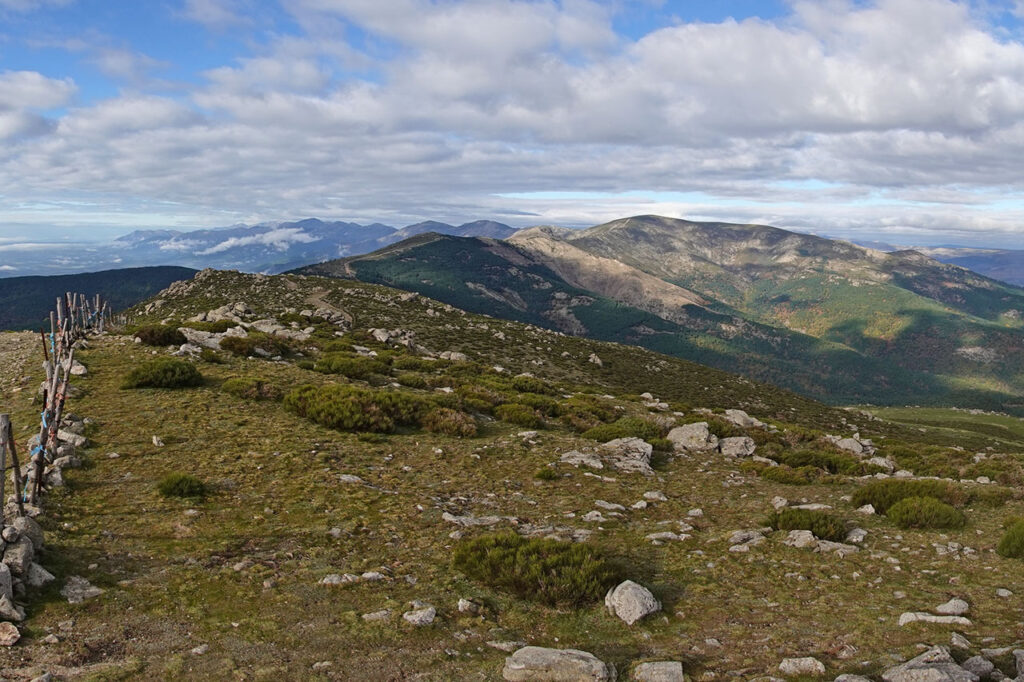
To descend, we will look towards the Cerro de la Encinilla. Look for a series of milestones that get lost among the pines and descend to a path (right) that leads to a track at the height of a heavily fenced pine forest. On the left we return to Portacho del Pozo, on the right we descend to the chestnut grove, following the circular route. We take the path to the right, which disappears at times as we cross a meadow, to reach the heavily fenced rope on the boundary with Madrid.
The path becomes a kind of firebreak that descends to a first pass, where we leave it to take a path on the left (milestone) that is barely visible. If you prefer, following the ridge we can take another clearer detour further on. We head towards two large oak trees to cross the head of the Yedra gorge and then climb slightly up the hillside to an abandoned sheepfold that we leave on the right. Shortly afterwards we turn right to start descending, at which point the path becomes clearer. At the beginning we cross a beautiful oak forest that gradually, as we approach the bottom of the valley, gives way to a chestnut grove.
The path gains width as it descends and joins other paths coming from below. We ignore a couple of crossroads to the right that climb up to the rope before rejoining the chestnut grove path at the foot of the...
(3h30min; 11,5km) Slopes of Garrido (1.178m). Return along the path above (signpost) passing by the Resecadal chestnut trees and when you reach a crossroads (7 minutes), turn right following the PR path.
In a few more minutes you reach the fountain of Cazueleros (3h50min), near the refuge of Majavilla, where the loop of this route ends. Without getting lost we continue downhill towards the...
(4h00min; 13,7km) El Regajo / Parking (1.080m).
Fastpacking is not about going faster. It's about going lighter.
If you come from classic trekking, this is the next step: learning to move with less weight,
more fluid and enjoying every kilometre more.
Join the Outsiders Newsletter and start discovering what lightness feels like.