4 3-day routes through Catalonia

Pyrenees and mountains 📩
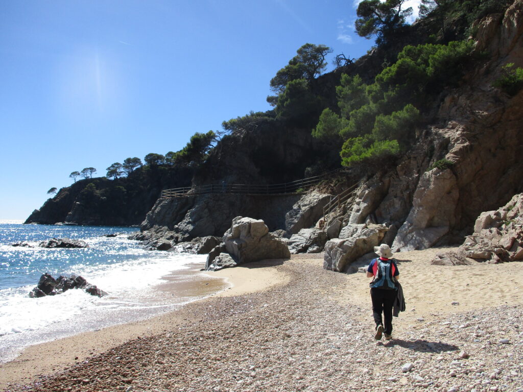
Here 🔥When we think of a trek of several days in Catalonia, the Pyrenees may come to mind. High mountain stages, staying overnight in refuges, carrying a "backpack" and cooking our provisions on a cooker. Nothing could be further from the four 3-day proposals we present below along the Catalan coast, pre-coastal and inland, staying overnight in villages, carrying very little weight in your backpack and all of them accessible by public transport.
You may also be interested in:
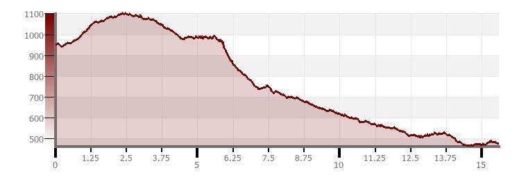
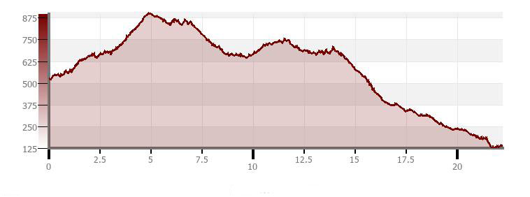
Proposal 1. Prades Mountains (Tarragona).
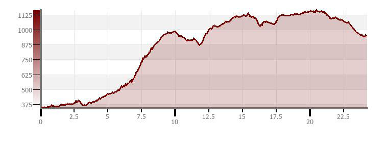
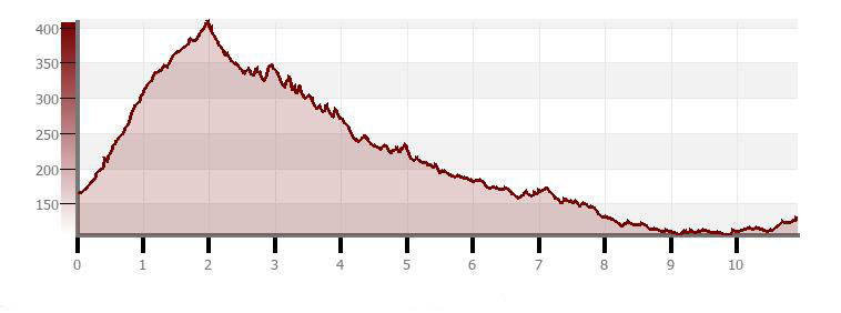
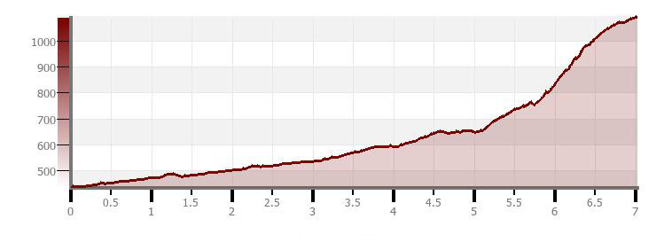
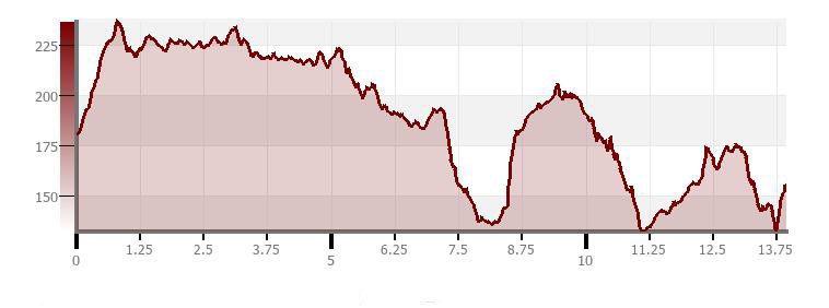
| Montblanc-Prades | 24,2km | +1.176m/-573m |
| Prades-Vimbodí | 15,6km | +231m/-704m |
| Vimbodí-Montblanc | 15,6km | +265m/-395m |
Download Tracks:
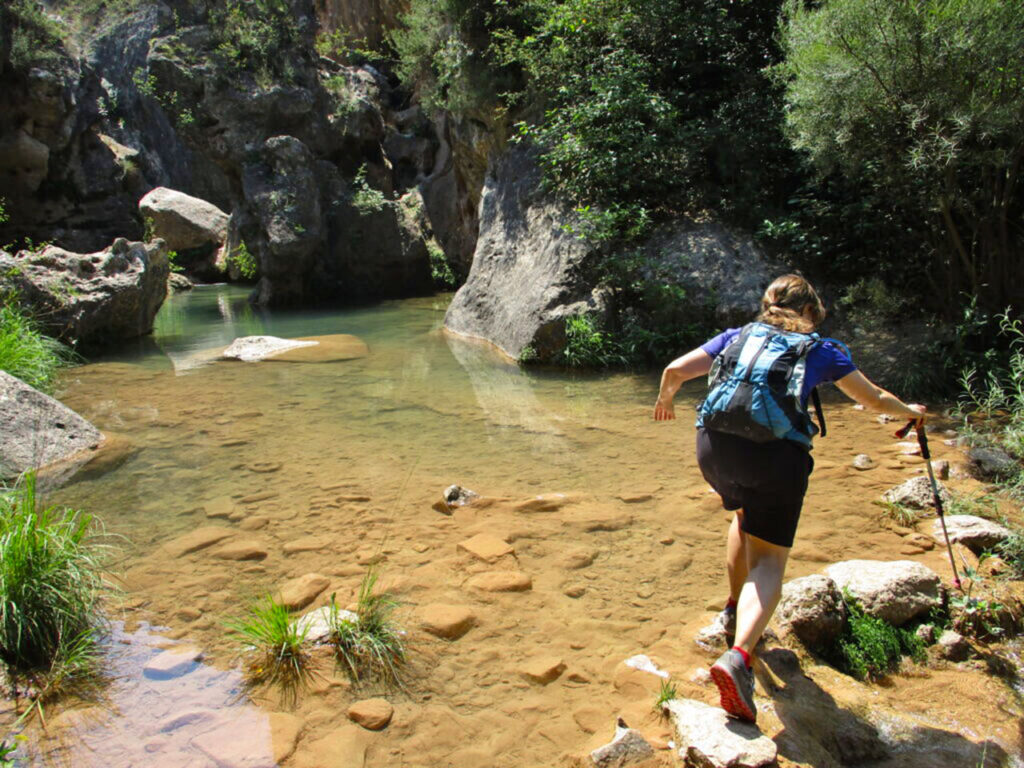
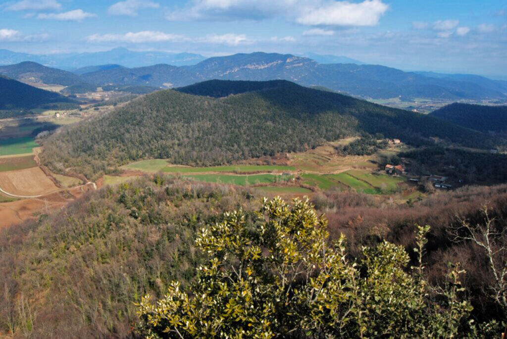
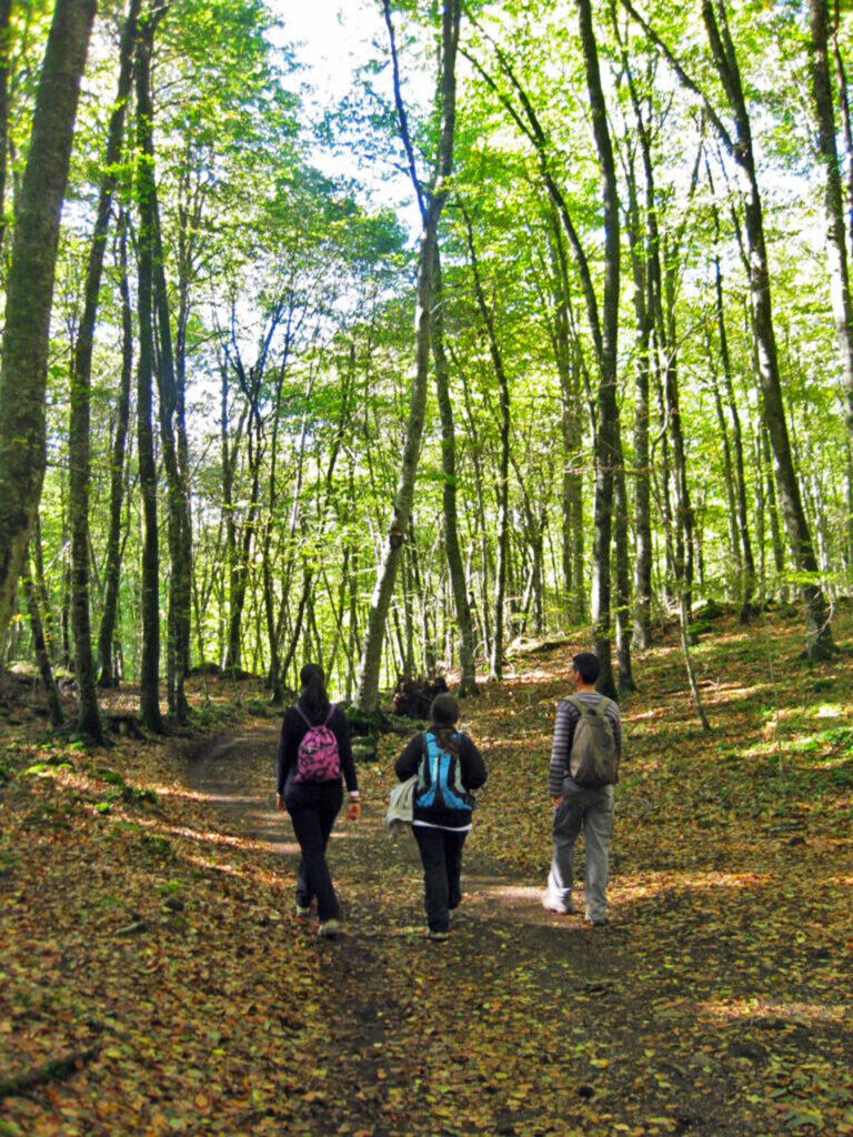
This mountain range is a wooded oasis in the middle of the surrounding arable plain. The different geographical slopes and their climatic variability are responsible for the great diversity of the woodland. Holm oak groves, pine forests of white, red, laricio or red pine and the rare forests of Pyrenean oak will accompany us on our route.
Stage 1. From Montblanc to Prades by the GR 171 (Stage 7).
We start from the medieval town of Montblancaccessible by Rodalies (Web). The first demanding stretch will take us to the village of Rojals. From here on it will be a slightly more pleasant route, alternating forests with peaks such as the Mola d'Estat and the Tossal de la Baltasana with its incredible views. We finish this route in the town of Prades and its curious fountain.
Stage 2. From Prades to Vimbodí.
From Prades We go up a local path that will take us to the "Coll de Bosc" and from there to the "Coll de les Masies". Shortly afterwards we will reach another marked path, which will allow us to follow the "bottom of the Salanca"with its chestnut trees. Then our steps will take us to the "castell de Riudabella" and to the village of Vimbodí.
Stage 3. From Vimbodí to Montblanc along the GR 171 (Stage 6).
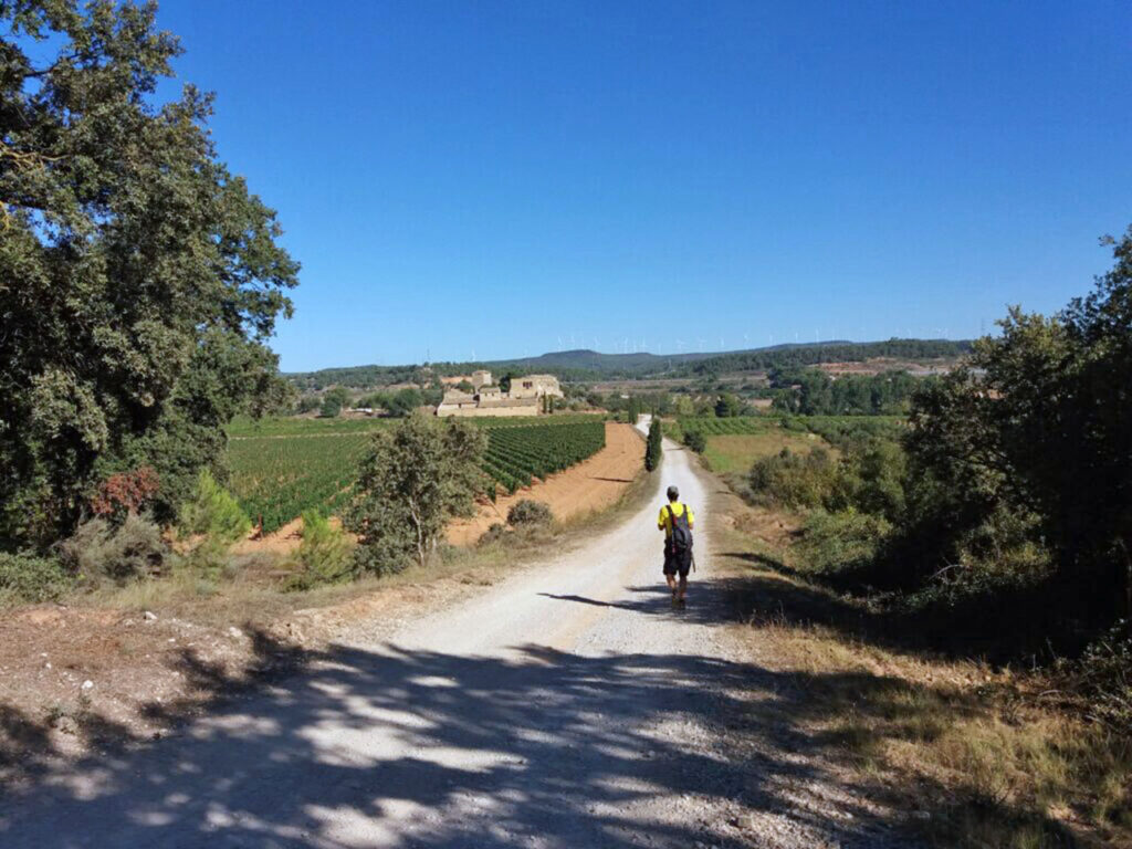
The first stretch will allow us to contemplate, among vineyards, the Milmanda Castle and visit the Cistercian Monastery of Poblet. The second, more wooded section will take us past two hermitages, "...".la Santíssima Trinitat" y "Sant Joan de la Muntanya"The latter is dug out of the rock. From here we descend to Montblanc.
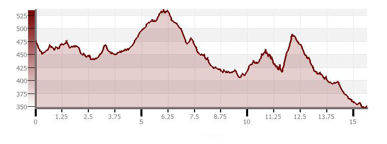
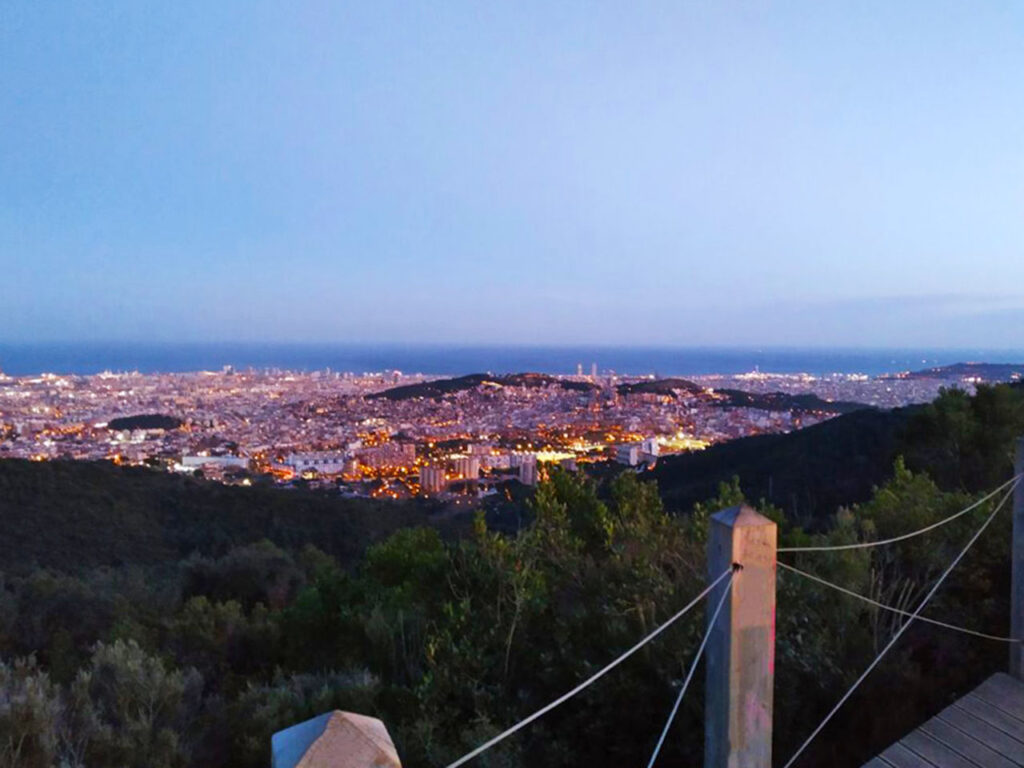
From Barcelona to the monastery of La Mola (Barcelona).
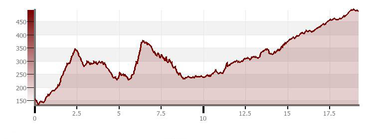
| Barcelona-Sant Cugat | 10,9km | +344m/-383m |
| Sant Cugat-Matadepera | 22,3km | +545m/-238m |
| Matadepera-La Mola | 7.0km | +685m/-28m |
Download Tracks:
From Barcelona we will cross the Collserola NP and we will take the "Camí dels Monjos". This path, which formerly linked two monasteries, will allow us, after passing through an interesting agricultural area, to enter into the domains of Sant Llorenç del Munt and climb up to its emblematic Romanesque monastery, La Mola.
Stage 1. From Barcelona to Sant Cugat along the GR 6 (Stage 1).
We crossed the wooded lung of CollserolaFirst we climb up to the coastal ridge with its peaks and viewpoints. Then we go down to the Vallès plain, where, through a wooded holm oak wood, we will arrive at Sant Cugat del Vallès and its Romanesque monastery.
Stage 2. From Sant Cugat to Matadepera along the Camí dels Monjos.
Long stage with some urban sections, but passing through a mosaic area with crops and forests that are well worth the effort. We finish in the town of Matadepera.
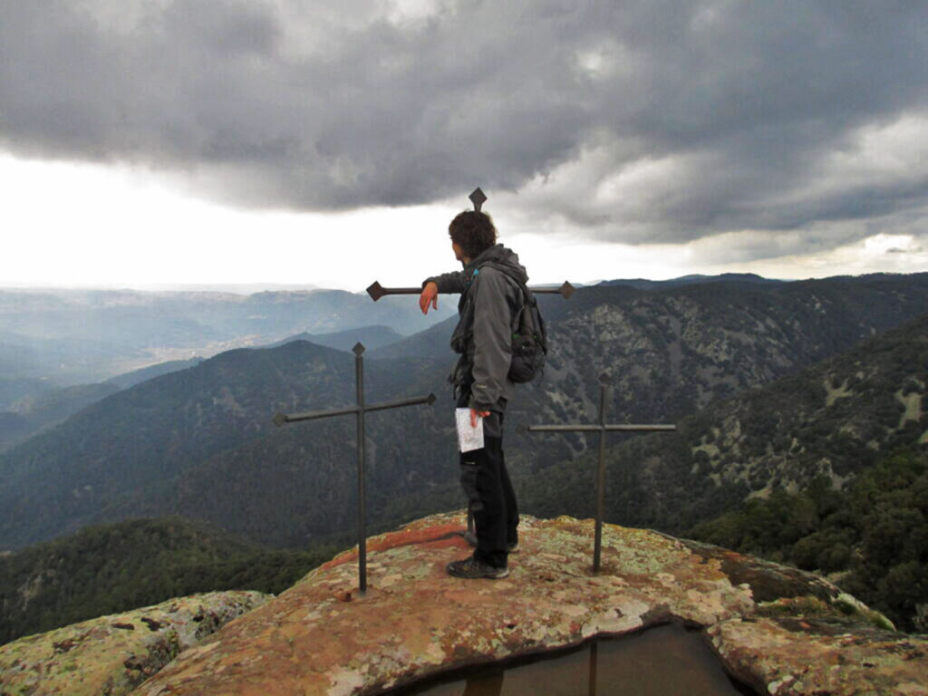
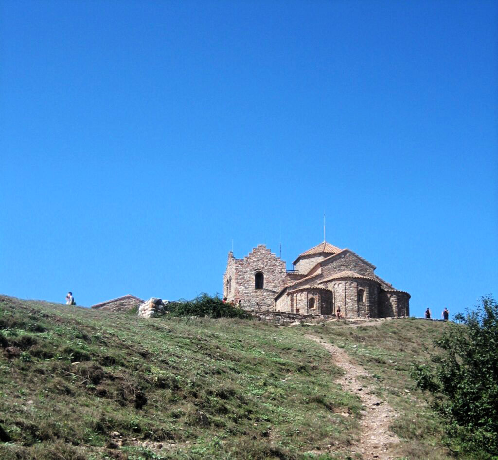
Stage 3. From Matadepera to La Mola on the Camí dels Monjos.
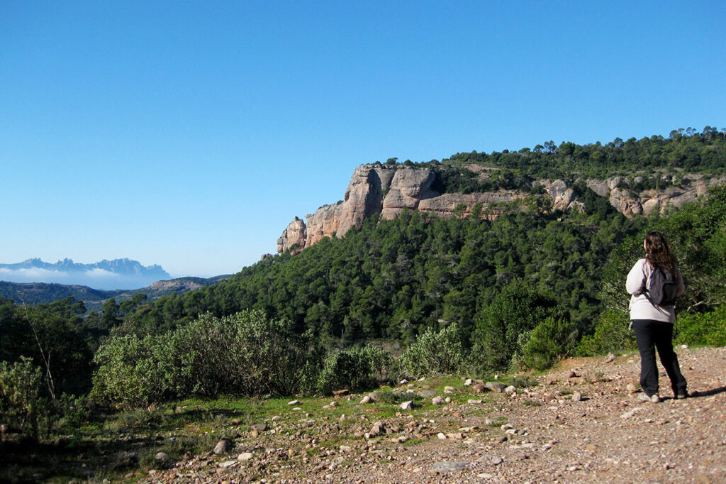
Last stretch of the marked path that will allow us to walk through a natural space dominated by geological conglomerate, Sant Llorenç del Munt. We will culminate in the Romanesque monastery at la MolaThere you will also find a restaurant, an information point and incredible views. We will now go down to Can Pobla and Can Robert to look for the Bus del Parc (web) at the Torre de l'Àngel (3-4 km downhill).
Proposal 3. Montseny and Montnegre (Barcelona).
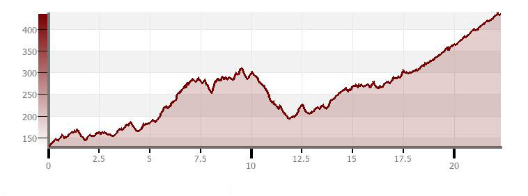
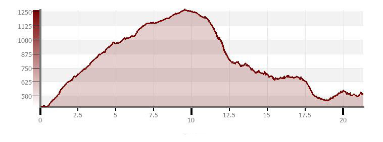
| Aiguafreda-Montseny | 21,3km | +1.155m/-1.040m |
| Montseny-Sant Celoni | 22,2km | +775m/-1.160m |
| Sant Celoni-Canet de Mar | 28.0km | +1.067m/-1.191m |
Download Tracks:
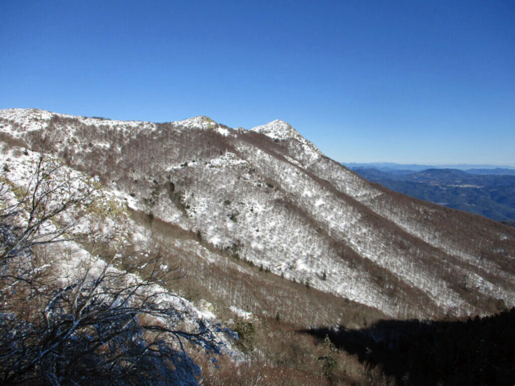
This demanding crossing allows us to link the pre-coastal massif of the Montseny with its Atlantic forests and its spectacular views, with the wooded and Mediterranean Sierra del Montnegre.
Stage 1. From Aiguafreda to Montseny along the GR 5 (Stage 9).
From Aiguafreda (we can get there by train on the R3 line) we climb to the top of Tagamanent (in case you want to take a look at it): El Montseny: Tagamanent ascent between Figaró and Aiguafreda). From here, through the "Pla de la Calma" and the remains of the old Café, we descend to the hermitage of Sant Martí and the village of Montseny.
Stage 2. From Montseny to Sant Celoni by the GR 5 (Stage 10).
From the village of Montseny we will have to go all the way back to Fontmartina. From here we will pass through forests, farmhouses and streams until we descend to Campins y Sant Celoni.
Stage 3. From Sant Celoni to Canet de Mar by the GR 5 (Stage 11 y 12)
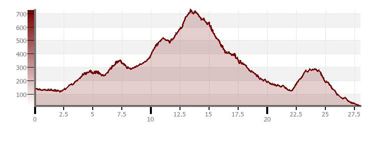
This long stage has two marked parts, the first one is Atlantic and shady, with oaks and cork oaks, passing by Sant Martí de Montnegre y Sant Iscle de Vallalta. And the second, more Mediterranean, which will take us down to Canet de Mar (here we find the Rodalies line R1).
The Pla de l'Estany and the volcanic area of La Garrotxa (Girona).
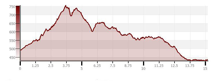
| Banyoles-Besalú | 13,9km | +206m/-231m |
| Besalú-Santa Pau | 19,2km | +747m/-411m |
| Santa Pau-Olot | 15,2km | +414m/-474m |
Download tracks:
On this route we will pass by one of the most emblematic lakes in Catalonia, visit charming medieval villages, walk among volcanoes and beech forests and of course, we will be able to taste the volcanic cuisine and the famous "fessolets" of the Garrotxa.
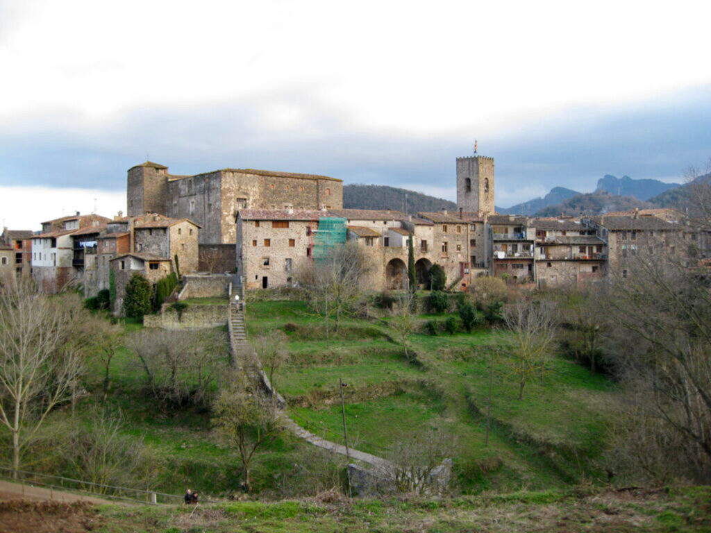
Stage 1. From Banyoles to Besalú on the GR 1 (Stage 4).
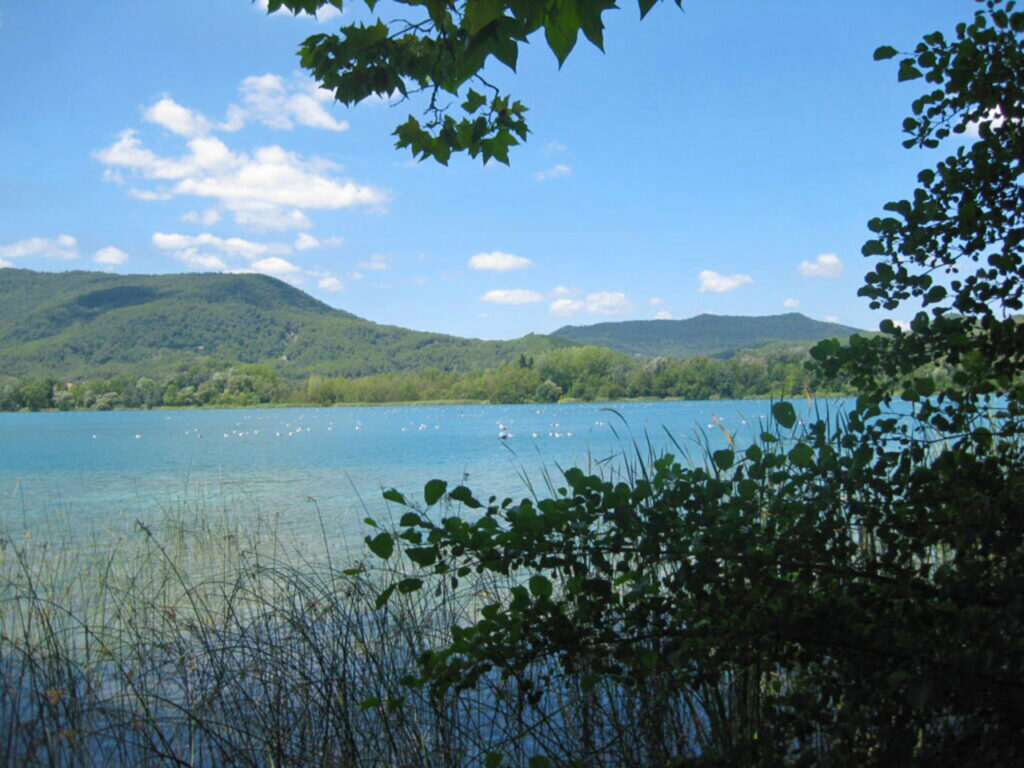
The beginning of this stage is the population of BanyolesThere you will find a system of lakes, where you will see the largest and most mediatic one. If you come from Girona or Barcelona you can get there by bus with the company Teisa (web). After passing through Serinyà we will end up at Besalú with its interesting medieval quarter and its Romanesque bridge.
Stage 2. From Besalú to Santa Pau along the GR 2 (Stage 4).
We combine holm oak groves, river valleys and waterfalls, small urban centres such as Sant Andreu del Torn y Sant Vicenç de Sallentand on the last stretch we will start to tread on "volcanic terrain" until the walled village of Santa Pau.
Stage 3. From Santa Pau to Olot
We set off along the GR2, but we will combine different marked paths of the GR2. Volcanic Zone NP. We have the option of going up to the Santa Margarida volcano and go down to its crater where we find a hermitage. The route will take us through the "fageda d'en Jordà"beech forest located on top of a wash of the Croscat volcanoWe then enter the town centre of Olot, where we will find the bus stop.

Recommended bibliography:
20 walking tours around Barcelona by public transport.
- Editorial: Cossetània Edicions
- Language: Catalan
- No. of pages: 168
- ISBN-10 : 8497918967
- ISBN-13 : 978-8497918961
- Publication: 2011
You may also be interested in:
1) GR92 and the Costa Dorada in Tarragona; 2) The Ebro delta and the Montsià mountain range; 3) The central coast and coastal mountain ranges of Barcelona; 4) The central coast of Maresme; 5) The Costa Brava, along the GR92 and the "camí de ronda".
1) Route des Golondrines; 2) Senda Camille; 3) The High Route of the Lost; 4) Pass Aran; 5) Eth Setau Sagèth; 6) Carros de Foc; 7) GRP Tour of Andorra; 8) Pass Aran; 9) Cavalls del Vent; 10) Porta del Cel; 11) Alta Ruta de los Cátaros or Camí dels Bons Homes; 12) Pass Aran; 13) Return to Aneto; 14) Return to Balaitous; 15) Return to Monte Perdido; 16) Return to Vignemale; 17) Route of the 3 refuges (return to Posets);".
Fastpacking is not about going faster. It's about going lighter.
If you come from classic trekking, this is the next step: learning to move with less weight,
more fluid and enjoying every kilometre more.
Join the Outsiders Newsletter and start discovering what lightness feels like.