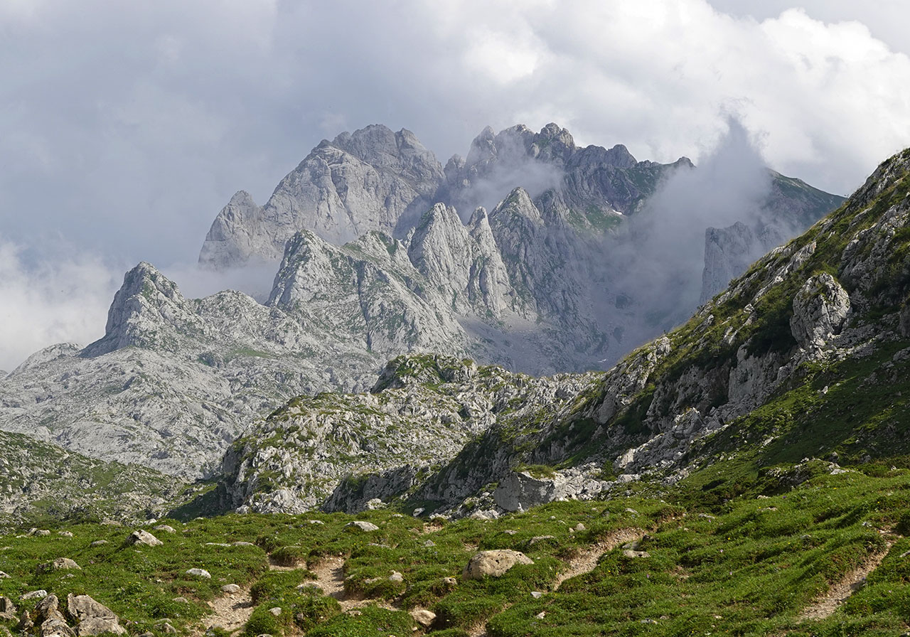
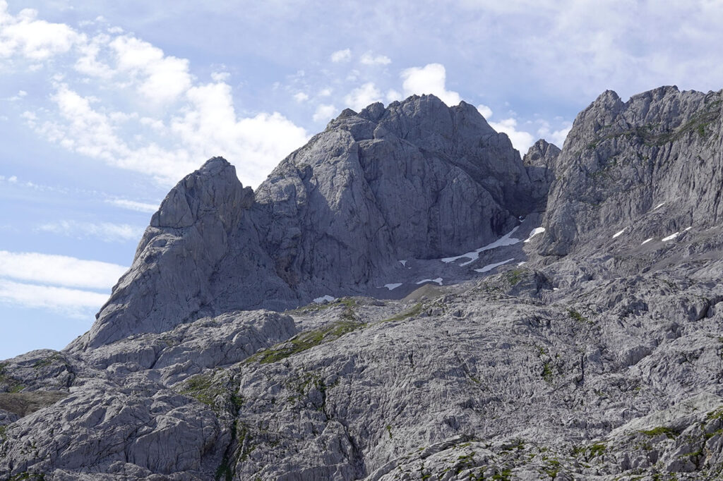
Peña Santa de Enol (2,476m) from Pandecarmen.
Pyrenees and mountains 📩
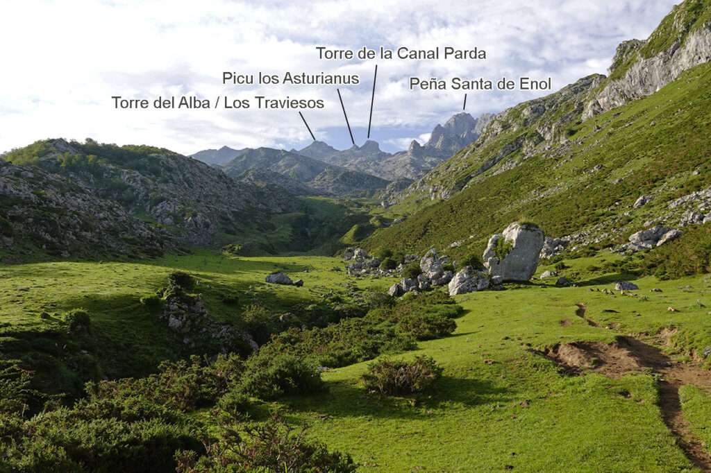
Here 🔥The Peña Santa de Enol or Torre de Santa María (2,476m)among other names, is the second highest mountain in the world in terms of height and presence. Cornión or Western Massif of Picos de Europa.
Its silhouette is one of the most recognisable in the Picos, as its slender north face dominates the surroundings of the Covadonga lakes in the distance.
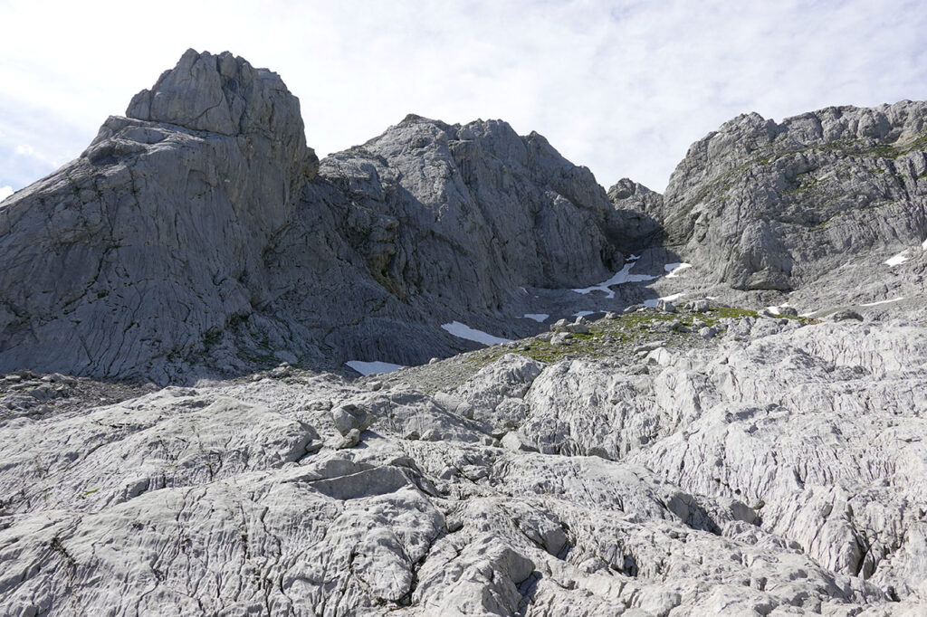
It is precisely here where the Marquis corridorThe route we will follow to ascend. An oblique route that runs along the north face from right to left and has become one of the most classic winter climbs in the Picos (300m, III/2). In summer, without snow, it is easier than it may seem from afar and than it looks in photos. Some steps of I and II at the entrance to the corridor and the final climb to the summit. As a curiosity, the name "Corredor del Marqués" comes from the first person to walk it, a certain Pedro Pidal, who descended it after having climbed the north spur.
The descent down the Grieta Rubia (PD), which is considered the normal route, has a similar difficulty (higher, I would say). On this route, over 100-150 metres of gradient, there are numerous grade I and II (max. II+ or III if you go to the Horcada de Santa María) pitches that don't allow you to let your guard down.
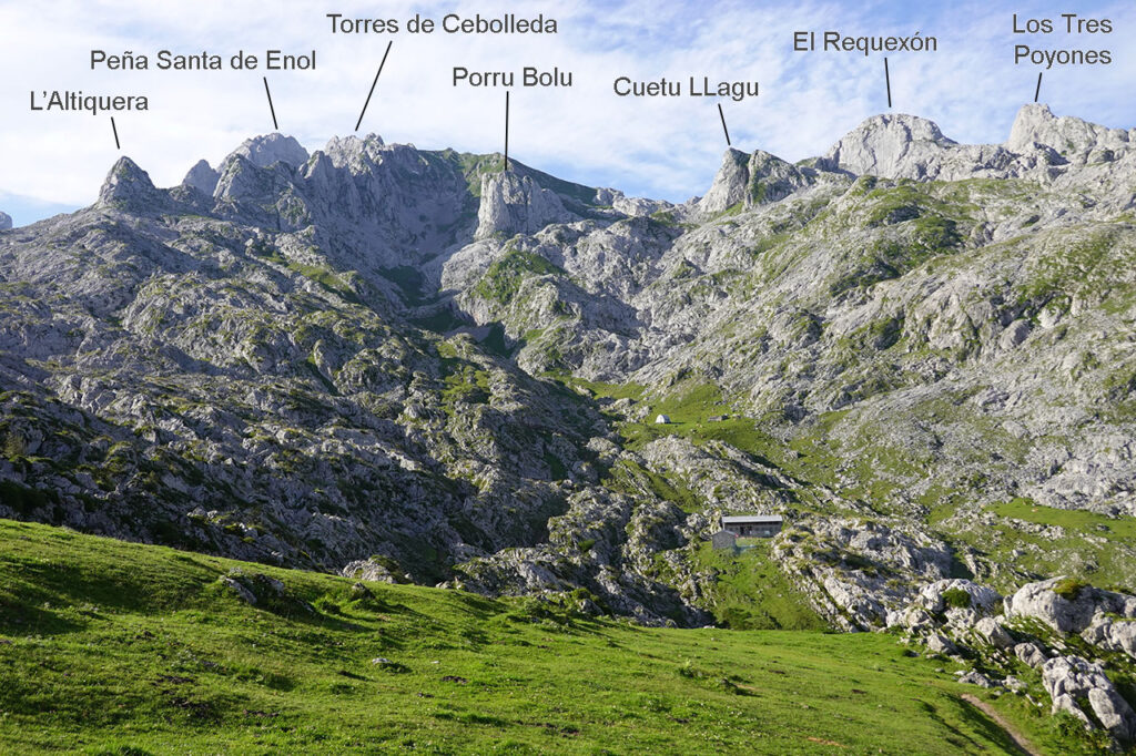
As a suggestion, the most avid climbers can complement the ascent of Peña Santa de Enol with another nearby peak. The most logical options and of similar difficulty towards the west are: the Torre de la Horcada (PD) and the Torre de Enmedio (F+), according to the book 50 mountains of the Picos de Europa by David Atela, Primera y Segunda Torre de Cebolleda y el Requexón (all three with maximum difficulties of II, according to the book Summits of the Picos de Europa by Alberto Boza). Towards the east side, a little further away, we can link up without exceeding the second grade: Pico de los Asturianos, Torre de la Canal Parda and Los Traviesos or Torre del Alba.
Summary:
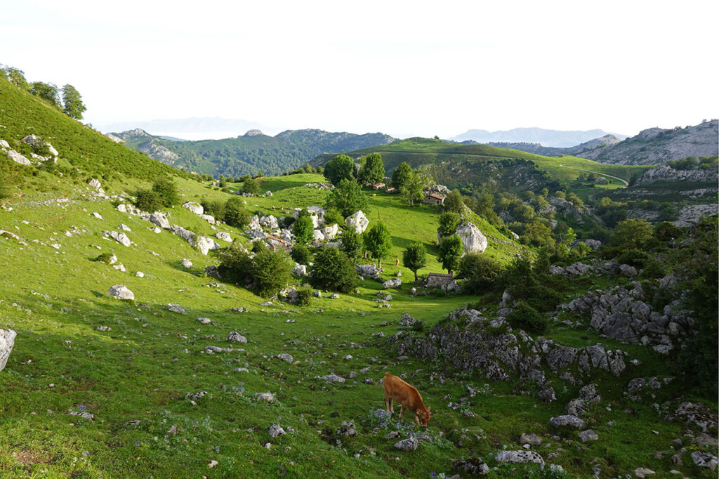
Ascent to Peña Santa de Enol or Torre de Santa María from Pandecarmen. Ascent via the Vegarredonda refuge, La Fragua pass and Corredor del Marqués; descent via Grieta Rubia, Jou de los Asturianos, Jou Sin Tierri, Vegarredonda refuge and Pandecarmen.
Map:
Downloadable:
How to get there:
See in Google Maps.
To get to the Pandecarmen car park, the start of this excursion, follow the road that goes up to the Covadonga Lakes until kilometre 11, just before Enol Lake, where a track starts on the right hand side that in about 3 km will take you to the Pandecarmen pass and car park.
It should be noted that access to the Covadonga lakes by private car has been completely closed. in high season and other specific dates on which the bus operates, except for some exceptionssince the accident of one of the buses on the route on 31 July 2023.
To find out how to get there by bus, see the web site of Alsa.
Technical specifications:
Distance: 18.3km.
Cumulative difference in altitude: +/- 1.530m.
Timetable: about 10 hours. Walking time without stops: 8h50min.
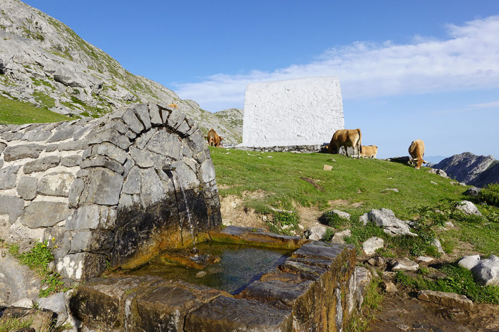
Water: At the beginning and end of the route we pass several springs, such as the one at Vega de la Piedra, 20 minutes from Pandecarmen. From the old Vegarredonda refuge onwards we did not see any more, although some of them appear on the maps.
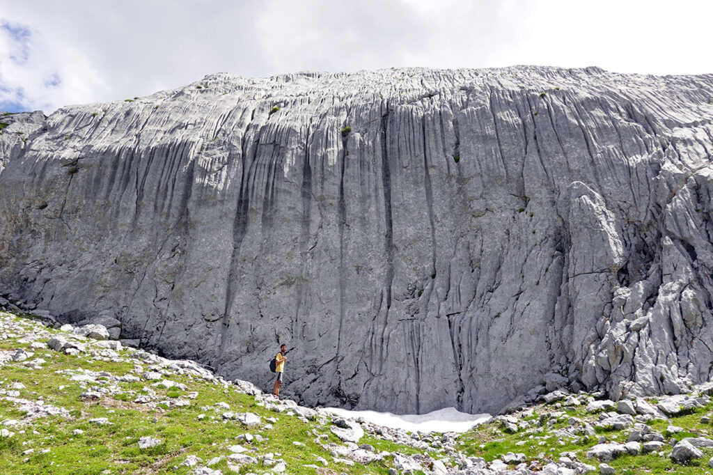
Difficulty: The path to Las Barrastrosas is very well marked and quite comfortable. The approach to the Marqués corridor, crossing an area of lapiaz, lacks a path but is well marked. At the base of the corridor is the persistent snow at Cemba Vieya, which if it has not melted enough to allow us to pass through the rimaya, will require the use of ice axes and crampons. In early July 2023 it was possible to pass through the rimaya with considerable difficulty. The entrance to the corridor is the most difficult part of the route because of the unstable mix of loose rock and snow, and because it is followed by the most vertical section. In my opinion, the climb of the "vertical" section is easier than the Grieta Rubia (PD), so as a guide I give it PD- or PD. The final climb (PD) has good holds and little yardage (it didn't feel like PD to me). The descent of the blonde crack is long (entertaining), about 150 metres of climbing (PD) that doesn't let you let your guard down for a second. The exit to the right, towards the Horcada de Santa María, has III pitches. We did not go that way, but to the left, towards the Jou de los Asturianos (II). The "way" down the Jou sin Tierre, from La Asunciana to Vegarredonda, becomes heavy. If you want to go fast, it is better to return the same way.
Recommended equipment for the summer: technical boots or shoes, helmet, two walking sticks, GPS (optional), canteen.
Itinerary:
(0h00min; 0,0km) Pandecarmen car park (1.070m). The path is obvious, it starts following the track along which we came by car, coinciding with the yellow and white PR-PNPE 5 signposting to the Vegarredonda refuge.
The PR-PNPE 5 is a short 10.2km (one way) footpath between Buferrera and the Ordiales viewpoint. Apart from being one of the best ways of getting into the Western Massif, it has the added attraction of visiting the Ordiales viewpoint, the resting place of the remains of Pedro Pidal, Marquis of Villaviciosa, who in addition to being the founder of the Covadonga Mountain National Park and the first person to climb the Picu with Cainejo, was also the first person to climb the Corredor del Marqués.
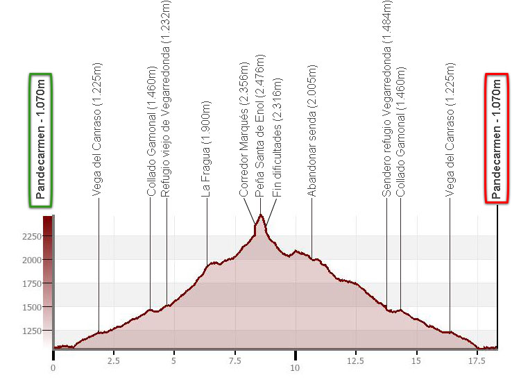
Five minutes into the walk, the track crosses the Redimuña Bridge over the Pomperi River, very close to the Pozo del Alemán.
The German's well is a small pool located a little further down from this bridge where, according to the story, the German liked to bathe. Roberto FrassinelliThe German of Corao", who lived in this small village where his wife was from between 1854 and 1887.
Shortly after crossing the bridge, take a shortcut to the right that leads to the track just before a sheepfold with a spring, the Vega de la Piedra.
The path leaves the forest behind for good and continues through meadows along the...
(0h40min; 2,0km) Vega del Canraso (1.225m).
The path crosses the stream and zigzags on the way to Majada de la Redondiella, where we pass by several huts that we leave on the left. Shortly afterwards you reach the...
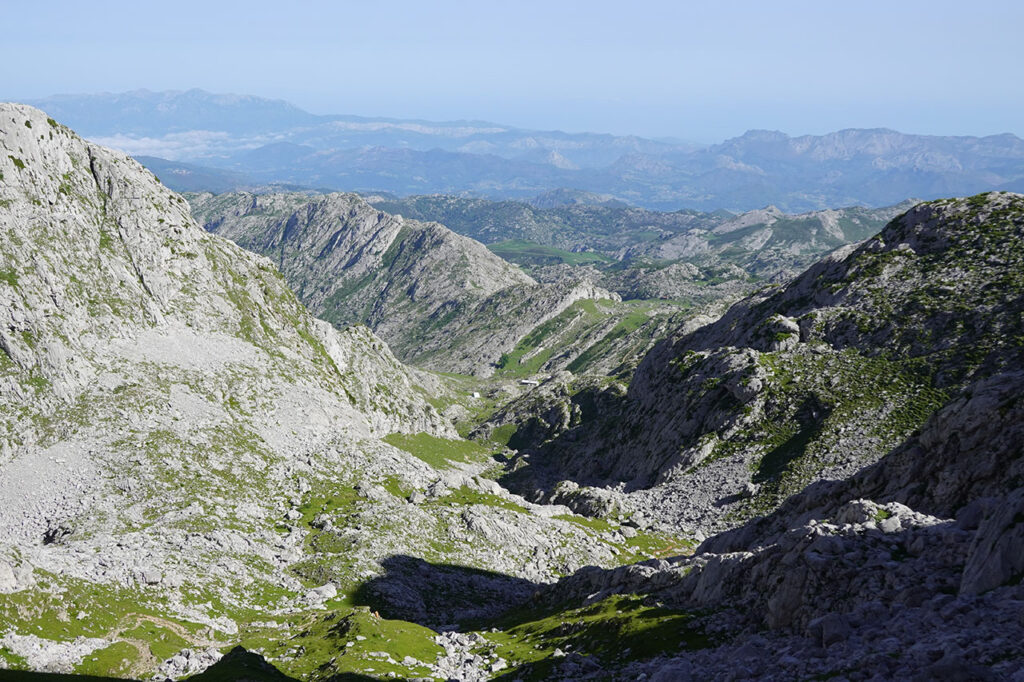
(1h15min; 3,9km) col Gamonal (1.460m)From here, the new and old Vegarredonda refuge is already visible, as well as the omnipresent Peña Santa de Enol with the Argaos in front of it, the Requexón...
We put aside the new shelter and we continue towards the...
(1h30min; 4,6km) old refuge of Vegarredonda (1.504m), where we will take the opportunity to get water for the rest of the day.
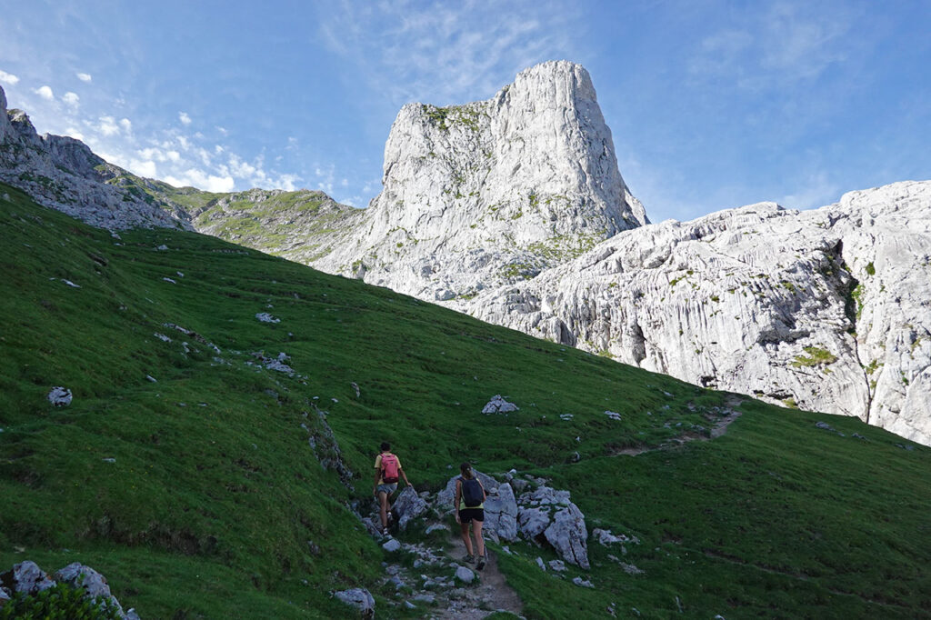
The path follows the valley onwards along the Vegarredonda channel and the Llampa crest to a junction (2h10min; 6,0km; 1790m) under the characteristic Porru Bolu.
On the right we can go to the Peña Santa de Enol via La Mazada, Fuente Prieta and the Horcada de Santa María, to ascend via the Grieta Rubia. We will turn left to head towards the col of La Fragua.
(2h25min; 6,3km) col de la Fragua (1.900m).
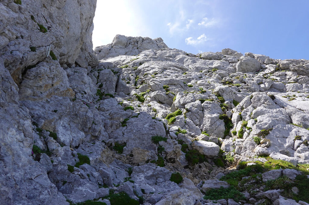
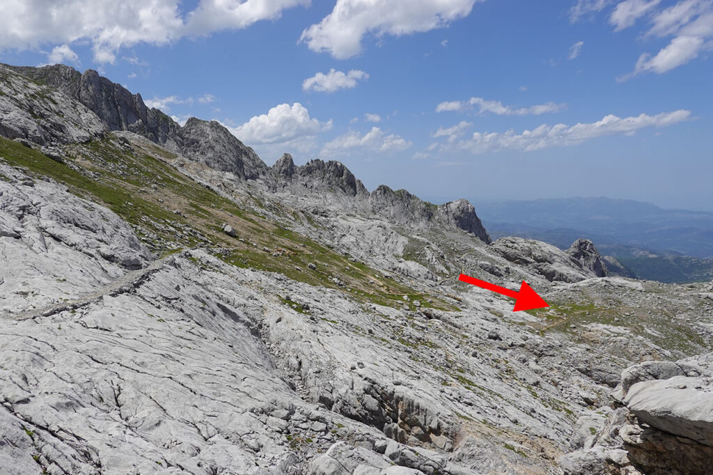
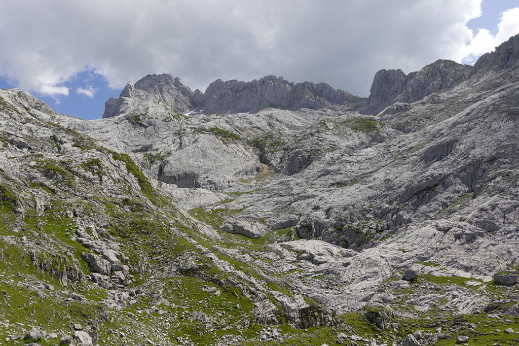
The path now continues halfway up the slope through the area of Las Barrastrosas. Continue for approximately one kilometre until you reach a small pass preceded by a descent. From here, or a little further on, we leave the marked path to enter the lapiaz, following the milestones.
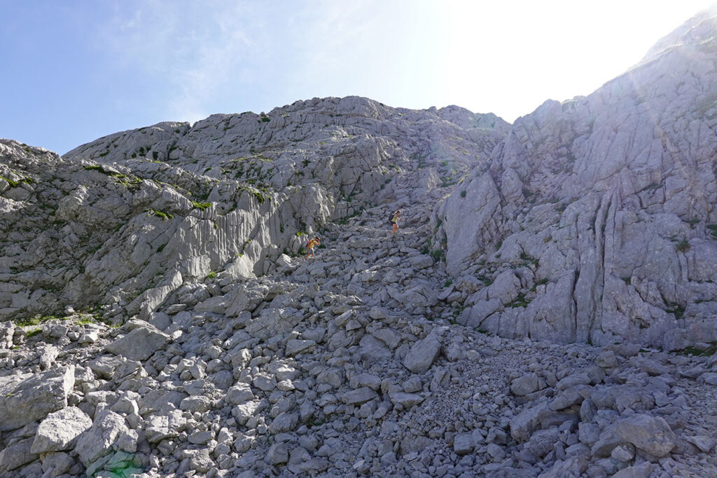
We head towards the persistent snowfield of Cemba Vieya where, depending on its condition, we may need ice axes and crampons. When we did this route in early July 2023 it was not necessary. The snow had melted sufficiently to allow us to pass through the rimaya, but not without some difficulty.
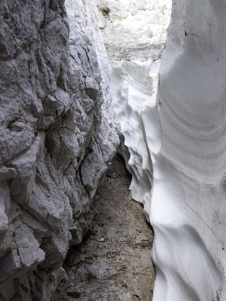
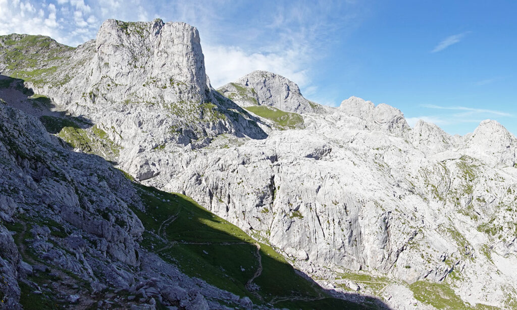
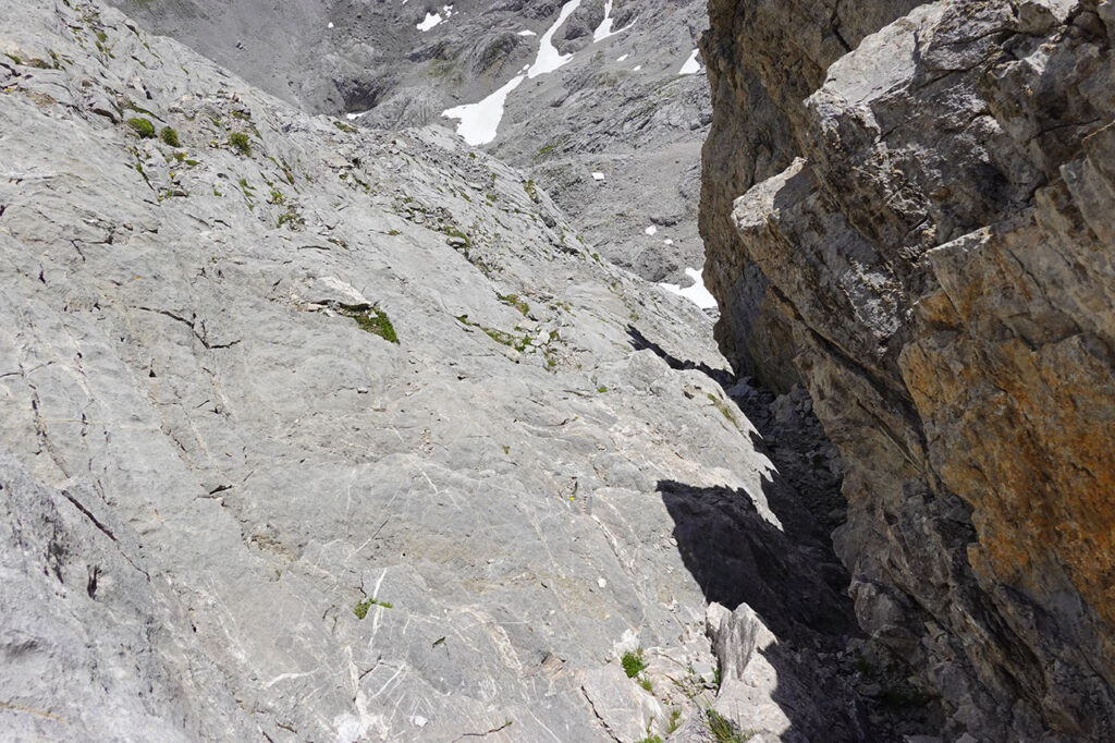
(3h40min; 8,3km) Entrance to Corredor del Marqués (2.356m). The greatest difficulty is found at the beginning of the corridor. In our case, more than in the initial climb, it was in the access itself, where the snow had turned into a very unstable paste of snow and rock that we decided to avoid by going round to the right, sticking to the walls that form a kind of small cirque and entering laterally.
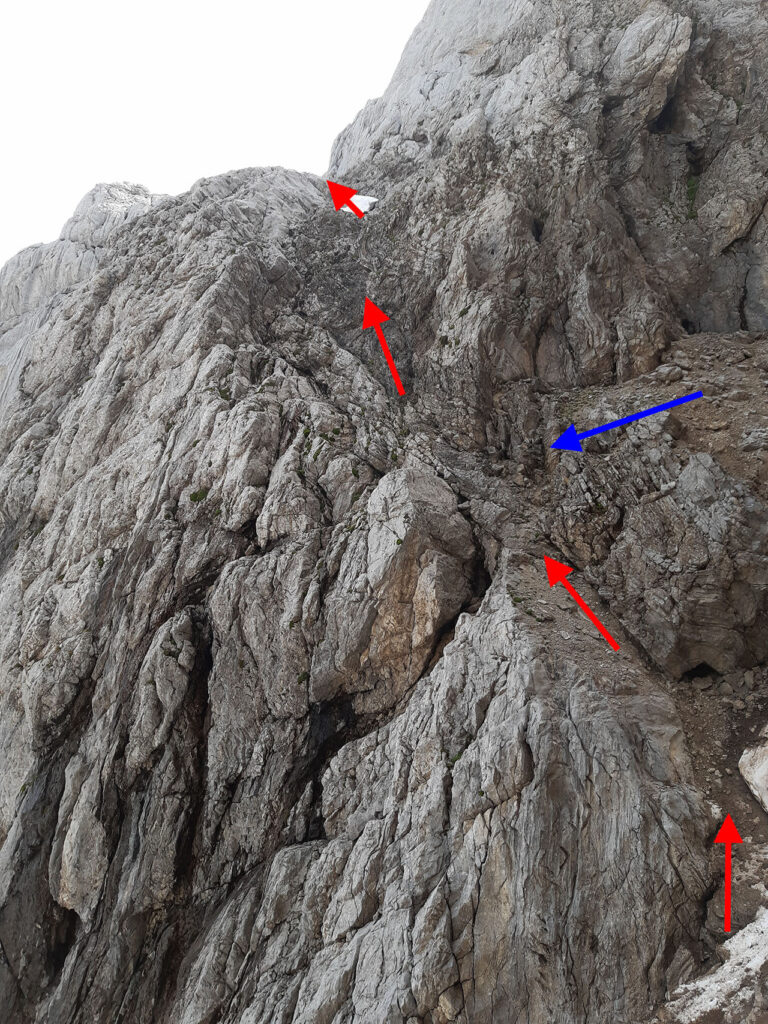
After the initial climb (PD-/PD?), we reach the oblique vira which runs along the wall and which, without snow, does not present any difficulty.
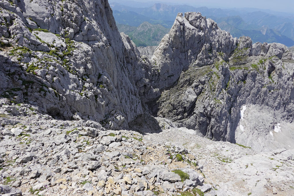
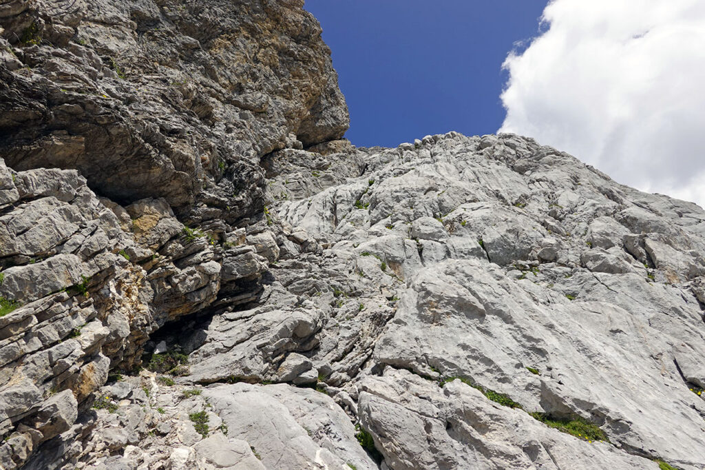
Shortly before it ends, the place where the wall can be easily overcome (PD) appears on the right hand side.
We change course and once again, following the milestones, we overcome a last section where we will have to use our hands again (II) to reach the ridge, next to the summit.
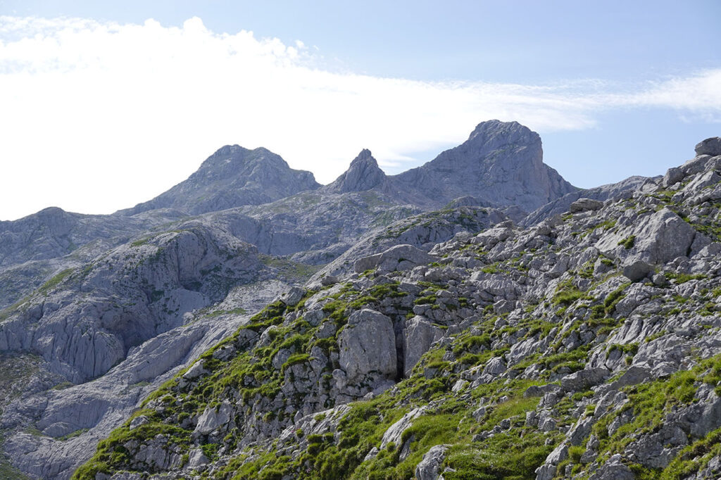
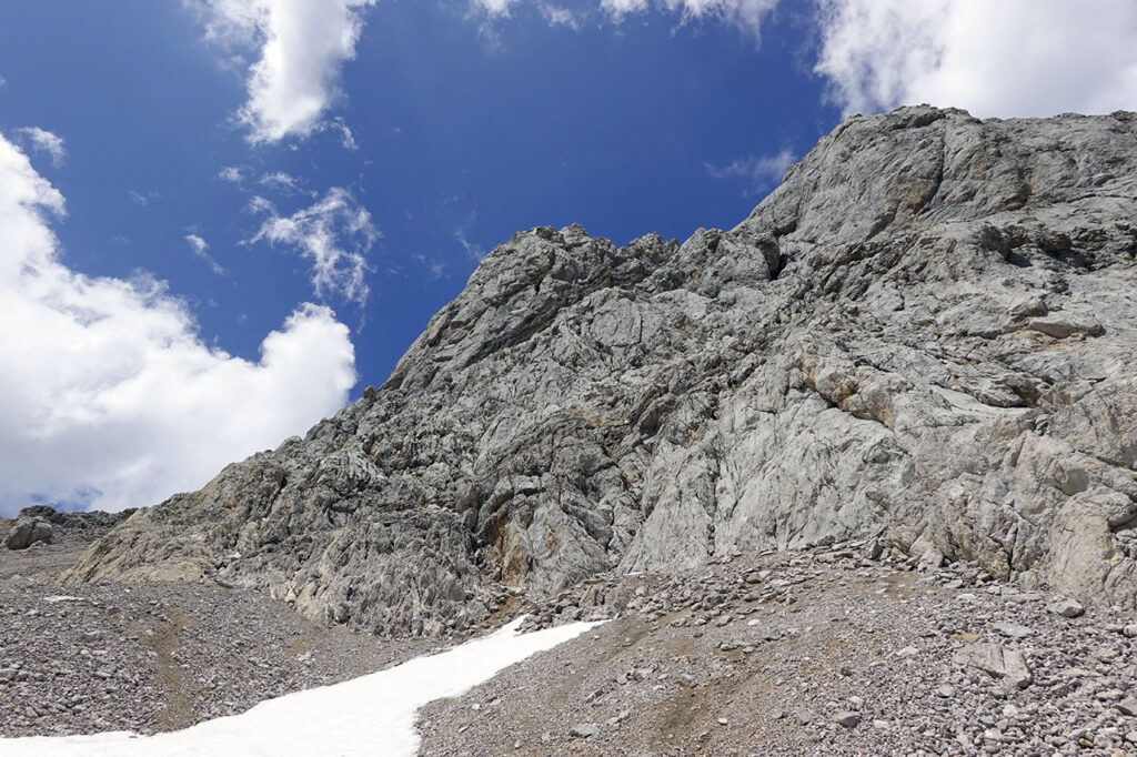
(4h05min; 8,6km) Peña Santa de Enol or Torre de Santa María (2.476m). The panorama is fabulous over the whole of the Western Massif, with the Peña Santa and the nearby Torre de la Horcada and Torre de Enmedio standing out to the south.
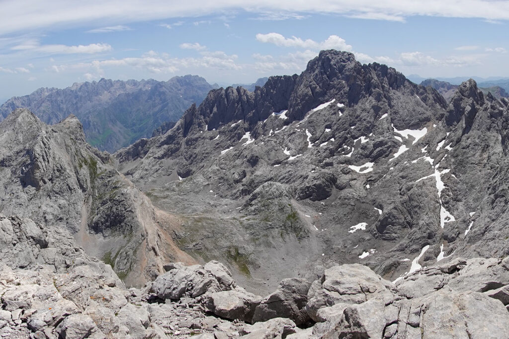
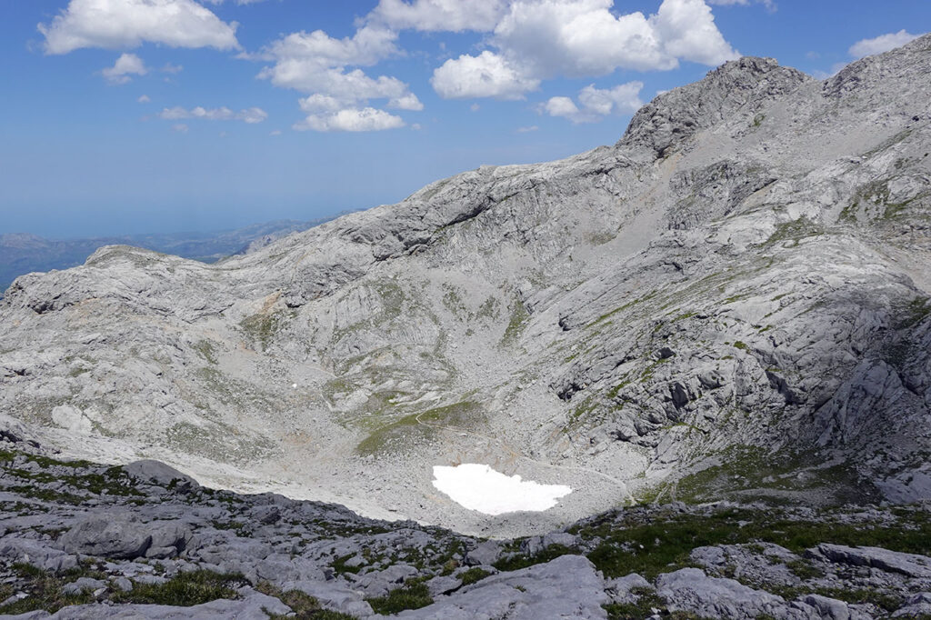
To go down the Grieta Rubia you have to go back to the corridor of the Marqués and finish topping it. The descent of the Grieta Rubia is not inside it, but next to it. We will carefully follow the milestones that go around the successive projections and that do not exceed the second grade.
Almost at the end of the rocky section we have two options, to climb the base (III) that gives access to the rocky area and head to the right, to the Horcada de Santa María; or, the option chosen, to turn left and continue along similar terrain (II) to head towards the Jou de los Asturianos.
(5h15min; 8,8km) Rock base - End of difficulties (2.316m). With more work than expected, we reached the stone quarry.
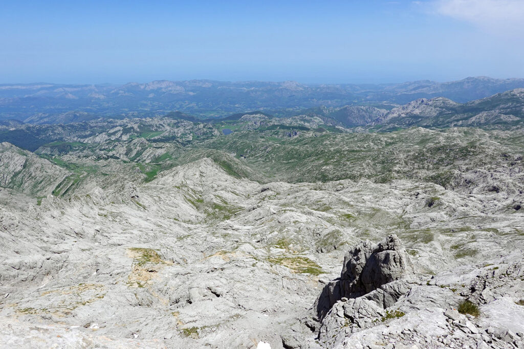
We will now continue halfway up the slope, on the left hand side, towards the Jou de los Asturianos, leaving the Jou Santo below on the right.
The milestones join a well-marked path near the pass between Jou Santo and Jou de los Asturianos, which we follow to the left. Shortly afterwards, the path joins another path that we also follow to the left, to reach the point where we turn off towards Peña Santa de Enol.
Here we can choose to return along the same path we came on the way out or another one. If we choose the latter, at the height of Asunciana (2,029m) we will notice some stone circles.
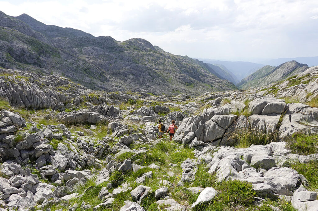
(6h15min; 10,6km) Leave the path (2.005m). We leave the Las Barrastrosas path and descend without milestones or a path towards the stone circles. It is a matter of going all the way around La Asunciana to reach a corridor that opens up on the other side, which we will follow slightly uphill from east to west. Already on the other side of this gully, the valley through which we are going to descend is revealed. We pass under a large plate with organ pipes and continue down towards the Jou sin Tierre, where the path becomes more and more obvious.
We follow the path over somewhat uncomfortable terrain (about 40 minutes from the Jou sin Tierre), until we see a small pass (1,620m) on the right hand side, where we again have to decide whether to leave the path to do the circular route, or whether to continue along it towards the Vegarredonda refuge. Here we opt for the convenience of leaving the Vegarredonda path as soon as possible and follow the path in a north-westerly direction.
(7h30min; 13,7km) Vegarredonda refuge path (1.484m). To the left, the old refuge and the fountain; to the right, the new refuge. Now on familiar terrain and on a more comfortable path, we start the return to Pandecarmen, passing again by the...
(7h40min; 14,4km) col Gamonal (1.460m),
(8h15min; 16,3km) Vega del Canraso (1.225m) y
(8h50min; 18,3km) Pandecarmen car park (1.070m).
Fastpacking is not about going faster. It's about going lighter.
If you come from classic trekking, this is the next step: learning to move with less weight,
more fluid and enjoying every kilometre more.
Join the Outsiders Newsletter and start discovering what lightness feels like.