Peñas de las Diez, Once y Mediodia desde el Refugio de Lavasar
Pirineos y montaña 📩
Aquí 🔥Las Peñas de las Diez (2.568m), Once (2.658m) y Mediodia (2.465m), situadas al norte del macizo de Cotiella, conforman un hermoso cordal de picos que cierran por un lado el circo donde se encuentra el ibón de Plan o Basa de la Mora, y por el otro, caen hacia el valle de Chistau y la localidad de Plan.
Hacia Plan es hacia donde muestran su cara más atractiva y más agreste, y desde donde reciben estos curiosos nombres que hacen referencia a la hora del día. La hora en la que el sol, visto desde Plan, incide sobre cada uno de ellos. Como un enorme reloj de sol.
IBÓN DE PLAN O BASA DE LA MORA
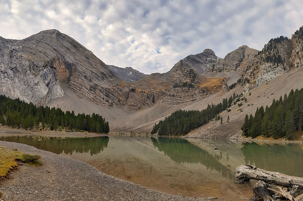
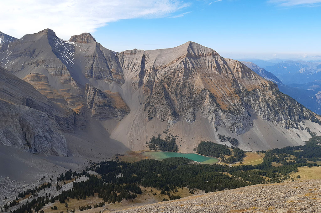
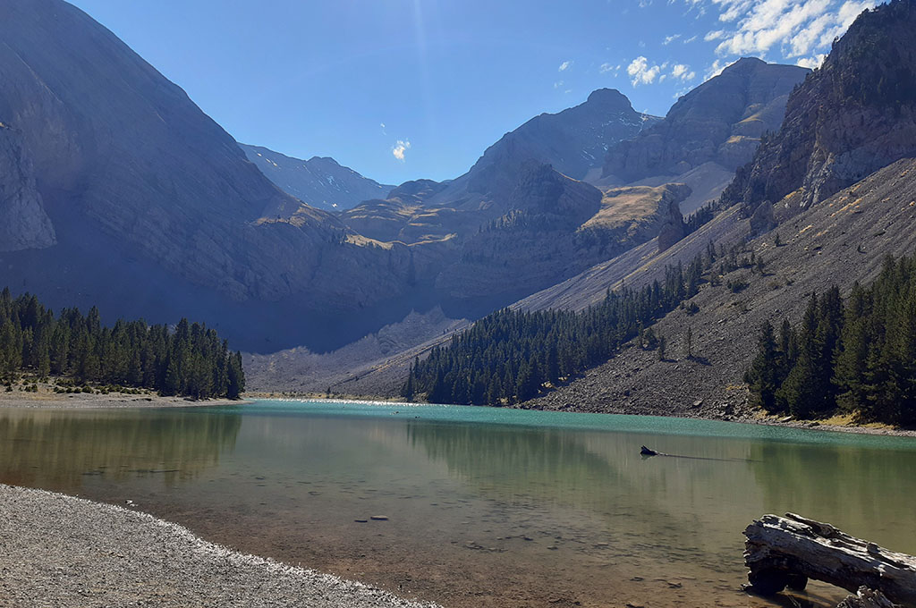
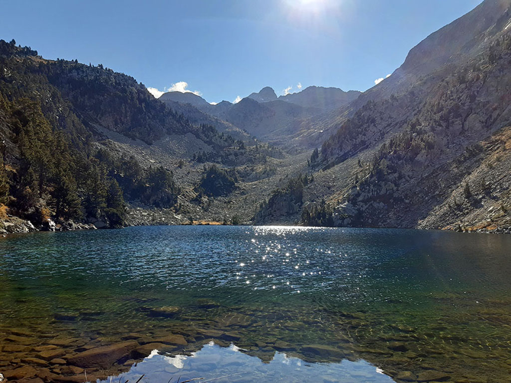
Al suroeste de este grupo de cumbres, por donde discurre la ruta, se ubica el ibón de Plan o Basa de la Mora, considerado uno de los más bellos del Pirineo. El color de sus aguas se vuelve turquesa a la luz del sol, entre grandes montañas y pendientes de derrubios que caen hasta su orilla, sobre la que crecen pinos negros y una verde pradera. Un lugar mágico en el que, según cuenta la leyenda, cada 24 de junio, el espíritu de una joven musulmana que huyendo de los combates entre moros y cristianos quedó presa en el ibón, lleva a cabo una danza sobre las aguas.
- TE PUEDE INTERESAR: Excursión al Ibón de Plan o Basa de la Mora
MACIZO DE COTIELLA
Aparte de leyendas y de la belleza del entorno, nos encontramos en un macizo sin igual a lo largo y ancho de los Pirineos. De aspecto árido, «africano», como se refería en 1.865 el conde Russel, cuando se adentró en España en busca de aquella montaña que veía desde la frontera y que tanto le intrigaba. De su incursión en el macizo, en la que lograría la primera ascensión al Cotiella (2.912m), el punto más alto, escribió: “Cotiella, pico sin igual en toda la cordillera de los Pirineos, y rodeado de Saharas. (…). La propia voz del viento tiene algo de sombrío en estas mesestas inhabitables y monótonas en las que un camello podría morir de sed, y que deben parecerse a los escabrosos desiertos de la luna.”
RUTA CIRCULAR A LAS PEÑAS DE LAS DIEZ, ONCE Y MEDIODIA DESDE EL REFUGIO DE LAVASAR.
RESUMEN:
Ruta de tipo raqueta a los picos que cierran por el norte el circo del ibón de Plan desde el refugio libre de Lavasar, accesible en coche por pista desde Saravillo (14kms).
Desde aquí, la ruta se dirige al ibón de Plan o Basa de la Mora siguiendo el GR15. Justo antes de llegar al ibón, la senda gira a la izquierda y asciende atravesando un bosque de pinos al salir del cual, las rutas de subida y bajada se separan. Seguiremos por el sendero GR15 hasta el collado de Aibón / colladeta L’Ibón (2.340m) y luego en dirección norte, hasta alcanzar la Peña de las Diez. La ruta continúa por la cresta hasta alcanzar su punto más alto en la Peña de las Once.
Para bajar, seguiremos la cresta (Oeste) pasando por la Peña del Mediodia y el vértice geodésico de Mediodia, donde se abandona para bajar al sur por pedreras inestables, hasta conectar con el camino de subida, justo por encima de la línea del bosque.
MAPA
> Descargar Track
> Descargar pdf (versión móvil)
CÓMO LLEGAR
Ver en Google Maps.
Una vez en Aínsa, seguiremos la A138 en dirección Francia, hasta el Mesón de Salinas (km 72,5), donde parte la carretera que da acceso al valle de Chistau o Gistaín y que seguiremos durante 5 kilómetros, hasta el desvío a Saravillo. En total, 33 kilómentros de Aínsa a Saravillo.
Ya en Saravillo, atravesaremos el pueblo hasta dar con la pista de acceso al ibón de Plan y el collado de Santa Isabel. La pista está regulada al tráfico y para transitarla, es necesario sacar un ticket de 3 euros en la máquina que hay justo al inicio (llevar cambio). Lo recaudado es para el mantenimiento de la misma. La pista tiene una longitud de 14 kilómetros hasta el refugio de Lavasar, donde acaba, y se encuentra en buen estado, se puede recorrer con un coche normal. Junto al refugio, hay una explanada de hierba donde se puede aparcar.
Hasta el refugio de Lavasar, donde comienza esta ruta, también se puede llegar caminando desde Plan (2h30min/ida), o siguiendo el GR15 desde Saravillo (3h30min/ida).
Ficha Técnica:
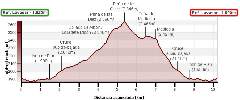
Distancia: 10,2 kms.
Desnivel acumulado: 965m.
Horario: Unas 6 horas. Tiempo de marcha sin paradas: 4h05min.
Agua: no hay fuentes a lo largo del recorrido y el único riachuelo que se cruza es el que desagua del propio ibón.
Dificultad: la bajada, fuera de sendero, por pedreras inestables, es la mayor dificultad de esta ruta.
ITINERARIO
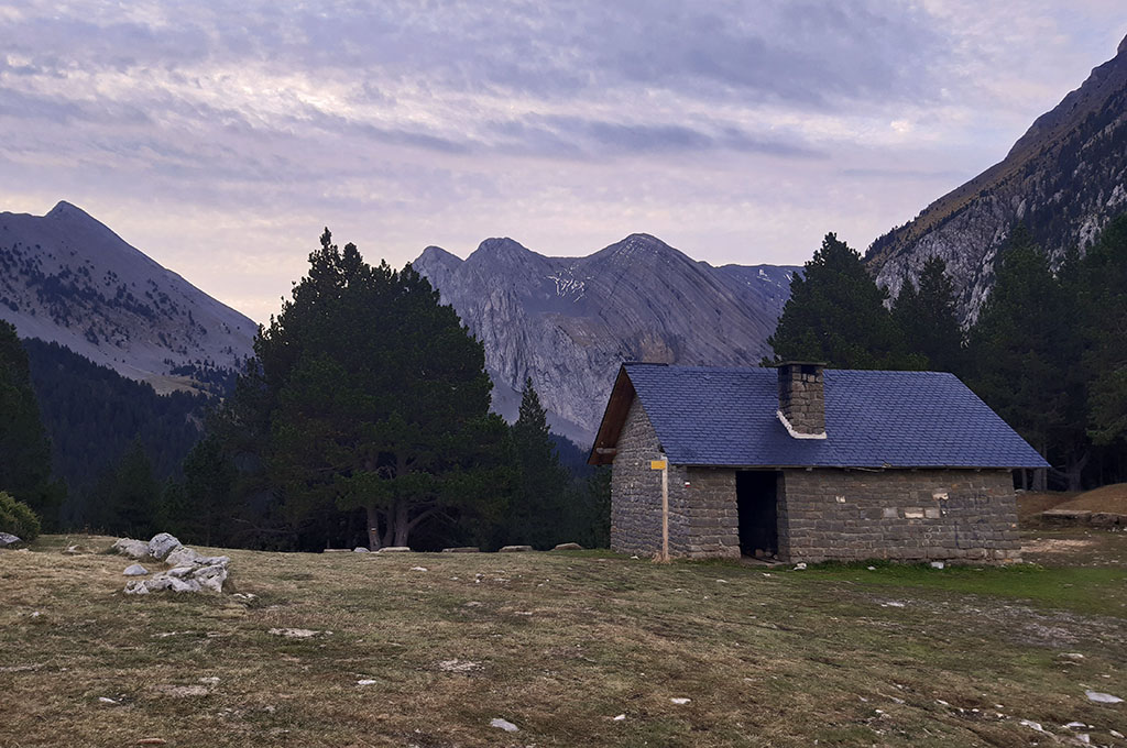
(0h00min; 0,0kms) Refugio de Lavasar (1.920m).
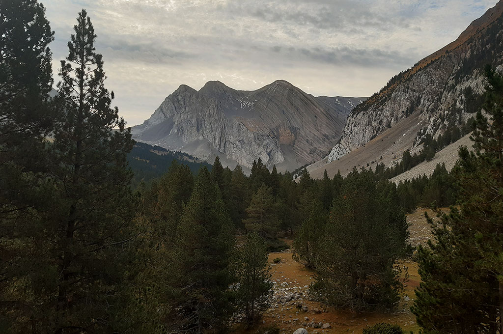
A la izquierda del refugio, un cartel señala el sendero al ibón de Plan, el cual seguiremos coincidiendo con el GR15 (Sendero Prepirenaico). El sendero discurre a través de un bosque de pino negro sobre el cual, asoman al fondo las cumbres de la Punta Alta (2.735m), la Punta la Picollosa (2.708m) y el Pico de la Ribereta (2.685m).
En unos 10 minutos pasamos el barranco del Ibón, por donde desagua, y salimos a una zona de praderas, donde un cartel (GR15) indica a la izquierda la dirección al refugio de Armeña y Seira. Nos desviamos un momento para ver el…
(0h25min; 1,5kms) Ibón de Plan / Basa de la Mora (1.900m).
De regreso al cartel, giramos en dirección norte, subida, a través de un bosque de pinos que atravesamos en apenas 10 minutos.
(0h40min; 2,1kms) Cruce de caminos subida-bajada (2.010m).
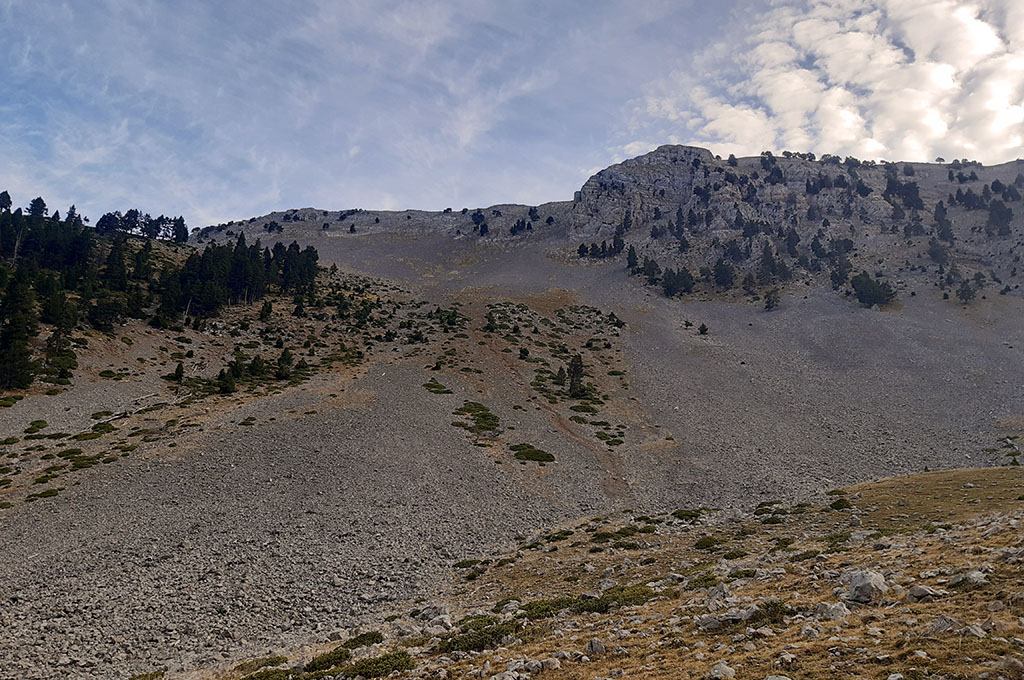
A mano izquierda, surcando la pedrera del Mediodia, podemos observar el camino de bajada. Subir por allí sería muy costoso y es preferible hacer la ruta en el sentido descrito, continuando en dirección SE por el GR15.
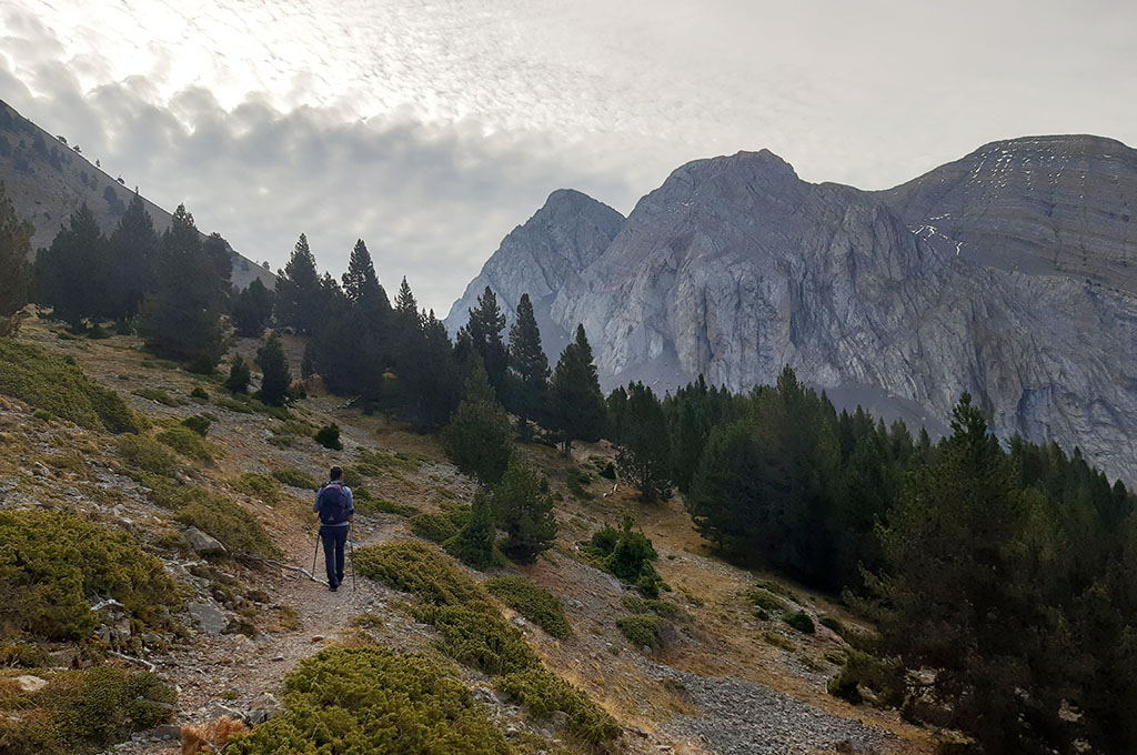
(1h25min; 4,3kms) Collado de Aibón / Colladeta L’Ibón (2.340m). La vista se abre hacia la vertiente sur y podemos contemplar a lo lejos el Turbón (2.492m), mientras que a la derecha, la Punta Alta se muestra inexpugnable. Nos separamos del GR15, que comienza a descender hacia Barbaruens, y continuamos a la izquierda del collado, esquivando los primeros escarpes rocosos, por un senderillo que asciende por la vertiente sur.
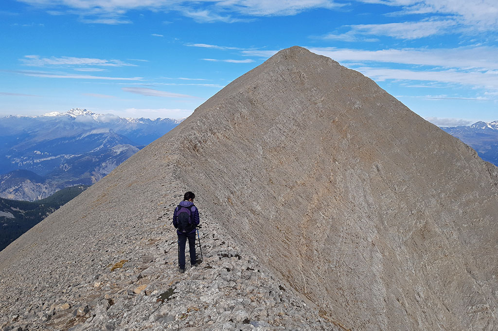
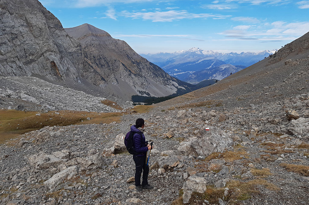
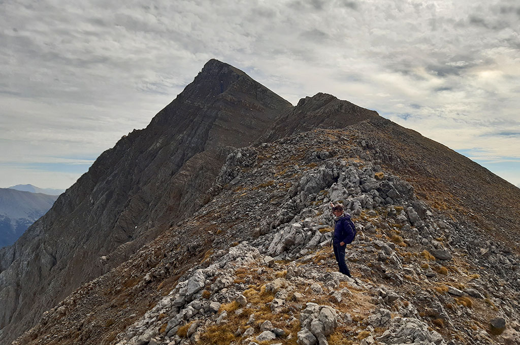
(1h50min; 4,9kms) Peña de las Diez (2.568m). La vista se abre ahora hacia el valle de Chistau y aparecen entre otros, los Culfredas, el Gran Bachimala, el Posets o el macizo de la Maladeta, algo más alejado. Por delante aguarda el tramo más espectacular de la ruta, una bonita cresta hasta la Peña de las Once, sin ninguna dificultad.
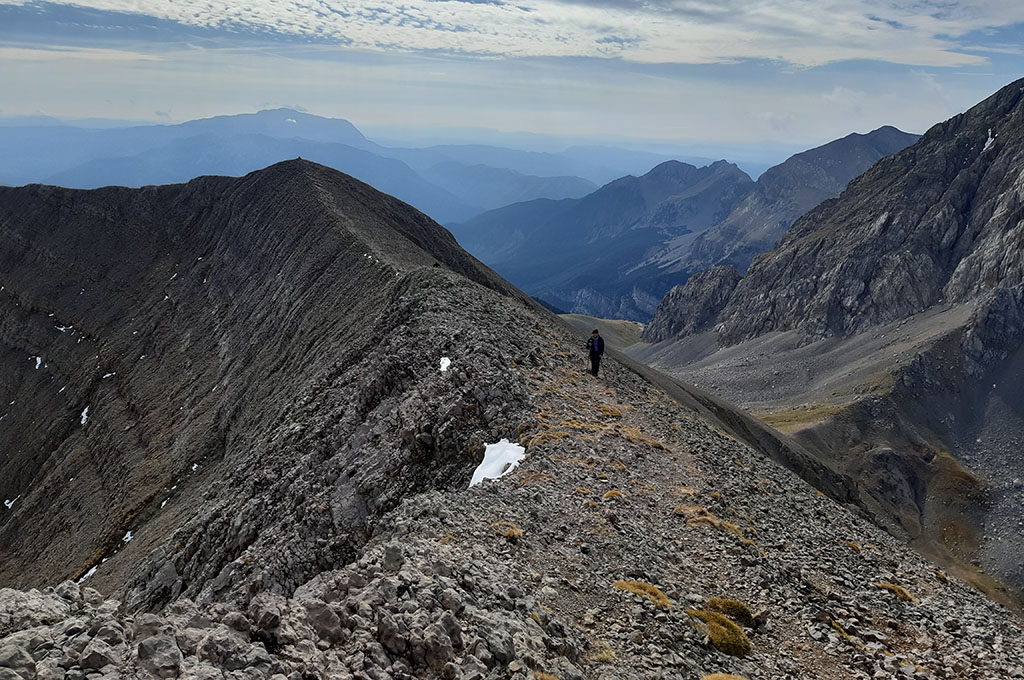
(2h05min; 5,4kms) Peña de las Once (2.645m). La panorámica es completa. Al sur, sobresaliendo sobre los picos que defienden el ibón de Plan: la Punta Alta (2.735m), la Punta la Picollosa (2.708m) y el Pico de la Rivereta (2.685m), sobresalen el Cotiella (2.912m) y el Pico Raymond d’Espouy (2.823m). Continuando hacia el Oeste con los picos que cierran el ibón, podemos ver la Peña de la Una (2.719m), el Putons Royos (2.694m) y la Peña es Litás (2.622m). Hacia el norte, de izquierda a derecha, sobre el eje principal de la cadena, sobresale el macizo del Monte Perdido, La Munia, Punta Suelza y los mencionados Culfredas, Gran Bachimala, Posets y Macizo de la Maladeta.
Iniciamos el descenso siguiendo un senderillo que recorre la cresta, evitando algunos tramos por la vertiente sur. Alcanzar la Peña del Mediodía cuesta menos de lo que parece, y 30 minutos más tarde nos encontramos en la cima.
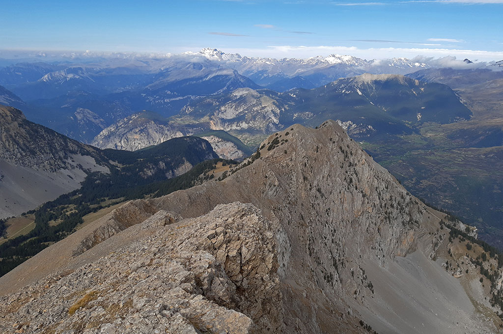
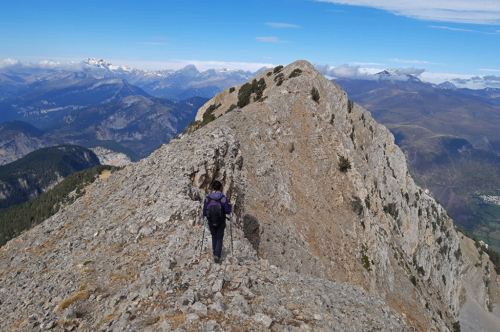
(2h35min; 6,5kms) Peña Mediodía (2.463m). Continuaremos por la cresta, recreándonos con las nuevas perspectivas hacia el ibón de Plan, hasta una cota llamada…
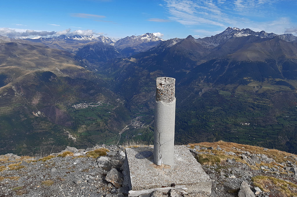
(2h50min; 7,0kms) Mediodía (2.421m). Un vértice geodésico señaliza esta punta que aunque no sobresale en la cresta, marca el punto partir del cual esta comienza a perder altura definitivamente.
Seguiremos unos pocos metros más por el filo, hasta encontrar unas trazas de senda que descienden de forma drástica hacia la vertiente sur, por una pedrera inestable que pondrá a prueba nuestras rodillas. Bajamos con la vista puesta en el prado que hay sobre la línea del bosque, por donde transcurre el…
(3h25min; 8,1kms) camino de subida (2.010m) que ya conocemos. Siguiendo el mismo itinerario bajamos nuevamente hacia el…
(3h40min; 8,7kms) Ibón de Plan o Basa de la Mora (1.900m), donde ahora nos podemos relajar, comer algo y disfrutar del entorno, antes de volver por el mismo camino al…
(4h05min; 10,2kms) Refugio de Lavasar (1.920m).
DATOS PRÁCTICOS
DÓNDE DORMIR:
Refugio de Lavasar (8 plazas, estado aceptable, banco, mesa, chimenea).
En los pueblos cercanos:
- Saravillo > ver alojamientos.
- San Juan de Plan > ver alojamientos.
- Plan > ver alojamientos.
MAPAS:
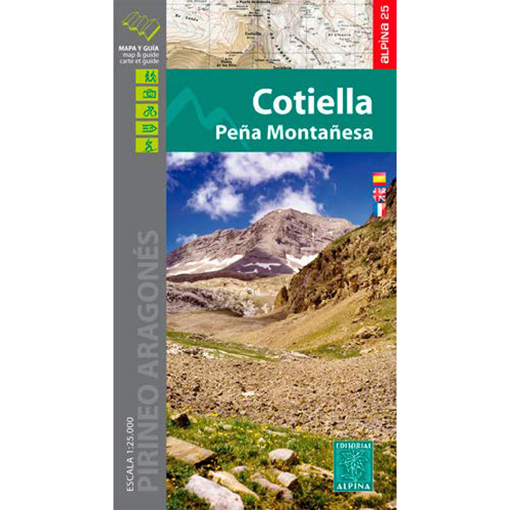
Mapa Alpina: Cotiella – Peña Montañesa
- Editorial: Editorial Alpina S.L
- Idioma: español, inglés y francés.
- Escala: 1:25.000
- ISBN-10 : 848090609X
- ISBN-13 : 978-8480906098
- Publicación: 2015

Mapa Prames TOP25 Bielsa – Valle de Chistau
- Editorial: Ediciones Prames S.A
- Escala: 1:25.000
- ISBN-10 : 8483214954
- ISBN-13 : 978-8483214954
- Publicación: 2020
CERCA DE AQUÍ TE PUEDE INTERESAR
Distancia: 13,3kms; Desnivel: +1.300m; Horario: 7-9 horas.
Una de las rutas imprescindibles en el valle de Chistau.