We are looking for this place: 2023
Pyrenees and mountains 📩
Here 🔥As we did in previous years, we begin this 2024 with a compilation of all those places that we proposed you to find out about each week.
The solution, as always, can be found in the weekly newsletter that we share with you on Thursdays. But, in case you missed any of them, here are the 45 places chosen in 2023.

25 PHOTO SPOTS in the Pyrenees 📸
Access to map Google Maps 📌with the most emblematic locations in the Pyrenees mountain range.
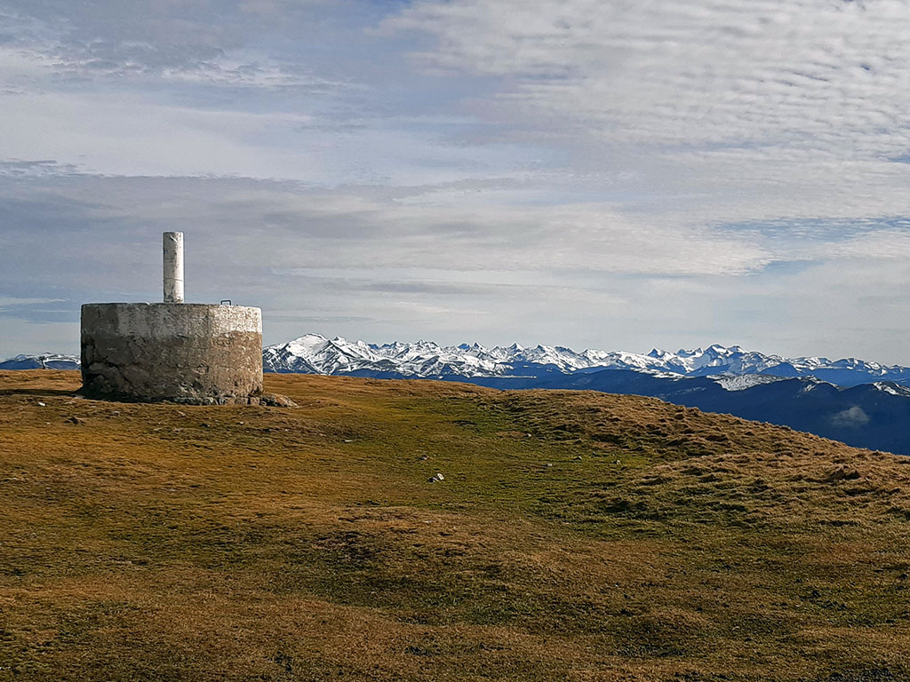
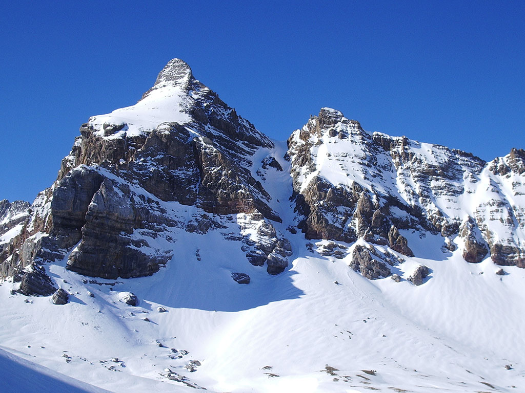
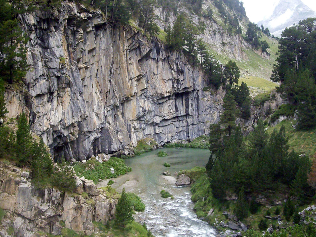
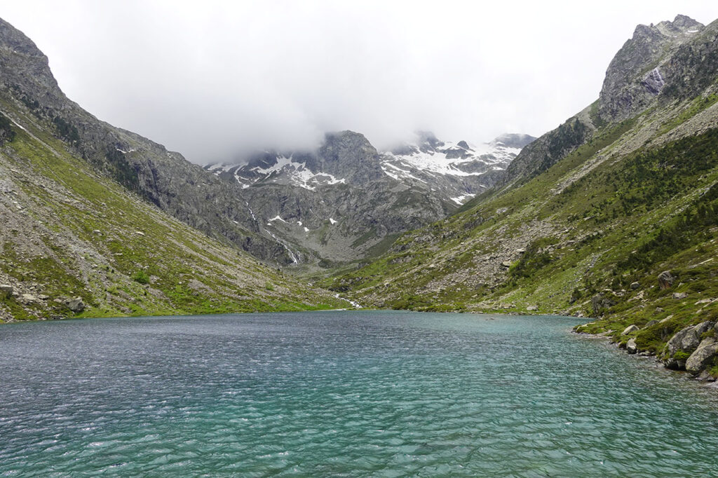
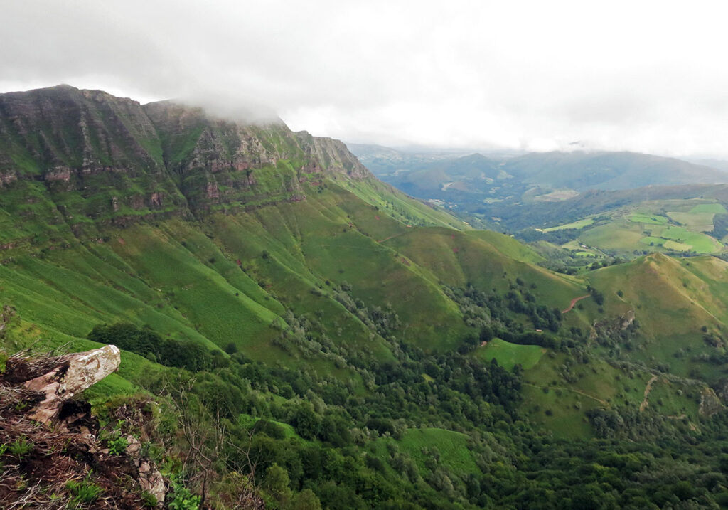
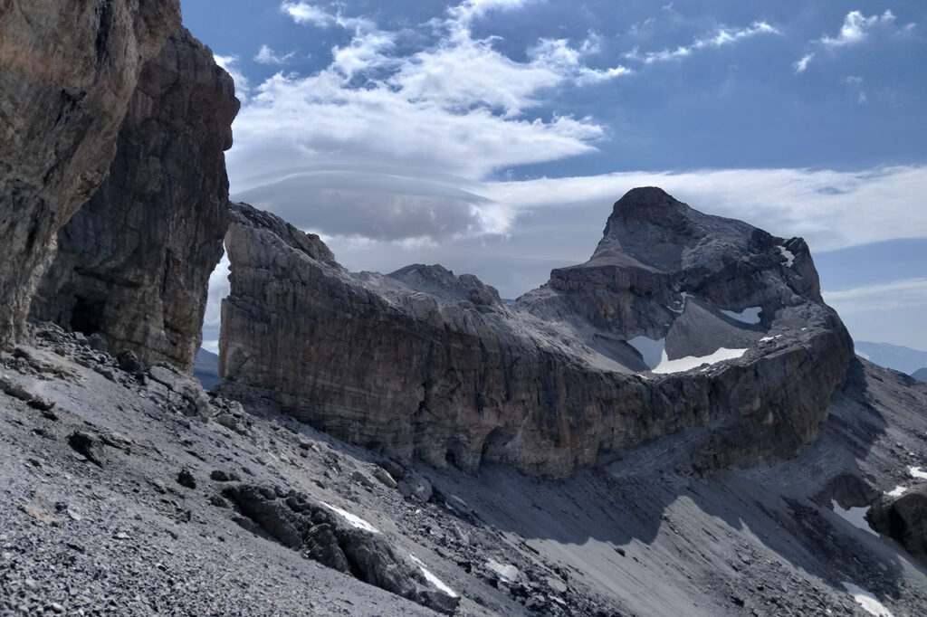
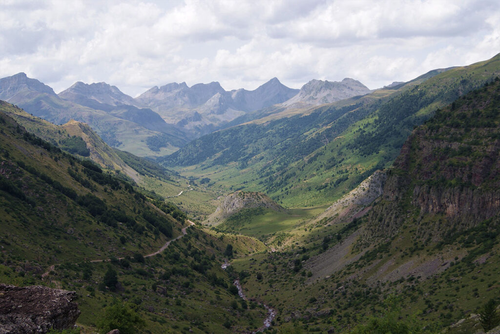
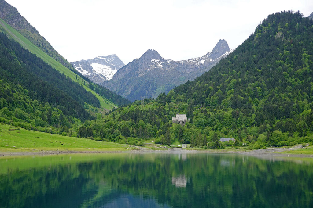
We are looking for this place #74:
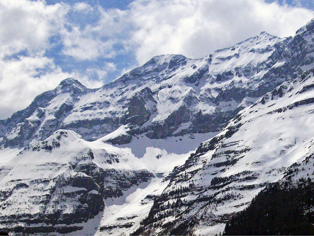
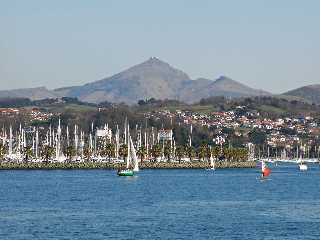
We continue through the Navarre Pyrenees, this time in search of the place from which this photograph was taken. Do you recognise it? The peaks in the background are the first two-thousanders coming from the Cantabrian Sea.
- Its summit is crowned by a geodesic vertex.
- No other peak exceeds this one in altitude from here to the Cantabrian Sea.
- A famous battle took place near here, disastrous for Charlemagne's troops.
Tracks:
Solution:
Last week's photograph was taken from the summit of Ortzanzurieta (1,565m), the highest peak in the mountains between Roncesvalles and the Irati Forest. A peak of which we brought you a picture some time ago. route from the Royal Munitions Factory of Orbaizeta and in which we visited several places with an important historical and natural attraction.
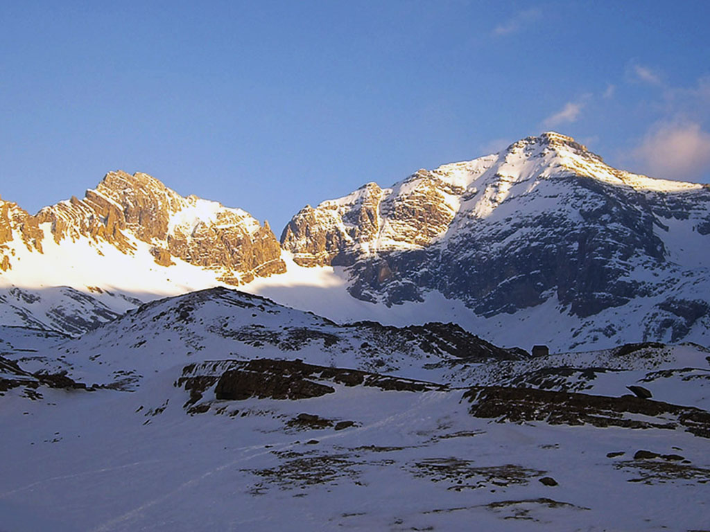
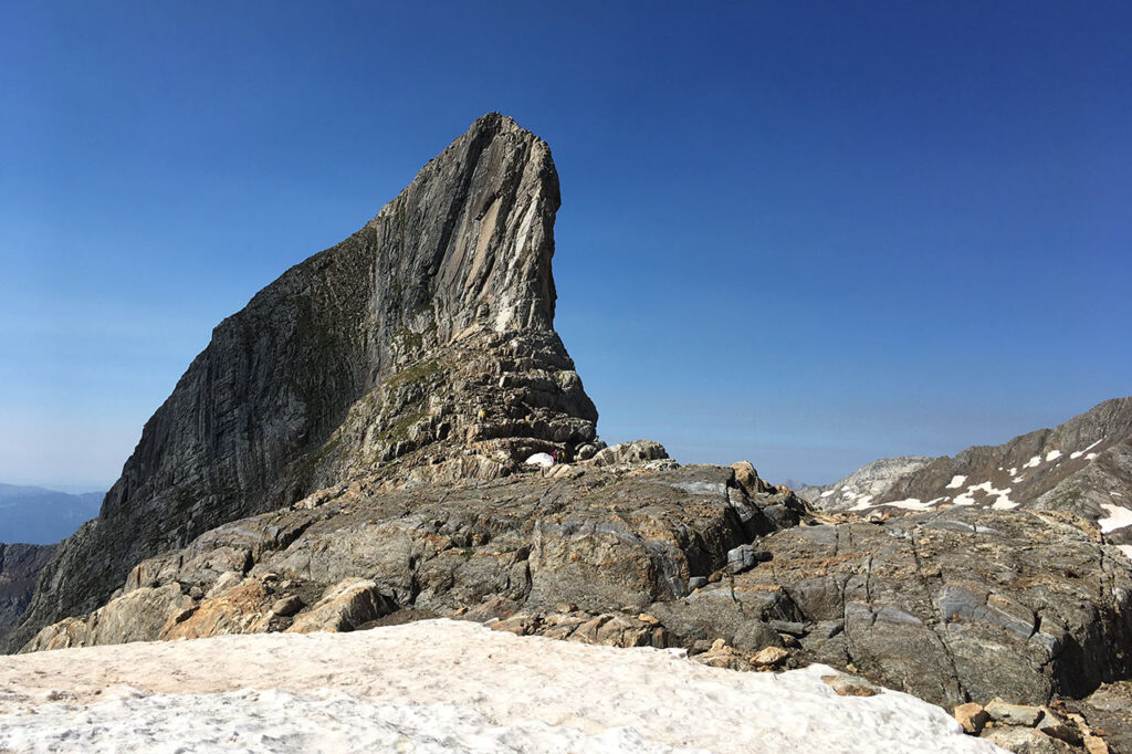
We are looking for this place #75:
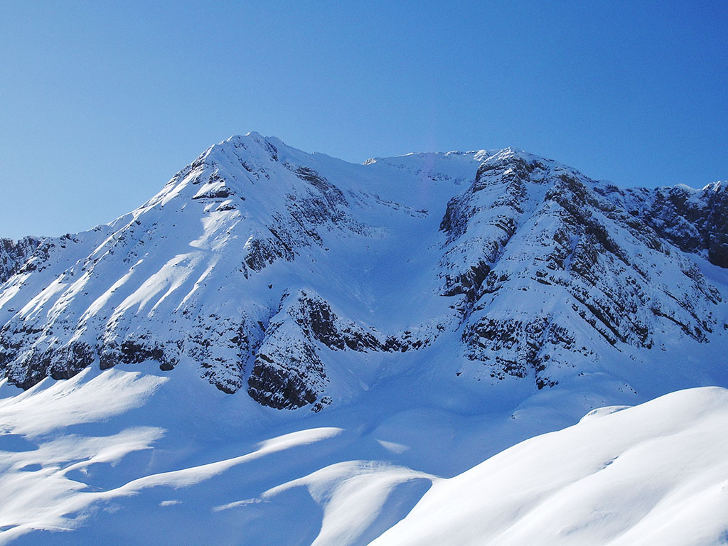
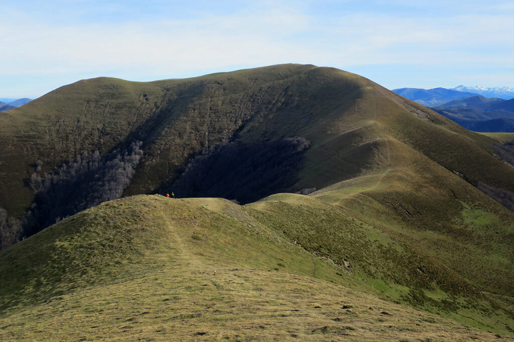
The mountain we are looking for this week is one of those that, in order to climb, you have to earn it. It is a quiet, solitary peak that goes somewhat unnoticed due to the proximity of other, better known mountains.
- As we said, our mountain has few suitors for several reasons. Among others: it is neither the highest nor the best known in the area, it has very long approach walks on any of its routes, a lot of unevenness and some climbing.
- This peak has two equally well-known names.
- If we access it from the southern slope, we will do so by passing through the lake of the same name.
Tracks:
Solution:
The peak we were looking for last week was the Pala de Alcañiz or Pico Bucuesa (2,765m). It is located in the Huesca Pyrenees, between the valleys of Canfranc (Aragón river) and Acumuer (Aurín river), closing the cirque of Ip. The presence of other higher mountains such as Collarada and Pala de Ip, as well as other more beautiful ones such as Punta Escarra, probably detract from the attractiveness of a mountain that already requires too much effort to attract the crowds.
We are looking for this place #76:
This week's spot was sent to us by Miguel Hernández, a photograph taken at the foot of "el Monarca" in which, pointing down the valley, the mountain we are looking for stands out.
- The peak we are looking for is like a lighthouse, always visible as we walk through this valley.
- Its position, facing the "Montes Malditos", makes it a privileged viewpoint of the massif.
- In winter, the valley from which the photograph is taken becomes a Nordic ski slope.

Tracks:
Solution:
The mountain we asked you to find out about last week was the Mall Pintrat or Tuca del Puerto Viello de Gorgutes (2,845m). Its advanced position towards the Benasque valley, dominating the whole area of the Llanos del Hospital and marking the entrance to the Remuñe valley, makes it a very visible peak, although not very visited. A good option for those days when the valley is at its fullest.
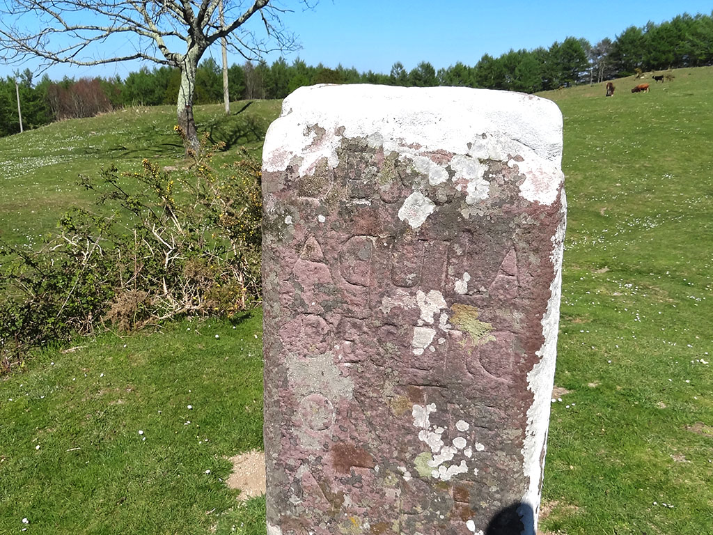
We are looking for this place #77:
A stone in the path..., no, no, don't start singing. This week we propose you to find a stone, but not just any stone, this red sandstone stone has an inscription that with a little effort you might be able to read.
- The inscription is a warning to the soldiers guarding the border.
- The mugarri in question is at the foot of the route. GR11/Pyrenean Path.
Tracks:
Solution:
The milestone we were looking for last week was the Mojón de Soroeta or De los Desertores, which has the following inscription engraved on it, which we reproduce, separating each line with a semicolon: DESDE; AQUI LA; DESERCI; ON TIE; NE PE; NA DE; LA VI: DA.
Apparently, according to Serapio Múgica, its origin dates back to the 18th century, when desertions to France by soldiers defending the border were quite frequent. If you want to know more, you can find more information about this cairn and others in the area in the blog Bidasoa-Txingudi by Ricardo Berodia.
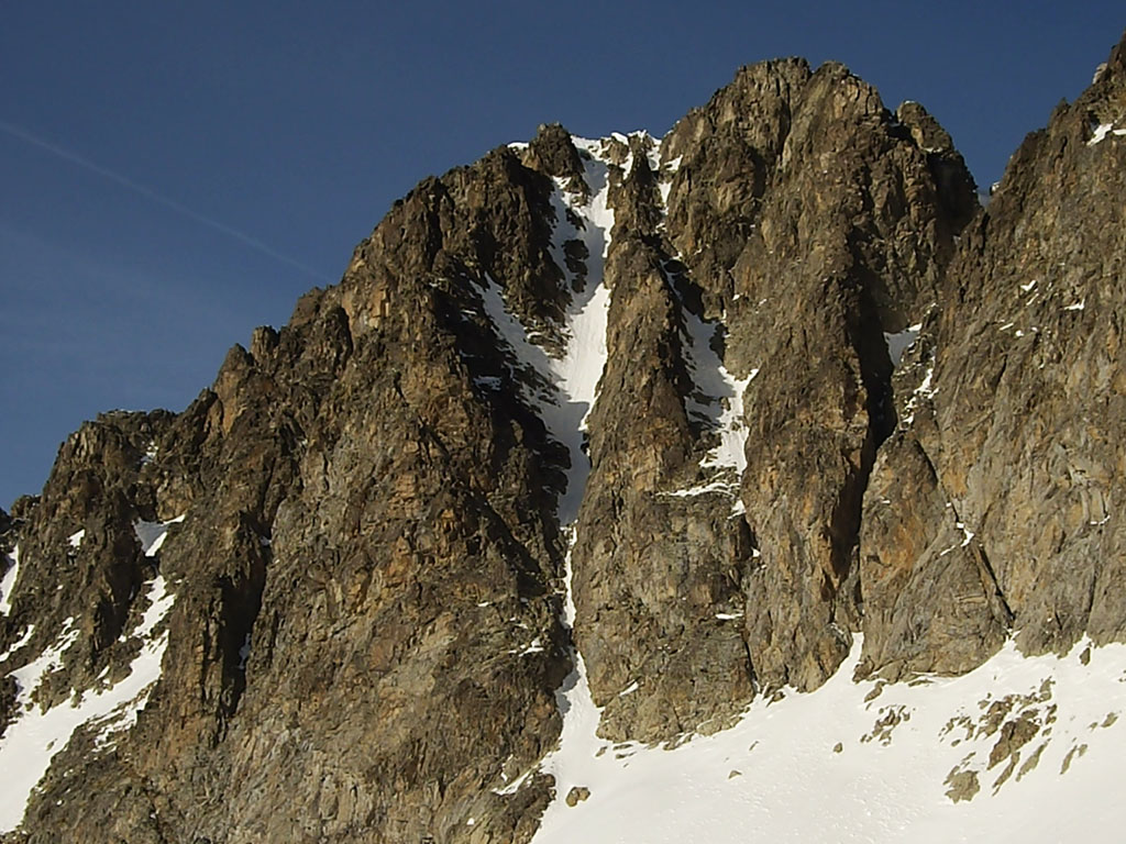
We are looking for this place #78:
The three peaks we asked you to find out about this week are easily recognisable, although not so easily recognisable from this perspective, and with this you have the first clue.
- These three peaks form an indissoluble trilogy of peaks.
- We are looking at the north face.
- There are two equally incredible explanations for their origin, the most recent pointing to the alpine orogeny, and the oldest, with an air of divinity, to the fact that they are actually three young petrified girls.
Tracks:
Solution:
Perhaps some of you may have thought when reading the clues that we were referring to the Tres Sorores or Treserols, but no, just 6kms from this place we have a much more modest trilogy known as Las Tres Marías or Tucas de Sesa, and which separately also have their own name. From east to west, as shown in the photo: Zuca Plana (2702m), Zuca Roncha (2757m) and Zuca Punchuda (2781m).
Alberto Martinez Embid, in his book "Monte Perdido, History and myths of the Pyrenean giant"The first version was about the three daughters of the Moorish King of Saragossa (Mohamed Altabill), who, fleeing from Islam and eager to embrace Christianity, were buried in this place. In the first version, it was about the three daughters of the Moorish King of Zaragoza (Mohamed Altabill), who, fleeing from Islam and wishing to embrace Christianity, were buried in this place under an avalanche of snow and rock when their pursuers were about to hunt them down. In the second version, the three virgins who were imprisoned in a cave, also by Mohamed Altabill, cried out to heaven and were transformed into snow-covered mountains, a symbol of purity and feminine virtue.
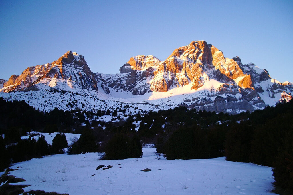
We are looking for this place #79:
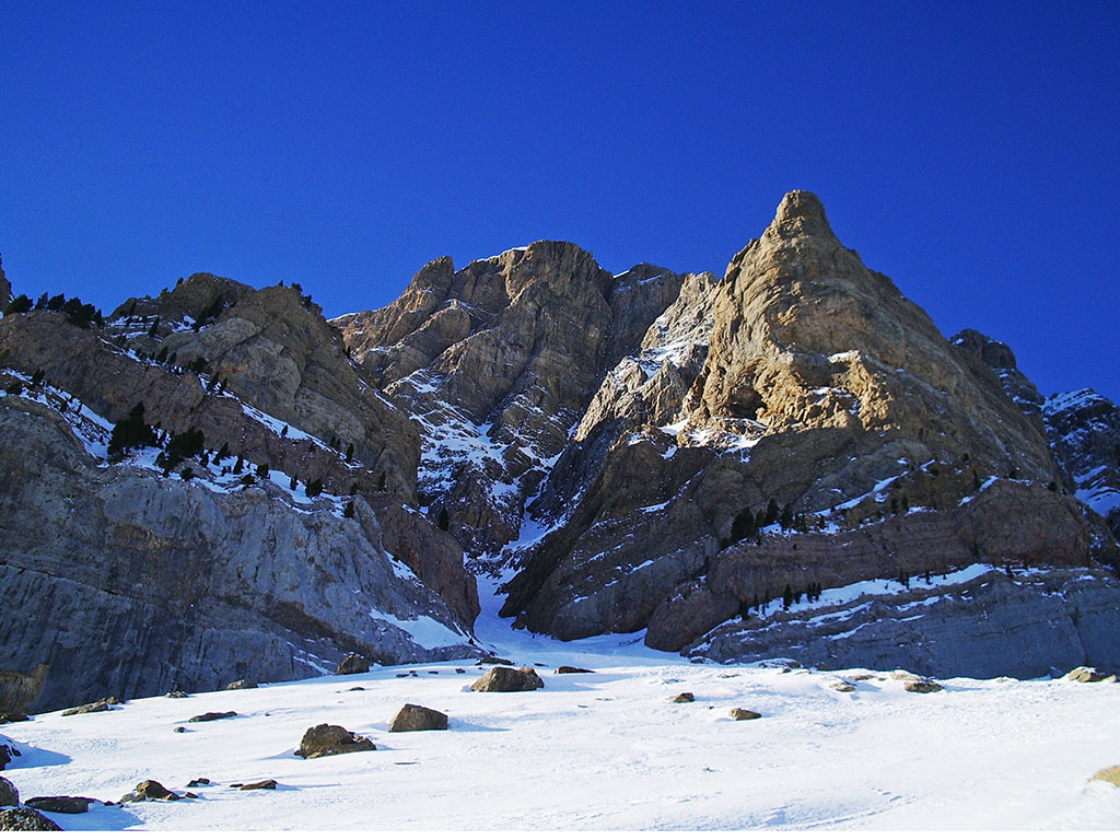
Mid-February is usually an ideal time for snow and ice climbing in the Pyrenees. In case this is the case and the conditions are right, this week we bring you two very interesting proposals to climb this mountain. Do you recognise it?
- The first route we refer to ascends the centre of the pyramid on the left and is known as the North Face route (AD+ to D-). This route ends at the summit of the peak after a final stretch of ridge, and was opened in the summer of 1976 by J.A. Romero, P.Alcay and E.Enmanuel, and repeated in the winter of 1983 by S.León and J.A.Romero.
- The second corridor climbs up the centre of the buttress on the right. It is an obvious line but somewhat more difficult than the previous one (D+), and since it was opened in 1990 by Julio Armesto, Enrique Villasur and Tomás Uriguen, it has not ceased to be repeated, becoming a super classic in the area.
Tracks:
Solution:
The mountain we were looking for last week was Peña Sabocos (2,751m), the most prominent peak in the western part of the Sierra de Tendeñera, which dominates the village and the ski slopes of Panticosa to the south. Precisely, the presence of the slopes brings us very close to this mountain, shortening considerably the approach of the routes we proposed, Cara Norte (AD+ to D-) and Panticosa Ice (D+).
We are looking for this place #80:
We are not changing valley. You already know where to find us if you found out what we were looking for last week, or if you read our weekly newsletter "Aires de Altura" in which we reveal the answer every week.
This week we will continue to make you happy with another beautiful corridor, a very elegant and affordable line (AD+) that leads to the summit of this peak.
- We are in the same valley as last week.
- There is another peak with the same name in the area.
Tracks:
Solution:
The place we were looking for last week was the West Corridor (200m; AD+) to Pico Serrato (2.888m). An elegant way to reach this peak near the Balneario de Panticosa in winter. The main difficulties of the route are concentrated at the start (65º), where there may be some rocky passes of III+ if there is not enough snow.
We are looking for this place #81:
After the two corridors that we proposed a couple of weeks ago to the Peña Sabocos (North Face and Panticosa Ice), and the one last week to the Pico Serrato, we continue through the Tena Valley with what we could consider the jewel in the crown in terms of difficulty. That said, as it would be too easy if we were to show you a good photo of the corridor, you will have to make do with the entrance.
- This famous corridor is located in the Tena valley, in one of the geologically known Sierras Interiores.
- The name of this corridor is not very original. The same name can be found on other mountains such as Untzillaitz, Pedraforca, Balaitús or Raymond D'Espouy, among others.
Tracks:
Solution:
Of course, last week's runner of the week was the Gran Diagonal a Peña Telera. One of the longest corridors (700m) that we can do in the Pyrenees with a difficulty that varies according to the guidebook consulted and the conditions, between AD and AD+. A superclassic that you can't miss if you practise climbing on snow and ice.
We are looking for this place #82:
Almost without changing valleys, we continue with another winter proposal that joins those of the last few weeks in the Tena valley. In this case, our mountain is situated on the dividing line between the aforementioned valley and its neighbour, although it is true that the corridor is in this second valley.
- The peak straddles the Tena valley and another valley.
- Although there are other higher peaks nearby, this mountain is much appreciated for its lofty silhouette, but not very popular. Perhaps it is because it is a little far from everything and to reach the top you have to climb a little.
Tracks:
Solution:
Indeed, last week's spot was the northern corridor to Punta Escarra. An easy corridor (PD) of 250 metres with a maximum gradient of 55º, a classic ski mountaineering route. The ascent to the summit is more complicated (AD) with several mixed sections. In winter the approach is considerably reduced from the Sarrios car park (Formigal), in summer, the most interesting route is the one that starts from Canfranc..
We are looking for this place #83:
Beautiful indeed, we thought the place was so beautiful that it has been on the front page of the homepage of the GR11. And we had 800 kilometres to choose from, about 1000 kilometres counting the variants.
- Huesca la Magia is located in Huesca.
- In order to protect this place, there is a Natural Park project which, for the Government of Aragon, has apparently expired.
- The intention is to waste 78% of the European funds from the Tourism Sustainability Plans destined for the whole of Aragon, to destroy this unique site, with the installation of a chairlift, 37 pylons, a large intermediate station and the consequent transfer of machinery.
Tracks:
Solution:
Last week's search could not be other than Canal Roya, the place that gives the title to our main article this week: Save Canal Roya. In the photograph we can see the Rinconada Plain with Espelunciecha in the background and the Anayet Peak on the right in the foreground.
We are looking for this place #84:
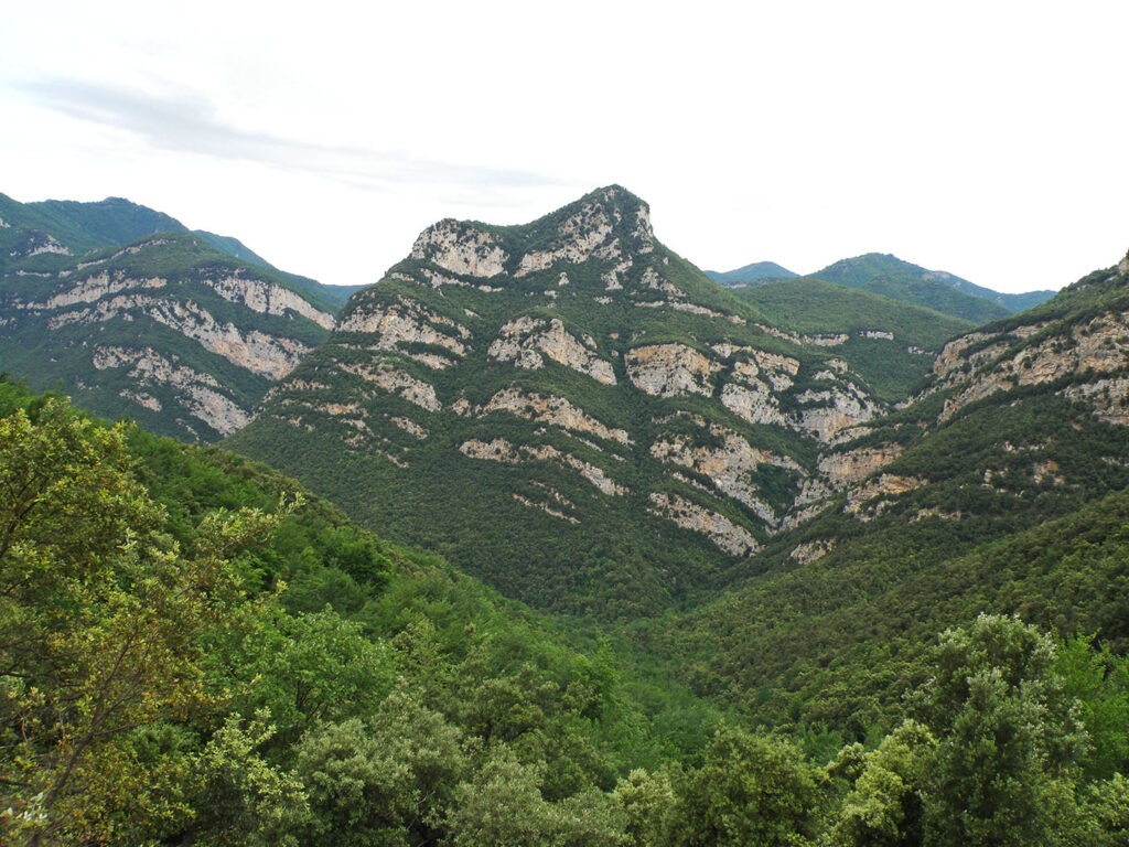
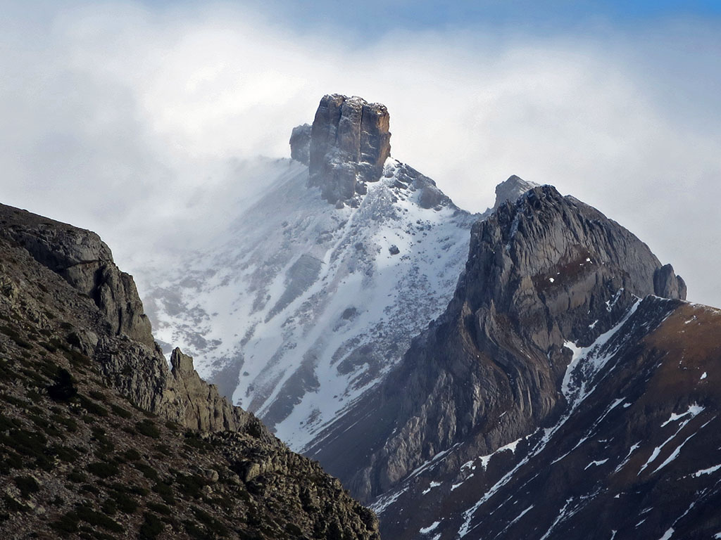
This week we move to the eastern Pyrenees, where it shows us its most Mediterranean side and where, although it is no longer as high as it was in the central Catalan regions, it is equally abrupt and wild.
- The mountain you see in the photograph is not particularly high, even within the area where it is located.
- We are very close to the border between the regions of Alta Garrotxa and Alt Empordà.
- At its foot is a small monastery, now uninhabited, founded in 859 by a community of Benedictine monks.
Tracks:
Solution:
The mountain we saw the previous week was Puig d'en Coll (1,031m). As we were telling you on the slopes, this peak is not one of the highest in the area, but its individual character gives it a certain importance and, to be honest, we found it very beautiful when we photographed it while we were walking along the stage of the GR11 between Talaixà and Albanyà. By the way, the monastery referred to in the tracks was Sant Aniol d'Aguja.
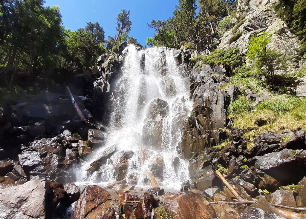
We are looking for this place #85:
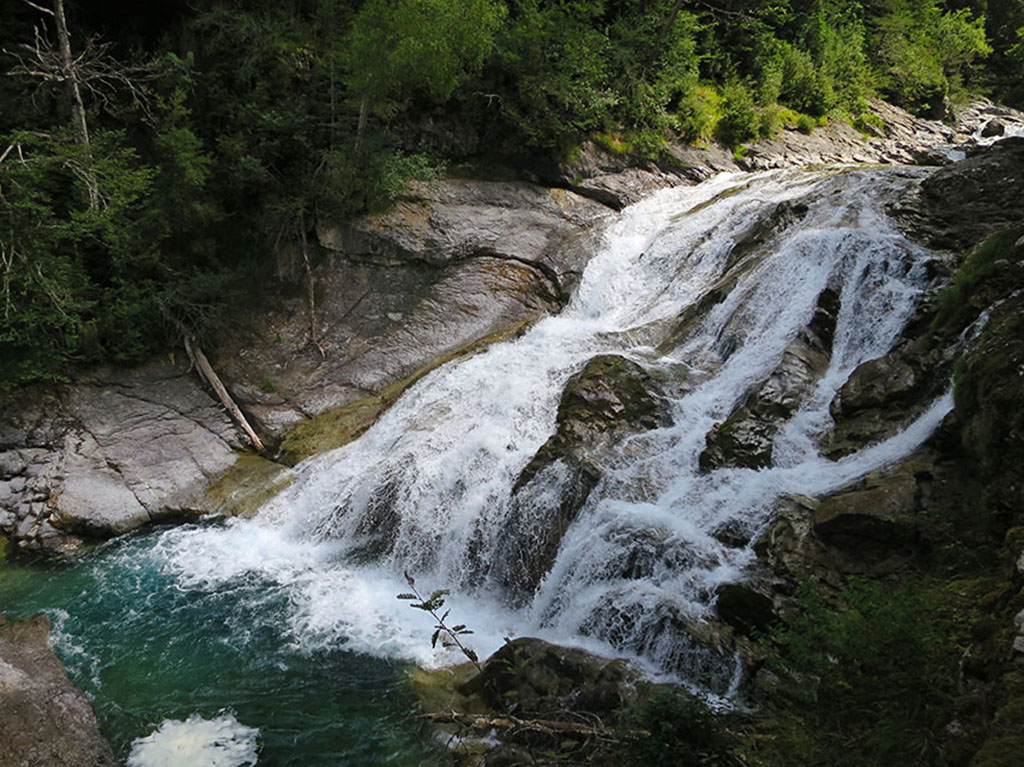
Spring is the ideal time to visit waterfalls. The mountain sheds the white mantle it has worn during the winter and the snow, now transformed into water, descends impetuously through valleys and ravines.
- The Ordesa Valley is famous for the waterfalls of Cola de Caballo, the cave, the Gradas de Soaso and many more, but not so much this one in the photograph.
- It is located in the less visited half of the valley.
Tracks:
Solution:
The place we saw last week was the waterfall of Abetos, one of the numerous waterfalls that we can see in the Ordesa valleyIf instead of taking the bus to access the meadow, we take the Turieto Bajo path, the path used in the past before the road was built.
We are looking for this place #86:
The mountain we are looking for this week is, if not the first, one of the first in the Pyrenees in the West, as can be seen in this photograph taken from the seashore in Hondarribia.
- The summit of this great mountain, despite not reaching 1000 metres, stands out for its impressive 360º views that reach as far as the Central Pyrenees, as well as for its disappointing appearance, marred by the presence of a repeater, a heliport, a couple of shops and even a rack railway, which is used by dozens of tourists every weekend.
- Through its summit passes the first stage of the High Pyrenean Route.
Tracks:
Solution:
The photograph we saw last week taken from the seashore, in Hondarribia, was of Mount Larún (901m), also known as Larrún, Larhún or La Rhune. Despite its modest altitude, this mountain has a not inconsiderable prominence of 670 metres and a height difference of 870 metres if we climb it from Bera.
We are looking for this place #87:
Few peaks are as iconic as the one we show you this week. Its silhouette does not go unnoticed by the walker or climber who will immediately fix their eyes on this kind of fractured tooth.
- It is located in the Western Valleys Natural Park.
- It is a very visible mountain from the GR11.1.
Tracks:
Solution:
Last week's mountain was the Mallos de Lecherines (2,452m), with the Rigüelo peak (2,299m) in the foreground. It is certainly a unique mountain, often compared to a fortress or a millstone, as we mentioned in the description. The normal route climbs up its east face, via the Faus chimney (PD). To get there, it is usually accessed from the Aísa valley, passing through the López Huici refuge, or with more effort from Canfranc. In both cases following the GR11.1.
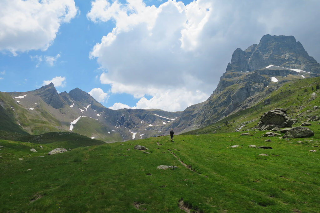
We are looking for this place #88:
This week's photograph is courtesy of Pintxo, who says: "we find ourselves in front of one of those places that remain engraved in the retina, one of those fairytale landscapes to which one never tires of returning in winter or summer, with the first snow or with the thaw".
- It is located in the Huesca Pyrenees.
- This valley has an unusual south-north orientation, then turns.
- The valley is crossed by the GR11.
Tracks:
Solution:
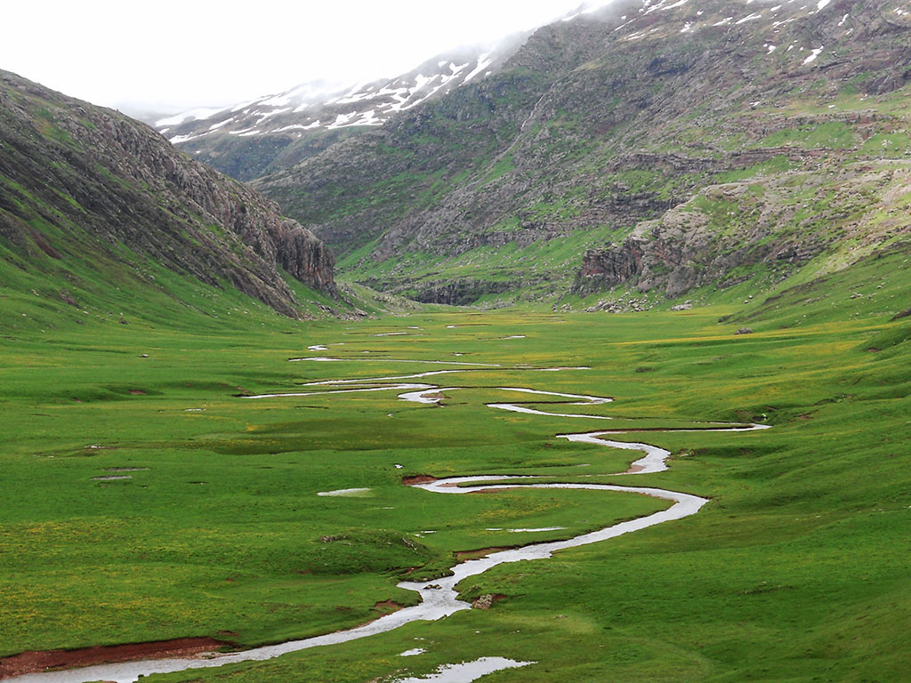
Last week's location was the Aguas Tuertas valley, located in the western end of the Aragonese Pyrenees, within the Valles Occidentales Natural Park and belonging to the municipality of Ansó.
The Aguas Tuertas valley, apart from being a place of great beauty due to the spectacular meanders created by the river, is very curious from a geological point of view. It is a glacial valley in which, after the ice tongue was removed, an over-excavation basin was left uncovered, which gave rise to an ibón and which, with the passage of time and sedimentation, was completely silted up, giving rise to the flat bottom that we can see today, through which the Aragón Subordán flows.
We are looking for this place #89:
This week we ask you to find out what this lake of dark waters is, as suggested by its not at all casual name and its no less dark legend.
- The lake was dammed in 1934 and used for energy production.
- It is located in the Principality of Andorra.
- The GR11 runs along its banks.

Tracks:
Solution:
The place we asked you to find out about last week was Engolasters Lake, located in the parish of Encamp, in the Principality of Andorra. It is a beautiful place to go on short excursions or visit with children, and where, according to a dark legend, there was once a village at the bottom of the lake, which has now been swallowed up by the mud. If you want to find out what happened, this week we have prepared an article about the Legend of Engolasters Lake.
We are looking for this place #90:
This week's photograph is a bit complicated, as this is not the version of the peak that we are normally used to. In any case, the photograph is beautiful, and if we manage to encourage someone to discover this wild corner of the Atlantic Pyrenees, we will have done a good job.
- The side we are looking at is the northern side.
- The valley through which the clouds enter is the head of one of the most beautiful, visited and photogenic ravines in the whole of the Pyrenees.
- For a few tens of metres, its summit is less than 2000 metres high.
Tracks:
Solution:
The peak we showed you was Otsogorrigaina (1,920m), which can be translated as Alto del Oso Rojo, although Otso could also be translated as wolf. It is a peak that we recommended some time ago in an article on Lonely Peaks in the western part of the Pyrenees and which, as we said on the slopes, is at the head of one of the most beautiful ravines in the whole of the Pyrenees. We were referring, of course, to the Gorgues de Holtzarte.
We are looking for this place #91:
This week's photograph does not do justice to the magic of this place, a large karst sinkhole through which the waters of the glaciers of the Pyrenean monarch mysteriously disappear.
- The water of this river, which due to the natural orography of the terrain should end up in the Mediterranean, surprisingly ends up in the Atlantic Ocean.
- This place is closely linked to another in the Aran Valley.
- It's not exactly a clue, but if the famous French speleologist Norbert Casteret hadn't solved the mystery in 1931, this place could have become a horrendous water collection site.
Tracks:
Solution:
I'm sure many of you have figured it out as soon as you saw the photograph. It is the Forau d'Aigualluts, one of the most visited places in the Benasque valley, together with the waterfall and the Plan of the same name. Three highly recommendable places that can be easily visited following a round-trip route starting from La Besurtaless than 5 kilometres long. The forau d'Aigualluts is a karstic sinkhole located at the foot of the Aneto, through which the waters of the river Ésera from the glaciers of the Aneto, Tempestades and Barrancs, and its tributary, the Escaleta, disappear. The natural course of the valley is towards the south, towards Benasque, the Ebro valley and the Mediterranean, however, the water filters to appear some 4 kilometres away in Artiga de Lin (Aran Valley), on the other side of the divide, and ends up in the Garonne and finally in the Atlantic. The spring through which the water flows is known as Uelhs deth Joèu, which means "The Devil's or Jupiter's Eyes".
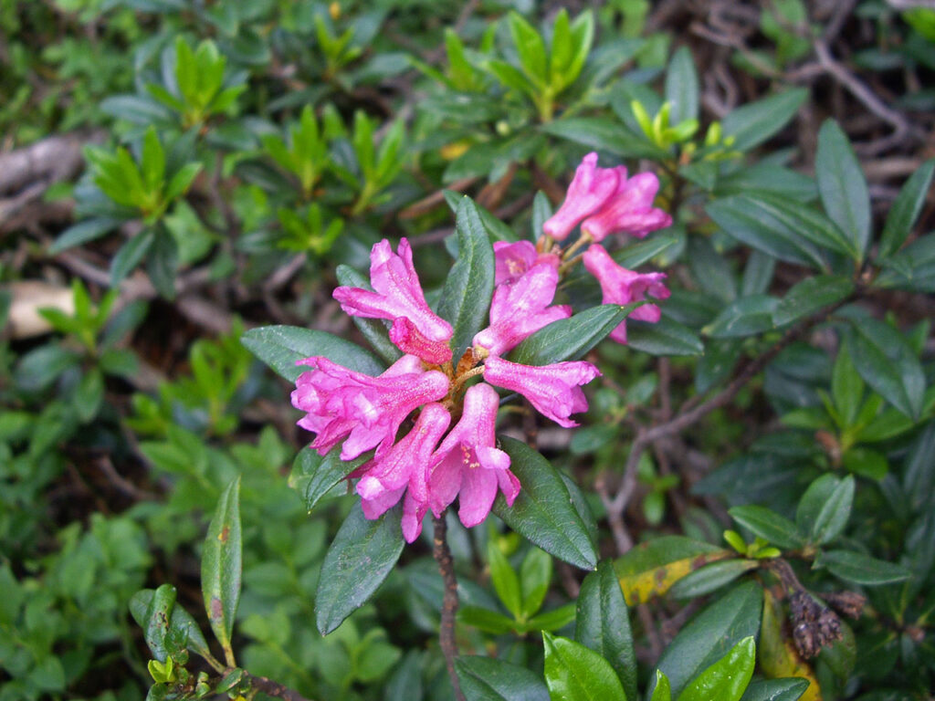
We are looking for this place #92:
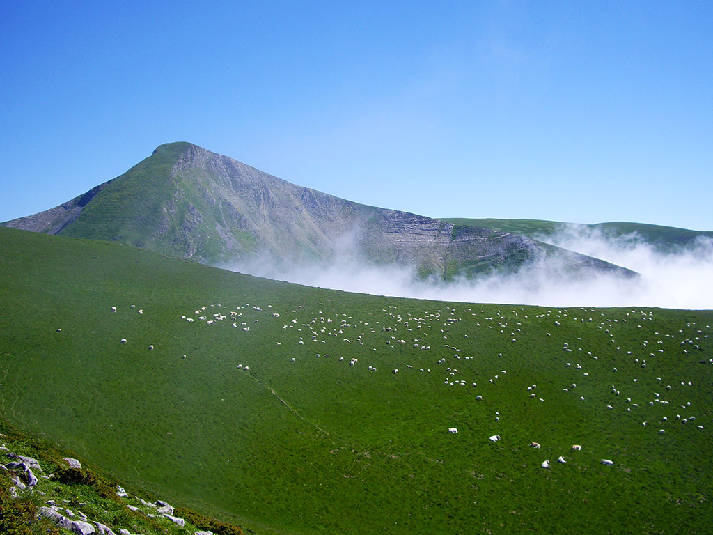
This week we are not looking for a place but for a flower, one that at this time of year is preparing to make its big appearance in the black pine forests, its favourite place.
- In the Iberian Peninsula it only inhabits the Pyrenees.
- It is typical of European mountain environments: Alps, Apennines, Carpathians...
- There are more than 1000 known species of this plant. One of them is the national flower of a certain Himalayan country. Which one is it?
Tracks:
Solution:
We were referring to the Rhododendron ferrugineum, commonly known as rhododendron, bujo or Alpine rose. This shrub, which is abundant in the Pyrenees, usually lives in subalpine pine and fir forests, and among its clearings, between 1,500 and 2,500 metres above sea level. So now you know, keep your eyes peeled on your next route through the Pyrenees, because the rhododendron flowers between June and August.
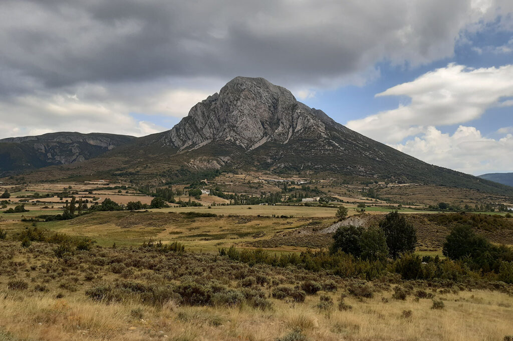
We are looking for this place #93:
The mountain we are looking for this week is not just another one, just ask the inhabitants of the city at its feet, how can they imagine it without this great decoration!
- The photograph was taken from this well-known locality.
- Although it is not a very high peak, it is one of the 50 most prominent on the Iberian Peninsula.
- Isolated to the south of the Pyrenean axis, its silhouette is like a beacon on the comings and goings to this Pyrenean region.
Tracks:
Solution:
This one was easy, the silhouette of Peña Oroel (1,770m) from Jaca is unmistakable. The most classic ascent is the one that goes up from the Parador (1,200m) through the area of Las Neveras, although there are also those who prefer to start in Jaca and face its 1,000 metres of vertical drop, or add a little more difficulty via the Mayencos route.
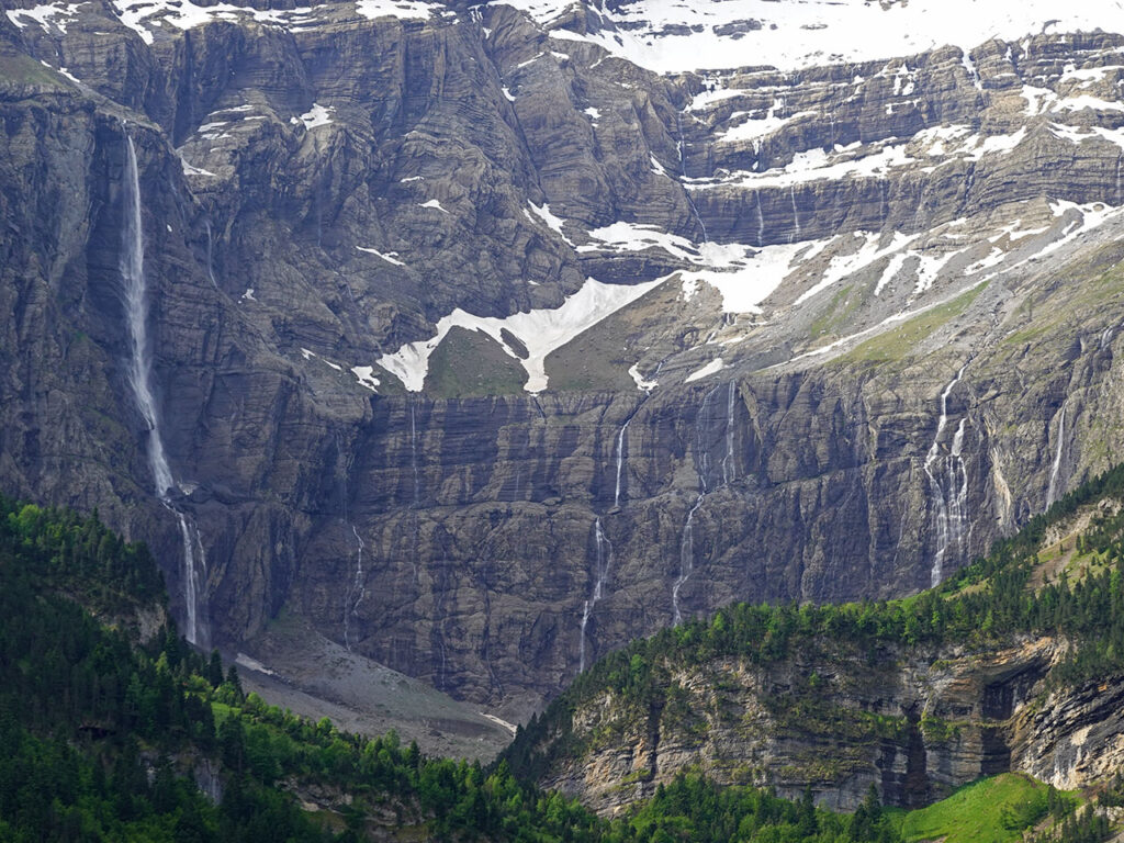
We are looking for this place #94:
Without a doubt, if we were to make a short list of essential places to visit in the Pyrenees, this would be one of them. As you can see, you don't need many clues to guess which place it is, but just in case, here they are:
- This site has been a Unesco World Heritage Site, together with Monte Perdido, since 1997.
- It is located within the Parc National des Pyrénées.
- The large waterfall on the left is the highest in France and in the Pyrenees.
Tracks:
Solution:
That's right, it was the Gavarnie Cirque and the Grand Cascade, the highest waterfall in France and the Pyrenees at 423 metres high. One of those must-see places that should be avoided in high season. The walk from the village of Gavarnie, which takes about two and a half hours there and back, is suitable for people of all ages and physical condition, with all the good and bad that this entails.
We are looking for this place #95:
We continue for another week in the French department of Hautes Pyrénées, but this time, in search of a beautiful lake. Do you recognise it? No? Let's see if with the clues...
- The lake we are looking for is located within the Parc National des Pyrénées.
- Next to the lake is the refuge of the same name.
- Although this is not the usual route, a very original way to climb the Vignemale would be to pass through this place.
Tracks:
Solution:
The lake we wanted to find out about was Lac d'Estom, at the head of the Lutour valley. A lake surrounded by peaks of around 2,800-2,900m above sea level, with the Pic de Labas (2,946m) in the background, hidden by the clouds, which is always present throughout the approach from La Fruitiere (4h return trip; 10.5km).
We are looking for this place #96:
Watching a waterfall, especially now in summer, is one of those things that everyone loves. Seeing the water rushing down, listening to the sound it makes, cooling off in it and breathing in those water particles that are always released and that put us in a good mood, scientifically proven. The waterfall we are asking you to find out about, because of the place where it is located, is quite well known. Do you know which one it is?
- It is located in one of the most visited natural areas in the Catalan Pyrenees.
- The waterfall has the same name as the river, estany y pico, where its waters are born.
- If you would like to visit it and to go around the lake, the best thing to do is to follow the route to the viewpoint, number 8 in the National Park brochure.
Tracks:
Solution:
The waterfall we saw in the photograph was the Ratera Waterfall, in the Aigüestortes i Estany de Sant Maurici National Park. This waterfall is located next to Sant Maurici Lake itself, on the right bank if we go up towards Ratera Lake. If you want to visit it, a good way is to follow the route of the viewpoint, a 6.6 km route that completely surrounds the Sant Maurici lake and visits several places of interest, such as the waterfall itself, the Ratera lake and the viewpoint, all with great views of mountains such as Els Encantats and many others.
We are looking for this place #97:
The pointed summit that we propose you to find out about this week sees hundreds of mountaineers parade past it every summer, but only a few make the detour to try to climb it. That's what it's like to be a "secondary" peak.
- Our pointed summit is the second highest mountain entirely on Gallic territory, behind only the other peak you see to its right.
- Under the vertical of its summit a gap can be seen, this is the exit of the most famous corridor in the Pyrenees.
- The photograph is taken from the only remaining glacier with a tongue in the Pyrenees.
Tracks:
Solution:
The sharp peak we saw in the photograph was the Piton Carré (3,197m), the second highest peak in the Pyrenees, entirely in French territory, after the Pointe Chausenque (3,204m), to the right of the photograph. As for the other slopes, the gap we could see at its foot was the Gaube gap, the exit of the most prestigious couloir in the Pyrenees; and the glacier was the Ossoue glacier, which with nearly 37 ha is the third largest glacier in the Pyrenees and the only one with a tongue.
The Piton Carré (F) is usually climbed in combination with other peaks when travelling along the crown of the Vignemale, (AD-) from the Petit Vignemale. If you are up for it, here we leave you this one route from Bujaruelo along the Moskowa corridor in which we climb 8 three-thousanders.the Python Carré among them of course.
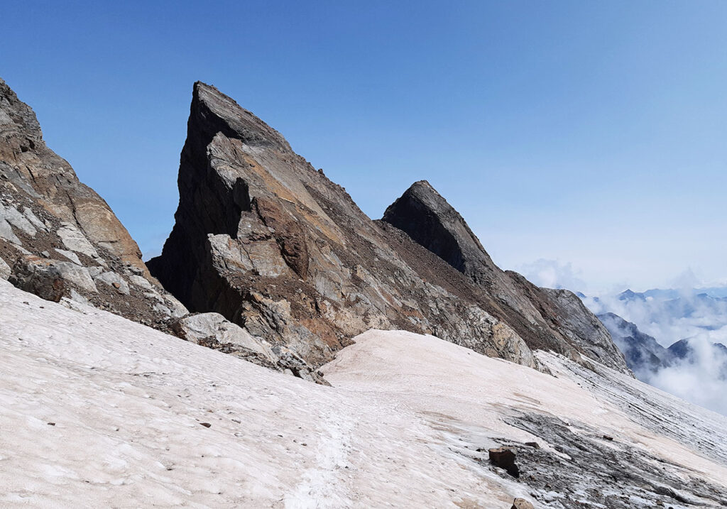
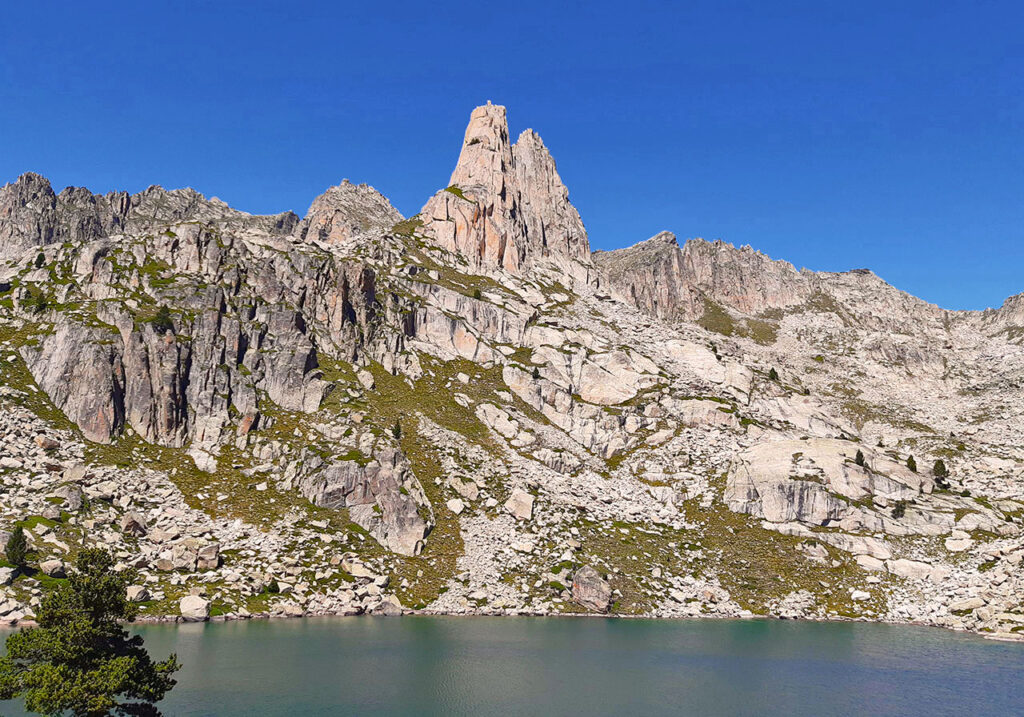
We are looking for this place #98:
We are in one of the great Pyrenean massifs, a labyrinth of peaks, U-shaped valleys, glacial cirques and countless lakes and sharp granite ridges. The needles we see are a good example of this, do you recognise them?
- These two spires are some of the most iconic in the massif and until recently, they were on the cover of Alpina's map of this area.
- They are half an hour from the refuge and the lake of the same name.
- Although these two peaks may seem to be the exclusive territory of climbers, the western slope offers a weak point for climbers.
Tracks:
Solution:
I am sure you have figured it out, it was the Agullas d'Amitges, the Lower Agulla (2,657m) on the left and the Upper Agulla (2,662m) on the right. The photograph is taken near the Amitges refuge, where it shows its best-known silhouette, separating the Saboredo and Bassiero glacial cirques. Its impregnable appearance should not discourage the "hiker". Surrounding the needles on the west side there is a small corridor (F) that leads to the Upper Agulla with little difficulty or exposure. The lower one is reserved for climbers, who will enjoy climbing its cracks on excellent granite.
We are looking for this place #99:
This week we travel to the Western Pyrenees in search of this well-known mountain, so loved and appreciated by the mendizales of the area.
- It is one of the first peaks to exceed 1,000 metres in altitude coming from the Cantabrian Sea.
- The GR10 and the ARP pass through its summit.
- The natural border between Spain and France, the most common route starts at the old customs house.
Tracks:
Solution:
This was Iparla (1,049m), the highest point of the ridge between the Izpegui pass and Bidarrai, which separates the Baztán valley from Lower Navarre, to where it drops steeply to almost a thousand metres. The most common route to this reddish sandstone peak is the one that starts from the Izpegui pass following the GR10, which continues to Bidarrai along the whole ridge, and which is a magnificent option if you have two cars. Other common routes are from Bidarrai and from Gaztigarko Lepoa.
We are looking for this place #100:
As you know, this week's search was a special one. Congratulations to Ignacio for this photo he sent us from a few weeks ago, when he did the Alta Ruta de los Perdidos. Here are the clues he sent us.
- It is a French refuge whose name could be a very bad translation of an Italian pasta dish (spaghetti).
- This is stage 3 of the High Route of the Lost.
- It is located at an altitude of 2027m on the heights of Gavarnie.
Tracks:
Solution:
The setting couldn't be more beautiful, the Gavarnie cirque with the Casco (3,011m), the Rolando Gap, the Punta Bazillac (2,976m), the Taillon (3,144m), the Gabieto Norte (3,031m)..., views that are hard to beat. By the way, the place we were looking for was the Espuguettes refuge, located in the heart of the Haute Route des Perdues and Haute Route Pyrénéenne (ARP / HRP), and a magnificent place to discover the north face of the Astazous.
We are looking for this place #101:
This week's search was sent to us by Yasmina Pérez, who said: "Life is like a mirror, it smiles at you if you look at it smiling".
- From Respomuso you will leave
- To Fabrègues you will arrive
- You will change your country
- From a Disney fairytale the name will seem
Tracks:
Solution:
Impressive views and the calm that can be breathed in this lake at the foot of the Palás peak, we are referring to the Arriel lakes, or more specifically, the Arriel Alto lake. A fabulous image captured by Yasmina Pérez, we don't know if she was doing the crossing between Respomuso and Lac de Fabrègues that she told us about on the slopes.
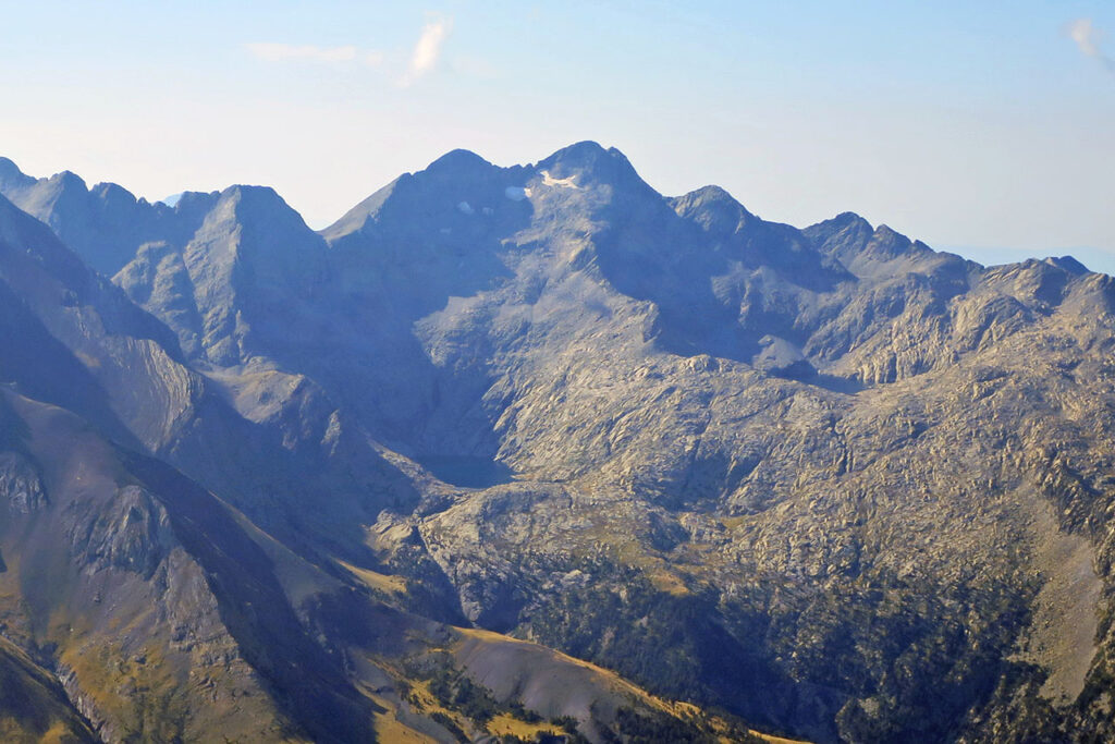
We are looking for this place #102:
This week's spot was sent to us by Fernando Royo, an image in which he played with the contrast of light and shadow and in which he asked us to find out which peak is this one in the background. Here are the clues he gave us:
- This is the second highest peak in the Pyrenees, after Aneto.
- The normal route comes from the Angel Orús Refuge, also called the royal route.
- Its name comes from some wells on its western slope... and that is what the area is called in Gistaín.
Tracks:
Solution:
With the clues we gave you there was no doubt, this is the Posets or Llardana (3,368m) as seen from Ordiceto lake. In addition to the ascent from the Ángel Orús refuge, other normal routes are those that start from the refuges of Viadós and Estós, three strategically located refuges that make a circular route around the massif possible. Route of the three refuges.
We are looking for this place #103:
This week's photograph was sent to us by Ana Remirez de Ganuza, who added: "We are in one of the westernmost massifs of the Pyrenees, on the border between Spain and France".
- Legend has it that a nephew of Charlemagne was the architect of this geographical feature.
- It has been one of the themes of the podcast 'Maldita montaña'.
Tracks:
Solution:
I'm sure you've got it right. It was the Rolando Gap, which, according to the legendRolando opened with his sword Durandarte. The peak that can be seen behind is Casco de Marboré (3,011m) which although it seems to be reserved only for climbers, the wall at its base hides a curious underground passage that makes it possible, when it is not blocked by snow, to overcome it without too much difficulty (F+). If this is the case, it would be better to follow the normal route via the Paso de los Sarrios that ascends the southern slope (F).
We are looking for this place #104:
This week's spot was sent to us by María García, who said: it is an almost forgotten peak, as few mountaineers usually climb it, as most of them always head for the second highest peak in the Pyrenees. The photo is taken from the col with which it shares its name.
- It seems impossible to climb, but a small path on the left with a few scattered milestones leads to the top without the need to climb.
- It shares part of its name with its neighbour, the second highest peak in the Pyrenees.
- Its base is usually reached by ascending the Canal Fonda, frequented by mountaineers on their way to its neighbour, the second highest peak in the Pyrenees.
Tracks:
Solution:
Yes, as María said, many of you may never have been to the Diente de Llardana (3,089m), but you will certainly have seen it when climbing the Posets via the Canal Fonda. The Diente de Llardana is one of the 17 listed three-thousanders in the Posets - Eriste sector and, although its impregnable appearance may put many people off, a climb (PD-) over somewhat broken terrain is the biggest obstacle to overcome.
As a curiosity, a very similar photo of the Diente de Llardana appeared on the cover of the book ¡Qué bonito son los Pirineos, by Hipolito Maeso Rueda, the first person to climb "consecutively" the 212 three-thousanders that had been catalogued in 1999. It is written in the form of a "diary" and although at times it can be very descriptive, it is told with a lot of humour. One of the 10 books of Pyrenean literature which we recommended to you some time ago.
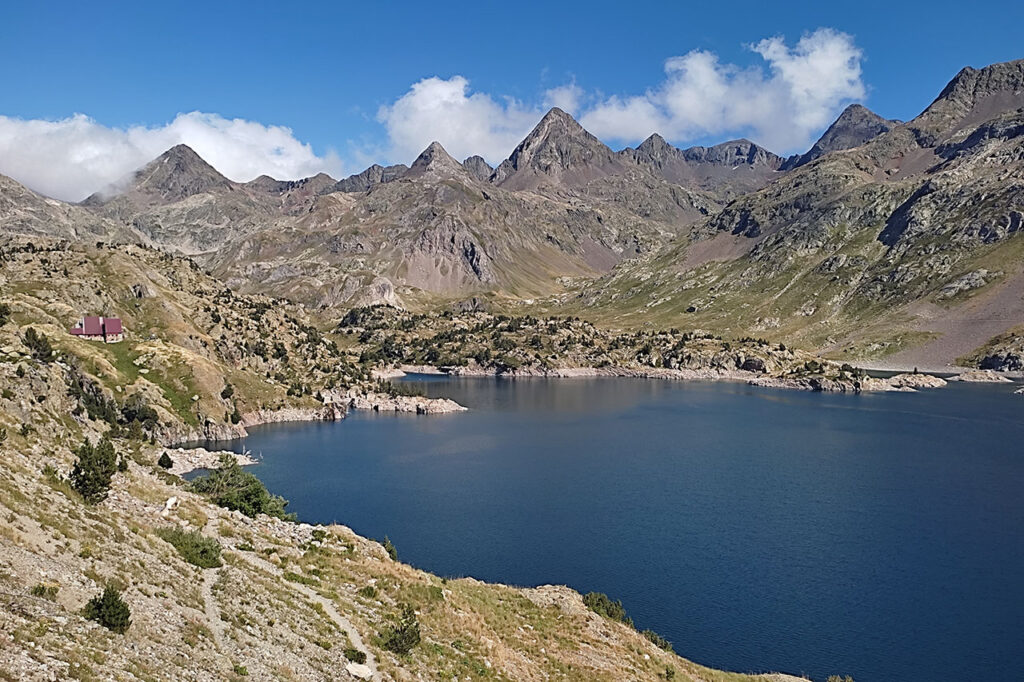
We are looking for this place #105:
This week's photograph was sent to us by Leire Muxica, a place where, coincidentally, a week ago we brought you a route (extra hint). Let's take a look at Leire's clues:
- The site is at an altitude of 2,200 metres, next to the refuge of the same name.
- It belongs to the province of Huesca.
- It is located inside the Piedrafita Cirque.
Tracks:
Solution:
This was the Respomuso reservoir and refuge, located at the foot of Balaitús. The peaks seen in the background are Gran Facha (3,005m), Pico de Campo ro Plano (2,717m), Pico de Piedrafita (2,952m), Pico de las Marmoleras (2,908m) and Pico de Tebarrai (2,886m), among others.
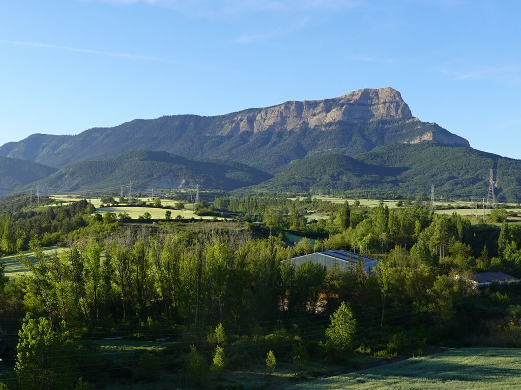
We are looking for this place #106:
The mountain we are looking for this week is one of the most picturesque in the Pyrenees, a peak 30 kilometres south of the Pyrenean axis.
- Without being a particularly high peak, its isolated location makes it one of the 100 most prominent on the Iberian Peninsula.
- To the south, from where the photograph was taken, it looks like a "volcano"; to the north, on the other hand, it encloses an elongated valley inside that resembles a horseshoe.
- Many cars have one.
Tracks:
Solution:
This was the Turbón, an exceptional viewpoint over the entire Central Pyrenees, from Collarada to Pedrafora, passing through Cotiella, La Munia, Pic Long de Neouvielle, Bachimala, Posets, Perdiguero, Aneto, Punta Alta and Puigmal. An ideal mountain to climb on a clear day and enjoy the views, or for one of those days when it is bad on the big peaks but here further south the weather holds out.
We are looking for this place #107:
The place this time was sent to us a few weeks ago by Garazi Autor, one of those places we never tire of returning to. In this case, the photo does not correspond to the place Garazi asks us about according to the clues, but to the landscape we left behind when we went to that place. Let's go there!
- Here the waters and hearts writhe.
- The beauty of this place can make you go one-eyed.
Tracks:
Solution:
With these tracks there was no doubt, we were referring to the Aguas Tuertas valley, in the Huesca Pyrenees. The photograph is not actually of the Aguas Tuertas valley itself, but of the landscape that we left behind when we reached it. In the background we can make out, standing out among all the peaks, the triangular silhouette of the Mallo de Acherito. To its left also stands out the Chinebral de GamuetaThe Gorreta de los Gabachos, the Mallo Gorreta, Anzotiello, Quimboa, Petraficha and Chipeta Alto.
We are looking for this place #108:
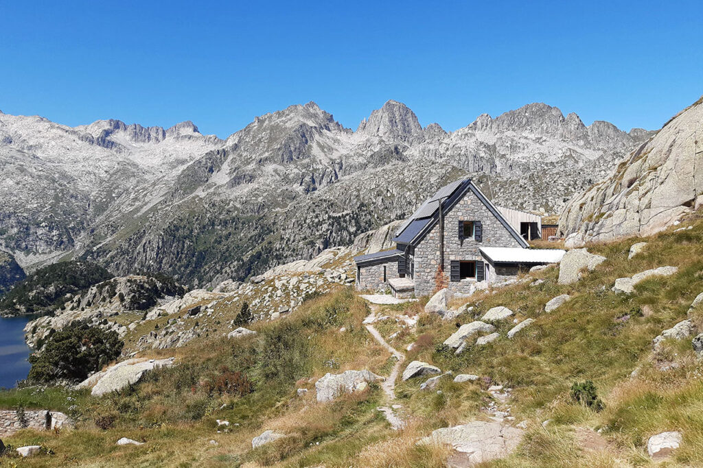
This week we are travelling to the Catalan Pyrenees in search of this refuge with an incomparable setting.
- Behind the refuge we can see several peaks of more than 3,000 metres.
- In the centre of the image is a peak named after the name by which sugar was traditionally traded in the late 19th century, as is the iconic rock overlooking Rio de Janeiro.
- The most famous one-week circular route between refuges in the Pyrenees passes through here.
Tracks:
Solution:
This was the Joan Ventosa i Calvell refuge, located at the head of the Boí valley in the Aigüestortes Natural Park. This refuge is named after a Catalan politician, founder of the Lliga Regionista and three times minister of Alfonso XIII, who decisively helped Franco during the Civil War by financially blocking the Republican government. Ventosa believed that at the end of the war he could obtain a relevant position in the future political regime. However, once the war was over, he realised that he had been used (although he made a fortune) and was one of the signatories of the "Manifiesto de los Veintisiete" (Manifesto of the Twenty-Seven) that asked Franco to restore the monarchy.
The original refuge from 1942, private property of Joan Ventosa, was originally called Estany Negre. It was in 1954 when he decided to donate it to the "Centre Excursionista de Catalunya" who named it after him in gratitude.
We are looking for this place #109:
This week we are going on an excursion to one of the most representative peaks in Navarre. Do you recognise it?
- Due to its importance and proximity to Pamplona, it is one of the most frequented mountains in the community.
- It lies on the Cantabrian-Mediterranean watershed.
- It is the highest peak in Baztan.
Tracks:
Solution:
This was Saioa (1,418m), one of the main peaks of the Navarrese mountains, the highest point of the Baztan valley and the highest peak of the range that stretches between the Velate and Artesiaga passes, from where the two most common routes start. Another interesting alternative is to climb the Saioa from LantzWe brought you a route that we brought you some time ago in which, in addition to this one, we linked a good number of summits around the Elzarrain ravine.
We are looking for this place #110:
The peaks we are looking for this week form a trilogy of three peaks located, like an appendix, to the south of one of the largest Pyrenean three peaks.
- Although in the intro we talked about a trilogy of three thousand, in the photo we only see two.
- The most common name for these peaks is the name of the town below.
- It straddles the valleys of Gistaín/Chistau and Benasque/Benás.
Tracks:
Solution:
We were referring to "Los Eristes" or Bagüeñola Peaks. Specifically to the two we saw, Eriste Norte (3,031m), also called Pico Beraldi or Bagüeñola Norte; and Eriste Central (3,056m), better known as Gran Eriste or Gran Tuca de Bagüeñola (3,056m). The Eristes are part of the Posets massif, in an area that stands out for the presence of lake basins, such as those of the two lakes that can be seen at the foot of these peaks: the ibón d'es Leners/Lenés and the ibón d'es Millars/Millares. These are two lakes that we visited some time ago on this route: Circular route to the lakes of Pixón, Solana/Luzeros, Leners and Millars..
We are looking for this place #111:
This week's challenge takes us to this small reservoir surrounded by lush forests and high mountains, on the northern slopes of the Pyrenees. Do you recognise it?
- We are located in the French department of Hautes-Pyrénées, in one of the 7 valleys that make up the historic Lavedan region.
- The snow-capped mountain in the background is over 3,000 metres high.
- This is the route of the GR10.
Tracks:
Solution:
This was the Lac du Tech with the Balaitous (3,146m), the Pourgadou (2,344m) and the Arriougrand (2,586m) in the background. The Lac du Tech is located in the Arrens valley, a secondary valley of the Val d'Azun. The gave (river) of Arrens, together with the torrent that descends from the Estaing valley, forms the gave d'Azun, one of the 3 main rivers that together with those of Cauterets and Gavarnie (Pau) make the gave de Pau, one of the most important rivers in France.
We are looking for this place #112:
This week we don't want you to tell us what you see in the picture, but the place from where it was taken.
- We are very close to a well-known mountain pass that is climbed every other year in the Vuelta a España.
- This port is actually located in the Principality of Andorra.
- The main peaks that can be seen in the background are Pic Alt del Griu (2,874m) on the left and Crestes de Gargantillar (2,843m) on the right.
Tracks:
Solution:
The photograph is taken very close to the Coll d'Ordino (1,980m), in the middle of the GR11 or Pyrenean Path. A very well known mountain pass in the cycling world, although it is not particularly hard. Its name comes from the town below it on the western slope. From this side it is 10km with an average gradient of 7%. The other side, Canilló, is easier, 9km with an average gradient of 5.1% but with some downhill in between which distorts the statistics. The Coll d'Ordino is also the starting point for two well-known mountains, the Bony de les Neres (2,211m) and the Casamanya peaks (2,757m).
We are looking for this place #113:
There are places where silence is heard, the clock stops and just contemplating them is like a breath of fresh air that invades our lungs.
- We are in the Western Valleys, as more than one might have suspected when looking at the limestone rock.
- It is located on the dividing line of the two main valleys that form the Natural Park.
- In December scarf and in May beanie.
Tracks:
Solution:
This was Mallo Gorreta (2,266m) and Gamueta Gap (2,181m). The normal route to Mallo Gorreta climbs up to the aforementioned gap to descend a few metres towards the eastern slope and ascend a beautiful channel (II) with somewhat decomposed rock, at the foot of the first Gamueta spire. In winter, this channel is transformed into a beautiful corridor that, depending on the conditions, can oscillate between PD and AD. From the Gamueta Gap itself, it is also possible to climb up a chimney (IV) that can be climbed in a single pitch. Another common activity is to join the Mallo Gorreta and the Gorreta de los Gabachos via a ridge (PD), where the greatest difficulty is centred on a very atmospheric climb.
We are looking for this place #114:
The mountain we are looking for this week is unmistakable, do you recognise it, or do you need some clues? Let's go with them:
- It is located in the Western Valleys N.P.
- Midi d'Ossau, Balitús, Frondiellas... these are the peaks we can see in the background.
- Its four sides defended by vertical walls have earned it the nickname "fortress".
Tracks:
Solution:
There was no doubt about it, it was El Castillo D'Acher, one of the essential mountains to climb in this part of the Pyrenees (See route from Oza). A climb that starts in the Selva de Oza, crossing a magnificent forest of firs and beeches, and which will surprise us with some very beautiful geological features, such as the colourful reddish rocks that we find throughout the climb or the suspended valley that crowns the summit.
We are looking for this place #115:
We love waterfalls and who doesn't? In this case, obviously, we are looking for the name of this waterfall, but not the name by which it is known and which appears on all kinds of maps, but its real name.
- We are in the French Pyrenees, next to the confluence of two large torrents that together form one of the main tributaries of the Pau Gave.
- If you want to visit it, you won't have to walk far, the waterfall is about 200 metres from a road.
- You can leave your car in the car park next to the thermal baths.
Tracks:
Solution:
It was the Pisse-Arros waterfall, better (mis)known as the Lutour waterfall. The local name of Pisse-Arros translates in French as Pisse Rosée, i.e. the waterfall that gives off foam that falls like fine pearls of water. If you want to visit it, it is located next to La Raillere, an area of shops, restaurants and hot springs, 3km from Cauterets. And if you like waterfalls, you can't miss the Waterfalls Trail between La Raillere and the Pont d'Espagne.
We are looking for this place #116:
The impregnable aspect of the mountain we are looking for this week may mislead more than one who is used to contemplating its southern slope, more accessible and friendlier, where many people start out in the winter mountains and which delights mountain skiers.
- There is no higher peak from here to the Cantabrian Sea.
- The most common route starts from the hut on the southern slope, although the route that starts from the hut on the western slope is also quite common.
- The GR11 and a variant of it completely surround this peak and are part of the main ascent routes.
Tracks:
Solution:
This was the Bisaurín (2,670m), the highest peak in this area. It is a very well known and frequented mountain in winter and summer due to its outstanding location and the accessibility of its normal routes. The most common are those that start from the Lizara and Gabardito refuges, in both cases following the GR11.1 variant up to the Foratón pass, although there are also several simple alternatives for those who want to discover them, such as the one that ascends the Plana Mistresa and the eastern slope (F), the NE ridge (F+) or the Fetas (F).
We are looking for this place #117:
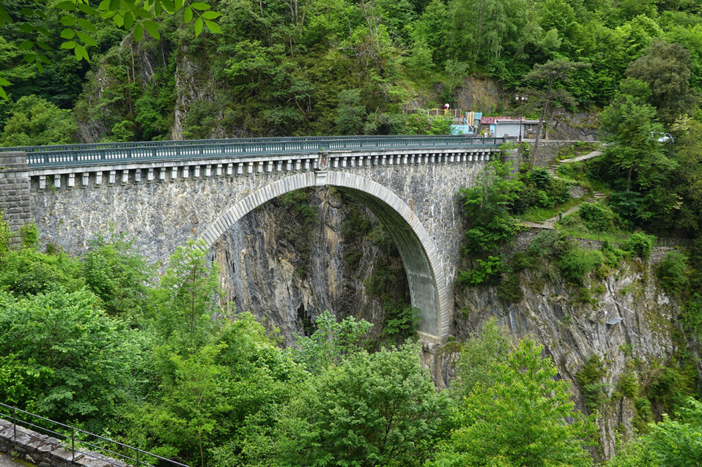
Bridges have always had a positive meaning, of union, of concord. The one we suggest you find this week is from the 19th century and is located in the French department of Hautes-Pyrénées.
- It is located at the exit of a town known, among other things, for being the start of what is probably the most famous port in the world.
- Today, the surrounding landscape attracts thousands of tourists, mountaineers and cyclists, but in former times it was aristocrats and emperors who began to frequent it, attracted by its healing waters.
- The bridge is open to vehicular traffic, bungee jumping is popular and there is a via ferrata and a climbing school at its base.
Tracks:
Solution:
It was Napoleon's Bridge, located over the Gavarnie Gave, just outside Luz-Saint-Sauveur. The bridge is named after Napoleon III, the last Emperor of France, who used to visit the thermal baths with his wife, the Empress Eugénie, in search of a remedy for infertility. It is said that both the construction of the bridge and its location were the emperor's idea. Work on the bridge was led by the engineer Bruniquel and lasted two years, ending in June 1861. It is 68 metres long and 63 metres high over the river.
We are looking for this place #118:
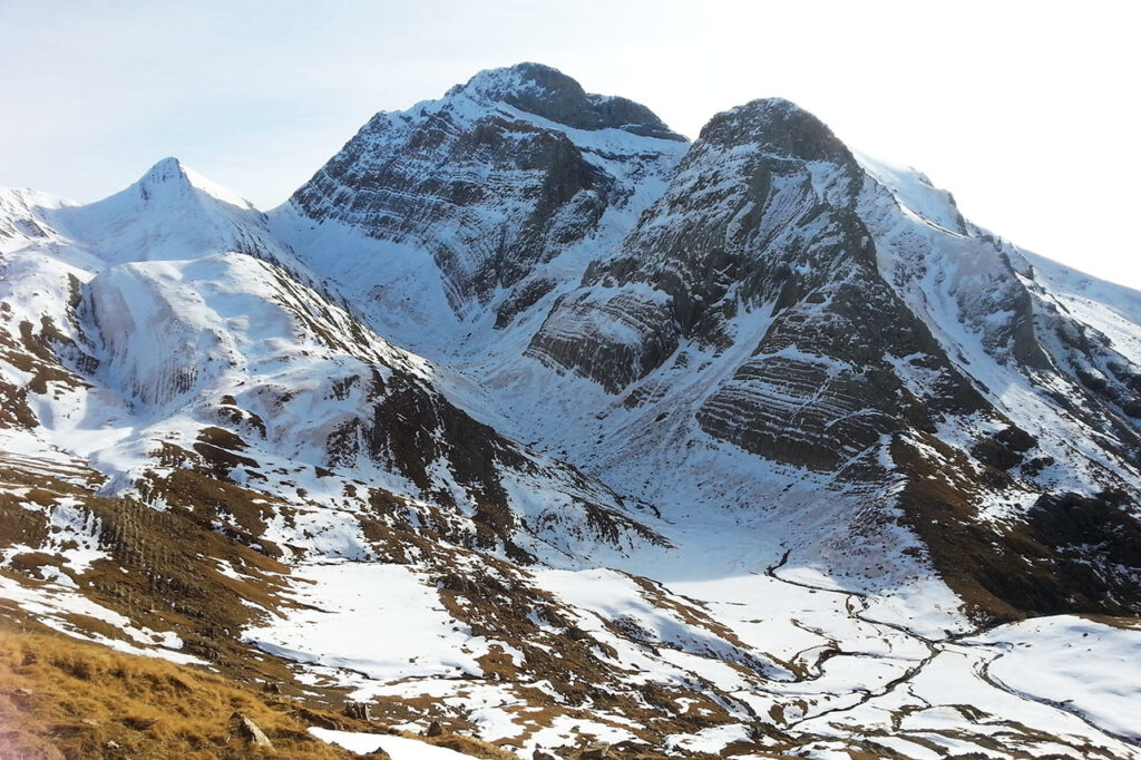
The last search of the year deserved a snowy landscape, one of those Christmas cards. A place that we love and that brings back so many memories. Surely we are not the only ones!
- The large peak on the right is the highest in the eastern sector of the sierra.
- At its base there is a well known and much visited lake.
- We are in the Tena Valley.
Tracks:
Solution:
It was about Peña Telera (2.762m)the best known and most emblematic peak in the Sierra de Partacua and the second highest after Peña Retona (2.770m). The complete panoramic view is as follows: Corona del Mallo and Peña Blanca (which practically merge into a single peak), Covachirizas channel, Peña Parda, Peña Telera, Capullo (the pointed one in the shadow), Pico Sin Nombre (the next one), Punta Plana (which stands out like a black notch from the previous one) and Pabellón (the white and sunny one which appears to be lower due to the perspective).
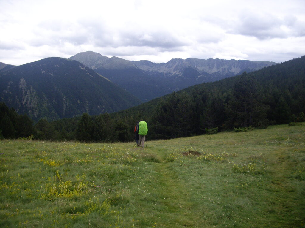
Fastpacking is not about going faster. It's about going lighter.
If you come from classic trekking, this is the next step: learning to move with less weight,
more fluid and enjoying every kilometre more.
Join the Outsiders Newsletter and start discovering what lightness feels like.