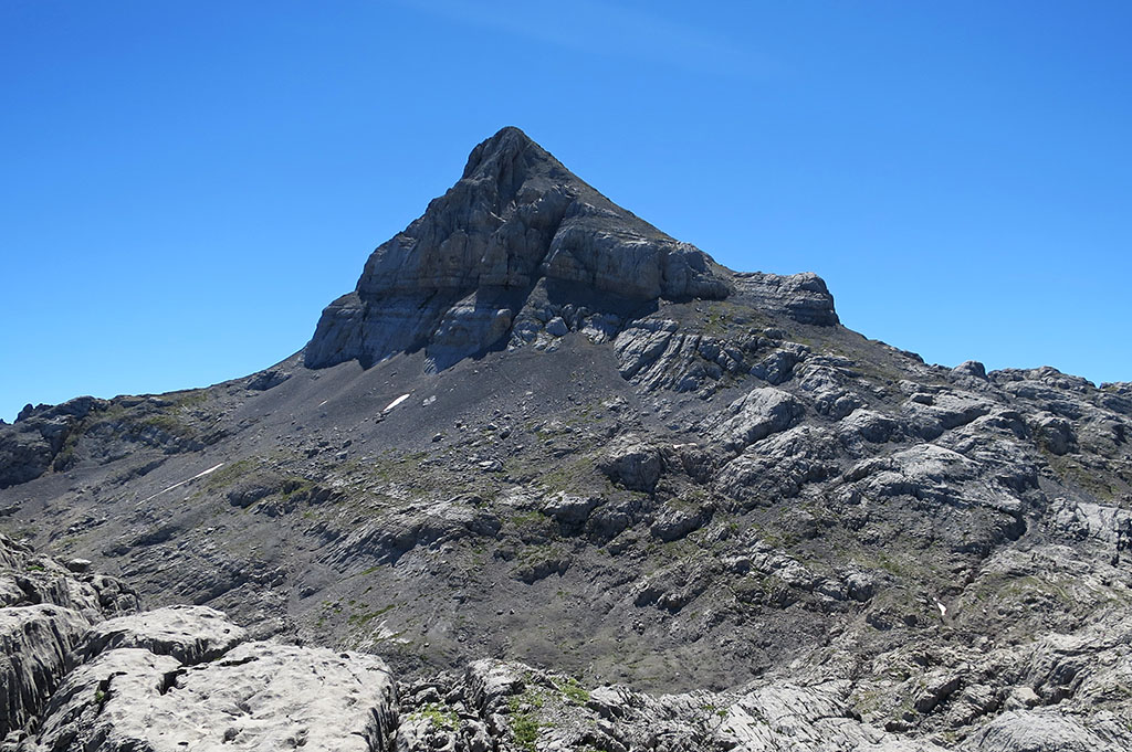
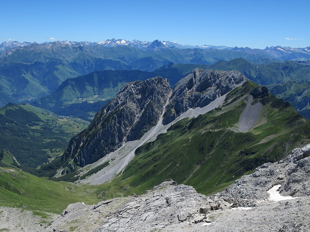
Anie (2,504m), Arlas (2,044m), Castetné (2,342m) and Añelarra (2,357m), from the Piedra de San Martín.
Pyrenees and mountains 📩
Here 🔥SUMMARY
Anie, Arlas, Castetné and Añelarra from the Piedra de San Martín. This route, which departs from the Ernaz passnext to the San Matin Stoneis the most common way to go up to the Anie. Depart in a westerly direction, towards the Arlas peakwhich can be climbed or skirted from the south to the Pescamou pass. The path runs along the Murlong and enters the karstic zone of the Arres d'Anie. The ascent to the Anie is done along the southern slope, with no technical difficulties. The return journey usually follows the same route. If you want to complete the day with the Añelarra, second highest peak in NavarreWe turn off at the end of the descent of the terminal ridge in a south-easterly direction. The milestones pass by the top of CastetnéWe can also take the opportunity to climb it. From the top of Añelarra descend in a northerly direction to join the route up to the Anie in the karst.
MAP
DOWNLOADABLE
THE ANIE / AUÑAMENDI
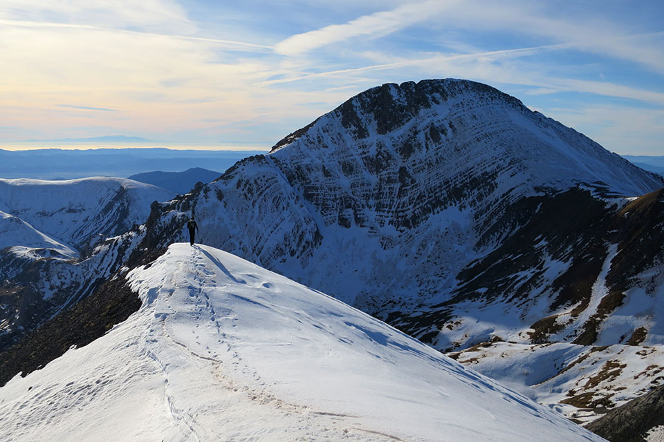
The peak of Anie/Auñamendi is the highest mountain in the Larra massif and the first to surpass the 2,500m barrier from the Atlantic Ocean. A sacred mountain in Basque mythology, it is located in French territory (Bearn), very close to Navarre and near to the Three Kings TableIt exceeds it by 60m in altitude. The Anie is the prototype mountain. From the west it appears as a perfect pyramid of greyish rock, isolated from the other peaks which it surpasses by far in altitude, dominating the great karst plateau as if it were a petrified glacier.
HOW TO GET THERE
After passing Isaba (Roncal valley), the NA-137 road enters the valley of Belagua and climbs up the mountain pass of St. Martin's Stone to the same border with France. From Isaba it is just over 29kms. To the right of the pass there is a large car park where you can leave your car.
TECHNICAL DATA
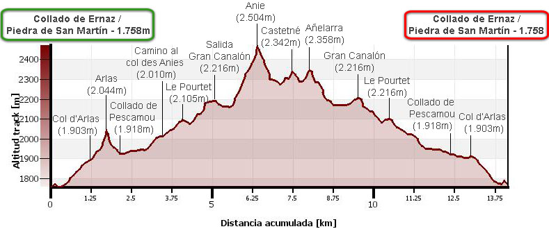
Distance: 14.2 kms.
Cumulative difference in altitude: 1.200m.
Timetable: About 9 hours. Walking time without stops: 7h50min. Subtract 20 minutes if you do not climb the Arlas and 1h15min if you do not climb the Añelarra.
Water: The only fountain on the route is at the beginning of the route, 2 minutes from the col d'Arlas. Bring at least 2 litres of water per person on hot days.
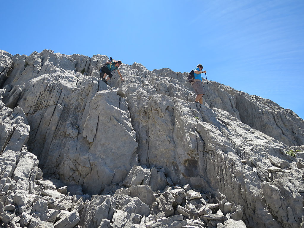
Difficulty: The terrain is very complex; cracks, holes, chasms... and leaving the usual paths can be a headache. It is advisable to carry a GPS, especially in foggy weather, which is very common in this part of the Pyrenees. In spring, with the thaw, it is a route to avoid, as we may find snow bridges that collapse in our path. Although neither the Anie nor the other peaks on this route present any technical difficulties, crossing the karst is difficult, especially in the Añelarra area.
Recommendations: The ascent of Añelarra does not add much to this route in which the Anie is the undisputed protagonist. A much more honourable way to climb the second highest peak in Navarre is from the Contienda car park, a solitary, demanding and beautiful route.
ITINERARY
(0h00min; 0,0kms) Col of Ernaz / Stone of San Martín (1.758m). Large car park with information panels on the ascent to Anie and Arlas. Take the well-marked path that starts next to the Piedra de San Martín, between meadows and black pines.
After 10 minutes you pass a small pond, which you leave on the left.
(0h25min; 1,2kms) Col d'Arlas (1.903m).
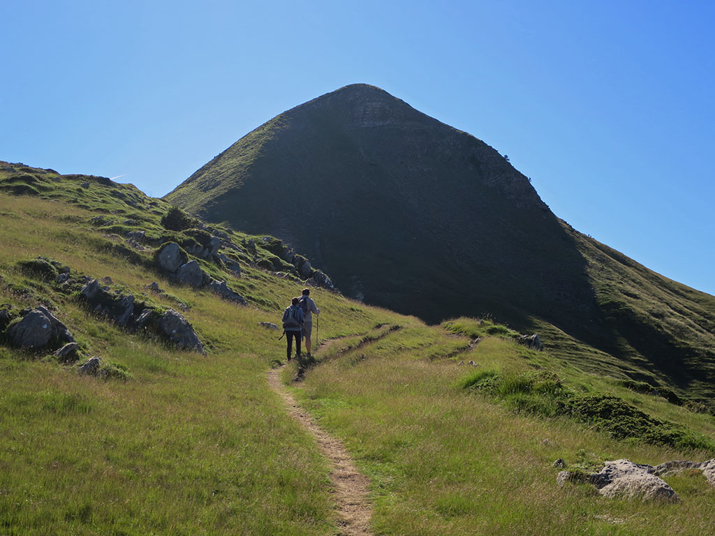
The path to Anie continues to the pass of Pescamou (0h35min; 1,6kms) along the right hand side of the peak of Arlas, passing by the fountain of La Contienda, 2 minutes away. If you want to climb to the peak of Arlas, take the path on the left that goes round it on the left and zigzags up the northern slope.
(0h45min; 1,7kms) Arlas (2.044m). The panoramic view of the Anie, the karst plateau and neighbouring peaks is fabulous, marred only by the ski slopes of the Arette ski resort.

A steep descent leaves us at the...

(0h55min; 2,2kms) pass of Pescamou (1.918m). The path climbs through meadows to the Baticoche pass (2.6kms) and the speleologists' refuge (2.9kms). Here the first rocky sections begin before entering the lapiaz. The path goes around the Murlong on the left. Keep an eye out for the red waymarks to follow the correct path at the numerous forks, which almost always join up again shortly afterwards.
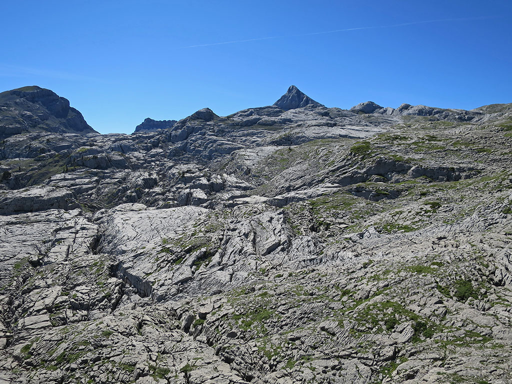
(1h30min; 3,4kms) Crossing the col des Anies (2.010m). On the left hand side, a marked path descends between a rocky corridor, which is often used as an alternative route to the Anie; straight on, we continue climbing alternating grassy and rocky sections until we reach the...

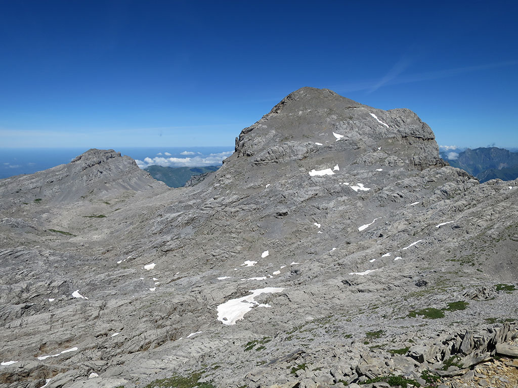
(1h45min; 4,1kms) Le Pourtet (2.105m)The path then descends slightly before climbing uphill to a characteristic rocky corridor with the Anie as a backdrop. The path descends slightly before tackling a climb that ends in a characteristic rock corridor with the Anie as a backdrop.
On some maps (OSM), the highest peak on the right is called Le Pourtet (2,238m).
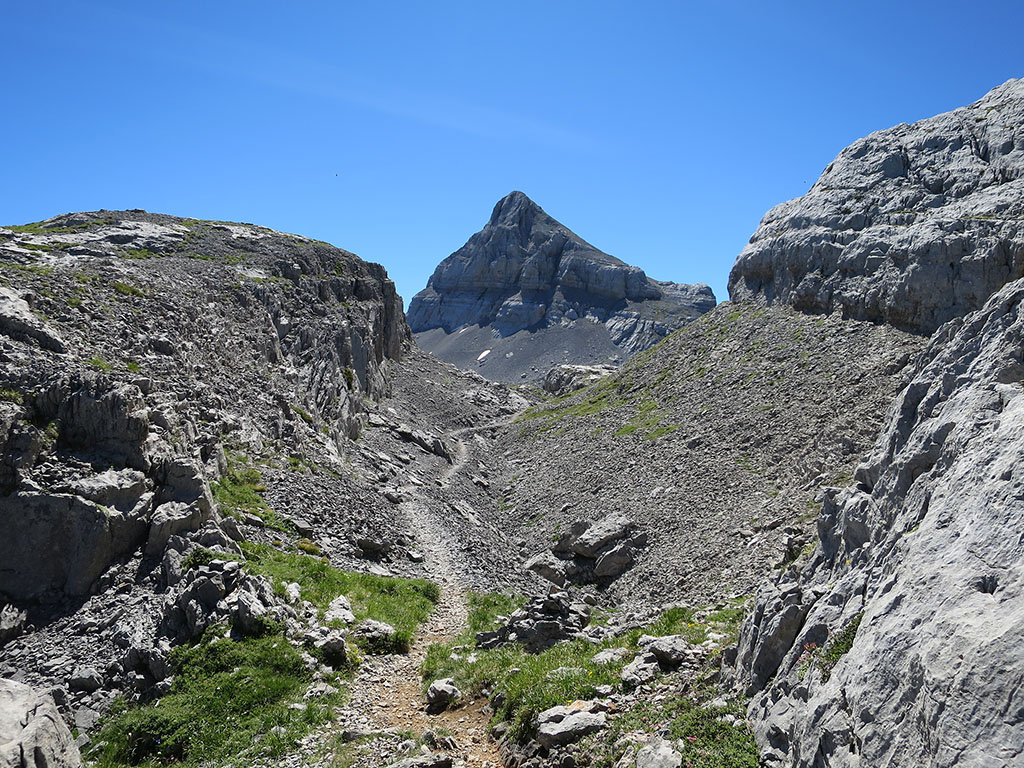
(2h30min; 5,1kms) Start of the big chute (2.216m). From here you can see the final stretch of the ascent. The milestones descend to the right to cross a very fractured area of karst, after which the final ascent begins.
At the base of the pyramid, the path rejoins the Col des Anies variant. The path climbs to the right to reach the end of the slope, which leads up to the summit with no difficulty other than the steepness of the slope.
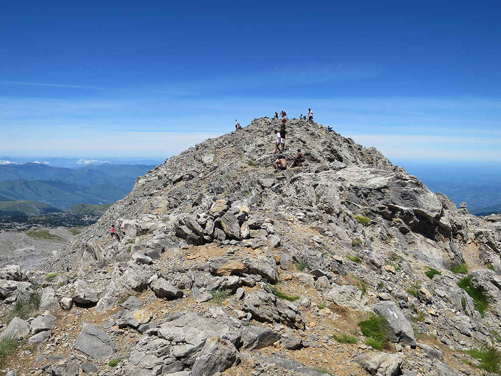
(3h50min; 6,4kms) Anie (2.504m). Great panoramic view over the neighbouring peaks, Lescún valley, Bisaurín, Collarada, Midi d'Ossau, Balaitús, Sesques or the mountains of Gourette, among many others.
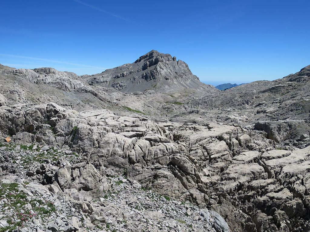
For the Añelarra, the descent follows the same route for the first 10 to 15 minutes. After descending the final slope, the path turns right heading west towards the Arres d'Anie. Be careful at this point to take a path to the left (marked in red) which you leave immediately (left), to continue along the base of a wall. The path is marked with milestones and runs along the western slope, that of the Arres d'Anie, without approaching the cliffs on the Lescún side. Leaving the milestones and climbing up to Castetné takes less than five minutes.
(4h40min; 7,5kms) Castetné (2.342m). Descend to the pass between Castetné and Añelarra and follow the milestones on the left, or straight on, with an eye on the...
(4h55min; 8,1kms) Añelarra (2.357m).
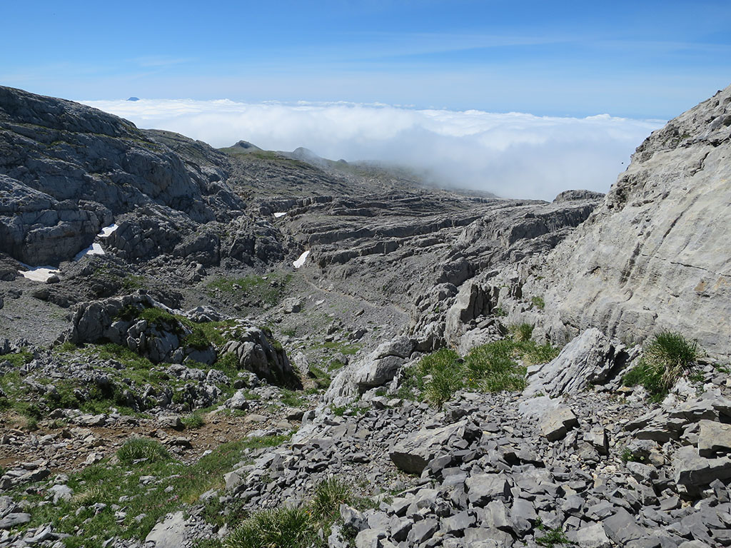
To return to the path up to the Anie, we have to cross the most chaotic section of the route.
From the summit itself you can descend in a northerly direction and turn right until you find a series of milestones; or retrace the final stretch of the summit and descend to the north to follow the same series of milestones. It is a rather chaotic section where it is very difficult to advance. There are times when we will not see any milestones and others when we will find them on both sides. The best thing to do is to follow your intuition until you find the...
(5h40min; 8,9kms) uphill (2.184m)We will be back.
(6h00min; 9,5kms) Entrance to the big gully (2.216m),
(6h30min; 10,5kms) Le Pourtet (2.105m),
(6h45min; 11,1kms) Crossing the col des Anies (2.010m),
(7h10min; 12,4kms) Col of Pescamou (1.918m),
(7h20min; 13,0kms) Col d'Arlas (1.903m),
(7h50min; 14,2kms) Col of Ernaz - Stone of San Martín (1.758m)
NEARBY YOU MAY BE INTERESTED IN
Circular to the peak of Acherito from the Linza refuge, passing through the Paso del Caballo, the Paso del Oso, the Plana de Diego...
Pico de Secús is one of those summits for those who seek solitude. Its peak is isolated, differentiated from the rest of the...
Fastpacking is not about going faster. It's about going lighter.
If you come from classic trekking, this is the next step: learning to move with less weight,
more fluid and enjoying every kilometre more.
Join the Outsiders Newsletter and start discovering what lightness feels like.