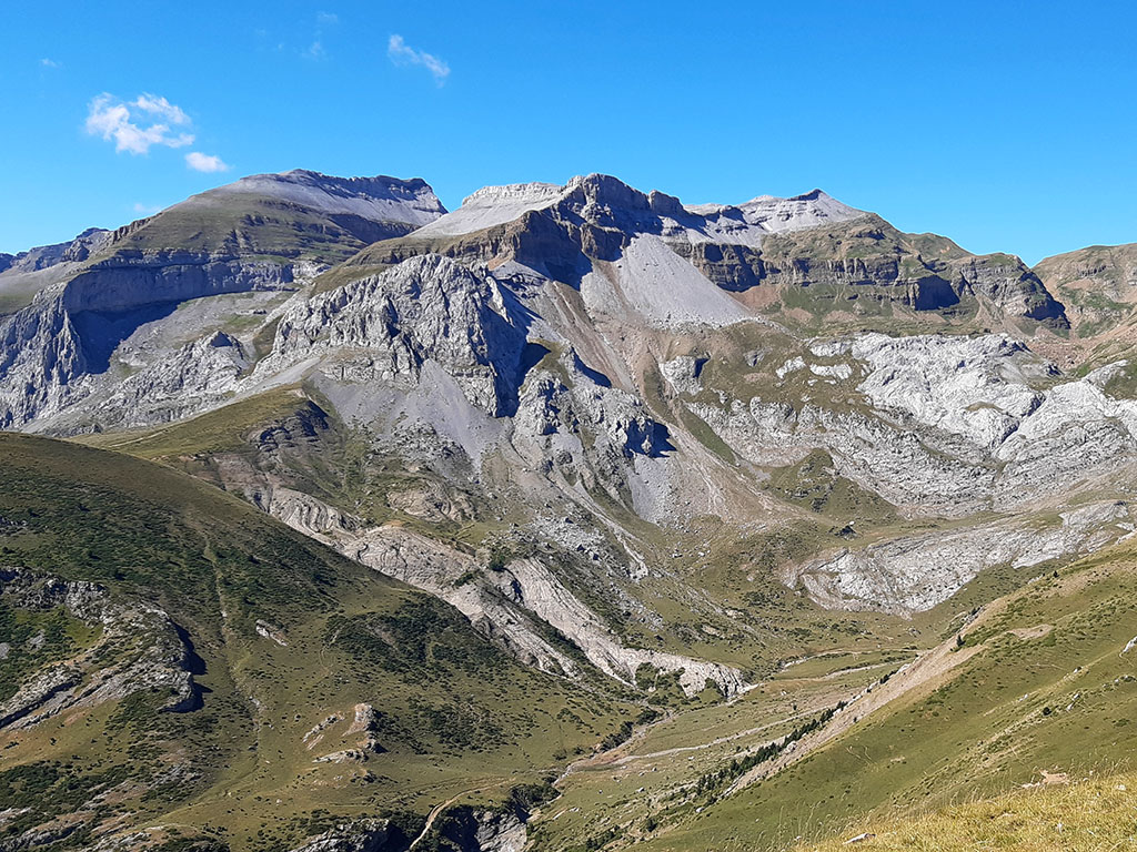
Peña Retona (2.770m), Puerto Rico (2.753m), Pabellón (2.707m), Petruso (2.198m) and Punta d'Icún (2.141m) from Acumuer
Pyrenees and mountains 📩
Here 🔥Very long and steep circular route to the westernmost peaks of the Sierra de Partacua. A classic ascent along the Aurín river track and the Canal Plana Pass to Peña Retona (2.770m). Return to Canal Plana Pass and crest the peaks. Puerto Rico (2,753m) y Pavilion (2.707m) to the exit of the Pacines channel. Descent through the Zecutar ravine and ascent to the Petruso Peak (2,198m) and the Punta d'Icun (2,141m). Return along the GR15 to Acumuer.
TECHNICAL DATA
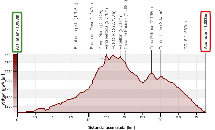
Distance: 26,3kms.
Cumulative difference in altitude: 2.500m.
Timetable: about 13 hours. Walking time non-stop: 10h30min.
Water: In the first half of the ascent there are some streams, although they have the problem of being in an area with a lot of livestock. There is no water on the descent. Plan for 3 litres of water or more on very hot days.
Difficulty: very high because of the distance but above all because of the difference in altitude. The final part of Peña Retona has a very easy climb, while the crossing of the Puerto Rico and Pabellón peaks is not technically difficult. The final sections of the ascent to the Canal Plana and Peña Retona, like the descent from Los Pacines towards Plan d'Igüés through the Zecutar ravine, are on unstable rocky slopes and areas of boulders that make progress very difficult. However, the most complicated part of this route is halfway up, in the area known on some maps as Forau del Onso and Balcón de Pilatos. Here we will have to look for the weak point to overcome the rock barrier that closes off the pass and which, without any major problems, consists of overcoming a couple of metres of grade II overhang on a small ledge with hardly any exposure.
Recommended equipment for the summer: light boots (recommended for the rocks) or trekking shoes, walking sticks, GPS (optional), canteensome food, sun protection, sunglasses...
Alternative routes: If instead of going up to Peña Petruso, we go down the Plan de Igüés track, we will save almost 400m of height difference. The track can be seen quite close before starting the ascent to Petruso. The ascent and descent to Peña Retona by the same path has a difference in height of 1,700m and the same distance as this circular route.
ITINERARY:
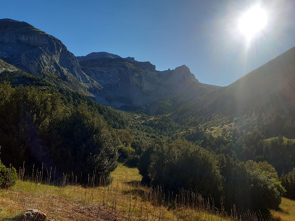
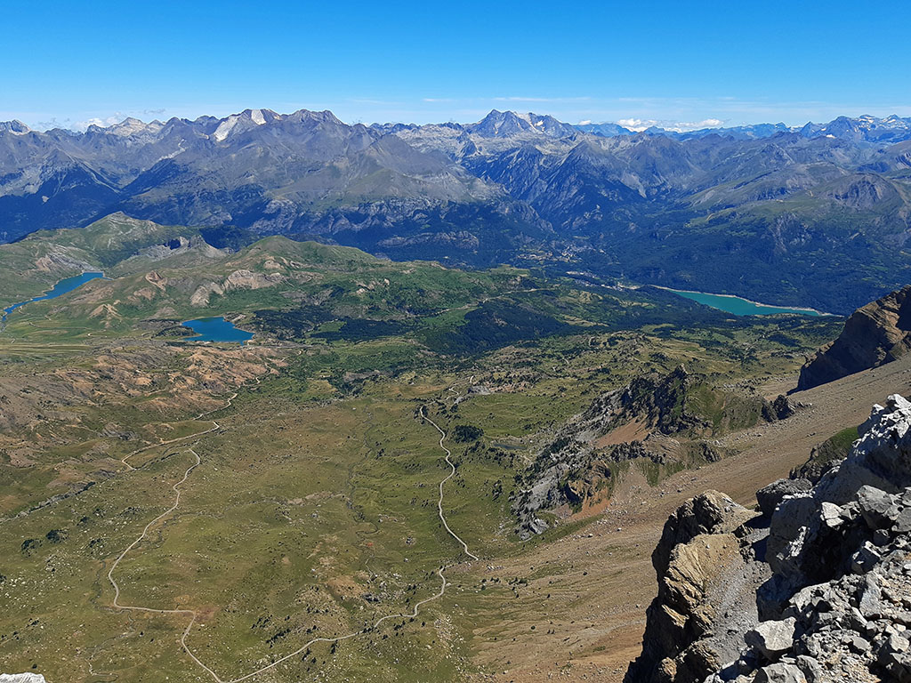
(0h00min; 0,0kms) Acumuer - Pista (1.088m). Just below the village of Acumuer, on a horseshoe bend to the right, begins the Acumuer valley track (Aurín river), which is closed to traffic. We start to walk along the track which soon crosses the GR15, the path we will use on the way back. At first the track is easy enough to do on a bicycle, although later on, some steep and rocky climbs make you think that it might not be a good idea. The valley is covered by extensive pine woods and boxwoods, which later give way to cooler vegetation as we gain altitude. You pass a fountain (0h20min; 1,8kms), a pipe that collects the water that runs off a wall, and soon after that you cross a gate. A path on your left (0h30min; 2,4kms) takes you around a bend of the track. You pass another metal gate (1h00min) and come to a bridge over the gorge of Zecutar (1h15min), just after passing another gate. Soon after that (1h20min; 6,2kms), on your right comes the track that you can use as an alternative on your return.
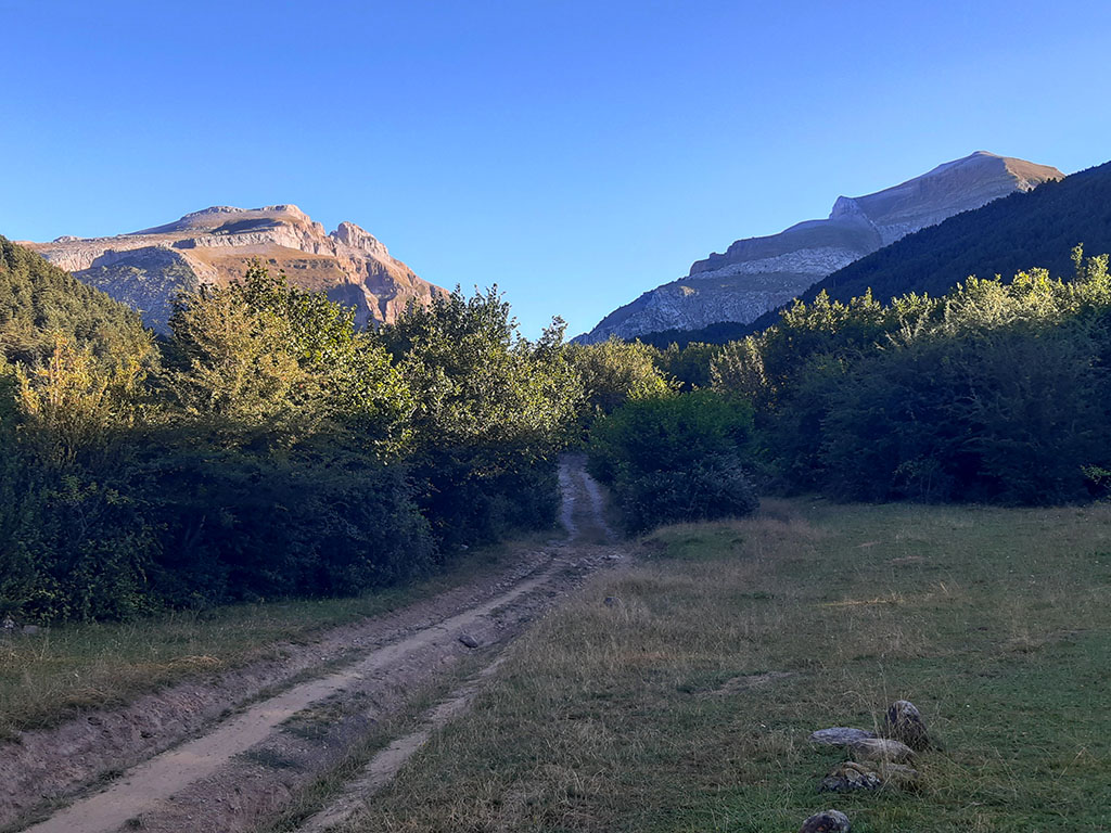
On one side is Somola Baja and Alta and on the other, Punta Blanca.
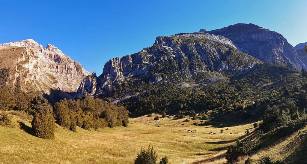
(1h50min; 8,2kms) End of the track /Campos de la Costera (1.516m). The valley is cut by a rocky strip with a waterfall at the base, the Cura Pass gorge. The track ends just before, in a sloping meadow with box trees (Campos de la Costera). A milestone marks the place where you leave the track and go up to the right in search of a path that crosses the meadow from one side to the other at the top. Once you are on it, the path crosses the beech forest in a SE direction and goes uphill to a nice meadow, the Plana del Rincón, just at the moment when you cross a fence (2h05min; 8,8kms).
Continue to the right next to the wire fence, following the contours of the slope until you change valley (Cantal ravine). The path is somewhat diffuse and there are hardly any milestones to be seen.
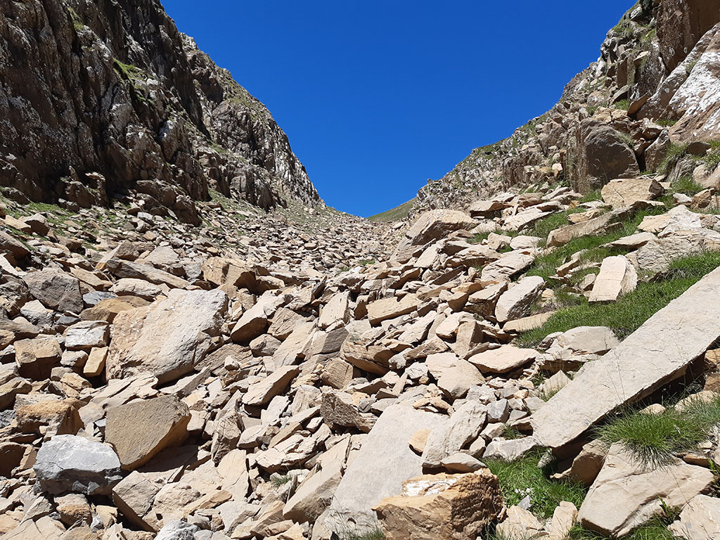
With a bit of intuition, we will limit ourselves to following the main riverbed as far as the place where the different ravines that form it converge. At this point, taking advantage of the last stretches of grass, we head towards the valley that opens up to the left and is interrupted by a rocky strip. Climb up along the dry riverbed to the base of the rocks.
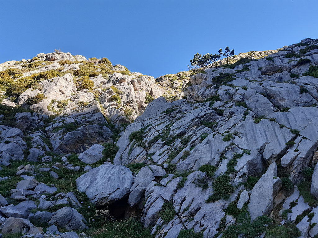
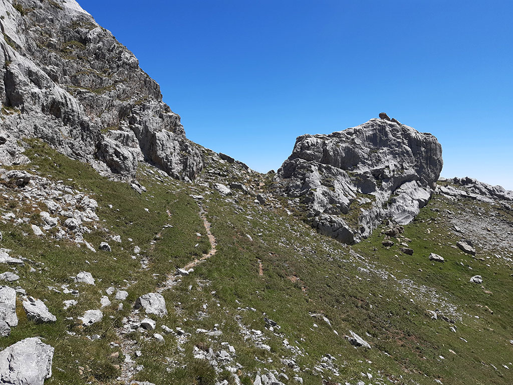
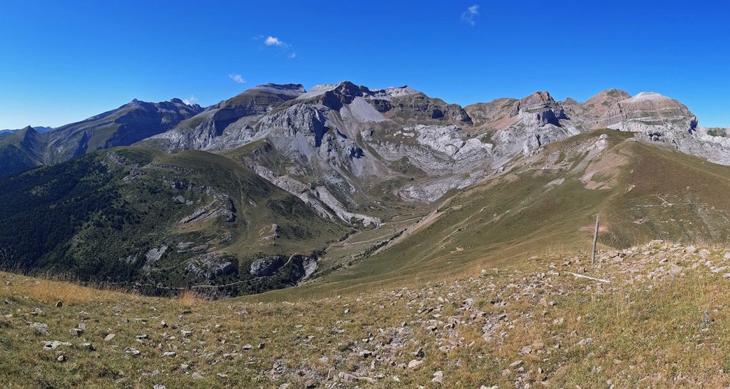
(3h05min; 10,5kms) Forau del Onso (1.942m). We will overcome the base of the rocks until we reach a marked crack in the centre-left of the wall, through which we will climb. The maximum difficulty consists of a couple of metres of a grade II pitch, on a small ledge, with hardly any commitment. At the exit of the wall, we continue along the grassy channel on the right and then to the left, avoiding a buttress. We continue along the valley bottom until we reach the Paso de la Canal Plana, the left most gap of all.
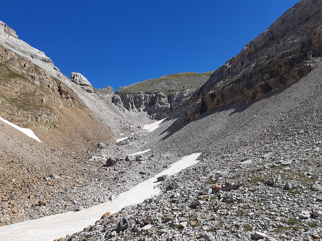
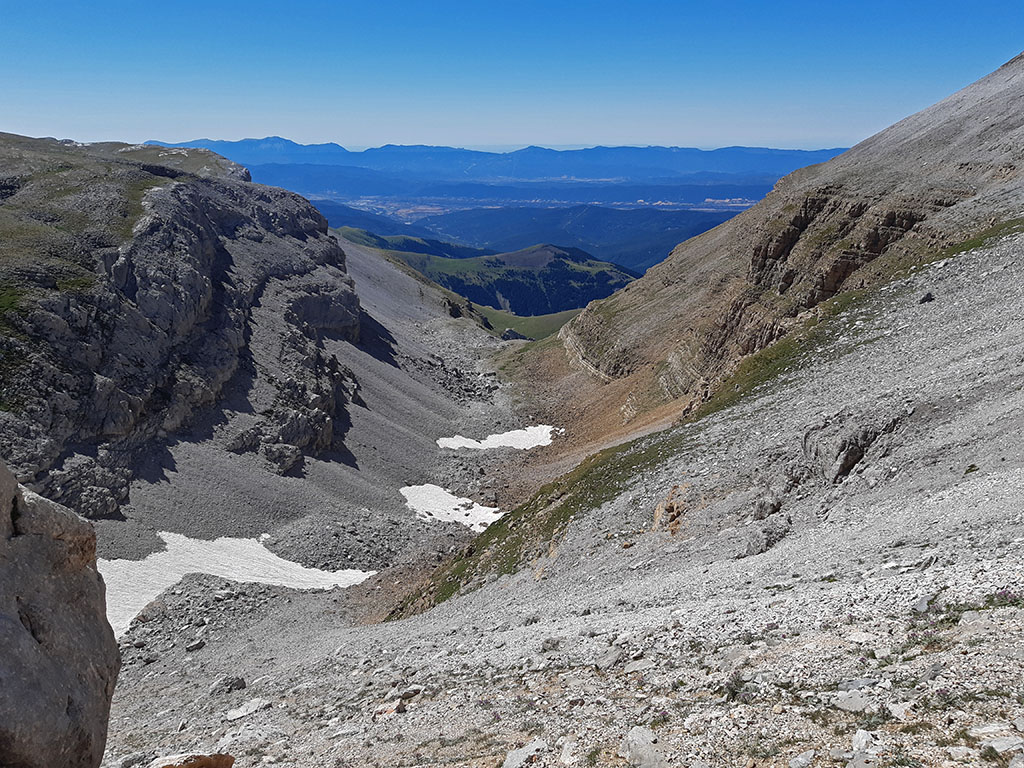
(4h40min; 12,2kms) Pass of the Canal Plana (2.612m). We go around a small strip of rocks on the left and ascend to the right, until we are just below the summit, which we reach with little difficulty by overcoming a small stretch of rock.
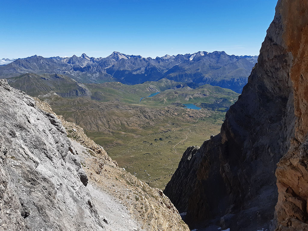
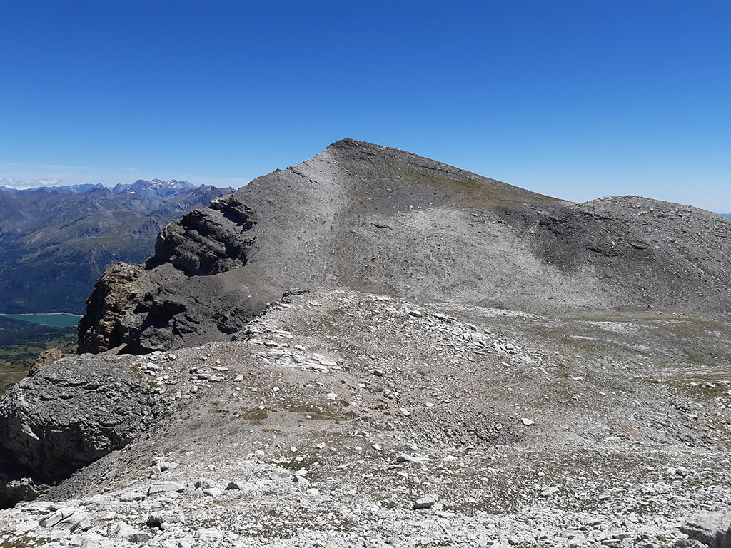
(5h00min; 12,5kms) Peña Retona (2.770m). The highest peak of the Partacua mountain range. Good views of the peaks that make up the cirque of Ip, the Central Pyrenees and the nearby Puerto Rico.
We descend again to the Canal Plana Pass where the Canal Ancha or Canal Plana leads, the normal ascent route on the northern slope, which is very exposed due to the slippery terrain. This other route is preferable to climb in winter with ice axe and crampons when conditions are good. The next ascent to Puerto Rico is much more comfortable than to Peña Retona.
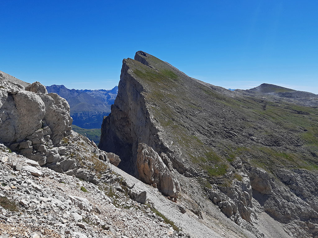
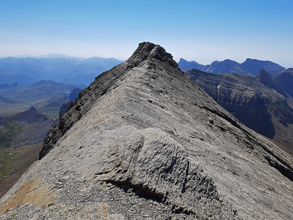
(5h45min; 13,3kms) Puerto Rico (2.753m).
We continue close to the edge of the sierra up to the...
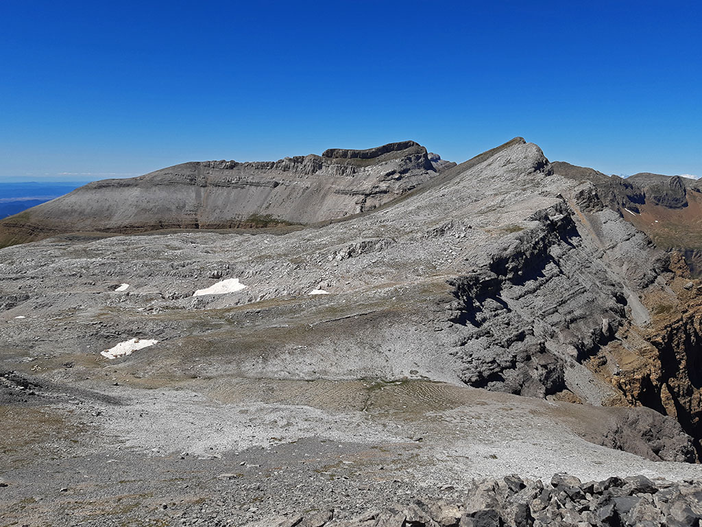
(6h10min; 14,3kms) Pavilion (2.707m), from which the rest of the ridge can be observed at Peña Telera.
We descend to the next pass, the start of the...
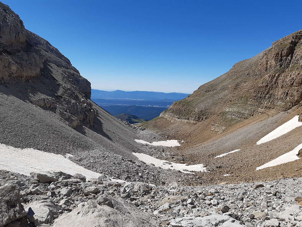
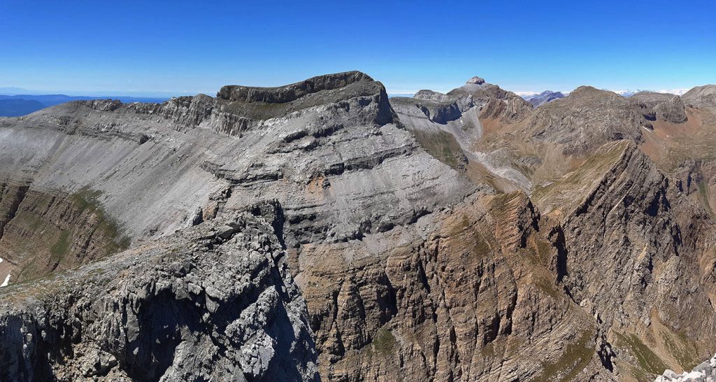
(6h35min; 15,2kms) Canal de Pacines (2.468m). Like the wide or flat channel, it is very exposed due to the slippery terrain. Descend through the valley that opens up to the south between blocks, the gorge of Zecutar, until you reach a depression (7h05min; 16,5kms) with a characteristic small pass on your left hand side between limestone rocks.
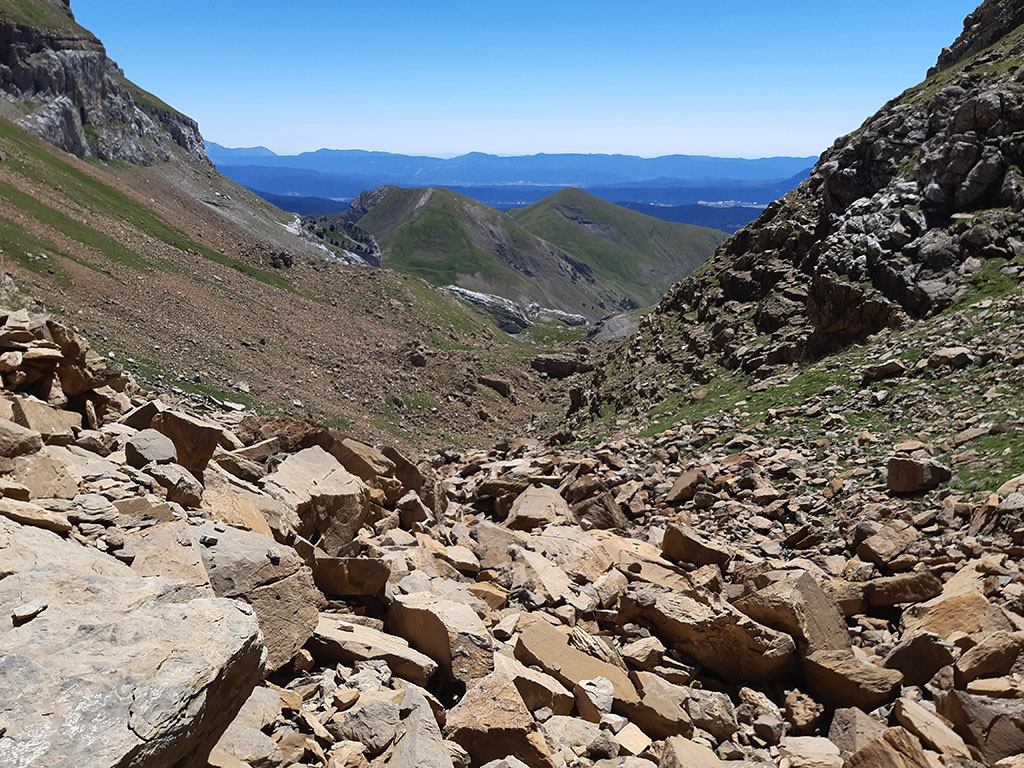
We cross the pass, with good views towards Peña Gabacha, and descend through the grass to a point where the rocks on the right allow us to cross them. We now descend to the left (SE) along a rocky corridor towards an area where the slope decreases. We head towards the pass that can be seen between Peña Gabacha and Peña Petruso without worrying too much about losing a little height, which is preferable to getting back into the rocky crags.
Finish the descent (7h30min; 17,5kms; 1.920m) and start the ascent to the pass (7h40min; 17,8kms) and the...
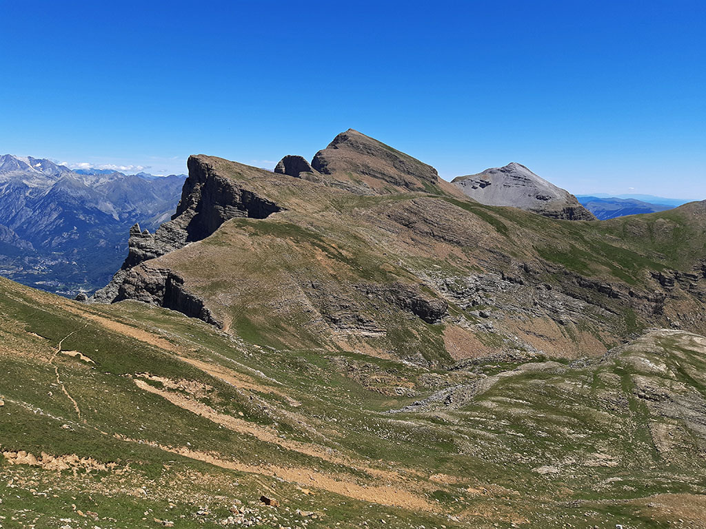
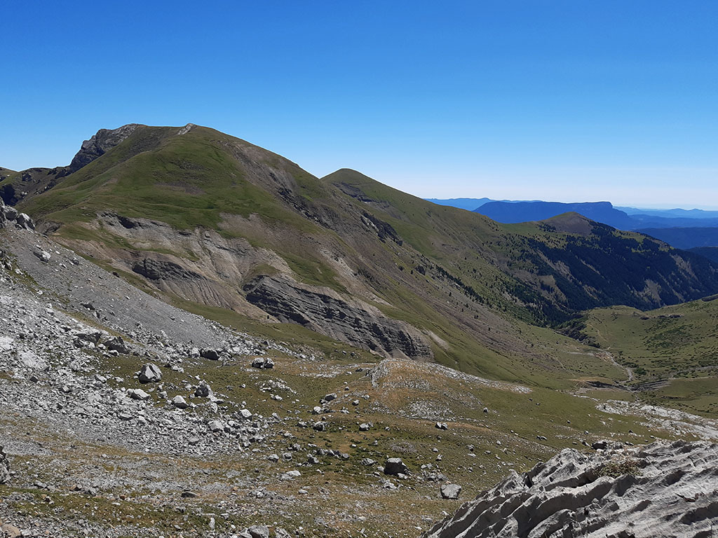
(8h05min; 18,6kms) Peña Petruso (2.198m). Fabulous viewpoint over the southern slopes of the Partacua mountain range. The route continues following the ridge southwards over a pass (8h20min; 19,5kms) and ascends to the...
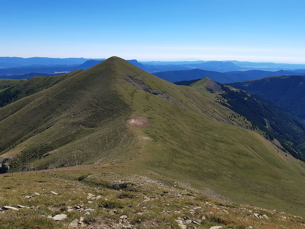
(8h40min; 20,1kms) Punta d'Icún or Cerro de las Canales (2.141m). From here we can see Peña Retona and almost the entire length of this route.
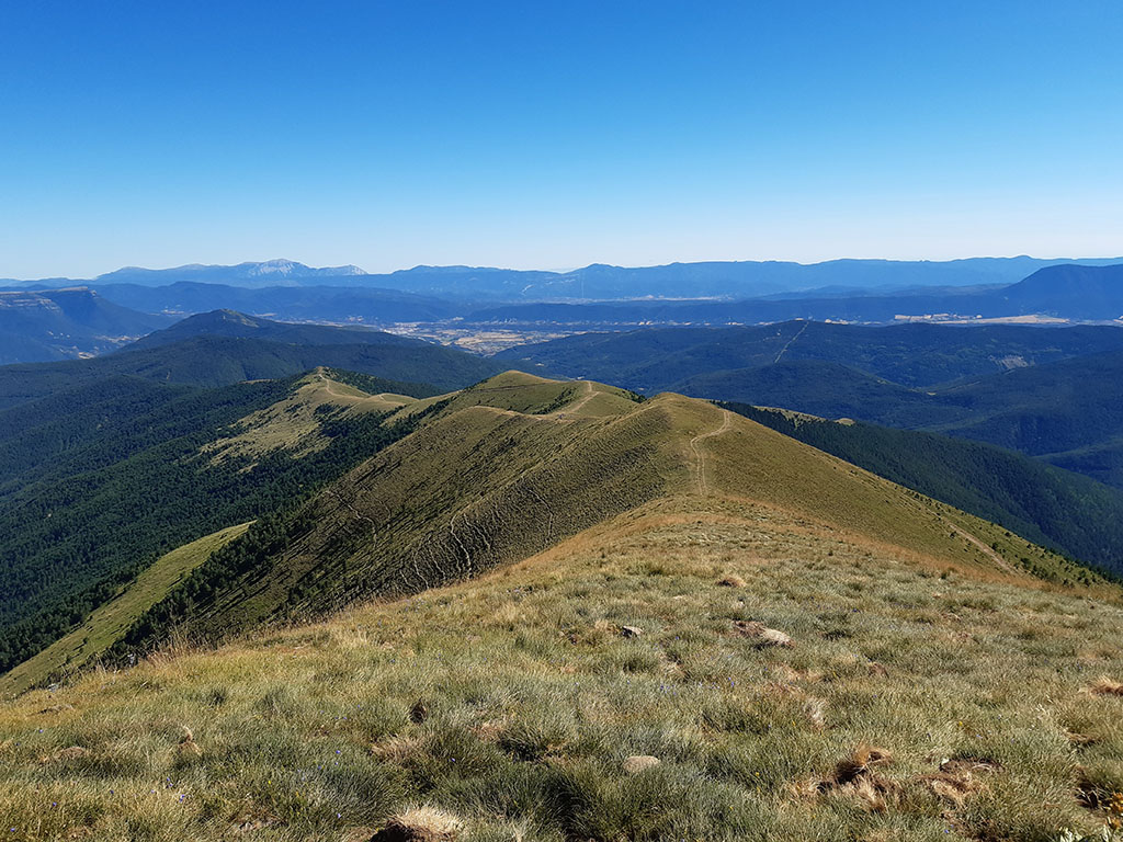
Descend along the ridge to a track (it does not lead to Acumuer) which we will follow for a little over a kilometre until a turning to the left. Leave it to follow the ridge in a SW direction, up to where the trees begin. Without reaching the forest, we cross to the left through the pasture until we find the...
(9h35min; 23,5kms) GR15 - Pre-Pyrenean Path (1.582m). A well-marked path with red and white markings along which we continue to Acumuer. We leave the church on the right hand side and just below it, we take the crossroads on the left that leaves us on the road.
(10h30min; 26,3kms) Acumer - Pista (1.088m).
NEARBY YOU MAY BE INTERESTED IN
Circular ascent of the Pala de Ip and La Moleta along the Tronquera ridge from the Coll de Ladrones (20.3kms; 1840m; 9-10 hours).
Fastpacking is not about going faster. It's about going lighter.
If you come from classic trekking, this is the next step: learning to move with less weight,
more fluid and enjoying every kilometre more.
Join the Outsiders Newsletter and start discovering what lightness feels like.