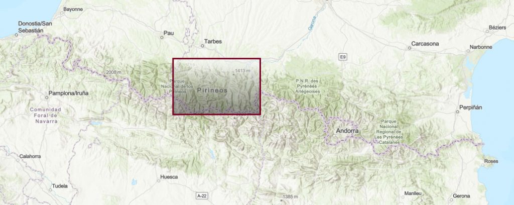
Pyrenees. Single Peaks #2: Hautes Pyrénées and Haute Garone.
Pyrenees and mountains 📩
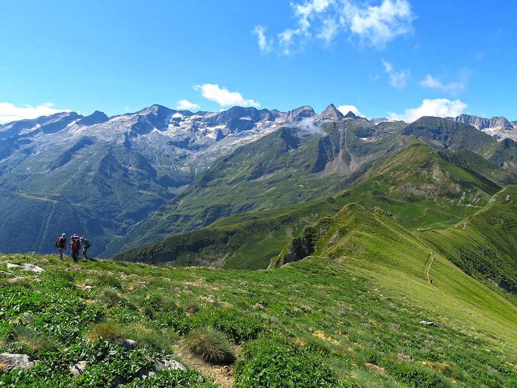
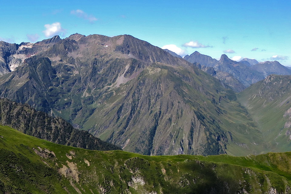
Here 🔥We continue the search for those great "lonely peaks" across the Pyrenees that we started with a previous article on the "lonely peaks". Western valleys. Large, little-visited, "forgotten" mountains, but which, because of their beauty or importance, are worth a visit.
In reality, many of them are quite well known peaks in their area and among the regular climbers, and the reasons for their lack of suitors have more to do with the proximity of other, better known peaks that are the focus of all the attention. Other times the "problem" is that they lack the comforts of a sheltered hut, long approach walks, big slopes or having to overcome a climbing pass, those inconveniences that for others are just the essence.
Hautes Pyrénées and Haute Garone
On this occasion we have covered the French departments of the Hautes-Pyrénées and Haute-Garonne, including several of the main Pyrenean massifs such as the mountains of Gourette, Balaitús, Vignemale, Barbat, Neouvielle, Arbizon or the area of the Grand Bachimala.
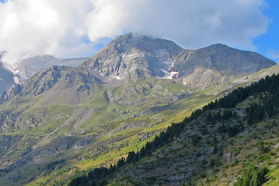
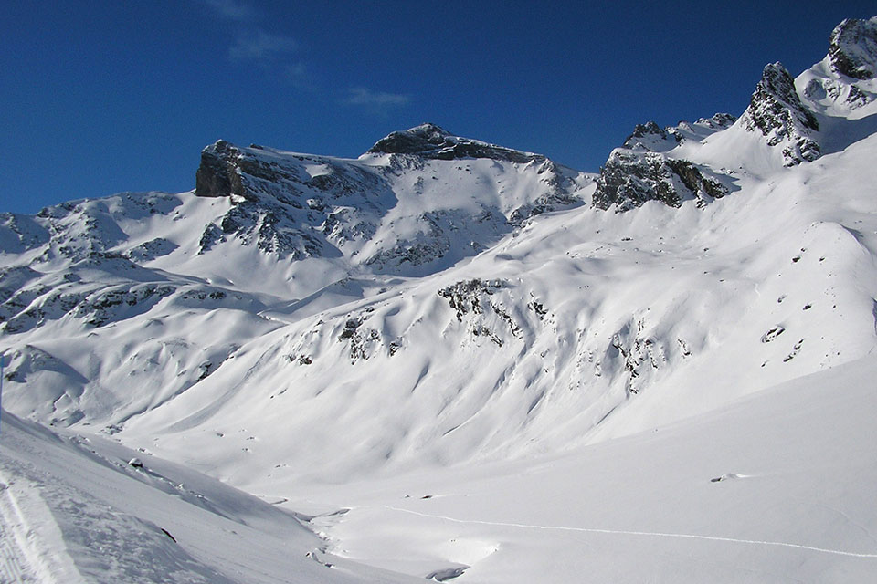
1. Grand Gabizos or Pic des Taillades (2.692m)
To the north of the Pyrenees, a massif of sharp ridges rises above the area of the Gourette ski resort. From the road to the Col de l'Aubisque, the Pic de Ger stands out, with a blunt appearance and somewhat spoilt by the presence of the ski resort, or the modest Pene Sarrière, famous for the route that runs along the very sharp southern ridge (AD). Continuing eastwards along the succession of ridges, on the col du Soulor there is another more secluded sector where there is a beautiful mountain which represents the culminating point of this range, the Grand Gabizos or Pic des Taillades.
To reach the summit, the most common routes are two, the one from the Litor valley and the one from the Gourette ski resort. A great option is to combine both routes if you have two cars or by following the GR10 (19kms; 1,800m).
For the Litor circus (Climb: F; Distance: 13 kilometres round trip; Approximate time: 6 hours; Elevation gain: 1,400m). The starting point is on the D918 road between the col de l'Aubisque and the col du Soulor, 4 kilometres from the latter. This is the quickest and easiest route to climb. From the road, take a path that climbs through forest at first and then continues up the valley on clear ground. On the way up we pass the Larue hut and the col de Pèneblanque, already on the ridge next to the Pic de Louesque, which we can also take the opportunity to climb. To reach the Grand Gabizos from the col de Pèneblanque, we follow the ridge with the help of our hands on some somewhat aerial but easy steps.
From Gourette (Climb: F; Distance: 15 kilometres round trip; Approximate time: 6-7 hours; Elevation gain: 1,300m). The route climbs up the valley to the east of the Pene Sarriere, passing the Coste de Goua hut, the Louesque lakes and the Louesque gap. If you go to the Louesque col, further to the right, instead of the Louesque gap, you will have to go over a grade II pass to reach the Louesque peak. Once here, follow the ridge to the Grand Gabizos as on the previous route from the Litor valley.
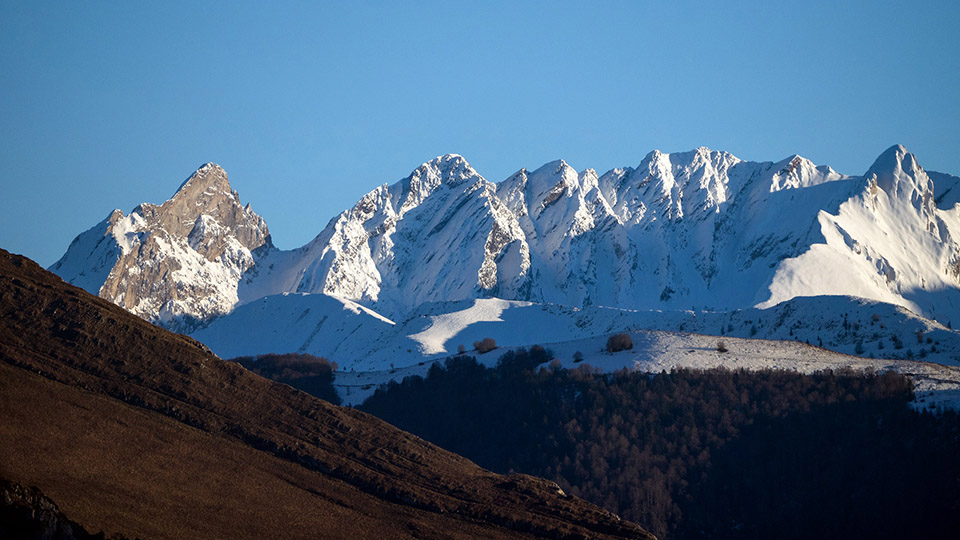
2. Grand Barbat (2.814m)
Grand Barbat is a colossal peak with a pyramidal appearance. It is the highest peak in a range of rugged peaks that breaks away from the axial axis separating the valleys of Estaign and Cauterets and concentrates a large number of extremely green lakes and valleys. It is precisely this position away from the main axis that makes it an excellent viewpoint and gives it a greater importance in the surrounding area. At the same time, the proximity of the first three peaks to the west and the fact that it is hidden above the Argeles valley by other notable peaks such as Monné, keep it safe from the gaze of mountaineers. The normal ascent routes are very beautiful and easy from Estaign or from Cauterets. From Estaign you can follow a circular route, which seems to us to be the best way to get to know this place, which we propose below.
From the Lac d'Estaing ascending the Lac de Barbat and descending the cirque of Arrouy (Distance: 20 kilometres; Approximate time: 10 hours; Elevation gain: 1,700m). The ascent route initially follows the GR10, passing the l'Escale fir tree, the Arriousec hut, the Barbat huts and the Barbat lake, before taking the rocky path that leads to the Barbat Gap and Grand Barbat. For the descent we return to the Barbat gap, but instead of descending north along the same path, we go south (slightly longer) towards the lakes of the Arrouy cirque and the lake of Plaa de Prat, in the main valley.
3. Great Tapou (3.150m) and Middle Peak (3.130m)
A good option in the Vignemale massif to climb three easy three-thousanders during the day are the Gran Tapou and the Pic du Milieu (Middle Peak). They are situated at the south-eastern end of the crown of peaks that form the massif, dropping sharply down into the Ara river valley to the south. The route that starts on the Spanish side from Bujaruelo is very long and ends up joining up with the route that climbs up the Ossoue valley, the quickest way up and a good option for getting to know this valley, as we prefer the route that climbs up the Gaube valley to visit the spectacular north face of the Vignemale.
From the Ossoue reservoir (Climb: F; Distance: 13 kilometres round trip; Approximate time: 7 hours; Elevation gain: 1,400m). Starting below the reservoir dam (1,840m), you climb up through the Lourdes hut, the Montferrat lakes, the Tapou Gap and the upper pass (3,111m), which separates the Gran Tapou (3,150m) from the Pico del Medio (3,130m) on the right. From the summit the views are impressive in any direction, however, what is most striking is the enormous marble slab of the Labaza slabs located below the Montferrat.
4. Pic d'Ardiden (2,988m)
The Ardiden peak is the highest point of a sharp ridge that separates the Lutour valley from the Luz Saint Sauveur valley. The Lutour valley, twinned with the Gaube valley, retains, unlike the latter, the solitude of the wilderness. Once again, the fact that it only just reaches 3000m means that it is little frequented, and apart from a few hikers who often walk along the bottom of the valley towards the lakes, the peaks remain rather marginalised. Nevertheless, the Ardiden is an elegant mountain, with an ascent via the Lutour valley that is neither difficult nor dangerous, but which leaves a taste of climbing because of the numerous boulders that must be overcome on the ridge to reach the summit.
From la Fruitière (Climb: F; Distance: 17 kilometres round trip; Approximate time: 8-9 hours; Elevation gain: 1,600m). A road runs through the Lutour valley as far as La Fruitiére, a hostel and refuge, where you can park your car. The route runs through the Lutour valley until it passes the Pouey Caut hut. It then climbs to the left, passing by the Russel hut, to gain the SW ridge on the Pourtau des Agudes, along which it continues to climb easy blocks to the summit.
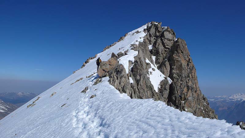
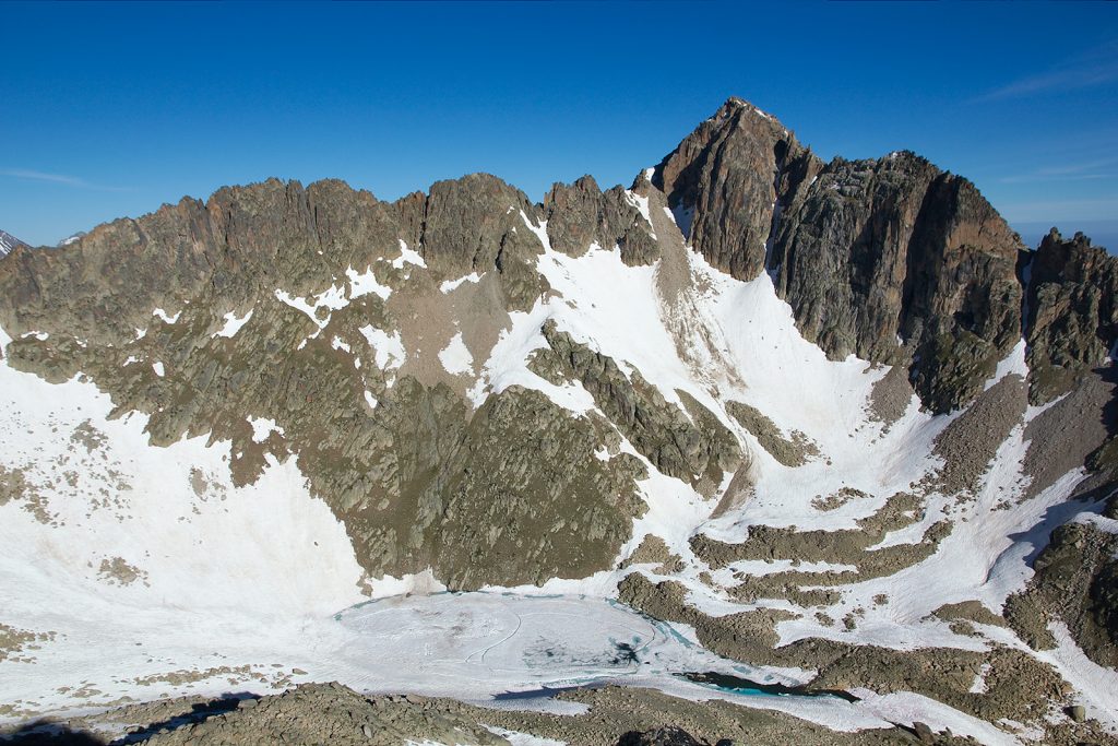
5. Pic Long (3.192m)
The Pic Long (3,192m), in the Neouvielle massif, is one of the 11 main summits of the Pyrenean three-thousanders, i.e. it is the highest peak of one of the 11 sectors in which the 217 catalogued three-thousanders are concentrated and is also the highest peak in the French Pyrenees entirely on French territory.
That said, it should be a popular peak, and would be if it were not also the most difficult of the 11 summit peaks. In reality, the normal routes are not very difficult, but enough to keep the less intrepid at bay. The classic route up the Pays Baché glacier has become more difficult due to the retreat of the glacier, and the route up the western ridge via Pic Badet (3,135m) now seems the most feasible option to reach the summit (PD).
From the Lac de Cap de Long (Climb: PD; Distance: 14 kilometres round trip; Approximate time: 8-9 hours; Elevation gain: 1,400m). Starting from the reservoir dam, which can be reached by car, follow a track, then a path, which skirts the reservoir to the south and then climbs up the valley that opens up at the end in a southerly direction (Montagne de Cap de Long). After passing a small pond, the path skirts the buttress that emerges from the Pic Maubic and turns to the right. The classic route ascends the fork of Pic Long (AD-), but nowadays it is preferable to ascend Pic Badet (PD-) to the left and continue along the ridge to Pic Long (PD). For the descent, one option could be to abseil from the Hourquette of the Pic Long via the classic route.
6. Pic Méchant (2.944m)
The Pic Méchant, together with its neighbour, the Pic de Bugatet, forms an elegant rampart to the south of the road to the Cap de Long, in the Neouvielle reserve. These two peaks are very visible from the road leading up to the lakes of Aumar and Aubert from Lac d'Oredon, but hardly attract a few mountaineers. It is a straightforward climb, ideal for a day or morning ascent.
From the road to Cap de Long (Climb: F; Distance: 5 kilometres round trip; Approximate time: 4-5 hours; Elevation gain: 850m) We climb up the left slope of the Estaragne valley, parallel to the north ridge, on a path with few markings and some milestones. At the end of the climb there is a steep corridor that leads to a gap between the Méchant and Toudes peaks. To reach the summit, there are still some grade II difficulties on exposed terrain.
7. Aguillous / Soum des Salettes (2.976m)
The Aguillous or Soum des Salettes passes somewhat unnoticed between the peaks that make up the La Munia sector (Troumouse cirque) and the southern sector of the Neouvielle reserve. Its eastern slope, visible from the Piau Engaly resort, remains safe from ski lifts, while to the west, it projects an elongated ridge towards Gedre, separating the Héas and Campbieil valleys.
From Piau Engaly (Climb: F; Distance: 14 kilometres round trip; Approximate time: 5-6 hours; Elevation gain: 1,200m). The route starts by following the Neste de Badet valley as far as the Moune hut, where we take a path that climbs up the slope to the right to the col de Campbieil. To gain the summit we continue southwards on a steep slope with good grip.
8. Arbizon (2.831m)
Separated from the main axis of the Pyrenean chain, to the northeast of the Neouvielle massif, and far from other higher peaks, it is a great viewpoint over the Pyrenees from the north. It is a mountain of great magnitude which, to the south, above Aulon, where the normal ascent route runs, has a height difference of almost 1,700m.
From Lurges Farms (Distance: 11 kilometres round trip; Approximate time: 7 hours; Elevation gain: 1,400m), The most common route starts from Aulon, which can be reached by car on a tarmac track. The route runs through forest following the main valley until a crossroads on the right, which ascends in a northerly direction passing the Espigous hut, the Coume d'Espigous, the Coulariot spring and the Aurey gap, before reaching the summit.
9. Pic d'Aret (2.939m)
In the area of the Bielsa-Aragnouet tunnel, the main axis has a series of peaks without much relevance. However, to the north and south there are some satellites and secondary ridges among which there are several significant peaks, such as the Pic d'Aret, which dominates the valley of St Lary 2,000 metres higher up.
From the Artigues forest track (Climb: F; Distance: 13 kilometres round trip; Approximate time: 8 hours; Elevation gain: 1,600m). The starting point is about 3 kilometres from Tramezaigues. With the car you drive up the Rioumajou track for about 1.5 km and then turn right for another kilometre and a half along the Artigues track. The route climbs up the Lassas valley to the Sarrouès lake. Without reaching the lake, the route turns left to reach the ridge just to the right of the peak, where there are some first degree difficulties.
10. Lustou (3.023m)
Lustou forms part of the Culfreda-Batoua group, within the Gran Bachimala sector, but detached from them to the north of the Pyrenean axis. This slope, the northern one, is the most accessible to reach its summit, unlike the rest of the other three-thousanders in this sector. The most common route starts in the Rioumajou valley and is relatively unfrequented, bearing in mind that we are talking about a three-thousander of a certain size in an area, St Lary, which is very busy.
From the Rioumajou camping site (Climb: F+; Distance: 13 kilometres round trip; Approximate time: 8 hours; Elevation gain: 1,700m). The route starts at the end of the Rioumajou valley road, 12kms from St Lary and accessible by car. Follow the track in the Péguère valley and without reaching the hut, climb up alongside the Piarre torrent. At an altitude of 1,780m, the path turns into the valley that opens up on the right to leave it a little further up (1950m) and climb further to the left, to the col de Lustou, where it continues along the ridge that is somewhat broken up and overhead (F+) to the summit.
11. Hourgade (2.964m)
The Pic de Hourgade is a mountain that goes somewhat unnoticed in an area where not even the three-thousanders receive too many visitors. The ascent of the Hourgade is a major climb, with a difference in altitude of about 1,900m, to a little-visited place that has managed to preserve hidden, charming corners with lakes, waterfalls and sharp ridges.
From the Pont des Chèvres (Distance: 19 kilometres round trip; Approximate time: 10 hours; Elevation gain: 1,900m). The starting point of this route is at the Pont des Chèvres (1,100m), in the Louron valley. To get here, leaving Loudenvielle, follow the road to the Pont de Prat for 2 kilometres. The path goes up the Aube valley, meeting the GR10 at a small dam (1500m). The route then follows the GR10 in the direction of the couret d'Esquierrey (2,131m) passing the Ourtiga hut. Well before reaching the col (1950m), we leave the GR10 to turn right and enter the Nère valley, where if the ground is wet we can find a slippery passage at about 2,100m, before the Nère lakes. After passing the second of the lakes, the largest, the path ascends the left slope of the cirque formed by the peaks of Hourgade, Nère and Espingo, and then crosses to the right (west) under the Pic de Nère to reach the Ibón de Hermitans (2,800m). To reach the summit we climb the rocky slopes that lead to the north ridge, which is wide but atmospheric and has some points where we need to rest our hands.
12. Lézat Peak (3,107m)
The peak of Lézat is an elegant three-thousander on all its slopes with several normal "affordable" routes, so one would expect it to be a rather more visited place. Nothing could be further from the truth and even less so among the Spanish public, frightened off by the remoteness of the usual access points and the long approach walks. However, it is a prestigious peak among fans of classic ridge routes. The integral of the Crabioules - Pic de Lézat ridge, popularised by Patrice de Bellefon in his book "The Pyrenees. The 100 best ascents and excursions".The climb has become an indispensable classic climb of medium difficulty (AD+).
There are four normal ascent routes. The most common is the one that starts from the Portillón hut, accessible from the Astau farms. From the Lys valley there are two others, one via the Sarnès hut and the other via the Maupas refuge. The fourth option is the one that climbs up from the Lliterola valley, on the Spanish side, which has no shelters.
The route we propose, practically circular, climbs up from the Lys valley and combines the ascent via the Sarnès hut with the descent via the Maupas refuge.
From the Lys valley up the Sarnès hut and down the Maupas refuge. (Climb: F; Distance: 23 kilometres round trip; Approximate time: 14 hours which can be divided into 2-3 stages; Elevation gain: 1,700m). The starting point is at the car park in the Lys valley, a rather touristy place accessible by road from Bagnères de Luchon (11kms).
The route follows route no. 43, one of the many signposted routes, which is marked 3h20min to the hut at Sarnès, in some places called the Crabioules hut. This is a free hut with a capacity for 20 people where you can spend the night and thus divide the route. The route continues halfway up the slope towards the Maupas hut, skirting the entire cirque. Well before this, once you have passed the spur that comes off the Grand Quayrat, you leave the path to gain altitude through the countryside (some milestones), without a path, until you reach the right of the northern buttress of Pico Lèzat. The key point is to find the correct route up the north ridge of the peak which, depending on where you take it, can vary between F and PD (or embolada). Once on the ridge, the route continues without major complications to the summit. The descent follows the same route until we return to the path that leads to the Maupas refuge. From the refuge there are several possibilities for descending, although the most direct is via the 41 route, passing by the Prat de Long hut.
You may be interested in:
Lonely Peaks #1: Western Valleys "
Fastpacking is not about going faster. It's about going lighter.
If you come from classic trekking, this is the next step: learning to move with less weight,
more fluid and enjoying every kilometre more.
Join the Outsiders Newsletter and start discovering what lightness feels like.