Pinajarro (2,099m) from Hervás (Cáceres)
Pyrenees and mountains 📩
Here 🔥The ascent of Pinajarro is a good mountaineering option on a visit to this region in the north of Extremadura. Cáceresbrimming with history. If this is your first trip to the area, don't miss the chance to discover some of its treasures: the Jewish quarter of Hervás, the Roman baths of Montemayor, the Roman Vía de la Plata or Granadilla, an ancient walled town that was vacated in the mid-20th century for the construction of a reservoir.
El Pinajarro and the Ambroz valley:
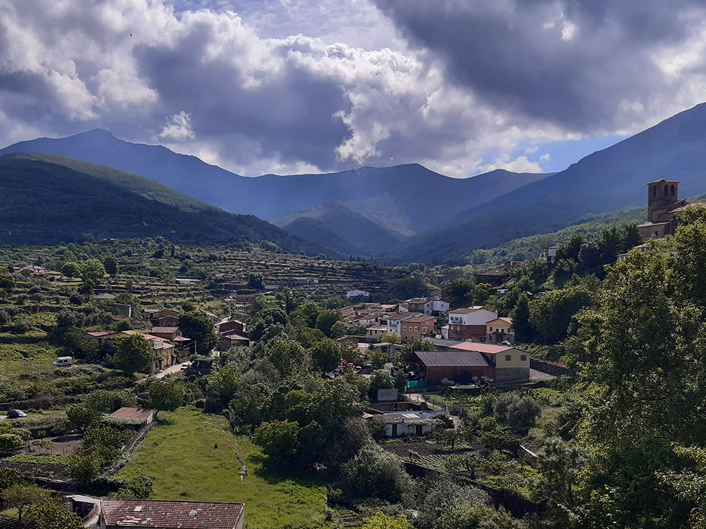
El Pinajarro is a mountain that enjoys a certain prestige among the mountains. Extremaduran. Its position overlooking the Ambroz valley, rising 1500m above the historic town of Hervás, gives it a leading role in the landscape.
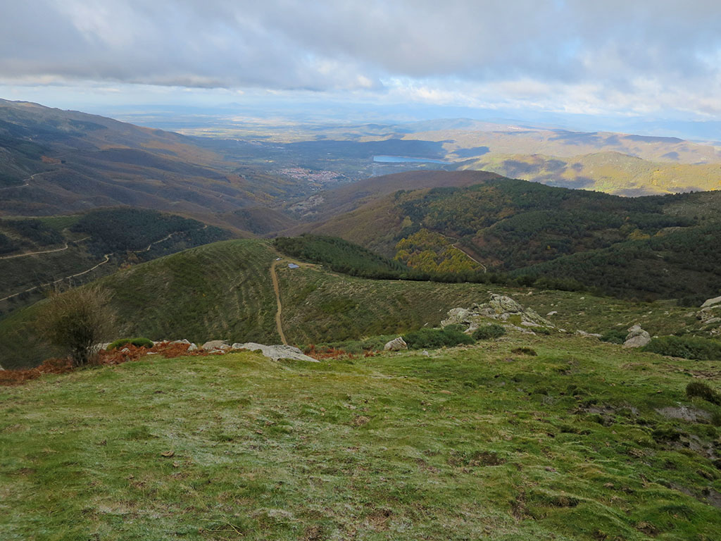
The Ambroz valley, with its mild climate in winter and the freshness of its rivers in summer, is an ideal place to visit at any time of the year, to stroll through the woods, to visit its villages, or to climb the Pinajarro, as on this occasion. However, if we have to choose a time of the year, we would choose the autumnThe chestnut forest is dressed in shades of ochre, yellow and brown and a multitude of activities are organised in the villages as part of the Otoño Mágico cultural programme.
Route summary:
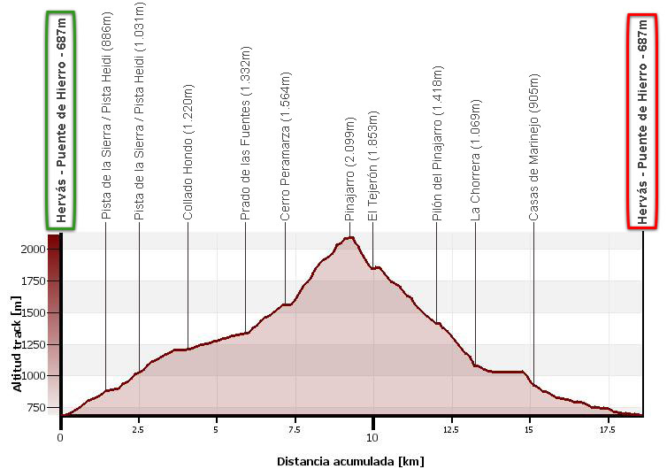
Circular route from Hervás to Pinajarro Peak (2,099m). Ascent via Collado Hondo, Prado de las Fuentes and Cerro Peramarza. Descent via the Tejerón and the Chorrera de Hervás.
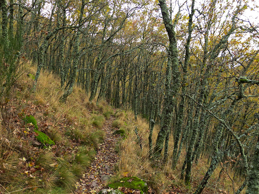
The route ascends taking advantage of the tracks in the lower part of the sierra, alternating with some stretches of path to the Prados de la Fuente. Once we have passed the forest line, a well-marked path through the pines will take us close to the ridge until we reach the summit.
The way down is not suitable for everyone, but rather for almost no one. Although we will always have the option of going down the way we came up. From the summit to the Tejerón and then to a track that comes from the Prado de las Fuentes, the path is non-existent and you have to fight your way through the piornos. After crossing the Pista Heidi, an unfrequented path descends to La Chorrera de Hervás, which is one of the most beautiful and popular routes in the area, and along which we return to Hervás.
Mapa:
Downloadable:
> Download Track
> Download pdf (mobile version)
How to get there:
See in Google Maps.
To get to Hervás from Plasencia or Salamanca, it is very simple. Follow the A-66 motorway (Autovía Ruta de la Plata) to exit 436. Enter Hervás along Avenida de la Constitución (leaving a park on the left) and take the first exit (right turn) at the roundabout at the end, along Avenida Piñuelas, in the direction of Presa del Horcajo. At the end of the avenue, after 300m, turn left into Calle la Vía, towards Presa del Horcajo. Continue around Hervás to the south, with the Pinajarro in front, until you reach the Puente de Hierro (Iron Bridge), where there is a small esplanade where you can leave your car. In total, 41 kilometres from Plasencia or 99 kilometres from Salamanca.
Technical specifications:
Distance: 18.6 kms.
Cumulative difference in altitude: +1.460m/-1.460m.
Timetable: about 6h45min. Walking time non-stop: 8-9 hours.
Water: On the way up there is the Prado de las Fuentes fountain, although it does not look very good. On the way down there is the Pinajarro fountain, but we cannot be sure that it is safe to drink.
Difficulty: The route is very steep due to the distance, the slope, the stretches between the pines and the network of paths in the lower part of the route. The first half of the ascent is not easy to follow without a GPS despite the description, due to the numerous crossroads and paths, which are quite diffuse in some sections. In the final part of the ascent, the milestones get lost among the pines and there is a small area that is difficult to cross. The descent from the summit, without a path and fighting against the pines, is very difficult and we do not recommend it for the ascent.
Itinerary:
(0h00min; 0,0kms) Iron Bridge of Hervás (687m). Situated next to the Iron Bridge, on the left bank of the river Ambroz, we start the route by crossing to the other side.

Once on the other side of the river, follow a track to the left of the bridge that ascends between plots of land and country houses, until it meets the...
(0h25min; 1,4kms) Pista de la Sierra or Pista Heidi (886m). Continue to the right for about 300 metres until you reach a horseshoe bend and continue straight on along a much less marked path (shortcut). Shortly afterwards (after about 75m) you will see some tracks on the left hand side, the path of the snowfields, along which you will ascend to a clearing in the forest (about 500m from the moment you leave the track). When you reach the clearing, leave the path and turn left to climb up the slope and return to the track.
(0h45min; 2,5kms) Pista de la Sierra or Pista Heidi (1.031m). If you prefer to go up along the track, carefully study the crossroads, you can continue to the left or right, and join the route described above. To follow the route on the path, turn left and continue a few metres to a clearing (pass 1,026m), just before the track forks in two. A faint path on the right crosses the clearing and enters the forest. The path is quite diffuse but you can follow it without major difficulties as you advance along the upper part of the hill, heading east. You will soon reach a fence where there is a small building that you leave to the left. Continuing along the paths, always on the ridge, we cross some trees and come out into another clearing, which we also cross. Afterwards, the oak wood becomes thicker and there comes a moment when it is better to leave the crest of the ridge and follow a path, not very well marked, that skirts the right side of 1,255m.
(1h20min; 4,2kms) Collado Hondo (1.220m). Crossed by a track. Continue straight on along a shortcut to come out onto the track again, which you can follow until you reach the...
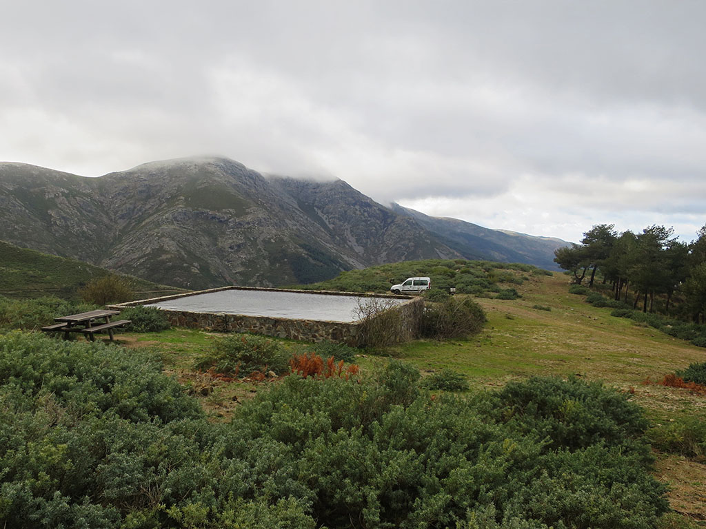
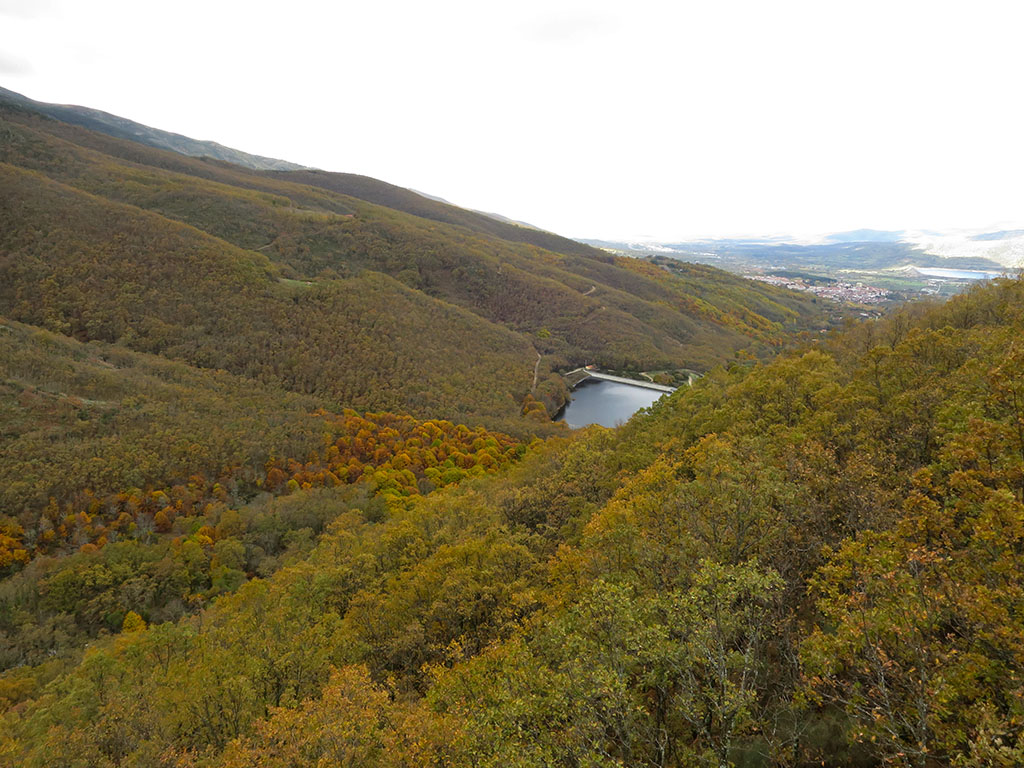
(1h40min; 5,8kms) Prado de las Fuentes (1.332m). A large pylon with a spout and a table/merendero.

The track forks. Continue to the left for about 150m, until a slight bend to the left in a somewhat waterlogged area. Leave the track at this point and climb to the right, in search of a path that runs along the upper part of the ridge. The forest is now below and its place is taken by the piornos. Cross a wire fence and advance through more or less clear terrain, dotted with pines, in the direction of the...
(2h15min; 7,1kms) Cerro Peramarza (1564m), which we leave on the right hand side.
We come out onto a grassy field. The wire fence, now a stone wall, goes straight up the slope. We climb close to the wall, on the left side, looking for the milestones that can be seen among the pines.
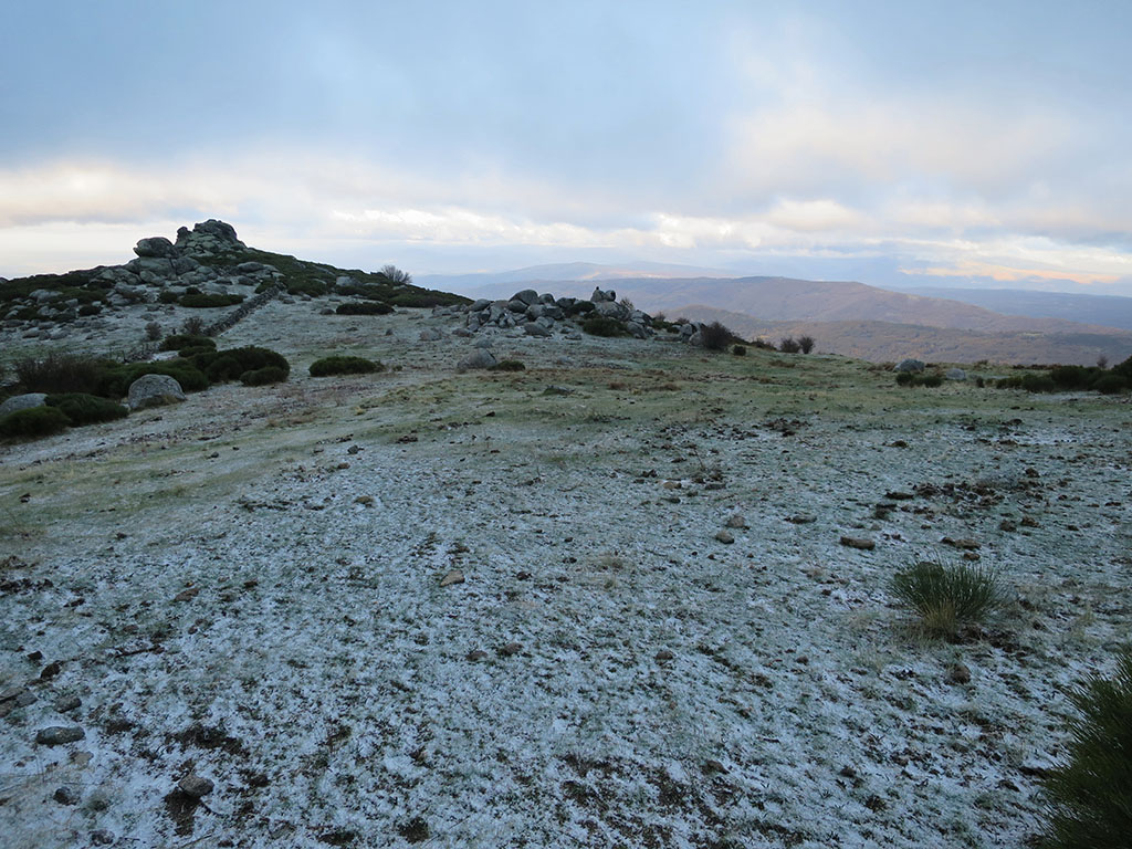
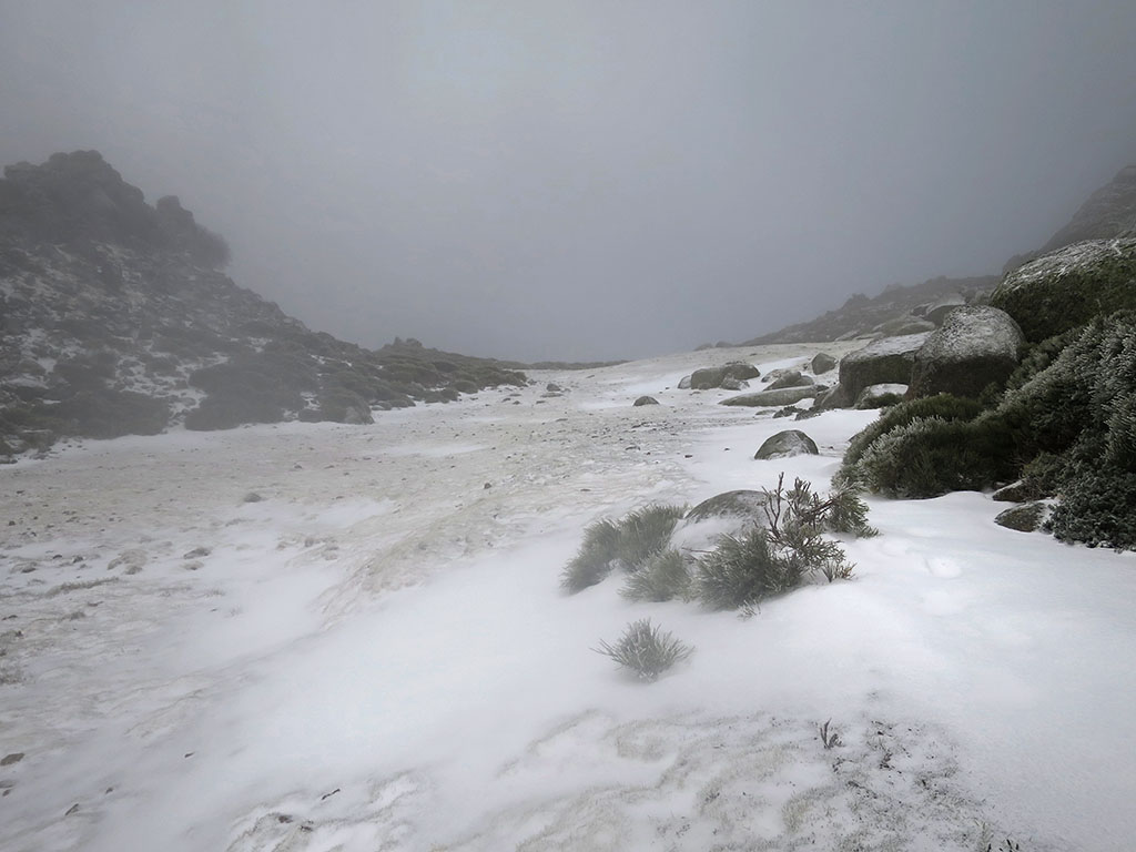
At El Cervunal, at an altitude of 1,800m, the path crosses to the other side of the wall. Further up, after passing Collao del Tio Jarilla, the path seems to get lost for good. Here we choose to head to the right, separating ourselves a hundred metres from the crest of the hill, along which the wall continues.
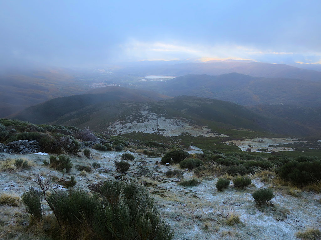
(3h40min; 9,1kms) Pinajarro Peak (2.099m). On a clear day, the views of the Sierra de Béjar/Candelario, the Ambroz valley and Trasierra are fabulous.
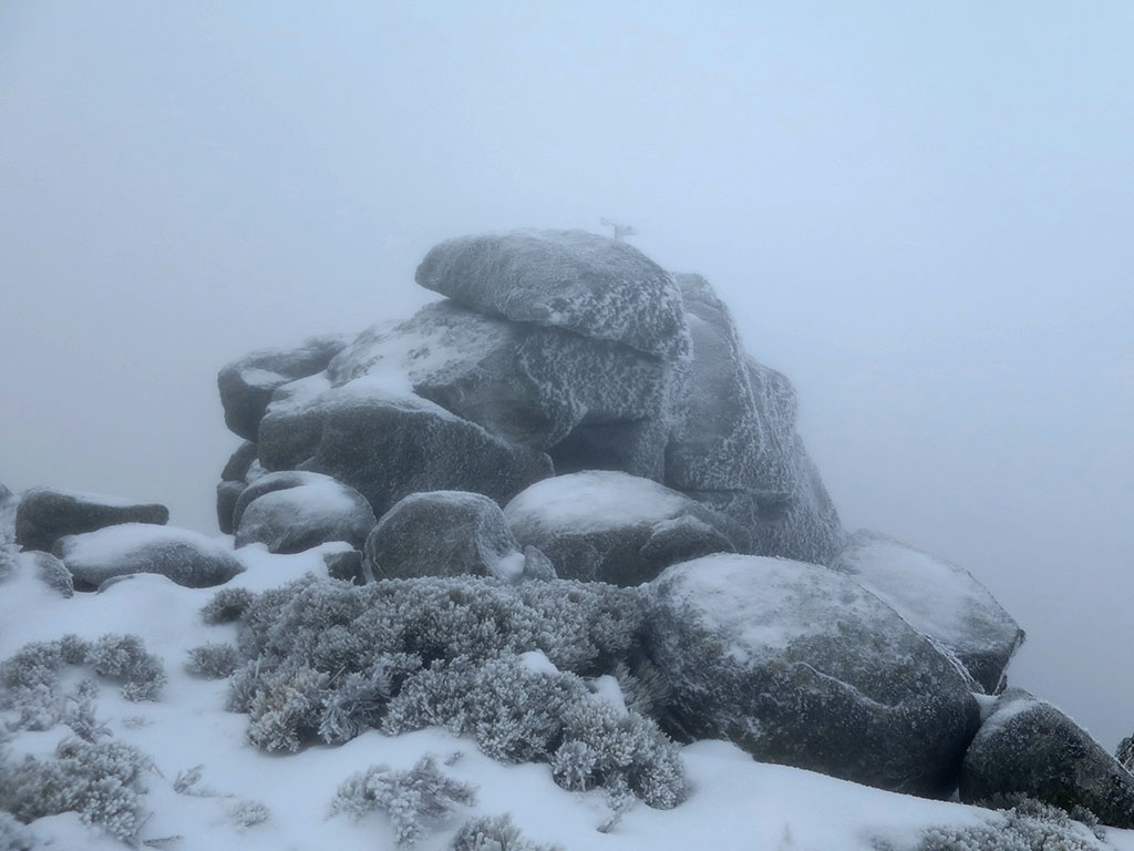
If you want to do the circular route, it would be better to put on your work clothes. So, leaving the blocks where the weather vane is on the right, go straight down a fairly wide channel that is clear of pines at the beginning. We descend with a tendency to the left side, until the pines end up cutting off the path and we opt for the middle way, going straight down wherever we can. In spite of everything, we can see some milestones.
(4h15min; 10,0kms) El Tejerón (1.853m). We arrive at an elongated field without piornos, like a balcony, which gives us a break.
We walk along it to the right until the end, until the pines close in on us again. We head towards some crags where we turn left to descend a few metres down the southern slope, the one that overlooks the Arroyo de las Costeras. As we lose height, we begin to see something similar to a path and the first milestones appear that lead us in a westerly direction. With a bit of instinct and our sights set on a track that emerges from the pine forest, we head towards a kind of hill where we can see a large pylon.
(5h05min; 12,0kms) Pilón del Pinajarro (1.418m).
This is as far as the track that comes from the nearby Prado de las Fuentes, where we passed on the way up. We ignore it and continue downhill straight ahead along the firebreak that leads to the well-known...
(5h15min; 12,9kms) Pista de la Sierra or Pista Heidi (1.184m). Straight ahead, a little-travelled path descends directly to the path that leads to the Chorrera, very close to the waterfall.
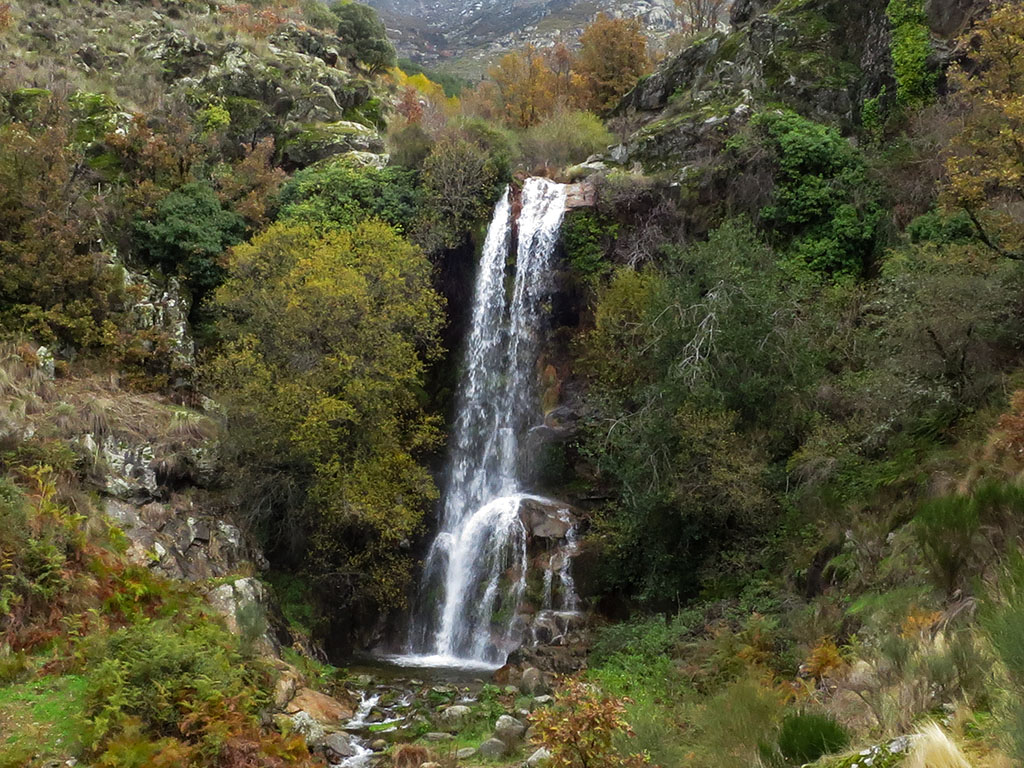
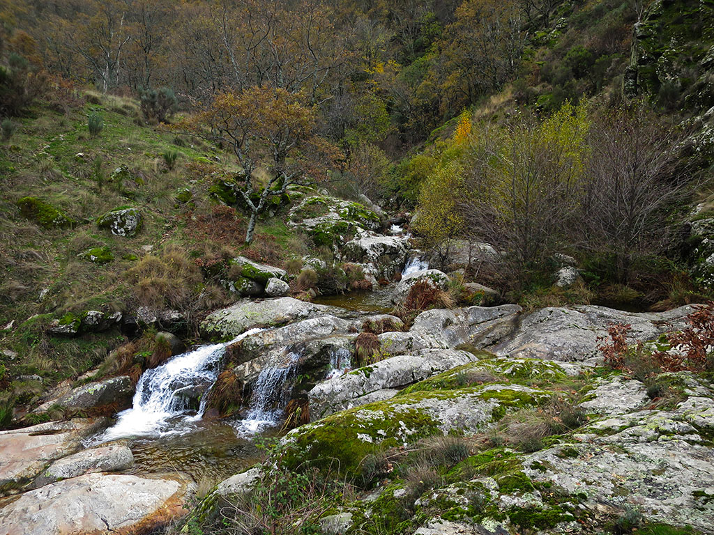
(5h25min; 13,3kms) La Chorrera (1.069m). A beautiful waterfall about 15m high.
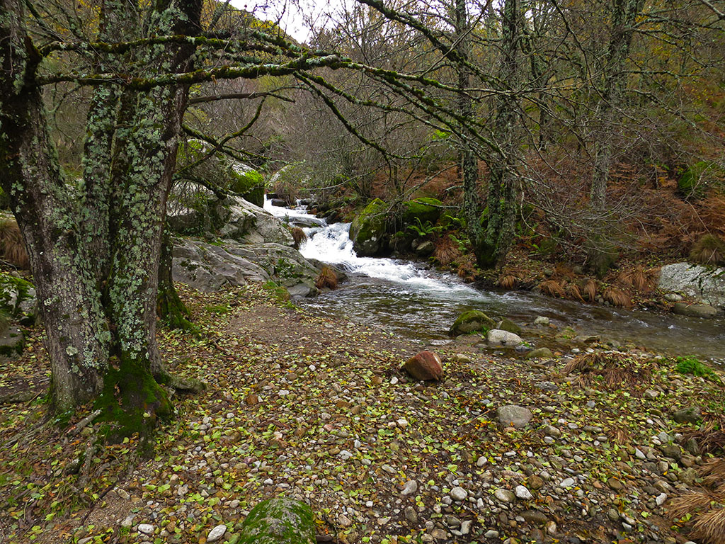
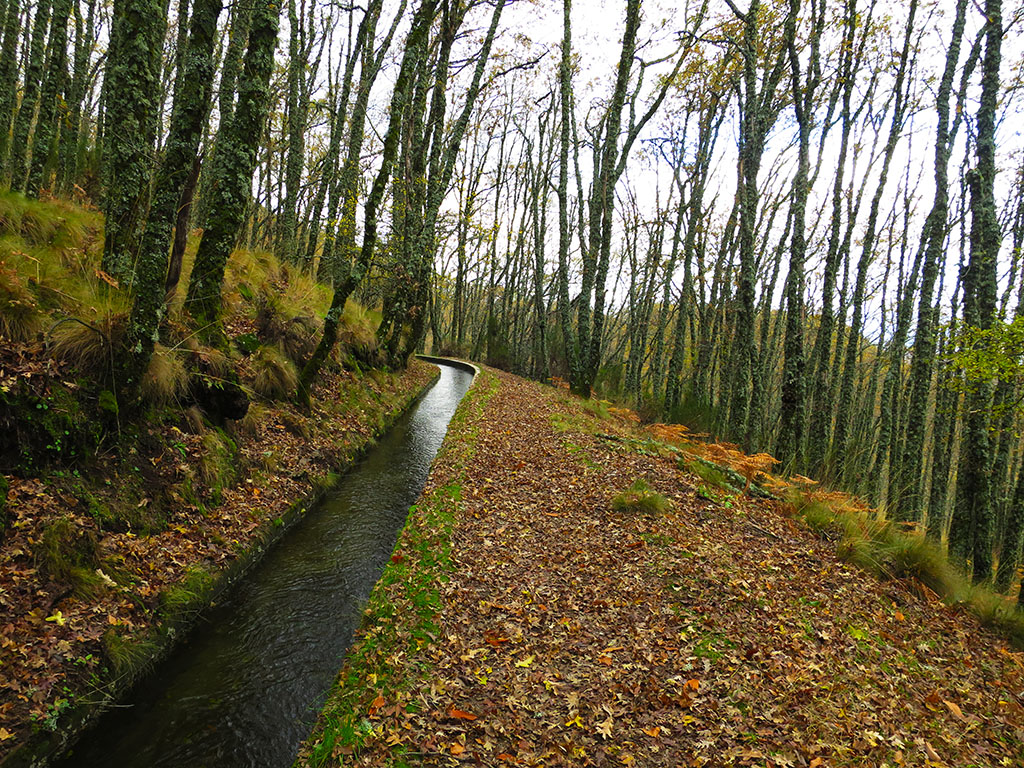
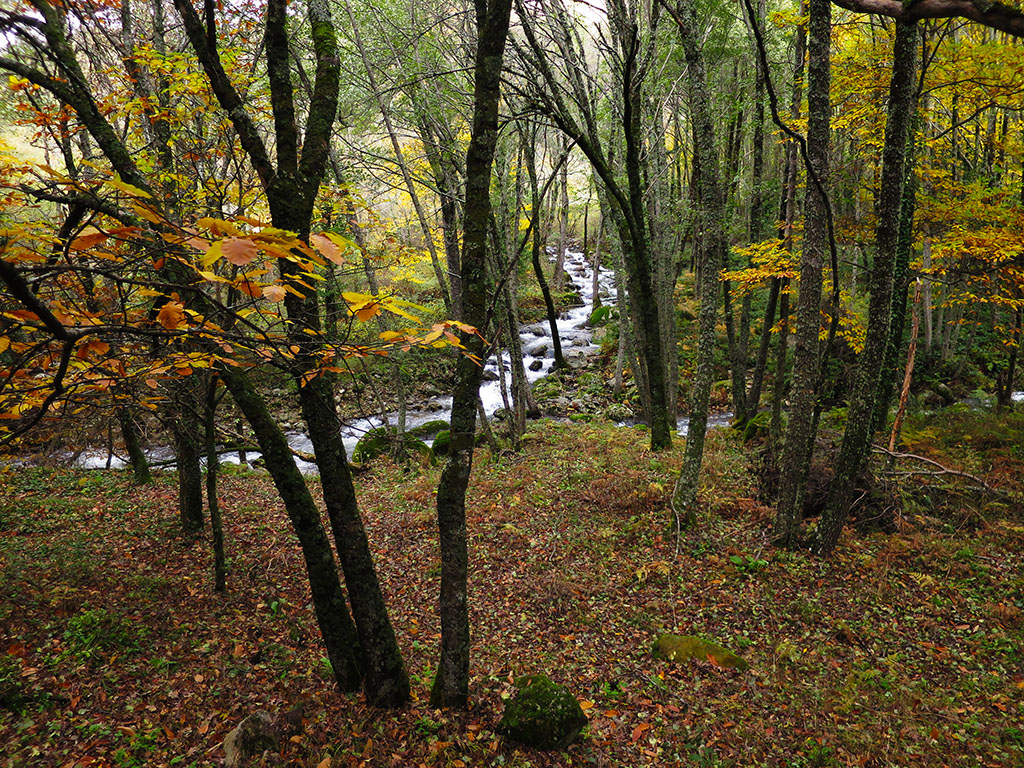
The route from Hervás, marked in white and yellow, is one of the most beautiful and busiest routes in the area. We will follow it to return to Hervás. The path descends through the oak trees to a small canal, along which we will continue walking comfortably downstream for 1.5 kms, until we reach the Casa de la Luz.
The path then zigzags down the 150m drop to the Marinejo houses. Before reaching them, a path turns off to the right to the Charcas Verdes.
It will only take a few minutes, but when it's really worth a detour is in summer, for a swim.
(6h00min; 15,2kms) Casas de Marinejo / turnoff to Charcas Verdes (905m). The path comes out onto a track along which we continue to Hervás. In 10 minutes we reach a car park, the only place to park the car if you want to do the Chorrera route. We cross a bridge and ignore a fork that climbs towards the Hervás reservoir. Without getting lost, following the track that runs parallel to the river Ambroz and through a beautiful forest, we reach the end of this route.
(6h45min; 18,6kms) Puente de Hierro (687m), start of this excursion.
NEARBY YOU MAY BE INTERESTED IN:

Circular ascent from Ladrillar to Cerro Rongiero (1,622m). Ascent via the Portilla del Samoral and return via the Piquito del Moro and the Alfonso XIII route.
15,7kms; +/-1.100m; 7 hours
Recommended books:
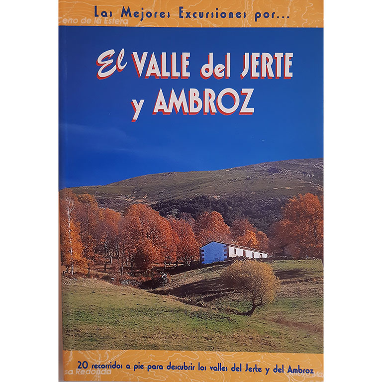
- Editorial: The Rambler
- Language: Spanish
- No. of pages: 192
- ISBN-10 : 8495368161
- ISBN-13 : 978-8495368164
- Publication: 2004
Fastpacking is not about going faster. It's about going lighter.
If you come from classic trekking, this is the next step: learning to move with less weight,
more fluid and enjoying every kilometre more.
Join the Outsiders Newsletter and start discovering what lightness feels like.