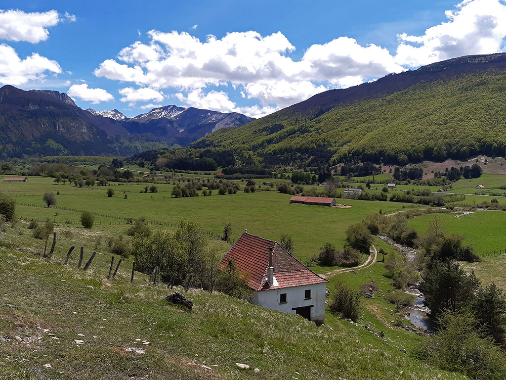
Ascent to Lakartxela from Arrako, in the Belagua valley.
Pyrenees and mountains 📩
Here 🔥We set off on a route through the Navarre Pyrenees to climb one of its most emblematic peaks, Lakartxela (1,982m), also known as Kartxela, Kartxila, La Kartxela, etc.
Lakartxela is one of the most important peaks overlooking the Belagua valley and the highest along the main axis of the Pyrenean chain, between Orhi and Arlas. Together with Lakartxela, Keleta, with an elegant shape and a more advanced position towards the Belagua valley, is one of the most recognisable peaks. Curiously, for this reason, it is often confused with Lakartxela.
The route described below ascends Lakartxela from Arrako, at the bottom of the valley. The most honest way of tackling a mountain. However, we will not only climb the main summit of the area, but also the other peaks that make up this beautiful corner of the Navarrese Pyrenees: Larrondo (1,703m), Keleta (1,906m), Ezkieta (1,906m) and Bimbaleta (1,758m).
Route summary:
From the small Arrako car park, well known for the nearby Arrako dolmen, the route climbs following the E3 link between the GR321 (Camino Real) and GR321.1 (Camino de los Contrabandistas) paths, to continue to the Lapatia pass. From here, in a round trip, the first peak of the day, the Larrondo peak, is reached. The route continues along the hill to Keleta and then, along a narrow, aesthetically pleasing and avoidable ridge, Ezkieta and Lakartxela. On the descent towards the Arrakogoiti pass, we will take the opportunity to add the Bimbalet peak to our collection. The descent from the Arrakogoiti pass follows the GR321 to the starting point of this excursion.
Map:
Downloadable:
> Download Track
How to get there:
See in Google Maps.
To get to the start of this excursion, the small car park at Arrako, at kilometre 43 of the NA-137, we will take the Navarrese town of Isaba as a reference point. Coming from Pamplona, take the NA-137, either via Lumbier and the Puerto de las Coronas, or further on via Sigües and Salvatierra de Esca. In total, 10 kilometres from Isaba or 100 kilometres from Pamplona.
Technical specifications:
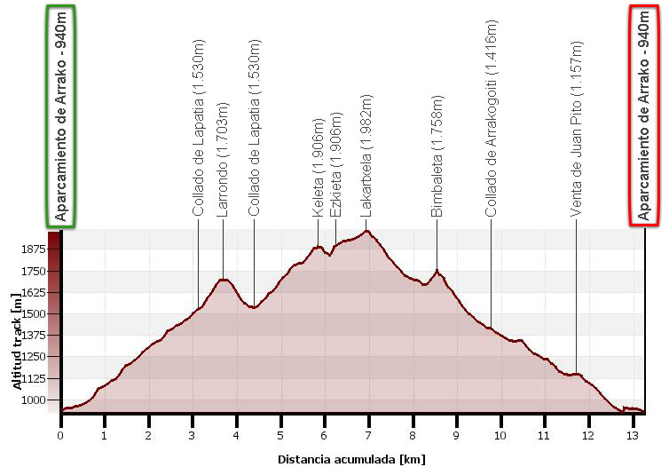
Distance: 13.3 kms.
Cumulative difference in altitude: +1.440m/-1.440m.
Timetable:6h00min. Running time non-stop: 4h45min.
Water: There are no springs along the route, although there are some streams along the way. The most notable is the one just below the Arrakogoiti pass, in a livestock area.
Difficulty: Tough route due to the accumulated difference in altitude. In spite of everything, due to the type of path it is, it is easy to gain altitude. Between Keleta and Ezkieta there are narrow sections of ridge, of little difficulty and avoidable, but which can be dangerous in windy or icy conditions. The ascent and descent is easy to follow because of the signposting. The route along the ridge is obvious and if the weather is clear, there are no problems with orientation.
Itinerary:
(0h00min; 0,0kms) Arrako car park (940m). Two information panels show the different routes in the area that pass through this place.
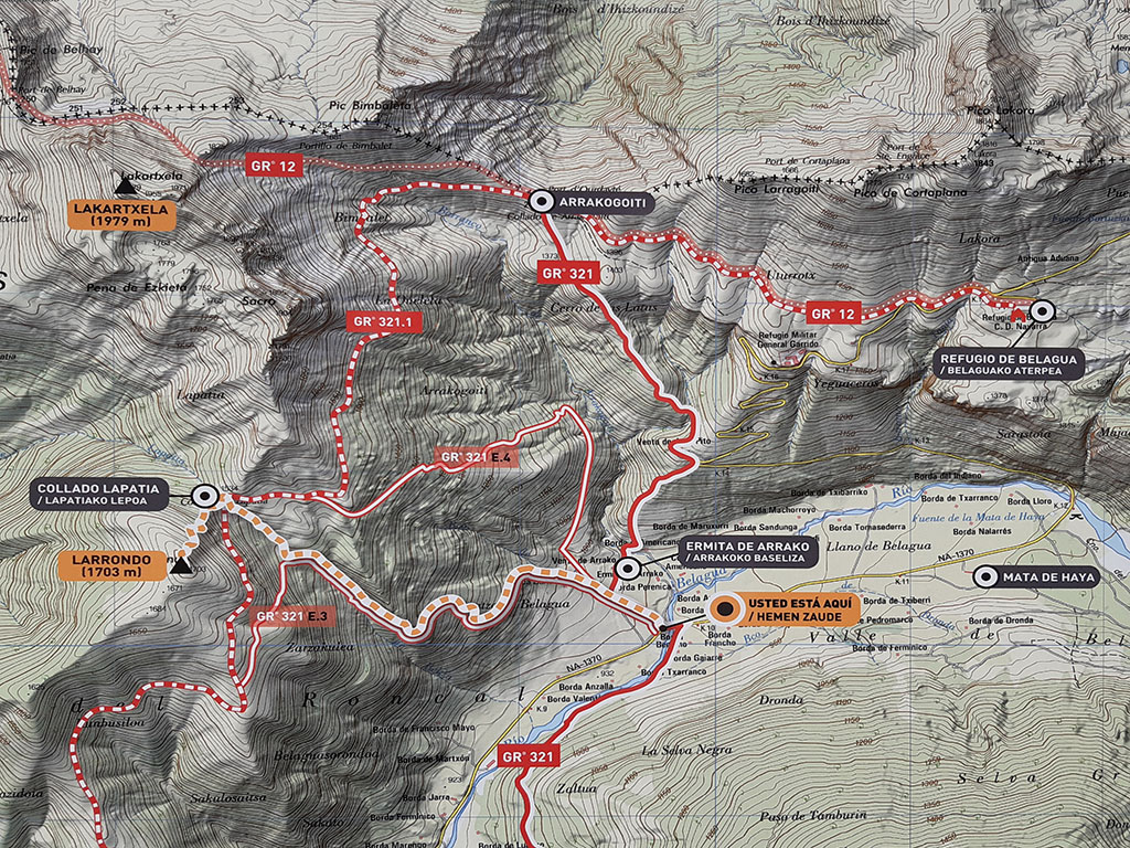
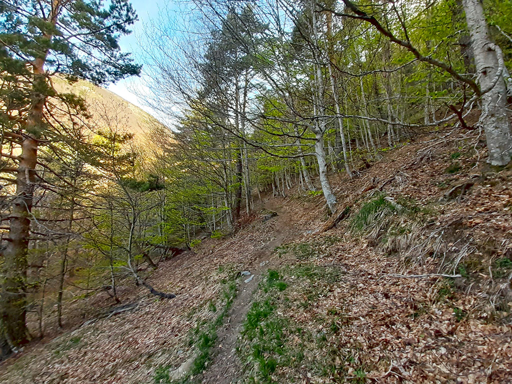
The route can be done in one direction or the other, but in this case, we will do it clockwise, going up through Lapatia and coming down through Arrakogoiti. Start by following the signs to Larrondo and Zarzakulea, along the E3 link to the GR321.1. As soon as you leave, go straight ahead at the first junction (0h04min) and turn left at the next junction (0h05min).

The path enters the beech forest and the ascent begins.
The path is not to be missed, and so we reach a small track (0h55min; 2,6kms) where a signpost indicates the direction to follow to continue along the GR321 E3 path and the direction we will take, towards Larrondo.
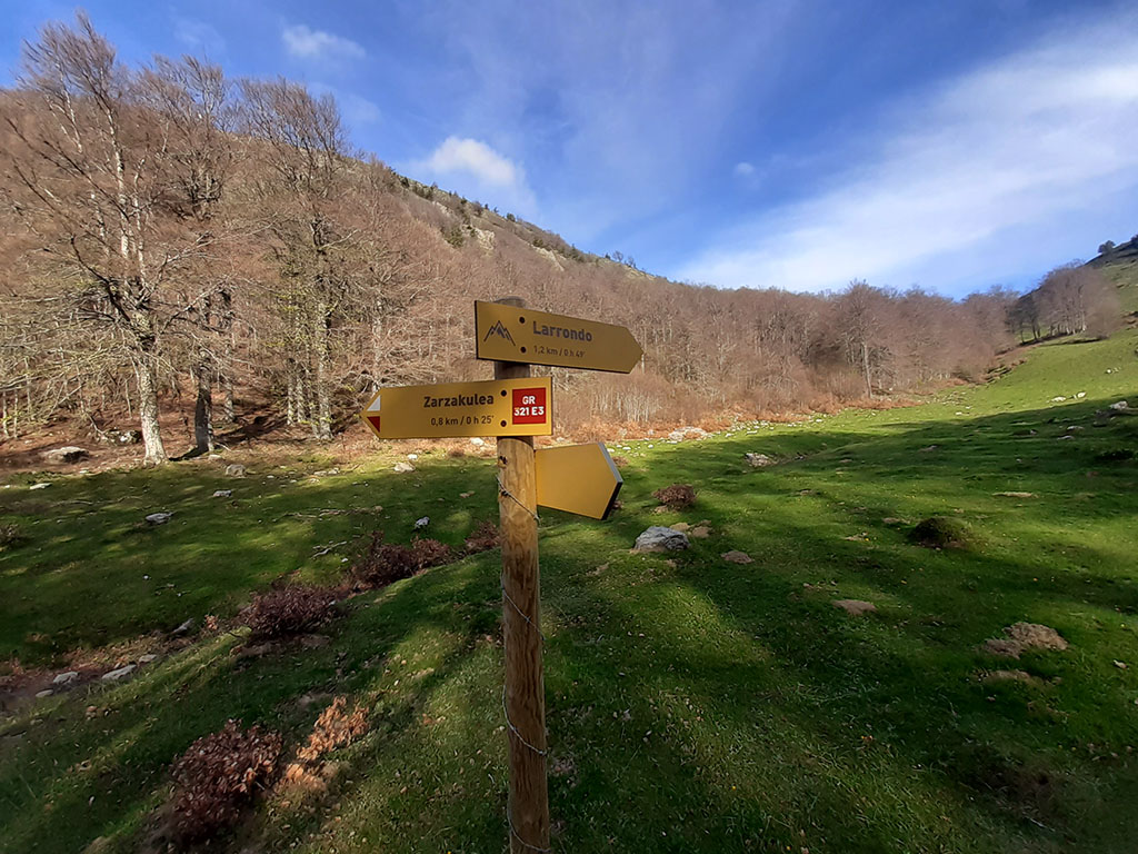
We leave the GR321 E3 and climb up the raso (white and yellow waymarks) following the signs to Larrondo. In just 10 minutes we reach the...
(1h05min; 3,1kms) Col of Lapatia (1.530m), located on the long ridge that separates the valleys of Belagua and Mintxate, and along which the GR321.1 (Smugglers' Route) passes. To reach the grassy hill of Larrondo we turn off to the left, without a defined path.
(1h25min; 3,7kms) Larrondo (1.703m). A letterbox marks this summit with magnificent views of the valleys of Belagua and Mintxate and the next section of the route.
By the same route we return to the...
(1h40min; 4,3kms) Col of Lapatia (1.530m). A path runs along the left side of the first stumbling block to climb the hill a little further up. In some sections the path is not very clear, which is not a problem. We can follow the ridge or go more sheltered to the left, avoiding the summits if we wish.

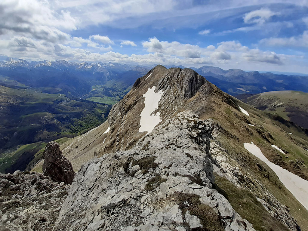
(2h25min; 5,7kms) Keleta (1.906m). From here you have the best views of the Belagua valley of the whole route. The ridge now really narrows and the most aesthetic section begins.
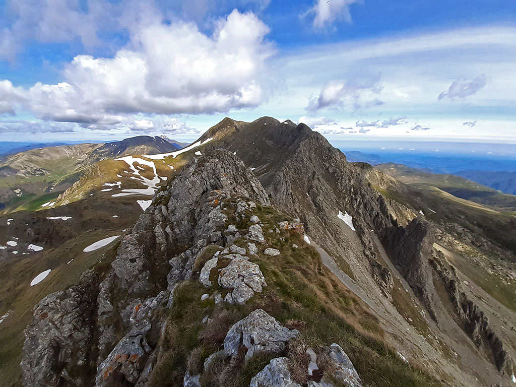
Beware of wind gusts. There is only one pass with some exposure that is easily crossed to the right. We descend to a pass and then face the crest to climb up to the...
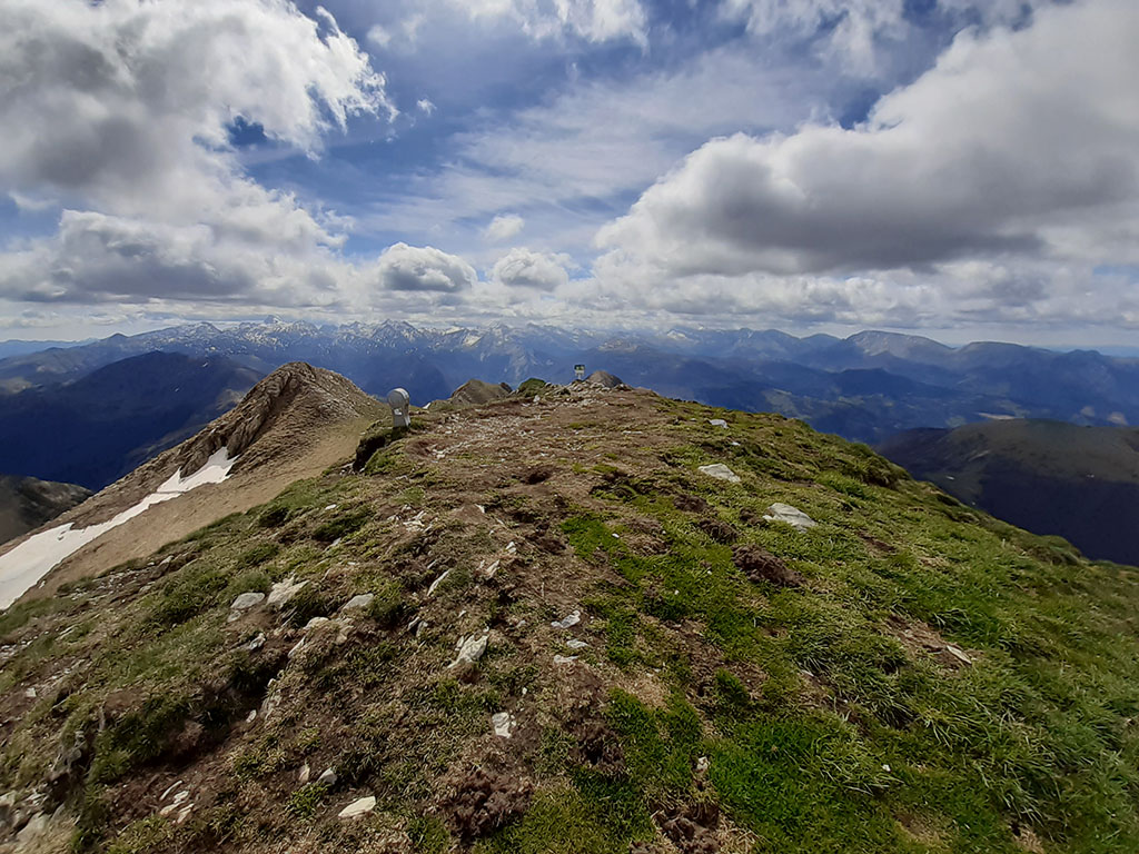
(2h40min; 6,2kms) Ezkieta (1.906m), which, rather than a summit, is a succession of 3 peaks.
We note the first one as Ezkieta, despite being the lowest of the three, and continue riding the ridge.
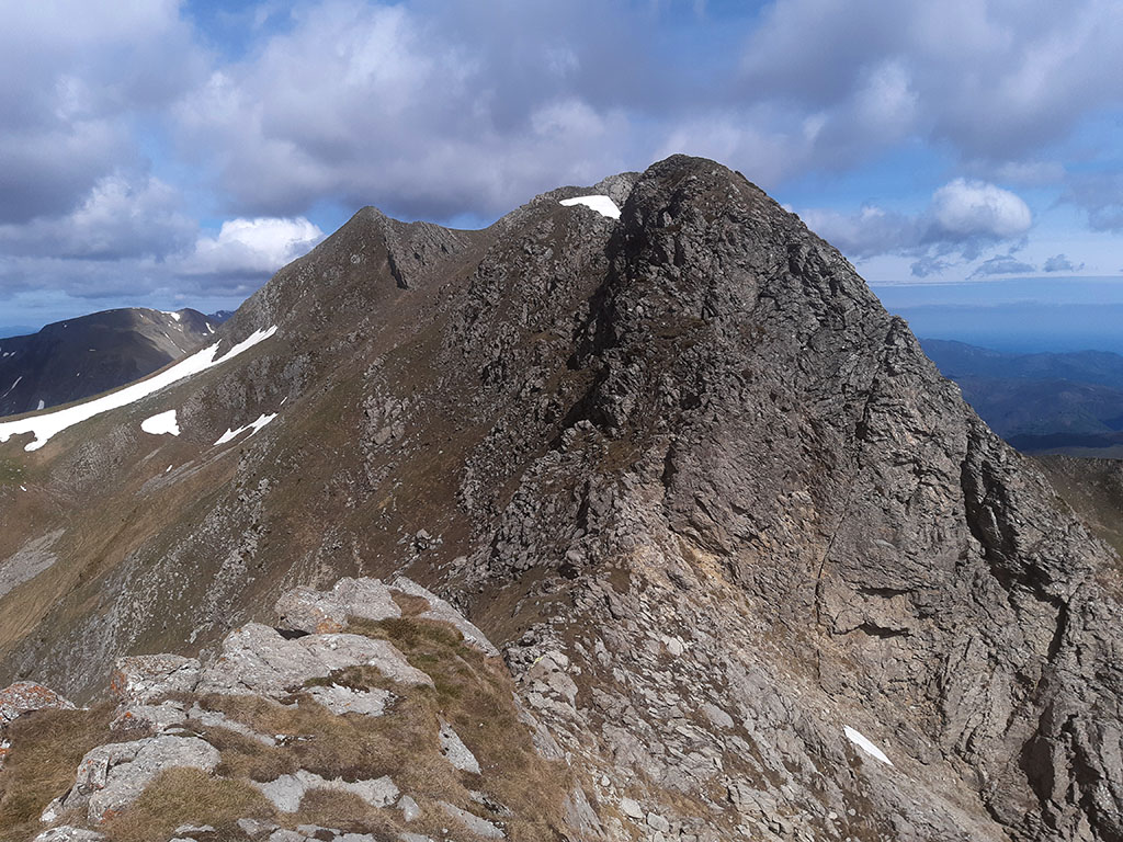
The path then skirts the summit of Lakartxela Oriental on the western slope, to gain a pass near the summit of Lakartxela....
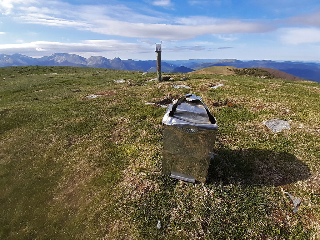
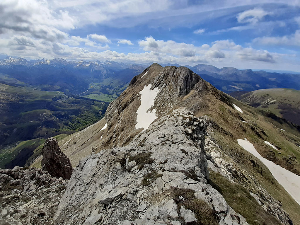
(2h55min; 6,9kms) Lakartxela (1.982m). The highest of all those that make up the Sardeka cirque and of a long stretch of the Cantabrian-Mediterranean divide.
To descend, we descend again to the pass between the main peak and the eastern peak, to continue to the left along a marked path to the Ginbeleta pass (El Cantalar), crossed by the GR12.
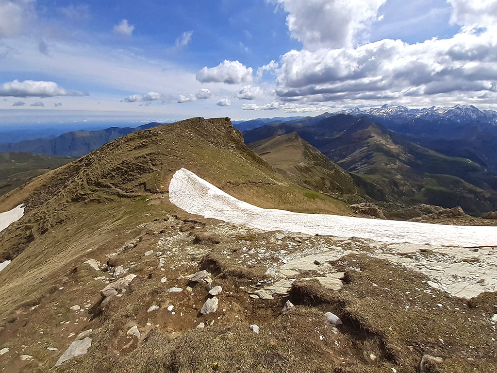
If you do not want to climb Bimbaleta, it is best to continue along the GR12 to the Arrakogoiti pass. Otherwise, go around a small point on the southern slope and descend eastwards to the Portillo de Bimbalet pass, which precedes Bimbaleta.
(3h40min; 8,5kms) Bimbaleta (1.758m). To continue descending towards the Arrakogoiti pass, you can climb a small strip of rock directly from the summit, or go back a little and go around the peak on the south face. Following the ridge we descend to the...
(4h05min; 9,8kms) Arrakogoiti pass (1.416m). The lowest point on the divide since the col de Bagargi. This pass is an important crossing point crossed by the GR12 and the GR321 and GR321.1, which separate here.

Following the signs to Isaba (GR321) we start to descend in a southerly direction. The path crosses a stream and continues along the Cerro de las Latas, without entering the forest until just before reaching the...
(4h20min; 11,7kms) Venta de Juan Pito (1.157m). Following the road we go down to a horseshoe bend in the main road, where we return to the path. The descent is well signposted and you will soon pass the crossroads to the Arrako waterfall and a couple of small houses where the Arrako hermitage is located.
Two minutes after the hermitage we take the path uphill again, very close to the start of this excursion.
(4h45min; 13,3kms) Arrako car park (940m).
Maps:
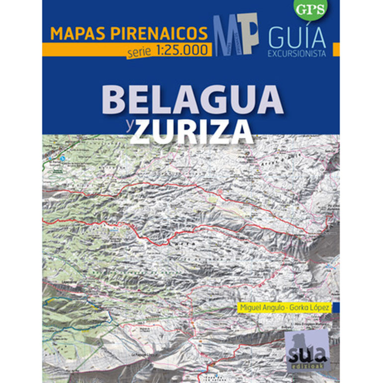
Belagua and Zuriza (Pyrenean Maps).
- Editorial: Sua Edizioak
- Language: Spanish
- ISBN-10 : 8482165887
- ISBN-13 : 978-8482165882
- Publication: 2015
Fastpacking is not about going faster. It's about going lighter.
If you come from classic trekking, this is the next step: learning to move with less weight,
more fluid and enjoying every kilometre more.
Join the Outsiders Newsletter and start discovering what lightness feels like.