Circular route to the lakes of Pixón, Solana/Luzeros, Leners and Millars.
Pyrenees and mountains 📩
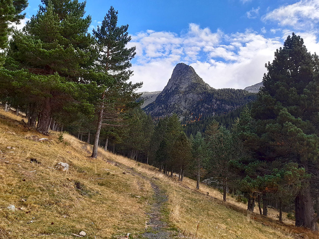
Here 🔥The Chistau Valley is a small jewel nestled in the heart of the Central Pyrenees, at the western end of the Posets-Maladeta Natural Park.
Much less known than its neighbouring valleys, the valley of Bielsa, Pineta, or Benasque on the other side, the valley of Chistau (Zinqueta river) is a place far from crowds, busy roads and ski lifts. A place that preserves the peace and beauty of unspoilt nature in harmony with its people, pastoralism, tradition, culture and the customs of its inhabitants.
The head of the Chistau valley is surrounded by peaks that in many cases exceed 3,000 metres and form endless granite ridges that dominate the valleys of Zinqueta de la Pez and Zinqueta de Añes Cruces. These peaks include Los Culfredas (3,034m), Bachimala (3,176m) and the whole succession of peaks that make up this sector, the Posets massif (3,369m), the second highest peak in the Pyrenees, and the continuation to the south with the Eristes (3,056m).
Under the peaks, occupying the bottom of the over-excavation basins modelled by the glaciers, there are a multitude of ibones. A pleasure for hikers and photographers alike. And this is where we will direct our steps on this occasion.
SUMMARY OF THE ROUTE:
A circular route in which we will visit the main lakes in the Viadós area, at the foot of the Eristes. One of the essential routes in the area. From El Forcallo Campsite / Virgen Blanca Campsite, we cross to the left bank to head down the valley following the GR19 path. One kilometre further on, the path leads up to the Pixón lake, one of the most beautiful in the Pyrenees. From here, green markings show the way to the Solana/Luzeros lake and the lake of Es Leners, separated by a pass at 2,570m, which is the high point of this route and the halfway point. A marked path descends to the fourth lake, Millars. The route continues descending the Ribereta ravine following the GR11.2, until it comes out practically at the bottom of a track where the GR is abandoned and along which we return to the starting point.

DOWNLOADABLE
> Download Track
> Download pdf (mobile version)


HOW TO GET THERE:
See in Google Maps.
Once in San Juan de Plan, continue for a couple of kilometres along the road that climbs towards Gistaín, until you reach a horseshoe bend on the left. Leave the road at this point and continue along a track (signs to the Viadós refuge) in good condition, but narrow at some points. Follow it for about 10 kilometres to the area of the Virgen Blanca Campsite and the El Forcallo Campsite, where there is a place to park.
Technical specifications:
Distance: 13.3 kms.
Cumulative difference in altitude: 1.300m.
Timetable: about 8-9 hours. Running time non-stop: 6h25min.
Water: On the way up to the lakes there are no fountains or streams that can be relied on. On the way down, shortly after the Millars lake, you will cross a couple of streams and later another one in the Ribereta ravine, where you can get water.
Difficulty: The ascent to the Pixón lake is steep in some sections and is better for going up than down. Later, between the Pixón and the Ibón d'es Leners, the path disappears at times, although it can be followed without much difficulty thanks to the painted markings and milestones. From Ibón d'es Leners onwards, the path reappears and descends quite quickly. The high area (2,570m) can be covered in snow for most of the year.
ITINERARY:
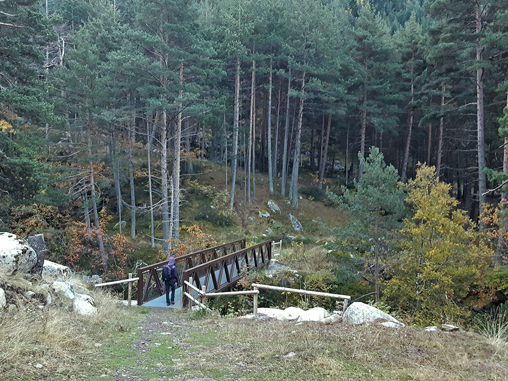
(0h00min; 0,0kms) Camping El Forcallo (1.560m). A little below the entrance to the El Forcallo campsite, there is a signpost indicating the different footpaths that run through the area. For the moment, follow the GR19 signs and go down a path that crosses a bridge over the Zinqueta de Añes Cruces.
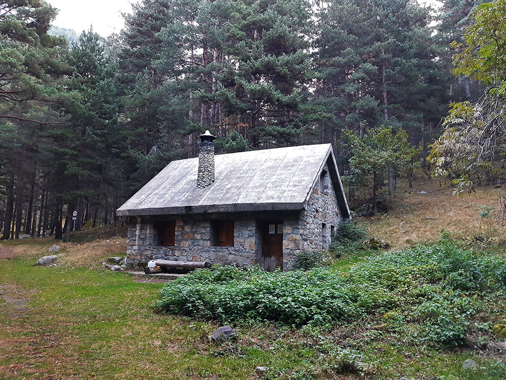
The path leads to a wide path along which we continue down the valley, passing in just five minutes by the Es Plans refuge (in very good condition and with room for about 16 people on the upper floor).
(0h15min; 1,0kms) Left - Path to the ibones (1.510m). Shortly after passing through a wooden gate, we reach the crossroads to climb up to the Ibón de Pixón (signpost), where we leave the wide path to continue on a steeply ascending path. We walk through a dense pine forest, pass a clearing and then come out into a larger clearing, where, looking back, we can see Punta Suelza (2,974m) and the Chistau valley.

The path steepens again as it enters the forest again.
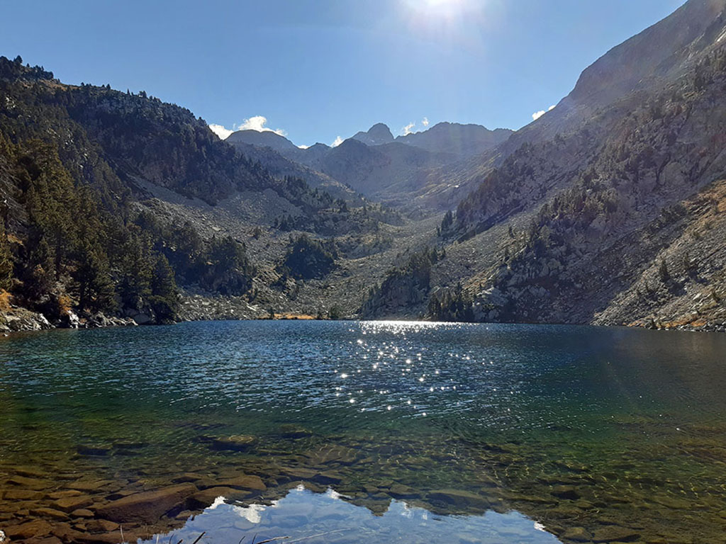
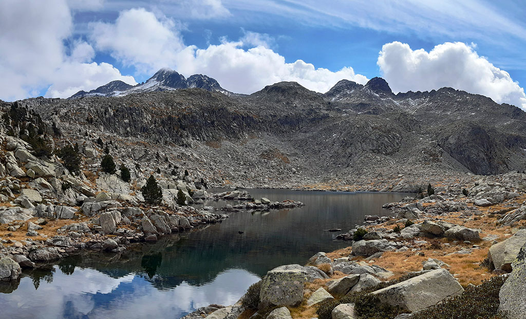
(2h05min; 3,4kms) Ibón de Pixón (2.180m). One of the most beautiful in the Pyrenees.
We start to go round the lake to the north, paying attention to a bend in the path on the left. In this way, we leave the bank of the lake and start to climb up the slope to the left. At first, we head straight up the slope and then we head to the right, halfway up the slope. The path is not very clear but it is well signposted with light green and dark green paint.
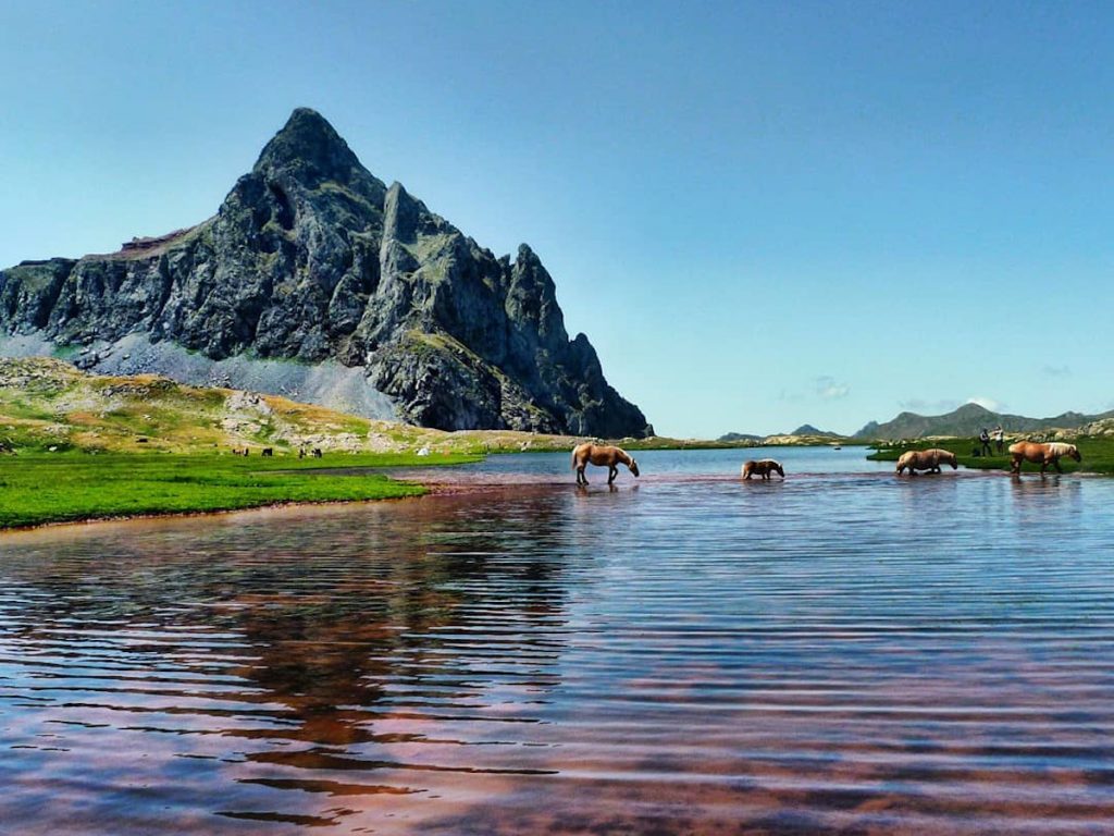
(2h50min; 4,5kms) Ibón de la Solana / d'es Luzeros (2.413m).
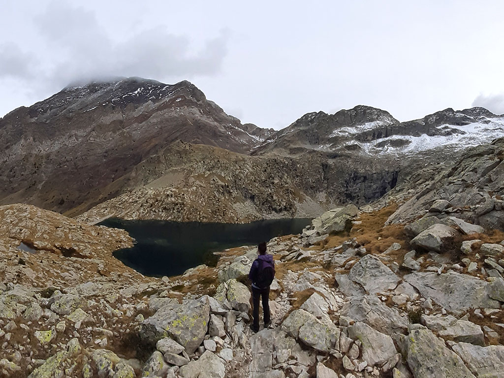
We leave the ibón to the right and continue climbing through a sea of granite and small meadows until we reach the highest point of the route, a kind of pass at 2,570m between the ibón de la Solana and the ibón d'es Leners. From here, the Bagüeñola / Eristes Peaks (3,053m) are close by. The markings zigzag between granite fields on the way to the...
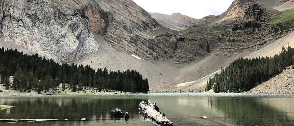
(3h45min; 5,9kms) Ibón d'es Leners / de Lenés (2.505m), where the path starts to regain its shape and we can move faster.

It didn't take us long to get to the...
(4h20min; 7,5kms) Ibón d'es Millars / Millares (2.350m)contained by a dam.
The path continues descending halfway down the slope to the other side of the Ribereta ravine. In less than ten minutes we cross one of the streams that feed it, where we can get water and where it joins the GR11.2, which we will follow onwards.
Then you cross another brook and continue between meadows, before you enter a pine forest where the path zigzags downhill towards a nook (5h05min; 8kms) where the ravines of Ribereta and Las Tuertas meet. The path descends along the right bank of the gorge of Ribereta through a dense pine forest. On the way down you pass a curious stream with ferruginous waters (5h30min; 10,2kms).

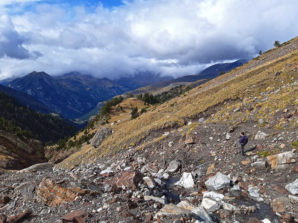
(5h55min; 11,7kms) Left - Leave GR11.2 (1.705m). Almost at the bottom, the Ribereta ravine opens up to the Añes Cruces ravine in an area where some clearings open up and the slope becomes less steep. Behind us is the valley through which we have descended, guarded by the iconic silhouette of Puntal de Barrau / Es Lenerez.
If we are attentive, at this point we can see a shy path that continues straight on, leaving the GR11.2, to join a track that runs a little further down, parallel to the Zinqueta de Añes Cruces valley. Either straight on along the aforementioned path or further on (about 150m further on), crossing a meadow, we leave the red and white markings to come out onto the aforementioned track. Once there, we continue down the valley for about a kilometre until we reach a path that leaves us at the first bridge we crossed at the beginning of the route, a few metres from the...

(6h25min; 13,3kms) Camping El Forcallo (1.560m).
PRACTICAL INFORMATION
WHERE TO SLEEP:
In the Viadós area:
- Refugio de Viados (974 341 613 / 620 928 209; refugio@viados.es).
- Camping El Forcallo (974 341 613).
- Free shelter Es Plans (good condition, benches, table, fireplace and about 16 seats upstairs).
- Tabernes free refuge (good condition, two fairly large rooms).
In the villages of the valley:
- Gistaín > see accommodation.
- San Juan de Plan > see accommodation.
- Plan > see accommodation.
BIBLIOGRAPHY / MAPS:
Walks and excursions in the Chistau Valley
- Editorial: Ediciones Prames S.A.
- Language: English
- No. of pages: 204
- ISBN-10 : 8483210886
- ISBN-13 : 978-8483210888
- Publication: 2018
- Editorial: Sua Edizioak
- Language: English
- No. of pages: 168
- ISBN-10 : 8482161504
- ISBN-13 : 978-8482161501
- Publication: 2003

Prames TOP25 Bielsa - Valle de Chistau map
- Editorial: Ediciones Prames S.A.
- Scale: 1:25.000
- ISBN-10 : 8483214954
- ISBN-13 : 978-8483214954
- Publication: 2020
Alpine Map: Chistau and Bielsa Valleys
- Editorial: Editorial Alpina S.L
- Scale: 1:25.000
- ISBN-10 : 8480904011
- ISBN-13 : 978-8480904018
- Publication: 2015
NEARBY YOU MAY BE INTERESTED IN
Distance: 10,2kms; Elevation gain: +965m; Time: 4-6 hours.