Mountain GPS: Garmin Models for Hiking & Trekking

Pyrenees and mountains 📩
Here 🔥The adventure-related GPS market evolves year after year with more discipline-specific models, new technologies, improvements over the previous series and some features becoming standard on the next generation.
Faced with the growing offer of increasingly specific devices, finding the model that best suits our activity, without going over budget and without paying for things we will never use, is not easy. If we are not familiar with the terminology, it will be inevitable not to get lost among the extensive nomenclature, the different series, the new generations and the jumble of acronyms that accompany each model.
Garmin GPS models for Hiking & Trekking
In this article we are going to focus only on the Garmin models that the brand itself recommends on its website for Hiking & Trekking activities. The current models as of today (June 2021) and that you can consult in the Garmin website.
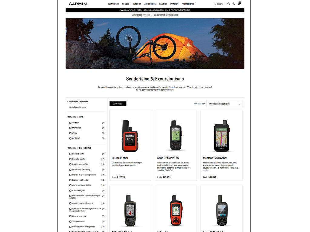
In total, there are 20 models if we break down each series.
- eTrex series: eTrex10, eTrex22x and eTrex32x
- GPS Map Series: GPSMAP64x, GPSMAP64sx, GPSMAP65, GPSMAP65s, GPSMAP66s, GPSMAP66st, GPSMAP66sr and GPSMAP66i
- Montana Series: Montana 680, Montana 700, Montana 700i and Montana 750i.
- inReach series: inReach Mini, inReach Marine Bundle, inReach SE+, inReach Explorer+ and the aforementioned GPSMAP66i, Montana 700i and Montana 750i.
But don't worry, the choice can be drastically reduced to a few models (2 or 3) if you know the main characteristics of each series and understand some important concepts.
Some concepts you should get to grips with before reading on
Well, before we get into it, we should familiarise ourselves with a series of concepts that you can skip if you think you already know them. What comes next is what will make the GPS go up in price (apart from the screen), the guts, the part that you can't see and that makes the difference between one model and another.
Extended GNSS compatibility: GNSS (Global Navigation Satellite System) systems are often referred to as GPS, including in this article. The truth is that increasingly, referring to them in this way is incorrect. GPS is the GNSS system of the United States, but it is not the only existing system. Over the last few years, new GNSS positioning systems have been incorporated with a greater or lesser degree of operability, such as: GLONASS (Russia), Galileo (Europe), Beidou (China), QZSS (Japan), NavIC (India), etc. A device compatible with these systems will be able to use a greater number of satellites to calculate its position, which means greater stability in difficult conditions (bottom of a ravine, etc.) and less signal loss.
Multi-band technology: the latest satellites to become operational in the Navstar constellation (GPS) and in the Galileo system, incorporate new frequencies for civil use: L5 (GPS) and E5a (Galileo) which improve positional accuracy. Currently (as of March 2021), this technology is present in the 52% of the GPS satellites and in the 22 operational Galileo satellites. Having a device with multi-band technology is particularly useful in areas where the signal is very degraded (e.g. bounced or very weak signals). If you want to know more, you may be interested in the interview with Jared Bancroftone of Garmin's engineers.
inReach technology: inReach technology, present in the inReach series and in some high-end devices with the "i" tag, is a satellite communication technology (Iridium network). It is very interesting for communicating in cases where there is no phone coverage, sharing your GPS position, sending an SOS message or communicating via messaging with any other compatible device, mobile phone or email address. This technology requires an annual or monthly subscription, plus an annual registration fee.
Helix Quadrifilar Antenna: An external antenna allows for better signal reception. This means better positional accuracy in adverse conditions (dense forest, hedged areas, buildings, etc.).
ABC sensors: By this acronym we mean devices that have a barometric altimeter and a three-axis compass. The barometric altimeter is highly accurate on a stable day, even better than the GPS signal when conditions are not favourable, and it will always work, even if the signal is lost. On the other hand, it loses accuracy as the hours pass (especially on days of increased instability and storms) and should be constantly calibrated for optimal results. The barometer will give early warning of weather changes. The three-axis compass is very useful for staying on course and seeing your map at all times, even when the GPS is tilted.
ANT+: is a protocol (similar to Bluetooth) to connect two devices to each other in a very simple way and share information, such as a track, instantly.
TopoActive Map: a good map with a lot of OSM based roads and routable. Some models have it installed as standard. This map does not have contour lines and to tell the truth, there are free alternatives that seem to us to be much better to go out in the mountains.
DeLorme TOPO map: OSM-based topographic mapping including contour lines and a high level of detail. Some models come pre-installed for €50. It is a good map for mountain activities, although as we underlined in the previous case, there are equally good free alternatives. If you want to see this map on your PC, you can play with it on the Garmin website: https://explore.garmin.com/.
The GPS we recommend
Let's get down to business. We had previously pointed out that there are 20 models that Garmin classifies for Hiking & Trekking.
To begin with, and although there is no one's taste, we are going to discard the Montana series models because of their excessive size. To get an idea, the Montana 700 has dimensions of 8.76cms x 18.3cms x 3.27cms (antenna included). In addition, for the mountains, we prefer other more robust models and avoid touch screens. As much as they have improved this type of screens, with gloves and in extreme conditions, we prefer the buttons or the joystick. However, if you are one of those who prefer a large screen, maximum resolution and to handle it as if it were a smartphone, this is the one for you.
We will also discard the inRech Mini and inReach Mini Marine Bundle (nautical pack) models, as they are more than just mountain GPS models (track following, map display, etc.), they are satellite communication devices that use GPS for geopositioning.
Finally, we will discard the GPSMAP 276Cx model, as it is a device that is intended for road navigation, TomTom style.
In total, of the initial 20 models, we will keep these 13, which we will analyse series by series.
- eTrex series: eTrex10, eTrex22x and eTrex32x
- GPS Map Series: GPSMAP64x, GPSMAP64sx, GPSMAP65, GPSMAP65s, GPSMAP66s, GPSMAP66st, GPSMAP66sr and GPSMAP66i (with inReach technology).
- inReach series: inReach SE+ and inReach Explorer+.
Garmin eTrex series:
The Garmin eTrex series models are probably the best sellers for hiking and mountain activities in general. They are very precise devices, small in size, with great autonomy (25 hours), with all the functions you need (load and record tracks, waypoints, display maps, etc.) and at the best price. A great buy. In addition, the latest generation of eTrex22x and eTrex32x models have a 240×320 pixel screen which, for those who come from eTrex20 and etrex30 models (176×220 pixels), is a substantial improvement.
eTrex10
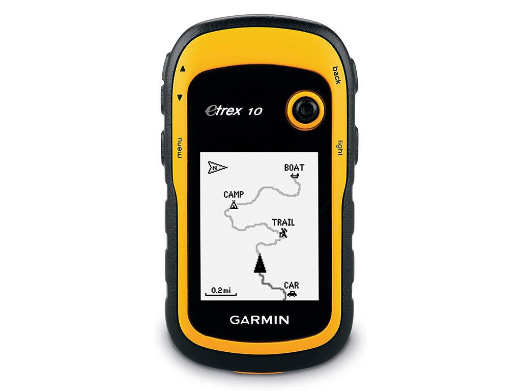
The eTrex10 is a two-generation model that has not been upgraded like its 20 and 30 siblings. It is the cheapest option for a new GPS. You can find it from 119€ on Garmin's official website and a bit cheaper on websites such as Amazon (92€).
The advantage of this model is the price. The cons are several. To highlight, the black and white screen and the low resolution (176×220 pixels) for what we are used to these days. If you are still interested, on the Garmin website you can check out all of their characteristics.
eTrex22x and eTrex32x
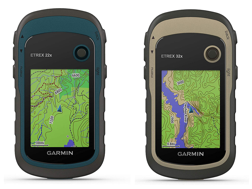
The eTrex22x and eTrex32x, launched in 2019, are the models that replaced the eTrex20x and eTrex30x. Basically, the only thing that changes from the previous generation is that the internal memory has been increased from 4GB to 8GB and that the TopoActive map of Europe is installed and charged as standard.
The difference between the eTrex22x and the eTrex32x is that the eTrex32x features a barometric altimeter, 3-axis compass and wireless connectivity.
If you want to see all its features and a comparison between the two models, you can see it in this link to Garmin website.
Garmin GPSMAP series:
The GPSMAP series, especially the new models, can be considered as the best mountain GPS of the brand. They are robust models. The preferred choice for the most demanding users looking for increased reliability and accuracy at all times. The external antenna (Quadrifilar Helix), extended GPS compatibility and multiband technology (depending on the model) allow you to obtain a reliable position in the most difficult conditions.
GPSMAP64x and GPSMAP64sx
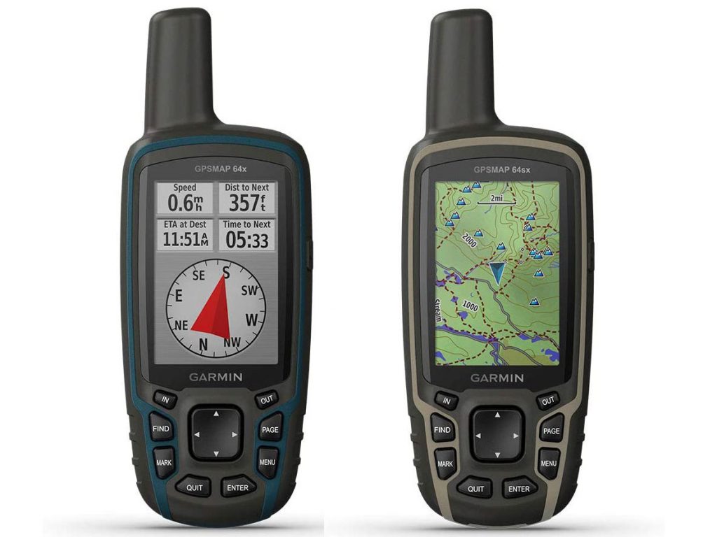
At this moment, the 64x and 64sx are the two models of the 64 series catalogued as current by Garmin.
The difference between one and the other is that the GPSMAP64SX model includes barometric altimeter, 3-axis compass and wireless connectivity.
The difference with the eTrex32x (supposedly inferior) is the compatibility with the Galileo system, the external antenna which makes it more accurate in unfavourable conditions and the more convenient operation via buttons instead of a joystick.
On the other handThe eTrex32x (more modern), has a smaller but higher resolution screen, a longer battery life, is lighter, comes with the TopoActive map of Europe as standard and is cheaper (285€ vs 205€).
GPSMAP65 and GPSMAP65s
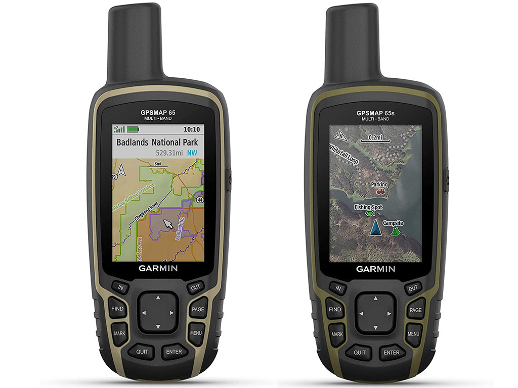
The difference between the two models is that the 65s has a barometric altimeter and compass.
DIFFERENCES COMPARED TO THE 64 SERIES
The main difference (really important) compared to the 64 series is that the 65 series adds multi-band technology (explained at the beginning) to all models.
Other changes The not-so-substantial differences are that in the 65 series the "x" that appeared in the 64 series disappears, as Galileo comes as standard in all models (Galileo is also present in the two models reviewed 64x and 64sx). The "s" is retained to indicate that an altimeter and compass are available, while wireless connectivity is standard.
The natural comparison between GPSMAP65 corresponds to GPSMAP64x (see comparison).
The differences The most significant benefits in favour of models 65 vs. models 64 are as follows:
| Series 65 | Series 64 | |
|---|---|---|
| Memory | 16GB | 8GB |
| Pre-installed maps | TopoActive Europe | |
| Extended GNSS | GPS, GLONASS, Galileo and QZSS. | GPS, GLONASS and Galileo |
| Multiband technology | YES | NO |
| Wireless connectivity | Yes, as standard. | In the 64sx model. |
| App compatible | Garmin Explore and website. | NO |
GPSMAP66s, GPSMAP66st, GPSMAP66sr and GPSMAP66i
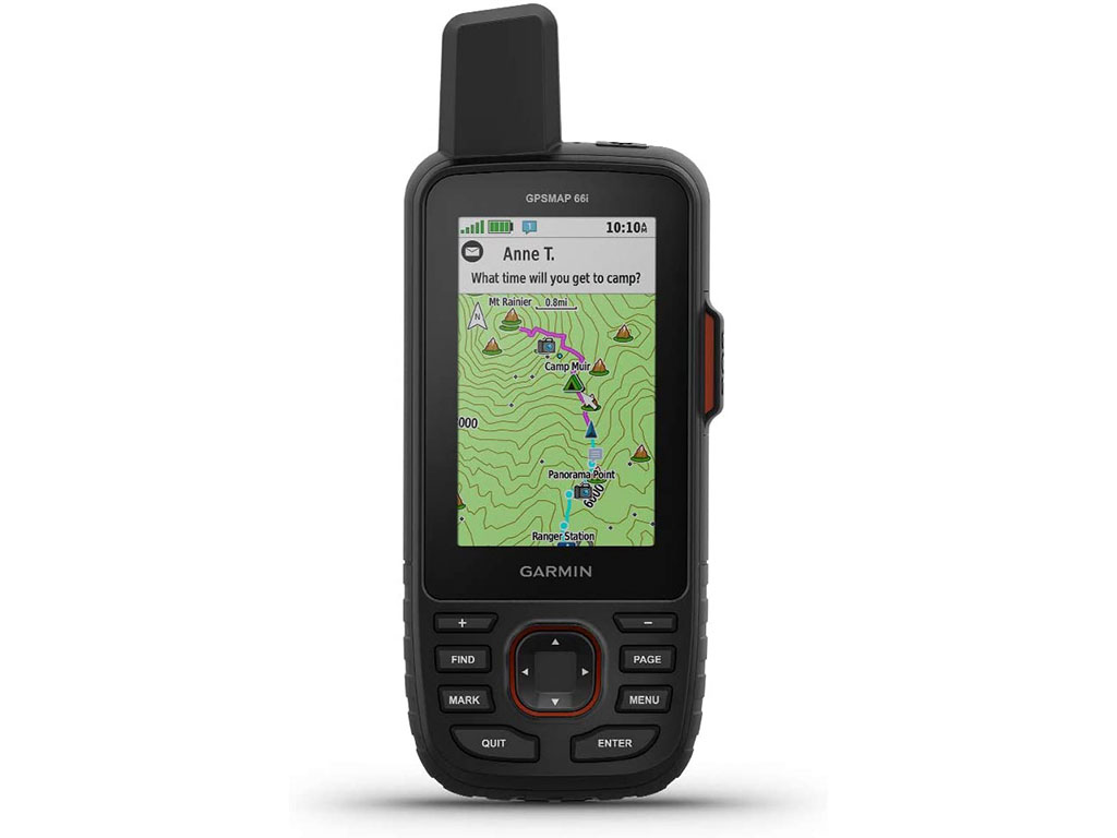
The 66 series can be considered as a natural evolution of the 64 series and the 65 series (with an important difference that we will now see). Among the main differences are the following.
Differences compared to the 64 and 65 series:
- A small change in the shape of the device, slightly more square.
- Higher resolution screen (240 x 400 pixels, compared to 160 x 240 pixels).
- Compass and barometric altimeter as standard.
- Increased capacity for storing tracks, waypoints, etc.
- Live Track (internet tracking via the Garmin Connect website).
- A variety of models that we will now take a look at.
Differences from the 64 series:
- 16GB vs. 8GB
Differences compared to the 65 series:
- The 65 series devices are all multi-band. In the 66 series, the multi-band model is the 66sr.
66 series models:
- GPSMAP66s: is the basic model of the 66 series. The natural comparison is with the GPSMAP64x model. When comparing with the 65s model, it should be noted that the 66s does not include the Topo Active map as standard.
- GPSMAP66st: the same model as above with pre-installed Topo Active map of Europe.
- GPSMAP66sr: with multi-band technology and pre-installed TopoActive map of Europe.
- GPSMAP66i: is not multi-band and includes the pre-installed TopoActive map of Europe. The main new feature is that it includes inReach technology (satellite communication), which, as we have already seen, requires an annual or monthly subscription, plus an annual registration fee.
And the question on many people's minds is, why not a multi-band 66 inReach model - are they saving this carrot for the 67 series? We will have to wait a while to find out the answer.
inReach series
inReach technology, found in the inReach series and in some high-end devices with the "i" designation, is a satellite communication technology using the Iridium network.
As mentioned above, this technology is very useful for communicating in places where there is no phone coverage, sharing your GPS position, sending an SOS message or communicating via messaging with any other compatible device, mobile phone or email address.
Please note that this technology requires an annual or monthly subscription plus an annual registration fee.
The inReach Mini model being a basic communication model, outside the scope of this article, the two exclusive models in this series are the inReachSE+ and the inReachExplorer+.
InReachSE+ and inReachExplorer+

The difference between the two models is that the Explorer+ model comes as standard with the DeLorme Topographic map (seen at the beginning). But beware, the inReachSE+ model, despite the screen, is a model that cannot be loaded with maps, what Garmin calls a non-mapping GPS. You can display a track on a grid and load waypoints, but not maps. If you need to view a map, the option is to sync it with your smartphone. The other difference is that the Explorer+ adds barometric altimeter and compass.
InReachExplorer+: As mentioned above, this model comes standard with the DeLorme topographic map. Maps can be added to this model, but only compatible maps that can be found on the website of Garmin Explore.
Otherwise, it is a GPS with very limited features for the price it has (let's not forget that its main feature is that it is a satellite communication device) and that we will have to continue paying to make use of the communication system.
On the Garmin website you can see all the features of the model. inReachExplorer+.
Final summary:
- Despite the advances, mountain GPS is still far from offering the operability of the smartphones we normally use. True pocket-sized superprocessors. However, mountain GPS devices offer greater resistance, autonomy and durability. That's what they are made for, to withstand and be used in adverse conditions. If you are looking for something smartphone-like, the Montana series is the closest thing in this class of devices. We haven't covered them here.
- For most users, the eTrex22x or eTrex32x are the best value for money choice.
- For demanding users, the GPSMAP64sx and GPSMAP64x models, with external antenna and Galileo system, provide a leap in quality in the calculation of position in adverse conditions (degraded signal, few visible satellites, etc.). However, they have a lower resolution screen and other disadvantages that we saw above with respect to the previous models.
- The GPSMAP65 and GPSMAP65s continue in the same vein, adding reliability and stability in position calculation with multi-band technology.
- The 66 series models are the latest generation GPSMAP, incorporating a higher resolution display. There are 4 models available in this series. Basic model 66s and 66st (including map). Model 66sr with multi-band technology (in the style of the 65 series). Model 66i with inReach technology (but not multiband).
- Between the models of the inReach SE+ and Explorer+ series, the Explorer+ is worth the price difference (€50), as it supports maps. Furthermore, in our humble opinion, if you want to spend €500 plus satellite communication fees (annual or monthly) and registration fees (annual), we prefer the GPSMAP64i for €600.
Price of all models analysed
| Model | Garmin website | Amazon |
|---|---|---|
| eTrex10 | 119,00 € | 119,00 € |
| etrex22x | 199,99 € | 199,99 € |
| etrex32x | 249,99 € | 214,99 € |
| GPSMAP64x | 299,99 € | 294,00 € |
| GPSMAP64sx | 349,99 € | 285,14 € |
| GPSMAP65 | 349,99 € | 349,90 € |
| GPSMAP65s | 399,99 € | 401,00 € |
| GPSMAP66s | 399,99 € | 399,99 € |
| GPSMAP66st | 449,99 € | |
| GPSMAP66sr | 499,99 € | |
| GPSMAP66i | 599,99 € | 569,00 € |
| inReach SE+ | 449,99 € | 395,99 € |
| InReach Explorer+ | 499,99 € | 470,00 € |
Fastpacking is not about going faster. It's about going lighter.
If you come from classic trekking, this is the next step: learning to move with less weight,
more fluid and enjoying every kilometre more.
Join the Outsiders Newsletter and start discovering what lightness feels like.