Circular route in the Irati Forest: Akerreria and Malgorra from the Houses of Irati
Pyrenees and mountains 📩
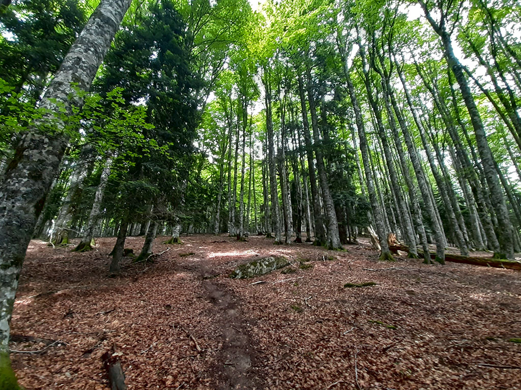
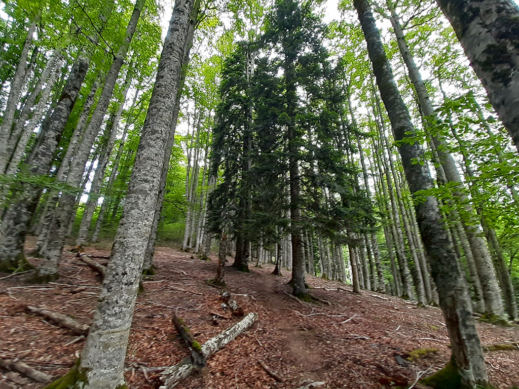
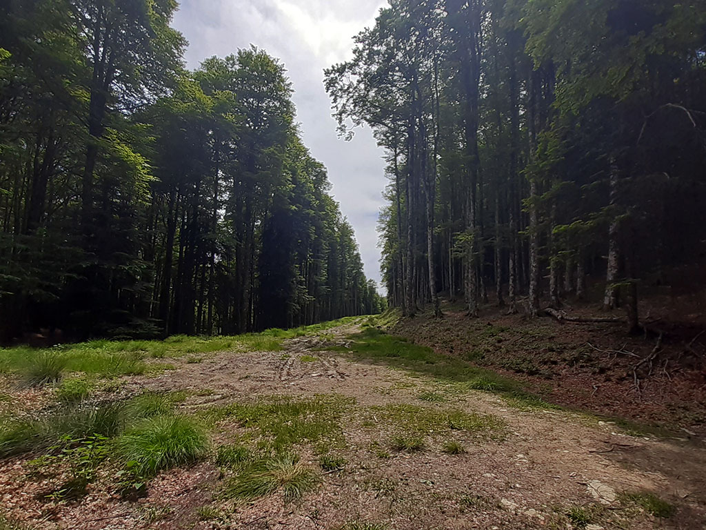
Here 🔥We go on a route to the heart of Irati, one of the largest and best preserved beech and fir forests in Europe.
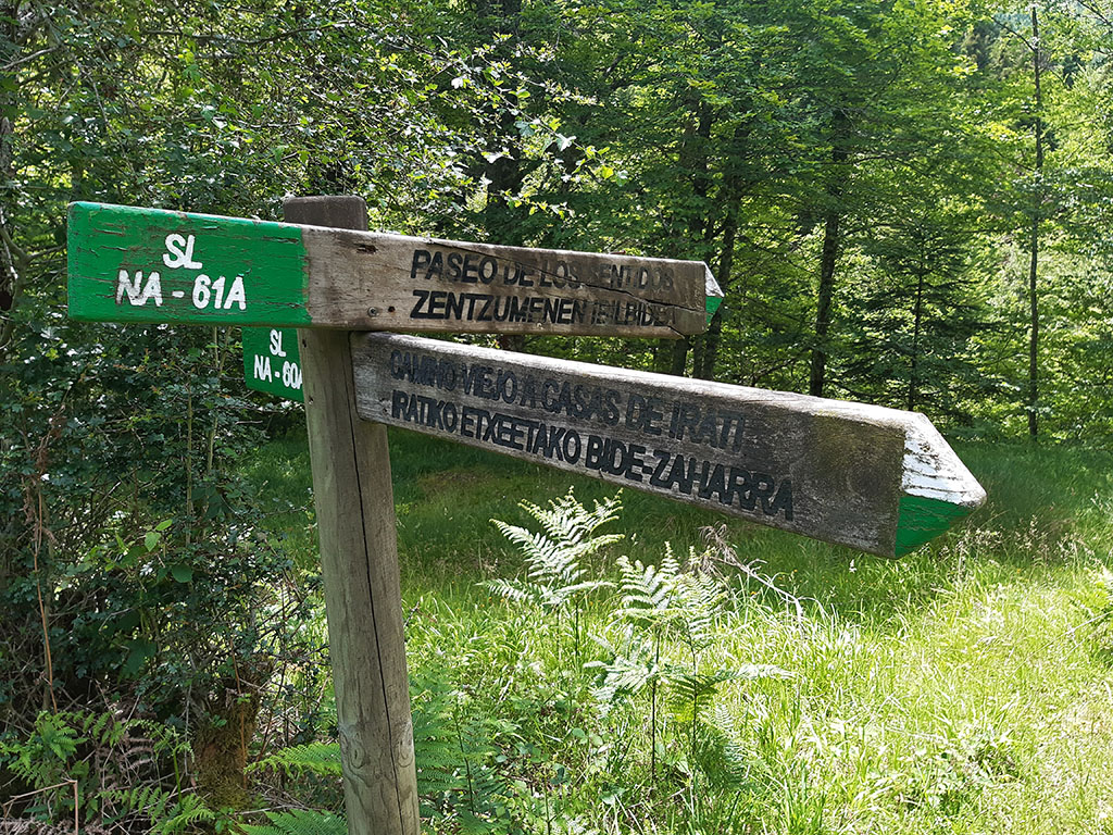
The route that we propose partly follows two of the many marked trails that run through this natural area, the Old Way to Casas de Irati (SL-NA 60A) and the Old Way to Koixta (SL-NA 69). Possibly the best combination of marked trails to get to know the interior of the Irati Forest and the Urtxuria ravine, one of the two main tributaries that form the Irati River.
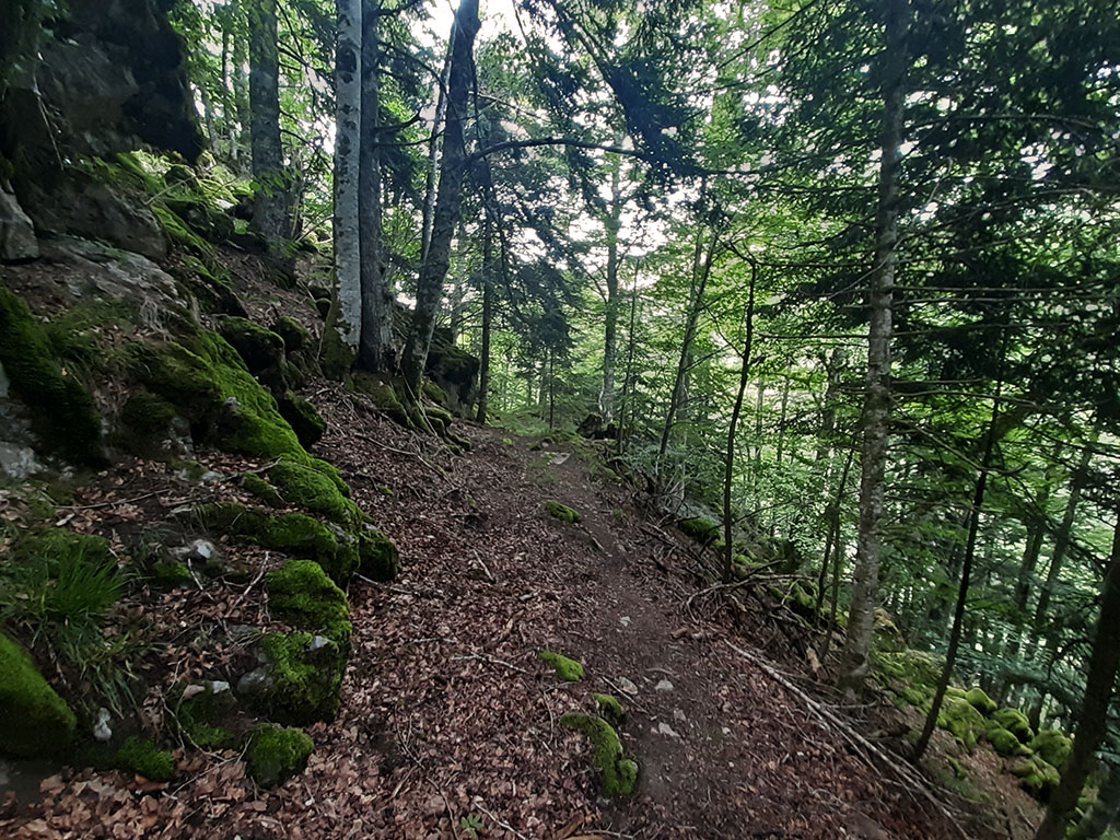
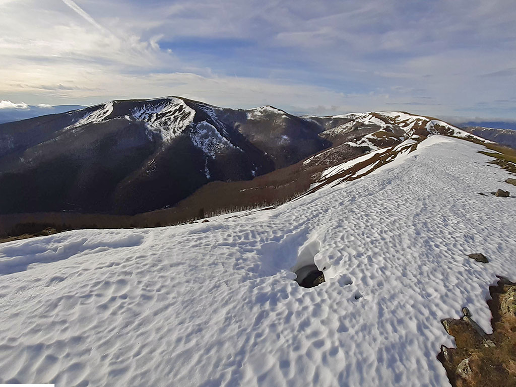
As an alternative to the local path, we propose a variant that runs along the ridge between Mount Akerrería (1,317m) and Malgorra (1,363m), a natural separation between the Urtxuria and Urbeltza basins. A place to get lost in, and this is not a metaphor. It is a confusing area, without references, difficult to find your way around, covered by a thick forest and with so many paint marks in some areas that rather than helping, they confuse even more. In short, this is a route that, despite not being too long and not too steep, should not be taken lightly.
SUMMARY OF THE ROUTE:
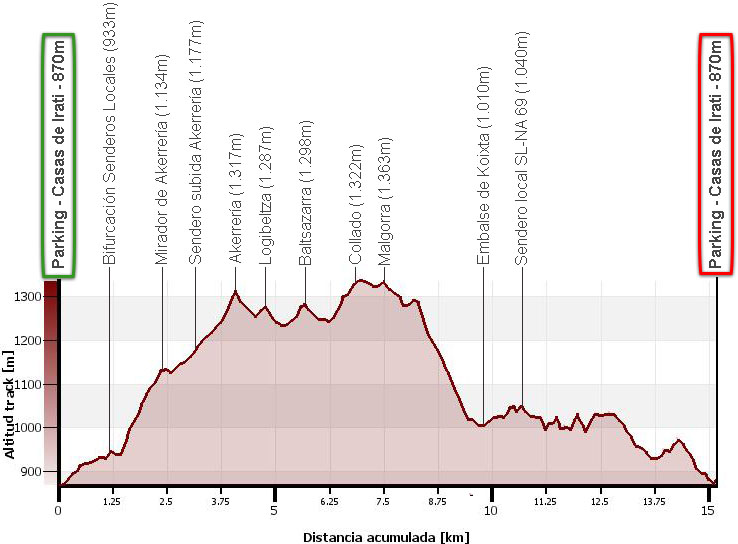
Circular route through the interior of the Irati Forest in which we will ascend Mount Akerreria (1,317m), Logibeltza (1,287m), Baltsazarras (1,298m) and Malgorra (1,363m). From Casas de Irati we will go up the Camino Viejo a Casas de Irati (SL-NA 60A) until we reach the Akerreria pass, where we will leave the local path to go to the Akerreria mountain. From the summit of Akerreria, the route continues along the ridge, gaining or going around Logibeltza and Baltsazarras, if you prefer, to then enter a confusing area with several peaks of similar altitude. Malgorra, the highest of them all, is broken to the south. Once the summit is reached, the route descends to cross the Malgorra stream to go down along a path to the Koixta reservoir. From here, along a track for approximately 1 kilometre and then along the old road to Koixta, we return to the start of this excursion at the Casas de Irati.
MAP:
DOWNLOADABLE:
> Download Track
HOW TO GET THERE:
See in Google Maps.
Once in Ochagavía, which we reach via the NA-178 and NA-140 from Lumbier (46kms), we take the turn-off at the entrance signposted to the Irati Forest. A narrow road through the Tapla Pass (usually with snow in winter) leads us in about 25 kilometres to the Casas de Irati and Virgen de las Nieves car park, the start of this excursion.
Technical specifications:
Distance: 15,3kms
Cumulative difference in altitude: +970m/-970m
Timetable: 6h00min. Running time non-stop: 4h30min.
Water: At the beginning of the excursion, at the car park, there is a fountain. During the walk you will pass several streams.
Difficulty: high due to the confusing nature of some areas in the upper part. Between Akerrería and Malgorra and the descent to Koixta.
ITINERARY:
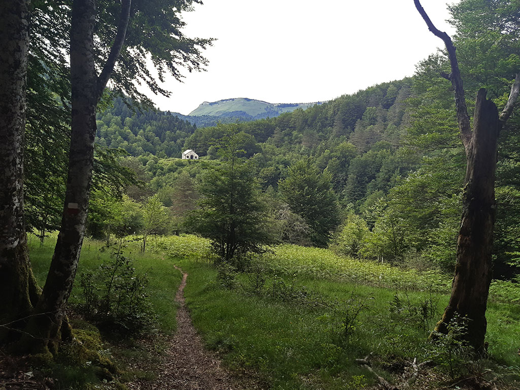
(0h00min; 0,0kms) Parking below Casas de Irati / Virgen de las Nieves (870m). A large car park with space for about 100 cars, picnic area, information point and fountain. We go back a hundred metres along the road to Ochagavía, crossing the Urbeltza river again, until we take the path that goes up to the Irati houses and the Virgen de las Nieves hermitage.

The path is marked with white and green paint corresponding to the Paseo de los Sentidos (SL-NA 61A) and the Camino Viejo a Casas de Irati (SL NA-60A). We pass the Casas de Irati, the ruins of the Casas del Rey and the hermitage of the Virgen de las Nieves before entering the realm of the forest.
(0h20min; 1,1kms) Fork of local paths (933m). A signpost on the right indicates the path back to the houses of Irati along the Paseo de los Sentidos.
Straight ahead on the left, our path descends slightly to cross a stream and continue on a steep ascent. After about 20 minutes, we reach a fork where we take the path on the right to go to visit the...
(0h50min; 2,4kms) viewpoint of Akerreria (1.134m)This is one of the few places where the path leaves the forest and allows us to contemplate the Irati Forest. From the viewpoint we can see the Urtxuria gorge through which the return path runs on the other side.

Continuing forwards, the path returns us to the local path (Camino Viejo a Casas de Irati) which continues ascending until it comes out into a large clearing, the Akerreria clearing. Cross it following the main path until you enter the forest again, ignoring the white and green signs that leave the path to get lost on the right.
(1h05min; 3,2kms) Ascent to Akerrería (1.177m). As soon as we enter the forest we find the path up to Akerreria, marked with blue Irati Trail paint in the opposite direction. The path leads us to the first summit of the day.
(1h25min; 4,2kms) Akerreria (1.317m). Covered by a dense forest, without a letterbox, a milestone marks the highest point. The path turns in an easterly direction to descend to a hill that separates Akerreria from Logibeltza. This is an unimportant height that, if we want to reach the top, we will do so without a path on the left hand side.
(1h40min; 4,9kms) Logibeltza (1.287m). Descend eastwards through the countryside to rejoin the path further on. The path of the Irati Trail (blue) continues winding along both sides of the ridge, avoiding the less important peaks.
The next one is Baltsazarra. To climb it, leave the path and head off to the right across the field.
(1h55min; 5,7kms) Baltsazarra (1298m). We join the path again further on, on a hill to which there is a track from the Koixta reservoir / Raso de Akerreria.
The route continues ahead, along a path that forks shortly after and that we take to the left. The path becomes clearly ascending, goes around a hill on the left (north) and arrives at a...
(2h15min; 6,9kms) col (1.322m) where on the left hand side there is a stream that descends to the north. We are at a key point on the route, a place of difficult orientation. We are at the most easterly of the three passes that separate a group of peaks of similar altitude (1334m, 1341m, 1347m and 1345m according to the IGN) and which on the Guide to the Mountains of Navarre (J.M.Feliu; 2007) call Malgorra Norte with an altitude of (1.363m).
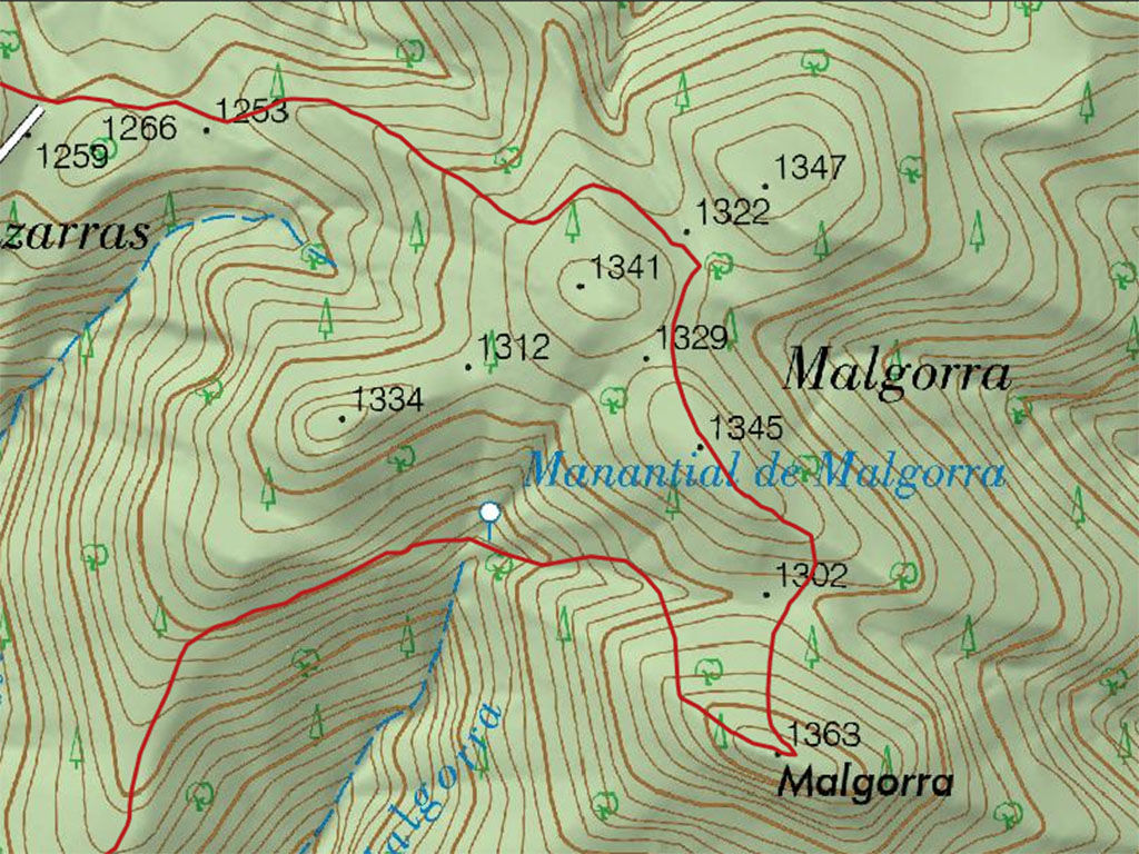
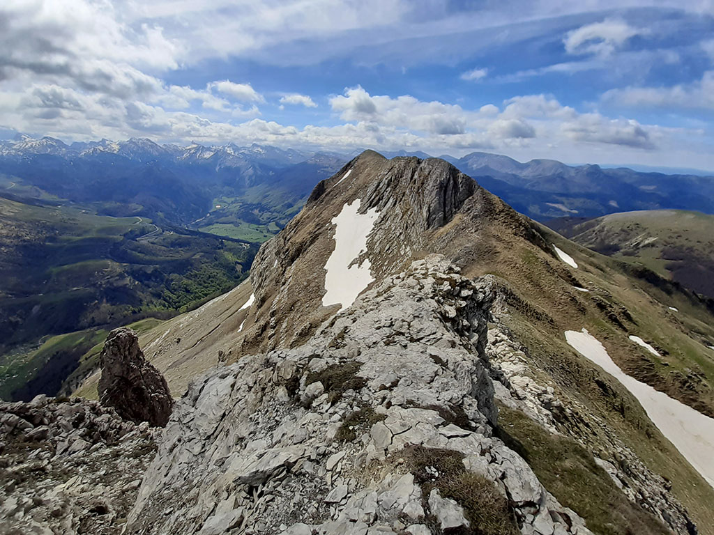
To continue, we will look at the paint markings on the trees (various colours). On one of them is painted the direction to descend to Koixta. We leave the blue points of the Irati Trail and turn right towards the south, following the pink markings on the right (on the left they will take us down to the Ibarrondo ravine). From here to the main peak of Malgorra and until you join the path down to Koixta, it is a rather confusing area where you will find paintings of various colours in all directions. As we said, we follow the pink markings to the right heading south to continue a little later to the left, walking along the south-southeast ridge, passing by 1,345m. We will advance carefully to see the main peak of Malgorra in the thick forest, separated to the south by a pass (1,302m) to which we descend before tackling the final climb.
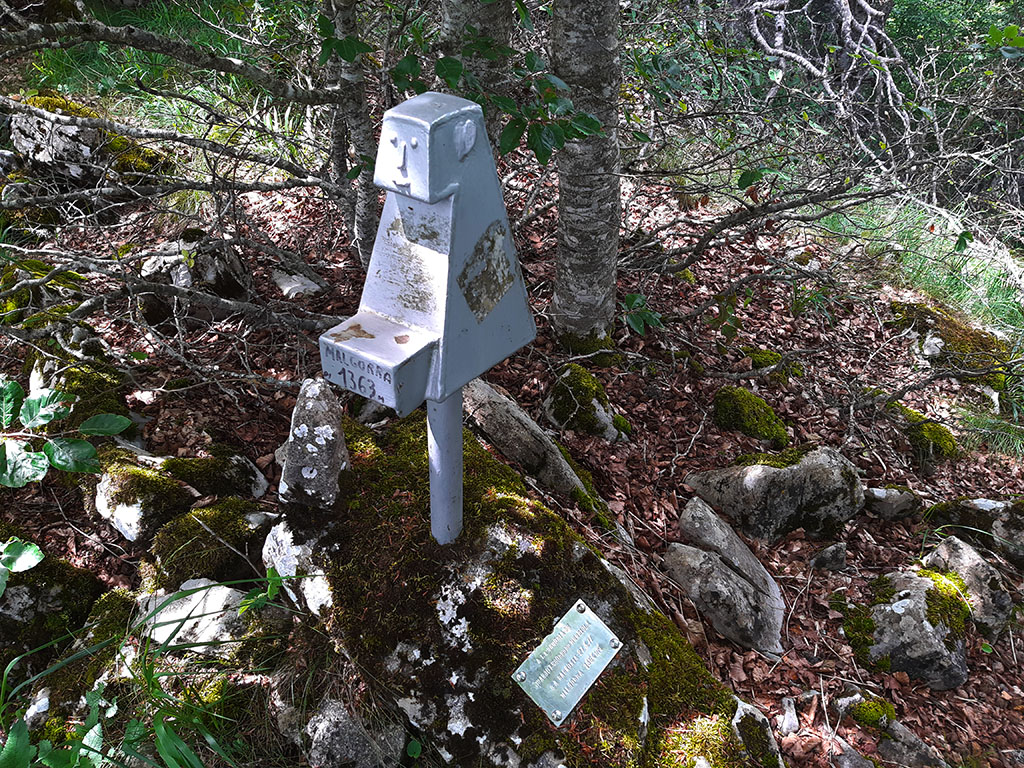
(2h30min; 7,6kms) Malgorra (1.363m). With no view, covered by trees, a letterbox crowns the top of this peak.
For the descent, it is preferable not to be tempted by the ridge that drops off to the west and descend back down to the valley that opens up on the right to change banks. If you prefer, you can go down the same way up to the pass and then start a descent on the right bank of the ravine. At first the path is not very clear, although it eventually becomes clear. The path descends over the hill that separates the Gorosti (to the west) and Malgorra (to the east), with no major concern other than to take a crossroads to the right halfway down, which if you skip it, it would be of no great importance. The path leaves the forest when you reach the bottom of the valley, where it joins a track that you take to the left.
(3h10min; 9,8kms) Koixta reservoir (980m). Next to the dam, several signs provide information about the different routes.

Cross the small reservoir dam and continue along the track for about a kilometre, until you find a path on the right that descends through the beech and fir woods, parallel to the Urtxuria ravine.
From here on, we will follow the path marked in white and green corresponding to the Camino Viejo a Koixta (SL-NA 69), until we come out onto the road from Ochagavía to Casas de Irati, very close to the end of this excursion.
(4h30min; 15,3kms) Car park below Casas de Irati / Virgen de las Nieves (830)
Maps:
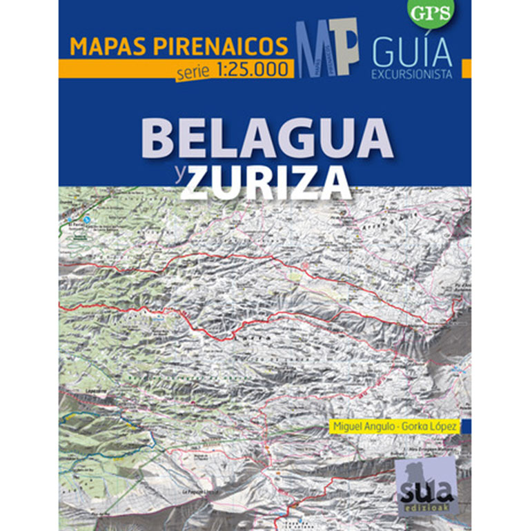
- Editorial: Sua Edizioak
- Language: Spanish
- ISBN-10 : 8482165887
- ISBN-13 : 978-8482165882
- Publication: 2015
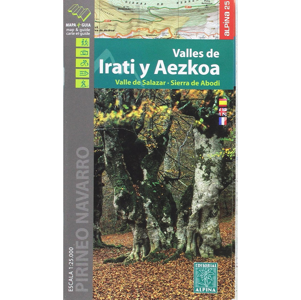
- Editorial: Alpina.S.L
- Language: Spanish, English and French.
- ISBN-10 : 8480906685
- ISBN-13 : 978-8480906685
- Publication: 2017
NEARBY YOU MAY BE INTERESTED IN
Urkulu (1.423m), Bentarte (1.384m), Leitzarateka (1.414m), Txangoa (1.471m), Menditxipi (1.377m), Astobizkar (1.499m), Mendimotx (1.492m), Ortzanzurieta (1.566m) and Murukoa (1.223m)
Larrondo (1,703m), Keleta (1,906m), Ezkieta (1,906m), Lakartxela (1,982m) and Bimbaleta (1,758m).