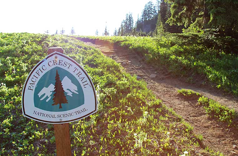
Pacific Crest Trail: the trekking of the USA, more than 4,000 km from Mexico to Canada
Pyrenees and mountains 📩
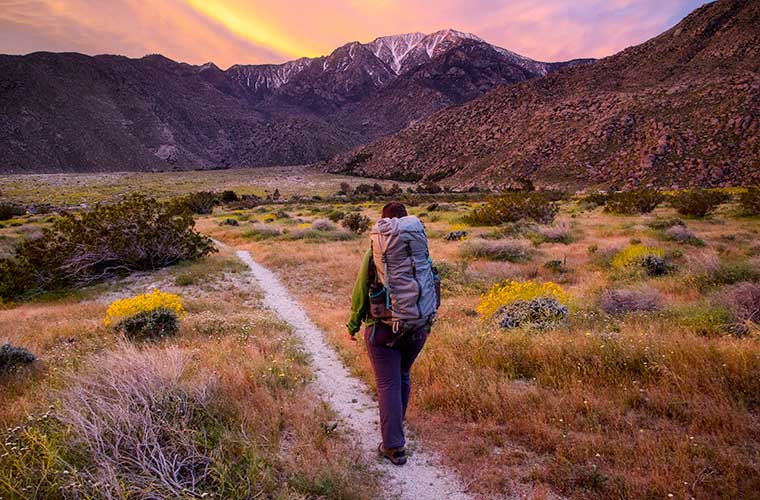
Here 🔥The Pacific Crest Trail (PCT) is the crown jewel of America's trails, stretching 4,286km from Mexico to Canada through three western states. Experience the beauty of the desert, hike the glaciated expanses of the Sierra Nevada and discover breathtaking views of volcanic peaks and glaciers in the Cascade Range. The trail also passes historic mining sites and evidence of humans' endless search for natural resources. The Pacific Crest Trail It runs through the mountain ranges that divide the west coast and the rest of the nation. There is a lot of history attached to this route and it makes for an interesting trek.
History of Pacific Crest Trail
This path, the Pacific Crest Trail, which stretches from the Mexican border to the Canadian border, was used by settlers in the 19th century in search of a better life in California, Oregon and Washington. This 4,286-kilometre trek offers a variety of environments ranging from dry, hot deserts to huge mountains stacked one behind the other. As most settlers came from the north, the trail area they encountered was very hilly. Whereas today's hikers will find a beautiful and challenging route, with a variety of environments and landscapes.
The story of the Pacific Crest Trail began when the route was first explored in the late 1930s by YMCA youth teams. Once it proved feasible, trail pioneers Clinton Clarke and Warren Rogers lobbied the federal government to secure a corridor of trails from border to border. However, they had to settle on several disconnected trails along each state's border. Largely through the efforts of hikers, the PCT was eventually designated one of the first scenic trails in the National Trails System authorised by Congress in 1968, and was opened in 1993.
Ironically, the Pacific Crest Trail is actually a relatively modern name. Prior to 1993, it was known as a general collection of trails that ran along the route with parts of trails such as the John Muir Trailamong others.
![The Pacific Crest Trail: Hiking the PCT from Mexico to Canada (International Trekking) [English Language].](https://m.media-amazon.com/images/I/61ZRVKnVnmL.jpg)
Planning your route
When to go?
The Pacific Crest Trail It must be done without snow. This should be taken into account when choosing the different sections, taking into account the climate of each area; Southern California is best tackled in spring or autumn and the High Sierra, Northern California, Oregon and Washington are best from the end of June to the beginning of October. Consider starting the route in mid-May.
Access to the route
Most hikers access the PCT from San Diego, Los Angeles, San Francisco, Portland, Seattle or Vancouver, all of which are about 80 km west of the trailhead.
Difficulty
The PCT is a wilderness trail. At many points you will be in remote places, far from road access, and you will need to carry enough food to last several days; you will find little to eat. accommodationso you will have to camp or make camp.
What not to miss
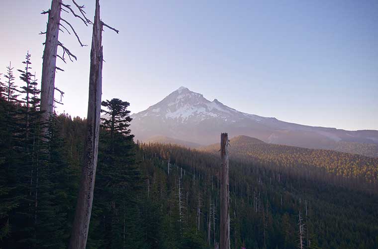
The High Sierra of California with Mount Whitney, the John Muir Trail and Yosemite National Park; Crater Lake in Oregon; the towering volcanoes of the Cascade Mountains: Lassen Peak, Mount Shasta, The Three Sisters, Mount Washington, Mount Jefferson, Mount Hood, Mount Adams, Mount Rainier and Glacier Peak.
Walking through the Pacific Crest Trail (PCT) from Mexico to Canada
Travelling from border to border, few hikers have attempted to walk the entire trail in one go - not least because we often have to do this strange thing called work. Nevertheless, a trip from Mexico to Canada, walking more than 4,000 kilometres, is likely to be a vital experience.. Let us imagine it.
Sections of the Pacific Crest Trail
The PCT consists of five distinct sections, each with its own unique climate, geology, flora and fauna. These sections are:
Southern California, Central California, Northern California, Oregon and Washington.
The Pacific Crest Trail Association". is an excellent source of information for anyone planning a trip in the PCT.
Southern California
- 1. Van Dusen Canyon Camp (Big Bear City)
- 2. ig Bear City to Agua Dulce
- 3. Agua Dulce to Kennedy Meadows
The High Sierra / Central California
- 4. Kennedy Meadows to Tuolumne Meadows
- 5. Tuolumne Meadows to Interstate 80 (Donner Pass)
Northern California
- 6. Donner Pass to Interstate 5 (Castella)
- 7. Castella to Interstate 5 (Ashland)
Oregon
- 8. Ashland to McKenzie Pass
- 9. McKenzie Pass to Cascade Locks
Washington
- 10. Cascade Locks to Snoqualmie Pass
- 11. Snoqualmie Pass to Manning Park
Map of the Pacific Crest Trail (PCT) "
![Map of the Pacific Crest Trail / Photo: USFS and EncMstr [Public domain].](https://travesiapirenaica.b-cdn.net/wp-content/uploads/2019/07/Large_PCT_Map-622x1024.jpg)
Pacific Crest Trail back and forth
Having paid his bills a few months in advance, he would head for the U.S.-Mexico border just west of the Campo city. There you will find five simple, unimportant wooden planks marking the beginning of the trail. Facing north and remembering how far those boots are going to walk, you are ready to start.
Winding its way northwards, it will pass through the mountains above Palm Springswill run through the Mojave Desertwill walk through the peaks of Kings Canyonwill arrive in the west of the lake Tahoe and finally it will go to Oregon walking along the I-5 motorway. On the way, you will walk along the mount Whitney and through the Yosemite National Park. Not bad, eh?
In California, trails through Kings Canyon are simply breathtaking and will leave you in awe of Mother Nature's beauty. Once in Oregon, you will turn eastwards through Ashford and then you will head north. Your next destination will be Crater Lake and the mountains Three SistersYou will leave Oregon by walking through old lava fields. You will leave Oregon behind you by crossing the Hood River near White Salmon, Washington.
When you reach the final stretch, you'll head straight to Washington, east of Olympia y Seattleto the Canadian borderjust below Manning Park. It's a long, long journey and you'll be tired of walking, but not of living intensely on the road .
The Pacific Crest Trail is above all a life experience, a unique beauty, and as many of those who have walked it would tell you, a change in their lives.
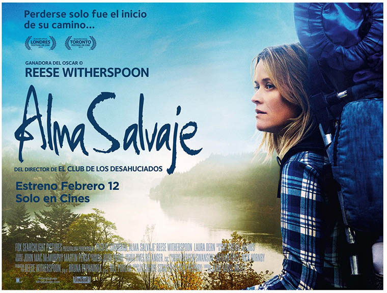
As an appetizer you can see the film "Wild Soul".directed by Jean-Marc Valléeen, in which a young woman walks the path after a personal experience in which she had hit rock bottom. If you are more of a reader, you can also read the book.
Fastpacking is not about going faster. It's about going lighter.
If you come from classic trekking, this is the next step: learning to move with less weight,
more fluid and enjoying every kilometre more.
Join the Outsiders Newsletter and start discovering what lightness feels like.