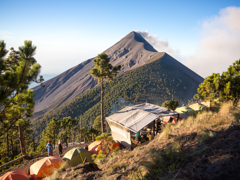
Acatenango Volcano - Guatemala

Guatemala is a country full of volcanoes and mountains to climb. Adventurous hikers and trekking fanatics will find here a place where they can enjoy an extraordinary holiday.
READ ALSO: Top 12 treks in Central America "
At an altitude of 3,976 metres, the Acatenango volcano is one of three volcanoes above 3,000 metres (together with the Fuego and Agua volcanoes) that make up the Antigua mountain range. The activity of these volcanoes dates back more than 200,000 years and some of them are still erupting. Some 100,000 people live around these volcanoes and are exposed to all kinds of risks.
This volcano has two peaks: Pico Mayor and Yecopaca. The last eruptions that occurred in this volcano were between 1924 and 1927 and another one in 1972 in the north of the summit of Pico Mayor. From the top of the volcano it is possible to see the surrounding volcanoes and all that surrounds the mountain such as the towns and villages in the area.
Practical guide for hikers
To do the route, the first thing to do is to think about the method you are going to use to climb it. There are three possible options: to do it individually, to hire a tour company at a cost of about 60 dollars and do the route with 15 other people, or in the town of La Soledad to hire the services of a local guide who will do the route privately at a cost of about 25 dollars.
The route starts in the town of San Pedro de Yepocapa, but most travellers stay in the town of Antigua.
The hike starts at 4am and takes about 3 to 4 hours. The hike starts at this time in order to have a good view of the area; clear, cloudless. It is not necessary to spend a long time at the top, 30 minutes to an hour is more than enough.
To finish the route and return to Antigua you have to take a bus to Parramos and from there another bus to Antigua. The direct service from the village of La Soledad only runs early in the morning.
Advice for hikers
The biggest problem with climbing to the top of this mountain is that during the trek there are many muggers who attack tourists. The way to avoid any kind of clothing or hiring a guide, either an agency or a local guide. This way you will avoid any kind of problem with the attackers. The route with a local guide can be a better experience. Local guides conduct private tours with the members of the group, i.e. they do not mix with other people. They allow you to sleep in their house or camp next to them. It is also much cheaper than hiring a travel agency.
As this is a high altitude mountain, warm clothing will be necessary. During the hike the temperatures will drop as the altitude increases. If the route is to be done at night, the clothing should be very warm. If the route is done during the day, the clothes could be lighter but warm clothes will be necessary for the summit. It is essential for everyone to wear comfortable, sturdy walking shoes.
As far as food and drink are concerned, it is important to calculate the rations that will be needed. The route is done in one morning, but it is necessary to bring enough food and drink.
Although there are no major problems in following the path, it is recommended to use a GPS device to avoid any risk. This way, in the event of an injury or any kind of problem, the rescue services will be able to act very quickly. Although in the case of people who are not experienced in hiking routes, it would be a better idea to hire a guide.
It is important to plan the trip in advance as weather conditions will make the route easier or more difficult. In order to be able to climb to the summit it will be important to take into account whether there is rain or not and the wind. However, there may be some parts of the trail where it is not always clear which route to follow.
The locals only speak Spanish, so a basic knowledge of the language is recommended. It is also quite difficult to find a local to ask for directions to the trail.
Fastpacking is not about going faster. It's about going lighter.
If you come from classic trekking, this is the next step: learning to move with less weight,
more fluid and enjoying every kilometre more.
Join the Outsiders Newsletter and start discovering what lightness feels like.
