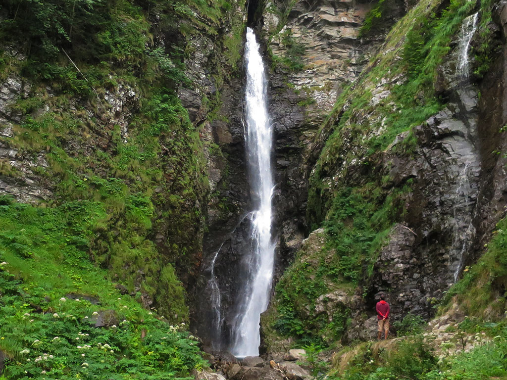
Cascade d'Enfer, at the headwaters of the Lys valley
Pyrenees and mountains 📩
Here 🔥The Cascade d'Enfer11 km from Bagneres de Luchon, is one of the most beautiful waterfalls in the Pyrenees. It is situated at the head of the Lys ValleyIt is a beautiful place where, in addition to the waterfall, there are several half-day routes signposted. For the more adventurous, it is also the starting point to reach several three-thousand-metre peaks, those that crown the Cirque de Crabioules, two thousand metres higher.
How to get there:
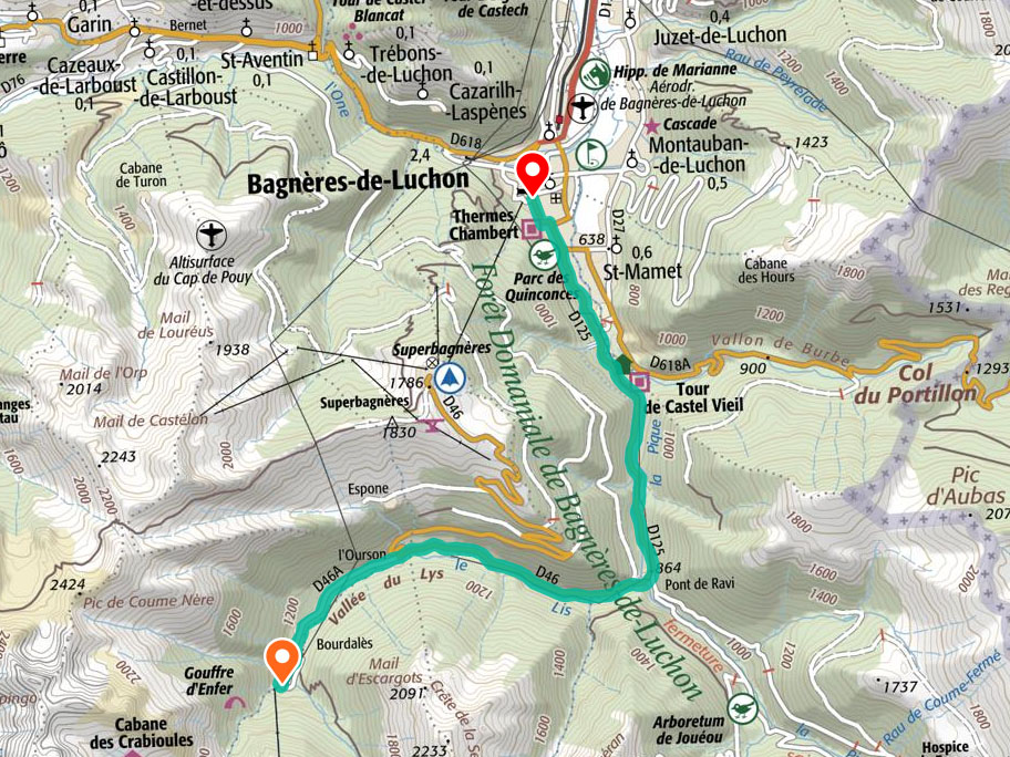
To get to the starting point of this mini-excursion, once you arrive in Bagneres de LuchonWe head towards the southern part of the village, on the left bank of the river "La Pique". Take the Avenue de Venasque (D125) following the signs for Superbagnères and Hospice de France / Vallée de Lys. After 4.5 km, turn right at a crossroads (D46) towards Superbagnères / Vallée de Lys, and after 3.6 km, turn left (D46a) towards Vallée de Lys. After 2.4kms you will reach Bourdalés, a small group of houses with a large car park (free of charge) where you can leave your car. In total, about 11kms from Bagnères-de-Luchon.
Excursion to the Cascade d'Enfer:
Distance: 1.2kms round trip.
Time: 0h25min.
Difficulty: This is a very easy excursion that we can do with children.

Itinerary:
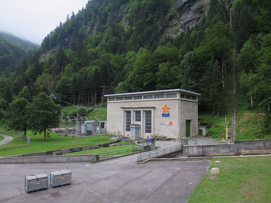
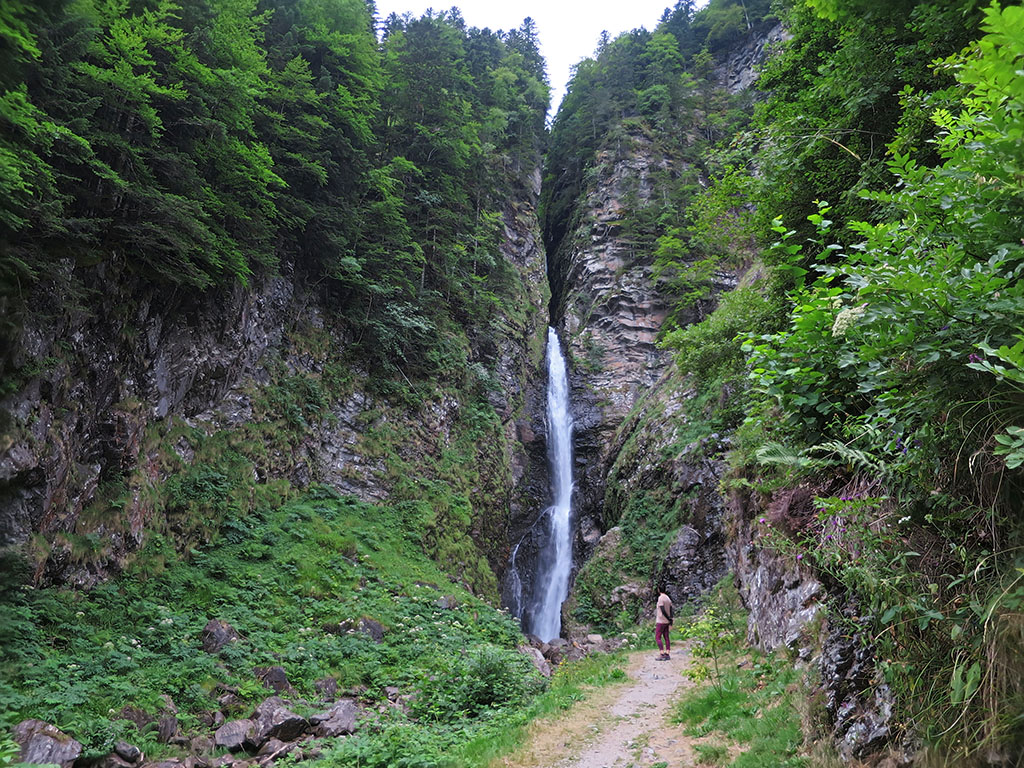
From the car park, follow the wide, clearly signposted and unmistakable path that runs parallel to the river. To the left is the noisy Portillón hydroelectric power station, the only infernal thing about this place. Continuing straight on, we soon reach the waterfall, which for safety reasons is not allowed to be approached for the last few metres.
The Enfer waterfall has a height of 55 metres according to canyoning descriptions. The descent of the canyon, Rue and Gouffre d'Enfer, is considered to be one of the most complete and difficult descents in the Pyrenees.


Other excursions in the area:
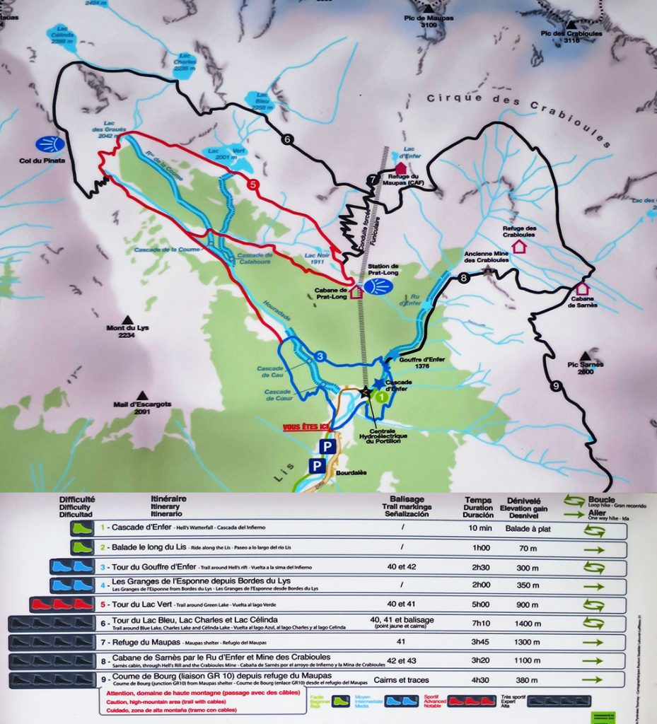
There are several marked trails in the area with different levels of difficulty. The best known and most popular route is the Circular to the Gouffre d'Enfer (medium difficulty). A 2h30min walk through the beech forest and visits several waterfalls. The best known is the Gouffre d'Enfer (Hell's Pit), a well dug by the water as it rushes down one of the countless waterfalls of the Ruisseau d'Enfer.
If you would like to go on one of these excursions, there is a sign just outside the car park detailing the different routes available in the area:
You may be interested in:
Holtzarte footbridge: a route across one of Europe's highest bridges >>
Fastpacking is not about going faster. It's about going lighter.
If you come from classic trekking, this is the next step: learning to move with less weight,
more fluid and enjoying every kilometre more.
Join the Outsiders Newsletter and start discovering what lightness feels like.