Ascent to the Moncayo from the Fuente de los Frailes
Pyrenees and mountains 📩
Here 🔥This week we propose a trip to Zaragoza to climb the Moncayo (2,314m) or Pico de San Miguel, the highest peak in the Sistema Ibérico.
The summit of the Moncayo is shared by Soria and Zaragoza, being the provincial ceiling in both provinces. The most common routes to reach its summit are: from the south from Cueva de Agreda (Soria); or from the north from the Santuario del Moncayo (Zaragoza). The latter is much more popular than the former. This is the route we propose for this excursion, which runs along the northern slope, declared a natural park in 1979 (Dehesa del Moncayo).
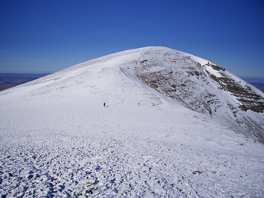
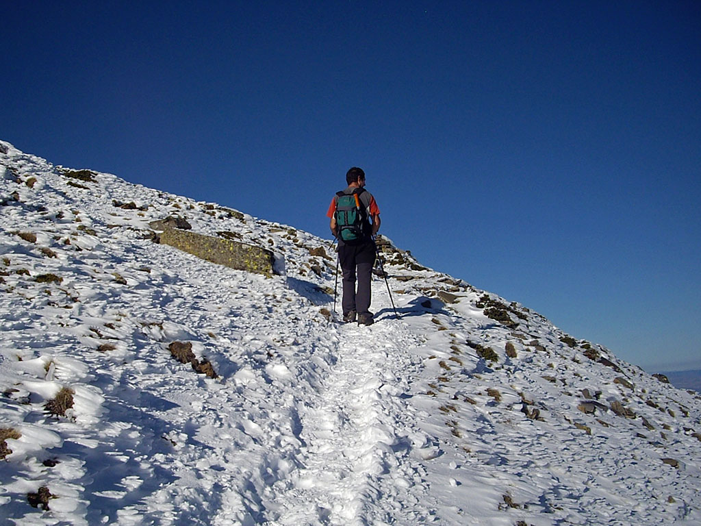
As you can see from the photographs, the route took place in winter, a time when the Moncayo can show its most hostile side and which should not be underestimated. The wind here has a reputation for blowing strongly, with the thermal sensation. In the upper part, just before leaving the summit ridge, there is a stretch that usually remains frozen and can be dangerous. It is known as the "escupidera" (spittoon), as this is also the name given to the final section of Monte Perdido. In any case, ice axes and crampons are compulsory at this time of year. It is better to carry them and not have to use them than to miss them.
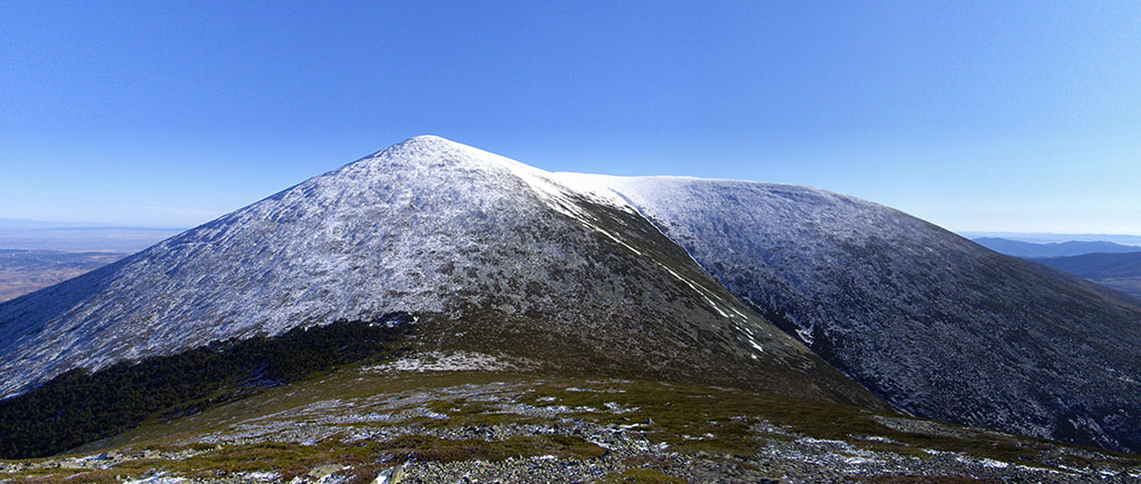
Once at the top of Moncayo, the views are endless. On clear days you can see from the Cantabrian mountain range to the Pyrenees, the Ebro valley, the rest of the mountains of the Iberian system and the Central System.
SUMMARY:
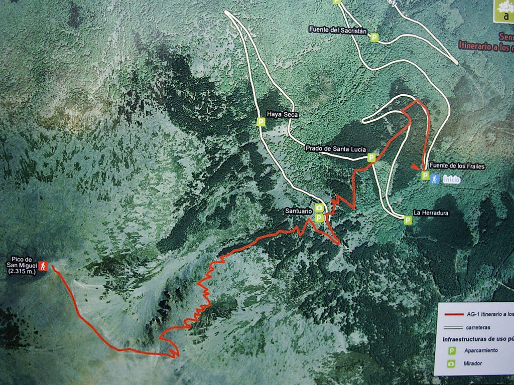
Circular route to Moncayo from the Fuente de los Frailes fountain, on the road that goes up to the Moncayo sanctuary. From here we take the AG-1 and GR90-1 path that passes by the sanctuary and ascends towards the base of the glacial cirque of San Miguel. Once here, the path zigzags along the slope on the left to gain the crest of the hill. On the left we leave the Alto del Corralejo, on the right in a few minutes we will reach the Moncayo. We will descend to the west to the Castilla or Pasalobos pass, where we can take advantage of the opportunity to climb Peña Negrilla in a few minutes. From the aforementioned pass, we descend along a path towards the northern slope and then continue flanking the hillside towards the sanctuary, where it joins the way up.
MAP:

DOWNLOADABLE:
> Download Track
HOW TO GET THERE:
See in Google Maps.
To get to the start of the excursion, at the Fuente de los Frailes, we will take Tarazona as our starting point. Once on the N-122 that borders Tarazona to the south, continue towards Soria until you reach the junction to Santa Cruz del Moncayo (3kms) and Sierra del Moncayo (14kms). Two kilometres after Santa Cruz del Moncayo we reach a roundabout where we continue towards "Vera del Moncayo" and 200 metres further on, we come to a crossroads where we turn right towards "Sierra del Moncayo". This road leads to the provincial border with Soria (14 kms from Tarazona), to a crossroads that on the right leads to Agreda and on the left to the "Parque Natural del Moncayo y C.I de Agramonte". We continue to the left along a narrow road that soon joins the road that goes up from San Martín and shortly afterwards comes to another crossroads where on the right it points in the direction of the "Santuario de la Virgen del Moncayo". The road to the sanctuary is 12 kilometres long, and we will stop halfway, at the Fuente de los Frailes, with a large car park. In total 21 kilometres from Tarazona.
Technical specifications:
Distance: 15,2 kms.
Cumulative difference in altitude: +/- 1.210m. Subtract 200 metres if you do not climb Peña Negrilla.
Timetable: about 6 hours. Walking time non-stop: 4h40min.
Water: at the beginning and in the sanctuary there is a fountain.
Difficulty: In winter, in icy conditions, the final part of the ascent can be dangerous on what is known as the "spittoon". Take ice axe and crampons. The Moncayo mountain range is famous for the strong winds that blow through it, making the wind chill much higher. Take warm clothes and glasses to protect your eyes. In summer, without snow, it is not technically difficult and the route is easy because, although the slope is considerable, the ascent along the path is quite bearable.
Recommended equipment for the summer: in summer boots or slippers, sunglasses, two walking sticks, GPS optional and canteen.
ITINERARY:
(0h00min; 0,0kms) Fuente de los Frailes (1.355m). At the beginning of the car park, an information panel indicates the route AG-1 (Itinerary to the remains of the glacial kingdom) which we will follow all the way up.
So we start walking along the asphalted track for about 200 metres until we reach the GR90.1. The path ascends through the pine forest, crossing the track on two occasions before reaching the...

(0h35min; 1,8kms) Sanctuary of Moncayo (1.610m). If you need water, there is a good opportunity to fill your water bottle at the fountain of the stream. The way up starts to the left of the sanctuary. Take a path to the right, ignoring on the left a path to the hermitage of San Gaudioso and the path to the Bellido pass, a good option to make the ascent to Moncayo circular. The path gains height above the sanctuary through a terrain dominated by Scots pine and scrubland.
(1h05min; 2,9kms) San Miguel glacier cirque (1.830m).
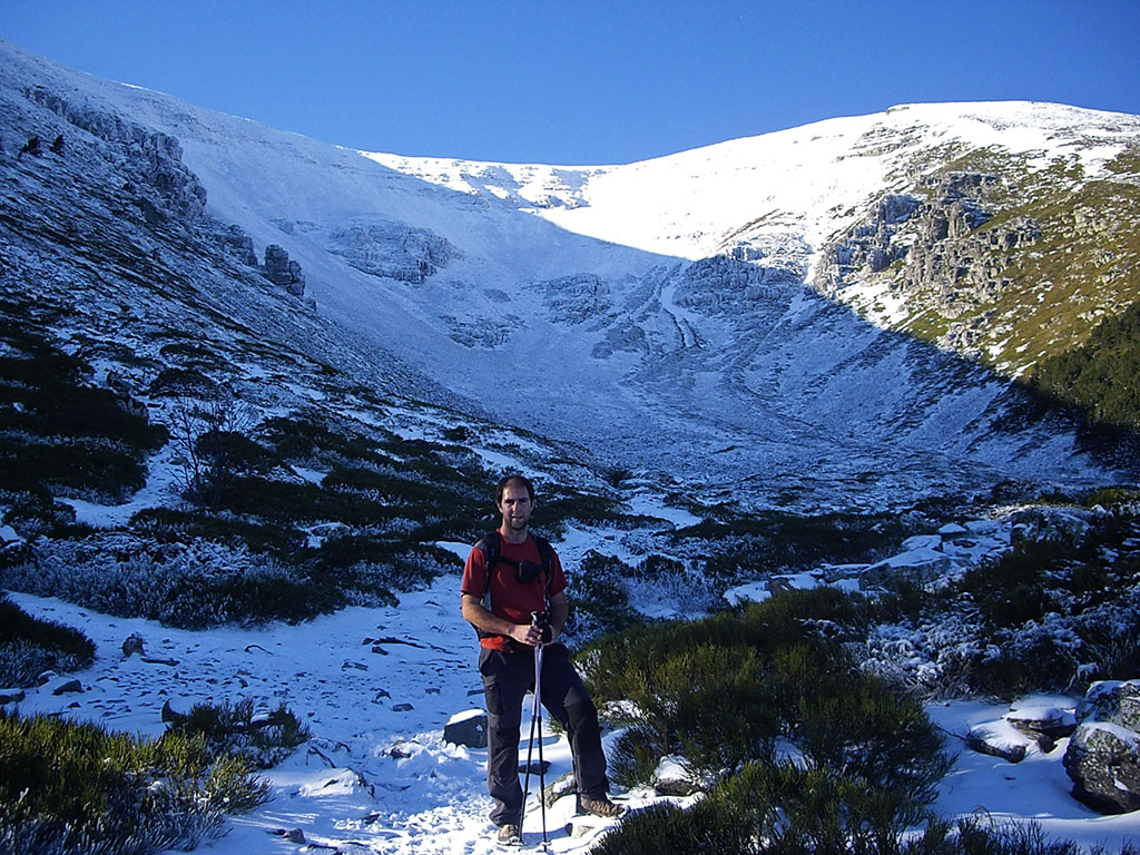
The path leaves the forest behind and the cirque of San Miguel appears before us with the peak of Moncayo on the right-hand side. To the right of where we are we can see a frontal moraine. Here the path divides. We will opt for the normal ascent, the one that goes up to the left, not through the valley but along the ridge that falls off to the left, separating the cirque of San Miguel from the cirque of Gaudioso.
The path zigzags until it reaches the crest of the ridge.
If you feel like it, a 5-minute detour to the left will take you to the...
(1h55min; 4,8kms) Alto del Corralejo (2.277m). Back on the ascent path, we continue over the wide ridge in a north-westerly direction, passing the Cerro de San Juan (2,282m) and the Collado de las Piedras (2,256m) before tackling the final climb to the summit of the...
(2h20min; 6,3kms) Moncayo (2.314m). Roof of Soria, Zaragoza and the Iberian System. On top of it there is a carving of the Virgin of Pilar, a geodesic vertex and several walls to bivouac (or have lunch safe from the wind).

As this is a circular route, we descend to the west, towards the pass of Castilla or Pasalobos (1,949m). Once here, if we wish, we can take the opportunity to climb up to...
(3h05min; 8,3kms) Peña Negrilla (2.117m). And with this one we would already have four of the seven two-thousanders of the sierra.
Once again at the Castilla or Pasalobos pass, we take the path back down towards the northern slope. We follow it until we reach 1,820m, where a large milestone indicates a very marked path to the right. We leave the bottom of the valley and take this path that crosses the pine forest and crosses to the east, passing next to Peña Nariz, which takes us back to the track that leads up to the sanctuary. Here we can choose to go down following the track, which is longer, or go up towards the sanctuary and join the path going up. We have chosen the second option.
(4h15min: 13.4kms) Santuario del Moncayo (1.610m). The way back to the car is familiar and in just 25 minutes we are back on the road...
(4h40min; 15,2kms) fuente de los Frailes (1.355)The start and end of this excursion.
Fastpacking is not about going faster. It's about going lighter.
If you come from classic trekking, this is the next step: learning to move with less weight,
more fluid and enjoying every kilometre more.
Join the Outsiders Newsletter and start discovering what lightness feels like.