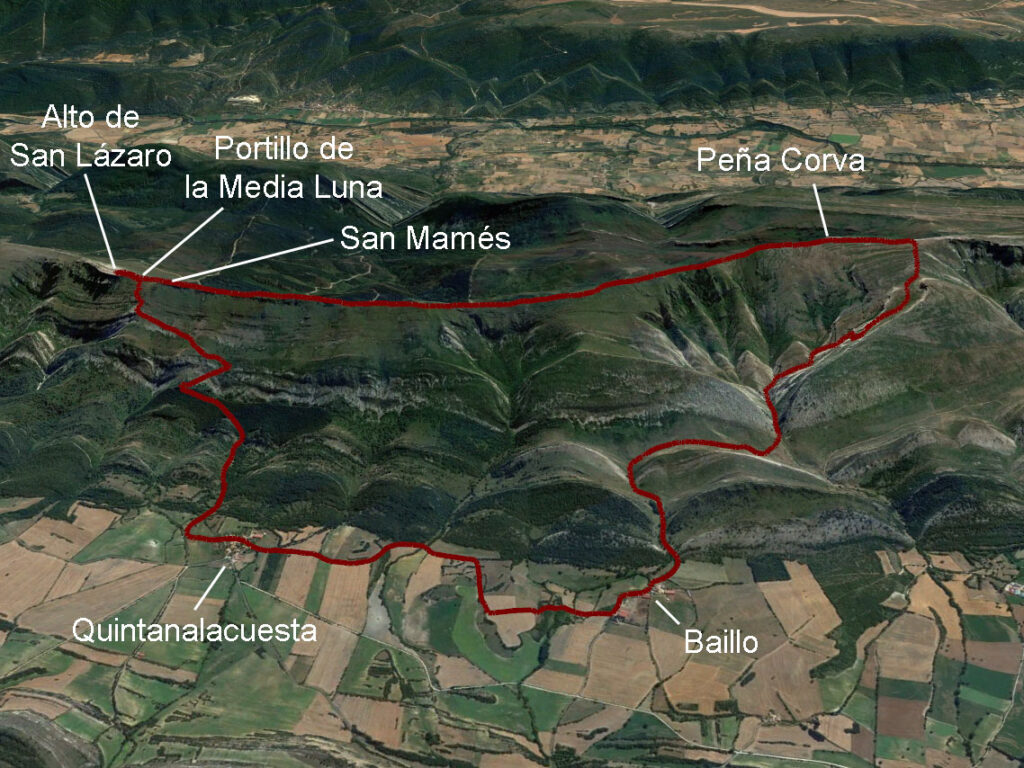
Burgos: Peña Corva (1,333m). Ascent via Baíllo and descent via Quintanalacuesta.
The Teslain Las Merindades, is one of the most outstanding mountain ranges in the province of Burgos. Approximately 25 km long, its sharp profile stretches from west to east, strangling the river Ebro, from the gorge of Los Hocinos to the gorge of La Horadada, where it emerges again into the open countryside on its way to the Obarenes Mountains.
Located to the south of Las Merindades, to the north of the hidden valley of Valdivielso and silhouetted to the south on the horizon of towns such as Villarcayo and Medina de Pomar, La Tesla was once a barrier to avoid on the trade routes that linked the city of Burgos with the ports of the Cantabrian Sea. It is precisely through one of these passes, once crossed by traders, that the way down the route we propose to you leads to the highest point of this mountain range, Peña Corva (1,333m).
Summary:
Circular route from Baíllo to Peña Corva (1,333m). Ascent via the hermitage of Nuestra Señora de la Hoz and the valley of the stream of Carcomas, passing under Monte Pilas; cresting to the top of San Lázaro passing by the peak of San Mamés; descent via the Portillo de la Media Luna to Quintanalacuesta and flat to Baíllo.
Map:
Downloadable:
> Download Track
How to get there:
See in Google Maps.
The start of this route is in the small village of Baíllo, which can be reached from Medina de Pomar by taking the BU-V-5601, then the BU-V-5606 towards Paralacuesta/Nofuentes and finally the BU-V-5608 towards Casares/Baíllo. In total 8km.
Technical specifications:
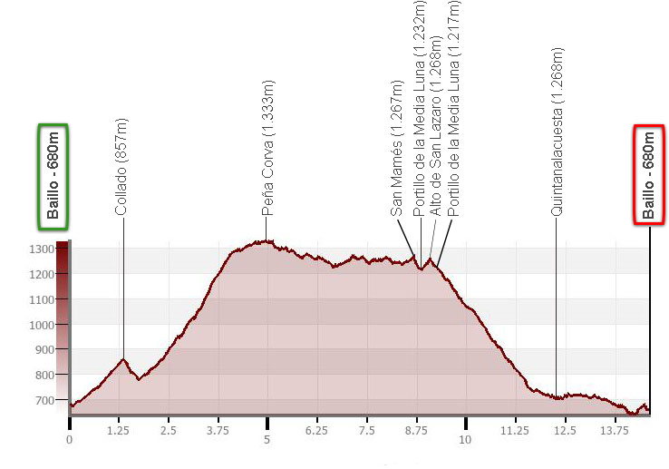
Distance: 14.6km.
Cumulative difference in altitude: +/- 930m.
Timetable: about 6 hours. Walking time without stops: 4h45min.
Water: There are no fountains along the route.
Difficulty: The main difficulty lies in the positive difference in altitude. The crest is easy and there are no climbing steps. The descent is on a very marked path.
Recommended equipment for the summer: boots or slippers, two walking sticks, GPS (optional), canteen.
Itinerary:
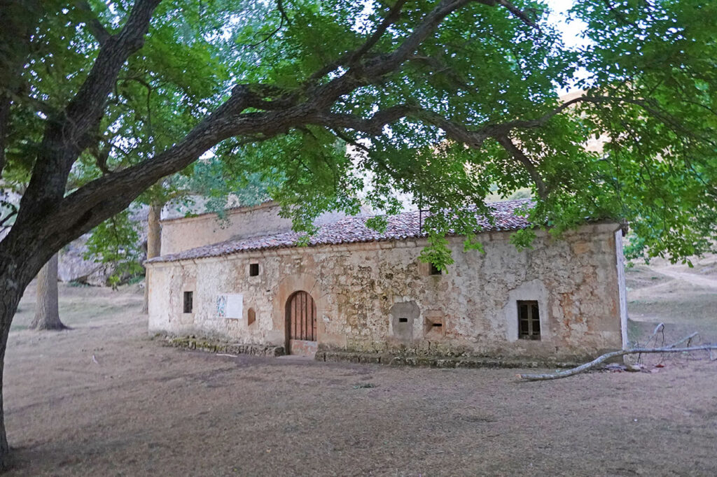
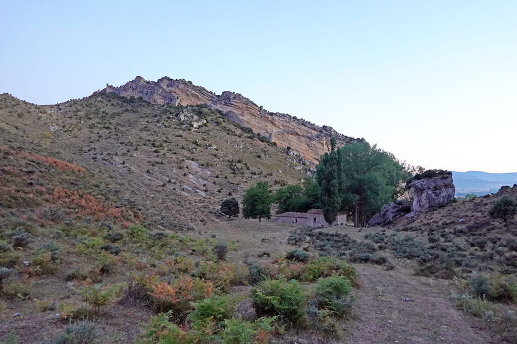
(0h00min; 0,0km) Baíllo - Barrio de arriba (680m). From here there is a track heading south that forks off as soon as we start, which we take on the right. The track goes through a narrowing known as El Cinto, to a kind of small corner where the Nuestra Señora de la Hoz Hermitage is hidden behind some poplars.
The path leaves the hermitage behind to continue along the main valley in a southerly direction and then turn right (west) in order to gain a small...
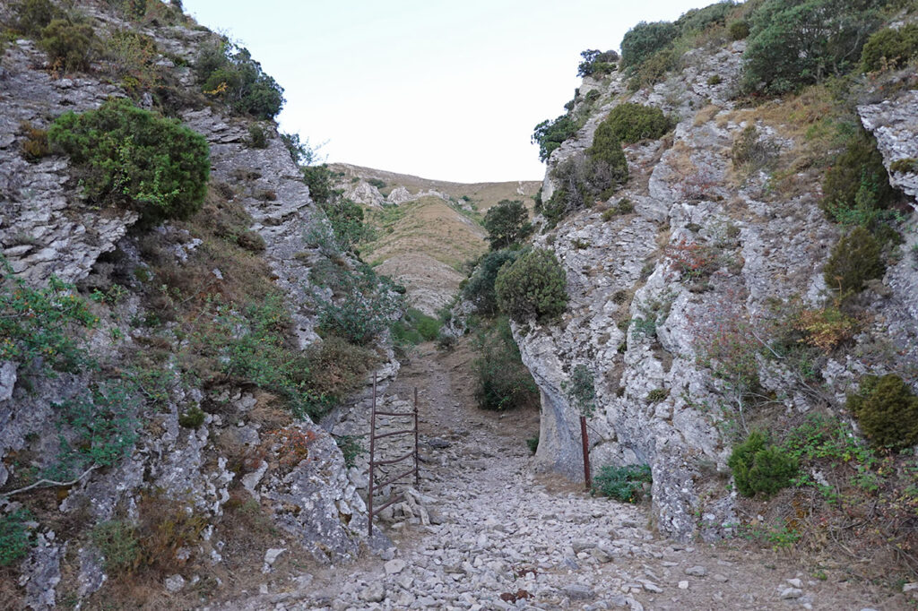
(0h30min; 1,4km) col (857m). On the other side opens up a valley with a very similar appearance to the one we have just left behind. The path descends towards this valley furrowed by the Arroyo de las Carcomas to turn left and cross a second narrowing, even narrower than the previous one.
On the other side is a large basin, the result of water erosion over millions of years in the limestone rocks. The path forks. We follow the main path to the right, leaving the stream (dry) to our left. A little further on the valley splits symmetrically in two. We will ascend by the right branch (West) following the path we have been following. Here we can say that the actual ascent begins. The path ascends amid low mountain vegetation with predominantly box trees to gain a pass under the stony silhouette of Monte Pilas (1h45min; 3,8km; 1207m).
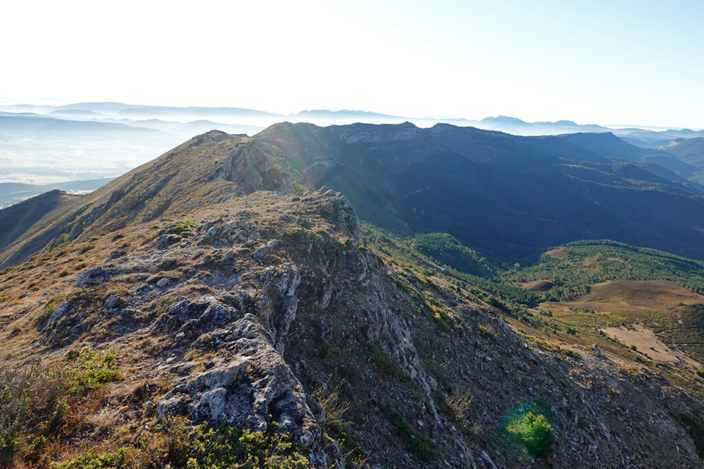
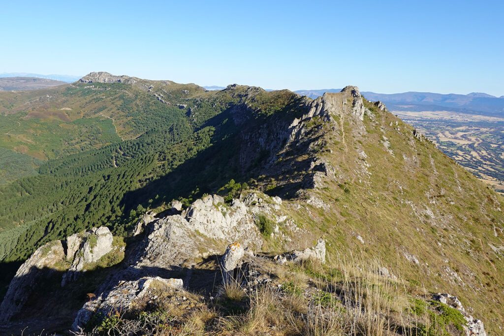
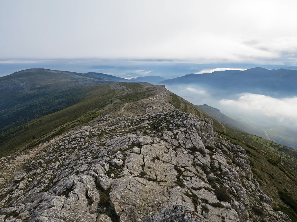
Once at the pass, turn left (south) to gain the wide crest of the sierra and then walk along it to the left (east), in search of the highest point of the sierra.
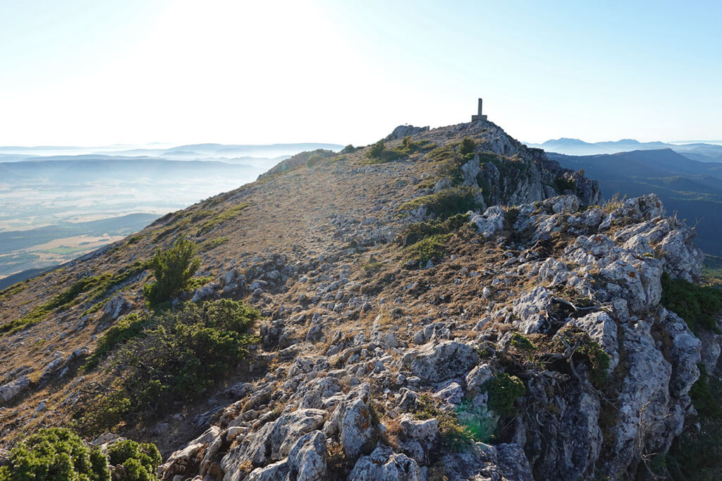
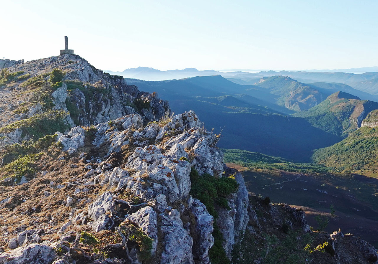
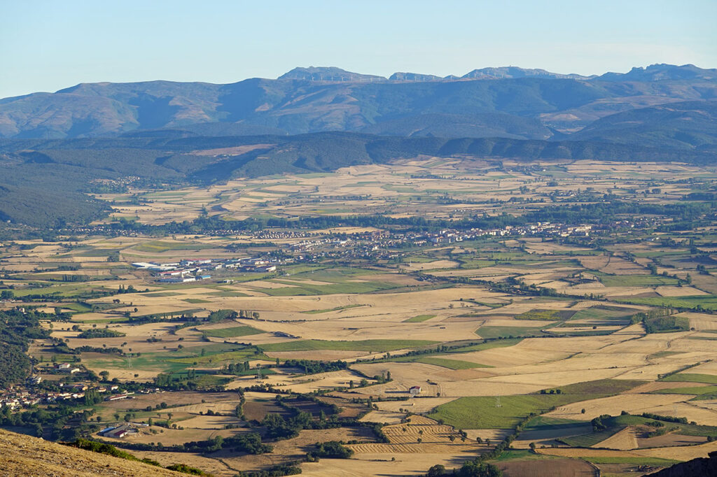
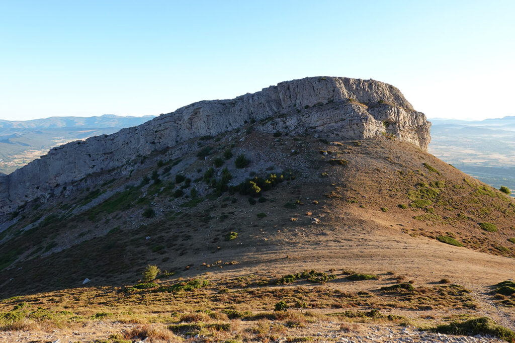
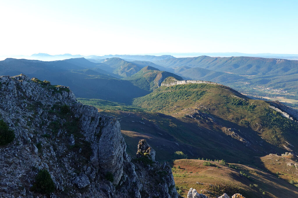
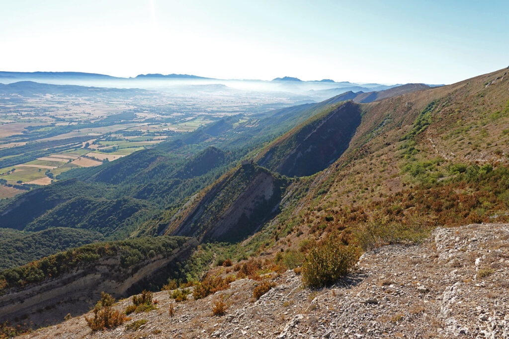
(2h15min; 4,9km) Peña Corva (1.333m)The summit is crowned by a geodesic vertex. The views from here, as well as those that we will be able to enjoy all along the ridge, are fabulous. To the north, the Merindades region is dominated, and in the background we can make out the Castro Valnera and Picón del Fraile, among others. To the south is the hidden valley of Valdivielso, crossed by the river Ebro. The route continues along the ridge in a very entertaining way, with no climbing problems.
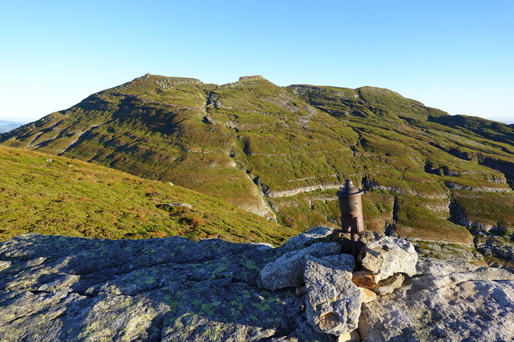
(3h20min; 8,6km) San Mamés (1.267m). The summit is dominated by two mailboxes.
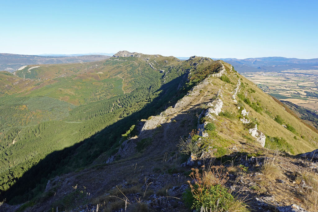
The route now descends towards the portillo de la Media Luna, where one of the old trade routes that linked the city of Burgos with the ports of the Cantabrian Sea used to pass.
(3h25min; 8,8km) Portillo de la Media Luna (1.232m). From here, a path leads in just 5 minutes to the Alto de San Lázaro (1,268m), where we can optionally climb. The highest point is the first and has no letterbox.
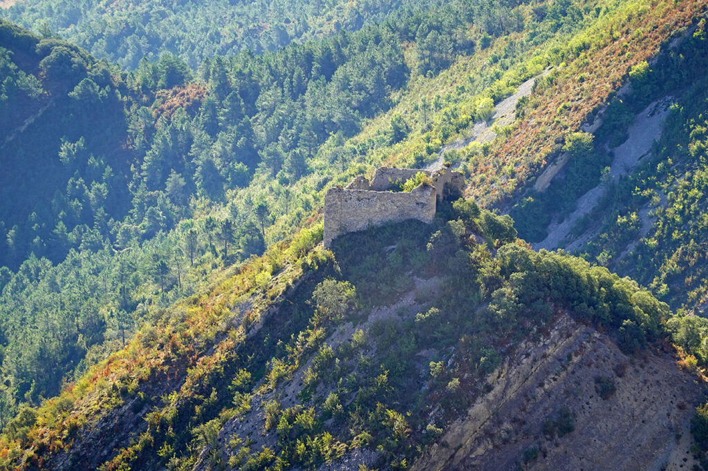
(3h35min; 9,3km) Portillo de la Media Luna (1.215m). Once again at the pass, we join the path that descends to Quintanalacuesta. It is quite comfortable, and you can see that more people climb this way. The descent is enlivened by the views of the ruins of the castle of Urría or Montealegre, perched on a crag in the middle of the sierra.
About 20 minutes after starting the descent from Portillo de la Media Luna, the path enters the pine forest, where, if it is very hot, we can finally enjoy some shade. At the exit of the pine forest, be careful to take a fork to the right and then to the left.
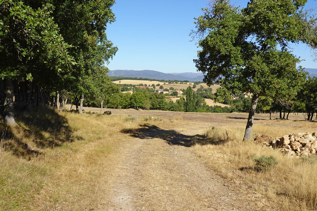
(4h15min; 12,2km) Quintanalacuesta (709m). As we arrive, we cross the village with our sights set on the church of Santa Leocadia, where a track starts. Shortly after leaving the village, we take a crossroads and then continue along the main road until we reach the Barrio de abajo de Baíllo and the road to...
(4h45min; 14,6km) Baillo - Barrio de Arriba (680m).
NEARBY YOU MAY BE INTERESTED IN
Montes Obarenes Natural Park - San Zodornil. Circular route to Humión y Flor from Orbañanos, on the northern slope. [4h30min; 15,4km; +/-935m].
Circular route to the Castro Valnera (1.718m) with ascent to the Cubada Grande (1.607m) from the cottages of El Bernacho. [3h50min; 8,8km; +/-850m].
Don't miss any adventure in the Pyrenees!