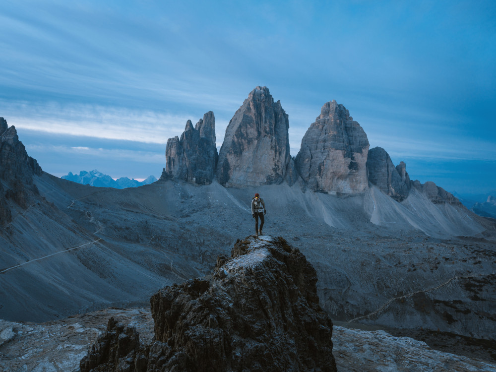
Trekking in the Dolomites

The Dolomites of northeastern Italy - a UNESCO World Heritage Site - are characterised by impressive volcanic and sedimentary rock formations. Hiking is an ideal way to discover this stunning landscape of angular peaks, towering pinnacles and craggy ridges, and the carefully chosen routes in this guide will be exhilarating, challenging and inspiring.
Practical guide
When to go?
From mid-June to the end of September, when most of the refuges are open. The peak holiday season in Italy is August, especially around 15 August. Snow can remain at the highest altitude well into July. Huts are open from late June to late September. From early summer, many low altitude walks are feasible, but it is worth waiting until July for the high altitude routes to be free of late snow.
How to get there?
The Dolomites are an ideal walking destination from June to September, and can be easily reached from Verona, Treviso, Venice and Venice airports. Innsbruck.
The extensive train and bus network through the Dolomites is relatively cheap, easy to use and reliable.
Cities & Services
The main centres of the Dolomites are Cortina, Belluno, Selva di Cadore, Arabba, La Villa, Selva, Bressanone, Dobbiaco, Canazei.
Cortina, Sesto, Dobbiaco, Misurina, Forno di Zoldo, San Cassiano, Corvara, Canazei, Arabba, San Martino di Castrozza, Funes, Selva di Val Gardena, Ortisei, Fiè, Madonna di Campiglio
Not to be missed
- Tre Cime di Lavaredo.
- The majestic Marmolada and Pelmo, the imposing Civetta and the Cinque Torre (which are now only four!).
- Sentiero delle Odle
- Piz Boè circuit on the Sella massif
- Pale di San Martino Altopiano
- The Civetta
- Rifugio Nuvolau, Rifugio Palmieri
- World War I Sites
- Fauna and flora: marmots and ibex, wild flowers. Discover your first chamois, marmot or ibex.
- Lagazuoi
- Dinosaur tracks in the Pelmo.
Trekkings
The routes are mostly circular and of 2 to 4 days duration, covering the Marmarole, Marmolada, Civet, Sella and Cortina Dolomites, among others. Moderate and challenging routes, including some mountain traverses involving climbing and exposure.
The routes are suitable for hikers with a reasonable level of fitness and experience in mountainous terrain, and some of them have exposed sections that require good handling in high altitude environments. They take advantage of the region's network of mountain refuges and the efficient public transport system, with most routes accessible by public bus.
- DOLOMITI FRIULANE // Anello delle Dolomiti Friulane /
- MARMAROLE // Along the Marmarole /
- DOLOMITI DI SESTO // Vallon Popera / Tre Cime tour / Tre Scarperi tour /
- FANES-SENES-BRAIES // Croda Rossa tour / Sasso della Croce-Cunturines
- CORTINA DOLOMITES // Tofane-Lagazuoi / Nuvolau-Cinque Torri / Croda da Lago-Pelmo /
- CIVETTA // Civetta tour /
- DOLOMITI BELLUNESI // Crossing Cime di Zita / Alpi Feltrine /
- PALE DI SAN MARTINO // Palarondatrek / About the Pale di San Martino /
- MARMOLADA // Behind the Marmolada /
- SELLA // Sella traverse /
- PUEZ-ODLE // Along the Puez-Odle Altopiano / Odle di Eores /
- SASSOPIATTO-SASSOLUNGO / Sassopiatto-Sassolungo tour /
- SCILIAR AND CATINACCIO / Sciliiar-Antermoia traverse / Vuelta Catinaccio /
- LATEMAR // Latemar traverse /
- DOLOMITI DI BRENTA // West Brenta / East Brenta /
Excursions
- Lago di Braies (5.0km 50m 1-2.5h, difficulty: easy)
- Rifugio Biella and Croda del Becco
- Picco di Vallandro and Monte Specie
- Alpe di Sennes (17.1km 735m 5-7h, difficulty: moderate)
- Landro to Cortina on the old railway line
- Circuit Torre dei Scarperi
- Croda Rossa di Sesto Traverse
- Val Fiscalina Tour
- The three peaks of Lavaredo (9.8km 380m 3-4.5h, difficulty: medium). The path around the Three Peaks of Lavaredo (also known as the Three Zinnen) is a must for hikers.
- Through Cadini di Misurina
- Monte Piana
- Upper Popena Valley
- Rifugio Vandelli Traverse
- Val d'Oten and Antelous
- Rifugio Padova a Rifugio Tita Barba
- Pramper Circuit
- The north-western flank of the Civetta
- Pelmo Tour
- Around Croda da Lago
- Cinque Torri
- Nuvolau (12.6km 720m 3.5-5h, difficulty: moderate)
- Bordering Tofana di Rozes
- The Lagazuoi Tunnels
- Lagazuoi a Passo Falzarego (5.0km 215m 2-3h, difficulty: easy)
- The Kaiserjäger Route
- Around the Settsass
- Col di Lana
- Santa Croce Sanctuary
- Sass de Putia
- Sentiero delle Odle
- The Rasciesa ridge
- Through the Altopiano of Puez-Odle
- Secada / Puez Odle (11.4km 446m 3.5-4.5h, difficulty: medium)
- Bullaccia
- Castel Presule
- Alpe di Siusi and Rifugio Bolzano
- Val Ciamin
- The Catinaccio Inside
- Sentiero del Masaré
- Latemar Labyrinth and Lake Carezza
- Lake Carezza (3.5km 280m 1-1.5h, difficulty: easy)
- The return to Sassopiatto-Sassolungo (16.4km 700m 5-6.25h, difficulty: moderate). Circular.
- Piz Boè and the Sella
- Viel del Pan Marmolada (8.7km 175m 2-3h, difficulty: easy). It runs along a historic path used by flour and bread traders.
- Sass d'Adam Crest
- The Marmolada and Punta Serauta
- Rifugio Falier in the Ombretta Valley
- Rifugio Mulaz
- Altopiano Pale di San Martino
- Val Canali and Rifugio Treviso
- Monte Pavione
- The tour of the Brenta Dolomites
- Val d'Ambiez
- Lake of Sorapiss (13.5km 325m 3-4.5h, difficulty: medium)
Fastpacking is not about going faster. It's about going lighter.
If you come from classic trekking, this is the next step: learning to move with less weight,
more fluid and enjoying every kilometre more.
Join the Outsiders Newsletter and start discovering what lightness feels like.
