Montserrat routes. Circular route from Collbató between hermitages and rocky spires.
Pyrenees and mountains 📩
Here 🔥Itinerary that allows us to discover rugged paths, dominated by holm oaks and geological conglomerates, characteristic of the massif. We will also get to know the spiritual side of the mountain with its hermitages and the famous monastery of Montserrat.
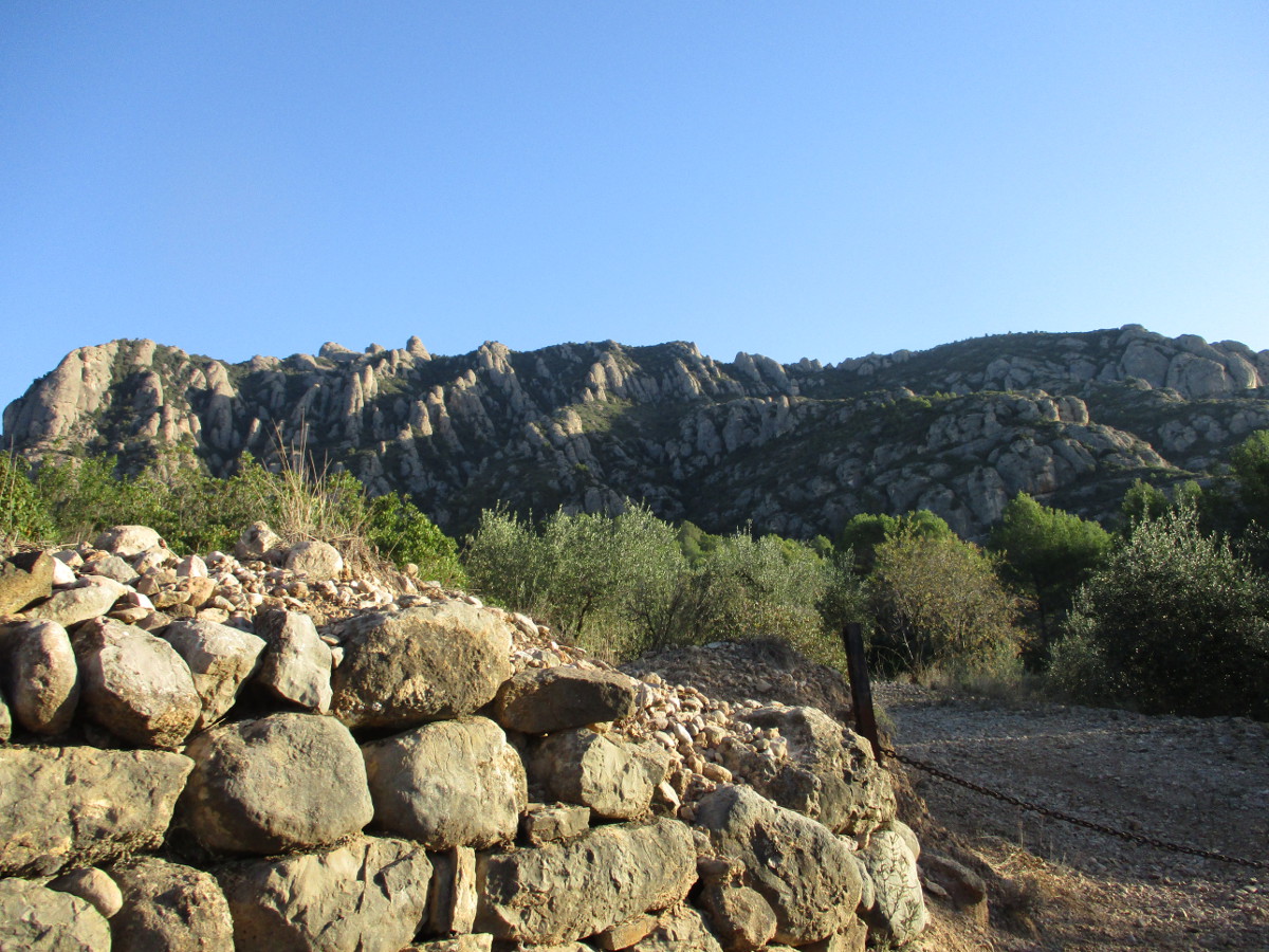
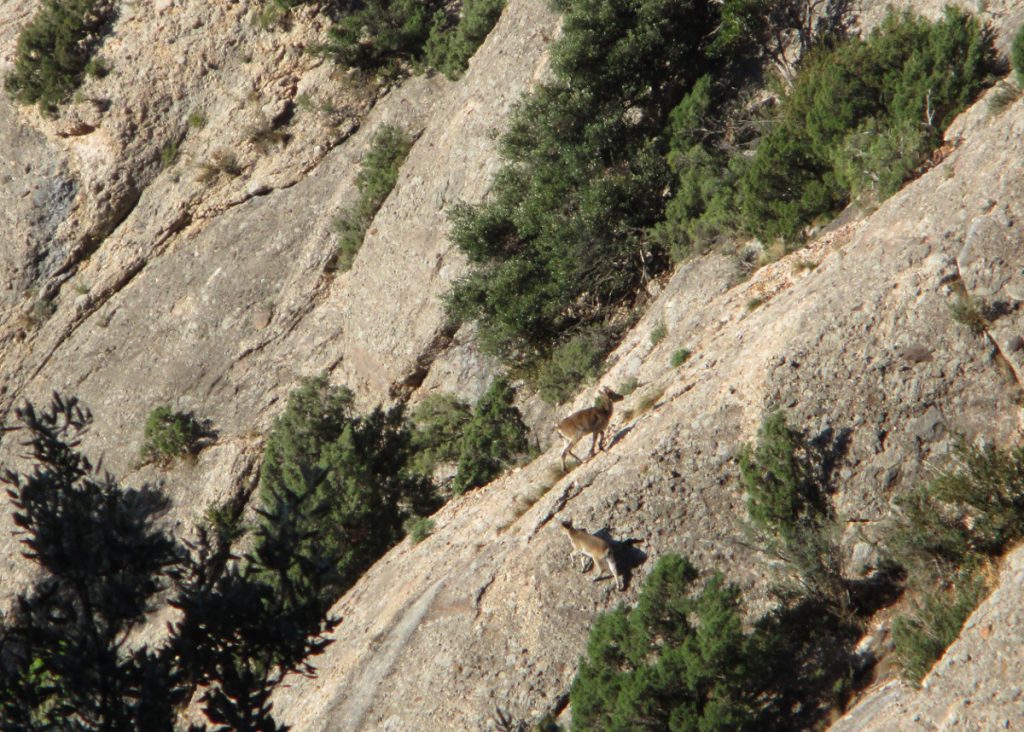
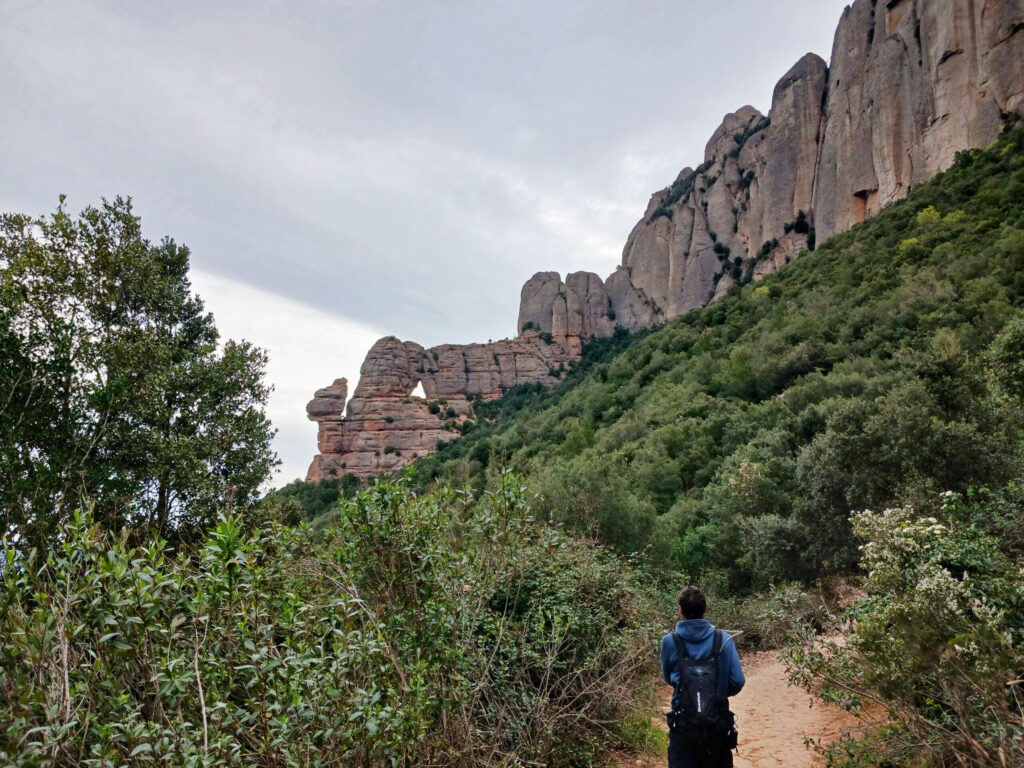
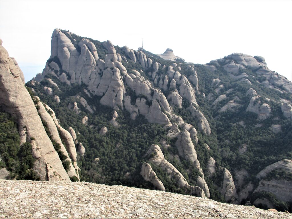
The Montserrat massif is part of the Catalan pre-coastal mountain range. It is elliptical in shape and fragmented into two parts in the Talaia area. It is 10 km long and 5 km wide. Its relief is abrupt, formed by needles and monoliths furrowed by channels. The geological material is conglomerate, a rock of fluvial sedimentary origin, which has subsequently been modelled by atmospheric phenomena. There is hardly any surface water; in some areas there is a network of underground water that emerges from a spring and has given rise to caves and chasms. The vegetation has a clear altitudinal zoning, white pines in the lower part and holm oaks with boxwood as we go up. In some areas we can find relict maples and yews. The fauna is more abundant in the lower areas. There are wild boars, genets, squirrels, bats in the underground caves, jays, peregrine falcons, Bonelli's eagles, snub-nosed vipers and a population of wild goats. Montserrat is a great spiritual and religious centre, thanks to its 11th century Benedictine monastery. Nearby, in a cave, the "Virgin of the Moreneta" was found. The sum of these two centres of interest attracts a large number of visitors. The mountain is also dotted with numerous hermitages, symbols of seclusion and used for other purposes, such as hiking.
Summary
Circular route from Collbató. We start walking between walls, almond and olive trees, up to the Clot de la Mónica path. A demanding climb that will take us to the hermitages of Sant Joan and Sant Onofre. Descend to the PR C-19 and the hermitage of Santa Anna, where the GR 4 and 172 stairs will take you to the Montserrat monastery enclosure. Now we will take a cobbled track that will lead us to the hermitage of Sant Miquel and shortly after we will go down the old path, which will allow us to descend to the foot of the mountain.
Map

Downloadable:
> Download Track
Technical specifications
- Transport to and from the airport: Private car or Hispano Igualadina buses. Barcelona- Igualada line (via Bruc). Collbató stop.
- Distance: 14.65 km
- Cumulative difference in altitude: + 1269 m /- 1269 m
- Duration: About 5 and a half hours. Not counting stops.
- Difficulty: Medium-high. Steady climb in the first part of the route. Stony paths and some slightly exposed passes.
- Water points: Shops in the monastery precinct.
- Recommended equipment: Comfortable clothes, water and some food, sun protection and a walking stick for the climb.
Itinerary
-0 h. 0 Km. 379 m. Collbató. We set off from the 18th century church and start walking along Carrer Pau Bertran. Follow the GR markings as you leave the historic quarter. We enter a dirt track that glides between stone walls, almond and olive trees. About 300 metres further on, on the right, you will see the old path from Collbató to the monastery, along which you will return. Walk through a Mediterranean forest dominated by white pine trees. Take a path on the right marked with blue markers. We pass an olive grove and the path gradually climbs upwards. You are now on the path to the "Clot de la Mónica", treading the conglomerate between rosemary, durillo, heather, strawberry tree, sarsaparilla, juniper... To the left is the serrat d'en Muntaner. On the ground you can see some pine cones eaten by squirrels or droppings that reveal the presence of mountain goats. The population was introduced in 1995 with 26 specimens and is currently estimated at around 200 specimens. The population numbers are regulated by selective hunting.
We climb steadily in zigzags, while we contemplate Collbató and part of the Baix Llobregat. We alternate some aerial stretches between conglomerates, we see some junipers and a change of vegetation. The pine trees are replaced by holm oaks with a "durillo" (a type of hardwood).
- 1 h 20 min. 3.2 km. 730 m. Fork to the right. We follow the paint marks to the right, to the left we would go to Pollegons. We continue climbing, to the left we see the area of Tebes and in the background the Mirador del Moro with its characteristic antenna and heliport. We pass an aerial area following the markings.
- 2 h 10 min. 4.2 km. 1021 m. Bassal dels Corbs. Small accumulation of water in the rock. It serves as a watering place for birds and mammals in the area. If it has water, it is common to find salamander larvae. We go up to a hill from where we can see the hermitage of Sant Joan, behind Sant Llorenç del Munt and the Montseny. The path leads us to an asphalted track that we go down a few metres.
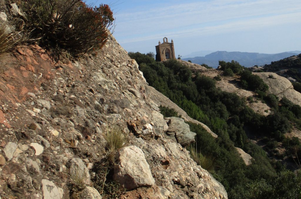
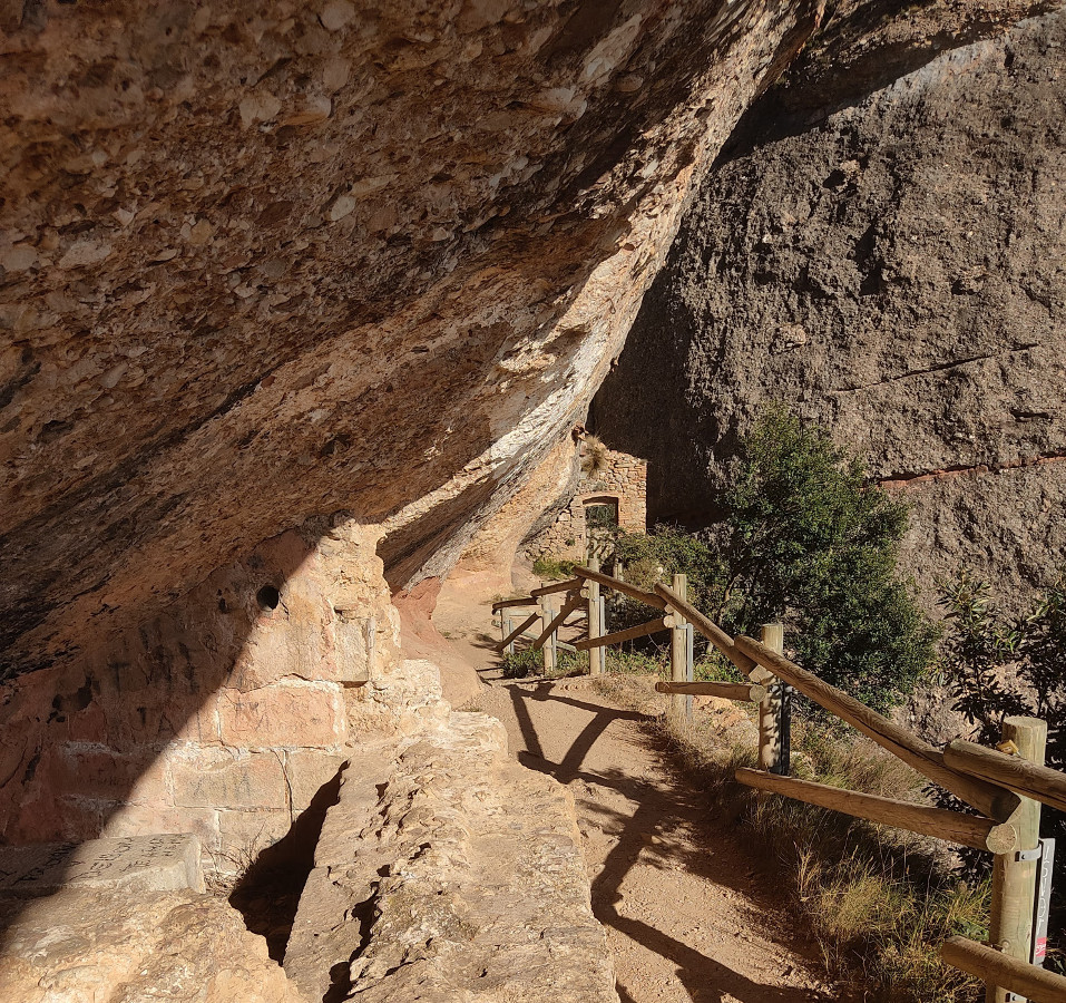
- 2 h 20 min. 4.5 km. 1026m. Chapel of Sant Joan. Building constructed in the 19th century, with a small bell tower. After relaxing with the view, we go back. We go up the stairs. We enter the hermitage of Sant Onofre, built in a natural cave. A place of retreat for anchorites and former abbots of the monastery. For a time, the enclosure was used as a restaurant. Remains of walls and cisterns remain, some with water. Here we can find tadpoles of one of the amphibians of the area, the midwife toad. The male carries the eggs rolled up in his hind legs and when they become tadpoles he deposits them in the water. We go up some stairs carved into the rock, down a path and another flight of stairs.
- 2 h 40 min. 5.2 km. 1014 m. Road to Sant Jeroni. We are on the track that would take us to the left to the top of Montserrat, Sant Jeroni (1236 m). We go to the right, through an area that is more frequented by walkers. Shortly after, on the left, we go up some steps, which will lead us to the PR C-19. We go downhill, passing the Santa Anna Vella cave and the Santa Marta stream.
-3 h. 6.4 km. 883 m. Chapel of Santa Anna. Currently under reconstruction, with a cistern. We reach a clearing, the square of Santa Anna. A little later we leave the PR and go down some stairs marked as GR. We go down the stepped section, pass the stream, a wooden bridge and little by little we get closer to the monastery enclosure.
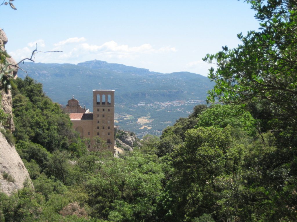
- 3 h 40 min. 7.2 km. 724 m. Monastery of Monserrat. Founded in 1025, it houses a community of Benedictine monks and a choir of singing children. Inside we find the original carving of the "Moreneta", which, according to legend, was found by shepherds in the "Santa Cova" in the 9th century. There is a museum, restaurants, cafés, hotels... On the right we see the Montserrat rack railway, next to it we have the cobbled path that we take uphill. We leave the Creu de Sant Miquel viewpoint on the right.
-4h5 min. 8.9 km. 821 m. Chapel of Sant Miquel. We see it on the right. Continue uphill until you pass a pond. A few metres further on, on the left, you will see the old path from Collbató to the monastery. The descent is gentle and follows the contour of the mountain, although the path is stony. In the past, it was a very popular route for pilgrimages and for going up on horseback or donkey. After a while, we leave the path on the right that will take us back to the hermitage of Sant Joan.
-5 h. 13.6 km. 450 m. Track. We are going out on the track where we started the excursion. All that remains is to return to the starting point.
-5h30 min. 14,6 km. 379 m. Collbató.
Nearby you may be interested in:
Can Maçana - Collet de Can Guirló - Roca Foradada - Coll de Port/Porc - Refugi Vicenç Barbé - Collet de Can Guirló - Can Maçana. [3h20min; 7,5km; +/-470m].
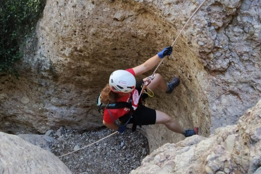
Dry canyon - Medium level - Total time: 5-6 h. Approach: 60′ approx. Descent: 2-3 h. Return: 40′.
Fastpacking is not about going faster. It's about going lighter.
If you come from classic trekking, this is the next step: learning to move with less weight,
more fluid and enjoying every kilometre more.
Join the Outsiders Newsletter and start discovering what lightness feels like.