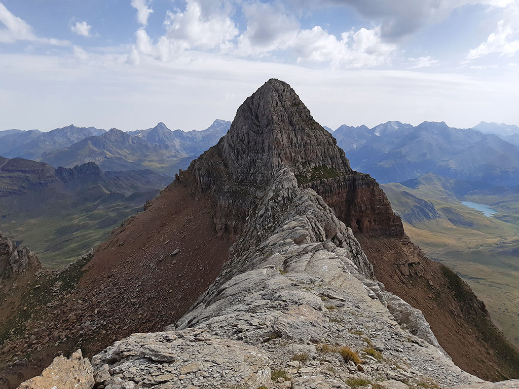
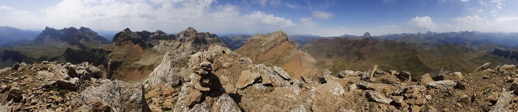
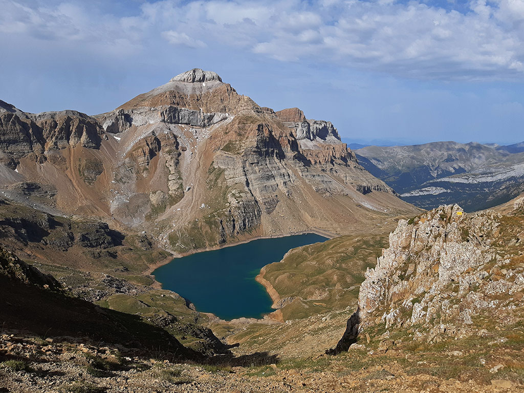
Punta Escarra (2.751m) and Balsera/Hombro de Escarra (2.701m) from Canfranc
Pyrenees and mountains 📩
Here 🔥A route in the shape of an eight to climb one of the iconic peaks of the Ip cirque, Punta Escarra (2,751m), and its neighbour, the peak of Balsera/Hombro de Escarra (2,701m).
Although Punta Escarra is not the highest peak of the Ip cirque, it is surpassed by: Collarada (2,883m), Pala de Ip (2,783m) and Bucuesa or Pala de Alcañiz (2,758m), its sharp appearance makes it a very attractive and coveted summit for any mountaineer. One of the must-sees in the area.
The most common starting points to climb these two mountains are from Piedrafita de Jaca, along the track, or from Canfranc, where we suggest you climb in this case.
SUMMARY
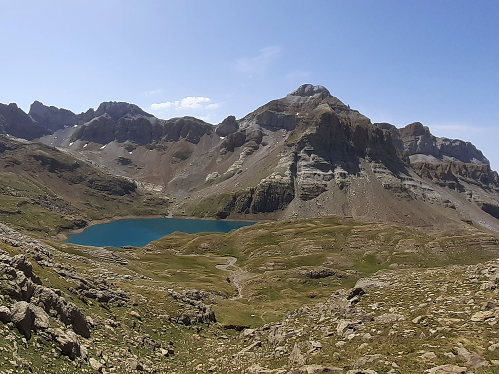
Starting from Canfranc, we go up the right bank of the Ip channel until we reach the Ip lake. From here we reach the base of Punta Escarra to climb the left side of the ridge and cross over to the east slope (II). An easy climb leads to the summit. To descend, we go around Punta Escarra on the east slope and climb, if we feel like it, to the peak of Balsera/Hombro de Escarra. We then descend to the pass that opens up between the peak of Balsera and the Campanils de Ip and, on obvious terrain, but without a path, we descend to the Ibón de Ip. Once again at the reservoir, and so as not to repeat the itinerary, we will go down the left bank of the Ip channel, along the Besera path.

DOWNLOADABLE:
> Download Track
HOW TO GET THERE:
See in Google Maps.
The starting point of this excursion is just past the village of Canfranc, on the right hand side, on the other side of a bridge that crosses the Aragón river.
Technical specifications:
Distance: 20,2kms.
Cumulative difference in altitude: 1980m.
Timetable: about 10 hours. Walking time without stops: 8h25min.
Water: Except for the highest part, the rest of the route has numerous streams, with the inconvenience of having loose cattle.
Difficulty: Escarra point has a fairly steady climb that oscillates between Iº and IIº grade during the last 100 metres of ascent. The most difficult pass is at the base, a chimney (II+) that can be avoided by climbing up another more to the right (II-). The peak of Balsera can be climbed without difficulty via the corridor on the left, indicated in the description. Through the central corridor there are some II steps at the beginning and not very good rock in some parts. Between the Escarra point and the peak of Balsera we cross a very steep slope of grass although with firm rock, with some exposure. Be careful with wet ground. Apart from these dangers, linking the two peaks means a difference in height of 2,000m and a distance of 20 kilometres.
ITINERARY:
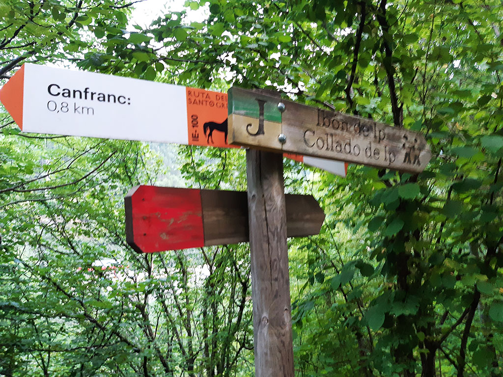
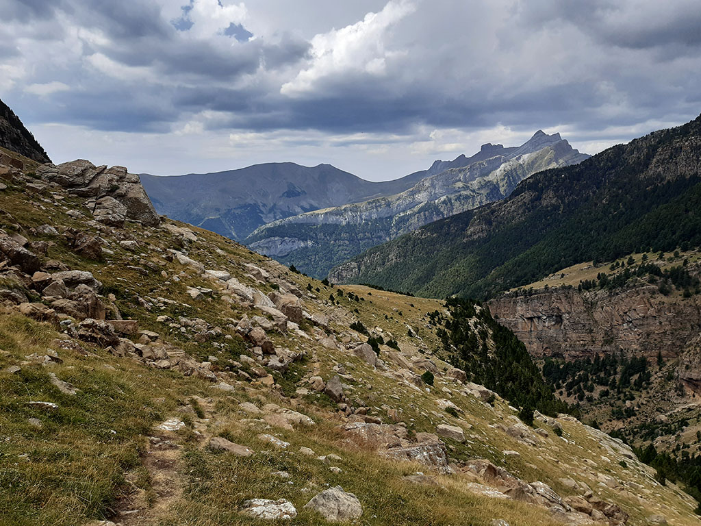
(0h00min; 0,0kms) Bridge - Car park (1.050m). We start the route following the GR11 signs in the direction of Canfranc-Estación, ignoring the path to Ibón de Ip via the Besera that we will use for the return. After 5 minutes we leave the GR11 to continue towards Ibón de Ip - Collado de Ip.
Shortly afterwards, the path crosses a bridge on the right bank of the Ip ravine and passes under a railway viaduct. The path ascends through a lush pine forest where you find numerous shortcuts that, as a rule, you should not take. Further up you pass a dry gorge (1h15min) and come to a small...
(1h20min; 3,4kms) Fuente (1.682m). A small piece of hosepipe that collects water from a stream. The path begins to leave the forest and crosses several ravines, some with water in the middle of summer.
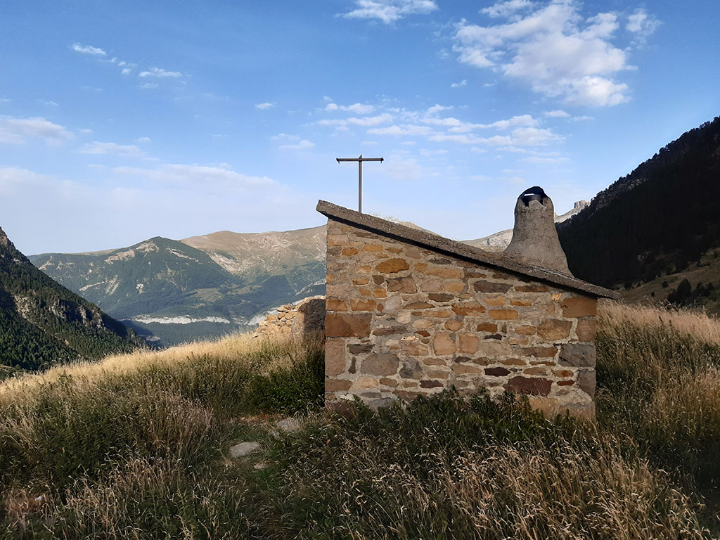
(1h45min; 4,5kms) Refugio de la Canal de Ip (1.875m). A small stone cabin with a bunk bed and space for 2 more people on the floor.
Continuing up the valley, the main riverbed divides into three. Cross the first one and go up the next one, which is dry, leaving a stream about 100m to the right....
(2h15min; 6,2kms) big white house with blue windows and doors (2.054m). One of the many constructions around the reservoir. We continue climbing without a path towards a round building at the foot of the Ip cart. We pass it and continue along the bottom of the valley, with some traces of a path, until we reach a small group of...
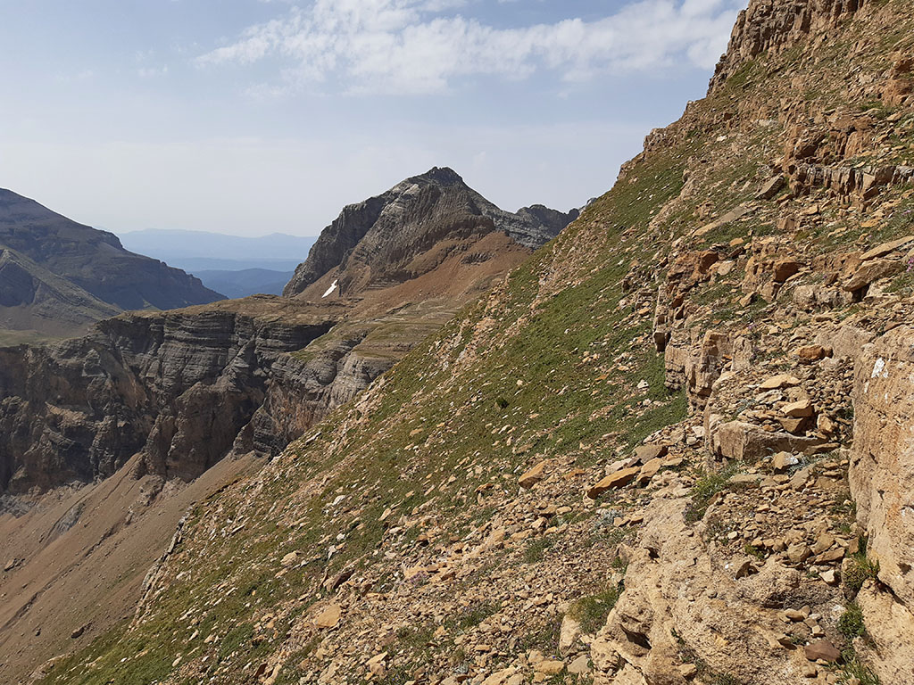
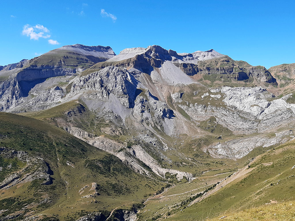
(2h30min; 7,1kms) charcas (2.160m). At this point the paths to Punta Escarra and Balsera/Hombro de Escarra peak separate. We leave the clearer path that continues horizontally to the right, and start to rise to the left (E-NE). The whole area is full of cattle trails, so we will follow our intuition to find the best path.
With the peak of Balsera as a reference point, we head towards a grassy corridor under some smooth slabs. Then the path turns to the left and continues along the right bank of the valley (left of the path). The path is now more defined and there are some milestones that lead to Punta Escarra.

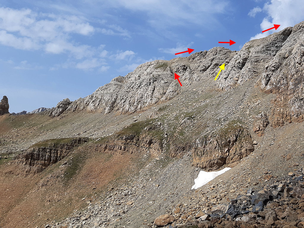
We head towards the left side of the ridge. Shortly before reaching the base of the Punta Escarra wall, the path splits.

On the left, where we propose to climb, there is a...
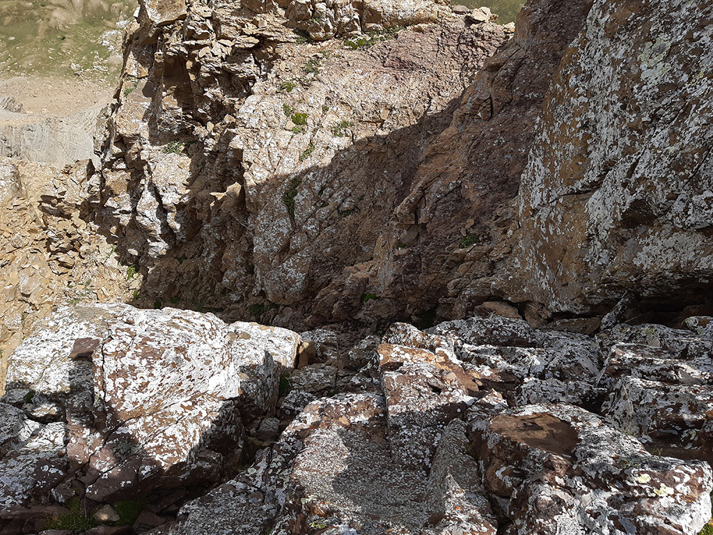
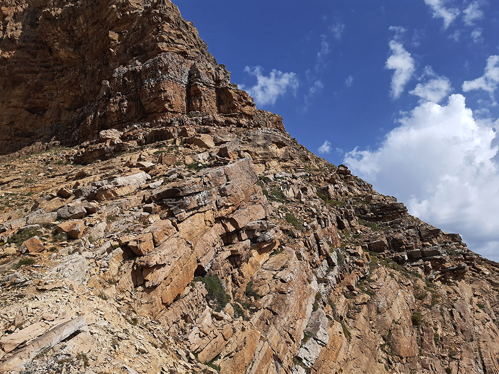
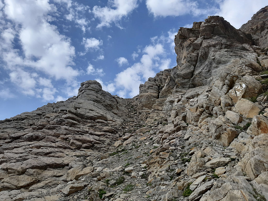
(3h55min; 9,3kms) Gap (2.650m) with a pass of II+ that we have to fight our way out towards the right side of the crevasse. Another option to the right is the one proposed by David Atela (100 summits of the Aragonese Pyrenees, SUA, 2002 edition). It is "look for a slightly sloping and thin area on the first escarpment of the wall, located one third away from the NW edge and two thirds away from the SW edge".. It gives it a difficulty of II-. This second option then follows a horizontal turn to the left that joins the first route.
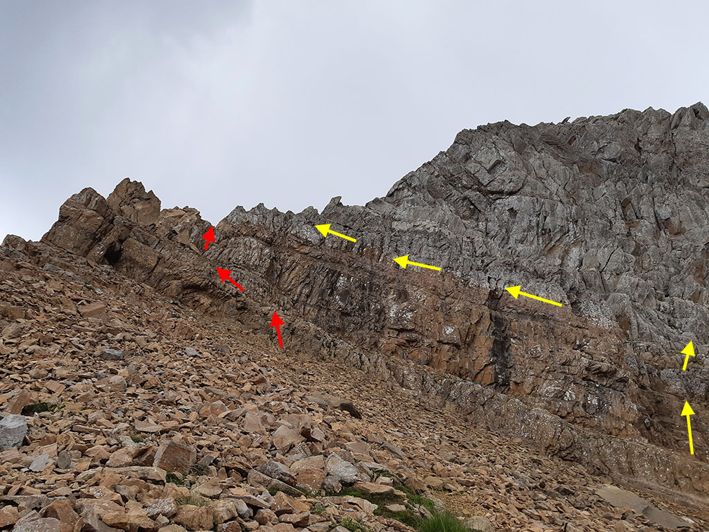
The climb continues more easily to a small gap that leads to the North and East slope, and continues along a characteristic horizontal traverse of about 20 metres in length.
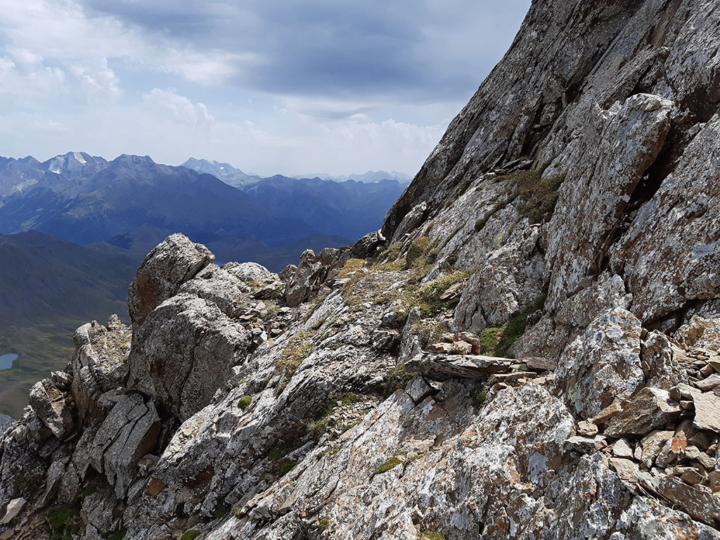
The rock is quite firm but you still have to be careful what you hold on to. Some milestones and the brown rock from the passage of mountaineers mark the route. We climb in small zig-zags, always with a difficulty of around grade 1.
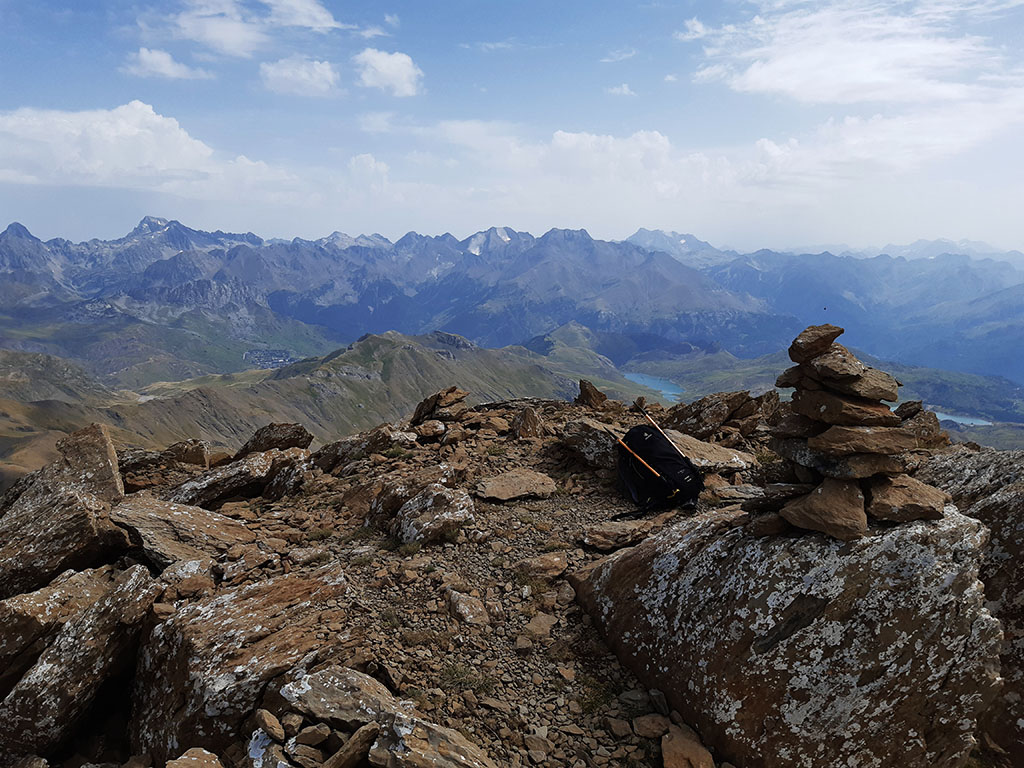
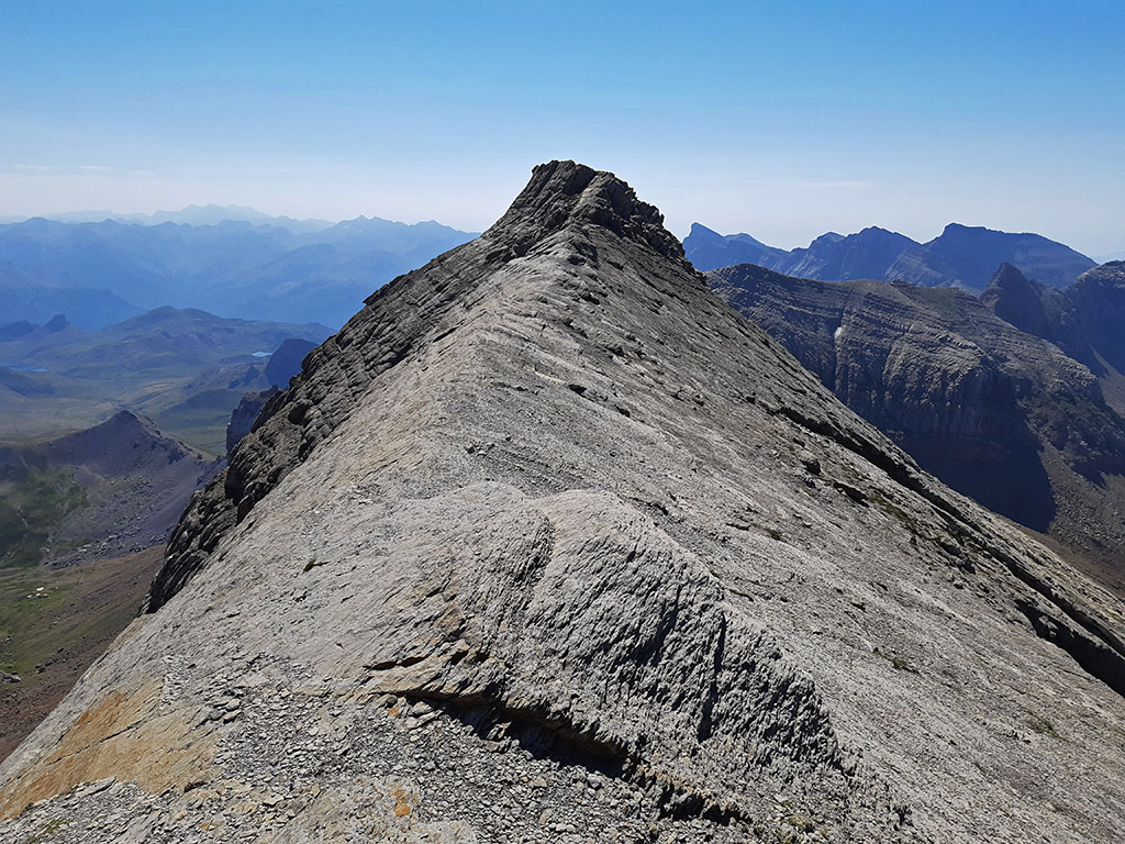
(4h15min; 9,4kms) Punta Escarra (2.751m). Privileged views of the mountains of the Aragon valley and the Tena valley.
To descend, we descend again to the horizontal crossing and gap (4h25min), which leads from one slope to the other. At this point we can choose to descend again along the same route, or descend to the right, along the (NE) side, to the beginning of the rocky slopes. This is the option we will follow if we want to do the circular route and go up (optionally) to the peak of Balsera/Hombro de Escarra.
Turn right shortly after reaching the scree and flank the steep grassy-rocky slope below Escarra point, gradually losing height in search of a pass under the southeast ridge.
This somewhat exposed traverse is fine on dry ground, but can be quite dangerous when it is wet or snowy. We now descend, taking advantage of the grassy areas, towards an elongated plateau occupied by large boulders.
(4h45min; 10,1kms) Riachuelo - Grandes Bloques (2.473m). To climb to the peak of Balsera, we will have to overcome the first plinth and go up the rocky slopes to the...
(5h10min; 10,5kms) base of the wall (2.624m), to the left of the peak. We will find ourselves under a wide corridor (double) that climbs directly up to a pass on the ridge (II and I), with some loose rock at times; and another that climbs more to the left in a south-westerly direction, which is easier and safer.
Either of the two options leads to the elongated ridge that leads to the...
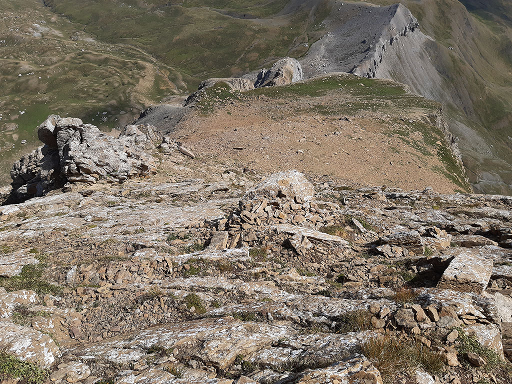
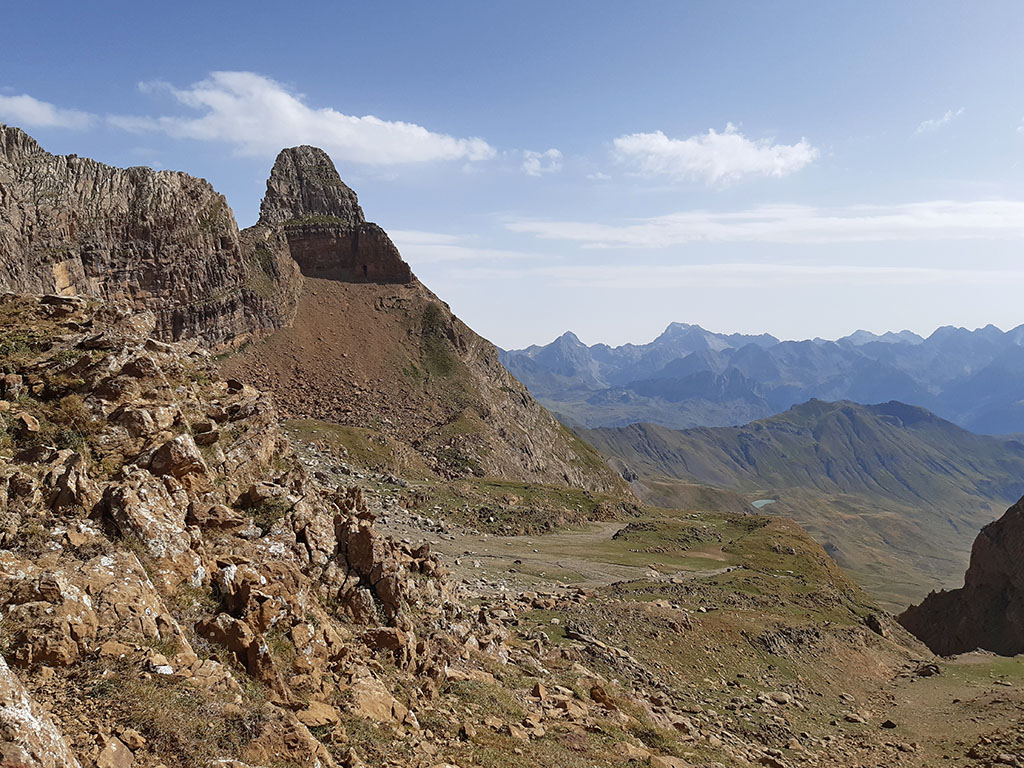
(5h25min; 10,8kms) Pico Balsera/Hombro de Escarra (2.701m). Nice view of Punta Escarra.
To descend we recommend the safest option (red arrows in the photo).
Once at the bottom, a quick horizontal traverse under the wall leads to the...
(5h45min; 11,7kms) col (2.526m) between the campanils and the peak of Balsera.
From here, we descend without a path to the Circo de Ip, along the right bank of the ravine.
We descend straight on, taking advantage of the grass, until we come to some practically horizontal paths at an altitude of about 2,200m. If we continue along them we will reach the area of the...
(6h25min; 13,4kms) Charcas (2.160m), where we now go uphill. We continue downhill taking the white house with blue doors as a reference point. About 100m to the left, there is a small...
(6h40min; 14,4kms) refuge (2.070m). At this point there are white and yellow markings (Besera path) that we will follow to go down. We cross a stream as soon as we start and shortly afterwards we take the path to the left at a fork. The path descends along the left bank of the Ip ravine, above the rocky outcrop.
The path leaves the meadows behind and enters the pine forest. On the way down you pass by a stone hut (7h40min; 17,7kms), which is followed by a flat stretch, and by a junction signposted to Collarada (8h05min; 18,9kms).

(8h25min; 20,2kms) Bridge - Parking (1.050m).
NEARBY YOU MAY BE INTERESTED IN
Circular ascent of the Pala de Ip and La Moleta along the Tronquera ridge from the Coll de Ladrones (20.3kms; 1840m; 9-10 hours).
Circular route, very long and very steep, to the westernmost peaks of the Sierra de Partacua.
(26,3kms; 2500m; 13 hours)
Fastpacking is not about going faster. It's about going lighter.
If you come from classic trekking, this is the next step: learning to move with less weight,
more fluid and enjoying every kilometre more.
Join the Outsiders Newsletter and start discovering what lightness feels like.