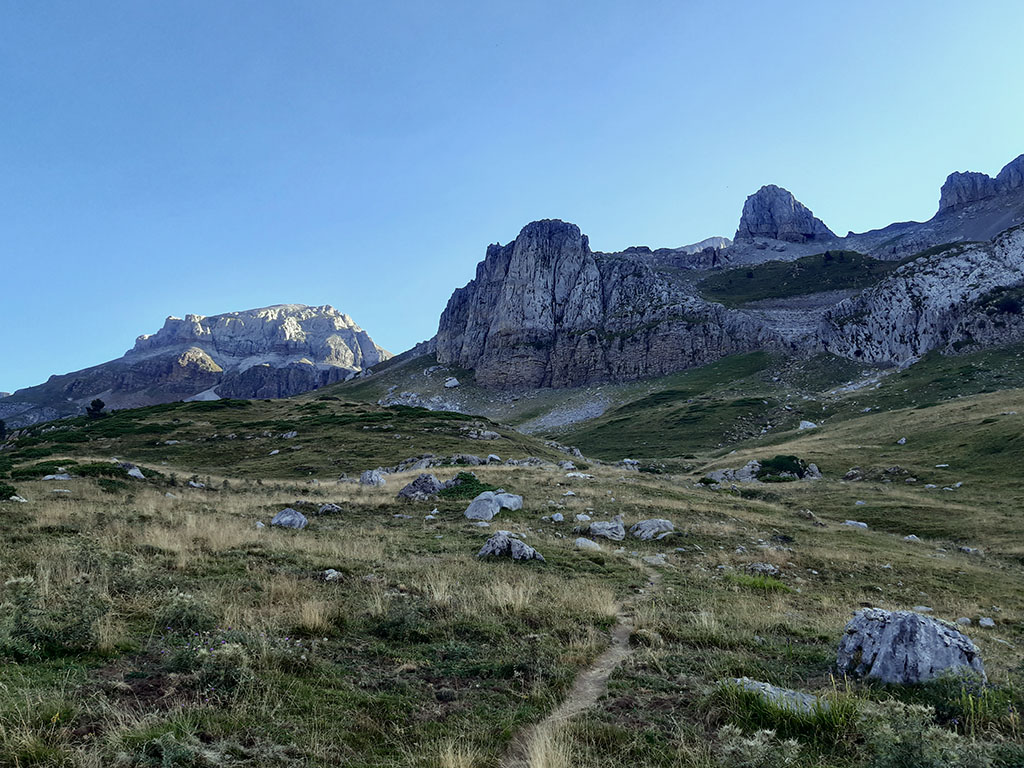
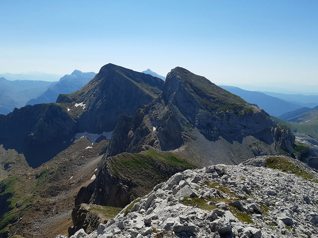
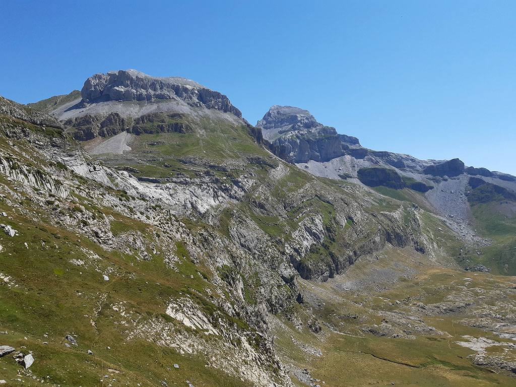
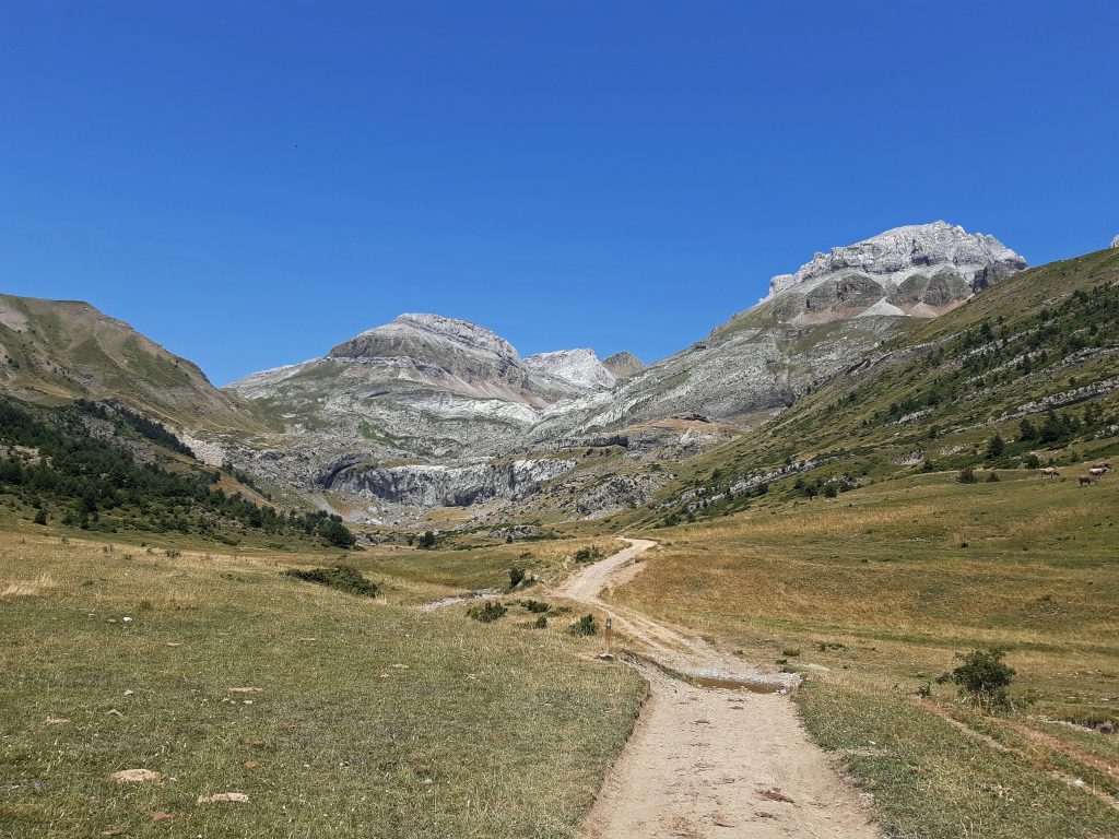
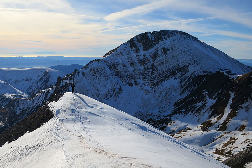
Llena de la Garganta (2,599) and Llena del Bozo (2,566m) from the Aísa valley.

Pyrenees and mountains 📩
Here 🔥Between Candanchú and the Aísa valley, the Llena de la Garganta and the Llena del Bozo (also called llanas), together with the Aspe (2,645m), form a trident of sharp peaks that we can combine in the same day.
Aspe is the best known and most ascended of the three and for this reason we will leave it aside this time. We do not want to repeat the climb. Our intention is to get to know the path that climbs up to the Napazal Pass, between the "llanas", and the direct descent from the Llena del Bozo to Cubilar d'o Cantal.
A route that some time ago we proposed to you to discover these great lonely peaksoften overshadowed by others of slightly higher altitude, as in this case.
SUMMARY OF THE ROUTE:
Circular route that ascends to the Llena de la Garganta and the Llena del Bozo from the car park of La Cleta, in the valley of Aísa. Once we have reached the Napazal Pass, we climb to the Llena de la Garganta (one-way) and then to the Llena del Bozo. For the descent, we will go down to Cubilar d'o Cantal where it joins the GR11, by which we will return passing the Bozo pass to the Igüer valley and the start of the route.
MAP:
DOWNLOADABLE:
> Download Track
HOW TO GET THERE:
See in Google Maps.
The start of this excursion is at the Cleta car park, at the end of the narrow road that goes up the Aísa valley (9kms; 1,500m). The reference point is the village of Aísa, which can be reached via the A-2605 if coming from Jaca (32kms), or via the A-176 and A-2605 if coming from Puente la Reina de Jaca (38kms).
Technical specifications:
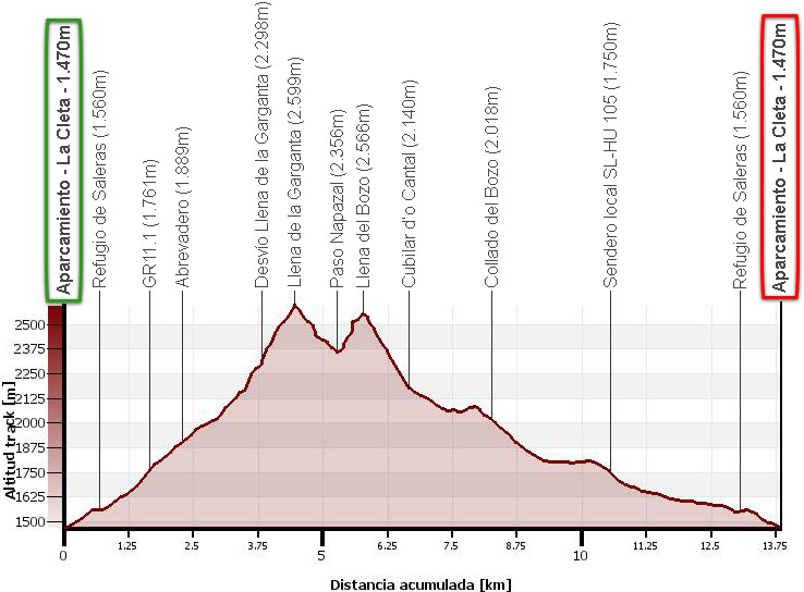
Distance: 13,6kms.
Cumulative difference in altitude: 1.400m.
Timetable: about 6-7 hours. Walking time without stops: 5h25min.
Water: although on the way down we will find some streams, we must be careful with loose cattle.
Difficulty: On the ascent to the Llena de la Garganta there is a chimney (F+) of about 20 or 25 metres. On the ascent to the Llena del Bozo from the Paso Napazal there is a somewhat exposed vira at the beginning (F) where you have to use your hands.
Recommended equipment for the summer: boots rather than trainers (long stretches of unstable rocky terrain), two walking sticks, GPS (optional), canteen.
Suggestions: The route described ascends first to the Llena de la Garganta and then to the Llana del Bozo, and then descends to the Cubilar d'o Cantal. It is better this way, as the ascent to the Llana del Bozo from the cubilar is through a strenuous and unstable rocky area, ideal for descending. If you still prefer to go in the opposite direction to the one described, it seems a better option to continue to the Aísa pass and climb up from here. Very often, the Llana de la Garganta and the Llana del Bozo are combined with the ascent to Aspe, thus completing the trident. This option would in any case rule out either the ascent to the Napazal Pass through the valley that separates the two Llenas, or the descent to Cubilar d'o Cantal.
Itinerary:
(0h00min; 0,0kms) Parking La Cleta (1.470m). At the end of the road we find an information panel on the local footpath SL-HU 105 (Ruta del Puerto de Aísa) and a metal gate, where a track closed to traffic in good condition begins. We follow it to the vicinity of the...
(0h10min; 0,7kms) Saleras refuge (1.564m)The road is set back a few metres from the track on the left hand side.

At this point, the local path splits. Turn right, following a path (white and green) that crosses the stream and climbs up over the divide separating the Igüer and Rigüelo valleys.
(0h35min; 1,7kms) GR11.1 (1.761m). The trail crosses the variant one of the Senda Pirenaica as we say goodbye to the local path (white and green), which turns left.
We continue along the ridge following the signs to Pico de Aspe, until we reach a watering place that we found to be dry in July.
(0h45min; 2,2kms) Abrevadero (1.889m). At this point, after passing next to a large rock or directly from the pylon, we leave the ascent to Aspe and take a path to the left that is rather blurry at the start. Continue on following the milestones around the base of Mallo Peñarruaba.
The grass gives way to rocks, to end up in a rocky area that leads to a kind of false hill that we face on the left, on the most stable part.
(1h35min; 3,8kms) Detour to the Llena de la Garganta (2.298m). Without having to reach the Napazal Pass, although it is better to get there, we leave the path and climb to the right, facing the slope, looking for the largest and most stable stones. We will soon connect with the path that comes from the Napazal Pass and heads south towards a very characteristic small gap at the foot of the wall.

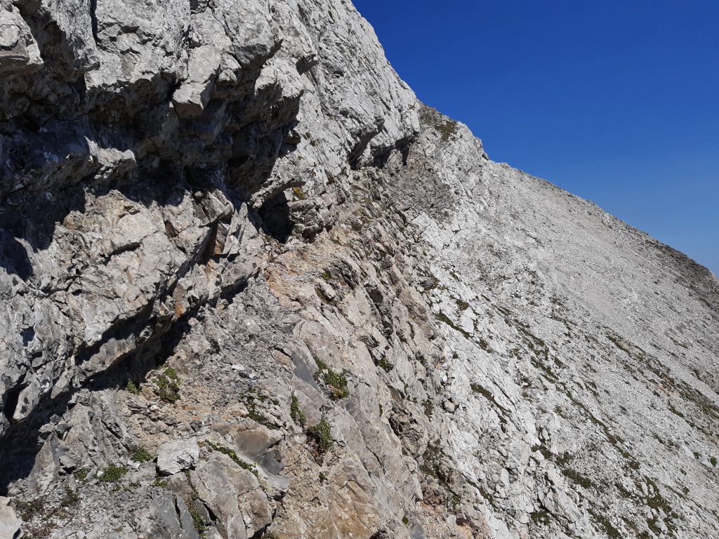
Shortly before the gap, where we can continue towards Aspe, we will notice a chimney of about 20m that climbs to the left. The most "complicated" step of the ascent (II).
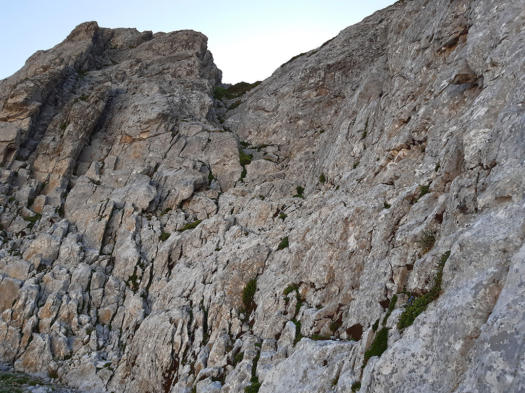
Once over it, we leave it on the right hand side, on a grassy field that we will take as a reference point for the descent. Without further complications we head towards the peak, without having to pay much attention to the milestones.
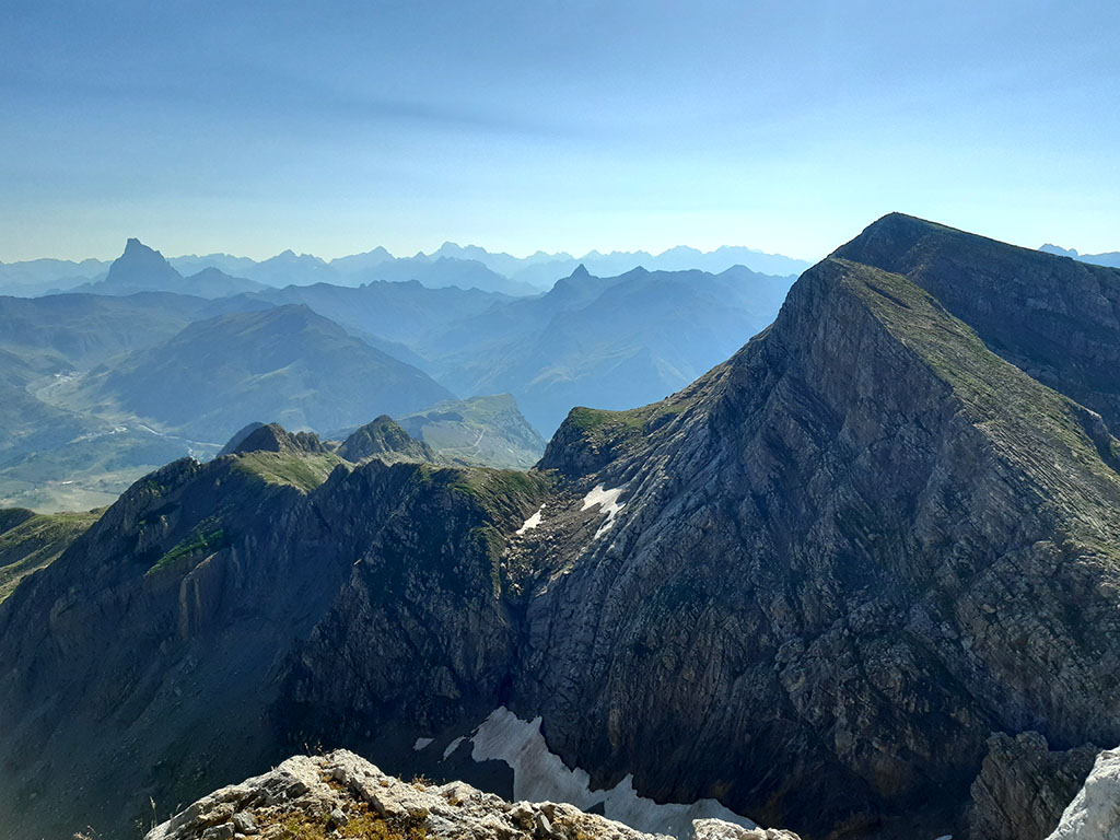
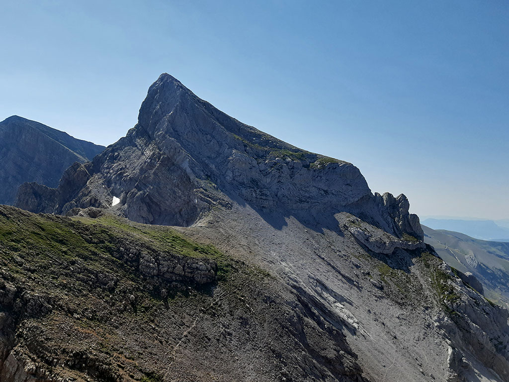
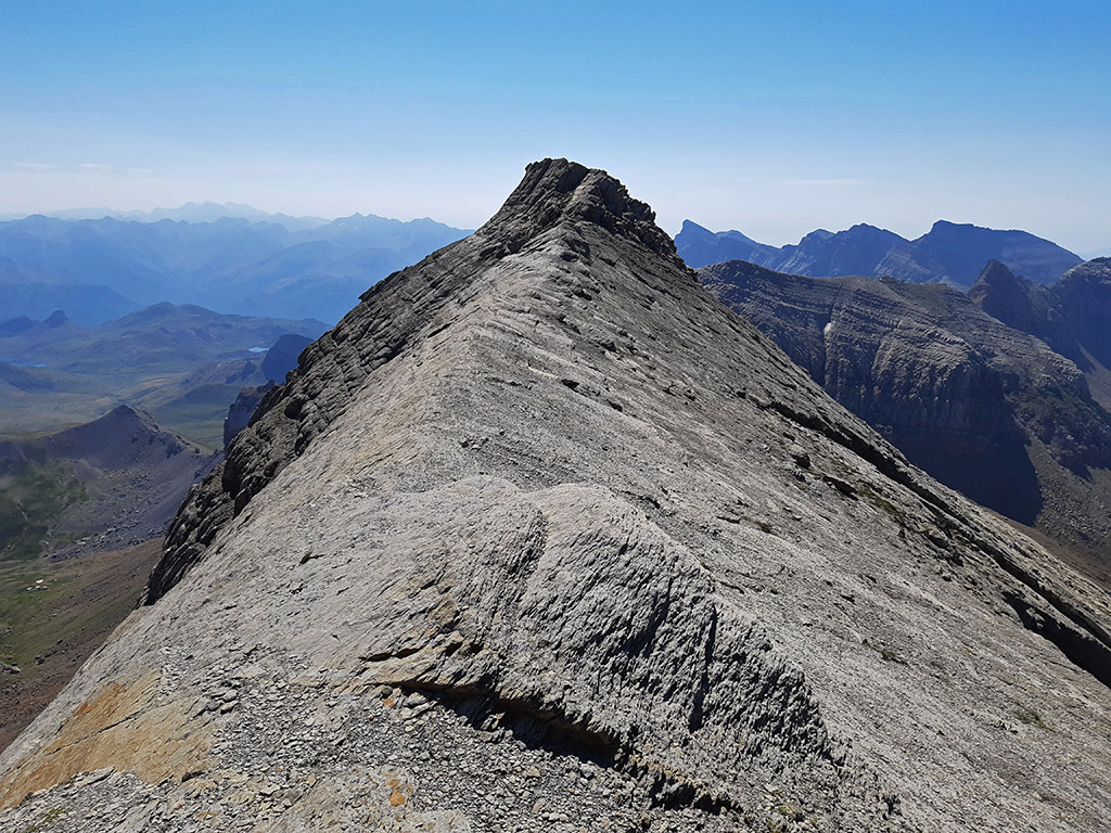
(2h20min; 4,5kms) Full of the Gorge (2.599m). The views are particularly exceptional to the east, where the Pyrenees take on a grander scale.
We return the same way back to the...
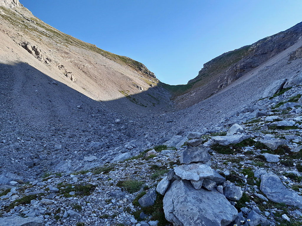
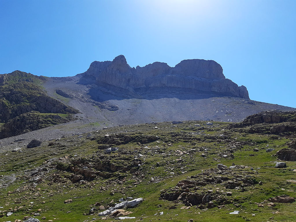
(2h40min; 5,3kms) Napazal Pass (2.356m). A line of cairns ascends close to the edge of the ridge, towards the base of the rocks, without being able to see the weak point of the climb.
A narrow, 50 cm wide and 50 m long virace runs along the base of the north wall and although technically not difficult, it can be impressive (F).
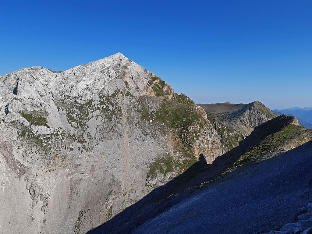
(3h10min; 5,8kms) Llena del Bozo (2.566m). Magnificent views, as well as the Llena de la Garganta.
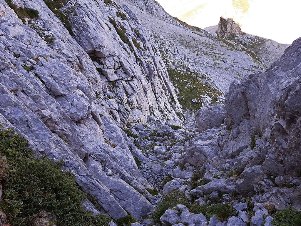
We descend to the left of the north-northwest ridge along a faint path that can be followed towards the Aísa pass, but which we abandon (8 minutes) to let ourselves fall down an endless rocky area where we can sense traces of a path. In a moment we are at the bottom.
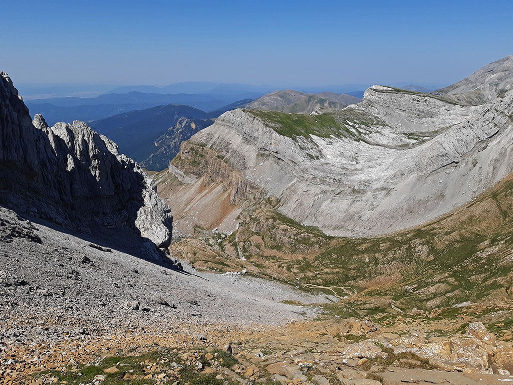
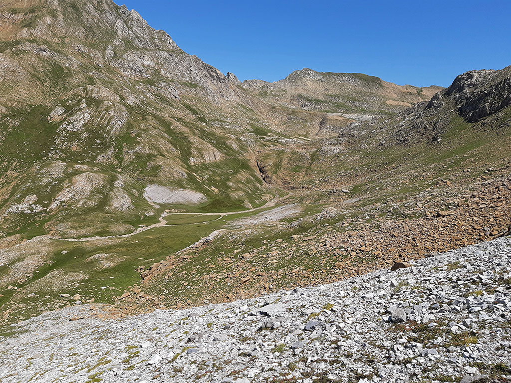
(3h45min; 6,9kms) Cubilar d'o Cantal - GR11 path (2.140m). We cross a stream which, although it carries water, may not be very reliable because of the stray cattle. We move quickly along the GR11 (red and white) in a south-westerly direction, towards the...
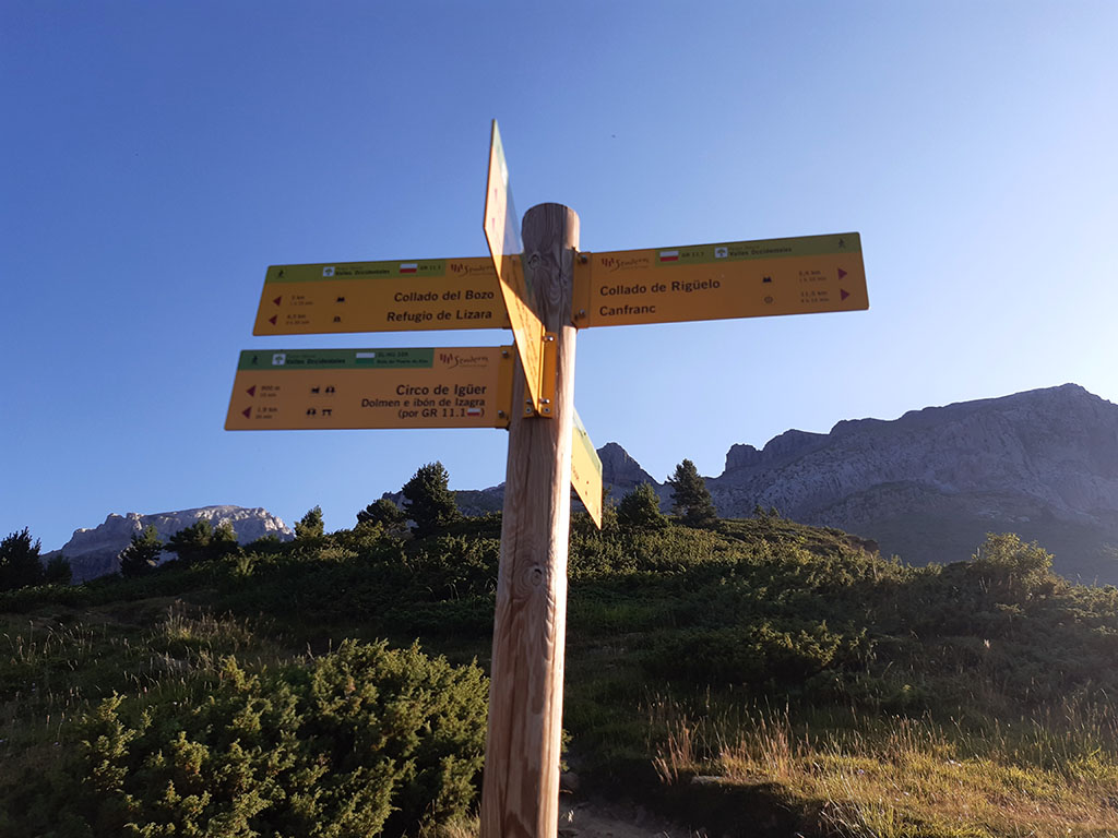
(4h05min; 8,3kms) Collado del Bozo (2.018). Crossroads of paths. On the right we go down to Lizara, on the left, along the GR11.1towards the valley of Aísa.
The path descends towards an esplanade crossed by the Igüer ravine and continues along a sort of balcony until it reaches a second ravine known as El Cubilar, where it meets shortly after with the...
(4h40min; 10,5kms) trail SL-HU 105 (1.750m) which we follow at the beginning of the route (green-white). We leave the GR11.1 and follow this short route to make the route more circular. The path descends towards the Igüer cirque where it joins a wide path (car tracks) that runs along the bottom of the ravine.
Further on, we pass the...
(5h15min; 13,1kms) Saleras refuge (1.560m), where it joins the uphill path where we started this excursion.
(5h25min; 13,8kms) Parking La Cleta (1.470m).
Recommended books:
The valleys of Ansó, Hecho, Aragüés and Aísa.
- Editorial: The Rambler
- Language: Spanish
- No. of pages: 192
- ISBN-10 : 8495368498
- ISBN-13 : 978-8495368492
- Publication: 2009
NEARBY YOU MAY BE INTERESTED IN
Pico de Secús is one of those summits for those who seek solitude. Its peak is isolated, differentiated from the rest of the...
Circular ascent of the Pala de Ip and La Moleta along the Tronquera ridge from the Coll de Ladrones (20.3kms; 1840m; 9-10 hours).
Fastpacking is not about going faster. It's about going lighter.
If you come from classic trekking, this is the next step: learning to move with less weight,
more fluid and enjoying every kilometre more.
Join the Outsiders Newsletter and start discovering what lightness feels like.