Senderismo por la Alta Saboya
Pirineos y montaña 📩
Aquí 🔥La zona de Chamonix y la cordillera del Mont Blanc son el centro de atención de los visitantes, pero esto no es más que una parte de la oferta de la Alta Saboya.
Al norte los alrededores de Evian-les-Bains, Morzine, Abondance, Châtel, St-Julien-en-Genevois, Bellevaux, Boège y Habère-Poche, con atractivos como Cornettes de Bise, Mont de Grange, Dent d-Oche y Pic Boré.
Al sur de la Alta Saboya francesa en los alrededores de Annecy, La Clusaz, Grand Bornand, Plateau d’Assy, Samoëns, Sixt, Sallanches, Thônes, la Roche-sur-Foron, podremos igualmente disfrutar de rutas que nos mostrarán un lado más tranquilo y menos bullicioso de esta zona de extraordinaria belleza.
Guía práctica
¿Cuándo ir?
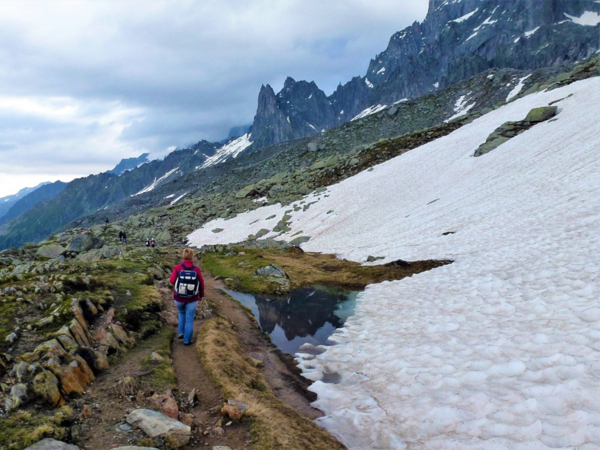
Primavera y verano, cuando la nieve se ha derretido y las laderas están llenas de flores alpinas; otoño, cuando las hojas están cambiando, o incluso invierno para algunas de las caminatas más bajas.
Ciudades & Servicios
- Al norte: Evian-les-Bains, Morzine, Abondance, Châtel, St-Julien-en-Genevois, Bellevaux, Boège, Habère-Poche
- Al sur: Annecy, La Clusaz, Grand Bornand, Plateau d’Assy, Samoëns, Sixt, Sallanches, Thônes, la Roche-sur-Foron
No te puedes perder
- Picos importantes. Al norte: Cornettes de Bise, Mont de Grange, Dent d’Oche, Lagos Pic Boré: Ginebra, Arvouin, Tavaneuse Cols: Cheséry, Cou, Brétolet. Al sur: Tournette, Tête de Boston, Parmelan, Môle Lakes: Annecy, Anterne, Vogealle, Gers, Lessy, Bénit y numerosos pequeños lagos de montaña.
- Atractivos históricos: abadías medievales; numerosas capillas pequeñas, santuarios, estaciones de la cruz y estatuas en las cimas de las montañas. Tras las huellas del alpinista inglés Alfred Wills, monumentos de la Resistencia Francesa, monasterios, capillas de montaña y santuarios
- Rutas de contrabandistas por las reservas naturales de los cols de la frontera franco-suiza.
- Características geológicas: acantilados de piedra caliza, barrancos y cuevas (Salève). Espectaculares cascadas y pavimentos de piedra caliza
- Reservas naturales, jardines alpinos, rutas de migración de aves
- Línea de falla y microclima (Vuache)
Salève, Vallée Verte, Abondance, Bellevaux, Morzine
6 áreas que cubren el Salève y Vuache, el Vallée Verte, el Vallée du Brevon, Pre-Alpes du Léman y el Val d’Abondance.
- Salève And Vuache /// Gorges du Salève / Balcon du Salève / Grand Piton / Pointe du Plan / Boucle de l’Iselet / Le Vuache /
- Vallée Verte /// Signal des Voirons / Mont de Vouan / Pointe de Miribel / Montagne d’Hirmentaz / Mont Forchat /
- Vallée Du Brevon /// Mont d’Hermone / Rocher de Nifflon / Pointe de la Gay / Pointe de Chalune / Haute Pointe / Pointe d’Uble /
- Pré-Alpes Du Léman /// Pic des Mémises / Pic Boré / Dent d’Oche /
- Val d’Abondance /// Cornettes de Bise / Lac d’Arvouin / Autour du Mont Chauffé / Roc de Tavaneuse / Mont de Grange / Pointe des Mattes / Le Morclan /
- Val de Morzine /// Col de Chésery / Pointe de Ressachaux / Col de Cou /
Annecy, Vallée de l’Arve, Samoëns y el Chaîne des Aravis
6 áreas que cubren el Valle del Arve, el valle del Haut Giffre, la Chaîne des Aravis (norte y sur), el Plateau de la Borne y el Lago de Annecy.
- Vallée de L’Arve /// Le Môle / Pointe de Marcelly / Tour de Chevran / Plateau d’Assy / Refuge de Moëde-Anterne /
- Vallée du Haut Giffre ///
- Lac d’Anterne et le Dérochoir / Lac de Gers / Lac de la Vogealle / Tête de Bostan / Chalets de Criou /
- Chaîne des Aravis: Norte /// Lac Bénit / Boucle des Confins / Trou de la Mouche / Circuito des Annes / Arête des Saix / Boucle du Lac de Lessy / Boucle de St-Jean-de-Sixt /
- Chaîne des Aravis: Sur /// Pointe d’Orsière / Tour de La Tulle / Tour du Sulens / Tour de l’Aiguille de la Tournette / Boucle des Tervelles /
- Plateau de la Borne /// Roche Parnal / Montagne de Sous-Dîne / Plateau des Glières / Le Parmelan /
- Lac d’Annecy /// La Tournette / Cascades d’Angon / Crête du Taillefer / Montagne d’Entrevernes /