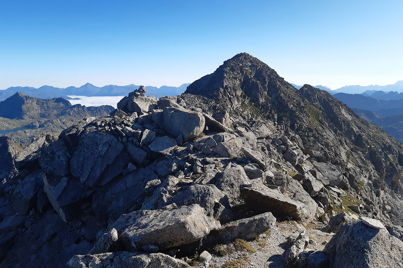
Punta Alta de Comalesbienes (3,014m) from the Cavallers reservoir.
Pyrenees and mountains 📩
Here 🔥The Punta Alta de Comalesbienes (3,014m), in the Aigüestortes i Estany de Sant Maurici National Park, is the culminating point of the nucleus of summits located to the east of the Cavallers reservoir and one of the 5 three-thousanders of the massif together with the Besiberris. For us, it is one of the great easy" three-thousanders in the Pyrenees.
The most common route ascends from the Cavallers reservoir through the Comlesbienes reservoirs and has no special difficulties, except for the physical effort and the need to know how to find your way around the sometimes chaotic and uncomfortable terrain. The quickest way down is by the same route, however, we would be missing out on a large part of the charm of this mountain. We recommend that you do the circular route, although it is a little longer, descending towards the Colieto Valley to return via the Ventosa and Calvell shelter and the Cavallers reservoir. The route described here.
Summary:
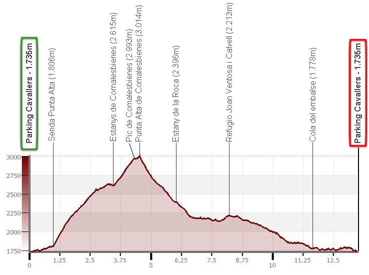
Circular route to the Punta Alta de Comalesbienes (3.014m) from the Cavallers reservoir. Ascent via the Comalesbienes reservoir and the Comalesbienes peak. Descent through the Colieto valley and the Joan Ventosa i Calvell refuge.
Map:
Downloadable:
How to get there:
See in Google Maps.
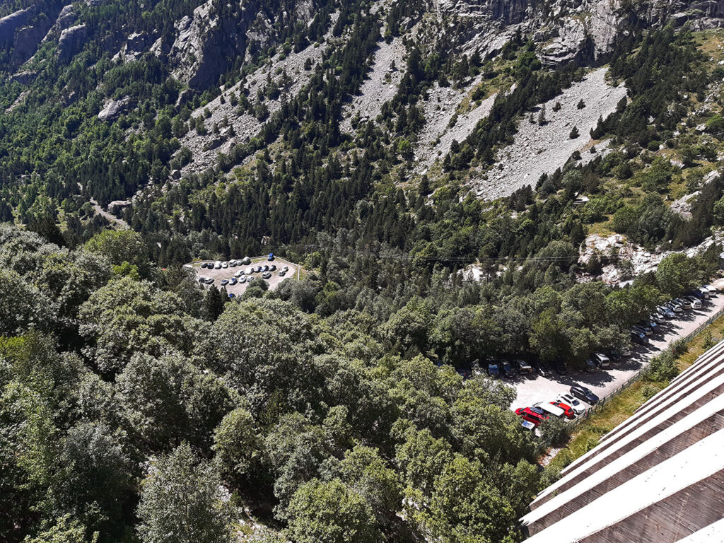
To get to the Cavallers dam car park, follow the L-500 road that runs through the Vall de Boí to the end. Take it a couple of kilometres above El Pont de Suert, at kilometre 125.5 of the N-230. The last village we pass through is Caldes de Boí, from where we still have 5 kilometres of ascent to go. In total, 27 km from Pont de Suert.
Technical specifications:
Distance: 13.5km.
Cumulative difference in altitude: +/- 1.510m.
Timetable: about 8-9 hours. Walking time without stops: 7h05min.
Water: During a good part of the route we will be near a watercourse or we will pass near a pond. The only spring as such is the one at the Joan Ventosa i Calvell refuge.
Difficulty: Punta Alta is one of the easiest three-thousanders in the Pyrenees if we take into account that there are no obligatory climbing steps. However, most of the trails run over very uncomfortable terrain, confusing at times, with a lot of blocks and loose stones and really steep sections. It is no walk at all.
Recommended equipment for the summer: better boots than trainers, two walking sticks, GPS (optional), canteen.
Itinerary:
(0h00min; 0,0km) Parking - Cavallers reservoir (1.735m). Once we are in the car park at the foot of the dam, we return some 300 metres along the track to the road by which we arrived by car. Just a little further down, turn left (S) onto a wide path that climbs upwards in wide zigzags, where, if we wish (it is not worth it), we can take a shortcut around the first hairpin bend. After 20 minutes, after 5 horseshoe bends, be careful to take a path that goes off to the right and of which a sign warns: "Attention, sender molt perillós, extremeu les precaucions". This is the path to La Punta Alta, although there is no sign indicating it.
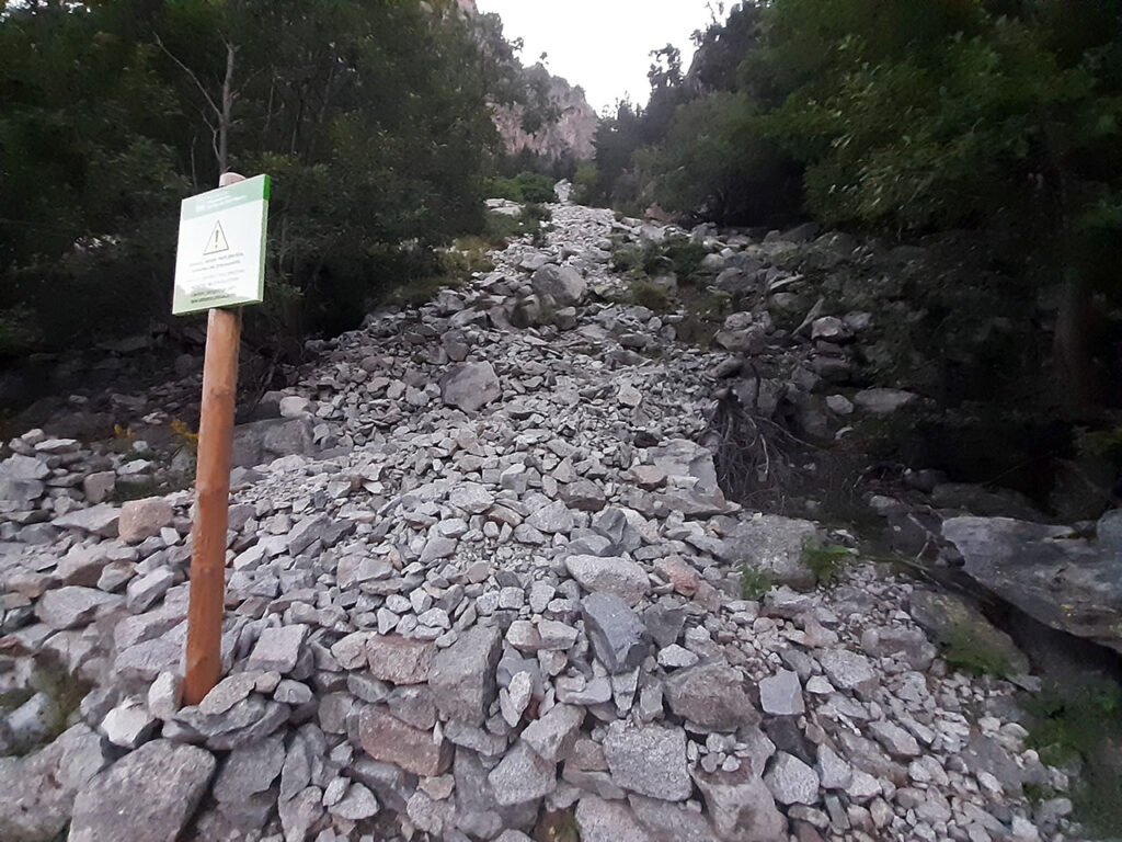
(0h20min; 1,0km) Right - Path to Punta Alta (1.806m). Things suddenly get serious. The path ascends a somewhat unstable rocky slope, although the path is well marked, where the poles are a great help. A little further up, the path bends to one side or the other in search of solid ground until you reach a plateau where the route is interrupted (0h50min; 1,4km; 2.074m).
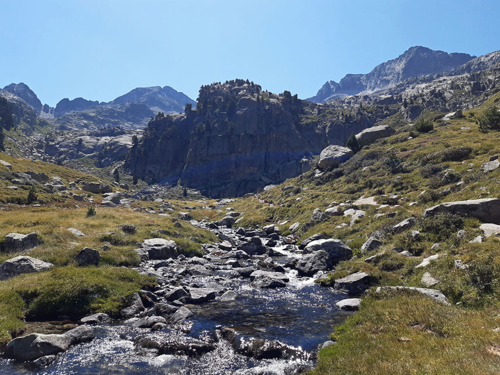
We will cross it to the right, entering the pine forest. Shortly after, we come out into a clearing and once again we pass through pine trees, before entering the chaotic rocky realm for good. The path follows the milestones parallel to the Barranco de Comalesbienes ravine through terrain where it is easy to lose the path.
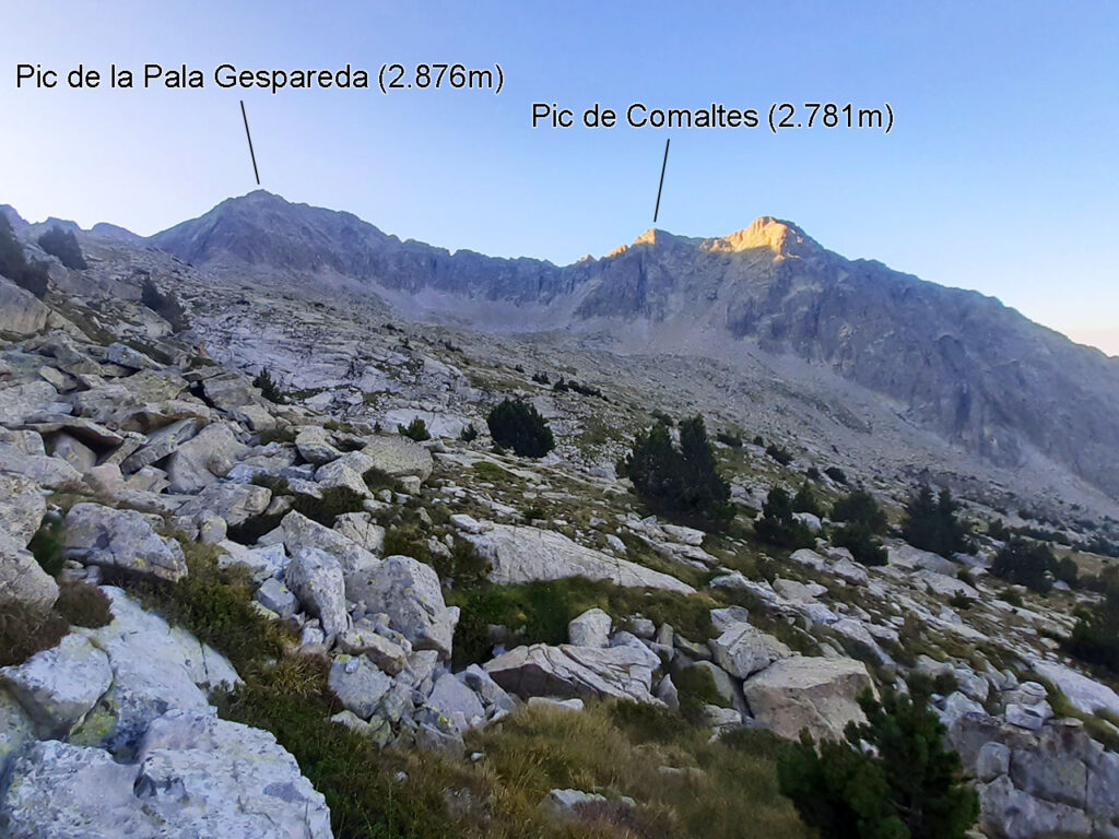
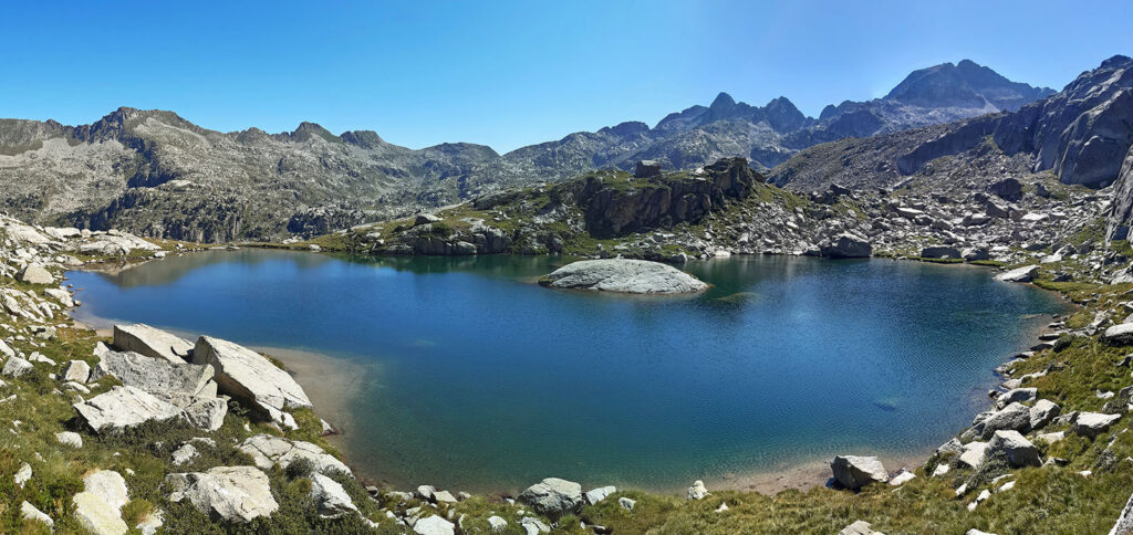
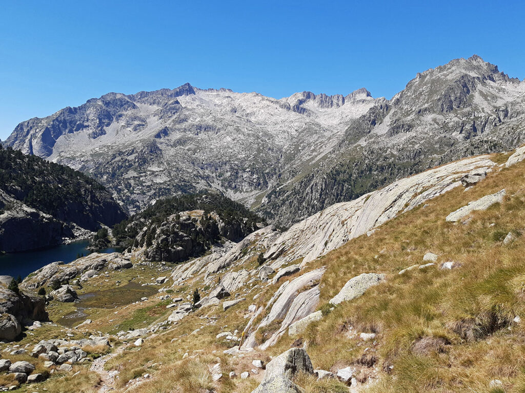
After about two hours from the start, we will reach a small lake that we border on the left before reaching another larger one.
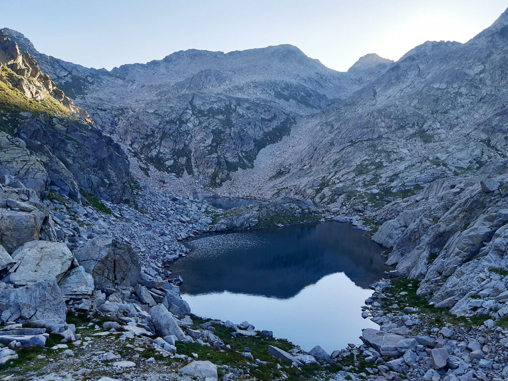
(2h05min; 3,4km) Estanys de Comalesbienes (2.615m).
The lake complex of the Estanys de Comalesbienes is made up of 2 main lakes and a group of small lakes (up to 9 more can be counted). The largest of these, with a surface area of 4.9 hectares, is hidden during the climb up to this spot. You will be able to see it further up. The one we can see up close is the second in size, about 2ha.
The path turns to the left to ascend in a north-northwest direction until it reaches an area of boulders. Here you can continue in the same direction to reach the pass between Comalesbienes and Punta Alta, or turn left (west) to reach the ridge to climb directly up to Comalesbienes. Although the ridge does not present any significant difficulty, it is best done without poles, as you have to constantly reach out your hands to negotiate the successive steps.
(3h05min; 4,3km) Pic de Comalesbienes (2.993m).
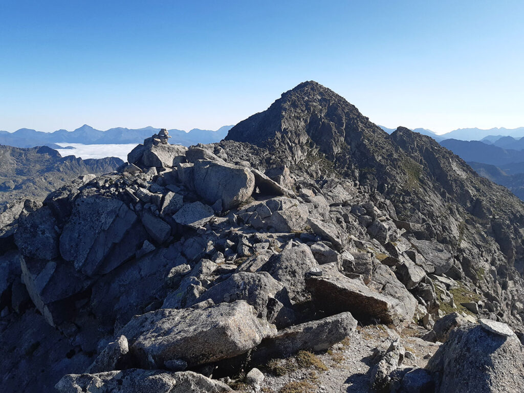
On the descent from the Pic de Comalesbienes to the first col on the ridge we will find the only notable pass on the route. To find it, follow the edge of the ridge until it suddenly appears. It is a small cliff facing the northern slope, with good support for feet and hands and on good rock which, although it does not give a sensation of emptiness, can impress the most novice climbers (F). A step that could be avoided if instead of climbing Comalesbienes we take the direct ascent to Punta Alta shortly after the Estanys de Comalesbienes.
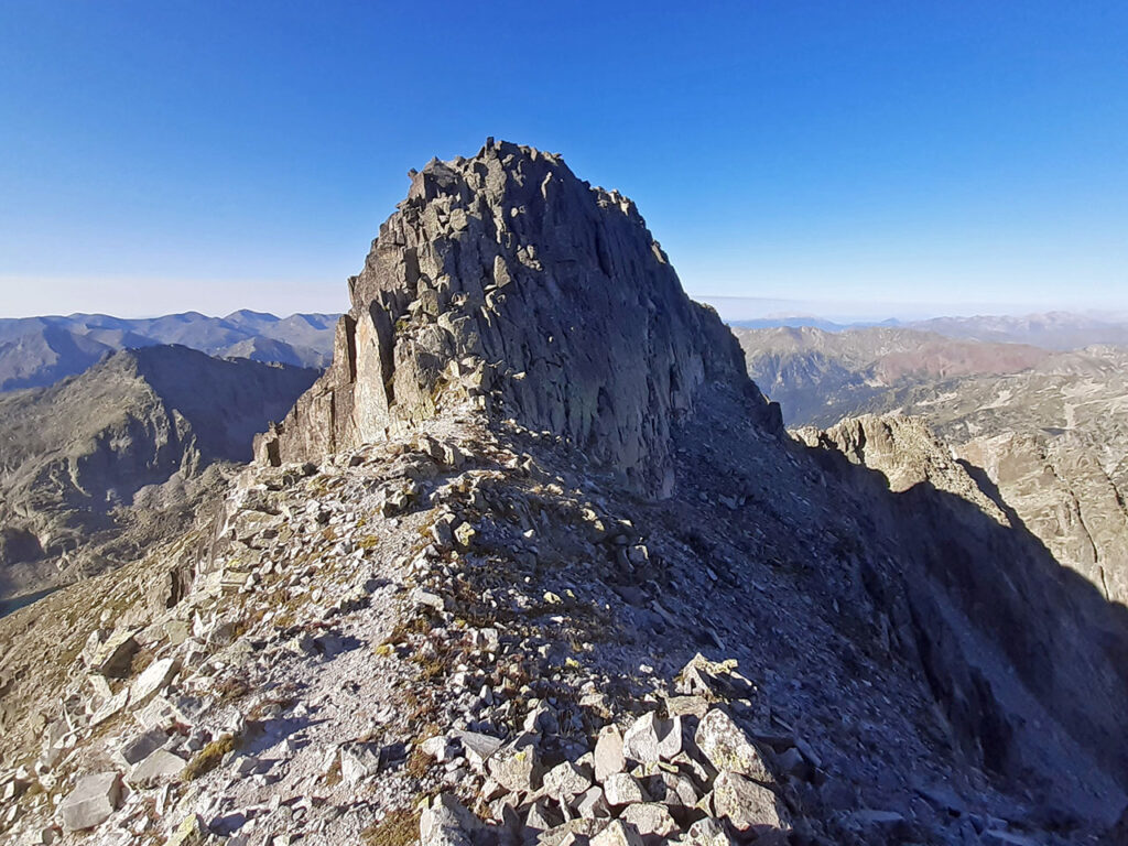
Once we have passed the crest, we pass a small pass and an intermediate height before joining the main path that came from the Estanys de Comalesbiens on a second pass. The final ridge that remains until Punta Alta does not present any notable difficulties.
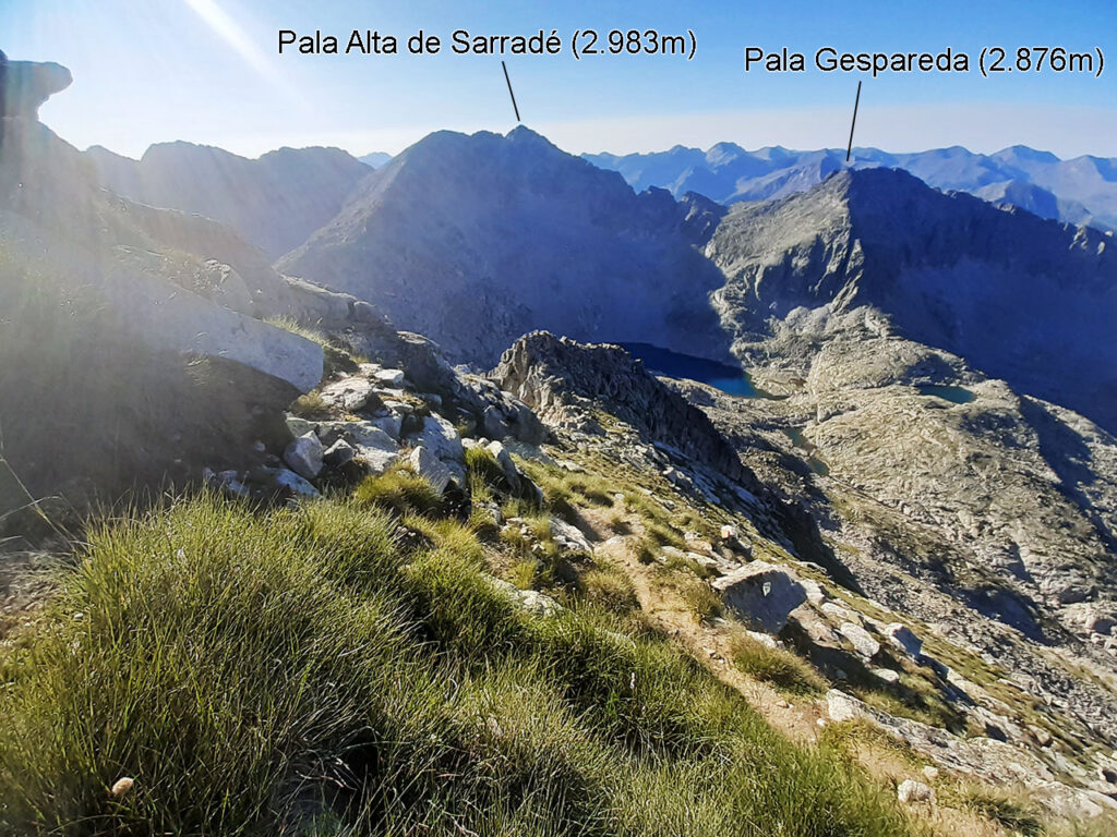
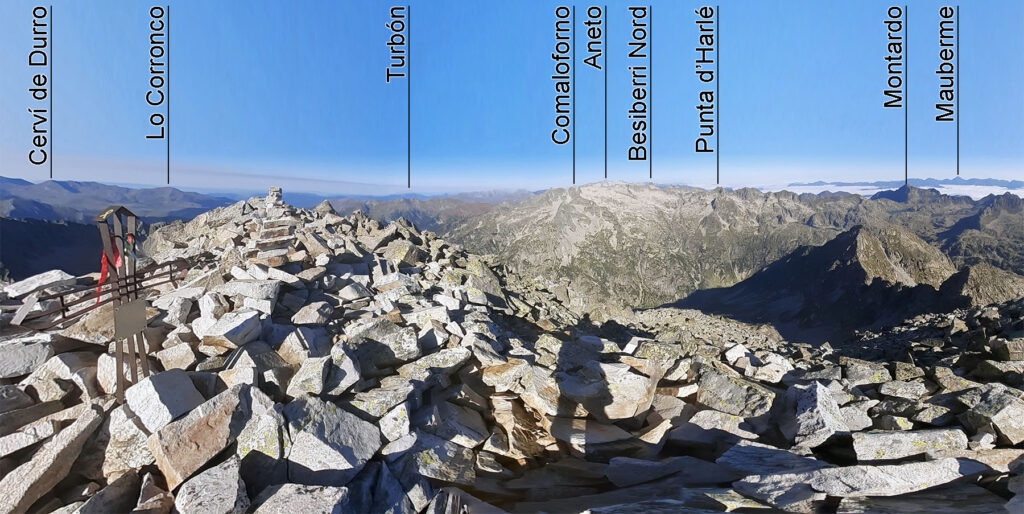
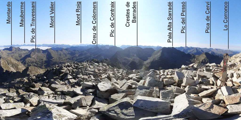
(3h20min; 4,5km) Punta Alta (3.014m). Magnificent 360º views, with the Besiberris group standing out to the west with the Aneto behind, and countless other peaks, from the nearby Pala Alta de Sarradé to the Pica d'Estats in the background.
We now descend towards the northern slope along a steep path marked with milestones, towards the Arenós pass but without reaching it. We can take the peaks of Comalespada and la cota (2,832m) as a reference point, which we leave to the left.
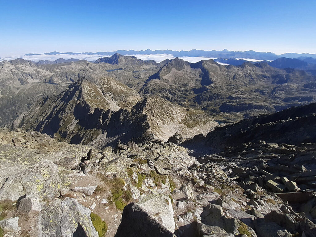
Without reaching the Arenós pass, take a wide channel to the right and go down to the Estany de la Roca, taking care not to miss the milestones and end up in a tangle.
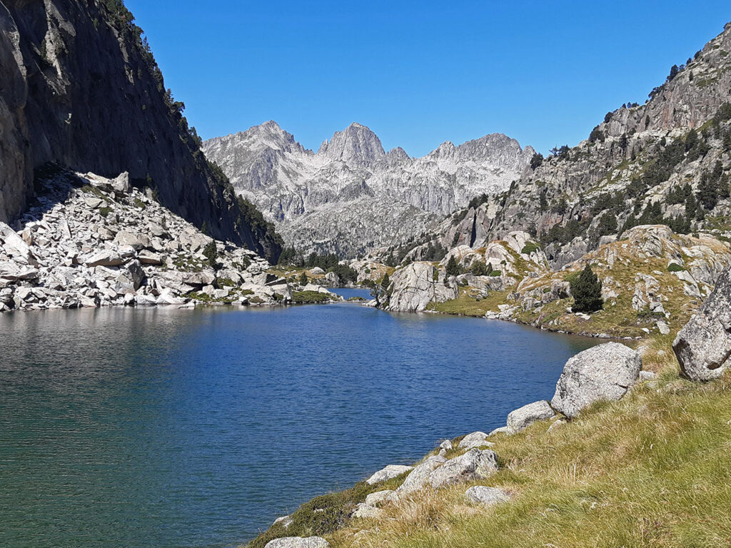
(4h25min; 6,0km) Estany de la Roca (2.396m). An idyllic place to take a break while contemplating the surrounding landscape.
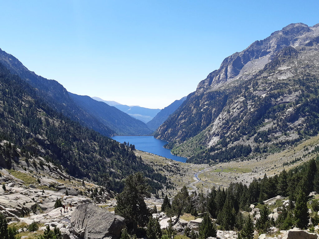
The path continues downhill to the valley of Colieto, where it meets the yellow waymarks of the Carros de Foc (4h50min; 6,9km; 2.179m).
We go round the right bank of the Gran de Colieto lake and then the Bassot de Colieto, before starting to recover some altitude on the way to the...
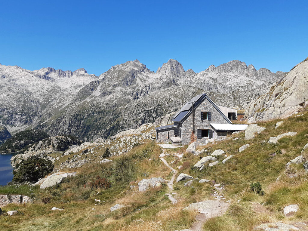
(5h25min; 8,3km) Joan Ventosa i Calvell Hut (2.213m). A good place to make another stop and fill up with water for the rest of the route.
The path, which is very popular, continues halfway up the slope but without the yellow marks of the Carros de Foc, leaving the Estany Negre below on the left, dominated by the Pics de Comalespada.
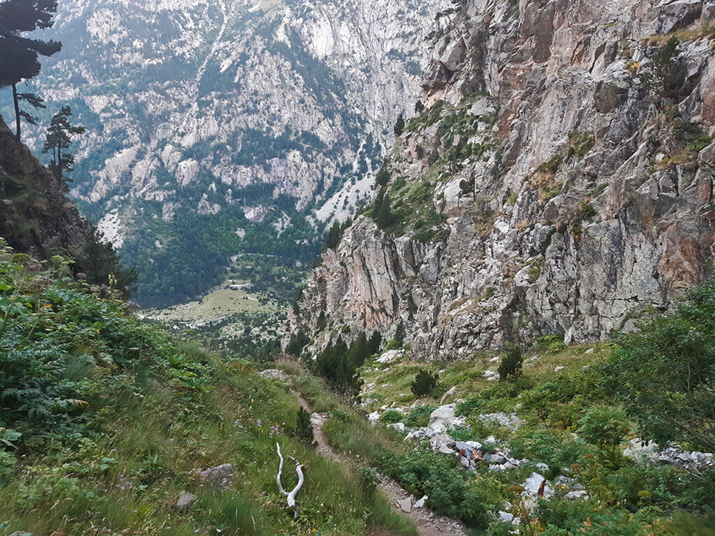
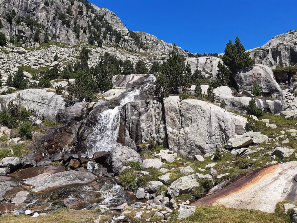
The path zigzags along the Llastres ravine, leaving the Riumalo waterfall on the right, to go down to the Planell de Riumalo (6h15min; 10,8km; 1.847m) and then to reach the...
(6h30min; 11,5km) tail of the reservoir (1.778m).
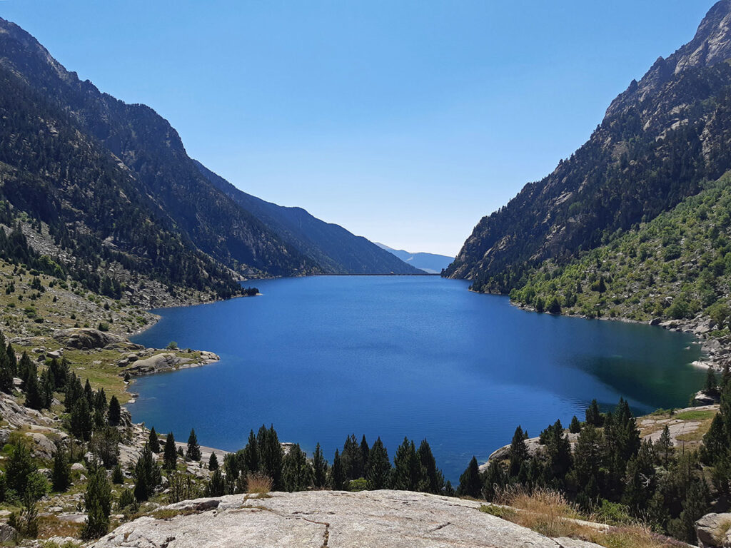
We go round it to the left, along a well-marked path that becomes a wide path before reaching the dam.
Once here, continue down the track for a hundred metres until you reach an esplanade that opens up on the right, at the end of which a shortcut leads down to the car park below the dam.
(7h05min; 13,5km) Parking - Cavallers reservoir (1.735m).
Nearby you may be interested in:

Ascent via Josep María Blanc hut and descent via Ernest Mallafré hut [9h10min; 23,7km; +/-1.785m; F+].
Fastpacking is not about going faster. It's about going lighter.
If you come from classic trekking, this is the next step: learning to move with less weight,
more fluid and enjoying every kilometre more.
Join the Outsiders Newsletter and start discovering what lightness feels like.