Burgos: Humión (1,434m) and Flor (1,338m). Circular route from Orbañanos.
Pyrenees and mountains 📩
Here 🔥Summary:
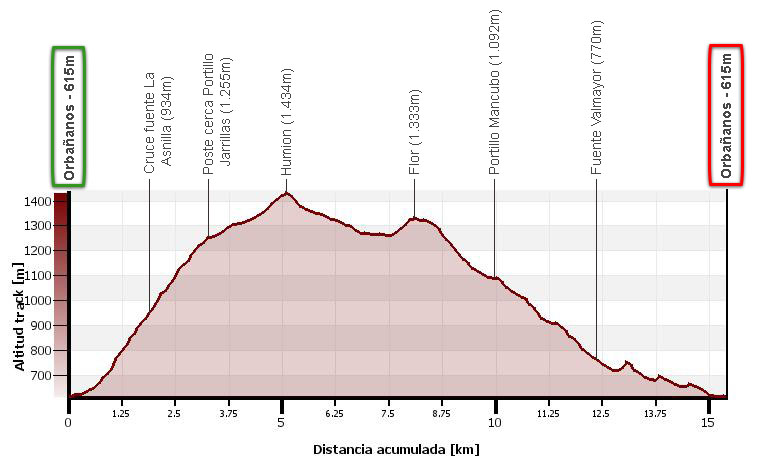
Circular route from Orbañanos to Humión (1,434m) -the highest point in the Obarenes Mountains- and Flor (1,338m). The route ascends the Humión following the PR-BU 111 (white and yellow), runs along the ridge to the Flor peak and descends to the Portillo Mancubo by the SCL-BU-91 path. From here we turn left to descend through the Vallejo de los Acebales and the Vau stream, and then cross westwards to Orbañanos.
Map - profile:
Downloadable:
The Humion and the Natural Park of Montes Obarenes - San Zodornil
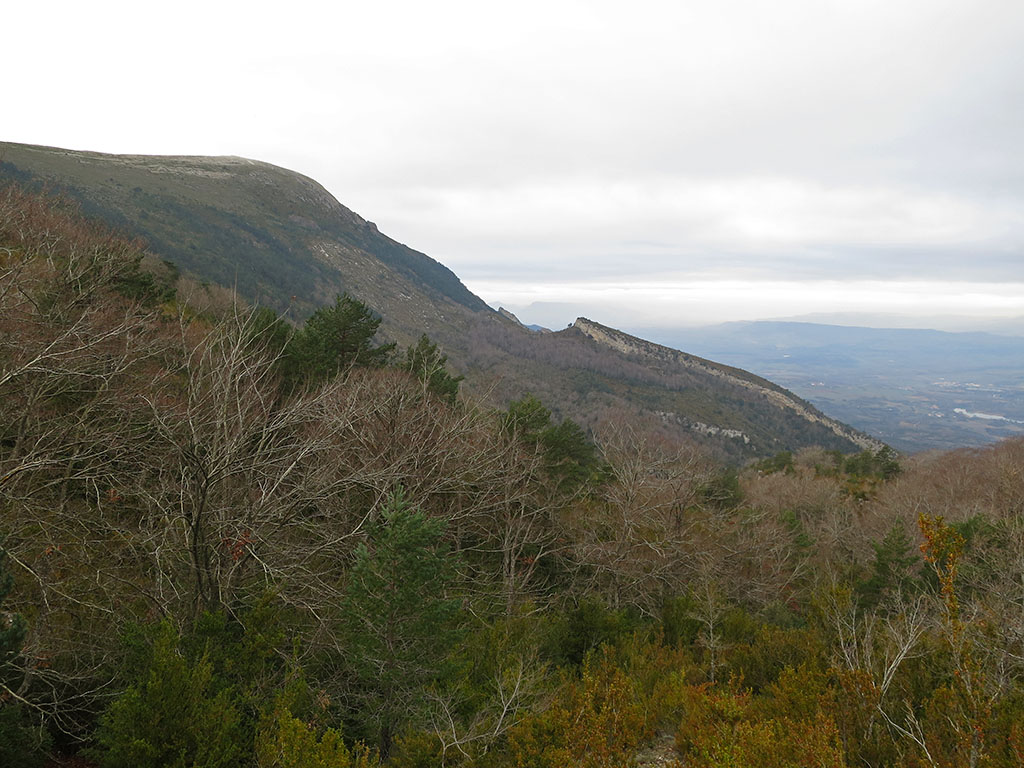
The Humion (1.434m) is the highest peak of the Montes Obarenes Nature Reserve - San ZodornilIt is also called Sierra de Pancorbo in some publications. It is located in the northeast of the province of Burgos, bordering Álava.
On the northern slope, through which this route climbs, is the Tobalina valley, crossed by the Ebro, which is dammed in a spectacular canyon between the Arcena and Montes Obarenes mountain ranges. On the southern slope is Cubilla, through which the most accessible route runs, and further on is the Sierra de Pancorvo. This is a very mountainous region with a predominantly continental Mediterranean climate, which causes significant contrasts in vegetation.
How to get there
See in Google Maps.
To get to Orbañanos, once in Miranda de Ebro, follow the BU-535 (Fontecha - Puentelarra) for 12.6kms, until a junction on the left (A-2122) indicating Sobrón and Trespaderne. Continue along this road for another 11kms until the junction to Orbañanos.
Technical specifications:
Distance: 15,4 kms.
Cumulative difference in altitude: +935m/-935m.
Timetable: about 5h30min. Walking time non-stop: 4h30min.
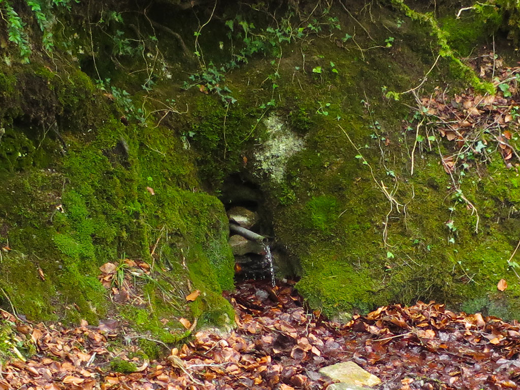
Water: At the Orbañanos car park there is a fountain. On the way up, turning off 200m, we will find the fountain of La Asnilla. On the descent we pass the Valmayor spring.
Difficulty: This is the most demanding ascent to Humión with more than 800m of positive height gain. The ascent route is perfectly signposted in the forest area, in white and yellow. In the high rasos area the signposting is lost and it can be confusing in fog. To go down, follow the white and green signs and then a white and violet one. In addition, there are several panels along the route at key points.
Itinerary
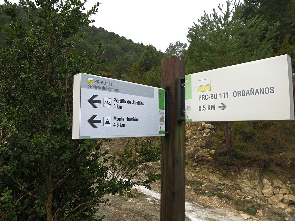
(0h00min; 0,0kms) Orbañanos (615m). In the upper part of the village there is a small car park, a fountain and an information panel about the route we are going to do. As soon as we start walking we will see a sign for the route, on the left the way back (white and purple) and straight ahead, the PR-BU 111 - Sendero del Humión (white and yellow), which we are going to climb. We start the route on a wide path, suitable for cars. When you come to a water reservoir (0,3kms; 0h03min) we continue straight ahead and soon after that we take the path of Portillo de Jarrillas y del Humión to the left (0,5kms; 0h07min).
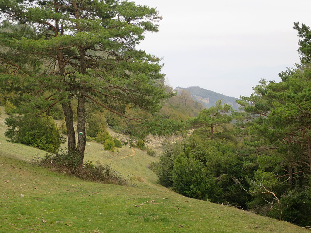
The path is very beautiful, it climbs hidden among a dense forest of boxwoods, pines, yews and beeches.
(0h40min; 1,8kms) Crossing La Asnilla fountain (934m). A signpost indicates the La Asnilla spring on the right after 200m. The path now crosses a beech forest after which we come out onto clear ground. The path changes direction. We advance with our sights set on the Humión, which we have been leaving far to the right along the ascent.
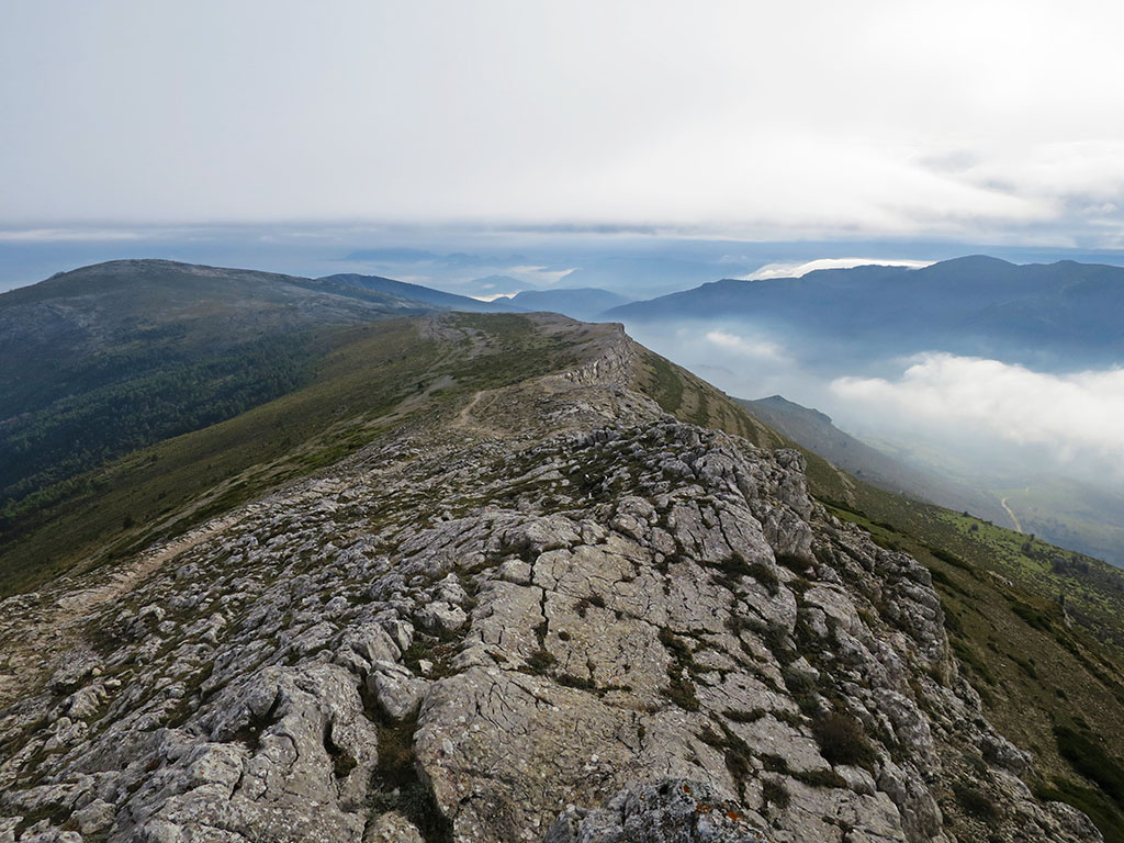
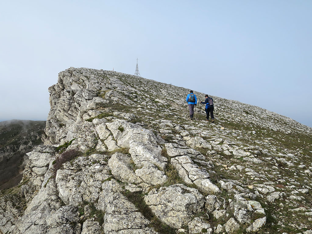
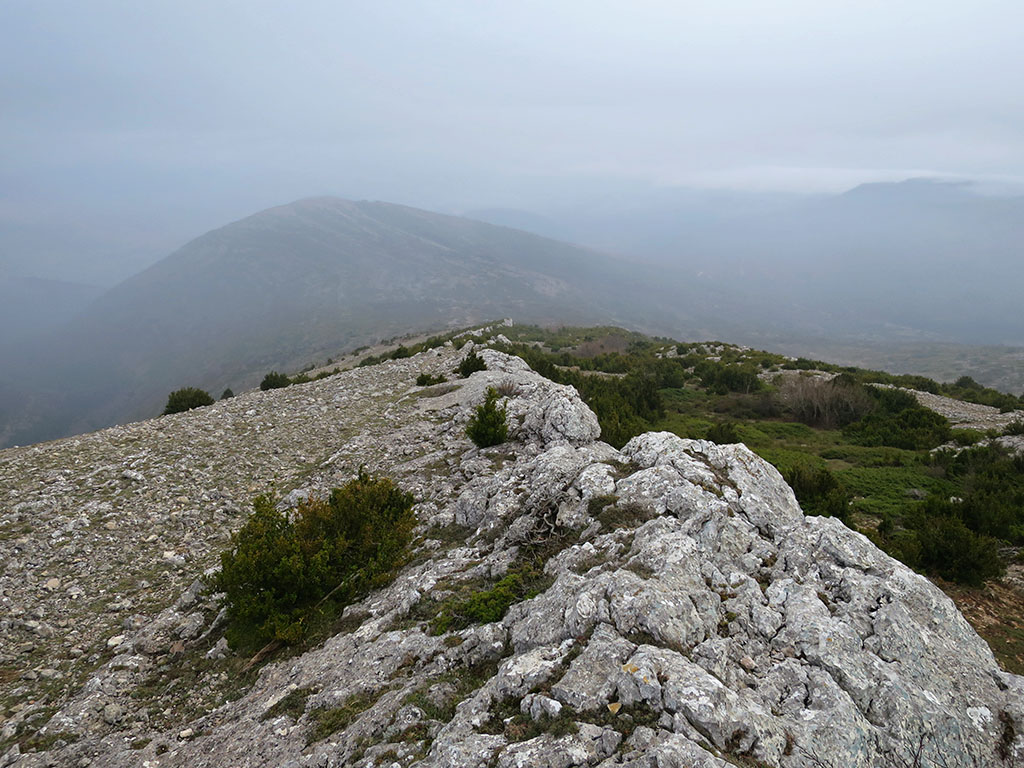
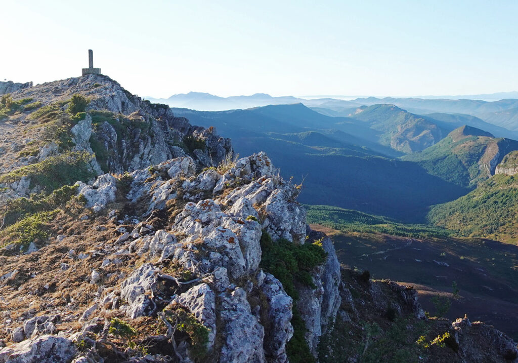
(1h20min; 3,3kms) Post near the Portillo de Jarrilas (1.255m). Without reaching the edge of the sierra, follow the path that ascends in a westerly direction. The final section ends by following the stylised rocky ridge that culminates at the summit, where there is a metal cross several metres high.
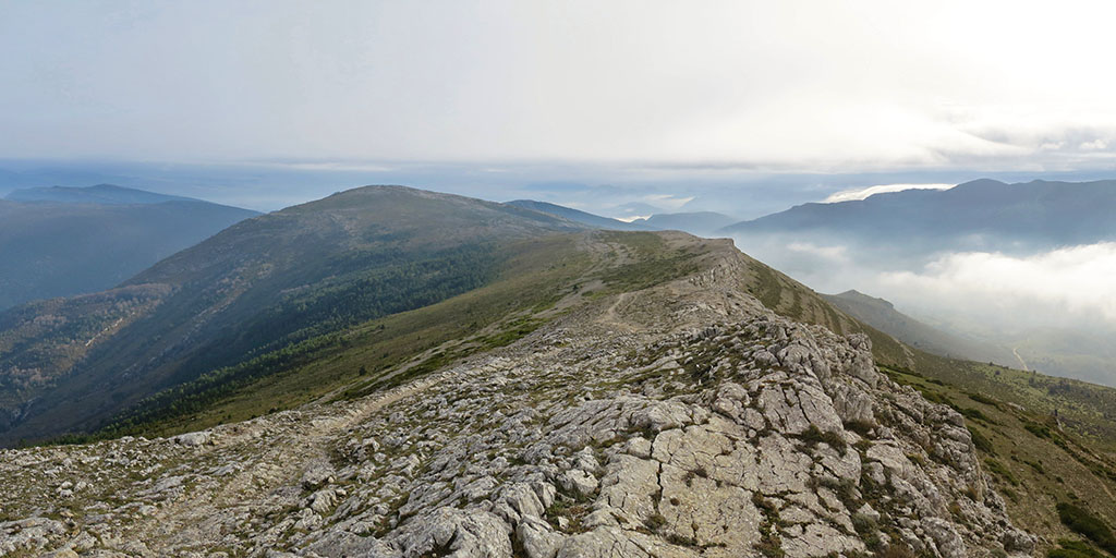
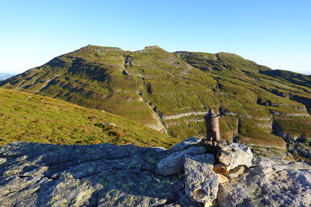
(1h50min; 5,1kms) Humión (1.434m). Maximum altitude of the Obarenes Mountains. If the day is clear the views are spectacular and the route to the Flor can be seen. We descend in an easterly direction, close to the edge of the ridge, towards Portillo de Jarrillas, to where the normal route from Cubilla goes up. Without a defined path but without difficulty, we reach the...
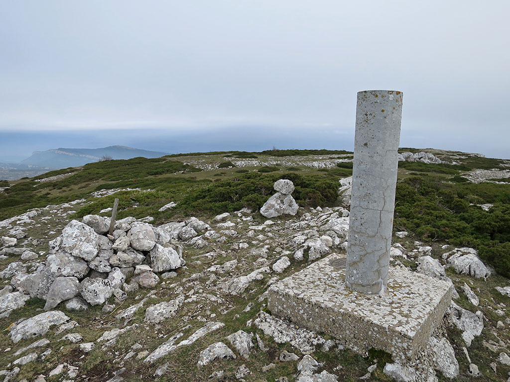
(2h35min; 8,0kms) Flor (1.333m).
Descend along the ridge or a little to the right, following the path to the...
(3h00min; 9,9kms) Portillo Mancubo (1.092m). If we still want more, we can climb Mancubo (1,186m) in 15 minutes. A wooden signpost indicates the way to Orbañanos, marked in white and green.

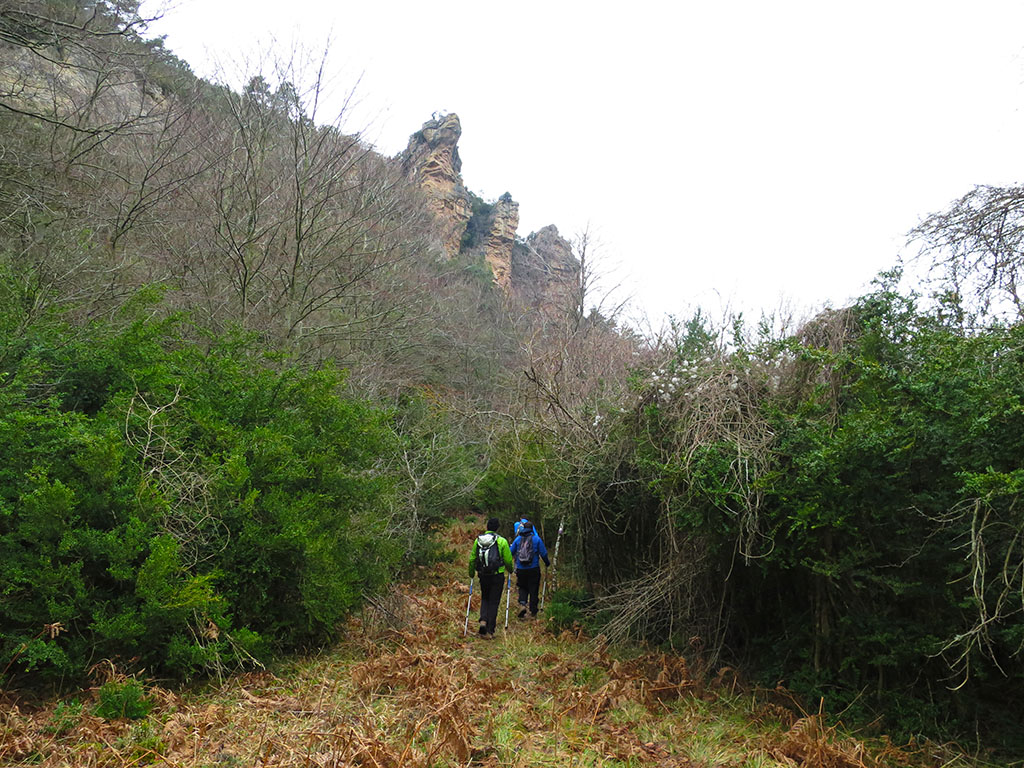
In 10 minutes we reach a pass where we leave the white and green signs to follow another white and violet one. The path descends to the bottom of a valley covered with beeches, large boxwoods and pines.

(3h45min; 12,3kms) Fuente de Valmayor (770m).
The path continues downhill for a few more minutes before leaving the valley and gaining a small pass on the left (13.1kms).
Further on, the path with white and violet signs forks. A signpost points to the left to the path to Orbañanos.

(4h30min; 15,4kms) Orbañanos (615m).
Other routes of interest in the area:
There are a number of interesting ascents to other peaks in the same area. In the same range: Mancubo (1,184m) and Recuenco (1,069m). In the neighbouring Sierra de Arcena we can highlight: Bachicabo (1,200m), Alto de la Mota (1,319m), Cueto (1,362m), Mojón Acuchillado (1,354m) and Revillanos (1,297m). To the south, in the Obarenes mountains and Sierra de Oña, the most important peaks are: Mesa de Oña (1,208m), Cuchillos (1,199m), Pan Perdido (1,234m), Galdampio (1,208m), Pico del Águila (1,328m), Cantoña (1,353m), Cimero (1,348m) or La Verdina (1,352m). There is also a network of local footpaths, both short and long distance, about which there is plenty of information.
Nearby you may be interested in:
Circular route to Peña Corva + San Mamés + Alto de San Lázaro. Ascent from Baíllo and descent to Quintanalacuesta. [4h45min; 14,6km; +/-930m].
Circular route to the Castro Valnera (1.718m) with ascent to the Cubada Grande (1.607m) from the cottages of El Bernacho. [3h50min; 8,8km; +/-850m].
Fastpacking is not about going faster. It's about going lighter.
If you come from classic trekking, this is the next step: learning to move with less weight,
more fluid and enjoying every kilometre more.
Join the Outsiders Newsletter and start discovering what lightness feels like.