Circular route to Ibón de Acherito
Pyrenees and mountains 📩
Here 🔥The excursion to the Ibón de Acherito is one of the best known and most beautiful routes in the Valles Occidentales Natural Park (Aragonese Pyrenees). A highly recommended route.
The route we propose, which is completely circular, follows the S5 path at all times. The main crossings are signposted and in favourable conditions, without ice, the route does not present any technical difficulties. During the summer and weekends, the route is usually quite busy, so if you can, it would be better to start early or go during the week.
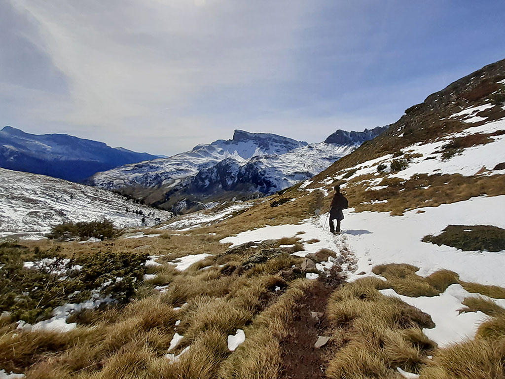
The climb up to the ibón is a route that is worthwhile in itself. The views that we will enjoy all the way up to Selva de Oza, Guarrinza and the mountains that rise on both sides of Aragón Subordán are magnificent.
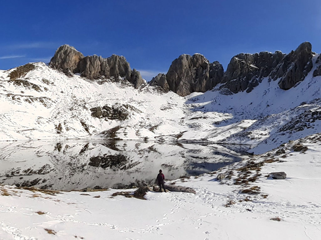
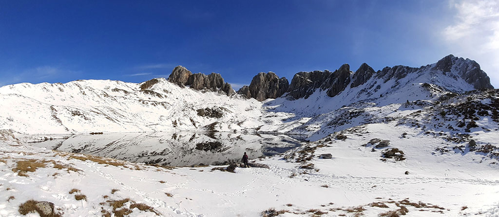
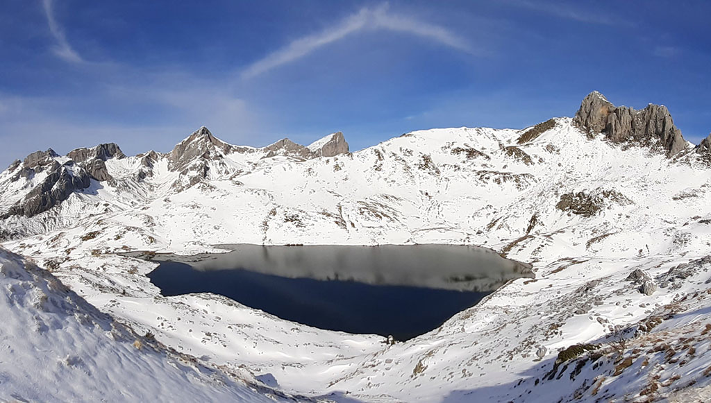
The Acherito lake, which we are not going to discover now, is spectacular. With a surface area of 5.9 hectares, it occupies the bottom of a beautiful glacial cirque, reflecting on its waters, like a natural mirror, the sharp rocky ridges that defend it to the north.
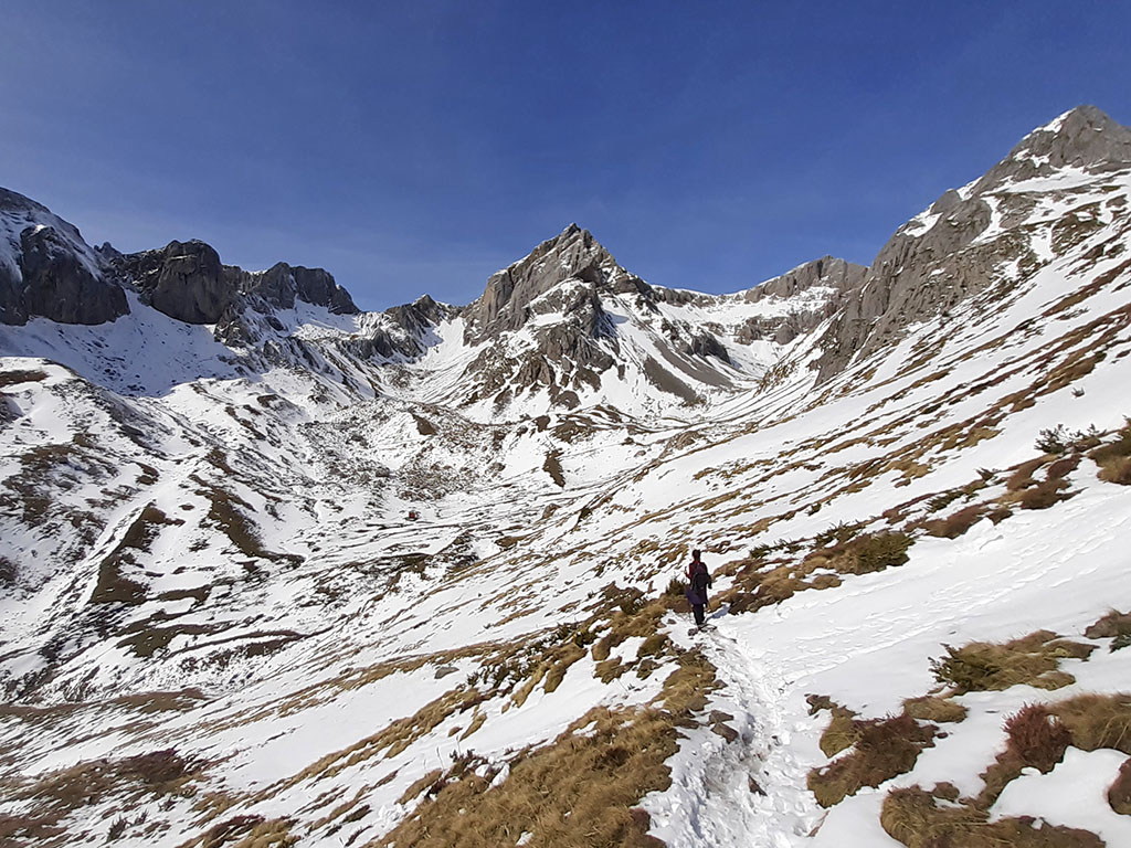
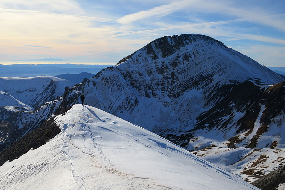
The descent through the Acherito ravine, which is more bearable than the way up, is perfect for this circular route and to get a close-up view of the Acherito Peak (2,374m) and its neighbours Sobarcal (2,257m) or Foya de Gamueta (2,308m), among others. In short, a route not to be missed.


Route summary:
From the Guarrinza - La Mina car park, the route climbs up the Foyas ravine in the direction of Puerto del Palo to continue halfway up, on the left hand side, along the S5 path. The descent follows the Acherito ravine, passing first by the free refuge of Barcal de Acherito.
Mapa:
Downloadable:
> Download Track
How to get there:
See in Google Maps.
To get to the starting point of this excursion, the Mina car park, in the Guarrinza valley, we will take as a reference point the town of Hecho, where we will arrive following the A-176 from Puente la Reina de Jaca (24kms).
Once in Hecho, we follow the road to Siresa (2kms), the last village in the valley, and continue straight on, along the narrow road that leads to Selva de Oza. The road follows the Aragón Subordán valley upstream, crossing the spectacular Boca del Infierno canyon and a colourful forest of fir and beech trees. A couple of kilometres after passing the Oza Bridge and the campsite, the track begins to leave the forest and the valley opens up as we enter Guarrinza. At this point we leave a car park on the left and then take a track to the left (signposted to the Acherito lake), which crosses the Aragón Subordan and which, after a kilometre, leaves us at the La Mina car park.
Technical specifications:
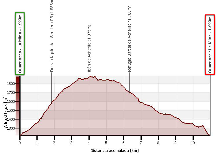
Distance: 11.0 kms.
Cumulative difference in altitude: +750m/-750m.
Timetable: 4h10min. Walking time non-stop: 5 hours.
Water: Along the route you will pass several streams, in addition to the lake, where you can get water. Bear in mind that there are cattle grazing freely.
Difficulty: without snow or with soft snow there is no significant difficulty, except for the distance and the difference in altitude to be overcome in the first part of the route. In hard snow it may be necessary to use crampons on the ascent, on the traverse between 1600m and 1800m above sea level.
Itinerary:
(0h00min; 0,0kms) Parking of La Mina / Guarrinza (1.223m). Next to the bridge over the Barranco de Acherito ravine, some signs indicate the path, to the right of the bridge, that we should take to go up to the ibón de Acherito. The path, which is quite clear due to the people passing by, starts going up the Acherito ravine on the left bank (right of the valley in the direction of the path) to continue a few minutes later, to the right, along the Foyas ravine.

In 25 minutes we reach a crossroads where the path to the ibón de Acherito (straight ahead) separates from the GR65.3.3, which heads towards Puerto del Palo. The path changes banks and continues up the right bank.
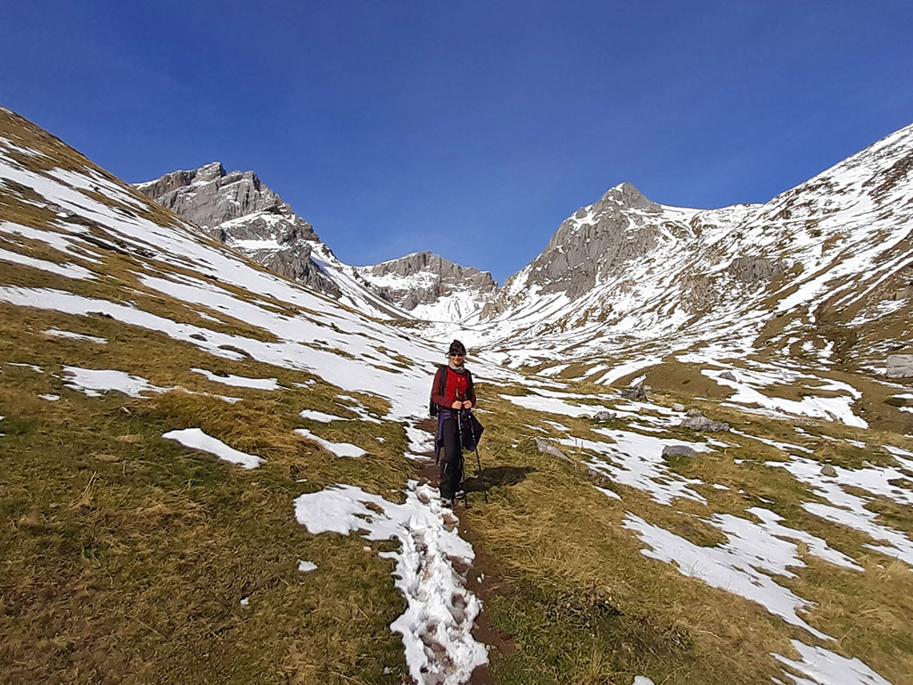
(0h50min; 1,8kms) Bend left to the ibón de Acherito (1.586m). We reach another crossroads where a signpost indicates the GR65.3.3 (straight ahead) and the S5 path (left) to the ibón de Acherito. The path now continues halfway up the slope heading west, flanking the southern slope of Mallo de las Foyas, with magnificent views of the valley and the surrounding peaks.

(1h50min; 4,0kms) Ibón de Acherito (1.875m). The panoramic view of the lake with the Pic du Lac de la Chourique, the Hanas Gap and the Pic de Larraille in the background is fabulous.
Without snow, the grassy meadow that surrounds the lake is perfect for resting for a while and having something to eat before starting the descent along the other path. To descend, we head towards the stream that drains the lake, in search of a path that runs halfway down the slope and gently descends towards the head of the Acherito ravine.
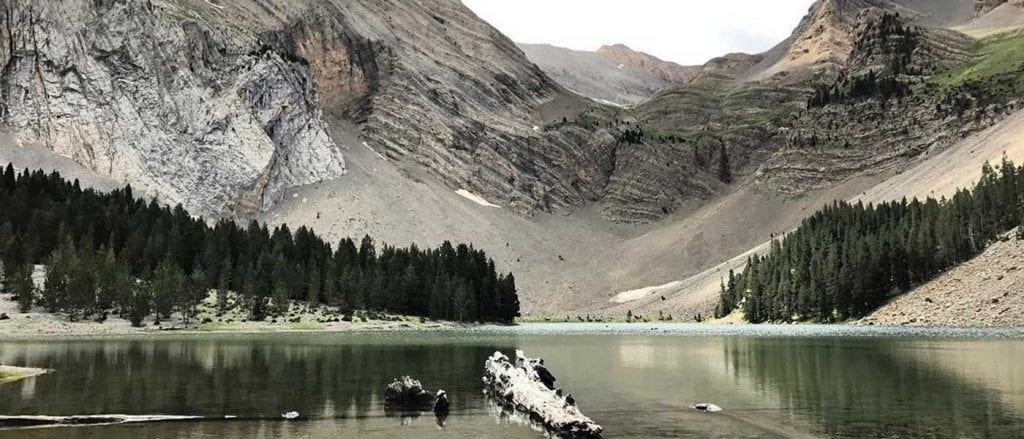
(2h45min; 6,3kms) Refuge of Barcal de Acherito (1.700m).
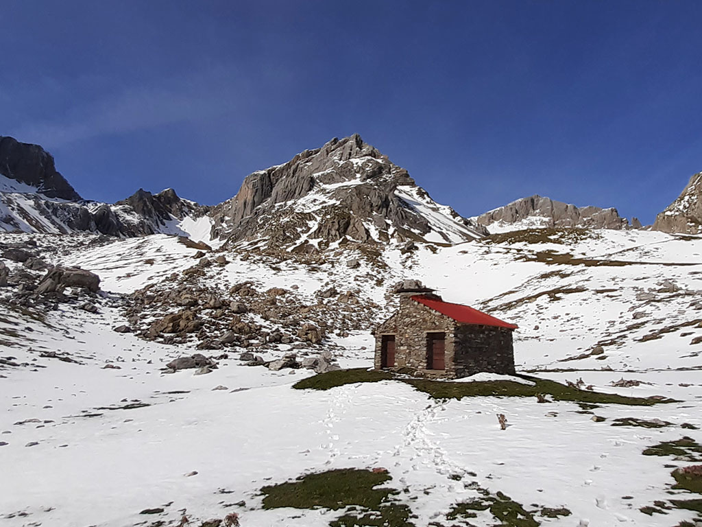
From here, a well-trodden path descends without loss along the right bank of the Acherito ravine.
(4h10min; 11,0kms) Parking of La Mina / Guarrinza (1.223m)
Recommended books:
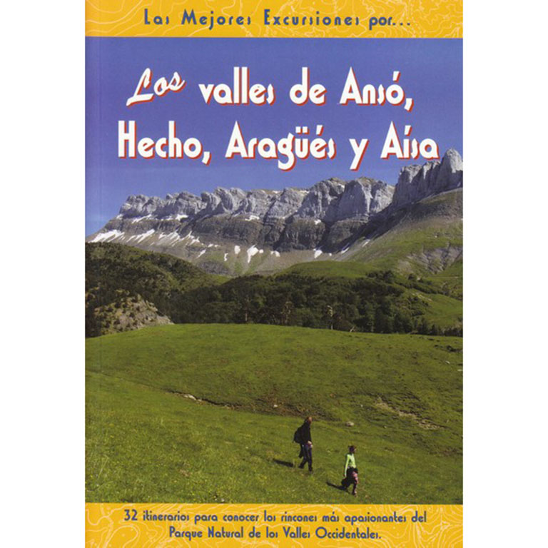
The valleys of Ansó, Hecho, Aragüés and Aísa.
- Editorial: The Rambler
- Language: Spanish
- No. of pages: 192
- ISBN-10 : 8495368498
- ISBN-13 : 978-8495368492
- Publication: 2009
NEARBY YOU MAY BE INTERESTED IN
Circular route to the peak of Acherito from the Linza refuge. Ascent via the Paso del Caballo, the Paso del Oso and the Huerto pass and descent via the Foyas del Ingeniero and the Petrechema ravine.
Pico de Secús is one of those summits for those who seek solitude. Its peak is isolated, differentiated from the rest of the...