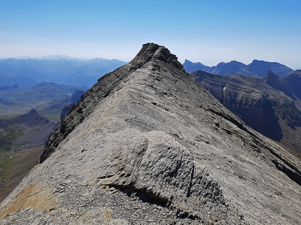
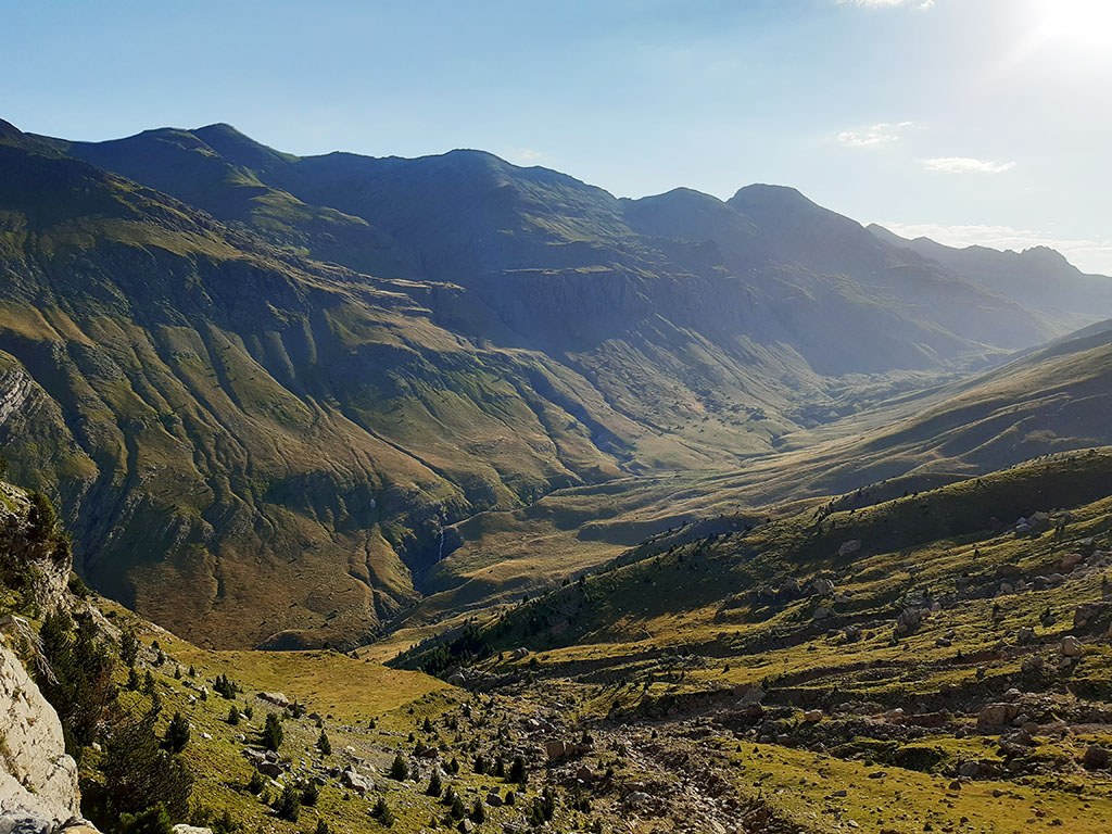
Pala de Ip (2,783m) and La Moleta (2,570m) from the Coll de Ladrones.
Pyrenees and mountains 📩
Here 🔥The Pala de Ip, despite being one of the most beautiful mountains to climb in the western Pyrenees, is still an unfrequented mountain and yet it is still very well known. Its truncated pyramid silhouette is unmistakable.
Undoubtedly, the long routes from any of its bases of ascent, a difference in altitude of around 1,800m on any of its routes and the absence of sheltered refuges, are the cause of this lack of suitors and the fact that it forms part of the list of mountains pending for many mountaineers.
Once this mental obstacle has been overcome, those who decide to undertake the ascent following the route we propose here will find themselves in front of a fabulous mountain to which they are sure to return.
SUMMARY OF THE ROUTE:
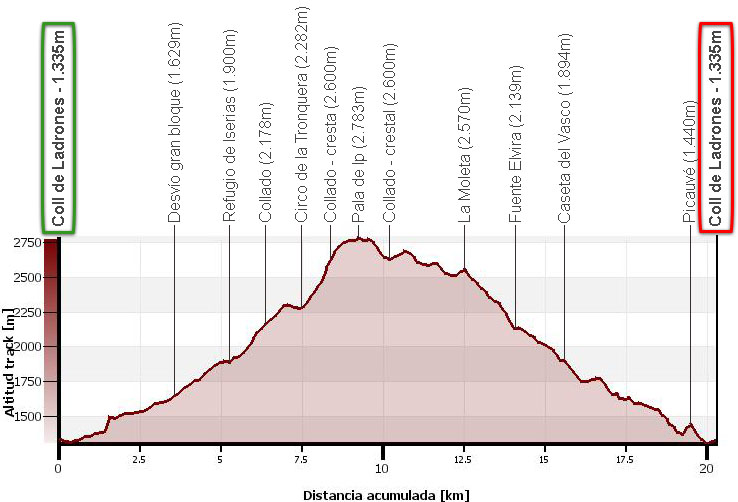
Circular route to the Pala de Ip from the Coll de Ladrones. Ascent via the Canal de Izas, Samán cirque, La Tronquera cirque, northern corridor between Pala de Ip and La Tronquera and western ridge. Descent via the peaks of La Tronquera, La Moleta, Elvira spring, Vasco hut and Picauvé.
MAP:
DOWNLOADABLE:
> Download Track
HOW TO GET THERE:
See in Google Maps.
The reference point is Canfranc-Estación, which can be reached via the N-330 from Jaca (23kms) in just 20 minutes. Once past Canfranc station, be careful not to continue through the Somport tunnel to France, take a track on the right that climbs up to the Coll de Ladrones (2kms), where there is plenty of room to leave the car.
Technical specifications:
Distance: 20,3kms.
Cumulative difference in altitude: 1.840m.
Timetable: about 9-10 hours. Walking time without stops: 7h50min.
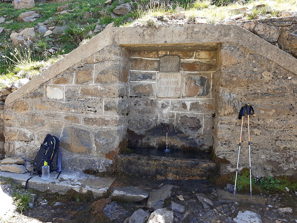
Water: The only fountain, from which a large stream flows, is the Elvira fountain, halfway down the descent. Along the ascent we will find several more or less reliable streams, which at the end of July were still flowing water.
Difficulty: the access corridor to the ridge between the Pala de Ip and La Tronquera is somewhat broken (II). The final section of the west ridge to the Pala de Ip has some easy difficulties (I) at the end. You just have to be careful to find the right path and not expose yourself on the slippery north face.
Recommended equipment for the summer: preferably boots rather than slippers, two walking sticks, GPS (optional), canteen.
Suggestions: An alternative descent along a clear path is from La Moleta to the Iserías/Samán lake. If you prefer to avoid the ascent via the broken corridor on the northern slope (II), the ascent via the corridor on the southern slope is safer.
Itinerary:
(0h00min; 0,0kms) Coll de Ladrones (1.335m). We start walking following the GR11.1 that comes from Canfranc railway station and heads for Canal Roya. In five minutes, a signpost on the right indicates the path to the ibón de Iserías (3h30min) and the old route of the GR11 along the Canal de Izas. This is too long a timetable for someone who intends to climb the Pala de Ip during the day. After the first stretch of forest, the valley begins to reveal itself with the unmistakable Campanal de Izas in the background on the right.
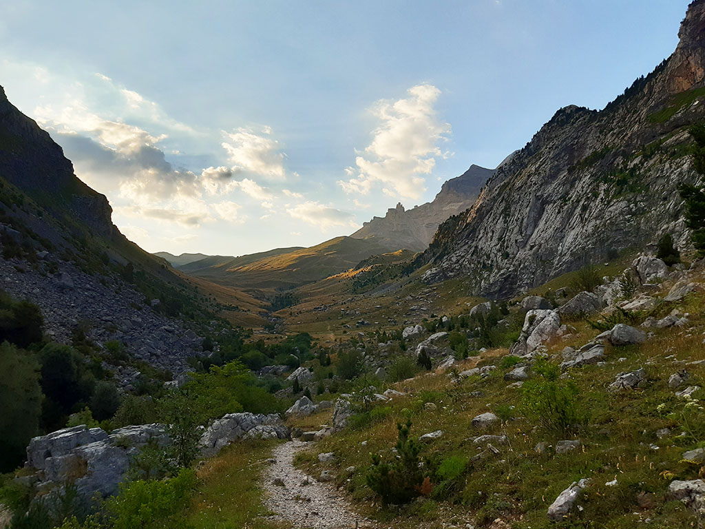
We advance quickly along the path, paying attention to the markings that indicate a path to the right instead of another that continues along the river. We cross a stream that has just cascaded over a beautiful waterfall and arrive at a characteristic square-shaped block.
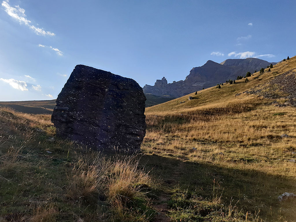
(1h00min; 3,5kms) Big block turnoff (1.629m). The ibón de Iserías route separates to the right from the GR11, which continues along the main valley towards a waterfall. We zigzag upwards in a southerly direction, towards a strip of rocks that we border from left to right just below. The famous Iserías turn.
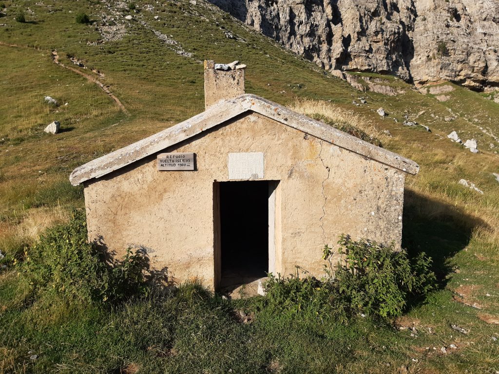
(1h35min; 5,3kms) Iserías Hut (1.900m). A precarious cabin with space for 6 people.
The path turns left (S-SE) in search of the...
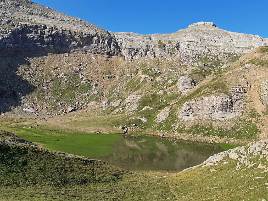
(2h10min; 6,4kms) Col (2.178m) which gives access to the Samán or Iserías cirque, where the lake of the same name is located.
From the pass, we head off to the left halfway up the slope, without milestones, with our sights set on a pass that crosses the ridge on the left (2h25min; 6,9kms) and leads to the...
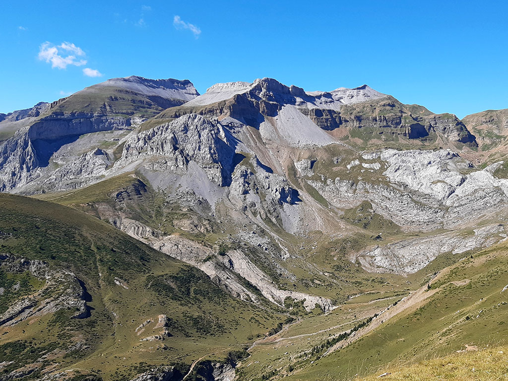
(2h35min; 7,5kms) cirque of La Tronquera (2.282m), suspended over the Canal de Izas.
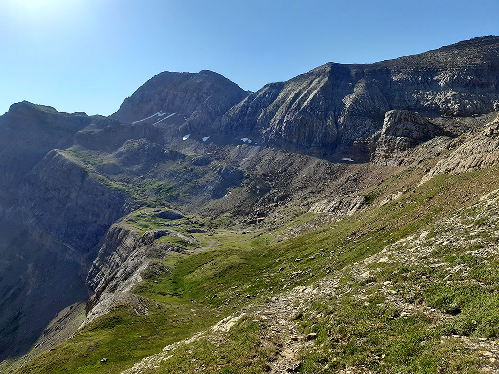
We cross a meadow crossed by a stream that was still carrying water at the end of July and head along the path, following the milestones, towards the start of the channel that separates Pala de Ip from the peaks of La Tronquera. The corridor reveals itself shortly before reaching a kind of pass that gives access to the northwest face of Pala de Ip. The path turns to the right and enters the corridor that shortly after splits in two.
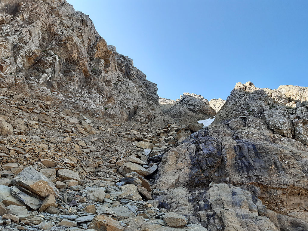
A milestone marks the one on the right. Although at the time of this route there was still some snow, we ascend it without difficulty, taking advantage of a kind of rimaya on the left. Shortly afterwards, the corridor becomes strangled and we find it cut off by the snow. If this is the case, the safest thing to do is to cross to the other side and climb up the rocks on the right, which look less broken. On the other side of the rocks there is a second corridor. Without much difficulty, but taking care not to step on anything that could fall off, we climb up the spur between the two channels directly to the crest, where we join the normal route from the Ip reservoir (easier and less exposed).

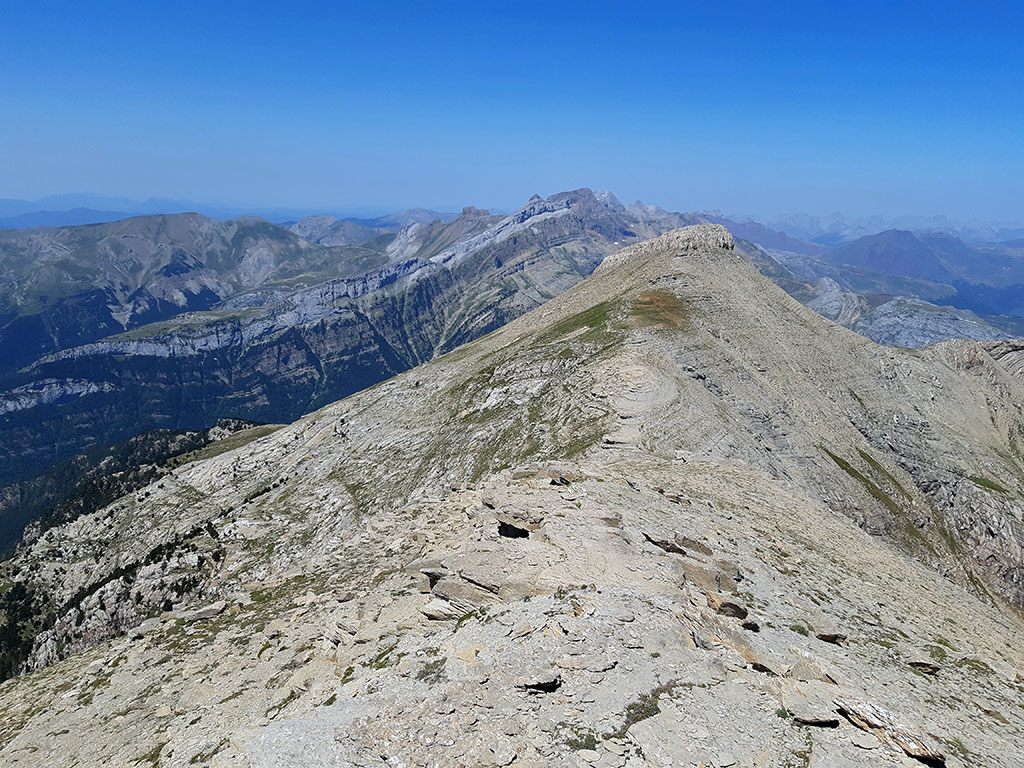
(3h25min; 8,3kms) Col-crest between La Tronquera and Pala de Ip (2.600m). The path starts close to the edge of the ridge and then heads off to the right along the southern slope and ascends a grassy slope to the first peak. Once here, avoid any path that runs along the north face, which is more exposed and decomposed, to advance along the edge of the ridge without difficulty, up to the second peak, the highest.
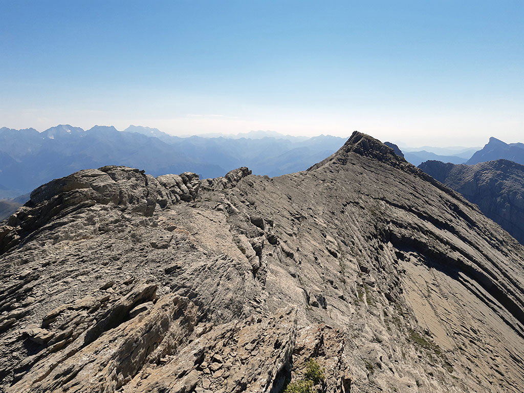
To climb the final part, we border the base of the peak on the right (I), following the milestones.
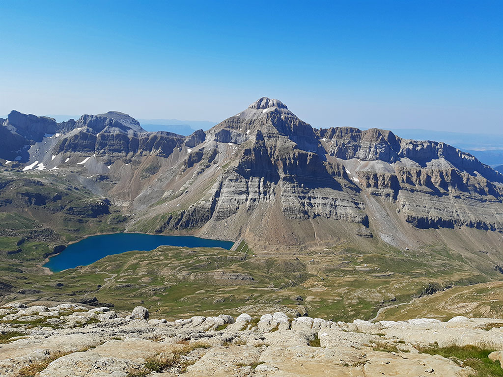
(3h55min; 9,2kms) Pala de Ip (2.783m). Impressive views towards the Midi d'Ossau area, Balaitús, Infiernos, Garmo Negro, Vignemale, Monte Perdido in the background, Sierra de Tendeñera, the nearby Punta Escarra, Sierra de Partacua and the peaks that close the cirque of Ip, with Collarada as the most outstanding peak.
We will return to the pass by the same route, taking care not to go off towards the slopes of the north face.
(4h25min; 10,2kms) Pass between La Tronquera and Pala de Ip (2.600m). Once at the pass where the ascents from the north and south converge, we continue along the Tronquera ridge, which does not present any real difficulties. The route follows the edge of the ridge avoiding complications on the left and right. In 10 minutes we pass the Punta de la Tronquera (2,689m). From here, the ridge gradually loses height before dropping towards the pass that separates La Moleta.
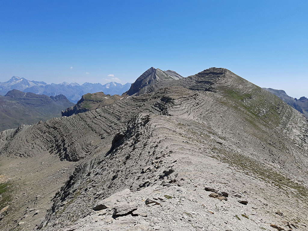
To climb up, look for a small chimney on the southern slope in the final rocks.
(5h15min; 12,5kms) La Moleta (2.570m). To go down to the next pass, we will head towards it with our eyes fixed on it, paying attention to a bend that the path makes on the left hand side to save the plinth. In less than 15 minutes we reach the pass. On the right hand side, the best marked path descends to the Saman cirque. On the left hand side, where we are heading, some milestones descend over the buttress until we reach a wall that we follow on the right hand side for about 200m, until we find a path marked with milestones at the beginning. The path descends crossing the Epifanio cirque from one side to the other, until it ends up blurring near the...
(6h00min; 14,1kms) Fuente Elvira (2.139m). A good place to take a break and recharge your batteries.
Continue to the right (N) walking along the wall, following the white and yellow markings. The path descends, describing some zigzags until it reaches the...
(6h25min; 15,6kms) Caseta del Vasco (1.894m). Continue downhill, following the signs to Picauve (PR 2.44). Before you know it, you will find yourself in a forest with some huge trees sticking out of it. The path zigzags and becomes quite heavy, with some stretches where it goes from one side to the other without losing height. Quite far down (7h30min; 19,1kms; 1.370m) you come to a junction where the PR path marks the fountain of Los Ingenieros on your left in 10 minutes. Leave the PR and continue on the right hand side along a path that takes you immediately to a track that ends a little further uphill, at...
(7h35min; 19,4kms) Picauvé (1.440m). Here, an information panel explains the defensive organisation of the Pyrenees that Franco's government set up in this sector after the Second World War. We continue along the PR 2.12 (white and yellow), facing a steep descent to the track that leads to the...
(7h50min; 20,3kms) Coll de Ladrones (1.335m).
NEARBY YOU MAY BE INTERESTED IN

Circular route from the Cleta car park, in the Aísa valley.
(13.6kms; 1400m; 6-7 hours; F+ climbing)
Circular route, very long and very steep, to the westernmost peaks of the Sierra de Partacua.
(26,3kms; 2500m; 13 hours)
Fastpacking is not about going faster. It's about going lighter.
If you come from classic trekking, this is the next step: learning to move with less weight,
more fluid and enjoying every kilometre more.
Join the Outsiders Newsletter and start discovering what lightness feels like.