The Joc de l'Oca gully
Pyrenees and mountains 📩
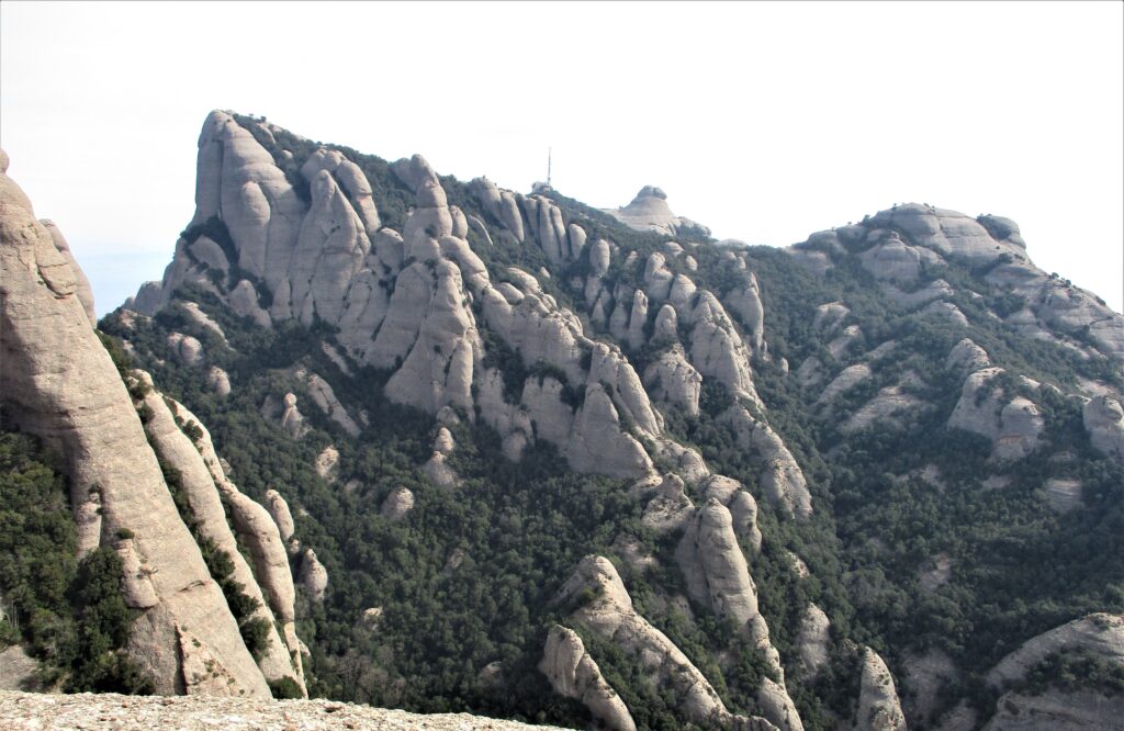
Here 🔥The passage of time has formed many ravines, channels and caves in Montserrat. Some of these capricious crevices can be traversed without the aid of any technical equipment, but there are others for which you will need to equip yourself with canyoning equipment. One of these "technical" gaps in this mountain is known as the ravine of the Goose game.
Translated as Game of the Goose, the name comes from the titanic effort involved in climbing up the ravine, which was like playing the famous game and going from square to square, climbing up ropes and chains. Nowadays, this gully has been upwards, due to the frequent rescues of people who got trapped, and nowadays, it can only be descended.
HIRING A GUIDE IS THE SMART CHOICE
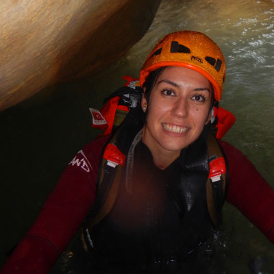
Canyoning is an activity that is not risk-free and requires a good knowledge of the environment in which it takes place and, of course, the physical and technical limitations of the group. When you are not trained, hiring the services of a guide is the smart option. But if the guide is also our friend Noelia Novoathe person behind Barrancs lo Pallarsthen the experience will be complete. 100% recommended.
ITINERARY: approach + ravine + return
Distance: 5.7km (about 650m of gully)
Unevenness: +350m / -350m (about 180m of gully)
Timetable: about 4-5 hours. On the approach we will spend a little over one hour. The canyoning depends on our experience and can be around two hours. The return is about 45 minutes.
Difficulty: difficulty of gully V3a1 III.
Start/End: parking Vinya Nova
Time of year: any. Be careful if it has rained, if the rock is wet it can make progress difficult.
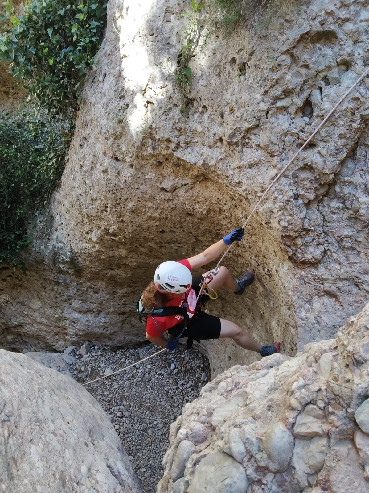
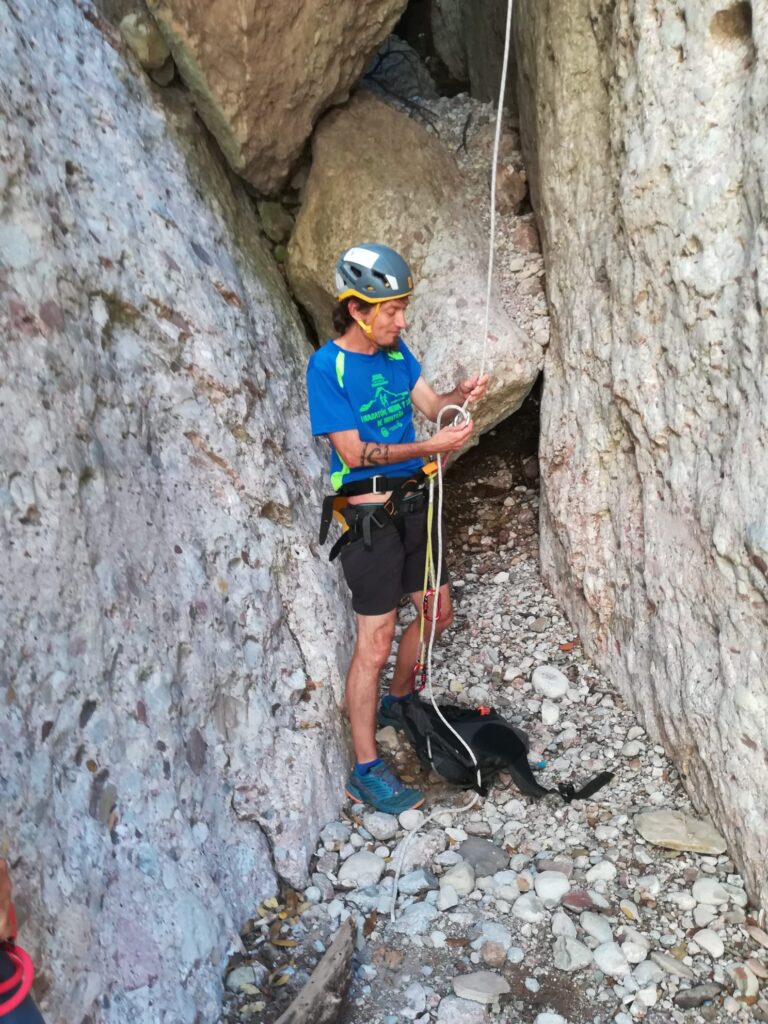
Necessary technical equipment: canyoning harness, helmet, eight descender, carabiners, gloves and ropes for the activity.
Recommended agency: Barrancs lo Pallars. Tel. +34 657 994 821 barrancslopallars@gmail.com
The approach to the ravine...
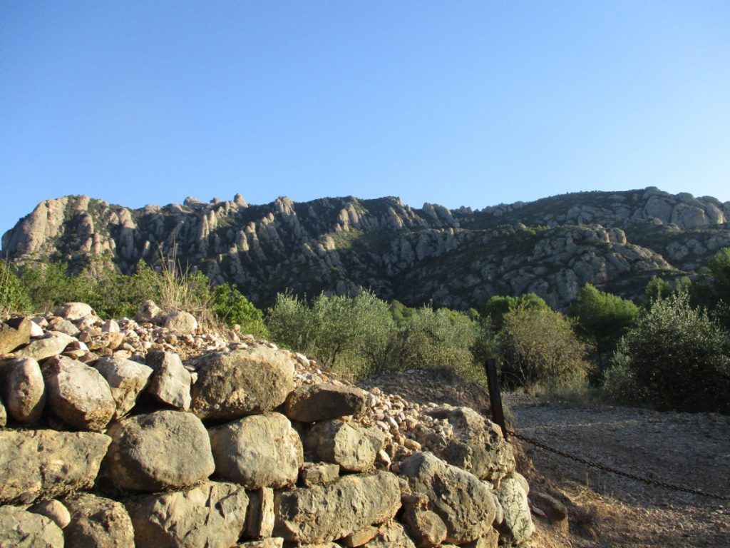
The morning began in a bar in Collbatówhich we used as a meeting point. To get to this town in the foothills of Montserrat, which is about 48 km from Barcelona, we took the A-2. Here we all got into a vehicle and drove to the start of the itinerary, the car park at Vinya Novain the neighbouring municipality of El Bruc.
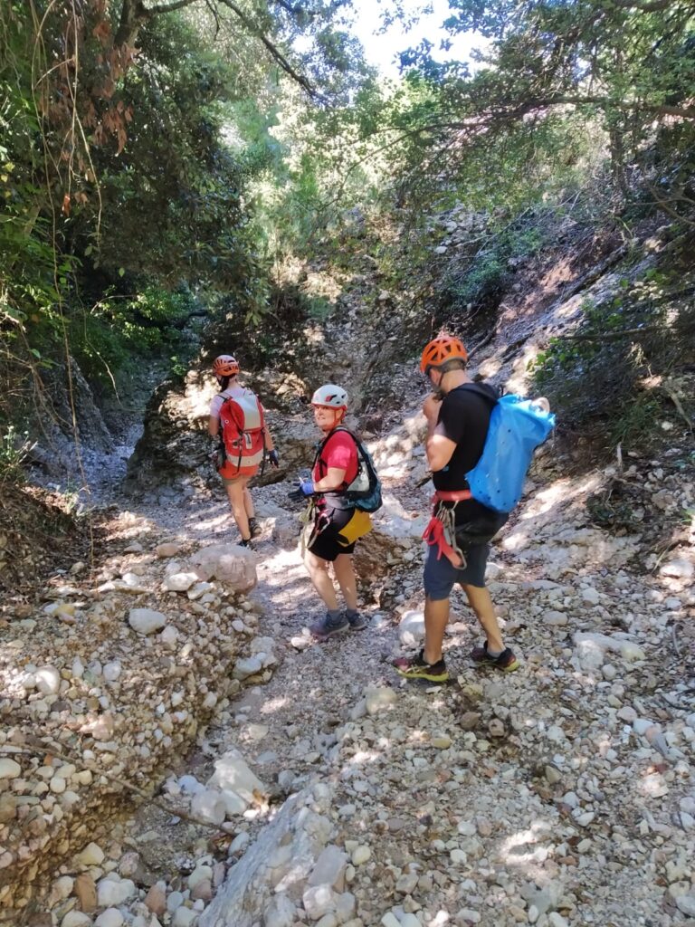
Noelia and Sergio (assistant technician) distributed our equipment, harness, gloves and helmets. They carried the ropes and the rest of the equipment in their backpacks. We started walking along a track until we reached the beginning of the "camí dels francesos or bassals dels gats". The whole mountain is full of place names that refer to the French invasion of 1812.
This area of the mountain is the inspiration behind the legend of the "Timbaler del Bruc". which tells the story of the victory of a handful of fighters from the area over the French army. Thanks to the acoustic reverberation of the mountain, the drums of the local population made the French believe that they were outnumbered and they fled. It is believed to be inspired by real events.
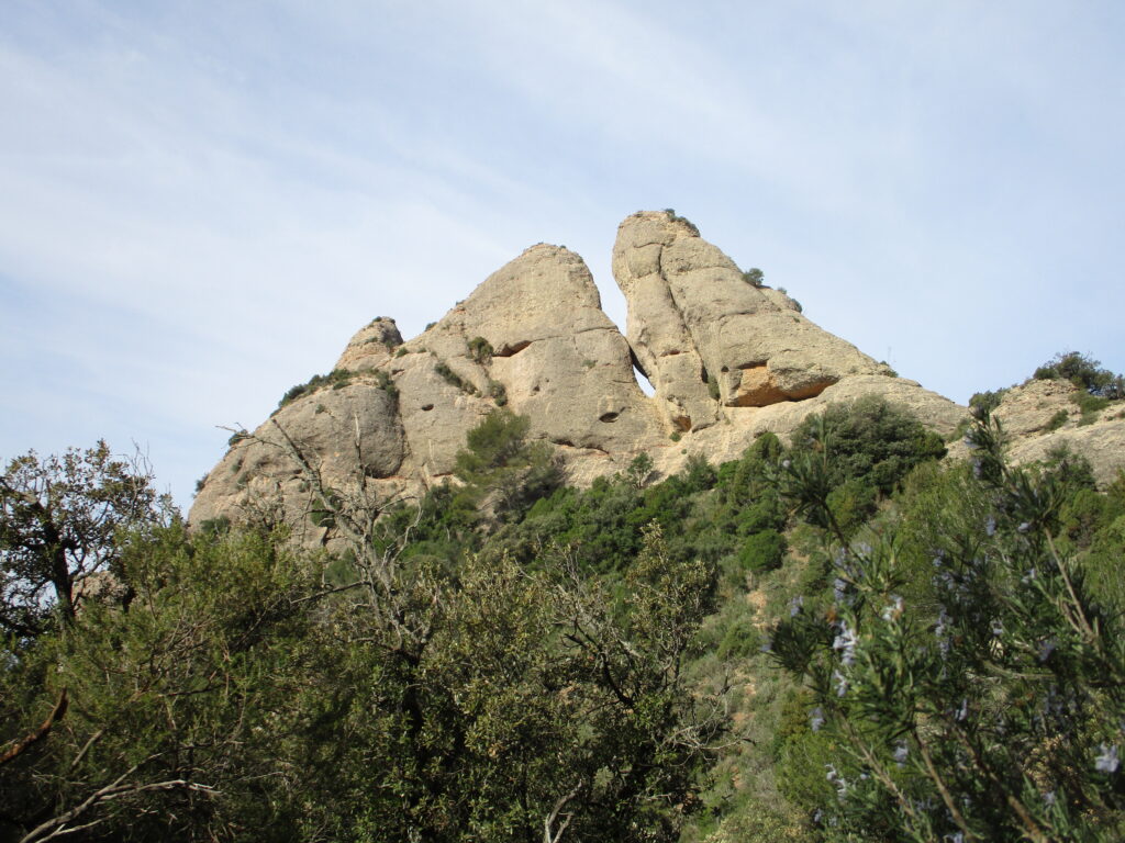
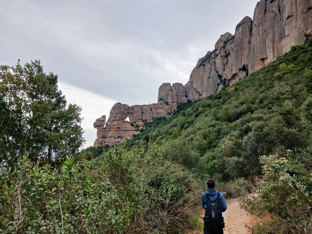
We start to climb quite steeply for about 45 minutes along a winding path. With the torrent below us, first through pine trees and later through a holm oak forest. Next to us we see the "Ajaguda" (lying down), a rocky spire with a small hole. We take a detour to the left and arrive at the Coll del Bassal dels Gats.
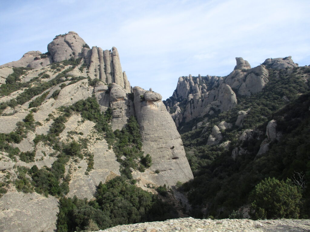
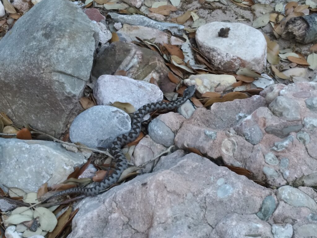
After catching our breath, we continue along the path downhill, accompanied by the holm oak and boxwood until we reach the Migdia channel. In this cleft that separates the massif into two parts there remains a stronghold of the primitive vegetation of the mountain, yew, holly and maple trees grow in isolation. We go to the left until we reach the beginning of the ravine. A little before we are surprised by a snub-nosed viper. These animals have always been mythologised and have a bad reputation.
In Montserrat, there is a legend that refers to what is known as the " Pla dels escurçons"(esplanade of the vipers, located above the monastery). This legend is collected in the book "Llegendes i tradicions de Montserrat" (Tales and traditions of Montserrat) by Joan Amades. In it he explains that all the vipers in Catalonia went to this place in Montserrat to breed. As all these snakes were born here, they always looked to Montserrat, wherever they were. The snake hunters, in order to catch the "viborera stone" (which they had in their heads with curative properties), could extract it without fear if they caught them on the side facing the sacred mountain. The abundance of these reptiles was such that there were more vipers than rocks, and if a viper touched a grass, it took on healing properties. These vipers only bite if they are touched and the remedies, according to tradition, could be of two types: burn the wounded part with embers or take the viper and crush it to make a poultice to put on the wound. In this way, the flesh of the reptile would trap its own venom. As the saying goes: "Picada d'escurçó, no hi hi és a temps l'extremunció". We could translate it as: if you are bitten by a viper, you are not in time for extreme unction.
Throughout the Montserrat area we can find the snub-nosed viper, with a small protuberance on its head (possibly the origin of the term "viborera stone"). They are small snakes with a dangerous venom, but they tend to flee easily. Obviously, we just photographed it and left it alone.
Now the interesting part began. The first part is a small, steep path and we reach a signpost.
Barranco, technical part
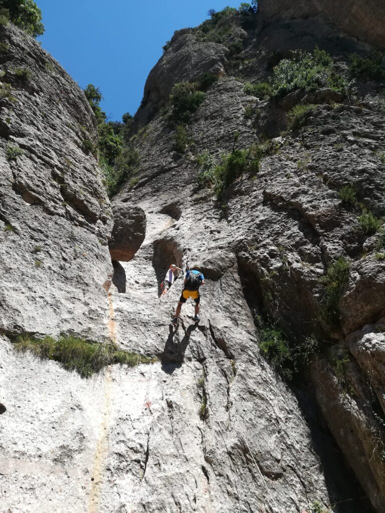
Before starting with the chronicle of the descent, I would like to comment a little on the technical characteristics of the canyon. There are 650 metres of dry riverbed, in which we will descend 180 metres of negative slope, for which we will need to do 13 abseils and some descents without the help of ropes. The classification in the canyoning hierarchy is as follows V3a1 IIIV3 refers to the verticality, the scale goes from 1 to 7. 3 would be not very difficult, as the abseils are less than 30 metres and the climbing pitches are not very exposed. The 1 that follows indicates that it is a dry canyon. And III, in Roman numerals, would indicate the commitment and the size of the canyon. These values go from I to VII, where III indicates that the escape route would take us a maximum of one hour to complete and the total time would vary between 4 and 8 hours.
This canyon is part of the challenge "50 barrancs"promoted by the FEEC (Federació d'entitats excursionistes de Catalunya). This challenge consists of completing as many canyons as possible in Catalonia. Currently, there are 73 proposals, 5 of which are in Montserrat.
We start with the technical part, we pass some informative signs and we "unclimb" some boxed sections with the help of our hands, legs and the resistance protection of the harness. A little later we pass through a chaos of blocks and a "hole". And then we come to the first abseil of 15 metres. Then abseil 2 of 5 metres. Abseil 3 of 8 metres. Abseil 4 of 15 metres, abseil 5 of 10 metres, abseil 6 of 15 metres and abseil 7 of 15 metres.
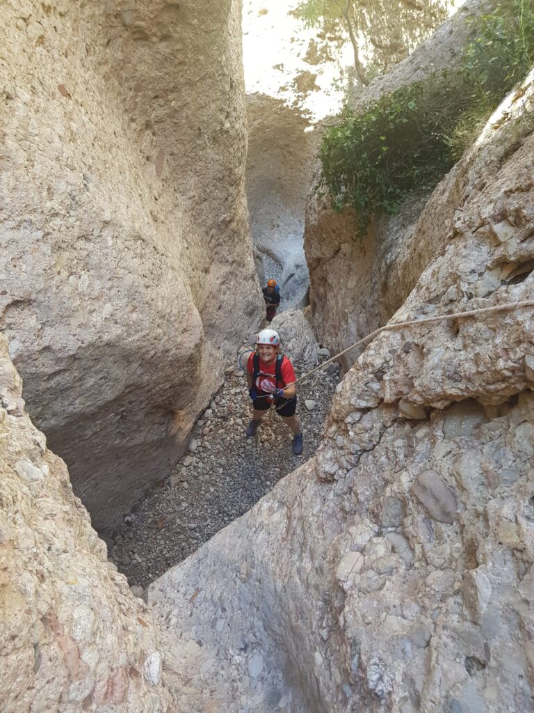
Now we have a short break and descend between rocks for about 50 metres. We are at rappel 8 of about 15 metres, the first part is boxy and we couldn't get through with the rucksack. In the second part you descend "suspended" and reach a small cave.
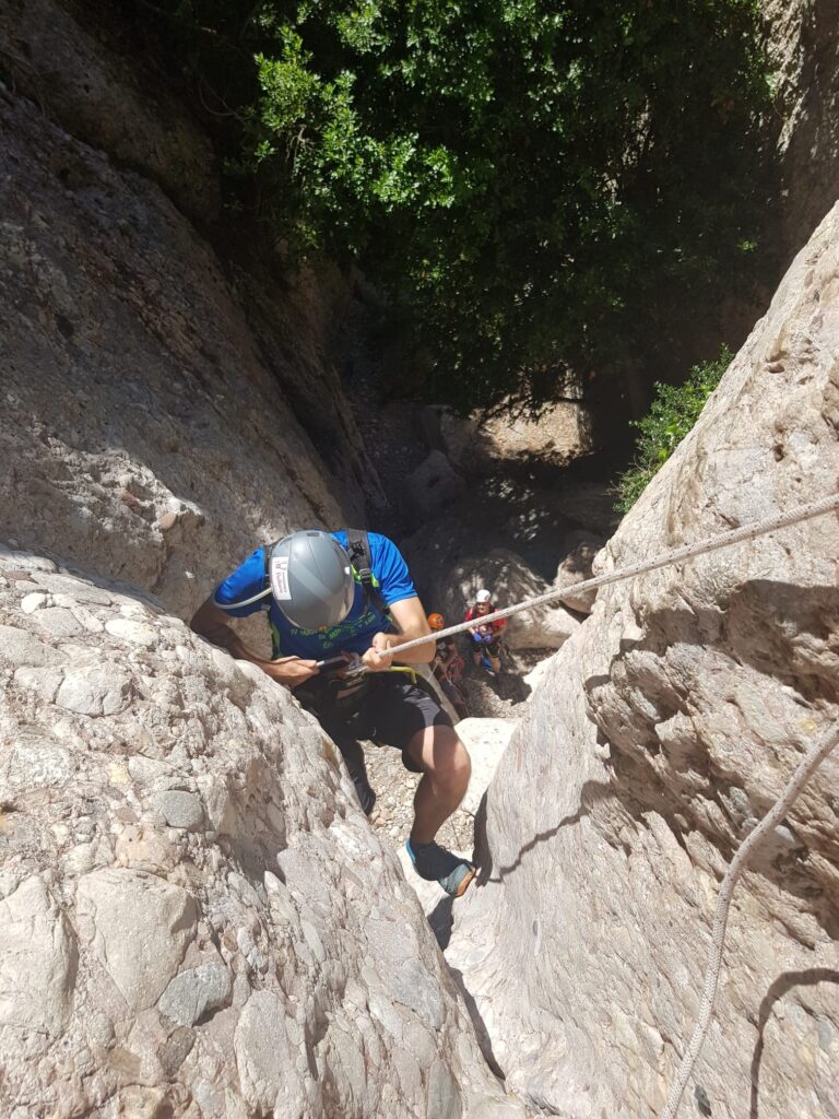
We still had 10-metre abseil 9 and 15-metre abseil 10 to go. We walk a little further at times using our hands and we reach abseil 11 of 15 metres. It leaves us on a small stone ledge, where we have abseil 12 of 18 metres. And now we are at the last rappel of the canyon, rappel 13 with its 11 metres.
The return...
Once we had finished the technical part we still had a stretch of trail left. We went on to touch the cave "Degotalls de Can Jorba"We continue descending until we reach Can Jorba. Now we come out onto a track that will take us in a left direction to the starting point at Vinya Nova
Now all that remained was to drive the few kilometres where we had left our vehicle. And as it was already lunchtime, we decided to finish the day by having lunch together in a local bar and recounting the various adventures of the day.
Nearby you may be interested in:
If you want to get to know the mountain of Montserrat and start with an impressive route, the ascent to Sant Jeroni (1,236m), the top of Montserrat, would be the recommended route. [3h30min; 11,7km; +/-760m].
Route through Montserrat from Collbató, on the southern slope of the massif [5h30min; 14,6km; +/-1.269m].
Can Maçana - Collet de Can Guirló - Roca Foradada - Coll de Port/Porc - Refugi Vicenç Barbé - Collet de Can Guirló - Can Maçana. [3h20min; 7,5km; +/-470m].