Hautes-Pyrénées (Lavedan)
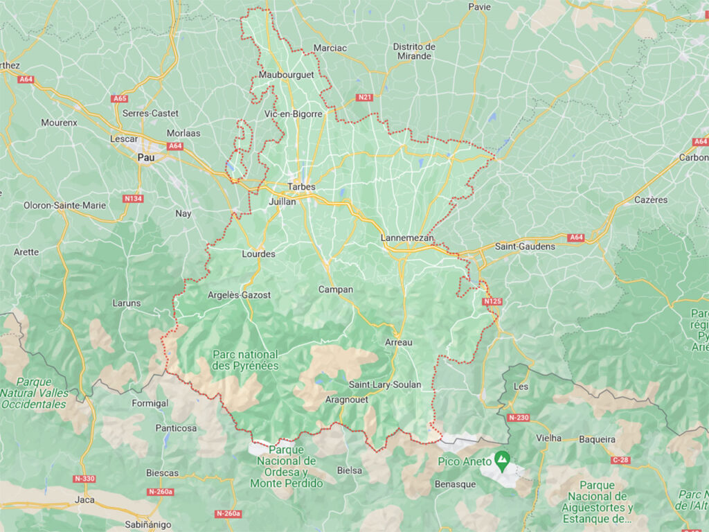
The French Department of High Pyreneesin French Hautes-PyrénéesThe Pyrenees, extends in the south of France, in the central-western part of the Pyrenees. It runs from the Balaitús massif in the west to the Gourgs-Blancs massif in the east (Loudenvielle area), and includes the main valleys of these three rivers: Gave de Pau, l'Adour and La Neste.
The capital of the department is Tarbes (42,000 inhabitants), situated a little further north and outside the narrow Pyrenean valleys (from Argeles Gazost it is 37kms; 38 minutes).
The other important nucleus, not because of population but because of religious issues, is Lourdes (from Argeles Gazost it is 14kms: 14 minutes).
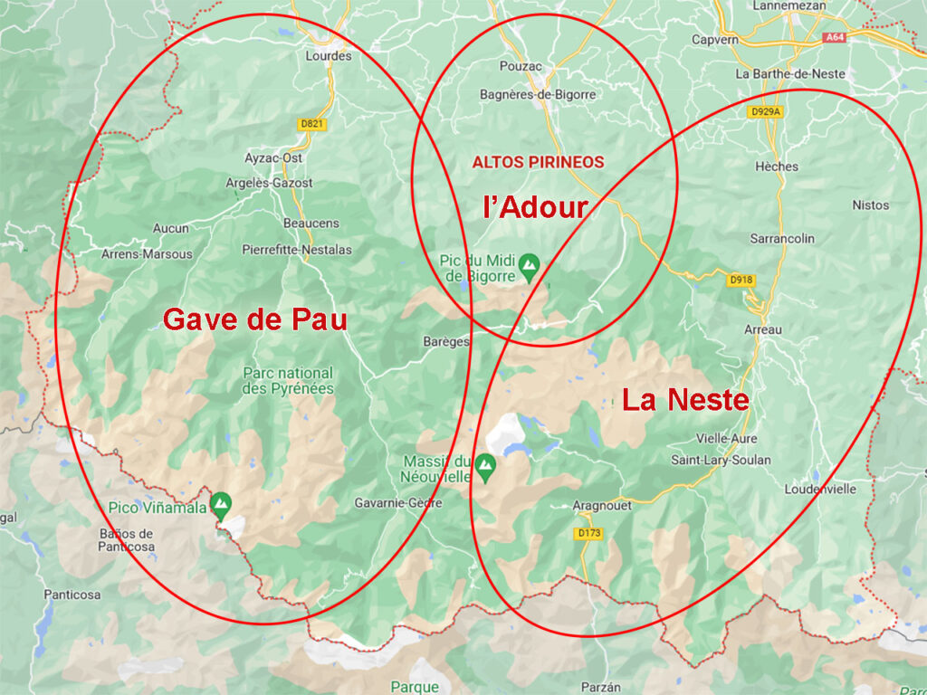
Hautes-Pyrénées (3 valleys): Gave de Pau, l'Adour, La Neste
The Pyrenean area of the Hautes-Pyrénées can be divided into the basins of 3 main rivers: Gave de Pau, l'Adour and La Neste..
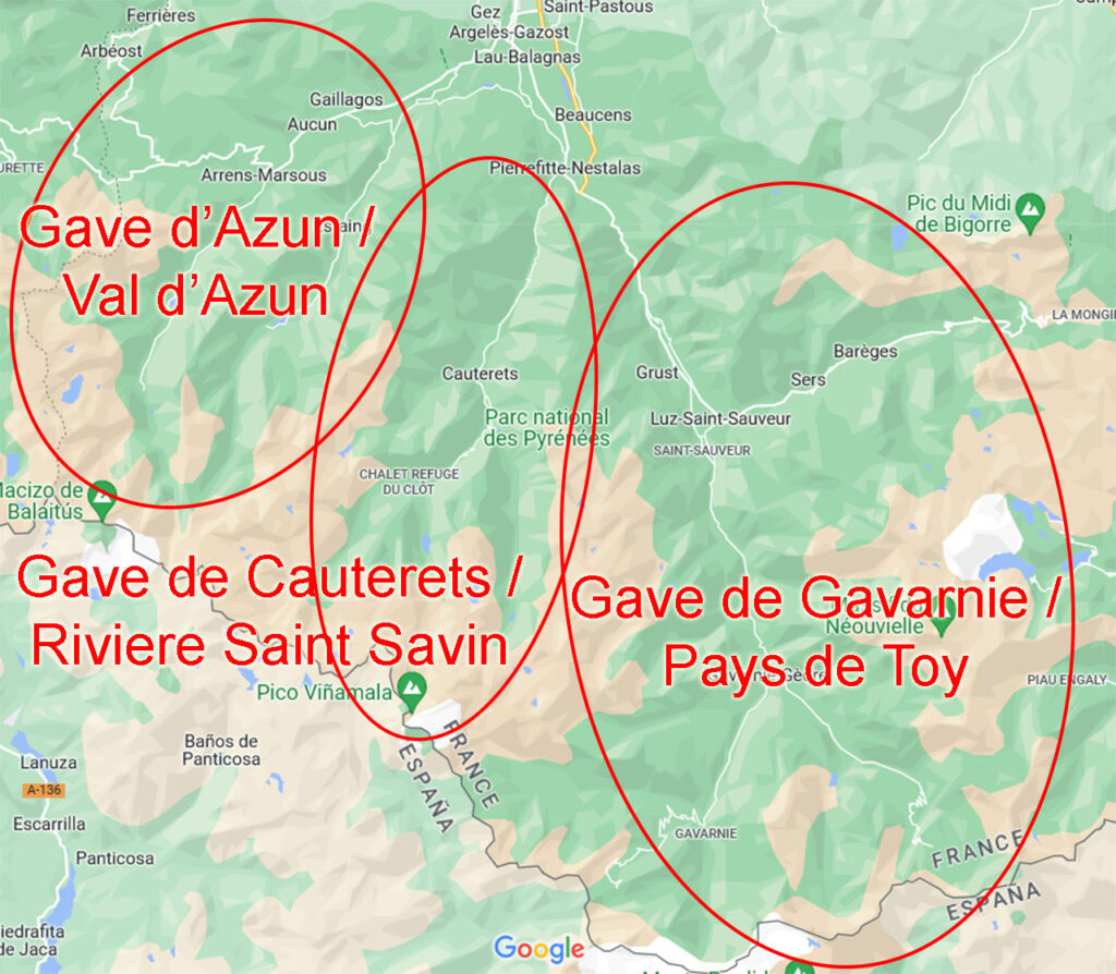
Gave de Pau (Cauterets, Gavarnie, Argeles Gazost...) - The 7 Lavedan valleys
The headwaters of the gave de Pau are known as the 7 Lavendan valleysa historical and geographical region, but not an administrative one.
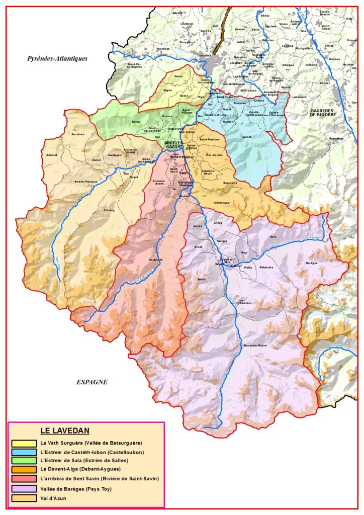
Le Lavedan, better known for being the valley in which Argèles Gazost, Luz Saint Sauver, Cauterets or Gavarnie are located, is by extension and by essential places to visit, the main of the three.
Of the 7 valleys of the Lavedan, the most important mountain valleys are those of the rivers: gave d'Azun, gave de Cauterets and gave de GavarnieThe most of the routes we are going to describe are concentrated in this section.
ROUTES
| ROUTE | DISTANCE | DENIVEL | INTEREST | ARGÈLES GAZOST |
| 1) Hautacam / Col de Tramasel - Lac de Isaby | 7,2km | +/-300m | 3,5/5 | 20 km 31 minutes |
| 2) Col de Soulor - Lac de Soum | 7,5km | +/-270m | 3/5 | 19 km 26 minutes |
| 3) Lac du Tech (Arrens Valley) | 2.5km | +/-40m | 3/5 | 18 km 26 minutes |
| 4) Lac de Suyen - Doumblas waterfall - La Claud (Arrens Valley) | 6km lake round trip: 2,5km | +/-420m lake round trip: +/-200m | 3/5 | 22 km 33 minutes |
| 5) Lac d'Estaing (Estaing Valley) | 2.3km | +/-60m | 3/5 | 16 km 25 minutes |
| 6) Cauterets - Lutour waterfall (Cauterets Valley) | 5,8km | +/-265m | 3/5 | 17 km 25 minutes |
| 7) Waterfalls path (Marcadau valley) | 9,3kms (round trip) | +/-450m | 4/5 | 19 km 27 minutes |
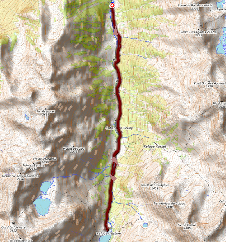
| 8. Lac d'Estom (Lutour valley) | 11,8kms (round trip) | +/-440m | 4,5/5 | 23 km 35 minutes |
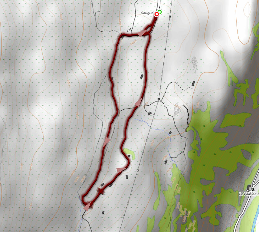
| 9) Plateau de Saugue | 2,9km | +/-40m | 3,5/5 | 7km 17min |
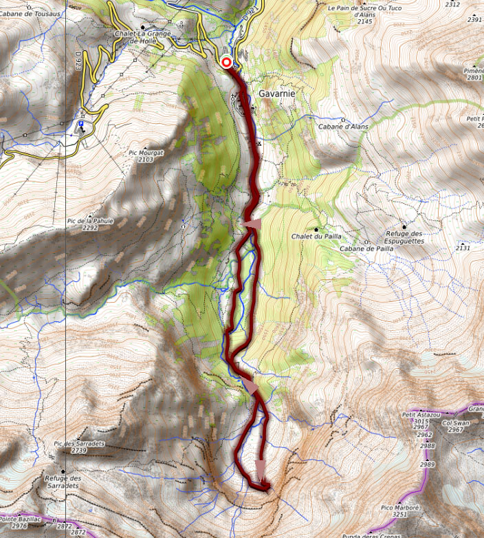
| 10) Cirque de Gavarnie | 11,4kms 8.4 to the hotel du cirque | +/-440m 220 to the hotel du cirque | 5/5 | 37 km 48 minutes |
| 11) Cirque de Troumouse | 7.0km | +/-180m | 5/5 | 46 km 1h04 minutes |
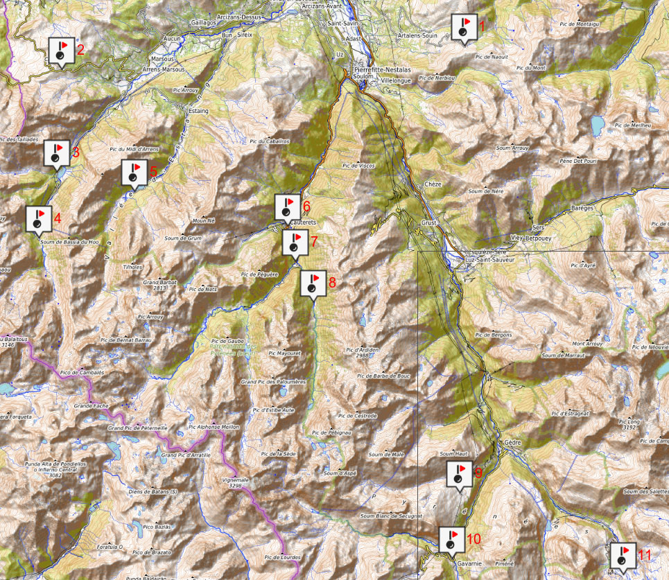
Routes near Argèles Gazost - Le Debant Ayga
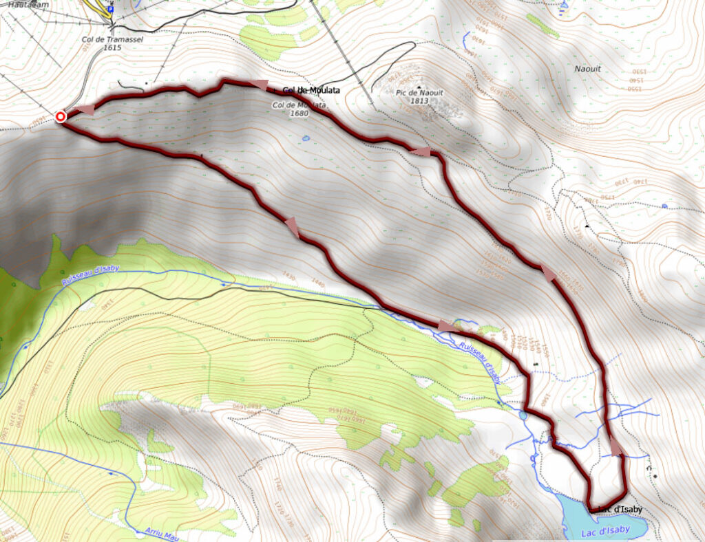
1) Hautacam / Col de Tramasel - Lac de Isaby
How to get from Argèles Gazost: View Google Maps (20km; 31 minutes)
> Download Track
Routes in the Azun Valley:
The Azun Valley is the least touristic of the three and the one that preserves the most authentic villages. The two main mountain valleys of the Val d'Azun are the Arrens valley and the Estaing valley.
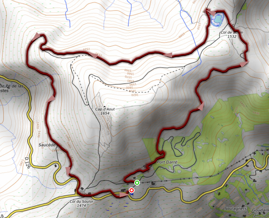
2) Col de Soulor - Lac de Soum
How to get from Argèles Gazost: View Google Maps (19km; 26 minutes)
> Download Track
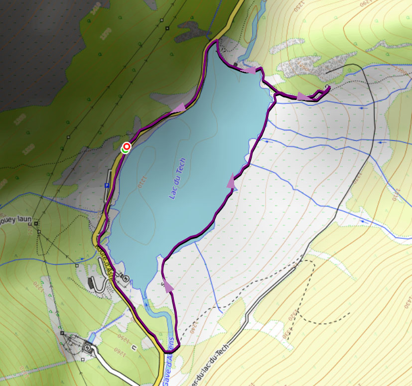
3) Lac du Tech (Arrens Valley)
How to get from Argèles Gazost: View Google Maps (18km; 26 minutes)
> Download Track
4) Lac de Suyen - Doumblas waterfall - La Claud (Arrens Valley)
How to get from Argèles Gazost: View Google Maps (22km; 33 minutes). From Lac du Tech (4km; 7 minutes).
> Download Track

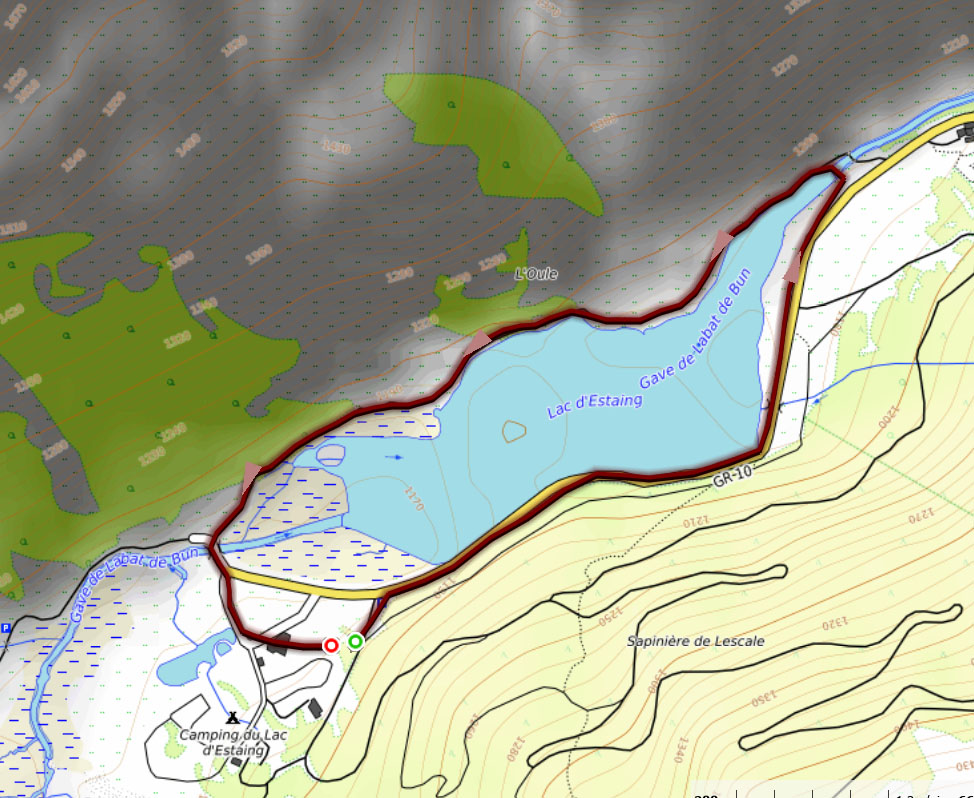
5) Lac d'Estaing (Estaing Valley)
How to get from Argèles Gazost: View Google Maps (16km; 25 minutes).
> Download Track
Routes in the Saint Savin valley (Cauterets)
The Saint Savin valley or better known as the valley of the gave de Cauterets, comprises the following main valleys: Cauterets, Marcadau, Gaube and Lutour.
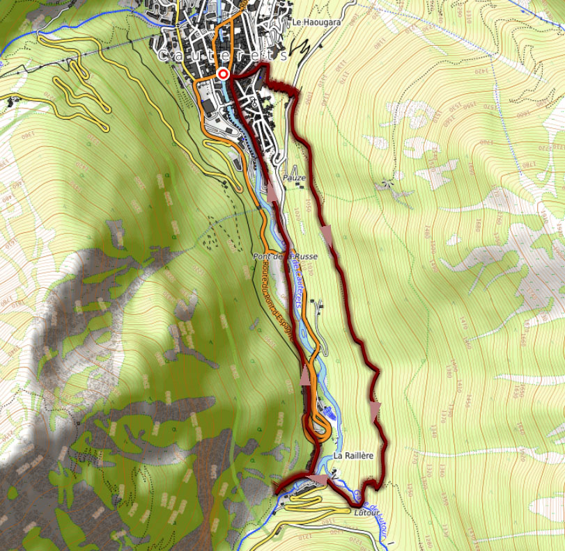
6) Cauterets - Lutour waterfall (Cauterets Valley)
How to get from Argèles Gazost: View Google Maps (17km; 25 minutes).
> Download Track
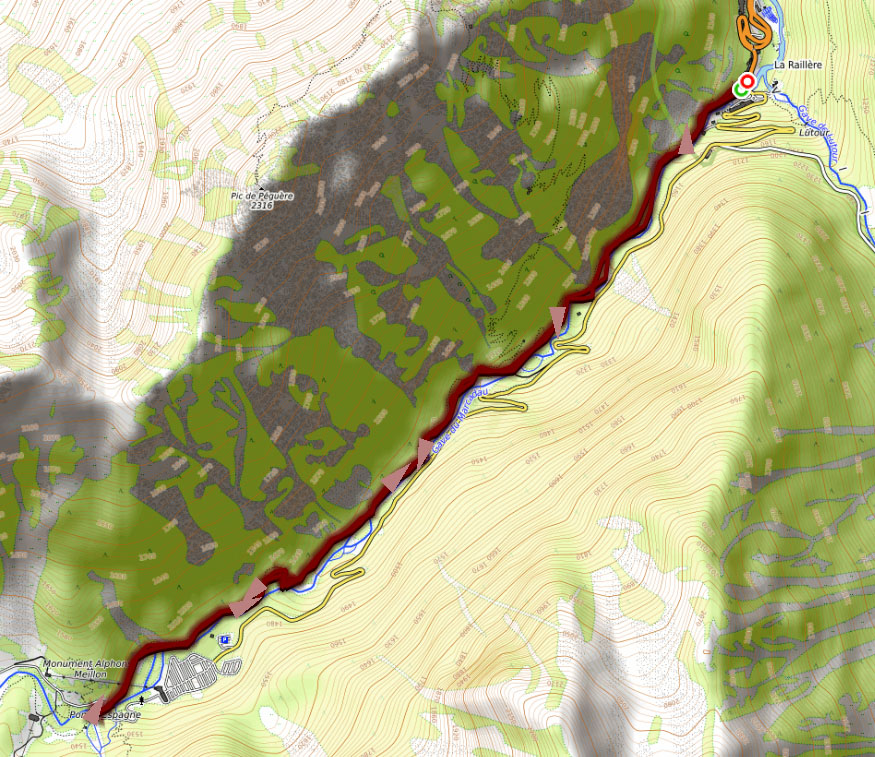
7 The Cascades Way (Marcadau valley)
How to get from Argèles Gazost: View Google Maps (19km; 27 minutes).
> Download Track
8. Lac d'Estom (Lutour valley)
How to get from Argèles Gazost: View Google Maps (23km; 35 minutes).
> Download Track
Walks in the Pays de Toy - Gavarnie valley
This is the area with the most spectacular landscapes (cirque de Gavarnie, cirque de Troumouse, col des Tentes).
9) Plateau de Saugue
How to get from Argèles Gazost: View Google Maps (36km; 54min). From Gedre (7km; 17min)
> Download Track
10) Cirque de Gavarnie
How to get from Argèles Gazost: View Google Maps (37km; 48 minutes).
> Download Track
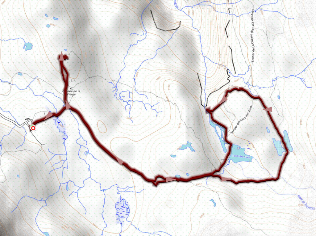
11) Cirque de Troumouse
How to get from Argèles Gazost: View Google Maps (46km; 1h04minutes).
> Download Track