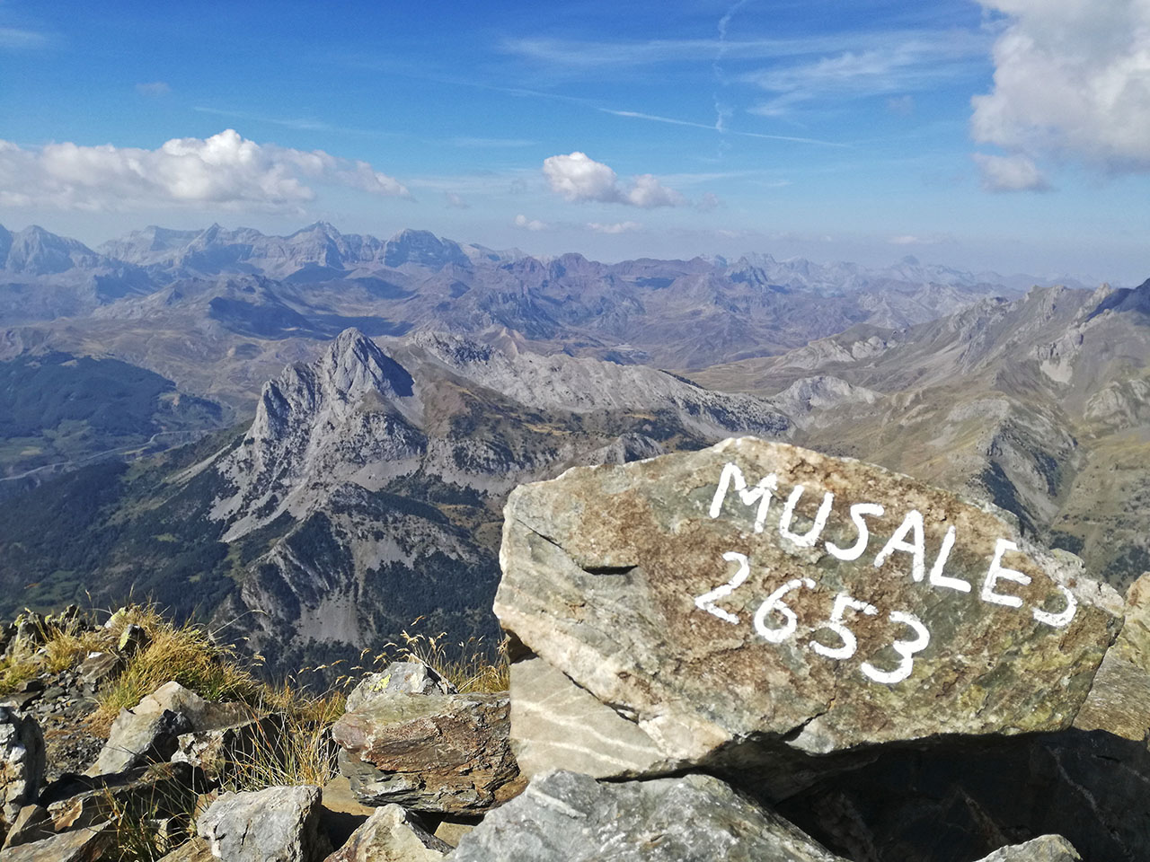
Musales (2.653m) from La Sarra reservoir
Pyrenees and mountains 📩
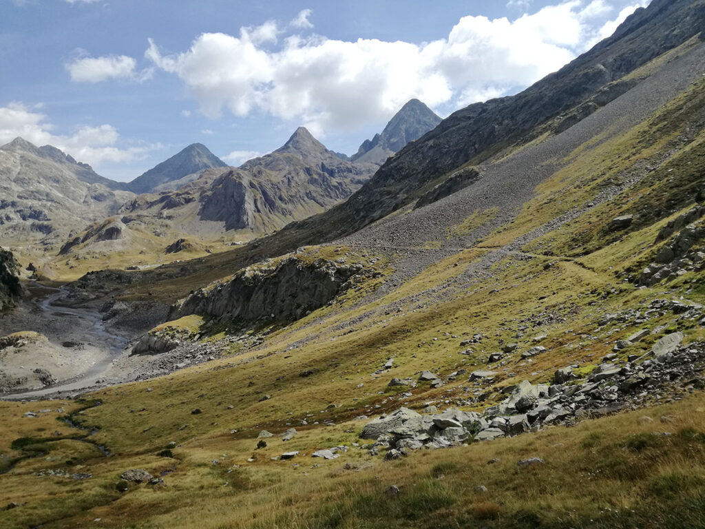
Here 🔥Between Sallent de Gállego, the Respomuso reservoir and the Barranco de Aguas Limpias, a range of mountains rises from west to east (dividing Musales, la Forqueta and Pondiellos) among which several peaks of similar altitude stand out such as: Garmo Carnicero (2.557m), the Garmo Pipós (2.581m), the Pico de Musales (2.653m), the Picos de Sancha Collons (2.686m and 2.697), the Forqueta (2.723) and the Pico de Tebarrai (2.886m).
Of all of them, by name, because of its privileged location in the western part of the mountain range, or perhaps because of the beautiful one-day circular route that we can do from the La Sarra reservoir, Musales (2,653m) stands out. A privileged viewpoint over the Tena valley, the Balaitús massif and many other peaks in the area.
Summary:
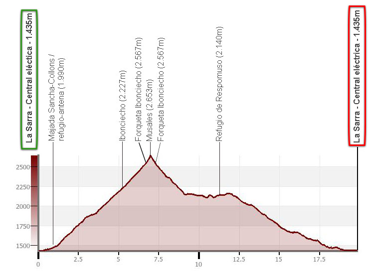
Ascent of Musales from La Sarra reservoir. Ascent via the Sancha Collons fold, Ibonciecho and Forqueta Ibonciecho; descent via Forqueta Ibonciecho, Respomuso reservoir and refuge and Aguas Limpias ravine.
Map:
Downloadable:
How to get there:
See in Google Maps.
To get to the start of this excursion, i.e. the car park next to the La Sarra reservoir power station, take the A-136 to the town of Sallent de Gallego. The same road that leads to Sabiñanigo crosses the town on one side and starts to climb upwards, taking a few loops towards Formigal. At one of these, the small road begins (duly signposted) that will take you to the La Sarra reservoir. It is also possible to park at the tail end of the reservoir, the usual point for climbing to Respomuso.
Technical specifications:
Distance: 19.8km.
Cumulative difference in altitude: +/- 1.330m.
Timetable: about 8-9 hours. Walking time without stops: 6h55min.
Water: Along the route you will pass numerous streams. There is a fountain and bar at the Respomuso refuge.
Difficulty: without technical difficulties, the main problem is the distance and the difference in altitude to be overcome. Most of the route runs along well-marked paths and except for the beginning of the descent from Forqueta Ibonciecho to Respomuso, there is no need to use your hands.
Recommended equipment for the summer: boots or slippers, two walking sticks, GPS (optional), canteen.
Itinerary:
(0h00min; 0,0km) Power station of La Sarra reservoir (1.435m).
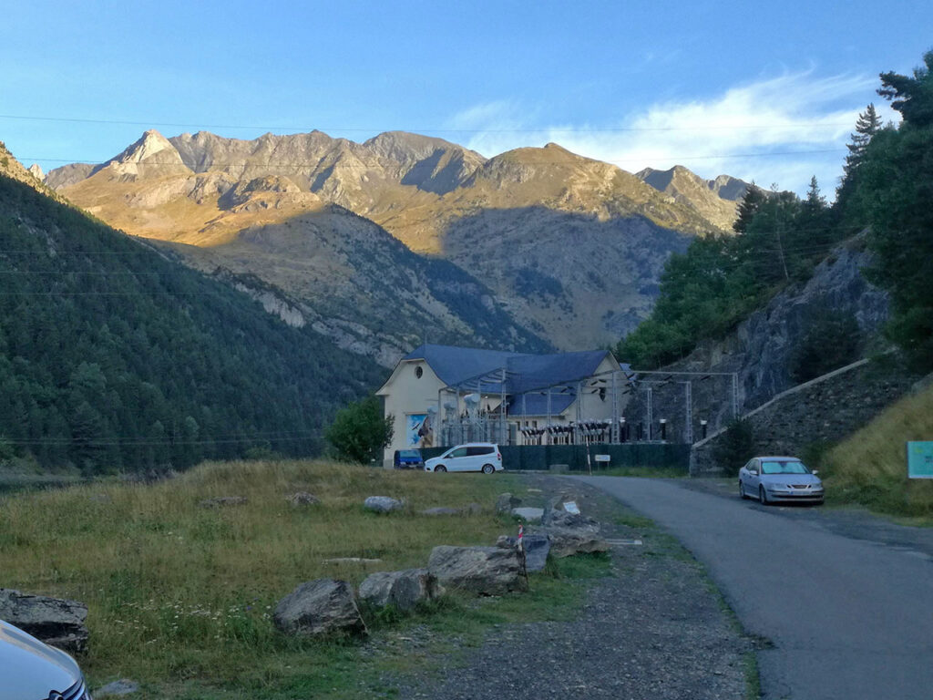
We start our ascent from the La Sarra reservoir dam. We cross a chain and continue along the track until we reach a crossroads, where we go left. From here you can continue ascending along the track, but we do so along paths marked with milestones, crossing pines, boxwoods and the occasional waterfall.
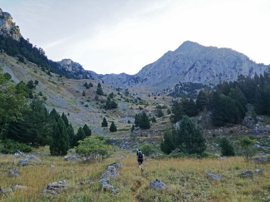
(1h25min; 4,0km) Majada de Sancha Collons - Refuge-antena (1.990m).
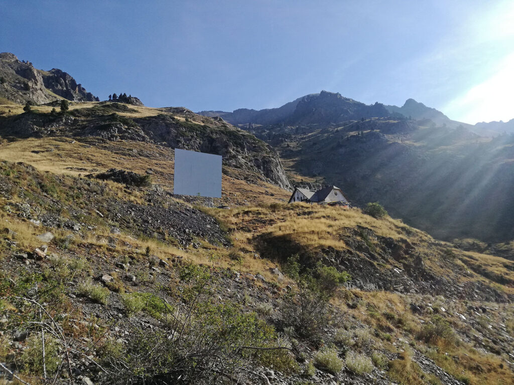
We leave a hut with a quadrangular antenna at the top right and shortly afterwards, when we reach a bend on the right-hand side of the track, we take an ascending path (N-NE). It is not long before we reach the...
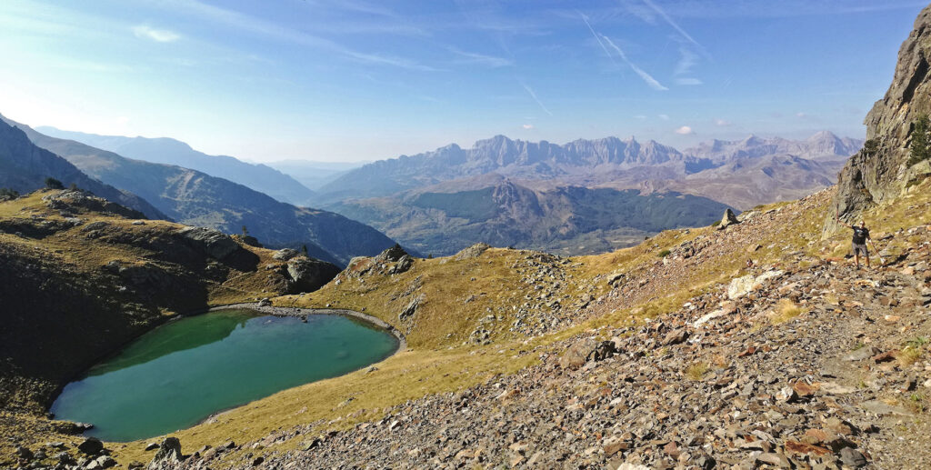
(1h55min; 5,2km) Ibón de Ibonciecho (2.227m)where we stop for a drink of water and enjoy the views.
We continue our way upwards along a well-marked path between stones and without any problems until we reach the...
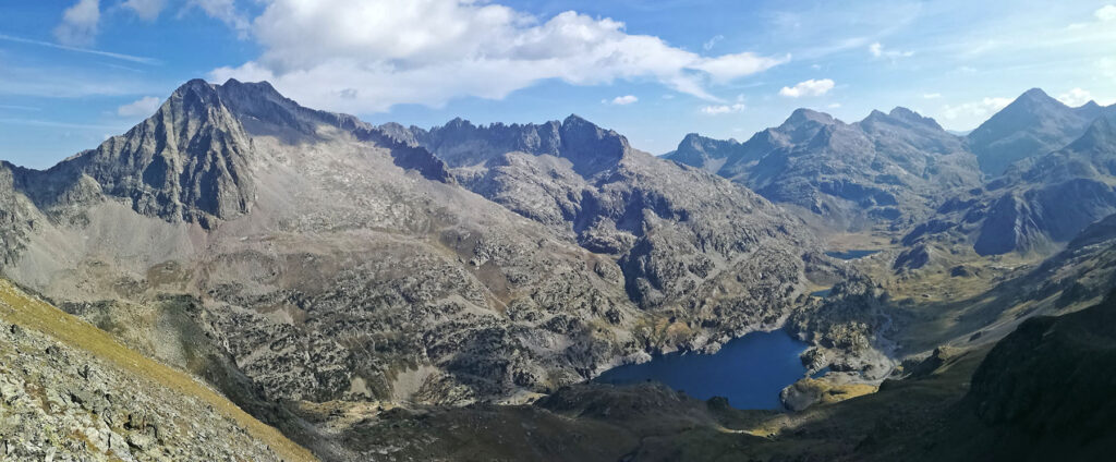
(2h35min; 6,7km) Forqueta ibonciecho (2.567m), where we can see which is going to be our way down towards Respomuso.
We climb the final stretch to crown the peak.
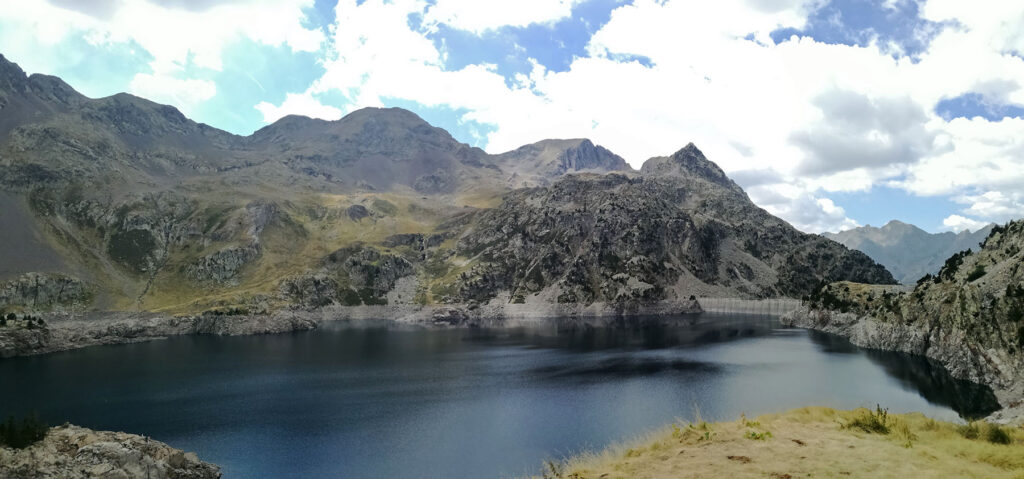
(2h45min; 7,0km) Musales (2.653m). Magnificent views of the Tena valley, Collarada, Pala de IP, Aspe, Bisaurin, Balaitús, Palas, Frondiellas, Devil's ridge, Gran Facha, Infernos, Midi d'Ossau, etc.

After a small lunch we start the descent, first to the...
(2h55min; 7,2km) Forqueta ibonciecho (2.567m) and then towards the Respomuso basin. At the beginning it is a descent between stones where we will have to help ourselves with our hands to avoid falling and then an easy descent through grass until we reach the GR11 variant.
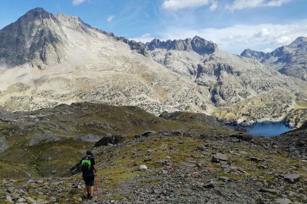
At this point (3h45min; 9,1km; 2.152m), if you want to make it shorter, turn left and reach the reservoir and then join the GR11 and descend. We wanted to stop at the refuge, so we turn right and walk around the reservoir to reach the GR11.
(4h35min; 11,4km) Respomuso refuge (2.140m). Here with a mug of beer we will spend a long time eating and enjoying the views.
After taking on water, we return to the GR11 and make the descent along the Aguas Limpias barrando.
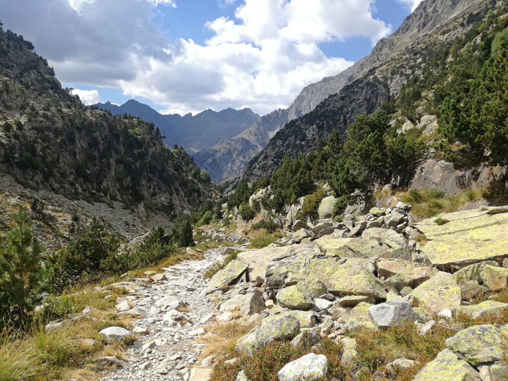
The path is marked with red and white waymarks, where we will cross countless streams. This way, until we reach the reservoir of La Sarra and complete our circular route.(6h55min; 19,8km) La Sarra reservoir power station (1.435 km)