Worldwide maps based on OpenStreetMap for Garmin devices
Pyrenees and mountains 📩
Here 🔥Over the last few years, driven by lower prices and increasingly improved performance, the Mountain GPS have definitely made a place for themselves in our backpacks.
Good handling of the device and quality maps are indispensable, but sometimes this can become a problem.This is even more so when the destination of our journey is some remote part of the planet. In this case, OpenStreetMap maps are often the best choice.The only one on many occasions.
What are OpenStreetMap maps?
OpenStreetMap (OSM) is a collaborative project to create free, editable maps worldwide made possible by a huge community. The main difference with other maps, such as Google Maps or other official maps, is that OSM data is open and owned by the community. You can use OpenStreetMap freely for any purpose (including commercial) as long as you give credit to OSM and its contributors.
And among the many purposes, one of the most demanded is this one, provide free and open cartography on Garmin devices.
Download OpenStreetMap for BaseCamp
BaseCampis the free desktop application of Garmin to plan routes, view maps, transfer files, etc.
The first step to download OSM maps, is to open the website: garmin.openstreetmap.nl/
We will see a series of sections where we can choose the type of map, country to download, manual selection and a location map.
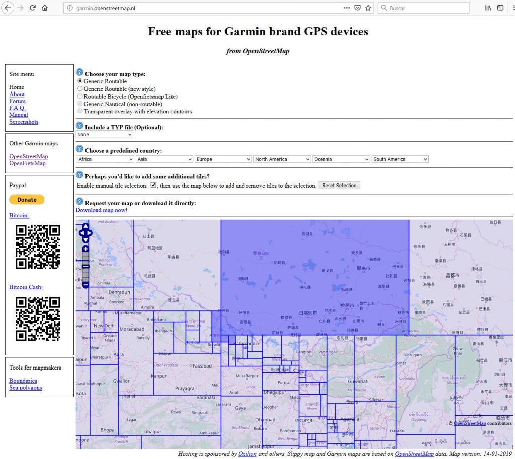
In this example, designed for the route of the Annapurna Circuitin Nepal, the map has been chosen Generic Routable and the following has been selected Nepal in the drop-down menu Asia. In this way, the viewfinder makes a quick approach to the area of interest.
As we don't need the whole selection, we click on the button "Reset Selection and tick the box "Enable manual tile Selection". to activate manual selection. By clicking on the map we mark the areas we are interested in. In this case, the four selected in the image.
The website checks that the requested map exists (it can take a couple of minutes) and depending on the type of choice, the map is downloaded directly, or a download link is generated and sent to the e-mail address you specify.
We will receive two mailings. The first is simply to know the status of the petition. The second one is the one we are interested in, as it contains the download link to the map.. Clicking on the link opens a window in which we must choose the download file. It will depend on the operating system used (Windows, Linux, Mac, GPS device).
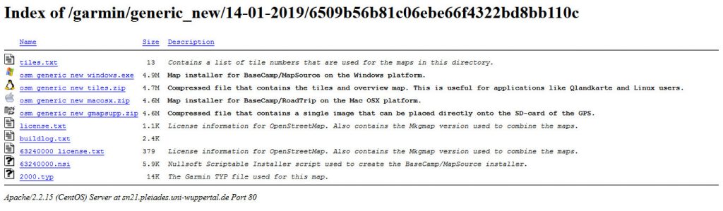
In the example, the Windows file has been downloaded. We execute the file, ignoring the warning that this "may put your PC at risk"..
Once installed, the map can now be viewed in BaseCamp. If it was open at the time of installation, we will have to restart it to see the changes.
We open the map in the "maps" tab to see the result; depending on the type of map chosen it will look like this:
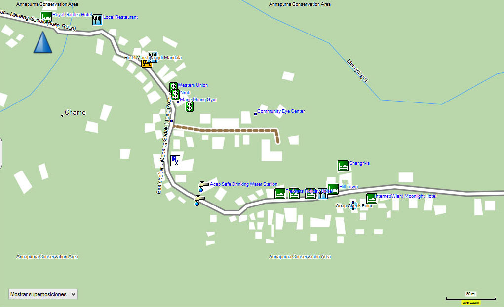
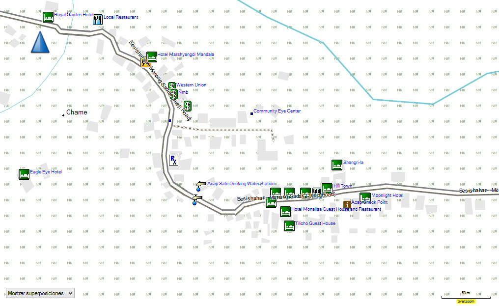

The appearance of the map is very simple, with basic colours and no contour lines or shading to indicate relief, so useful for mountain activities. However, the level of detail of the information is extraordinary. On a global scale, you will not find any other map as up to date or as complete as this one.
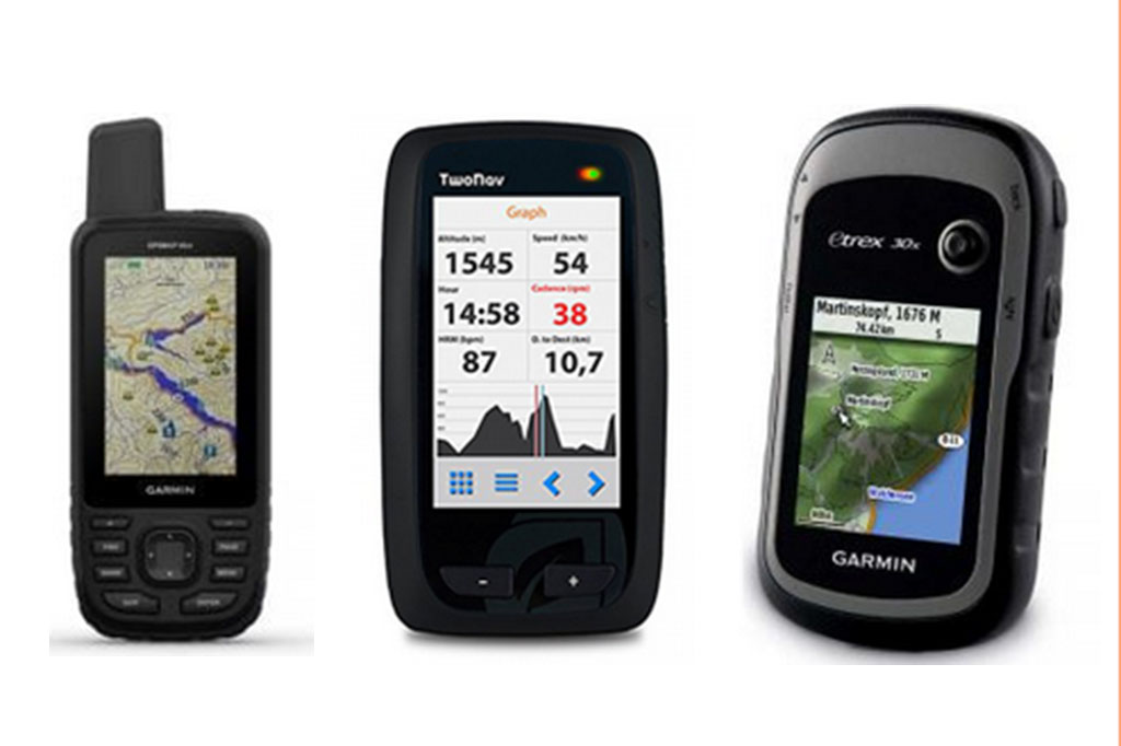
GPS or mobile phone, the best brands, aspects to take into account when choosing one, GPS models on the market...
Cover photo: Open Street Map
Fastpacking is not about going faster. It's about going lighter.
If you come from classic trekking, this is the next step: learning to move with less weight,
more fluid and enjoying every kilometre more.
Join the Outsiders Newsletter and start discovering what lightness feels like.