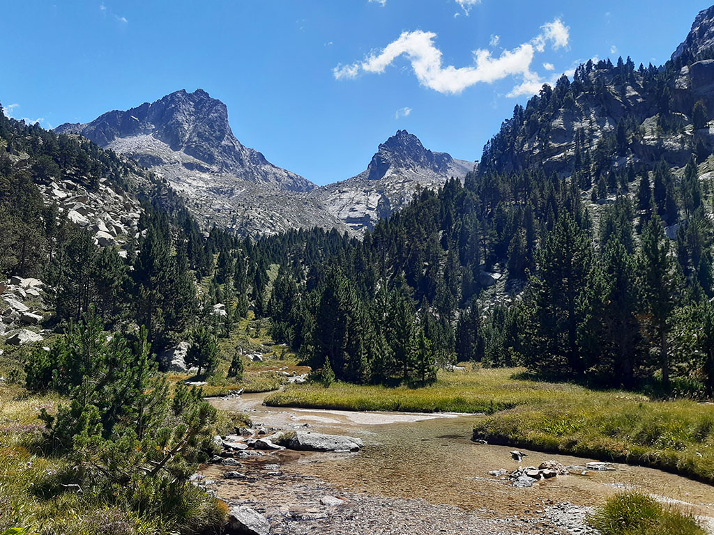
Peguera (2,983m) and Monestero (2,877m) from Prat de Pierró
Pyrenees and mountains 📩
Here 🔥Peguera peak, in the heart of the Aigües Tortes i Estany de Sant Maurici National Park, is one of the great peaks of the area and, why not, of the Pyrenees. It is the highest peak in the eastern part of the National Park, in the surroundings of the Sant Maurici lake, where it shows its most abrupt and wild side.
It is one of the most coveted peaks in Catalonia, but it is not overcrowded, and it is by no means uninteresting. This tranquillity is probably due to the fact that the summit is not a gift, and whether we go up the Sallente side or the Sant Maurici side, we have to overcome some climbs with second grade passes.
The route described below, even without climbing the proposed peaks (Peguera and Monestero), is a magnificent route to get to know this part of the P.N. of Aigües Tortes i Estany de Sant Maurici and to visit the surroundings of the lakes of Peguera (Tort, Negre and Llastra lakes, etc.).
SUMMARY:
From the Prat de Pierró car park, the route climbs along a track to the Josep María Blanc refuge, where it is possible to spend the night and divide this route into two days. The route continues along the Negre and Llastra lakes to the Monestero pass, the base point for reaching the peaks of Peguera (West) and Monestero (East). The Pic de Peguera has several climbing passages on good rock (II) that are not suitable for everyone. The Pic de Monestero, on the other hand, does not have the prestige of its big brother, but it is more accessible and offers equally sensational views. The descent from the Monestero pass is towards the northern slope, along the Monestero lake. Without reaching Sant Maurici lake, take the detour that passes by the Ernest Mallafré refuge and takes you to the busy path up to the lake from the Prat de Pierró car park.
MAP:
DOWNLOADABLE:
> Download Track
HOW TO GET THERE:
See in Google Maps.
The starting point for this excursion is at the Prat de Pierró car park, 4 kilometres from Espot. At this point, a barrier prevents unauthorised vehicles from passing. To get to Espot, take the C-13 road between Sort and the Aran Valley until kilometre 154, where the turn-off to Espot and the National Park starts. In total it is 37kms from Sort or 57kms from Vielha.
Technical specifications:
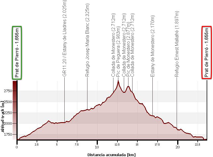
Distance: 23,7kms.
Cumulative difference in altitude: 1.785m.
Timetable: 10-12 hours. Walking time without stops: 9h10min.
Water: In addition to the numerous lakes and various places where you can find water, there is a fountain at the Josep María Blanc refuge and the fountain at the hermitage, on the descent from the Sant Maurici lake to the car park.
Difficulty: As we have already mentioned, the ascent to the Peguera peak has IIº steps on good rock. It is not very difficult, but it is not suitable for everyone. In addition, there are few milestones on the ascent, giving a greater sense of embarkation. Otherwise, the route is quite long and with a lot of accumulated height gain to do it in a single day (especially if we climb the two peaks).
Recommended equipment for the summer: boots (recommended) or trainers, walking sticks, GPS optional, etc.
ITINERARY:
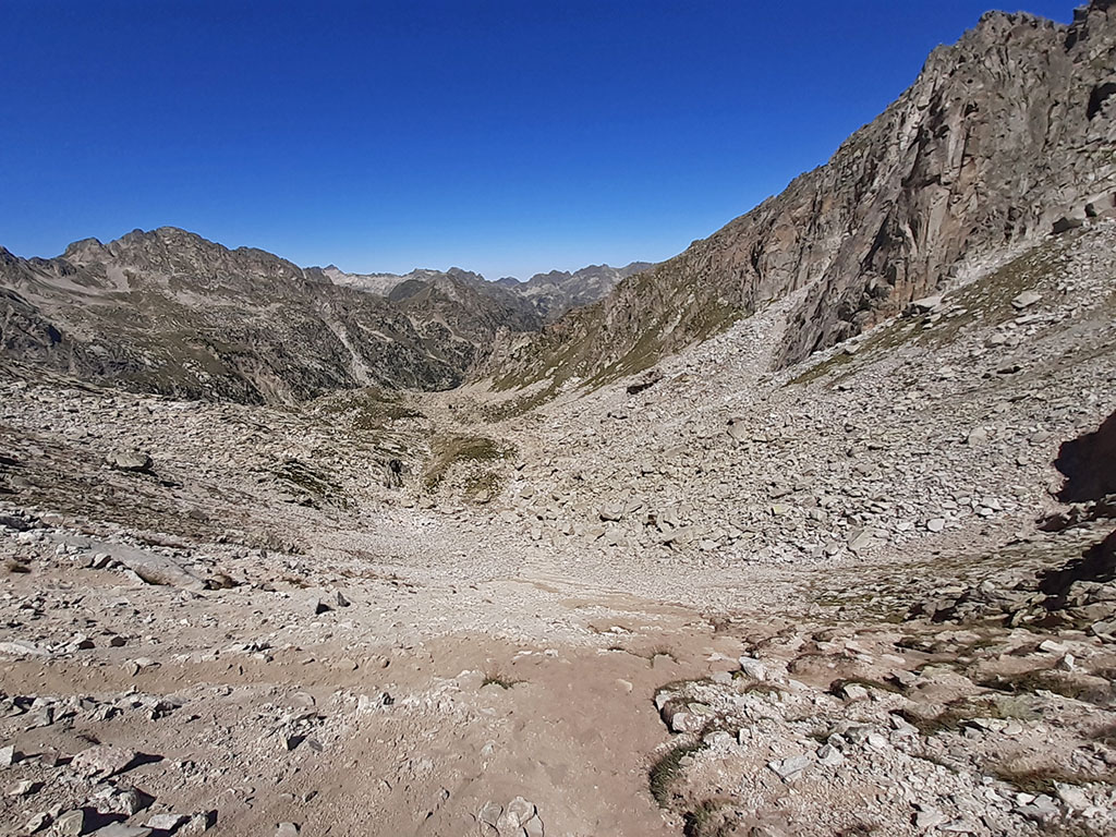
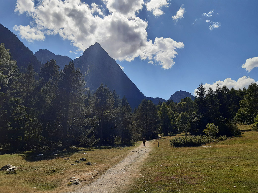
(0h00min) Prat de Pierró (1.655m). We start this walk by following the track on the left hand side that starts at the end of the parking place, just after crossing the barrier. In about half an hour (0h30min; 2,2 kms) you take a shortcut on your right hand side, which, although we took it and it appears on the track, is not worth it. The track goes round an artificial pond enclosed by a fence (0h35min; 2,5kms), leaving it on your left to continue ascending. After overcoming a kind of shoulder (1h00min; 3,9kms) after which comes a short descent, comes a flat area where you cross a tunnel. The track joins the GR11.20 that comes from Espot, shortly before reaching the...
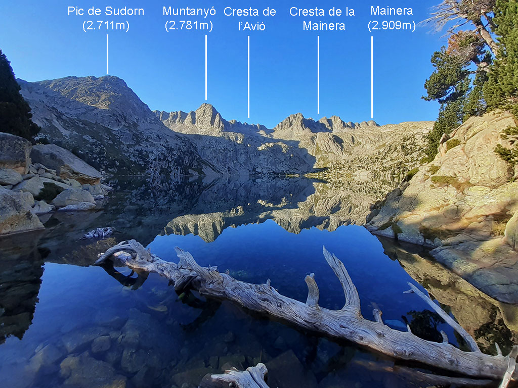
(1h25min; 5,9kms) Lladres Lake (2.025m). The route continues without loss along the track to the Tort de Peguera lake and the refuge....
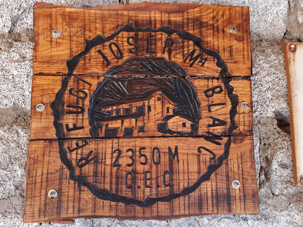
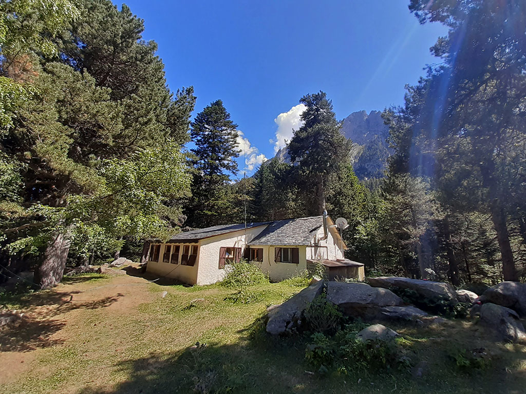
(2h20min; 8,8kms) Josep María Blanc (2.325m), where we can get water and make a technical stop.
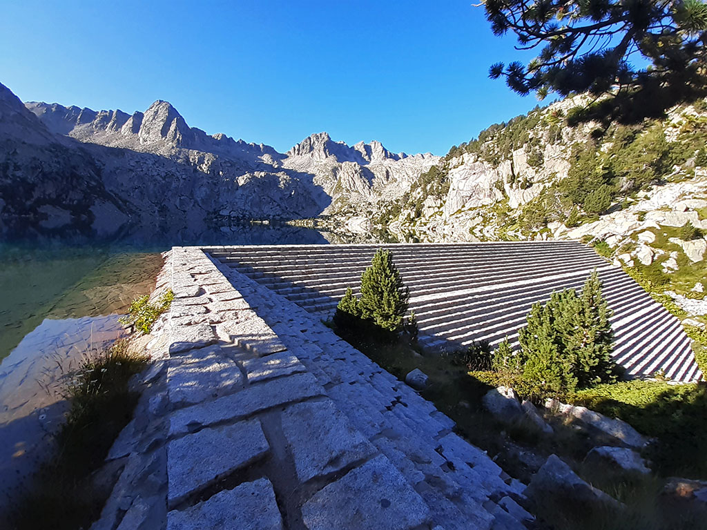
From the refuge, continue along the track for another five minutes until the end at Estany Negre, next to a small retaining wall.
The path, which coincides with the Carros de Foc and is marked with red and white GR11.20 waymarks, ascends to the right and then descends to the main wall of the dam (2h35min; 9,4kms), which you cross from above.
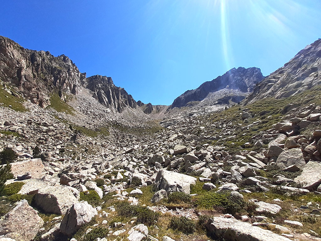
The path passes next to the Coveta lake and continues uphill on the way to the Llastra lake, where a signpost marks the Monestero pass, to which we head.
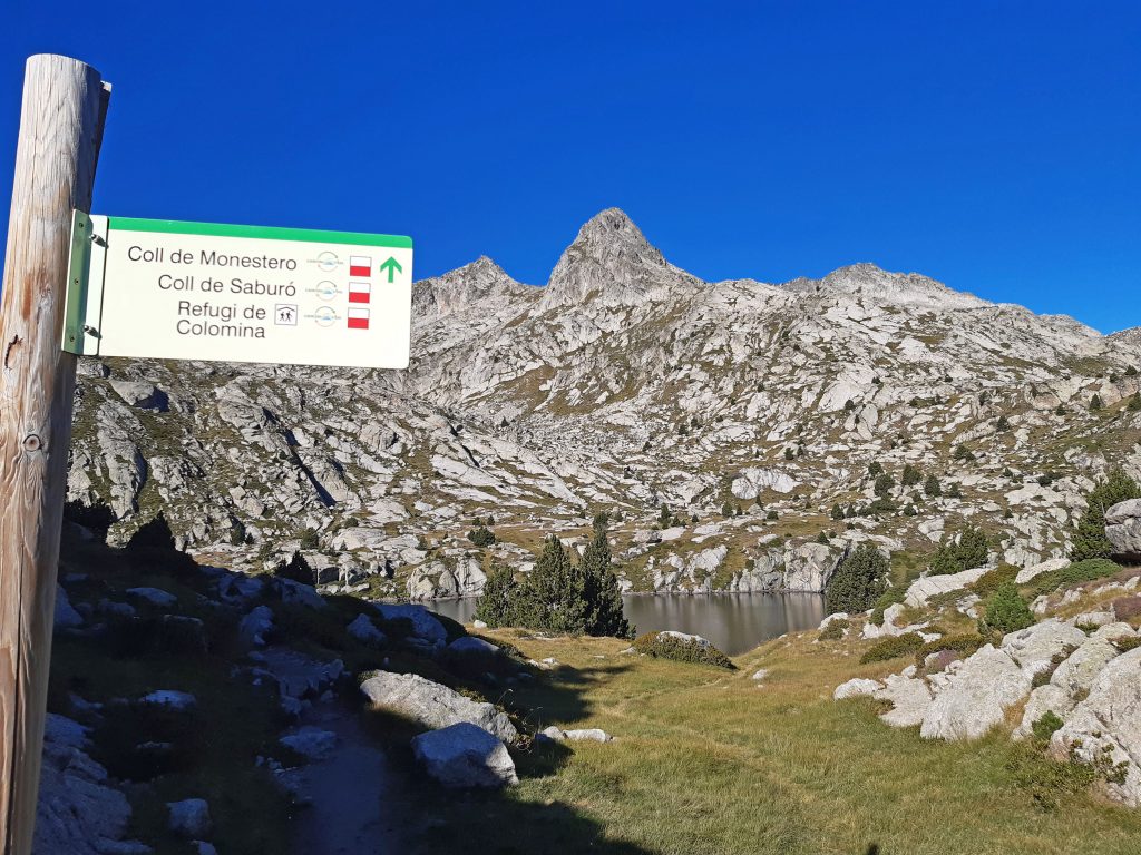
On the right there is also a well trodden path that surrounds the lake on the other side and joins the path on the left just on the other side. It doesn't matter much which of the two you choose. On the track we have followed the path on the right, which disappears just before meeting up again with the Carros de Foc (no longer with the GR11.20 which continues towards the Coll de Saburó). The path leaves the small lake of Peguera on your left (3h15min; 10,7kms)...
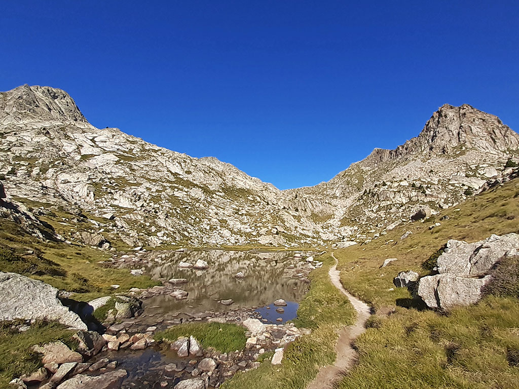
and later the estany Gran de Peguera (3h30min; 12kms), before reaching the...
(3h45min; 12kms) col de Monestero (2.712m).

The coll de Monestero is a very busy place for hikers who hike in the area. The peaks, on the other hand, are much less frequented. The Pic de Peguera offers some climbing difficulties (IIº) that reserve it only for mountaineers with a certain amount of experience in this type of terrain. The Pic de Monestero, on the other hand, is easy, but does not enjoy the prestige of its big brother.
The ascent to the Pic de Peguera can be done by several routes of similar difficulty. Here we describe two different ones, one uphill and one downhill (a variant of the NE ridge that coincides with this one in the first downhill section). Although the route we describe for the ascent seems to be more common, the downhill route probably has fewer climbing areas, and everything is reduced to overcoming the key pass of the embedded block.
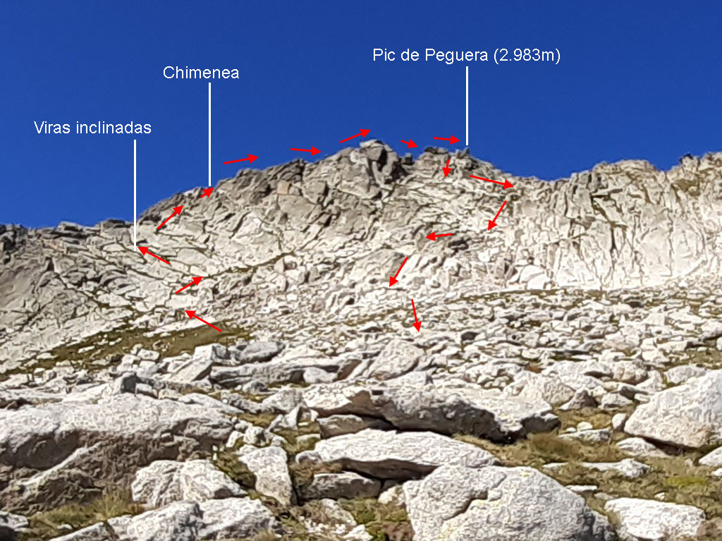
The ascent route climbs diagonally up the southeast slope, taking advantage of the grassy area, to a rocky wall crossed by several easily distinguishable switchbacks. There are a few milestones marking the route that ascends taking advantage of one of these ridges to then go upwards in search of a hidden chimney of about 10 or 12 metres that leaves us on the crest of the crest. The chimney climb is the most vertical section (F+). It is easy to solve thanks to the good quality of the rock and the numerous foot and hand holds.
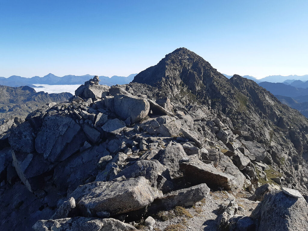
Once on the ridge, the climb up the large boulders to the top is very entertaining.
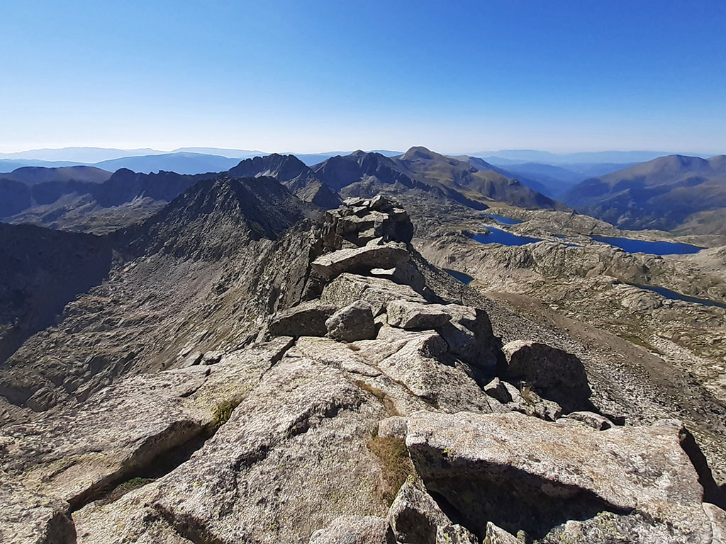
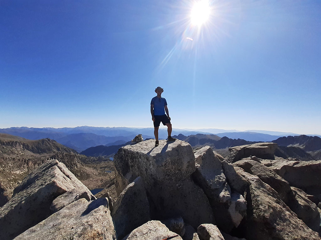
(4h35min; 12,6kms) Pic de Peguera (2.983m). The summit is small and airy, although next to it, there are other, more spacious blocks to stay and enjoy the views for a while.
If we do not want to repeat the ascent, we can descend along the following route. Returning over the last blocks of the crest we will notice some milestones that descend along the south face, along a small corridor through which we lose some height. We then turn left to progress parallel to the crest, a few metres below. The description of this part can be confusing and we will simply follow the milestones in search of the easiest area. The only somewhat complicated, somewhat athletic step is the clamber over a crevasse where there is a small block embedded in the rock. To descend to the Monestero pass we can choose to follow the crest, but descending to the grassy area on the southern slope is tempting and we take a sloping corridor on the right hand side that, with little difficulty, takes us to the path up.
(5h15min; 13,3kms) col de Monestero (2.712m). The ascent to the Monestero peak is not difficult. From the pass we advance along the ridge on the south side until it appears to become more difficult. The path descends to the right for a few metres and then climbs a stretch to put your hands on and continue without any difficulty to the summit.
(5h40min; 13,8kms) Pic de Monestero (2.877m).
(6h00min; 14,4kms) pass of Monestero (2.712m). Once back, we start to descend towards the northern slope. At first we will lose height quickly sliding down the rocky slope, but when we reach the boulder area, progress becomes more difficult.
At this point, at the beginning of the first boulders, the main path turns to the left to make a horizontal crossing and change to the valley that opens up further to the left (head of the main valley). We did not see this detour, which would have prevented us from crossing the difficult area of boulders. Descending along the boulders, we follow the milestones jumping from stone to stone until we reach the first pine trees (6h50min; 2.360 m).
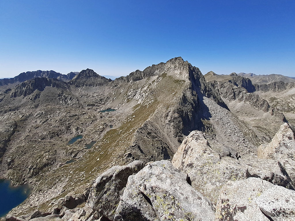
Here the path becomes steeper and forces you to use your hands on a small cliff. The path connects with the main path, which you leave at the beginning of the descent, to follow the valley of the Monestero river. An idyllic spot. The river of crystalline waters descends through an area of meadows where the first pine trees begin to appear. In the background, the silhouette of the Pic de Peguera (2,983m) showing its steepest side, a slender peak of unknown name (2,806m) and the Pic de Mar (2,842m), frame the postcard.

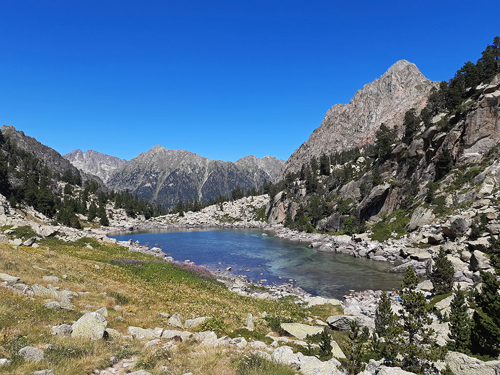
(7h15min; 16,9kms) Monestero Lake (2.170m). A beautiful lake dominated by the presence of the Gran Encantat.
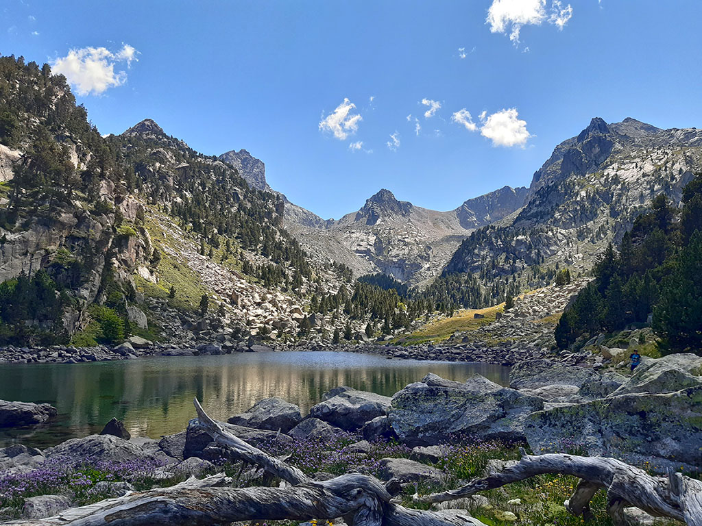
From here the path becomes busier. The path descends almost all the time through forest. You pass a clearing, the Prat de Monestero (7h30min) and continue again through forest to an area (Fangassals de Monestero) where the path has been prepared with wooden crossbeams (7h40min). Now on the left hand side of the valley you continue downhill until you reach a track on your right hand side that descends to the...
(8h05min; 19,8kms) Ernest Mallafré Hut (1897m).
Five minutes later, the track comes out onto the one that climbs up to the Estany de Sant Maurici. Follow it to the right without getting lost in the summer crowds, following the signs to Prat de Pierró. On the way you pass a hermitage with a fountain (8h30min) and the road closed to traffic (8h55min), where 4×4 taxis constantly come and go from Espot.
(9h10min) Prat de Pierró (1.655m)
WHERE TO SLEEP:
At Espot There is a variety of accommodation and some campsites. See accommodation.
During the tour we also have the shelters in place:
- Josep Maria Blanc Refuge (+34 973 641 681; info@refusonline.com).
- Ernest Mallafré Refuge (+34 973 250 118; mallafre.refugi@feec.org).
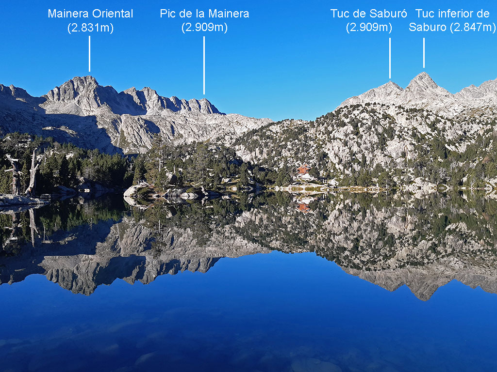
Nearby you may be interested in:
Circular to Punta Alta (3,014m) from the Cavallers reservoir. Ascent through the Comalesbienes reservoir and descent through the valley of Colieto. [7h05min; 13,5km; +/-1.510m] [7h05min; 13,5km; +/-1.510m].