🏔️ Pyrenean Crests: 20 x 3miles in the Perdiguero Sector
Pyrenees and mountains 📩
Here 🔥(Activity carried out by Edgar Duch and Sergi Vàzquez in July 2023).
For some time now we have been thinking about trying to linking different Pyrenean ridges on the same day. We opt for the Perdiguero sectorThis is due to the large number of Tresmiles and their moderate difficulty, which would allow us to link them together fairly quickly.
👉 YOU MAY BE INTERESTED IN: Pyrenean crests
What we didn't know before we started was that it would be one of the most magical nights to be able to achieve such a feat, as the conditions were the best imaginable.
The initial idea was to be able to climb as many Tresmiles as possible, this time without worrying about time and without setting ourselves a specific objective of doing it in less than X number of hours. We traced an itinerary that seemed to us the most "logical" to be able to climb the greatest number of peaks in a row without involving great difficulties, as our idea was to go with the minimum possible material to be able to move with agility and without the need to use climbing equipment, as it would make us lose much more time and we preferred to invest it in being able to climb more Tresmiles.
| 📋 Technical specifications: |
| Distance travelled: 42'64 Km Cumulative positive difference in altitude: 3.800+ Time invested: 17h 15' Three-thousanders ascended: 20 Track of the route: https://strava.app.link/BKKAg4fscFb Full Moon Night (of tresmiles). Activity carried out by Edgar Duch and Sergi Vàzquez. |
| 📌 Summits climbed in order |
| 1) Tusse de Remuñe, 3,041 m. 2) Rabadá Peak, 3,045 m. 3) Perdiguero Or. milestone, 3,170 m. 4) Perdiguero Peak, 3,222 m. 5) Hito Occ. de Perdiguero, 3,176 m. 6) Tuca de Lliterola, 3,095 m. 7) Royo Peak, 3,121 m. 8) Punta de Lliterola, 3,132 m. 9) Lliterola Needle, 3,028 m. 10) Punta Mamy, 3,048 m. 11) Pic d'Spijeoles, 3,065 m. 12) Pic Belloc Sud, 3,007 m. 13) Pic Belloc Central, 3,006 m. 14) Pic Belloc, 3,008 m. 15) Pic Gourdon, 3,034 m. 16) Pic d'Audoubert, 3,045 m. 17) Cap dera Baquo Occ. , 3.097 m. 18) Cap dera Baquo Or. , 3.103 m. 19) Pic du Seil dera Baquo, 3,111 m. 20) Small Portillón Peak, 3,000 m. |
The Challenge
The route we set out to follow started from the Llanos del Hospital (Benasque)and linked the crests of Tusse de Remuñe, Perdiguero, Spijeoles - Bellocs (France), Seil de la Baque (France) and Gourgs Blancs.
A total of 30 peaks over 3,000 metres in altitude.. Neither Edgar nor I had ever climbed so many peaks in the same day, so, with all the motivation and the minimal but necessary equipment to be able to make the journey, we began the ascent.
The route was not circular, as we started in the valley of Remuñe and ended on the opposite side of the massif.So we had to leave a car in the Estós Valley (where our route ended) and go up to the Llanos del Hospital to start the ascent from there.
The weather forecast for the next few hours forced us to bring forward our departure time. Our idea was to start at around 3 a.m. in order to be able to start the crests with the first light of day, but the possibility of thunderstorms from midday onwards forced us to leave at 8 p.m. the previous day, which meant spending the whole night above 3,000 m. This was not a big problem for us, as we knew the terrain and the route very well. This was not a big problem for us, as we knew the terrain and the route very well, and the fact of spending a whole night climbing Tresmiles seemed very attractive and gave an extra special touch to our particular adventure.

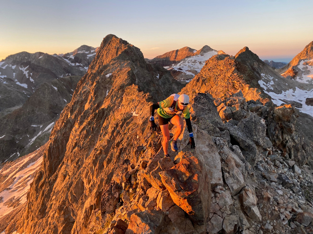
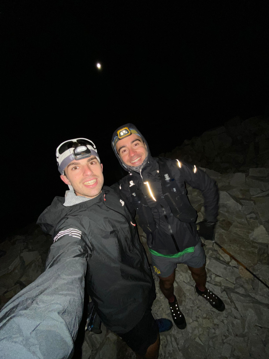
Photo from the summit of Rabadá Peak 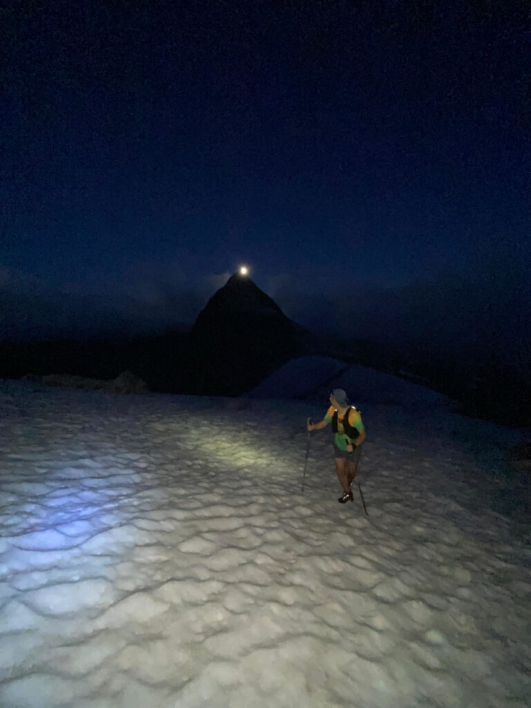
Arriving at Tusse de Remuñe

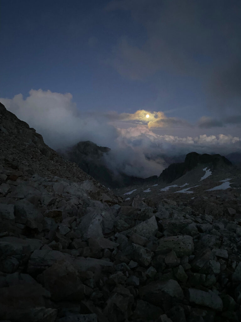
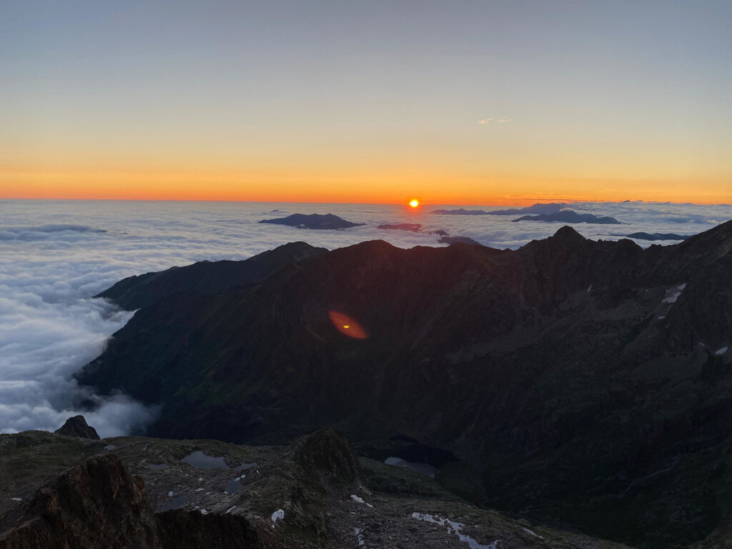
We start the ascent in Llanos del Hospital, in the direction of the Remuñe Valley. with the intention of still reaching the first two summits of our challenge during the day; the Tusse de Remuñe and the Rabadà Peak. As we gain altitude, the light falls, and as we get to the Remuñe portalAt 2,800 metres, we can see the sunset through the mist that occupied most of the sector. Luckily for us, the clouds were low, and at all times remained below us, giving us splendid views of a sea of clouds as it gradually got darker. What we didn't yet know was that there was a full moon that night, and that we would have splendid visibility at all times to be able to walk the ridges all night long. The fact of being able to advance along the ridges with light, and being able to dispense with the headlamp in some sections, allowed us to advance much faster, in addition to the magnificent views we had at all times of all the summits in the sector and the surrounding area.
Photos of the sunset from the Portal de Remuñe with the sea of clouds and the full moon.
We reach the summit of Tusse de Remuñe, 3,046 metres. We followed the easy ridge that took us to the nearby Pico Rabadá, 3,043 metres. At no time had we imagined having these conditions despite the fact that it was completely dark, and that encouraged us to continue towards our next objective; the Perdiguero ridge. We descend a few metres in search of the Ibón Blanco de LliterolaWe take the opportunity to recharge water, as once we gain altitude we won't be able to drink again for quite a while. The temperature is ideal, it is hardly cold and the wind blows very moderately, so with a short T-shirt and a windbreaker, we get ready to start the crest of the Perdiguero.
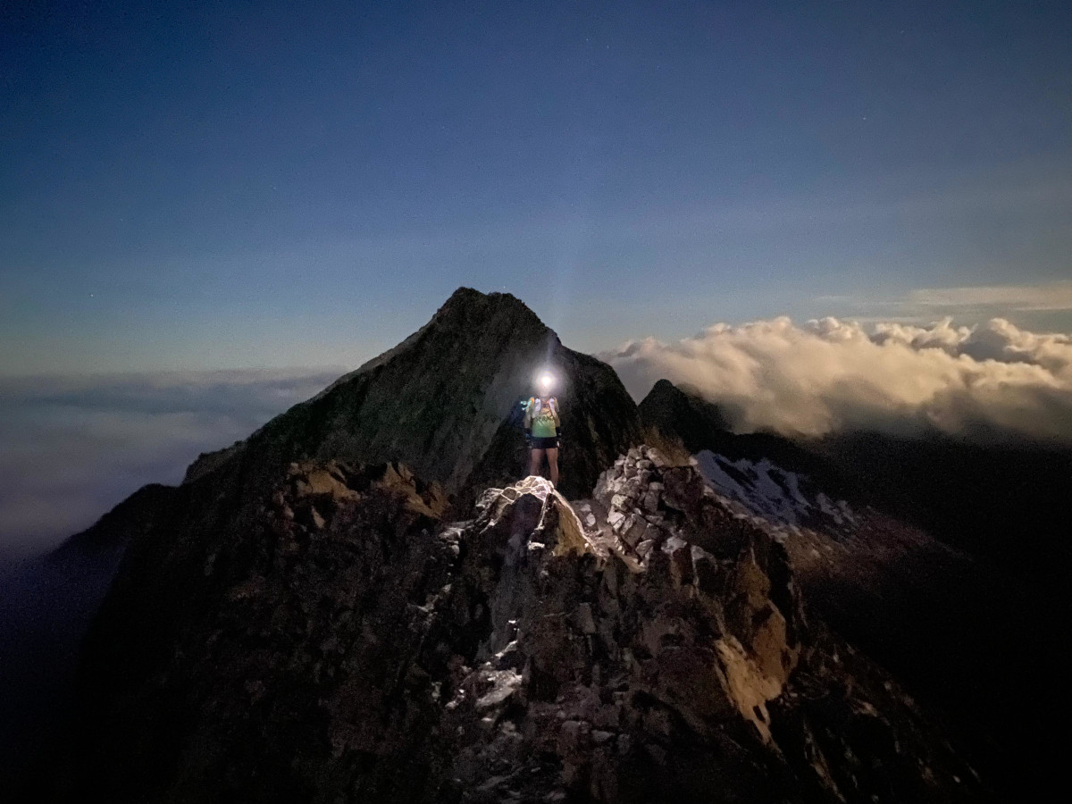
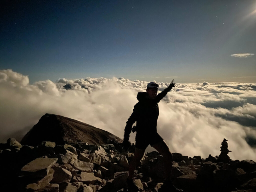
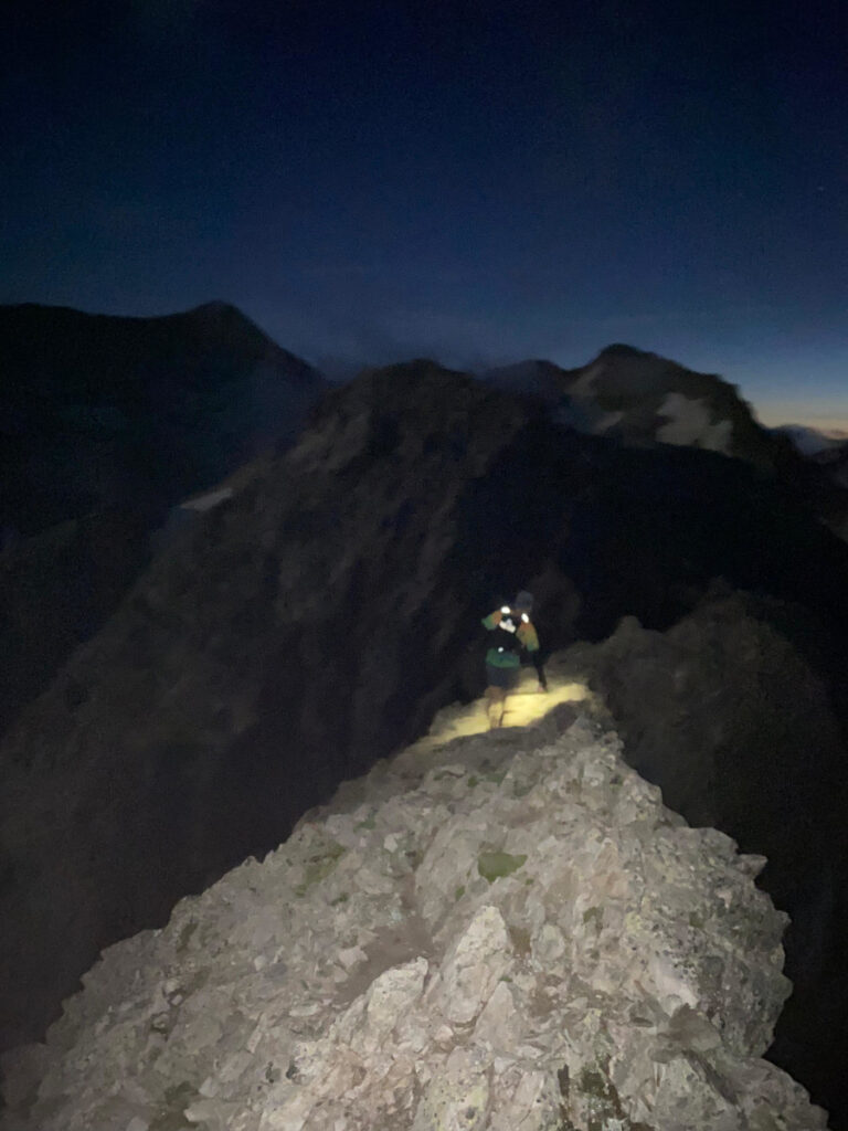
The ridge is generally straightforward, with some steep sections where we have to pay attention and constantly check the track on our watch to make sure we are on the right track. We arrive at the summit of the Perdiguero at midnight, with splendid views of the sea of clouds that the full moon allows us to contemplate.
From this point the next peaks are much closer, so we continue to advance at a good pace and little by little we are adding Tresmiles to our back. The descent to the upper pass of Literola We have to be extremely careful, as some sections are on the French side, where the moonlight is less bright and we have to be careful not to make a mistake or go off the right path. We overcome without difficulty the peaks of the Tuca de Lliterola, Pico Royo and Punta de Lliterolaand with a short descent and a subsequent climb we reach the Needle of Lliterola. The descent to the lower pass of Lliterola is somewhat delicate due to the decomposed terrain, so we gradually lose altitude until we reach the base of the imposing wall that presents the Crabiolues ridge.
Our next objective is the Mamy PointThis is probably the most technical of the entire route, so we have to pay close attention to every step, as we have to climb a fairly vertical wall that is somewhat broken up, and at this point, as we are trapped in a channel, we have little visibility. We come to a steep snow pit that we have to cross horizontally before starting the last climb up to the Mamy gap. From this point we only have to overcome a short ledge to reach the summit at around 2:30 am.
Photos from the summit of Punta Mamy, 3,048 metres. 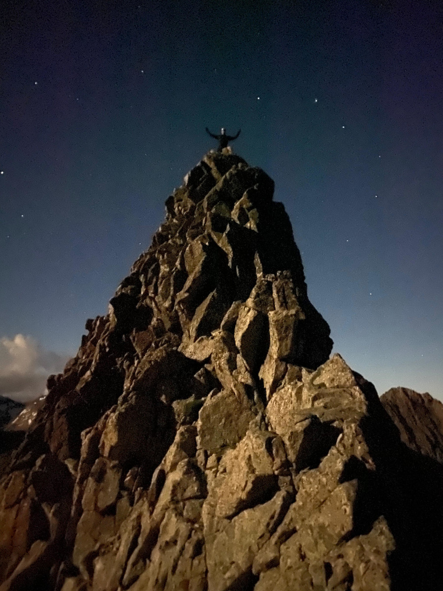
Photos from the summit of Punta Mamy, 3,048 metres.
We have been active for about 6 hours now, we are having a great time and the conditions are still excellent. From Punta Mamy we have to descend all the way down the channel until we reach the base of the ridge, where we start our descent, now on the French side, to the Portillón refugeWe arrived at around 3:30 am.
We decided to stop for something to eat, as we had been there for many hours and were starting to feel tired from not having slept, and it was a good time to get some energy before facing a long climb up to the next ridge; the Spijeoles - Bellocs. In this section we have some difficulties to find the right path, the GPS signal is not entirely accurate due to the large walls that form the cirque of the Oô valleySo we spend a long time struggling to find the ascent to the Lac de Port de Oô. The path is not very busy, very exposed in some sections, as it overcomes the great wall of the valley at the top, even in some sections we find small chains that help us to overcome the most exposed areas. We were not familiar with this stretch, and for the first time so far on the route we started to go below the times we had planned at each point. This discourages us a little, but we continue to gain altitude and little by little we are approaching the Pic d'SpijeolesWe reached the summit around 5:30 am. We reached the summit around 5:30 a.m. after more than 9 hours of activity and more than 3,000 metres of accumulated positive difference in altitude. It was undoubtedly the hardest climb of the whole route, and it also came together with the coldest time of the day and the technical terrain made us take longer than expected.
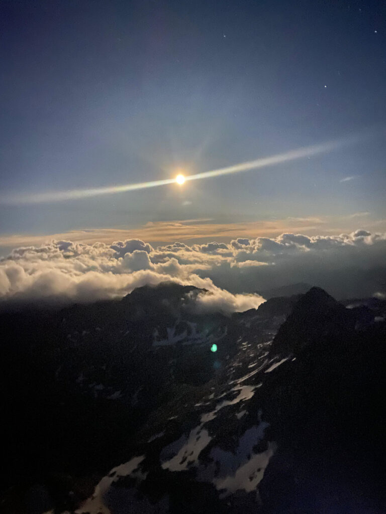
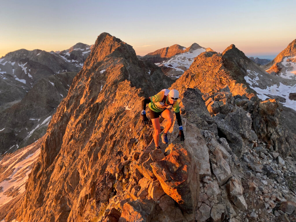
Once at the summit, we must lose height by following the ridge towards the Belloc Peaks. This ridge is the most complicated of the whole day, not because of its technical difficulty, but because of the very difficult terrain. We have to make some flanking routes through very exposed areas where the poor quality of the rock makes us feel very insecure at all times. As we get closer to the Belloc PeaksAs the sun begins to rise, we have the luxury of stopping for a few minutes to contemplate the spectacular sunrise over the immense sea of clouds that covers the entire valley. Undoubtedly one of the most magical moments of the whole day and probably one of the best landscapes we had seen so far.
Sunrise views from the ridge towards the Belloc Peaks 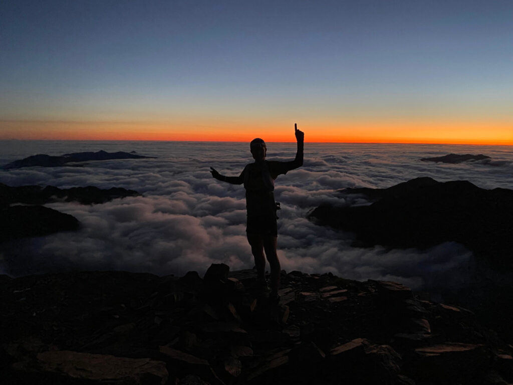
Sunrise views from the ridge towards the Belloc Peaks


After 45' of crest we reach the summit of the third Belloc, 3,008 metres and at this point we turn around to undo the section of crest again until we return to the Pic d'Spijeoles. The terrain is slow and it takes us almost 1h30' to get to and from the Bellocs Peaks.
At daylight we continued our march in the direction of the Gourdon Peak3,034 metres. Although it has been an ideal night as far as conditions are concerned, after so many hours we are very grateful to have light and sunshine to face this last part of the route. From the Gourdon Peak we have to lose height along a vertical rocky path until we join the ascent to the Port de Oô. The day looks great, although we know that from midday onwards the forecast is for thunderstorms, so we can't let up the pace as for the first time so far we start to go against the clock. We begin the third ridge of the day; the cresta du Seil dera Baquewhich starts in the Port of Oô and ends in the Portillón Peak.
At this point Edgar starts to feel a little tired and with a bad headache, so many hours without sleep are beginning to take their toll, added to the great difference in altitude that we have already accumulated in our legs. He encourages me to continue up the ridge and decides to rest for a while so that we can then do the 10 3,000m crest together. Gourgs Blancs sector. This changes the situation, so I try to shift up a gear and do and undo the ridge as fast as I can. The terrain at the beginning of the ridge is slow, as I try to go along the ridge so as not to lose too much height and I constantly come across small gendarmes and steps that force me to be careful. In 40' I reach the top of the Pic de Seil de la Baque3,111 metres, having crossed the two summits of the Caps de la Baque and the most difficult part of the ridge.
From this point it is time to descend a few metres to the summit of the Little Peak of PortillónThe next part of the ridge is more complicated to do alone and would have taken a lot of time, which we did not have. After going down the ridge until we got back to Port de Oô, where Edgar was waiting for me, we stopped for a few minutes to assess the situation. It is about 11 o'clock in the morning, much later than the time we had planned to arrive at this point. We know that doing the remaining 10 3,000 metres will take us at least 2 hours more, and that means risking being caught in a thunderstorm in the middle of the ridge, if the forecast has not been advanced, as we had not had an update since the previous day.
So we took the decision to descend towards the lakes of Gias and leave the last of the remaining crests for another occasion. We start to lose altitude through the valley towards the Estós refuge, where we realise that we have made the right decision, as the clouds start to cover the highest peaks of the sector and the sky gradually becomes threatening. Finally we arrive at the car park of the Estós Valleywhere our adventure came to an end, with the first drops of what was to be a heavy afternoon of thunderstorms.

Fastpacking is not about going faster. It's about going lighter.
If you come from classic trekking, this is the next step: learning to move with less weight,
more fluid and enjoying every kilometre more.
Join the Outsiders Newsletter and start discovering what lightness feels like.