Exploring lonely peaks: Western Valleys of the Pyrenees
Pyrenees and mountains 📩
Here 🔥Discover the unspoilt beauty of the Western Valleys of the Pyrenees, where lonely peaks and quiet valleys await you. This article explores lesser-known peaks such as Otsogorrigaina, Billaré and Sesques, detailing routes that promise adventure away from the crowds.
Our nearby Pyrenees hide a myriad of mountains where you can find solitude in the middle of the wilderness, and hundreds, if not thousands, of peaks are rarely climbed. In the end, most people concentrate in summer in a few valleys, and even the most touristy places are lonely at any other time of year.
We have been thinking about which are the big mountains that for one reason or another are rarely visited. There are various reasons, but they usually have to do with the proximity of other, better known peaks, the absence of a sheltered refuge, long approach walks, steep slopes or a difficult pass. Those inconveniences that for others are just the essence.
In order to have the dubious honour of belonging to this list of forgotten mountains, we have taken into account several premises: to be an attractive, prominent, differentiated and little frequented mountain within its importance, trying not to share the route with other more popular routes such as those leading to a refuge or to other more illustrious mountains and trying to ensure that the main massifs are represented in some way.
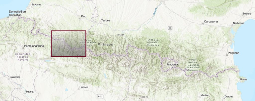
The Western Valleys
This division includes the Navarrese Pyrenees, the western valleys of Huesca (Ansó, Hecho and Canfranc) and the French department of the Atlantic Pyrenees.
Otsogorrigaina (1,923m)
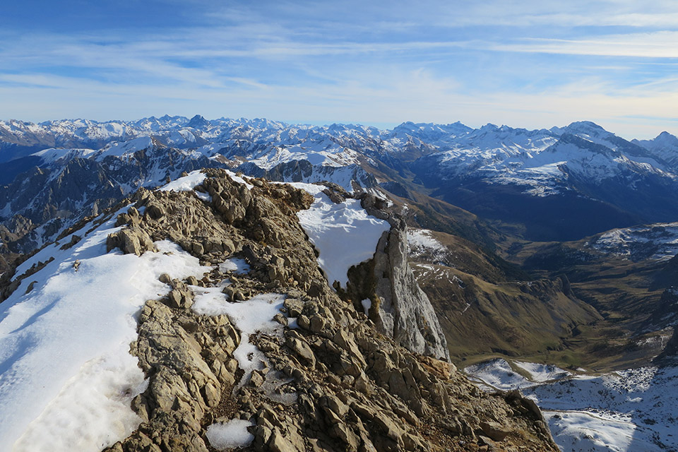
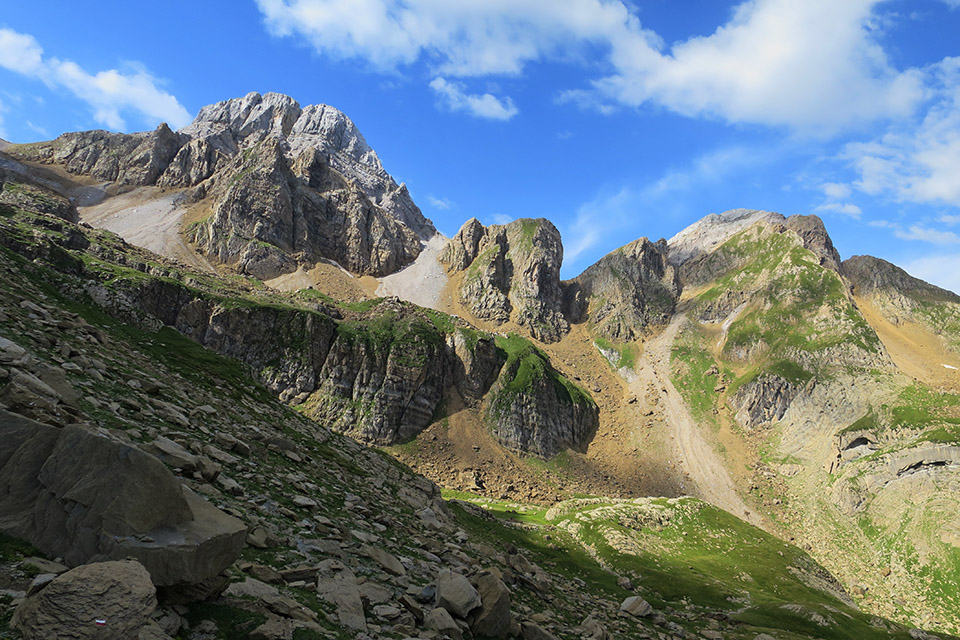
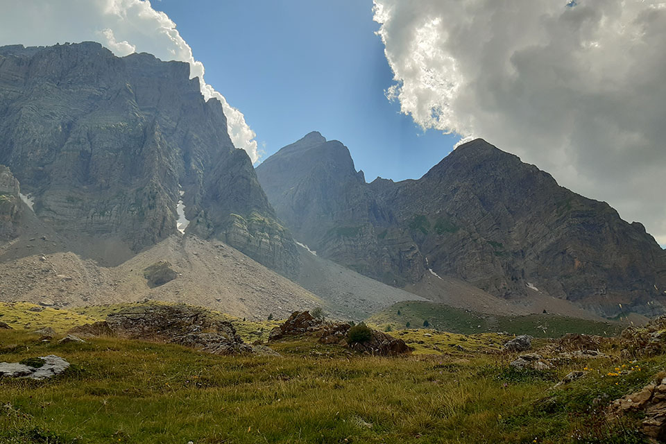
On the mountain divide between the Orhi, the first two thousand metres in the west, and the Larra massif, there are several interesting peaks. The best known and most abrupt is La Kartxela, which falls into the Belagua valley. A little further west, and more hidden, is Otsogorrigaina, which together with Barazea/Txardekagaina and La Kartxela, forms a beautiful cirque of mountains to the south that flows into the Mintxate gorge. Otsogorrigaina can be translated as Alto del Oso Rojo, although Otso could also be translated as wolf. The easiest route runs from the Larrau pass, riding over the crest of the ridge. From the south, the ascent via the Foz de Mintxate is beautiful, but the wildest route is via the northern slope from Laugibar.
From Laugibar (Distance: 22kms round trip; Approximate time: 8h00min; Elevation gain: 1,600m)Gite d'etape de la GR10The route follows the path to the Holtzarte footbridge, a suspension bridge with a free fall of 150 metres. The route then climbs up the leafy ravine, before turning left onto the path that leads to the Pista waterfall, now out of the forest. The upper part is covered by meadows and can be climbed cross-country.
Billaré (2.318m)
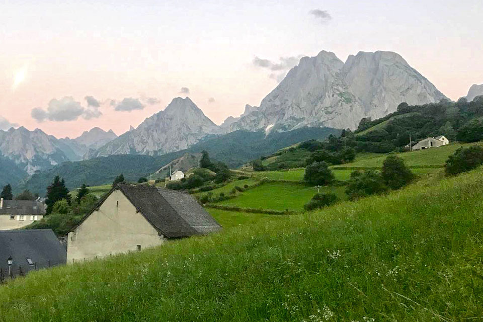
The Billaré is perhaps the most majestic mountain in the Cirque de Lescun and there is no shortage of competitors for this prize: Anie, Table of the Three Kings or the Aiguilles d'Ansabere, among others. The site is reminiscent of the Dolomites or other mountains in the Alps. In a picturesque green valley, the white limestone cliffs of Billaré and other peaks drop down to a height of about 1,000m. It is precisely on this slope, the Cirque de Lescun, that the proposed route passes.
From Sanchese (Climb: F; Distance: 11kms round trip; Approximate time: 7h00min; Elevation gain: 1,250m). The easiest route up this peak runs along the western ridge with some overpasses and an easy chimney (F). The starting point is the Plateau de Sanchese, where there is a recreation area where you can park your car. The route climbs up the Anaye ravine to then gain the crest of the summit ridge in a southerly direction via a rocky ridge. If you feel like walking, you can first take the NW corridor to the Grand Brèche and from there to the Billaré (PD) and then descend along the normal route.
100 itineraries through the Aragonese Pyrenees
Llana de la Garganta (2.599m) and Llana del Bozo (2.566m)
In the area between the Bisaurín and the Aspe, there are a series of very interesting peaks that are much less frequented than these, such as the Sierra de Bernera, Secús, the Picos de la Garganta de Aísa or the two Llanas, the Bozo and the Garganta, which together with the Aspe, form a trident of sharp peaks visible from the Canal de Berdún (Jaca). They are two very aesthetic mountains, with a pyramidal shape from the south, while to the north they drop steeply.
From Aísa (Distance: 14 kilometres round trip; Approximate time: 7 hours; Elevation gain: 1,250m) We drive up to the Cleta car park, at the end of the narrow road (9kms; 1,500m) that climbs up the valley. The usual route climbs up towards the Llanos de Napazal, leaving the Saleras refuge on the left, and ascends over the divide separating the Igüer and Rigüelo valleys. After crossing the GR11.1The path continues along the ridge following the Aspe route until it reaches a watering place where it leaves the watering place to go to the left through the valley that leads to the Napazal Pass and separates the two peaks. To the right we reach the Llana de la Garganta (F+) overcoming an easy chimney of about 20-25m, to the left we climb to the Llana del Bozo (F) crossing an easy turn on the northern slope that may impress some. The descent from the Llana del Bozo can be done by descending towards the cubilar d'o Cantal (GR11), without difficulty down the steep rocky slope, and then the Bozo pass. Do not try to descend following the ravine. From the pass of Bozo we will follow the GR11.1 which descends to the Llanos de Napazal where this route begins. It is quite common to link these two peaks with the neighbouring Aspe, completing the trilogy.
Another alternative route is via the northern slope, from Candanchu or from the Sansanet car park, passing through the Chorrota de Aspe (II).
Sesques / L'Escarpu (2.606m)
The Sesques is a colossal massif, isolated to the north of the Pyrenean axis. It is a sort of Canigó of the western Pyrenees. Ascending any of its slopes is a great effort in which you will have to overcome significant slopes with no shelters to divide the ascent.
From Etsaut (Distance: 19 kilometres; Approximate time: 10 hours; Elevation gain: 2,050m) the route is a return trip along the same path. The route starts in the village of Etsaut (575m) and climbs through the Ourtasse forest, the Yese hut and the Lespetouse pass.
From the Gorges de Bitet (Distance: 15 kilometres; Approximate time: 8 hours; Elevation gain: 1,700m) It can be approached by car along a track up to an altitude of 950m, shortening the approach, and making a circular route. The most common ascent is along the main valley to the end of the track (small car park) and then along the path that climbs up to Lac de Isabe. From here, the path ascends to the left, skirting the lake via a terrace and then goes up the valley to the right, with a view of the western summit, which is the first one to be climbed. For the descent we can go down to the Sesques pass and then along the valley that opens up to the east, passing Cujala de Sesques, where the trees begin, and the Artigue de Sesques hut.
Peak of Soques (2.716m)
The Pico de Soques, to the east of the Portalet pass, is located on the border of the French department of the Pyrénées Atlantiques. It is a mountain that is often seen on the way to Respomuso or Pombie, in the Midi d'Ossau, but rarely enters into our plans. The highest point does not stand out too much on the steep ridge where there are several peaks that could be linked, but it has significant slopes on both sides, towards the Ossau valley and the Aguas Limpias ravine.
From the Caillou de Soques (Climb: PD-; Distance: 10 kilometres; Approximate time: 7 hours; Elevation gain: 1,250m) is the most remote, but somewhat more difficult of all the normal routes. The route consists of going up the Soques torrent at first and then to the right, along the wide corridor that ascends towards the Dent du Soques gap. The most difficult part of the route is reaching the summit of the peak, which is attacked from the south ridge (PD-).
The easiest route ascends the north ridge (F), which can be reached from the La Sarra reservoir via the Barranco de Aguas Limpias ravine.
Alcañiz or Bucuesa mountain pass (2.765m)
The Pala de Alcañiz or Pico de Bucuesa, is a mountain that goes somewhat unnoticed due to the proximity of other mountains such as Collarada, Pala de Ip, Punta Escarra and the wide repertoire of peaks in the Sierra de Partacua. In its favour, it is a beautiful and quiet mountain. This peak is close to Peña Retona, the next summit in this article and which, from Piedrafita de Jaca (PD-) or Acumuer (F+), shares a large part of the routes described below. The proposed route is the one that climbs from Ibón de Ip, somewhat more complicated (PD) than from Piedrafita or Acumuer, and which those who have climbed Collarada will surely already be familiar with.
From Canfranc Estación (Climb: PD; Distance: 19 kilometres; Approximate time: 10 hours; Elevation gain: 1,800m). Shortly after Canfranc Estación there is a track to the right along which the Camino de Santiago comes and which crosses a bridge where you can leave your car. The route climbs up the Ip valley along a marked path to the Ibón de Ip reservoir, which is skirted on the right. The west wall facing the reservoir is too difficult and to reach the summit, we must go to the right to the corral de Ip, where there is a practically dry lake, just below the pass between the Cuchillares and the Pala de Alcañiz. From the ibón you can climb up to the pass and then along the ridge, or better still, reach the ridge via a marked channel on the left from which you then exit to the right, and then follow the ridge avoiding the more difficult sections on the left (PD).
Peña Retona (2.775m)
Peña Retona, although it is the highest peak in the Sierra de Partacua, better known as the Sierra de la Peña Telera, is a much less recognised peak than this one. Its position at the western end of the sierra implies a long approach walk, both from the east and from the south, which reserves it only for peak collectors and ski mountaineers.
From Acumuer (Climb: F; Distance: 27 kilometres round trip; Approximate time: 11 hours; Elevation gain: 1,700m) follow the track (closed to traffic) in poor condition for 8.5 kilometres to the end. Then we turn right, through confusing terrain, to Plana del Rincón and head north to the col of Canal Ancha, between Pico Puerto Rico and Peña Retona. To find the access chimney to the summit (F), cross the rocky area to the left and then to the right along a diagonal.
From Piedrafita de Jaca along the Canal Ancha (Wide Canal) (Climb: PD; Distance: 24 kilometres round trip; Approximate time: 10 hours; Elevation gain: 1,400m). From the car park of the Cuniacha Fauna Park, continue along a track closed to traffic (8.5kms) until a bend where it starts to move away from the mountain range, in the area of the Goluso springs. The track is in good condition and some people choose to cycle along it. The ascent to Peña Retona follows the marked Canal Ancha (PD), which is quite rough and is best climbed with snow (ice axe and crampons).
Fastpacking is not about going faster. It's about going lighter.
If you come from classic trekking, this is the next step: learning to move with less weight,
more fluid and enjoying every kilometre more.
Join the Outsiders Newsletter and start discovering what lightness feels like.