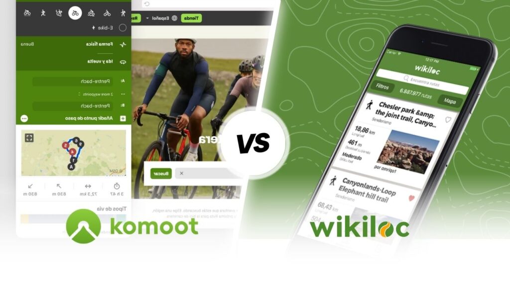
Relive vs Wikiloc
Pyrenees and mountains 📩
Here 🔥In this comparative analysis between Relive vs Wikiloc you can find out about two of the applications that all lovers of outdoor activities should try. The use of technological tools makes it easier to plan and plot routes. Therefore, it is essential that you have information about both apps and can decide which one to use on your next adventures.
Relive
Relive is currently one of the GPS-enabled mobile phone applications designed for tracking your sporting activitiesas well as sharing the most popular ones on social networks. It has been an impressive success worldwide, due to its simplicity of use and well-maintained graphical interface.
It's an app for mapping out the route you want to take when you go running or cycling, but it's also important to do the following hiking through the mountains. With Relive a 3D video of the adventure can be created using Google Earth-like graphics to visualise the walk you have taken.
You can also watch videos made by other people so that you can really get an idea of the route to take. The application Relive can be used in combination with other applications.


Main functions
Relive is an application whose main function is to generate interactive videos through a GPS radar that will accompany you along the planned route at all times.
Another interesting function is to collect all the important data during the tour for the creation of a file system that allows sharing what has been projected during the entire journey. To develop all this, various audiovisual materials are used, which are transferred together with the well-known Google Maps tool to obtain a better view.
Important features
Some of the most relevant characteristics of Relive are as follows:
- The graphics are produced with the latest 3D technology in order to compile first generation images with a high level of quality.
- It is the most suitable app to accompany you in all your cycling adventures in the mountains, in your excursions to natural places and their most beautiful landscapes.
- It allows you to keep track of all the performance materials you have shown to others about your experiences, allowing you to express your emotions.
- Generate a compilation of photos to create a video with the best pictures of the whole journey, with the advantage of being able to manage all the content as you prefer.
- All this is done by creating a simple account using your personal details. In addition, connecting with your social networks to reach a wider range of your content.
- The records are made through a routing system that marks your start, regular follow-up and finally the closing of the cycle at the determined place.
- The waiting time to receive the video is 20 to 24 hours, depending on the number of pending applications and the complexity of the file submitted.
Advantages
Some of the advantages you get with the use of the app are Relive are listed below:
- The application can work seamlessly with other systems including: Strava, Garmin Connect, Polar Flow, Apple Health (Watch), MapMyRun, MapMyWalk, MapMyRide and MapMyHike.
- This facility to connect with the above applications is an example of their commitment to providing a good experience and being able to show others your view of the journeys you have made in a relatively simple way.
- The number of users in the community reaches nine million people interested in being constantly improved with all the functions offered in each period of time of the different updates.
- The download can be carried out through the official platform of the application or simply through the official shops of the operating systems of the mobile device, with a very simple registration.
- Edits are important, as you can vary the sequence of images, effects, sounds and modes of publication according to your preference.
Cost of Relive
Relive is a very easy to use application and is completely free to download. The app can be found in the official shops of devices with Android and iOS operating systems.
Nevertheless, you can also subscribe to the Relive Plus at a price of 6.99 euros per month. Through this option you will be able to do the following:
- You will have access to high-definition quality videos.
- You will keep control of the playback speed of your files at all times.
- Import past activities you have carried out.
- Make edits whenever you want.
- Priority in obtaining your videos.
- Add activities of longer duration (more than 12 hours).
- Make use of the interactive route to explore in detail in 3D.
- Adding music to the adventures.
In addition, it is possible to take a free trial of the app for 30 days without any additional charge.
Wikiloc
Wikilocis one of the most popular hiking apps in Spain for trekking. It also has other outdoor activities such as cycling, MTB, kayaking, skiing, and an interesting variety to reach a total amount of 75 disciplines.
To date, the app has more than 10 million users and its interface offers the possibility of accessing more than 35 million routes, with almost 60 million photos available to evaluate nature before making the decision to travel it. It also gives you the option of recommending routes you have discovered or places of interest that have caught your attention.
Maps can be downloaded for offline use and it is also possible to activate a notification function that warns you when you deviate from the original route. It also has a weather forecast system that predicts how long a route will take you and has a live tracking function using your location. With this option, friends and family can find you if you get lost.
In the following video that we have prepared for you by the mountaineer and youtuber Pau Calado tells us in detail how we can use the application, which has recently added "Route Planner" and 3D mapping functionality.
Main functions
Wikiloc will allow you to see the most relevant data of a route such as: the distance travelled, the time taken, the average speed and the elevation gain.
It also features a high-precision GPS, and can work as an altimeter. You can track live tracks and download maps in GPX or KML formats offline.
In this app you can generate a route from the filters it offers and thus select the one that best suits your preferences, such as length, slope, difficulty or activity performed.
Interesting features
The Wikiloc features The most noteworthy of these are listed below:
- You can view free topographic maps from all over the world.
- Operation can be offline or in offline mode.
- It has the functionality to record your routes and add waypoints, among a variety of other features.
- The paid version offers extra features such as live tracking and the ability to sync with other devices in order to connect with family and friends.
- The app works in a similar way to a GPS navigator.
- It has an extensive database containing almost 35 million routes.
- It has a large community of more than 10 million users.
Advantages
Some of the benefits to the user of using Wikiloc are as follows:
- The app is compatible with a wide range of Garmin devices.
- Its search engine makes it possible for you to locate routes according to specific areas.
- The guidance service can be configured through sounds to allow you to enjoy the experience without having to constantly use your mobile phone to see the location.
- With regard to activities, Wikiloc has a wide range of options such as mountaineering, hiking, running, mountain biking, cycling, kayaking, among many other activities.
- As for the places where it has recorded routes, the number of countries and cities where you can find a route is large. On the website you can see a list of all the countries where you can search for a route.
Cost of Wikiloc
Wikiloc can be downloaded completely free of charge. However, in case you want to enjoy outdoor navigation and audible warnings to notify you when you have left the route, among many other features, you will need to subscribe to Wikiloc Premium, for 9.99 euros per year or 4.99 euros per quarter.
In this version Wikiloc Premium you will find the possibility to obtain the following functions:
- Outdoor Navigation.
- Search according to the zones of passage.
- Send the route to your Garmin device.
- Live monitoring.
- Meteorological data.
- Photo scanning.
- Route search by user.
- Advanced filters.
- Routing lists.
Conclusion
Through comparison Relive vs Wikiloc have you noticed that both applications are considered to be among the best sports applications at the moment.
Each of them has its own characteristic features and functionalities that make them different. For this reason, it is recommended that both be tested and the use of one of them be made taking into account the user's interests and requirements.
Fastpacking is not about going faster. It's about going lighter.
If you come from classic trekking, this is the next step: learning to move with less weight,
more fluid and enjoying every kilometre more.
Join the Outsiders Newsletter and start discovering what lightness feels like.