Tour of the Aneto. Stage 2: La Renclusa Refuge - Cap de Llauset Refuge
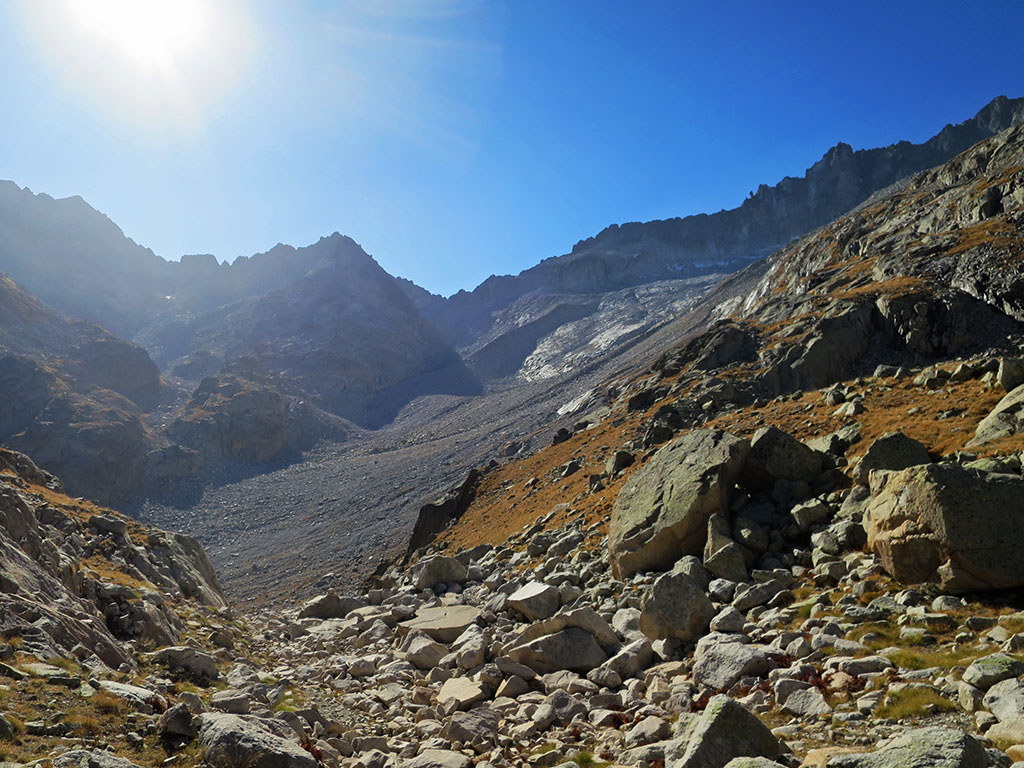
SUMMARY:

This is the most difficult stage. On this second day we finish rounding the Maladeta massif to the north. The vegetation disappears almost completely and it is very difficult to advance through the chaos of boulders. In addition, you will have to overcome the highest pass on the route, the Salenques/Ixalenques pass at 2,809m, which is usually icy. In any case, this stage offers wonderful views of the monarch Aneto and his court.

Downloadable:

> Download Track

Technical specifications:

Distance: 11,3kms.
Cumulative difference in altitude: +1.117m /-829m
Timetable: about 10 hours. Running time non-stop: 7h30min.
Difficulty: High mountain stage. The upper part runs between large boulders and it is very difficult to make progress. The Salenques pass used to have snow all year round (crampons essential). In recent years it is common to find it without snow at the end of September and October. Another option when there is still snow is to climb the rocks on the right.
Water: Apart from the lakes there are not many other opportunities to get water. On the ascent there is a stream past the Barrancs pass and another one further up that can be heard between the blocks. After the Salenques pass, on the ascent to the Cap de la Vall lake, there is another stream.

ITINERARY:

(0h00min; 0kms) La Renclusa refuge (2,140m). Just after passing the fountain next to the refuge we will find a panel of the GR11.5 (Return to Aneto) path. The red and white markings separate to the left from the busy route up to Aneto.

Cordier (3,263m), Sayó (3,211m), Mir (3,185m), Pico de Alba (3,118m), Tuca Blanca (2,847m) and Pico de Paderna (2,622m), from the ascent to the pass of La Renclusa.

(0h20min; 0,6kms) Col de la Renclusa (2.282m).

Plan d'Aiguallut below Pic d'Aiguallut (2,692m). In the background the Forcanada (2,833m).

The path descends towards the Plan d'Aiguallut, crossed by several streams that flow down from the slope on the right and from the Barrancs and l'Escaleta valleys.

Plan d'Aiguallut and Aneto

Once at the bottom, if you are not familiar with it, we recommend you visit the Forau d'Aiguallut and the waterfall. To get there, you can take a shortcut across the river, or else follow the GR11 to the end of the Plan, to a series of footbridges.

Aiguallut and Aneto waterfalls

The Forau d'Aigualluts is a karstic sinkhole into which the waters of the river Ésera seep, born in the glaciers of Aneto and Maladeta. The waters reappear again 3.6 kilometres from here, but incredibly not in this valley but in the Aran valley, on the Atlantic side, being the only waters in Aragon that do not end up in the Mediterranean. See more.

(0h55min; 2.3kms) End of Plan d'Aiguallut (2,036m). A signpost points to the crossroads that on the left, towards the back, leads to the Forau d'Aiguallut and La Besurta, and up (south) to the Coll de Salenques pass and the Cap de Llauset hut. Ascend south through the Barrancs valley. The terrain starts to become more difficult due to the boulders.

In the Barrancs valley. In the background, the Pico de la Mina (2,708m).
Blocks going up to the Barrancs pass.

On this first part of the ascent we walk alongside a stream.

(2h15min; 4.8kms) Colladeta de Barrancs (2.481m). To the left of the pass is the Turonet de Barrancs (2,508m) and hidden behind it is the ibón de Barrancs. In the background we can see the Salenques pass where the famous Salenques ridge begins on the right.

Barrancs mountain pass. In the background, the Salenques/Ixalenques pass. To the right, the Salenques ridge.

The Salenques Ridge to the Pico de Margalida (3,239m), and its continuation to the Pico Tempestades (3,278m) and the Aneto (3,404m), is probably the best known classic ridge climbing route in the Pyrenees. The difficulty is not excessive D(IV+), however, the length of the route (2.5kms of continuous difficulties and 750m of positive difference in altitude) makes it a great undertaking for any Pyrenean climber.

The GR11.5 advances following the milestones through a chaos of boulders. Shortly after the pass you pass a stream. Further up, if we are lucky, we can catch water in an underground stream that can be heard running between the boulders, at an altitude of 2,650m.

Climbing up to the Salenques pass. Below in the background, the Barrancs lake.

The final part of the ascent to the Salenques pass has a snowdrift, or rather ice, which usually persists all year round.

Final stretch to the Salenques pass. Ice axe and crampons were not necessary.

If you cannot avoid it, you will need ice axes and crampons. Depending on conditions and experience, it is possible to avoid it by climbing the rocks on the right.

(4h05min; 6.3kms) Col of Salenques/Ixalenques (2.809m).

Salenques Valley. In the background, the P.N of Aigüestortes i Estany de Sant Maurici.

The views are formidable. The GR11.5 descends steeply to the right - between landslides - towards the Salenques valley.

Descending from the Salenques pass.

The descent ends at about 2,560m. It then continues along the slope to the right, skirting the ridge that descends from East Russell Point (3,051m). It is possible to take water from a stream shortly after skirting the spur.

We leave the Salenques/Ixalenques pass behind us.
Salenques Valley and Ixalenques Ponds.

The terrain continues to be very difficult on the way to the...

(6h00min; 8.9kms) Cap de la Vall lake (2.660m).

Cap de la Vall lake.

Skirt the lake on the left and gain a small pass (2,702m). To the right is the Cap de la Vall lake, to the left - far below - the Estany Negre. The GR11.5 heads to the left (SE) without losing height until another pass (2,676m), to the west of Tuca d'Anglios (2,813m). From this pass we can see Cap de Llauset refuge.

Cap de Llauset lake and refuge.

We do not descend directly, but cross the slope (SE) of the Tuca de Anglios, until we reach the buttress that descends to the...

(7h10min; 10.8kms) Col dels Estanyets (2.524m).

Cap d'Anglios lake seen on the descent to the Estanyets pass.

At this point, the GR11.5 variant we came along joins the main route. To the left, the GR11 continues through the Anglios lakes towards the Conangles refuge, to the right, we are going to finish the stage at the nearby...

Cap de Llauset lake and refuge.

(7h30min; 11.3kms) Refuge of Cap de Llauset (2,425m).

Cap de Llauset Hut.